Regional overview
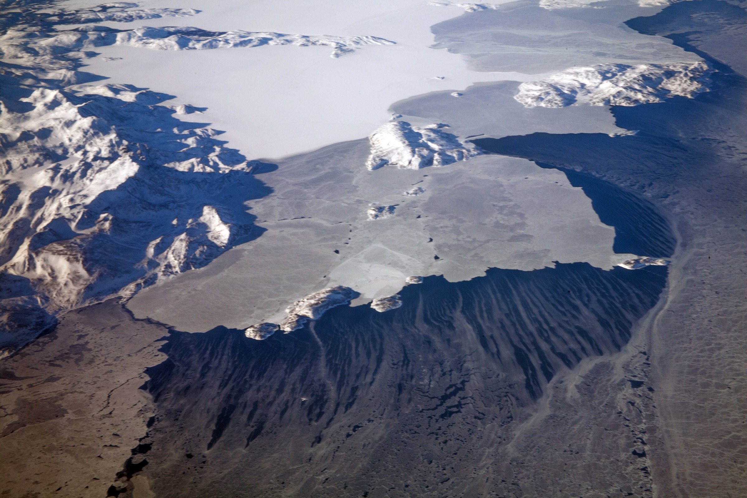
The Mealy Mountains form a compact 100 km east–west range of rounded, ice-scoured Precambrian-shield summits on the south shore of Lake Melville in central Labrador. The highest peaks reach about 1,180 m and stand directly above the lake, giving a relief of more than a kilometre from saltwater shoreline to summit tundra. The range is the centrepiece of the Akami-Uapishkᵁ-KakKasuak-Mealy Mountains National Park Reserve, established on 25 May 2015 and the largest national-park unit in eastern Canada at 10,700 km². The park reserve is co-managed by Parks Canada with the Nunatsiavut Government and the Innu Nation, and its name carries both Innu (Akami-Uapishkᵁ, “white mountain across”) and Inuit (KakKasuak, “the mountain”) forms alongside the colonial “Mealy” name.
The park reserve also contains the Wonderstrands (Furdustrandir of the Norse Vinland sagas) — about 50 km of unbroken sandy beach on the south Labrador Sea coast, the lower Eagle River salmon valley, the Backway fjord arm of Lake Melville, and a long stretch of subarctic boreal forest stepping up into alpine tundra above the treeline at about 700–800 m. The interior is patterned with hundreds of un-named lakes (the Memekueshu-nipi system at Gods Pocket among them) and broad upland barrens. Caribou (the threatened Mealy Mountains herd), black bear, marten, fox, wolf, and Atlantic salmon are the headline wildlife.
Parks Canada is explicit that “there are currently no established hiking routes” inside the park reserve. All walks are open-route wilderness traverses requiring map, compass, and full self-sufficiency. Visitors must register their trip with the Happy Valley-Goose Bay park office (+1 709 896 2394, mealys@pc.gc.ca) before entering. There is currently no admission charge. There are no roads into the park; access is by floatplane from Goose Bay, by boat from Cartwright or Rigolet, or by snowmobile in winter. The five walks below are therefore framed as candidate routes from documented access points — fly-in or boat-in shore landings, named geographic features — rather than waymarked trails.
The summer walking window is short. Black flies are intense from mid-June through mid-July, mosquitoes from late June through August; the bug-relief window is roughly the last week of August through to the end of September. Snow is possible on the upper ridges in any month, and the Lake Melville coast and Wonderstrands are exposed to North Atlantic storm cycles year-round.
Selection rationale
There are no signed trails in the Mealy Mountains National Park Reserve. The five walks below are picked to cover the most representative day-route landscapes — the Atlantic beach line at the Wonderstrands, a Mealy summit-ridge attempt from the lake shore, the lower Eagle River salmon valley, the Backway/English River fjord shore, and the high tundra plateau — and to anchor each to a documented access point usable by parties chartering into the reserve. All are described as candidate routes; specific tracks must be confirmed with Parks Canada in advance.
Summary table
| # | Hike | Country | Route type | Distance | Gain | Max elevation | Difficulty |
|---|---|---|---|---|---|---|---|
| 1 | Wonderstrands beach walk | Canada | Linear | 10-25 km | ~50 m | ~30 m | Easy-moderate |
| 2 | Mealy Mountains summit-ridge walk from Lake Melville | Canada | Out-and-back | 12-18 km | ~1,100 m | ~1,180 m | Strenuous |
| 3 | Eagle River lower-salmon-valley walk | Canada | Out-and-back | 8-14 km | ~150 m | ~200 m | Moderate |
| 4 | Backway / English River fjord shore walk | Canada | Out-and-back | 8-12 km | ~150-300 m | ~300 m | Moderate |
| 5 | Akami uplands tundra walk | Canada | Out-and-back | 8-14 km | ~300-500 m | ~900-1,000 m | Moderate |
1. Wonderstrands beach walk
Snapshot
Itinerary
The Wonderstrands run about 50 km north–south along the Labrador Sea coast inside the park reserve, with a near-continuous strip of sand backed by low dunes and stunted boreal forest. A typical day-walk uses a boat or floatplane to land at a north-end cove, then walks south along the strand on firm wet sand to a pre-arranged pickup point. The walk crosses several small streams that may need to be waded at low tide. Caribou, fox and shorebirds are commonly seen.
Why it is essential
The Wonderstrands are the longest unbroken open beach on the eastern Canadian Arctic / Subarctic coast and the only Mealy Mountains landscape mentioned by name in the Norse Vinland sagas (as Furdustrandir, “wonder strands”). The walk is the easiest big-distance day-route in the park reserve and gives the best chance of seeing the migratory southern Labrador herd of caribou close to the shore.
Equipment
- Sand-tolerant hiking shoes
- Wind- and waterproof shell
- Insulation layer for cooler coast conditions
- Sun protection (high glare off sand)
- Bug net and DEET (June-August)
- Bear awareness — black bear active on the strand
- 2 litres of water
- VHF radio or satellite messenger
Hazards and notes
- Parks Canada trip registration mandatory in advance
- Polar bears very occasionally come ashore in winter and early spring; check current bear activity reports
- Cold-water immersion risk on stream crossings
- Coastal weather closes flying windows quickly; carry buffer days
- No drinking water on the strand itself; fill from inland streams
GPX / KML links
No open route file located. Wonderstrands approximate north end 53.55°N, 56.55°W.
External links
- Wikipedia — Akami-Uapishkᵁ-KakKasuak-Mealy Mountains National Park Reserve
- Parks Canada — Mealy Mountains
2. Mealy Mountains summit-ridge walk from Lake Melville
Snapshot
Itinerary
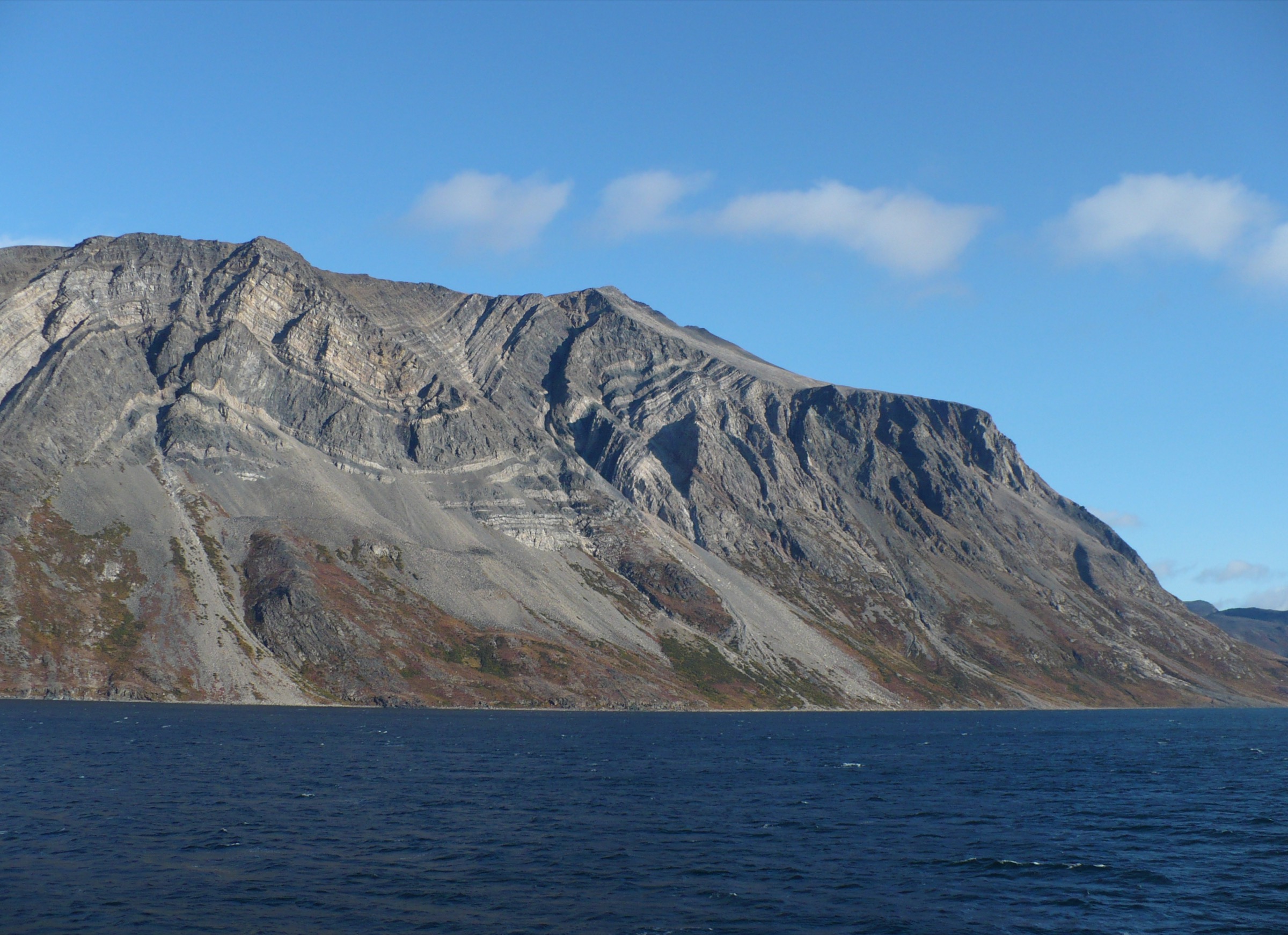
From a boat landing on the south shore of Lake Melville, the walking line climbs through dense subarctic boreal forest for about 2-3 km, breaks above the treeline at roughly 700-800 m, and continues on open tundra and lichen-covered shield bedrock to one of the higher Mealy summits at about 1,180 m. The route is entirely off-track and depends on choosing a clean line through the lower forest band. The descent retraces the ascent.
Why it is essential
This is the only practical day-walk that reaches the actual Mealy Mountains summit ridge — the namesake landscape of the park reserve. The view north from the high summits over Lake Melville to the lower Labrador Coast and the inland boreal sea is unique in eastern Canada, and the summit tundra holds wind-sculpted lichen and dwarf-shrub communities of high ecological interest.
Equipment
- Stiff hiking boots with ankle support
- Full waterproof shell layer
- Insulation layer plus spare gloves and hat
- Bug net and DEET (until late August)
- Bear deterrent (bear spray)
- Map, compass, GPS, satellite messenger
- 3+ litres of water
- Headlamp (long day; possible late return)
Hazards and notes
- Parks Canada trip registration mandatory; this is one of the more committing day-routes in the reserve
- Weather can close in within minutes on the summit ridge
- Bushwhack through dense black-spruce and alder; expect slow progress on the lower section
- No water above the treeline; carry enough for the upper traverse
- Risk of getting cut off by deteriorating boat-pickup weather
GPX / KML links
No open route file located. Range axis approximately 53.55°N, 59.20°W.
External links
3. Eagle River lower-salmon-valley walk
Snapshot
Itinerary
The Eagle River drains the southern interior of the park reserve and is internationally famous as one of the world’s premier wild Atlantic salmon rivers. The walk uses a floatplane drop on a lower-river lake or wide-water as a base; from there the route follows the river bank downstream through black-spruce and tamarack forest, past clear gravel-bottomed pool sequences, to a turn-around point at one of the named salmon pools. The bank is a mix of mossy boreal floor and gravel terraces; the walking is off-track.
Why it is essential
The Eagle River is the signal river of the Mealy Mountains park reserve and the protected centrepiece of the wild-Atlantic-salmon habitat on the south Labrador slope. The walk gives close access to the salmon-pool habitat in late summer, with high chances of seeing black bear, otter, mink, osprey and bald eagle along the bank.
Equipment
- Stiff hiking boots (wet ground in places)
- Waterproof shell
- Bug net and DEET
- Bear-deterrent spray and bear-aware food storage
- Map, compass, GPS
- 2-3 litres of water (or filter)
- Satellite messenger
Hazards and notes
- Parks Canada trip registration mandatory
- Black bears concentrated on the river during salmon season; respect distance and never approach feeding bears
- River crossings are dangerous in high flow; do not attempt without local advice
- Floatplane access is weather-dependent; carry buffer days
- No fishing without a Labrador angling licence
GPX / KML links
No open route file located. Lower Eagle River approximately 53.40°N, 57.30°W.
External links
4. Backway / English River fjord shore walk
Snapshot
Itinerary
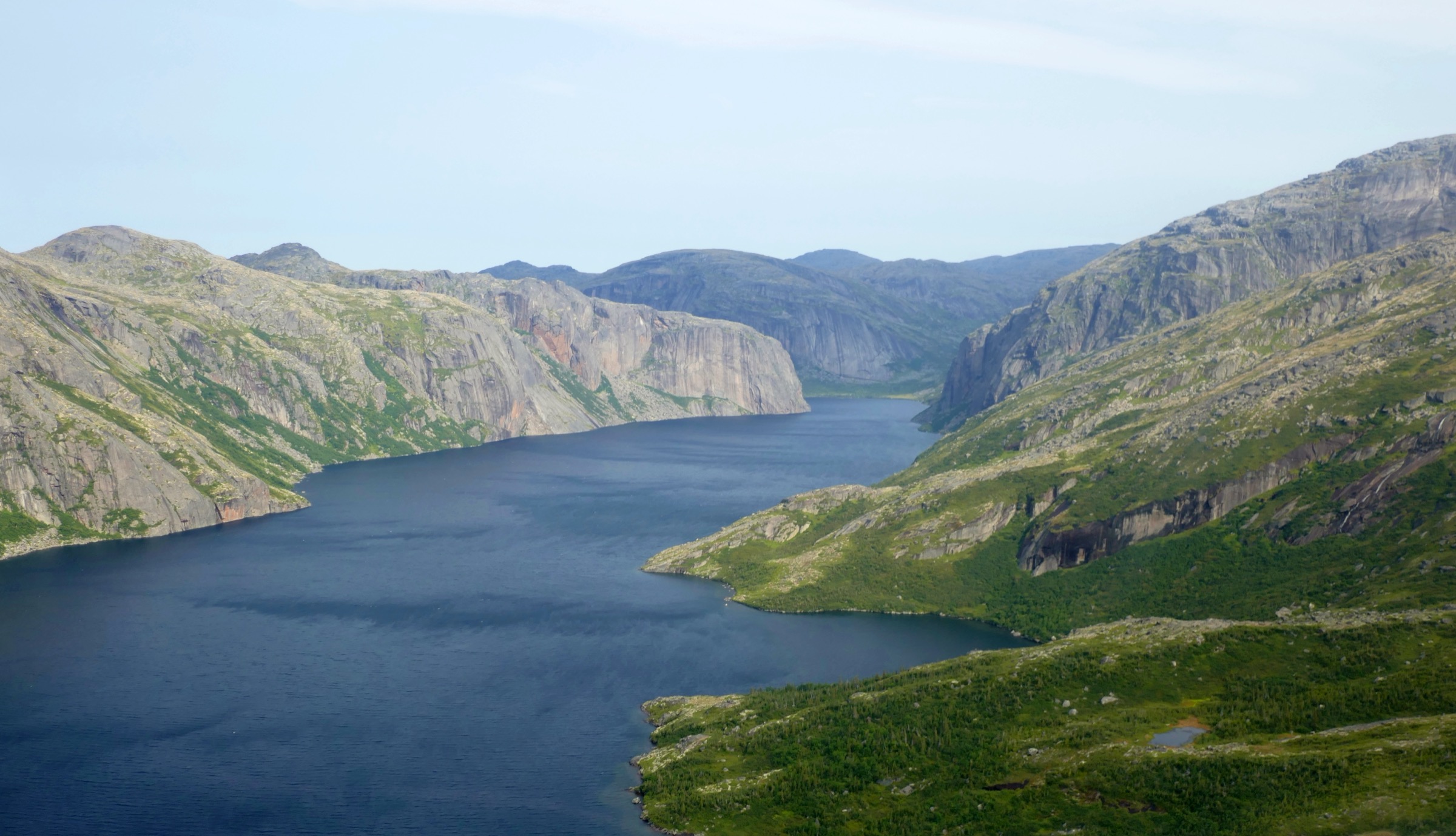
The Backway is the long south-east fjord arm of Lake Melville that wraps around the north flank of the Mealy Mountains. The walking line uses a charter-boat drop on a south-shore beach, climbs the immediate forest band onto a low shelf with views back across the fjord, traverses the shelf for several kilometres, then descends to the shore for the return walk by the beach. The route is entirely off-track and depends on local landing conditions.
Why it is essential
The Backway is the quietest of the Lake Melville inlets and gives the best low-altitude view of the Mealy Mountains rising directly from saltwater. The fjord is rich in eider, common loon, harbour seal, and the shore is a productive black-bear habitat in late summer.
Equipment
- Stiff hiking boots
- Wind- and waterproof shell
- Insulation layer
- Bug net and DEET
- Bear deterrent
- Map, compass, GPS, satellite messenger
- 2 litres of water
Hazards and notes
- Parks Canada trip registration mandatory
- Boat-pickup weather can change quickly inside the fjord
- Tide range modest but real; check landing accessibility
- Off-track shoreline can include slippery boulder fields
- Black bear and possibility of moose in the fjord-head forest band
GPX / KML links
No open route file located. Backway approximately 53.60°N, 58.45°W.
External links
- Wikipedia — Lake Melville
- Wikipedia — Akami-Uapishkᵁ-KakKasuak-Mealy Mountains National Park Reserve
5. Akami uplands tundra walk
Snapshot
Itinerary
Using a floatplane drop on one of the un-named interior lakes (the Memekueshu-nipi system around Gods Pocket is one option), the walking line climbs out of the lake basin onto the open tundra plateau between the Mealy summits, traverses lichen and dwarf-shrub barrens to a high point, and returns by the outbound line. The plateau is rolling rather than steep, with frequent shallow tarns and broad views over both the Lake Melville drainage to the north and the Eagle River drainage to the south.
Why it is essential
The Akami uplands are the signature open-tundra landscape of the park reserve and the headwater zone of the threatened Mealy Mountains caribou herd. The walk is the most likely day-route in the reserve to give close views of the herd, and crosses some of the most pristine subarctic tundra in eastern Canada.
Equipment
- Stiff hiking boots
- Full waterproof shell
- Insulation layer plus spare gloves and hat
- Bug net and DEET
- Bear deterrent
- Map, compass, GPS, satellite messenger
- 2-3 litres of water (lakes/streams plentiful)
Hazards and notes
- Parks Canada trip registration mandatory
- The Mealy Mountains caribou herd is threatened; keep clear of cows with calves and never disturb feeding groups
- Tundra weather changes fast; sustained wind and cold-rain risk
- Open horizon means navigation depends on GPS in mist
- Aircraft access is weather-dependent
GPX / KML links
No open route file located. Gods Pocket / Memekueshu-nipi approximately 53.59°N, 58.57°W.
External links
External links
- Parks Canada — Akami-Uapishkᵁ-KakKasuak-Mealy Mountains National Park Reserve
- Wikipedia — Akami-Uapishkᵁ-KakKasuak-Mealy Mountains National Park Reserve
- Wikipedia — Mealy Mountains
- Wikipedia — Lake Melville
- Wikipedia — Eagle River (Labrador)
- Wikipedia — Wonderstrands
- Nunatsiavut Government
- Innu Nation