Regional overview
The Garibaldi–Pemberton sector of the southern Coast Mountains stretches from the Cheakamus and Mamquam drainages north of Squamish, through the high alpine plateau of Garibaldi Provincial Park, and across the Pemberton Valley into the steeper, more glaciated terrain of the Joffre and Cayoosh ranges along Highway 99. The dominant geology mixes Pleistocene-to-Holocene volcanism — Mount Garibaldi, Black Tusk, The Table, the Cinder Cone — with classic Coast Plutonic granite-and-ice country further north and east. Glacier-fed lakes — Garibaldi, Wedgemount, Cheakamus and the three Joffre lakes — owe their luminous turquoise to suspended rock flour and form the visual signature of the region.
Trail centres divide cleanly. To the south, the Diamond Head area above Squamish gives access to Elfin Lakes, Mamquam Lake and Opal Cone. The central Black Tusk / Garibaldi Lake / Taylor Meadows complex is reached from the Rubble Creek trailhead off Highway 99 between Squamish and Whistler. North of Whistler, the Wedgemount trailhead climbs steeply to a hanging cirque under Wedge Mountain. East of Pemberton, the Duffey Lake Road services Joffre Lakes Provincial Park and the rougher forest service roads that climb to Blowdown Pass, Tenquille Lake and the Stein Divide.
The reliable hiking season runs from mid-July to early October. Snow lingers on north-facing alpine sections — Panorama Ridge, Black Tusk, Blowdown Pass — well into July in average years; early-season parties should expect snowfields on the approach above Taylor Meadows and on the upper Joffre boulder field. Afternoon thunderstorms are uncommon by Alpine standards but possible, and Coast Mountains weather can change rapidly with marine systems pushing in from the west. Black bear are widespread; grizzly are present at lower density east of Pemberton, notably the Blowdown and Stein drainages.
Access requires planning. BC Parks operates a day-use pass system at the busiest trailheads. For 2026, vehicle day-use passes are required at Garibaldi’s Rubble Creek and Diamond Head trailheads on Fridays, Saturdays, Sundays, Mondays and statutory holidays from 12 June to 12 October, and at Cheakamus Lake daily from 13 June to 7 September then Friday to Monday until 12 October. Joffre Lakes Park requires a per-person trail pass every day from 11 May to 25 October, with cultural closures of the park on 20–27 June and 8–30 September 2026 for Líĺwat Nation and N’Quatqua observances. Passes for all three release at 07:00 two days before the visit on the BC Parks day-use reservation portal. Dogs are prohibited throughout Garibaldi Park, Joffre Lakes Park and most adjacent ecological reserves.
Selection rationale
The five hikes below were chosen to represent the principal landscape types of the Garibaldi–Pemberton sector while remaining feasible for fit walkers in a single long summer day: Garibaldi Lake, the iconic glacial lake of southwest British Columbia; Panorama Ridge, the high balcony viewpoint over Garibaldi Lake, Black Tusk and the Sphinx Glacier; Wedgemount Lake, the short, brutally steep hanging-cirque hike north of Whistler; Joffre Lakes, the classic Pemberton lakes route, culturally important to the Líĺwat Nation and N’Quatqua, and the easiest big-scenery objective in the region; and Elfin Lakes via Diamond Head, the long, gentle Paul Ridge balcony hike that showcases the Mamquam Icefield and Mount Garibaldi’s south face. Black Tusk and Blowdown Pass were considered and referenced as variants or follow-up candidates: Black Tusk sits at the upper boundary of single-day effort and shares its lower 11 km with both Garibaldi Lake and Panorama Ridge; Blowdown Pass standard access requires a high-clearance 4WD up the Blowdown FSR.
Summary table
| # | Hike | Country | Route type | Distance | Gain | Max elevation | Difficulty |
|---|---|---|---|---|---|---|---|
| 1 | Garibaldi Lake (Rubble Creek) | Canada | Out-and-back | 18 km | approx. 820 m | approx. 1,490 m | Moderate |
| 2 | Panorama Ridge | Canada | Out-and-back | 28–30 km | approx. 1,500 m | approx. 2,130 m | Strenuous |
| 3 | Wedgemount Lake | Canada | Out-and-back | 12–14 km | approx. 1,160–1,200 m | approx. 1,910 m | Strenuous |
| 4 | Joffre Lakes (Lower / Middle / Upper) | Canada | Out-and-back | approx. 10 km | approx. 370–400 m | approx. 1,600 m | Moderate |
| 5 | Elfin Lakes via Diamond Head | Canada | Out-and-back | 22 km | approx. 600 m | approx. 1,660 m | Moderate |
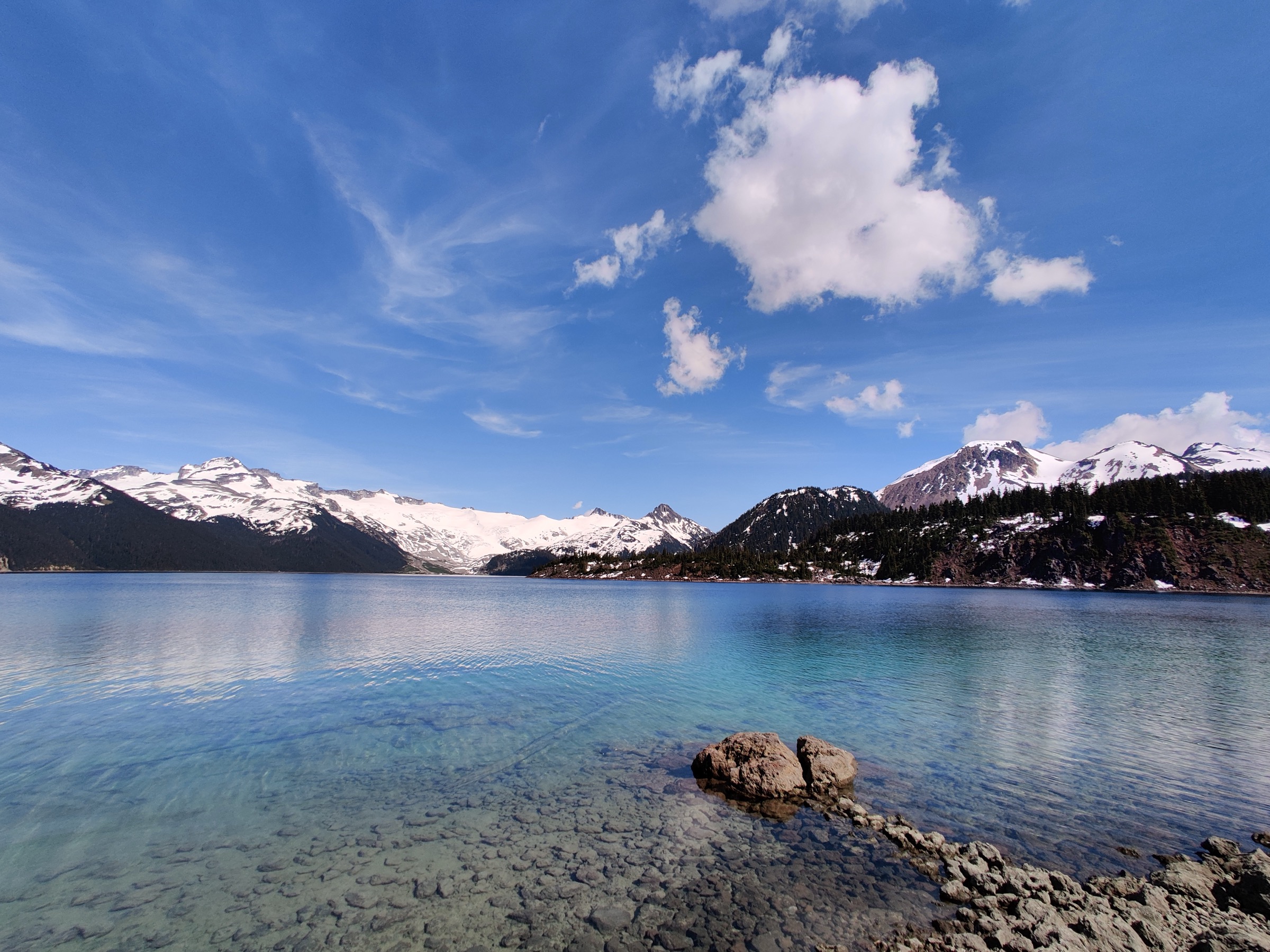
1. Garibaldi Lake (Rubble Creek)
Snapshot
Itinerary
From the upper Rubble Creek parking lot the trail climbs steadily through second-growth hemlock and Douglas-fir on a wide, well-graded path. Roughly 6 km of switchbacks gain most of the day’s elevation before the trail reaches a signed junction at approximately 1,400 m. The right branch contours past Barrier Lake and Lesser Garibaldi Lake, both perched above The Barrier — a 300-metre-high lava dam that holds back the Garibaldi Lake system. The path continues through open subalpine forest to the Battleship Islands area on the western shore of the lake, where the ranger station, day-use shelter and Garibaldi Lake walk-in campground are located. The return reverses the route. A short extension of roughly 1 km follows the shoreline path toward the Sphinx Bay viewpoint.
Why it is essential
Garibaldi Lake is the visual icon of southwest British Columbia hiking and the principal landscape feature of the park that gave Coast Mountains parks their template. The combination of a vivid turquoise glacial lake at 1,490 m, the Sphinx and Bookworms glaciers across the water, and the volcanic backdrop of Mount Price, Clinker Peak and the lava dam of The Barrier is unique in the region. The grade is sustained but moderate; the route is therefore accessible to fit walkers without scrambling skill and serves as the gateway objective to the Black Tusk / Panorama Ridge / Helm Creek high country.
Equipment
- Standard hiking equipment: boots, weatherproof and warm layers, water, food, sun protection, map / GPS.
- Bear-aware food storage on rest stops; bear hangs and food lockers at Battleship Islands.
- Microspikes in early season (June and early July) if the upper switchbacks retain snow patches.
- Vehicle day-use pass Friday to Monday and holidays, 12 June to 12 October 2026; reserve two days ahead at 07:00.
Hazards and notes
- Exposure is minimal; the principal hazards are heat exhaustion on the lower forested switchbacks in midsummer and black-bear encounters near the campground.
- Dogs are not permitted anywhere in Garibaldi Park, including the parking lot.
- The lake is cold year-round; swimming is permitted but requires care.
- The Rubble Creek lot fills early on weekend mornings even with the day-use pass system.
GPX / KML links
| Source | URL | Format / access | Reuse status |
|---|---|---|---|
| BC Parks Garibaldi park map (PDF) | nrs.objectstore.gov.bc.ca | Official park map | Government of BC — Open Government Licence (verify per file); reference only, not a GPX |
| OpenStreetMap ways (Rubble Creek – Garibaldi Lake) | openstreetmap.org | OSM derivation | ODbL; geometry derivable and re-publishable under ODbL |
External links
- BC Parks — Garibaldi Provincial Park
- BC Parks — Day-use passes (2026 schedule)
- Tourism Squamish — Garibaldi Lake
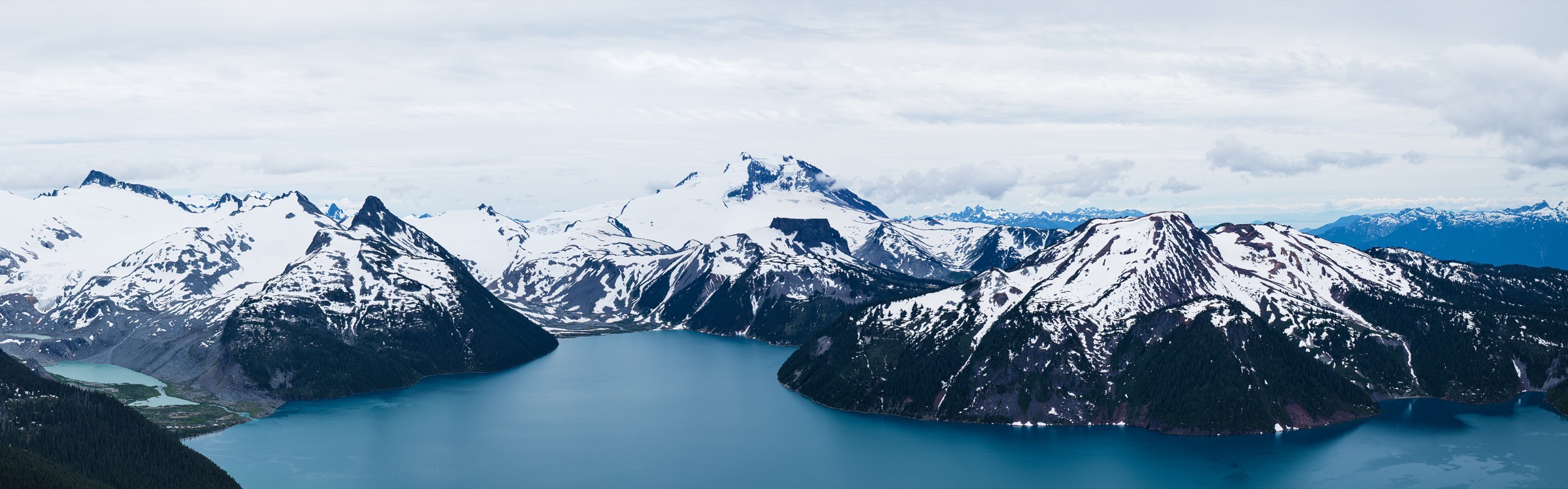
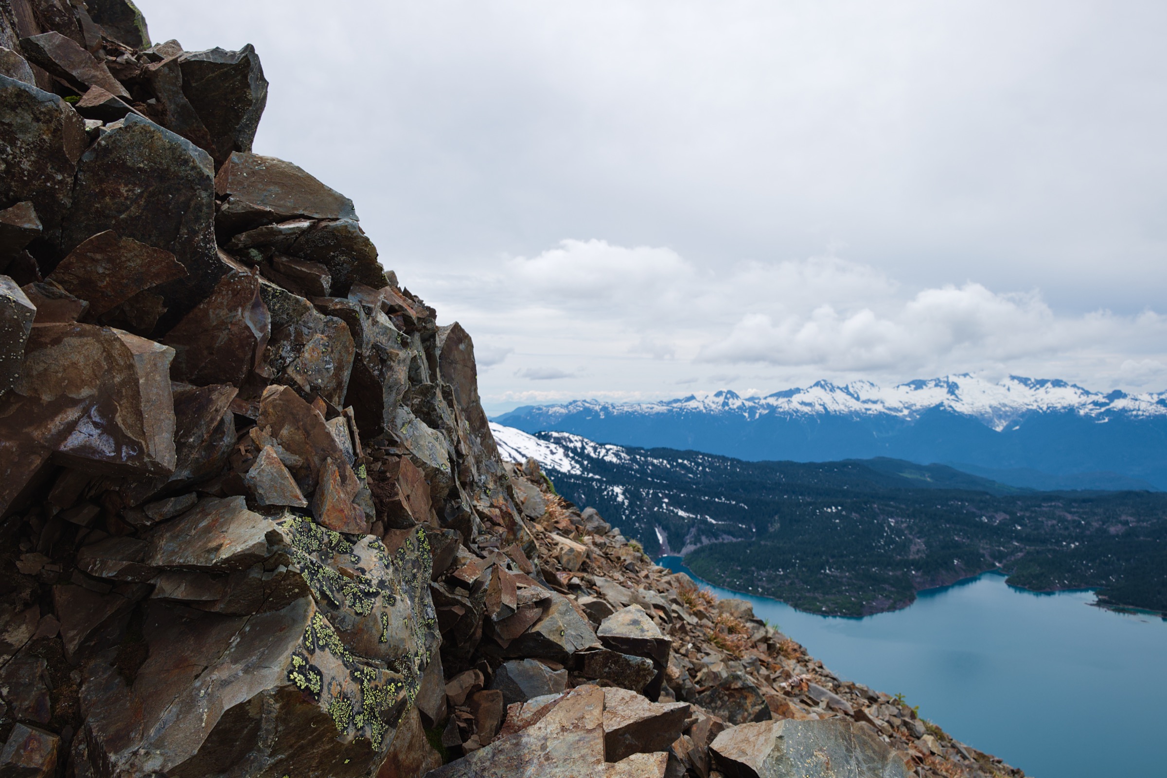
2. Panorama Ridge
Snapshot
Itinerary
The route shares the first 6 km of switchbacks with Garibaldi Lake before diverging at the signed junction. The Taylor Meadows variant — recommended for day-hikers because it cuts roughly 3 km from the round trip — climbs left through subalpine forest, then opens into wide subalpine meadows of heather, lupine and Indian paintbrush in late July and August. Beyond the Taylor Meadows campground the trail traces a level then gently rising line across the plateau, passing the signed Black Tusk junction at about 11 km. The Panorama Ridge spur trends east-southeast, climbs a final 400 m through krummholz and over a loose volcanic ridge, and tops out at approximately 2,130 m above the western shore of Garibaldi Lake. The view encompasses the full lake, the Sphinx and Bookworms glaciers, Mount Garibaldi, Castle Towers and Black Tusk. Return is by the same route; the Garibaldi Lake variant descends to the lake shore for a longer return.
Why it is essential
Panorama Ridge is the defining high balcony of southern Garibaldi Park, providing the postcard view of Garibaldi Lake from above that appears in every guidebook to the region. The objective is non-technical despite its length, which makes it the natural extended day for fit hikers who want the high alpine experience without the loose-chimney scramble of Black Tusk’s summit block. As a day hike at the upper boundary of distance and gain it is honest hard work, but the grade is even and the trail well-trodden.
Equipment
- Mountain hiking equipment: sturdy boots, trekking poles recommended, extra warm layer, hat and gloves outside midsummer, navigation backup, headtorch.
- Bear-aware food storage.
- Microspikes in early season; often required on the upper ridge into mid-July in average years.
- Vehicle day-use pass Friday to Monday and holidays, 12 June to 12 October 2026.
- A headtorch is non-optional for any party starting after 07:00 in late summer.
Hazards and notes
- The upper 200 m of ascent is on loose volcanic scree and can be slippery in wet or icy conditions.
- The ridge top has a corniced edge above Garibaldi Lake; keep well back, particularly with snow.
- Snow cover on the ridge often persists into mid-July; check the BC Parks trail report.
- The Black Tusk summit block — an optional variant from the same plateau — involves a class 3 chimney with rockfall risk and is discouraged by BC Parks.
- Cell coverage is unreliable beyond Rubble Creek. Dogs prohibited.
GPX / KML links
| Source | URL | Format / access | Reuse status |
|---|---|---|---|
| OpenStreetMap ways (Rubble Creek – Taylor Meadows – Panorama Ridge spur) | openstreetmap.org | OSM derivation | ODbL; geometry reusable and derivable under ODbL |
| Vancouver Trails — Panorama Ridge | vancouvertrails.com | Reference page | Proprietary; cross-check stats only |
External links
- BC Parks — Garibaldi Provincial Park
- Vancouver Trails — Panorama Ridge
- BC Parks — Day-use passes (2026)
3. Wedgemount Lake
Snapshot
Itinerary
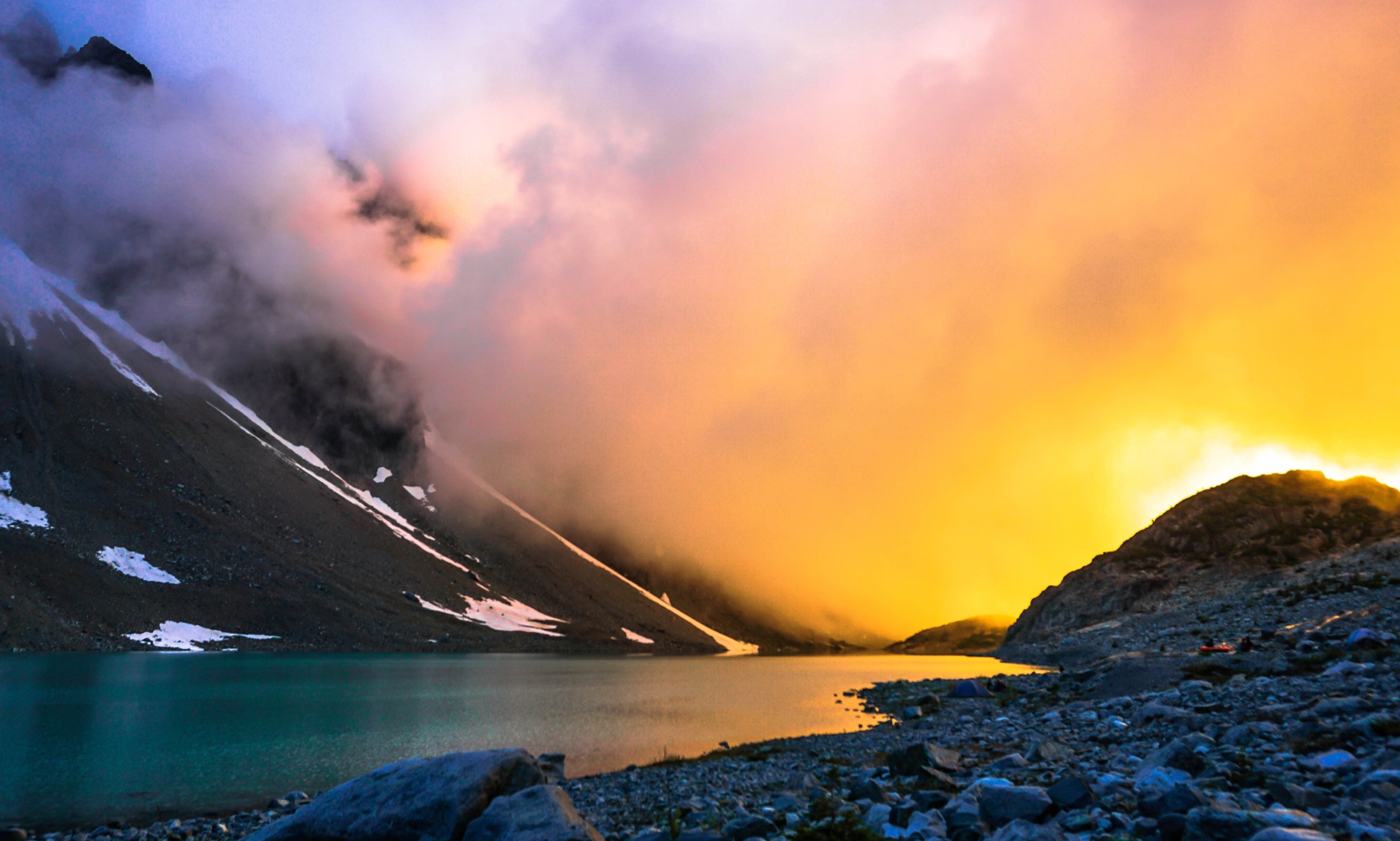
From the parking area at the end of the Wedge Creek FSR the trail descends briefly to a footbridge over Wedge Creek, then turns sharply uphill. The grade is unrelenting from this point: through old-growth and second-growth coniferous forest, with frequent root steps and a few short rocky pitches, the path gains roughly 1,000 m in 5 km. A boulder field near the top of the cirque headwall is the crux for most parties; cairns mark the line. The trail crests at the lake’s outlet stream, where the BC Parks ranger cabin and walk-in tent platforms are located. The lake, a deep glacial blue, sits beneath the icefalls of Wedge Mountain and Mount Cook, with the Wedgemount Glacier terminus across the water. Return is by the same route.
Why it is essential
Wedgemount packs more vertical relief into a shorter distance than any other established Garibaldi trail and delivers the closest day-trip view of a true Coast Mountains hanging glacier. The cirque under Wedge — the highest peak in the park at 2,891 m — is geologically dramatic and visually distinct from the lava-volcanic landscape of Garibaldi Lake further south. The trail is non-technical despite its grade and represents the steep alpine end of the regional hiking spectrum.
Equipment
- Mountain hiking equipment: sturdy boots essential, trekking poles strongly recommended, extra warm layer, hat and gloves, headtorch.
- Bear-aware food storage at the lake.
- Microspikes in early season; snow can persist in the boulder field into mid-July.
- No BC Parks day-use pass requirement at Wedgemount in 2026; the pass programme is concentrated at Rubble Creek, Diamond Head and Cheakamus.
Hazards and notes
- The trail is steep enough that descents are slow and hard on knees; the lower half can be slick when wet.
- The boulder field near the top requires careful foot placement.
- The lake outlet is the highest safe point for most day-hikers; the surrounding glaciers are crevassed and must not be approached without rope team training.
- Dogs prohibited (Garibaldi Park).
- The Wedge Creek FSR is potholed but passable to 2WD in dry summer conditions; check current road status with Recreation Sites & Trails BC.
- The trailhead has no water source; fill at Whistler.
GPX / KML links
| Source | URL | Format / access | Reuse status |
|---|---|---|---|
| OpenStreetMap ways (Wedge Creek FSR – Wedgemount Lake trail) | openstreetmap.org | OSM derivation | ODbL; geometry reusable under ODbL |
| Vancouver Trails — Wedgemount Lake | vancouvertrails.com | Reference page | Proprietary; cross-check for stats only |
External links
- BC Parks — Garibaldi Provincial Park
- Vancouver Trails — Wedgemount Lake
- Hike in Whistler — Wedgemount Lake
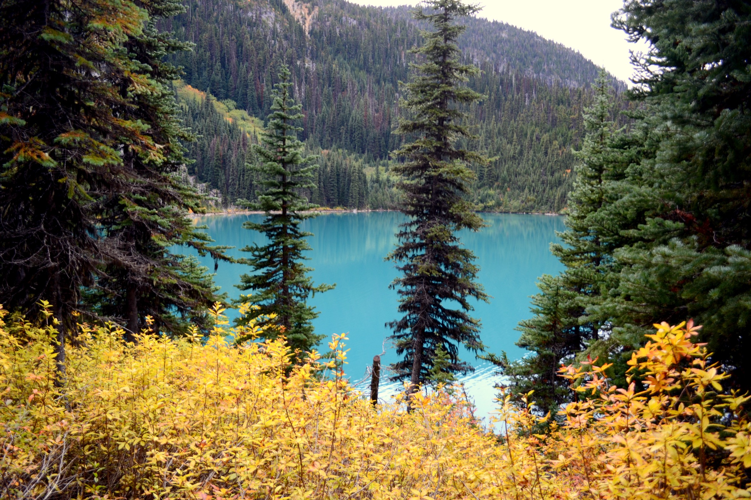
4. Joffre Lakes (Lower / Middle / Upper)
Snapshot
Itinerary
Lower Joffre Lake is reached in roughly 5 minutes on a paved viewing path from the parking lot. The main trail then climbs through old-growth hemlock and Engelmann spruce forest on a steady but moderate grade. After approximately 3 km the route emerges at a boulder field below the headwall, with Middle Joffre Lake to the right; this is the most photographed location in the park, with the Matier Glacier on the cirque headwall behind. Beyond Middle Joffre the trail climbs more steeply over roots and boulders, then crosses Joffre Creek on a footbridge before traversing the moraine to Upper Joffre Lake at approximately 5 km. The Upper Joffre walk-in campground sits at the head of the lake. Return is by the same route.
Why it is essential
Joffre Lakes is the most accessible big-scenery alpine objective in the Pemberton sector and the cultural-spiritual heart of the area for the Líĺwat Nation and N’Quatqua; the park’s Indigenous name, Pipi7íyekw, is now used in BC Parks signage. The three turquoise lakes terraced beneath the Matier Glacier are an exceptional and short walk for the gain involved, and the day-use pass system has made the experience materially more manageable than it was during the pre-pass era. The combination of cultural significance, low technical difficulty and high scenic value makes it indispensable to any catalogue of regional day-hikes.
Equipment
- Standard hiking equipment.
- Microspikes in early season; June and early July often retain snow on the upper trail and boulder field.
- Bear-aware food storage; bear lockers at Upper Joffre campground.
- Mandatory BC Parks trail pass (per person, not per vehicle) every day from 11 May to 25 October 2026; children 12 and under accompanied by an adult pass-holder are exempt. Book on the BC Parks day-use portal from 07:00 two days before.
Hazards and notes
- Dogs are not permitted in Joffre Lakes Park.
- Swimming and entering the water are prohibited for cultural and ecological reasons; BC Parks signage is explicit.
- The park closes entirely on 20–27 June 2026 (National Indigenous Peoples Day and summer solstice) and 8–30 September 2026 (fall harvesting and National Day for Truth and Reconciliation); these are firm closures, not reduced-access periods.
- The Matier Glacier is heavily crevassed and the moraine slopes above Upper Joffre are loose; do not approach the glacier without rope team training.
- Late-day thunderstorms occasionally develop on the divide.
GPX / KML links
| Source | URL | Format / access | Reuse status |
|---|---|---|---|
| OpenStreetMap ways (Joffre Lakes trail) | openstreetmap.org | OSM derivation | ODbL; geometry reusable under ODbL |
| BC Parks — Pipi7íyekw / Joffre Lakes brochure (PDF link from park page) | bcparks.ca | Park page / linked PDF | Government of BC — Open Government Licence (verify per file); reference only, not a GPX |
External links
- BC Parks — Pipi7íyekw / Joffre Lakes Provincial Park
- BC Parks — Day-use passes (2026)
- BC Government — 2026 day-use passes and Joffre closures release
- Vancouver Trails — Joffre Lakes 2026 update
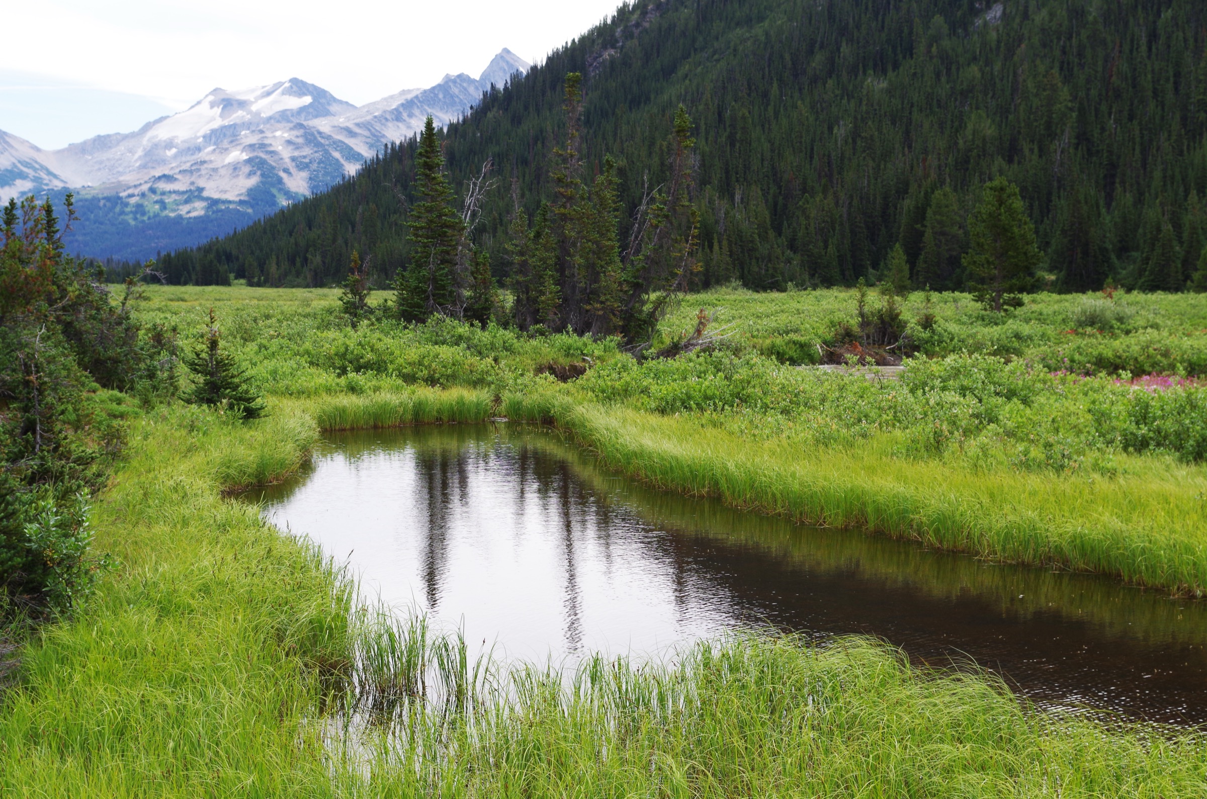
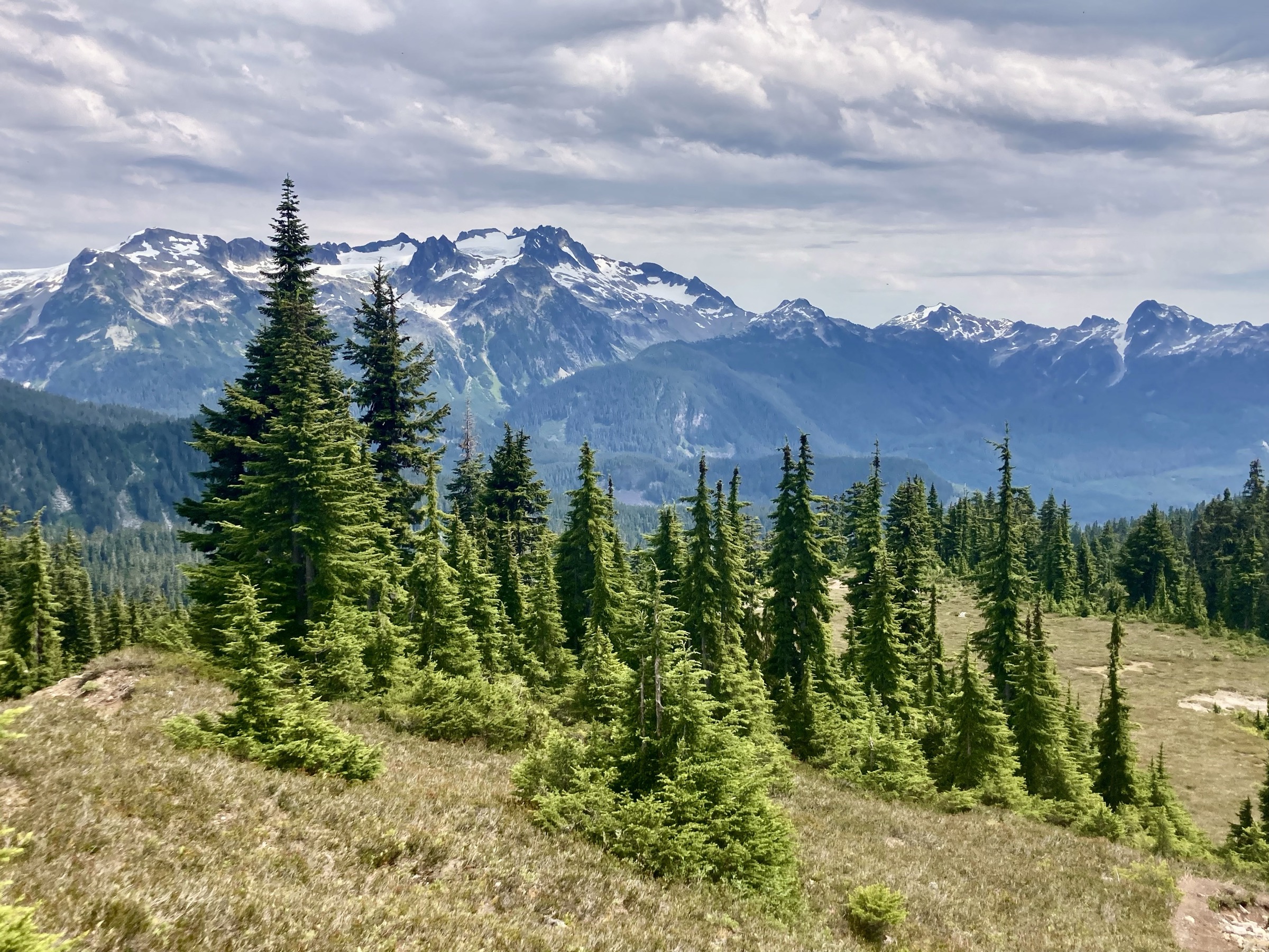
5. Elfin Lakes via Diamond Head
Snapshot
Itinerary
From the Diamond Head parking area the trail follows a former service track through subalpine forest, climbing gently to the Red Heather day-use shelter at about 5 km. Beyond Red Heather Meadows the route leaves tree cover and traverses the open crest of Paul Ridge for several kilometres, with views east to Mount Garibaldi and the Mamquam Icefield and south down the Squamish valley. The path crests Paul Ridge at approximately 1,660 m, then descends about 150 m to the Elfin Lakes basin at 1,470 m, where the BC Parks Elfin Lakes hut and walk-in campground are located. The two small Elfin Lakes sit beneath the slopes of Round Mountain. Return is by the same route; a longer variant continues to Opal Cone and the Mamquam Lake area for overnight parties.
Why it is essential
Elfin Lakes via Diamond Head is the long, open balcony day of the Garibaldi–Pemberton region: the gradient is gentle, the views above treeline extend the entire walk, and the objective combines a working BC Parks hut, an alpine meadow system and a direct close view of Mount Garibaldi’s south face and the Mamquam Icefield. Diamond Head was the site of one of the earliest backcountry ski operations in western Canada in the 1940s to 1960s, which gives the trail historical resonance. The route is also the principal winter ski-touring approach in the region.
Equipment
- Standard hiking equipment.
- Mountain hiking equipment in spring or autumn; the open ridge is exposed to wind.
- Bear-aware food storage at the lakes; food lockers at Elfin Lakes campground.
- Vehicle day-use pass Friday to Monday and holidays, 12 June to 12 October 2026.
- Tire chains and 4WD between October and April on the Mamquam FSR (per BC Parks).
Hazards and notes
- Exposure is minimal in summer; the principal hazard is weather on the open ridge, which can change quickly with marine systems.
- Swimming is not permitted in the second Elfin Lake (drinking-water source).
- Dogs are prohibited.
- The Diamond Head day-use pass system applies to the parking lot and is enforced; the lot is small and fills early.
- In early summer, snow lingers on Paul Ridge into mid-July in average years; in winter the area sees significant avalanche terrain on Round Mountain and Diamond Head, and winter parties require avalanche training and equipment.
GPX / KML links
| Source | URL | Format / access | Reuse status |
|---|---|---|---|
| OpenStreetMap ways (Diamond Head – Red Heather – Elfin Lakes) | openstreetmap.org | OSM derivation | ODbL; geometry reusable under ODbL |
| BC Parks — Garibaldi: Diamond Head area | bcparks.ca | Park page / linked PDF | Government of BC — Open Government Licence (verify per file); reference only, not a GPX |
External links
- BC Parks — Garibaldi: Diamond Head area
- Tourism Squamish — Elfin Lakes
- Vancouver Trails — Elfin Lakes
Missing data / follow-up work
- No official BC Parks GPX downloads. BC Parks publishes PDF maps for Garibaldi and Joffre Lakes but does not appear to release GPX. Route geometry must be derived from OpenStreetMap (ODbL) or generated against BC Parks PDF maps as ground truth.
- Hike 5 figure resolved: a 4032×3024 px CC BY-SA 4.0 photo from the Elfin Lakes area (Davidwegan, Wiki Loves Earth 2025) is now used. A higher-resolution direct frame of the lakes themselves would still be a welcome upgrade.
- No licence-compatible Blowdown Pass photo found in this pass; Blowdown was therefore not selected as one of the five.
- Black Tusk is achievable as a strenuous day hike (approx. 28.5–29 km, approx. 1,735–1,750 m gain, 7–12 hours) but shares its lower 11 km with both Hike 1 and Hike 2, and the summit block (class 3 chimney) is discouraged by BC Parks. It is treated as a variant from Taylor Meadows for parties who want the longer day.
- Public-transport access requires local confirmation. Seasonal shuttle services to Rubble Creek, Diamond Head, Joffre Lakes and Whistler-area trailheads (Epic Rides, Parkbus, Pemberton Valley Lodge shuttle, etc.) operate variably year to year and current 2026 schedules were not confirmed.
- Wedge Creek FSR road status varies seasonally; Recreation Sites & Trails BC publishes road advisories and current condition should be confirmed before publication.
- Tenquille Lake and Blowdown Pass are listed as strong follow-up candidates if the catalogue ever expands beyond five hikes for this region.
External links
| Source | URL |
|---|---|
| BC Parks — Garibaldi Provincial Park | bcparks.ca |
| BC Parks — Garibaldi: Diamond Head area | bcparks.ca |
| BC Parks — Garibaldi: Cheakamus Lake area | bcparks.ca |
| BC Parks — Pipi7íyekw / Joffre Lakes Provincial Park | bcparks.ca |
| BC Parks — Day-use passes (2026 schedule) | bcparks.ca |
| BC Parks reservations portal | reserve.bcparks.ca |
| BC Government — 2026 day-use passes and Joffre closures release | news.gov.bc.ca |
| BC Parks — Garibaldi park map (PDF) | nrs.objectstore.gov.bc.ca |
| Tourism Squamish — Garibaldi Lake | exploresquamish.com |
| Tourism Squamish — Elfin Lakes | exploresquamish.com |
| Vancouver Trails — Panorama Ridge | vancouvertrails.com |
| Vancouver Trails — Wedgemount Lake | vancouvertrails.com |
| Vancouver Trails — Elfin Lakes | vancouvertrails.com |
| Vancouver Trails — Joffre Lakes 2026 update | vancouvertrails.com |
| Hike in Whistler — Wedgemount Lake | hikeinwhistler.com |
| Best Hikes BC — Wedgemount Lake | besthikesbc.ca |