Regional overview
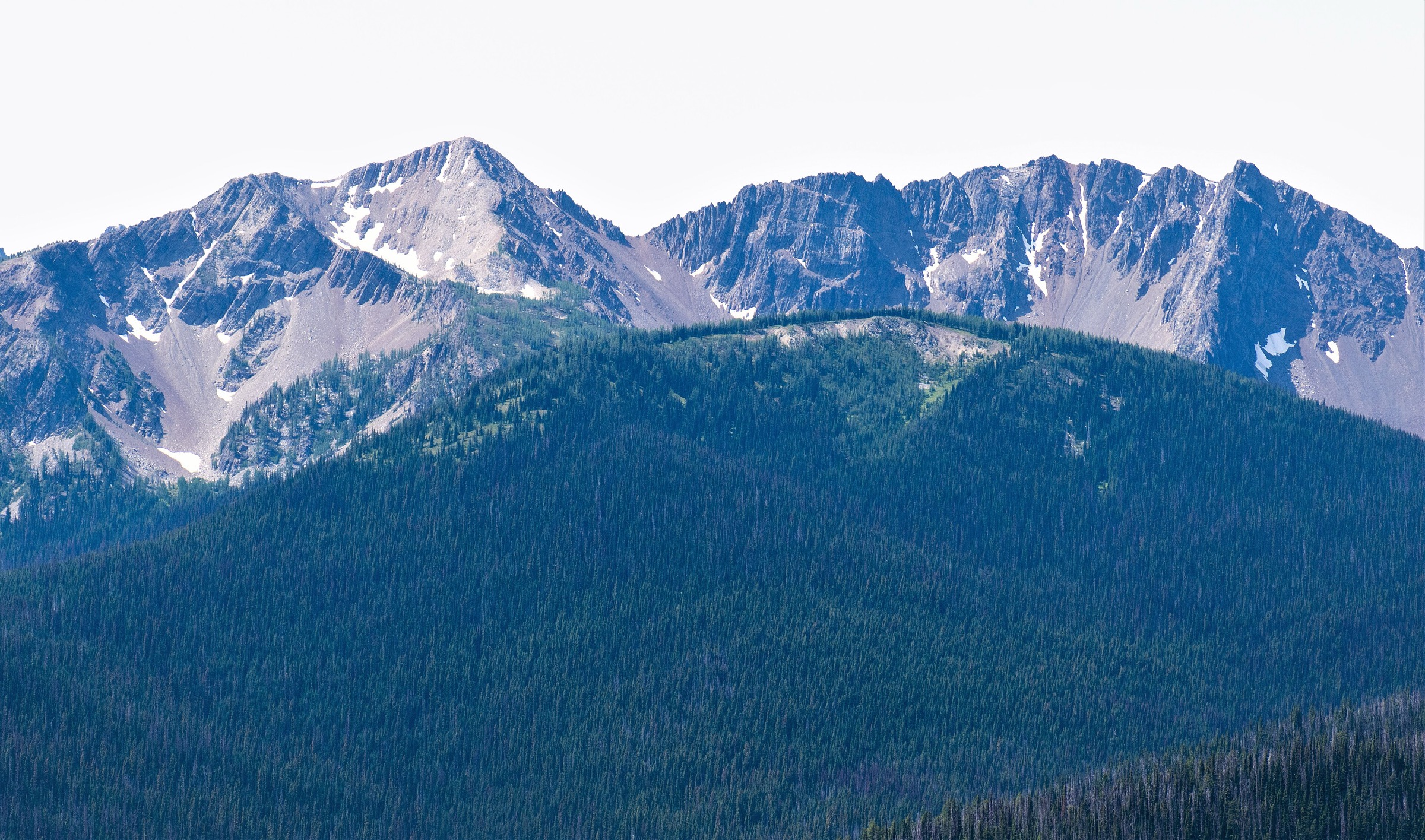
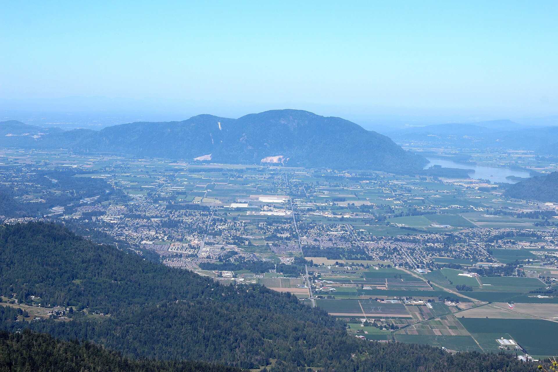
The Fraser Valley / Chilliwack Ranges sub-region of the Canadian Cascades sits roughly 90–140 km east of Vancouver, where the Fraser River cuts north-west around the abrupt north-western terminus of the North Cascades. Terrain is characteristically rugged and steep: granite and granodiorite intrusions of the Chilliwack batholith form sharp peaks such as Mount Slesse (2,439 m) and Mount Rexford, while older metamorphic and sedimentary rocks build the Cheam Range — a small but visually dominant subrange of the Skagit Range whose “Four Sisters” (Cheam, Lady, Baby Munday, Stewart) define the eastern Fraser Valley skyline. Treeline sits at roughly 1,500–1,700 m, lower than in the Coast Ranges to the north, so even modest day climbs from the Chilliwack River valley quickly reach open subalpine meadow and ridge.
The principal hiking centres are the Chilliwack River Valley (south-east of Chilliwack city, leading to Sx̱ótsaqel/Chilliwack Lake Provincial Park), the Cheam Range cluster (approached from forest-service roads off Chipmunk Creek FSR above Bridal Falls/Popkum), and the gentler front-range trailheads close to Chilliwack itself (Elk–Thurston, Vedder Mountain). Most popular alpine destinations require a private vehicle and, in several cases, a high-clearance 4×4 to negotiate deactivated logging roads (Mount Cheam FSR, Nesakwatch Creek FSR for Slesse, Liumchen/Borden Creek FSR for Mount McGuire). The Chilliwack River Road itself is paved as far as the lake and is accessible to ordinary cars.
The reliable alpine season is short — typically mid-July through late September on the higher routes (Cheam, Slesse Memorial, McGuire), with snow lingering on north-facing approaches into early July. Lower lake hikes such as Lindeman are usable from April or May until October. The lower elevations are wet temperate rainforest, and weather can change rapidly; afternoon thunderstorms are common over the Cheam Range in summer. Black bear are common throughout, with grizzly presence increasing east of Chilliwack Lake. Cellular coverage is unreliable beyond Vedder Crossing and effectively absent east of the “On the Way” store in the upper Chilliwack River valley. Several trailheads have had reported vehicle break-ins; valuables should not be left visible. No park-entry fee is charged for day use in Sx̱ótsaqel/Chilliwack Lake Park, but backcountry camping at Lindeman, Greendrop, Flora and Radium Lakes requires advance registration ($5/person/night). Dogs are prohibited in the Chilliwack Lake Park backcountry but permitted (under control) on most BC Recreation Sites and Trails (RSTBC) trails such as Cheam and Elk–Thurston.
Selection rationale
The five hikes below were selected to span the sub-region’s three main trailhead clusters and to balance its distinctive characters — iconic summit, accessible ridge, classic lake basin, cultural pilgrimage, and quieter strenuous big-day peak — while staying inside day-feasibility:
- Mount Cheam (Lhílheqey) — the iconic summit and most recognised peak of the eastern Fraser Valley, the “mother mountain” of the Stó:lō people, and the easiest 2,100 m summit in southern coastal British Columbia.
- Elk Mountain–Thurston Ridge — the most accessible non-4×4 alpine outing in the sub-region, a long open ridge walk from a 2WD trailhead with views matched only by Cheam itself.
- Lindeman & Greendrop Lakes — the classic forest-and-lake hike inside Sx̱ótsaqel/Chilliwack Lake Provincial Park, feasible without a high-clearance vehicle.
- Mount Slesse Memorial Trail — a strenuous forest climb to the 1956 TCA Flight 810 memorial below Mount Slesse’s north-east buttress, the principal cultural and historical pilgrimage of the Canadian Cascades.
- Mount McGuire — a quieter strenuous representative of the granite-and-limestone summits south of the Chilliwack River, with one of the broadest panoramas in the sub-region.
Vedder Mountain and the Williamson Lake / Williams Peak area were considered but excluded: Vedder is largely a mountain-bike and viewpoint area without a single signature alpine objective, and Williamson Lake has unstable forest-service-road access and is poorly documented in official sources.
Summary table
| # | Hike | Country | Route type | Distance | Gain | Max elevation | Difficulty |
|---|---|---|---|---|---|---|---|
| 1 | Mount Cheam (Lhílheqey) | Canada | Out-and-back | 8.4–9.5 km | ~650–700 m | 2,104 m | Moderate |
| 2 | Elk Mountain–Thurston Ridge | Canada | Out-and-back | 8 km (Elk) / ~15 km (Thurston) | ~765 m / ~990 m | 1,432 m / 1,632 m | Moderate / Difficult |
| 3 | Lindeman & Greendrop Lakes | Canada | Out-and-back | 3.4 km / 10.4 km | ~220 m / ~495 m | ~997 m | Easy / Moderate |
| 4 | Mount Slesse Memorial Trail | Canada | Out-and-back | 12–16 km | ~920–1,050 m | ~1,570 m | Difficult |
| 5 | Mount McGuire | Canada | Out-and-back | ~14 km | ~1,100 m | 2,019 m | Difficult |
1. Mount Cheam (Lhílheqey)
Snapshot
Itinerary
From the Spoon Lake trailhead at roughly 1,460 m, the trail climbs north through stunted subalpine fir and yellow-cedar onto an open meadow shelf above Spoon Lake, with the first views west to the Fraser Valley. The path swings north-east across heather and wildflower meadows below the south-east face of Mount Cheam, then turns north onto a broad rubble slope. A signed junction is reached at roughly 1,800 m where a side trail breaks east toward Lady Peak (an out-and-back extension for experienced scramblers); the main Cheam route continues north-west, climbing more steeply onto the south ridge.
The final 200 m of ascent follow a well-trodden path on rust-coloured volcanic-tuff scree and short rocky steps, with one short hands-on section near the summit. The 2,104 m top is a narrow rocky platform with a 360-degree view: Mount Baker dominates the south, the entire Fraser Valley extends west to the Coast Mountains, the Lucky Four Group (Welch, Foley, Stewart, Knight) lies east, and Lady Peak is immediately south-east. Camping is not permitted on the trail or summit.
Why it is essential
Mount Cheam is the most prominent and culturally significant peak of the eastern Fraser Valley. Known as Lhílheqey in Halkomelem, it is the “mother mountain” of the Stó:lō people. It is also the easiest 2,100 m summit in southern coastal British Columbia, with a well-defined trail managed by Recreation Sites and Trails BC, and its summit panorama — Mount Baker, the Cheam Range “Four Sisters”, and the full Fraser Valley — is widely regarded as the finest in the sub-region.
Equipment
- Mountain hiking equipment: sturdy boots, weatherproof shell, warm midlayer, hat and gloves, sun protection.
- 2 L of water; no reliable on-route source after early summer.
- Map, GPS backup, headtorch as long-day insurance.
- Trekking poles useful on the scree; microspikes can be helpful in early July for hard-packed snow on the upper south ridge.
- High-clearance 4×4 with low-range gearing is effectively required for the deactivated Chipmunk Creek / Mount Cheam FSR.
Hazards and notes
- The summit drops abruptly on the north side into the “Angel’s Bowl” — a sheer cliff with multiple recorded fatalities from people approaching the edge on loose rock; stay well back.
- The upper meadow is exposed to lightning and wind; weather can change rapidly.
- Black bear and occasional cougar are present; carry bear spray.
- Dogs permitted but should be kept close near the summit.
- No camping on the trail; outhouse at the trailhead only.
- Cell coverage is poor; no reliable on-route water.
GPX / KML links
| Source | URL | Format / access | Reuse status |
|---|---|---|---|
| Wikiloc — Mt Cheam trail | wikiloc.com | GPX (account required) | Wikiloc user-content terms; reference only |
| Gaia GPS — Mount Cheam Trail | gaiagps.com | GPX (account) | Gaia GPS terms; reference only |
| OpenStreetMap (Cheam Peak area) | openstreetmap.org | OSM ways | ODbL; reusable with attribution |
| RSTBC trail factsheet | sitesandtrailsbc.ca | Web (no GPX confirmed) | Government of BC; reference only |
External links
- Recreation Sites and Trails BC — Mount Cheam Trail (REC3109)
- Wikipedia — Cheam Peak
- Vancouver Trails — Mount Cheam
- Stó:lō Heritage Trust — MountCheam.ca
2. Elk Mountain–Thurston Ridge
Snapshot
Itinerary
From the gravel parking area at the top of Elk View Road, the trail enters second-growth forest and climbs steadily north-east via long switchbacks. After approximately 1.5 km the path crosses an old logging road; the gradient steepens for the final 1.5 km of forested climb to a small clearing on the west shoulder of Elk Mountain at roughly 1,300 m. Continuing east along the open ridge, the trail emerges onto the paragliding launch and the broad subalpine summit of Elk Mountain at 1,432 m, with sweeping views across the Fraser Valley to Mount Cheam and north to the Coast Mountains.
From Elk, the trail continues east along the open ridgeline, dipping into a saddle and re-climbing through subalpine forest and meadow to the rounded summit of Mount Thurston at 1,632 m (~3 km beyond Elk). Strong parties can extend a further ~2 km east along the ridge to Mount Mercer (1,786 m), creating the “Elk–Thurston–Mercer Traverse” (~24 km return, ~1,540 m total gain). Most parties turn around at Elk or Thurston and return by the same route.
Why it is essential
Elk–Thurston is the most accessible alpine ridge walk in the Fraser Valley: a 2WD trailhead, a continuous and unambiguous trail, and a long open ridge with views matched only by Mount Cheam itself. It is one of the most popular hikes in the sub-region and is one of very few routes where strong day-walkers can chain three summits.
Equipment
- Standard hiking equipment: hiking boots or trail shoes, weatherproof layer, warm midlayer, sun protection.
- 1.5–2 L water; no reliable water on the ridge.
- Map, GPS backup; trekking poles useful for the steep upper forest.
- Microspikes recommended outside July–September.
- Headtorch for the full traverse to Mount Thurston or Mercer.
Hazards and notes
- The ridge is exposed to weather; thunderstorms develop quickly in summer.
- The trail crosses toadlet-migration routes on Elk View Road in July and August — Detour signs are posted by the Fraser Valley Regional District during the migration.
- Dogs permitted but must be under control; no camping; no fee.
- Reported vehicle break-ins at the trailhead.
- Wasps can be active on the ridge in late summer.
GPX / KML links
| Source | URL | Format / access | Reuse status |
|---|---|---|---|
| Trailforks — Elk Thurston | trailforks.com | GPX/KML (account) | Trailforks terms; reference only |
| Gaia GPS — Elk Mountain Trail | gaiagps.com | GPX (account) | Gaia GPS terms; reference only |
| Wikiloc — Elk Mountain trails | wikiloc.com | GPX (account) | Wikiloc user-content terms; reference only |
| OpenStreetMap (Elk–Thurston ridge) | openstreetmap.org | OSM ways | ODbL; reusable with attribution |
External links
- Tourism Chilliwack — Elk-Thurston Trail
- Vancouver Trails — Elk Mountain
- Best Hikes BC — Elk Mountain
- Wikipedia — Elk Mountain (British Columbia)
3. Lindeman & Greendrop Lakes
Snapshot
Itinerary
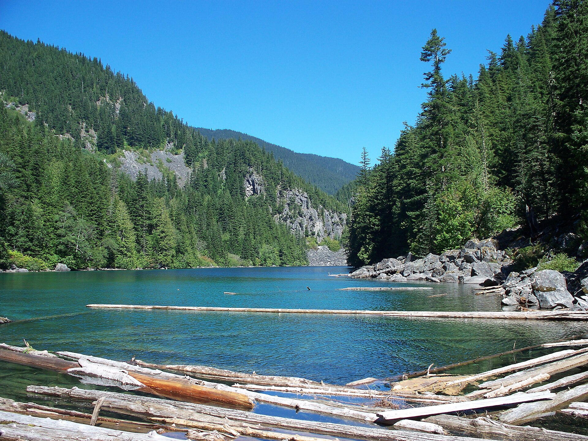
From the Post Creek parking lot on Chilliwack Lake Road, the signed trail crosses a metal footbridge over Post Creek at roughly 500 m from the trailhead and begins a steady climb on a rocky path through Douglas-fir and western hemlock forest. At about 1 km the trail passes the toe of a large old rockslide, then climbs more gently to reach the south end of Lindeman Lake at 1.7 km (842 m). A short side path leads to a wooden dock and the BC Parks tent platforms at the lake’s south end.
For Greendrop, the route continues along the east shore of Lindeman, crossing a series of small boulder fields where the path is marked by orange square markers (per recent BC Parks notice — flagging tape should be ignored). The trail then climbs gradually north through old-growth forest along Post Creek, with several light-scrambling sections across mossy boulders and one stretch of large fallen timber, before levelling at the south end of Greendrop Lake at approximately 997 m and 5.2 km from the trailhead. A small BC Parks campsite occupies the south shore. The onward trail toward Flora Lake is reported by BC Parks as overgrown and crossing several landslides, and is not recommended for day-hikers.
Why it is essential
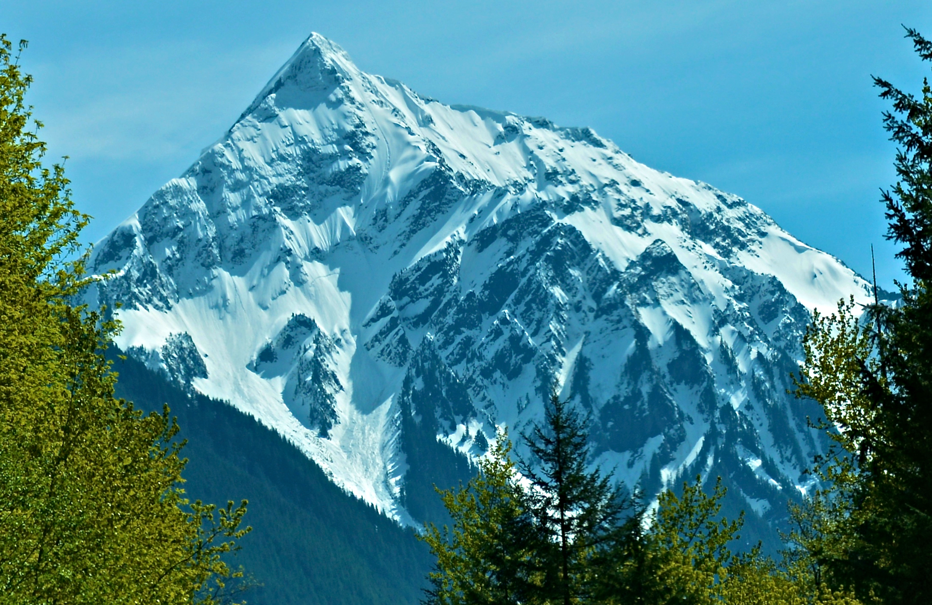
Lindeman and Greendrop Lakes are the signature short hike of Sx̱ótsaqel/Chilliwack Lake Provincial Park and one of the few classic lake-basin hikes in the sub-region that is feasible without a high-clearance vehicle. Lindeman’s emerald colour, the steep granite slabs of Mount Lindeman above, and the old-growth forest along Post Creek make it the most photographed lake in the Canadian Cascades north of the border.
Equipment
- Hiking shoes or boots; sturdier boots and trekking poles useful for the boulder fields and downed timber beyond Lindeman.
- Weatherproof layer and warm layer; sun protection.
- Water (lake water drinkable only with treatment); food.
- Map and bear-aware food storage at BC Parks campsites; bear spray recommended.
Hazards and notes
- Boulder fields between Lindeman and Greendrop have re-routed after washouts — follow orange square markers and ignore older flagging tape (per current BC Parks notice).
- Black and grizzly bears are present in the upper Chilliwack valley.
- Dogs are not permitted in the Chilliwack Lake Park backcountry.
- Backcountry camping at Lindeman or Greendrop requires advance permit registration through BC Parks ($5/person/night).
- Parking lot fills early on summer weekends and has had reported vehicle break-ins; no valuables should be left visible.
- No cell coverage past the “On the Way” store at the start of the Chilliwack Lake Road.
GPX / KML links
| Source | URL | Format / access | Reuse status |
|---|---|---|---|
| AllTrails — Lindeman and Greendrop Lakes Trail | alltrails.com | GPX (paid account) | AllTrails terms; reference only |
| Trailforks — Lindeman/Greendrop Lake Trail | trailforks.com | GPX/KML (account) | Trailforks terms; reference only |
| BC Parks — park map (PDF) | nrs.objectstore.gov.bc.ca | PDF map | Government of BC (Open Government Licence); reusable under OGL-BC |
| OpenStreetMap (Post Creek / Lindeman) | openstreetmap.org | OSM ways | ODbL; reusable with attribution |
External links
- BC Parks — Sx̱ótsaqel/Chilliwack Lake Park
- BC Parks — Backcountry permit registration
- Vancouver Trails — Lindeman Lake
- 10Adventures — Lindeman and Greendrop Lakes Trail
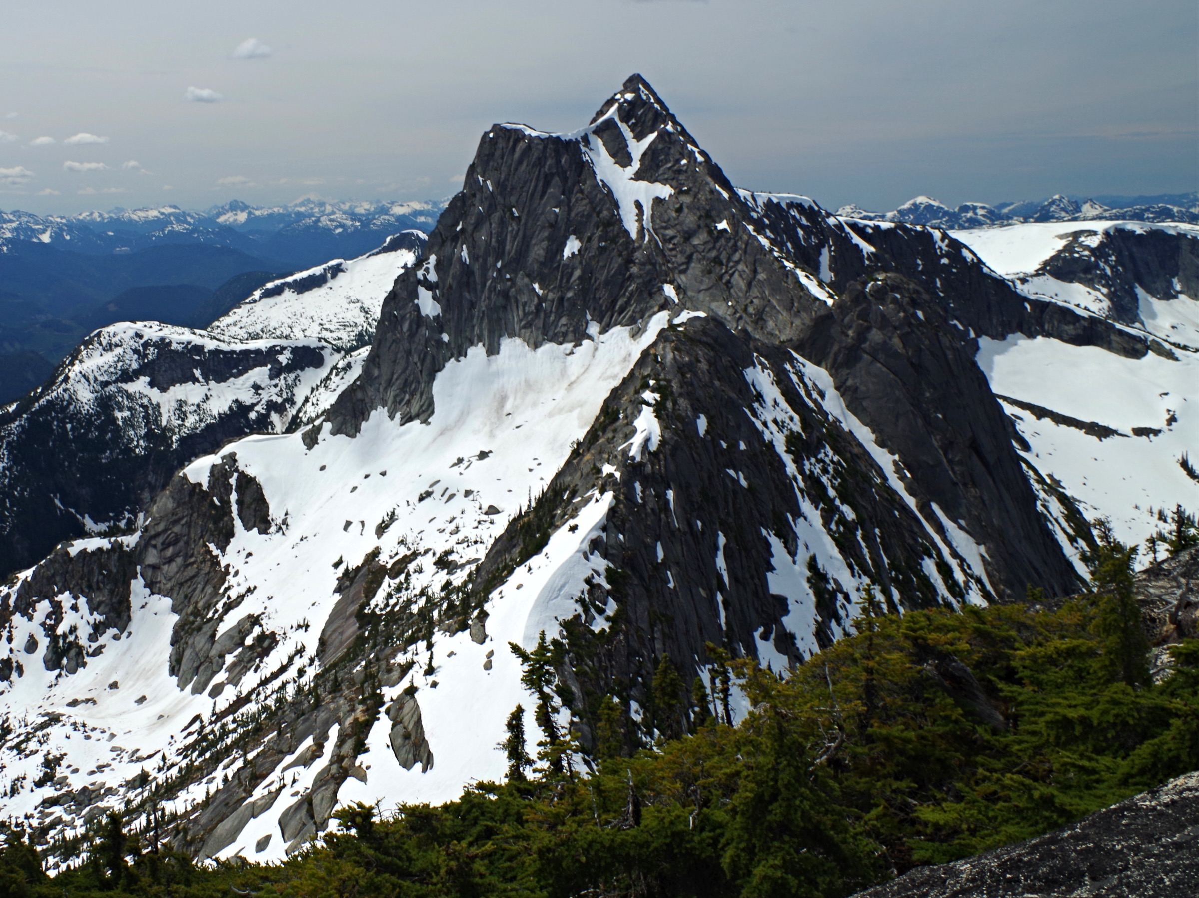
4. Mount Slesse Memorial Trail
Snapshot
Itinerary
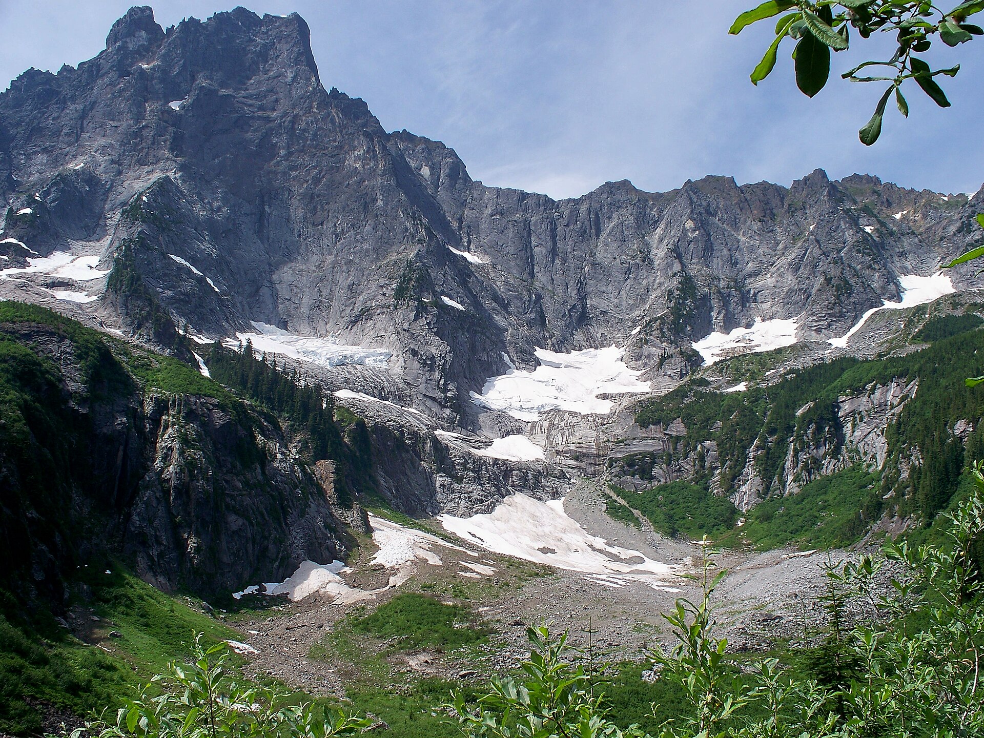
From the Nesakwatch Creek FSR trailhead at roughly 600 m, the trail drops briefly to a log bridge over Nesakwatch Creek, then climbs steadily through second-growth and pockets of old-growth western red-cedar and Douglas-fir. The path is well-defined but narrow and frequently brushy, with several sections of mossy switchbacks and old root-and-rock steps. After roughly 4 km of continuous climbing the gradient eases as the trail emerges into a more open subalpine band with intermittent views east to Mount Rexford and north-east to the granite spires of the Border Peaks.
The trail terminates at a small bench in the forest at approximately 1,570 m, directly below the north-east buttress of Mount Slesse. A memorial plaque and a section of one of the propellers from Trans-Canada Air Lines Flight 810 are set into a rock cairn at the site. The crash debris field above is a designated Heritage Conservation Area; removal or disturbance of any wreckage is prohibited by provincial law.
Why it is essential
The hike is the principal cultural and historical pilgrimage of the Canadian Cascades. On 9 December 1956 TCA Flight 810 struck the north-east face of Mount Slesse, killing all 62 people on board — the wreckage was not located until May 1957 and the site is now permanently protected. The trail also delivers the closest legal walking approach to Mount Slesse itself, whose 900 m granite north-east buttress (one of the Fifty Classic Climbs of North America) towers directly above the memorial.
Equipment
- Mountain hiking equipment: sturdy boots, weatherproof shell, warm midlayer, sun protection.
- 2–2.5 L water; no reliable on-route source.
- Map, GPS backup, headtorch; trekking poles strongly recommended on the steep, often muddy descent.
- Bear spray; microspikes useful before mid-July or after mid-September on shaded upper sections.
- High-clearance 4×4 effectively required for the Nesakwatch Creek FSR.
Hazards and notes
- The Nesakwatch Creek FSR is frequently washed out and has multiple cross-ditches; parking lower on the road significantly lengthens the day.
- The trail is narrow, brushy and occasionally hard to follow; navigation requires attention.
- The memorial is the legal terminus — the upper crash debris is protected as a Heritage Conservation Area.
- Avalanche terrain is present above the memorial and is a winter/spring hazard.
- Dogs permitted but should be on leash where wildlife sign is fresh.
- No camping or toilets on the trail.
GPX / KML links
| Source | URL | Format / access | Reuse status |
|---|---|---|---|
| Trailforks — Mount Slesse Memorial Trail | trailforks.com | GPX/KML (account) | Trailforks terms; reference only |
| RSTBC factsheet — Slesse Mountain Trail | sitesandtrailsbc.ca | Web (no GPX confirmed) | Government of BC; reference only |
| Wikiloc — Slesse Memorial | wikiloc.com | GPX (account) | Wikiloc user-content terms; reference only |
| OpenStreetMap (Nesakwatch / Slesse area) | openstreetmap.org | OSM ways | ODbL; reusable with attribution |
External links
- Vancouver Trails — Slesse Memorial Trail
- Best Hikes BC — Mount Slesse Memorial Trail
- Wikipedia — Mount Slesse
- Wikipedia — Trans-Canada Air Lines Flight 810
5. Mount McGuire
Snapshot
Itinerary
From the upper trailhead beyond the destroyed Borden Creek bridge, the trail climbs steeply north-west through dense second-growth forest, gaining elevation on a relentless rooty path with few switchbacks. After approximately 3 km the gradient briefly eases as the trail crosses a series of small forested benches, then resumes the climb up the south-east ridge of Mount McGuire. The forest opens at roughly 1,700 m onto subalpine heather and granite/limestone slabs — Mount McGuire is geologically unusual in the Canadian Cascades for its limestone summit cap.
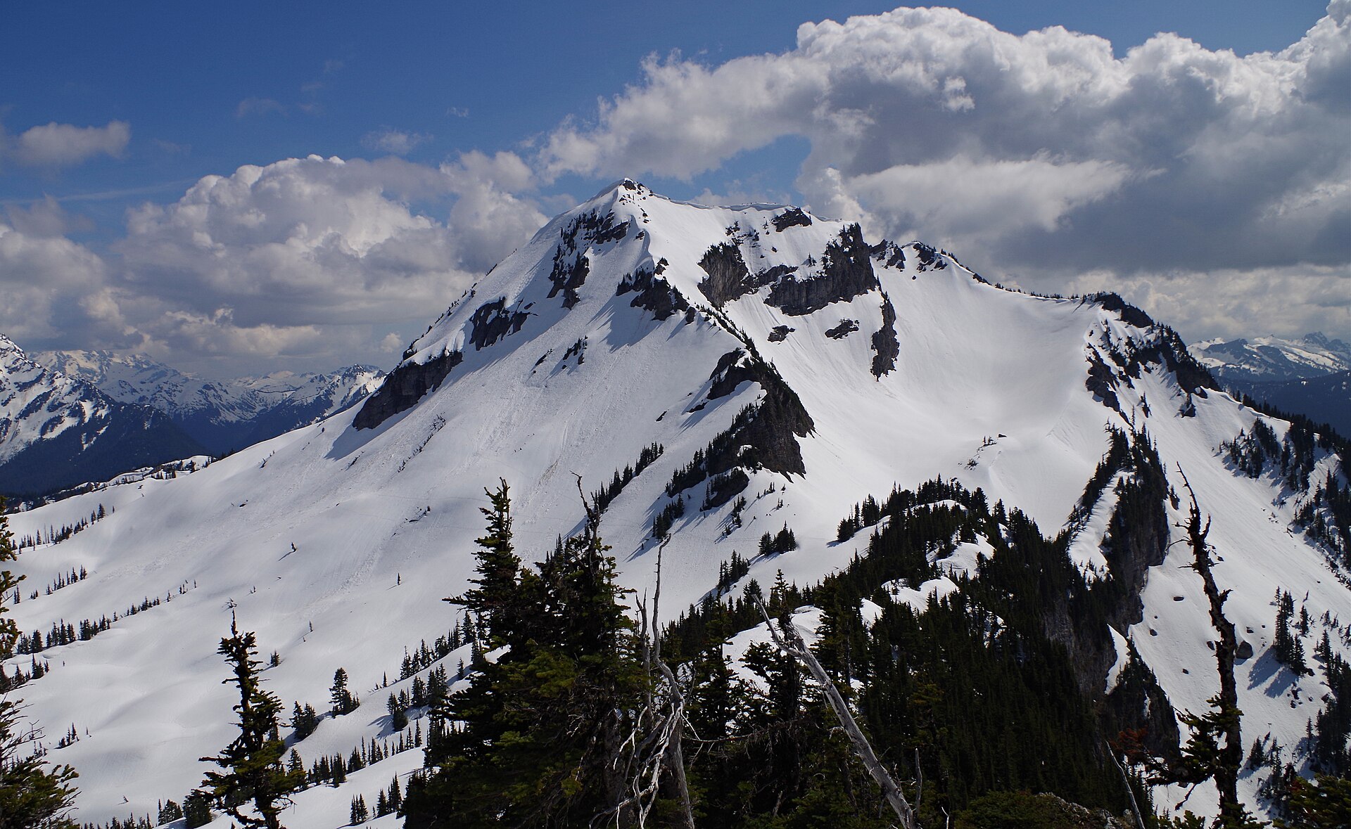
The final 300 m of ascent follow a clear path along the south-east ridge to a small rocky summit at 2,019 m. The view encompasses Mount Slesse and Mount Rexford to the east, the Border Peaks (American and Canadian) and Tomyhoi to the south across the international boundary, Mount Baker to the south-east and the Cheam Range to the north.
Why it is essential
Mount McGuire delivers one of the broadest panoramas in the sub-region from a true 2,000 m summit, and is the most accessible big-day peak south of the Chilliwack River. Its limestone summit cap is geologically distinctive, and the route serves as a strenuous, quieter alternative to the more crowded Cheam and Elk–Thurston trails. The mountain also has cultural significance: T’ehmeehiy in the Chilliwack-Halkomelem language is recorded as “the place of the deformed”.
Equipment
- Mountain hiking equipment: sturdy boots, weatherproof shell, warm midlayer, sun protection.
- 2.5 L water; no on-route source.
- Map, GPS backup, headtorch; trekking poles useful on the steep descent.
- Microspikes recommended before mid-July or after mid-September; bear spray.
- High-clearance 4×4 strongly recommended to reach the upper trailhead.
Hazards and notes
- The Chilliwack–Liumchen and Borden Creek FSRs have multiple washouts and a destroyed bridge over Borden Creek; the practical trailhead depends on current road conditions and may change year to year.
- The forest section is steep, rooty and slippery when wet.
- The upper ridge has minor exposure on weathered limestone — care needed when wet or icy.
- Black and grizzly bears are present.
- Dogs permitted on the RSTBC trail but should be on leash.
- No water sources on route; no camping or toilets at trailhead.
GPX / KML links
| Source | URL | Format / access | Reuse status |
|---|---|---|---|
| Gaia GPS — Mount McGuire Trail and Borden Creek FSR | gaiagps.com | GPX (account) | Gaia GPS terms; reference only |
| AllTrails — Mount McGuire via Borden Creek FSR | alltrails.com | GPX (paid account) | AllTrails terms; reference only |
| RSTBC factsheet — Mt McGuire Trail (REC3081) | sitesandtrailsbc.ca | Web (no GPX confirmed) | Government of BC; reference only |
| OpenStreetMap (McGuire / Borden Creek) | openstreetmap.org | OSM ways | ODbL; reusable with attribution |
External links
- Recreation Sites and Trails BC — Mt McGuire Trail (REC3081)
- BC Geographical Names — Mount McGuire
- Wikipedia — Mount McGuire (Cascade Range)
- Best Hikes BC — Hiking Mount McGuire
External links
| Source | URL |
|---|---|
| BC Parks — Sx̱ótsaqel/Chilliwack Lake Park | bcparks.ca |
| BC Parks — Backcountry permit registration | bcparks.ca |
| BC Parks — Chilliwack Lake park brochure (PDF) | nrs.objectstore.gov.bc.ca |
| Recreation Sites and Trails BC — Mount Cheam Trail (REC3109) | sitesandtrailsbc.ca |
| Recreation Sites and Trails BC — Mt McGuire Trail (REC3081) | sitesandtrailsbc.ca |
| Recreation Sites and Trails BC — Slesse Memorial (REC106514) | sitesandtrailsbc.ca |
| Recreation Sites and Trails BC — Slesse Mountain Trail (REC106768) | sitesandtrailsbc.ca |
| Tourism Chilliwack — Elk-Thurston Trail | tourismchilliwack.com |
| Wikipedia — Cheam Peak | en.wikipedia.org |
| Wikipedia — Cheam Range | en.wikipedia.org |
| Wikipedia — Elk Mountain (British Columbia) | en.wikipedia.org |
| Wikipedia — Mount Slesse | en.wikipedia.org |
| Wikipedia — Trans-Canada Air Lines Flight 810 | en.wikipedia.org |
| Wikipedia — Mount McGuire (Cascade Range) | en.wikipedia.org |
| Vancouver Trails — Fraser Valley trail index | vancouvertrails.com |
| Best Hikes BC — Chilliwack hike summaries | besthikesbc.ca |
| Stó:lō Heritage Trust — MountCheam.ca | mountcheam.ca |
| Wikimedia Commons — Category:Mount Slesse | commons.wikimedia.org |
| Wikimedia Commons — Category:Chilliwack Lake Provincial Park | commons.wikimedia.org |