Regional overview
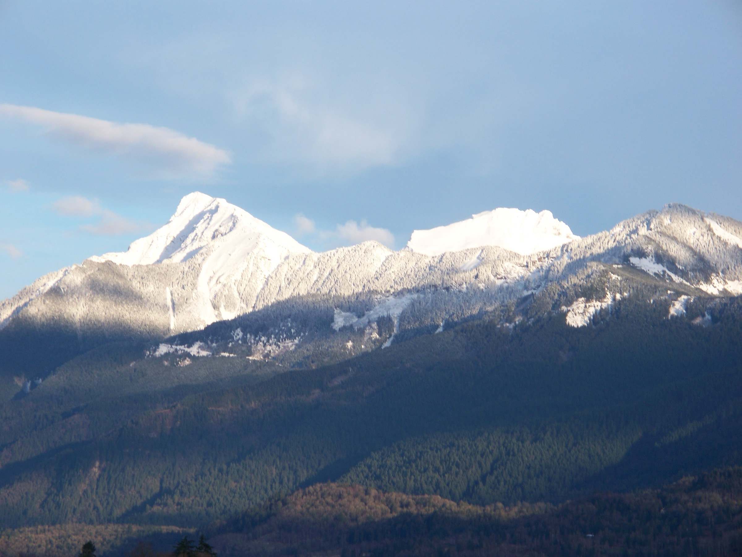
The Coquihalla and Hope corridor occupies the south-western edge of the Canadian Cascades, where granite spires and glacier-sculpted ridges rise abruptly from the Fraser Canyon at Hope (about 40 m elevation) to alpine summits above 2,000 m within a 50 km radius. The sub-region is split by Highway 5 (the Coquihalla), which crosses the range at Coquihalla Pass (approximately 1,244 m) inside the Coquihalla Summit Recreation Area — a 5,750 ha BC Parks-managed protected area whose alpine basins, tarns and ridges define most of the area’s high hiking. Closer to Hope, lower forested summits rising directly from the Fraser and Coquihalla rivers provide year-round walking, often maintained by the volunteer-led Hope Mountain Centre.
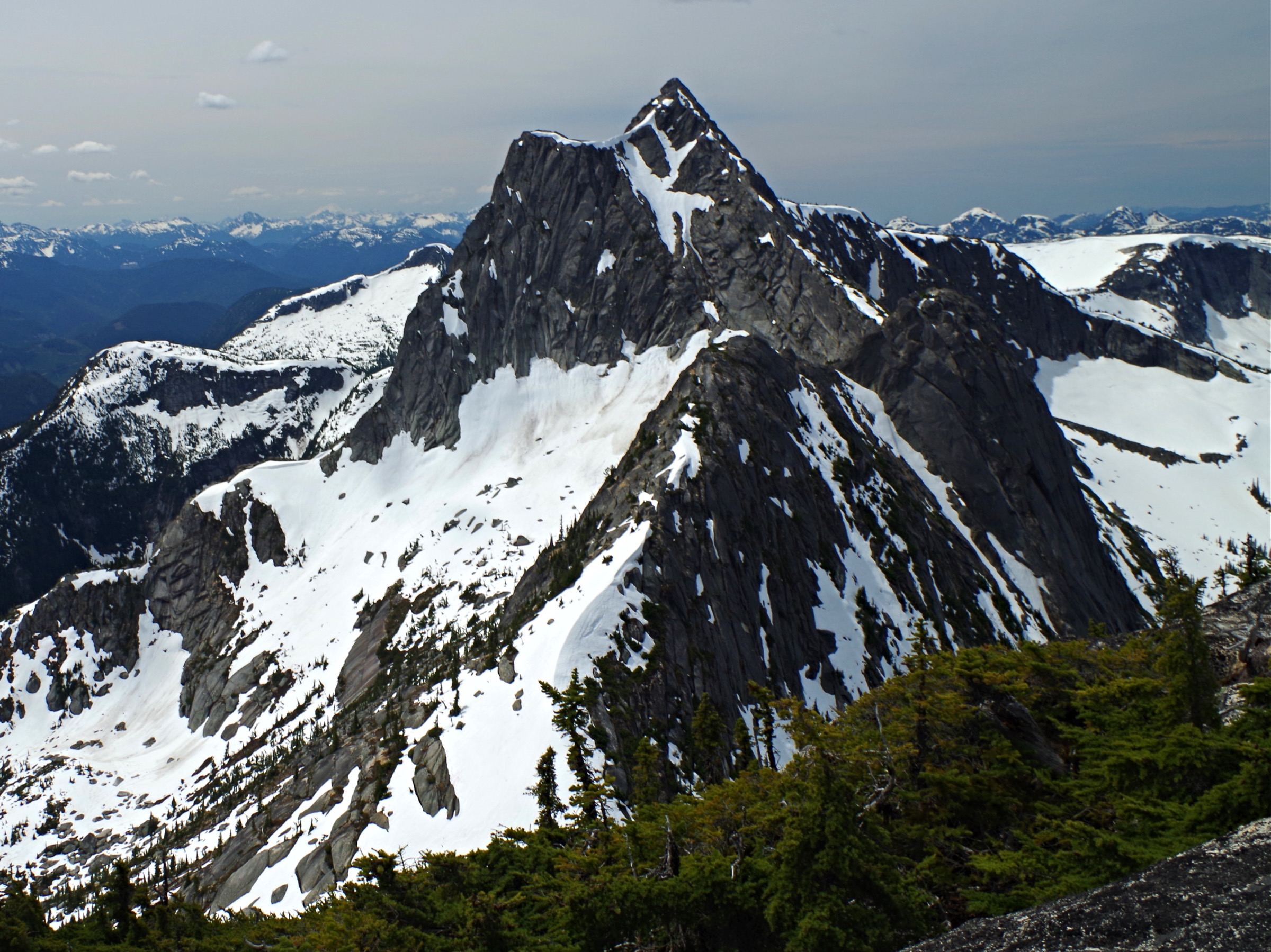
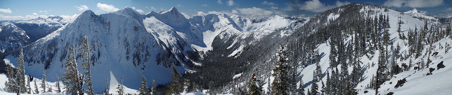
Terrain is predominantly granitic and slabby in the alpine (Yak, Needle, Markhor), with sub-alpine meadow, heather and small lakes filling the basins around Falls Lake and Zoa Peak. Lower elevations near Hope are mixed coastal-interior forest of Douglas fir, western hemlock and red cedar, transitioning to mountain hemlock and subalpine fir above approximately 1,400 m. The Coquihalla Pass receives very heavy snowfall (multi-metre snowpack into June), and many alpine routes only become reliably snow-free from late June or early July through October. Hope itself, sheltered by the Cascades from interior weather, has milder shoulder seasons — Thacker Mountain and Hope Lookout are typically walkable from February to November.
Access is overwhelmingly private-vehicle based. Highway 5 (Coquihalla) connects Hope to the Zopkios Rest Area (Exit 217) and the Falls Lake exit (Exit 221), the two main alpine trailheads. Highway 1 (Trans-Canada) services Hope town trails and the Mt. Lincoln trailhead near Yale. Greyhound-era intercity bus service through Hope has effectively ceased; current options are limited to BC Bus North / Ebus connections, and there is no public transport to any of the Coquihalla Summit trailheads. Safety considerations specific to the corridor include slick granite slabs (multiple recorded fatalities on Yak Peak), late-lying avalanche terrain on north aspects, sudden Coquihalla Pass storms, black and grizzly bears and cougars throughout, and a documented history of vehicle break-ins at Highway 5 trailhead parking.
Selection rationale
The five hikes below were chosen to balance the corridor’s two distinct hiking centres — the Coquihalla Pass alpine and the lower forested summits around Hope — across the full range of difficulty, from an easy lake walk to a technical scramble, while staying inside day-feasibility:
- Needle Peak — the corridor’s most iconic alpine summit and the standard “first big hike” of the Coquihalla, a non-technical climb with a short Class 3 scramble at the top.
- Zoa Peak — the representative sub-alpine ridge walk, accessible across more of the season than the harder peaks and a popular intermediate snowshoe objective in winter.
- Falls Lake — the short, family-friendly lake hike inside the BC Parks recreation area, the only sub-2-hour entry and a sensible poor-weather option.
- Yak Peak (NE ridge) — the granite scramble of the corridor, included as the technical end of the spectrum and flagged accordingly as a Class 2–3 route.
- Hope Lookout Trail — the cultural and accessible counterpoint, maintained by Hope Mountain Centre, walkable year-round and emblematic of the town itself.
Mount Lincoln, Flatiron and Thacker Mountain are noted as strong alternatives but were displaced to keep variety — Lincoln duplicates the short-but-steep scramble character of Yak, Flatiron shares a trailhead with Needle, and Thacker overlaps with Hope Lookout in role.
Summary table
| # | Hike | Country | Route type | Distance | Gain | Max elevation | Difficulty |
|---|---|---|---|---|---|---|---|
| 1 | Needle Peak | Canada | Out-and-back | 10–13 km | ~820–890 m | 2,090 m | Difficult |
| 2 | Zoa Peak (via Falls Lake exit) | Canada | Out-and-back | ~8–9.5 km | ~670–700 m | 1,872 m | Moderate |
| 3 | Falls Lake | Canada | Out-and-back | ~2 km | ~50 m | ~1,295 m | Easy |
| 4 | Yak Peak (NE ridge / SE face) | Canada | Out-and-back | ~5.5–7 km | ~800–830 m | 2,039 m | Difficult |
| 5 | Hope Lookout Trail | Canada | Out-and-back | ~4.2–5.0 km | ~462–470 m | ~535 m | Moderate |
1. Needle Peak

Snapshot
Itinerary
From the small pull-out on the north side of Highway 5 just east of the Zopkios Ridge tunnel (Exit 217), the trail enters dense coastal-interior forest and climbs steeply for the first 1.5 km on rooty switchbacks. The grade eases briefly through a band of subalpine fir before resuming a sustained climb to a treed ridge at approximately 1,700 m. The route then breaks out into open heather meadows that sweep around to a broad saddle at about 3.0–3.3 km, directly between Flatiron to the south-east and Needle Peak to the north-west. Many parties stop at the saddle for views over the Coquihalla.
For the summit, the route turns north-west and ascends the increasingly rocky west ridge on exposed slab and blocks, with cairn-marked route-finding. About 200 m below the summit, a short Class 3 step (often aided by a fixed rope or sling left in place) gains a notch, with a second slab section immediately above leading onto the small rocky summit cap at 2,090 m. Views span east to Yak, Thar, Nak and the Anderson River peaks, and west to the Cheam Range. Descent is by the same route; the upper scrambles are notably more committing on the way down.
Why it is essential
Needle Peak is the most widely recommended introductory alpine summit in the Coquihalla corridor and appears in nearly every regional guidebook and BC trail database. It offers a representative cross-section of the area’s character — heavy timber low down, a perfect heather saddle in mid-route, and a granite scrambling summit — and its proximity to the highway, modest elevation gain by alpine standards, and famed summit view make it the corridor’s defining day climb.
Equipment
- Mountain hiking equipment: sturdy boots with good edge for slab, trekking poles, weatherproof shell and warm midlayer.
- 2+ litres of water (none on route above the parking area); sun protection, map and GPS backup.
- Headtorch as a margin for long days; gloves useful for the rope-assisted step.
- Microspikes useful into early July on the saddle and upper ridge.
- Helmet sensible on the upper scramble if a party is above.
Hazards and notes
- The two upper scrambles are the principal hazard; granite slab becomes treacherously slippery when wet, so avoid the ridge in rain or fog.
- Visibility loss on the descent has caused parties to lose the cairned route.
- Lingering snow can persist on the saddle and upper ridge into early July.
- Lightning exposure on the open ridge is significant during summer afternoon storms — start early.
- No facilities on route; no potable water; highway parking is limited and vehicle break-ins have been reported.
- Dogs struggle with the summit scramble; bear-aware food storage recommended.
GPX / KML links
| Source | URL | Format / access | Reuse status |
|---|---|---|---|
| OpenStreetMap (Needle Peak Trail) | openstreetmap.org | OSM XML / GPX export | ODbL 1.0; reusable with attribution |
| Gaia GPS user track | gaiagps.com | GPX (user-contributed) | Site terms; reference only |
| AllTrails recorded track | alltrails.com | GPX (members) | AllTrails terms; reference only |
External links
- BC Parks — Coquihalla Summit Recreation Area
- Best Hikes BC — Needle Peak
- Wikipedia — Needle Peak (British Columbia)
2. Zoa Peak
Snapshot
Itinerary
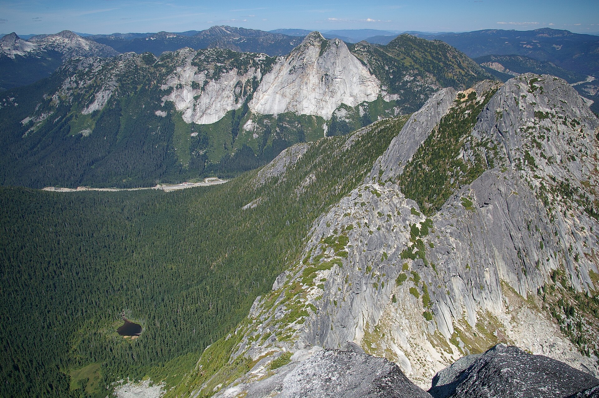
From the Falls Lake parking area, the Zoa route diverges right (north-east) near the trailhead and climbs through dense subalpine forest on a marked but rooty path. The grade is sustained but never desperate for the first 2.5 km. The route gains a forested ridge crest around 1,650 m, then continues north-east along a broadening rib, breaking into intermittent meadow and heather. At roughly 3.5–4 km from the trailhead, the trail reaches the broad western sub-summit of Zoa Peak — an open meadow plateau at approximately 1,860 m with views over Falls Lake, Nak, Yak and Thar, and Mt. Outram beyond.
Most hikers turn around at this sub-summit, where the views are arguably superior to the true summit. Parties continuing to the true summit (1,872 m, approximately 1 km further north-east along the ridge) cross gently undulating sub-alpine terrain that retains snow late and forms cornices in winter. Descent is by the same route.
Why it is essential
Zoa Peak is the corridor’s representative ridge walk. It demands no scrambling, opens reliably earlier than the harder alpine summits, and delivers a comprehensive panorama of the surrounding Llamoid Group (Nak, Yak, Thar, Zupjok). It also doubles as the corridor’s most popular intermediate snowshoe objective, extending its season effectively year-round for prepared parties.
Equipment
- Mountain hiking equipment: sturdy boots, trekking poles, weatherproof shell and warm layers.
- 1.5–2 L water; map, GPS backup and sun protection.
- Microspikes useful into July on the forested ridge.
- Full snowshoe and avalanche kit (transceiver, probe, shovel) plus AST training in winter.
Hazards and notes
- The route is poorly signed at the forest junctions in the first kilometre — parties have followed the Falls Lake trail by mistake.
- The ridge between sub-summit and true summit is recognised avalanche terrain in winter and spring.
- Cell coverage is unreliable.
- Bears (black and grizzly) and cougars are present throughout.
- Vehicle break-ins reported at the trailhead lot.
GPX / KML links
| Source | URL | Format / access | Reuse status |
|---|---|---|---|
| OpenStreetMap (Zoa Peak Trail) | openstreetmap.org | OSM XML / GPX export | ODbL 1.0; reusable with attribution |
| Komoot smart tour | komoot.com | GPX | Komoot terms; reference only |
| AllTrails: Falls Lake to Zoa Peak | alltrails.com | GPX | AllTrails terms; reference only |
External links
3. Falls Lake
Snapshot
Itinerary
From the gravel parking area, the wide path enters subalpine forest and climbs gently north-west, crossing two small wooden bridges over feeder creeks. After about 700 m the trail levels and then descends slightly to the eastern shore of Falls Lake, a small sub-alpine tarn at approximately 1,295 m. The lake is bordered by Nak Peak rising directly to the west and broken talus slopes from the Zoa massif to the north.
Two BC Parks tent pads sit near the shoreline (first-come, first-served, no fires), with a bear cache and outhouse. The route is informal beyond the eastern shore — a faint shoreline path circles toward the inlet creek under Nak. Return is by the same path.
Why it is essential
Falls Lake is the only short, family-feasible walk in the corridor inside a designated BC Parks recreation area, and the only one that delivers a true sub-alpine lake with minimal effort. It complements the four longer entries and is a sensible turnaround for groups with mixed fitness, an introduction to the area’s landscape for visitors, and a high-value option in poor weather when the bigger peaks are off the table.
Equipment
- Trail shoes or light boots; weatherproof layer.
- Water and snack; no potable water at the trailhead.
- Sun protection.
- Insect repellent — mosquitoes are common near the lake in early summer.
Hazards and notes
- Inside an avalanche path in winter — should not be approached in deep winter without avalanche assessment.
- Vehicle break-ins reported at the trailhead lot.
- No fires permitted at the campsite.
- Cell coverage is unreliable.
- Bears regularly use the area; dogs permitted on leash.
GPX / KML links
| Source | URL | Format / access | Reuse status |
|---|---|---|---|
| OpenStreetMap (Falls Lake Trail) | openstreetmap.org | OSM XML / GPX export | ODbL 1.0; reusable with attribution |
| Trailforks: Falls Lake Trail | trailforks.com | Site map / GPX | Trailforks terms; reference only |
| AllTrails: Falls Lake Trail | alltrails.com | GPX | AllTrails terms; reference only |
External links
- BC Parks — Coquihalla Summit Recreation Area
- Outdoor Vancouver — Falls Lake Hike
- Vancouver Trails — Falls Lake
4. Yak Peak
Snapshot
Itinerary
From the Zopkios Rest Area, walk through the highway tunnel underpass and follow the Hwy 5 shoulder east for approximately 800 m to a small cairn on the north side marking the trailhead. The route enters forest and climbs steeply north up the south slope of Yak via a marked but unmaintained boot-path. The grade is unrelenting, with frequent hand-use on roots and rock steps. After about 2 km the trees thin into open subalpine and the route trends north-east toward the Yak–Nak saddle at approximately 1,750 m.
From the saddle, the route turns west and ascends the broad north-east ridge and upper south-east face. The terrain becomes granite slab and blocky steps; the bulk of the route is Class 2 scrambling with low exposure, but the slabs become very serious when wet. A short Class 3 step gains the summit cap at 2,039 m. Views span the full Llamoid Group, Coquihalla Pass, and on a clear day Mt. Outram and the Anderson River peaks. Descent is by the same route; the upper slabs are markedly more committing on the way down and have been the site of multiple accidents.
Why it is essential
Yak Peak is the corridor’s most visually distinctive granite summit — the south face is one of BC’s most photographed roadside walls. The hiking route up the back is the standard non-technical ascent and is included in Matt Gunn’s Scrambles in Southwest BC as a classic. It represents the high end of the corridor’s hiking spectrum and is a defining objective for scramblers, though it sits at the edge of the day-hike envelope and must be approached as a scramble.
Equipment
- Approach-shoe or sticky-soled boots for granite slab; trekking poles for the steep forest.
- Weatherproof shell, warm midlayer, gloves, helmet if hiking with a party above.
- 2+ L water; sun protection; map and GPS backup.
- Light rope or sling for confidence on the summit step.
- Microspikes useful into early July.
Hazards and notes
- Class 2–3 scramble character: the upper south-east face is granite slab with consequential fall potential and should not be treated as a standard hike. A commemorative plaque near the route records a past fatality.
- Slabs become treacherously slick in any precipitation — avoid the upper face if rain or fog is forecast.
- Avalanche hazard persists on the south slope into June.
- Lightning exposure on the open upper face; start early to avoid afternoon storms.
- Not suitable for dogs; vehicle break-ins reported at the trailhead.
- No water on route; cell coverage unreliable.
GPX / KML links
| Source | URL | Format / access | Reuse status |
|---|---|---|---|
| OpenStreetMap (Yak Peak) | openstreetmap.org | OSM XML / GPX export | ODbL 1.0; reusable with attribution; partial coverage |
| AllTrails: Yak Peak Trail | alltrails.com | GPX | AllTrails terms; reference only |
| SummitPost: Yak Peak | summitpost.org | Route page | Site terms; reference only |
External links
5. Hope Lookout Trail
Snapshot
Itinerary
From the trail kiosk and small picnic area off Old Hope–Princeton Highway, the path enters mixed Douglas-fir and western hemlock forest and climbs steeply on switchbacks. The grade is consistent and relentless, gaining approximately 470 m over about 2 km. After a brief level section through more open forest, the trail emerges onto a rocky outcrop at approximately 535 m — the historic Hope Lookout.
A pit toilet, interpretive signs identifying surrounding summits and a hikers’ logbook are at the top. Views extend west over the town of Hope, the Fraser River and its confluence with the Coquihalla, Kawkawa Lake, and Mount Ogilvie to the south. Descent is by the same route.
Why it is essential
Hope Lookout is the cultural and accessible essential hike of the corridor. It is the only trail in this selection that is walkable directly from a town, walkable nearly year-round, and maintained by the volunteer-led Hope Mountain Centre — making it the most representative community trail of the region. Its summit panorama is the definitive context-setting view of where the Fraser breaks out of the Cascades.
Equipment
- Trail shoes or light boots — the trail can be muddy.
- Weatherproof layer, water and snack.
- Sun protection.
- Microspikes in December–February if icy; tick awareness in spring.
- Bear spray; black bears are regularly reported on this trail despite proximity to town.
Hazards and notes
- The trail is steep enough that descents on wet roots and mud are the principal injury risk.
- Black bears use the trail; carry bear spray.
- Cell coverage is variable; offline maps recommended.
- The trail is within town limits — respect adjacent private property and Leave No Trace.
- No water on trail.
- Dogs permitted on leash.
GPX / KML links
| Source | URL | Format / access | Reuse status |
|---|---|---|---|
| OpenStreetMap (Hope Lookout Trail) | openstreetmap.org | OSM XML / GPX export | ODbL 1.0; reusable with attribution |
| Trailforks: Hope Lookout Trail | trailforks.com | Site map / GPX | Trailforks terms; reference only |
| AllTrails: Hope Lookout Trail | alltrails.com | GPX | AllTrails terms; reference only |
External links
- Hope Mountain Centre — Hope Lookout Trail
- Tourism Hope Cascades & Canyons — Hope Lookout Trail
- Outdoor Vancouver — Hope Lookout Trail
External links
| Source | URL |
|---|---|
| BC Parks — Coquihalla Summit Recreation Area | bcparks.ca |
| Hope Mountain Centre — trails overview | hopemountain.org |
| Tourism Hope Cascades & Canyons | tourismhcc.ca |
| Best Hikes BC — Needle Peak | besthikesbc.ca |
| Best Hikes BC — Yak Peak | besthikesbc.ca |
| Vancouver Trails — Zoa Peak | vancouvertrails.com |
| Vancouver Trails — Falls Lake | vancouvertrails.com |
| Outdoor Vancouver — Needle Peak | outdoorvancouver.ca |
| Outdoor Vancouver — Yak Peak | outdoorvancouver.ca |
| Outdoor Vancouver — Falls Lake | outdoorvancouver.ca |
| Wikipedia — Needle Peak (British Columbia) | en.wikipedia.org |
| Wikipedia — Yak Peak | en.wikipedia.org |
| Wikipedia — Zoa Peak | en.wikipedia.org |
| SummitPost — Yak Peak | summitpost.org |
| OpenStreetMap | openstreetmap.org |