Regional overview
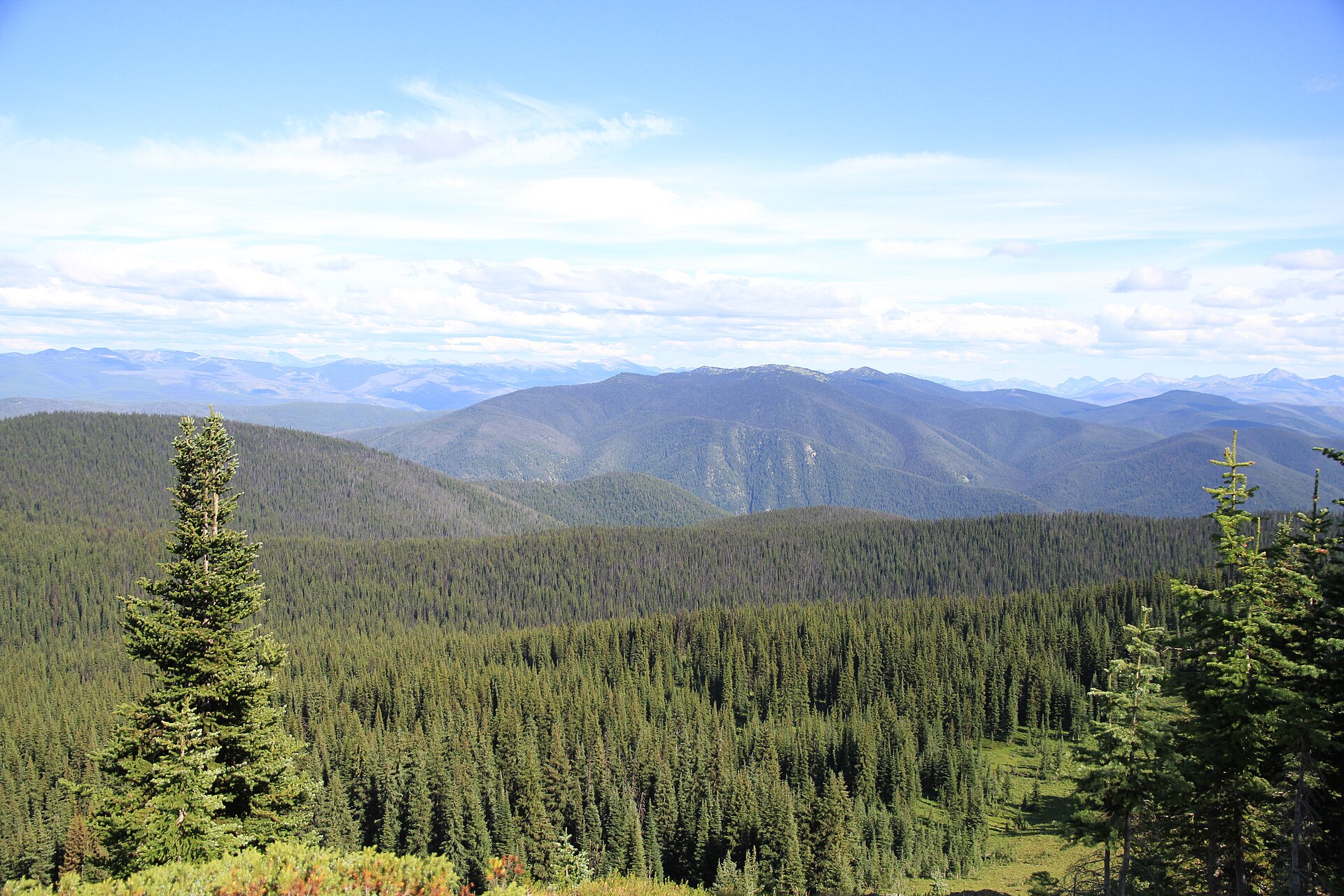
E.C. Manning Provincial Park and the adjoining Skagit Valley Provincial Park sit on the British Columbia side of the international border, straddling the Cascade Mountains where the wet coastal forests of the Skagit valley grade into the drier interior subalpine of the Similkameen. The two parks together cover roughly 99,000 hectares of protected terrain, with elevations ranging from about 600 m on the Skagit River bottomlands to 2,426 m on the summit of Frosty Mountain, the highest peak in Manning Park. Geologically the area is dominated by the Hozameen Range, with broad rolling subalpine plateaux above 1,800 m (Blackwall, Three Brothers, Snow Camp) and sharper rocky summits along the international border (Frosty, Hozameen, Castle Peak).
The walking is unusually accessible by Canadian Cascade standards. BC Highway 3 (the Crowsnest) bisects Manning Park east–west; the paved Gibson Pass Road and the Blackwall Road give vehicles direct access to subalpine trailheads at 1,400–2,000 m. As a result, classic high-meadow hikes such as the Heather Trail, Three Brothers Mountain and Skyline I begin near or above treeline, which is why Manning is widely regarded as one of the best wildflower destinations in southwestern BC. The Skagit Valley side, accessed from the gravel Silver-Skagit Road south of Hope, is lower and wetter, with riverine western hemlock and Douglas-fir forest along the Skagit River Trail.
The standard hiking season runs from late June or early July, when the high trails clear of snow, through mid-October. The alpine larches below Frosty Mountain typically turn gold from late September to mid-October and draw heavy weekend traffic. Snow patches can linger on north slopes and on the upper Frosty Mountain scramble well into July. Black bears are common throughout both parks and grizzlies are present at lower densities. Pacific systems crossing the divide produce afternoon thunderstorms over the exposed ridges, and the Three Brothers plateau in particular is fully exposed for hours. Cell coverage on the trails is unreliable. Access is realistic by private vehicle from Vancouver (about 2.5–3 hours) or from the Okanagan via Princeton; the long-running Greyhound service on Highway 3 was discontinued in 2018.
Selection rationale
The five hikes below were chosen to represent the breadth of the sub-region rather than cluster on one trailhead, spanning the iconic high summit, the signature ridge-and-meadow walk, the western alpine traverse, the most-walked valley loop, and the internationally significant cross-border landmark:
- Frosty Mountain — the iconic high summit, golden larches, the biggest physical effort of the catalogue.
- Three Brothers Mountain via the Heather Trail — Manning’s signature ridge-and-meadow walk and the most internationally known wildflower hike in the BC Cascades.
- Skyline I to Snow Camp Mountain — a high traverse from the Lightning Lake side onto Skyline ridge, representing the western alpine.
- Lightning Lake Loop — the easy valley and lake circuit, the park’s most-walked trail, balancing the catalogue at the family end.
- Monument 78 — Pacific Crest Trail Northern Terminus — historically and culturally important, the official northern end of the 4,265 km PCT.
The Skagit River Trail was strongly considered as the valley/forest representative but was set aside because the Sumallo Grove bridge over the Skagit River was washed out in November 2021 and the trail’s status from the north end remains intermittent. If the bridge is reinstated it would become the natural fifth choice as the valley/forest representative and could displace one of the current selections.
Summary table
| # | Hike | Country | Route type | Distance | Gain | Max elevation | Difficulty |
|---|---|---|---|---|---|---|---|
| 1 | Frosty Mountain (via Lightning Lake) | Canada | Out-and-back | ~20.8 km | ~1,150 m | 2,426 m | Difficult |
| 2 | Three Brothers Mountain via Heather Trail | Canada | Out-and-back | ~20–22 km | ~750–900 m | ~2,272 m | Moderate (long) |
| 3 | Skyline I to Snow Camp Mountain | Canada | Out-and-back / loop variant | ~16–20 km | ~775 m | ~2,050 m | Difficult |
| 4 | Lightning Lake Loop | Canada | Loop | ~9 km | Minimal | ~1,260 m | Easy |
| 5 | Monument 78 (PCT northern terminus) | Canada | Out-and-back | ~26–28 km | ~600–700 m | ~1,700 m | Difficult (length) |
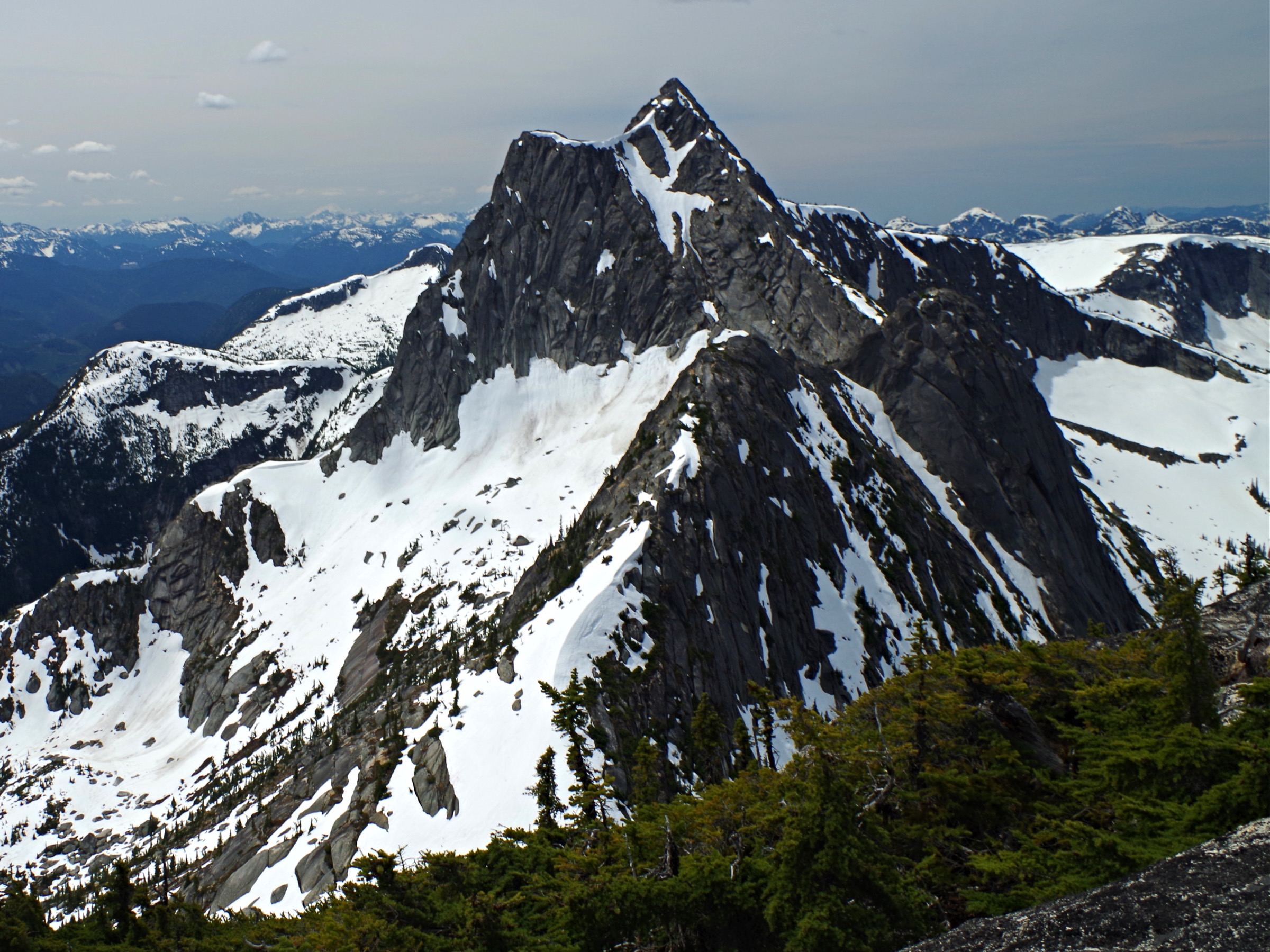
1. Frosty Mountain
Snapshot
Itinerary
From the Lightning Lake day-use area the trail starts beside the lakeshore, briefly joins the Lightning Lake Loop and then turns south at the signed Frosty Mountain Trail junction. The path climbs steadily through Engelmann spruce and subalpine fir on a long series of switchbacks. After roughly 6 km the grade eases and the trail enters the alpine larch grove on a broad south-facing bench at about 2,000 m — the principal scenic destination for many hikers and the reason for the autumn crowds. Frosty Creek Camp lies in this basin and is the natural turnaround for those not continuing to the summit.
Above the larch meadow the trail climbs into open alpine, traverses below the north ridge and joins the route from Windy Joe near a saddle on the ridge. From the saddle the trail follows the north ridge over scree and broken rock; the final summit pyramid involves a short, exposed Class 2 scramble on loose blocks to the cairn at 2,426 m. On a clear day the view spans the Hozameen Range, the North Cascades in Washington (Hozameen Peak, Jack Mountain, Mount Baker), and north to the Coast Mountains. Return is by the same route.
Why it is essential
Frosty Mountain is the highest summit in Manning Park and the westernmost easily accessible alpine larch grove in Canada. It is consistently listed by BC Parks, regional tourism bodies and major BC hiking guides as one of the defining hikes of the Canadian Cascades. The combination of subalpine forest, ancient larches (some over 1,900 years old) and a non-technical summit above 2,400 m makes it the single hike that best represents the upper-elevation character of the sub-region.
Equipment
- Mountain hiking equipment: sturdy boots, trekking poles recommended, extra warm layer, hat and gloves outside midsummer, weatherproof shell.
- Headtorch for long days in shoulder season; navigation backup; ample water (no reliable source above the larch basin).
- Microspikes useful for lingering snow in July or early-season ice on the summit blocks.
- Bear-aware food storage; bear spray recommended.
Hazards and notes
- The summit scramble is rated easy Class 2 but is on loose rock with significant exposure on the west side.
- Snow can linger on the upper route into July and may return any time after mid-September; microspikes or turning back may be appropriate.
- Afternoon thunderstorms are common in summer — start early.
- Dogs are permitted on leash in Manning Park backcountry trails but should be evaluated carefully for the summit scramble.
- No permits required for day use; backcountry camping at Frosty Creek requires a BC Parks backcountry reservation.
GPX / KML links
| Source | URL | Format / access | Reuse status |
|---|---|---|---|
| BC Parks — E.C. Manning Park Hiking Trail Guide | nrs.objectstore.gov.bc.ca | PDF (descriptive, no GPX) | BC Crown copyright; facts reusable |
| OpenStreetMap — Frosty Mountain Trail ways | openstreetmap.org | OSM XML / GPX export | ODbL; reusable with OSM attribution |
| AllTrails — Frosty Mountain Trail | alltrails.com | Web view; GPX behind paywall | Proprietary; cross-check only |
External links
- BC Parks — E.C. Manning Park
- BC Parks — E.C. Manning Park Hiking Trail Guide (PDF)
- Wikipedia — Frosty Mountain
- Happiest Outdoors — Frosty Mountain Larches
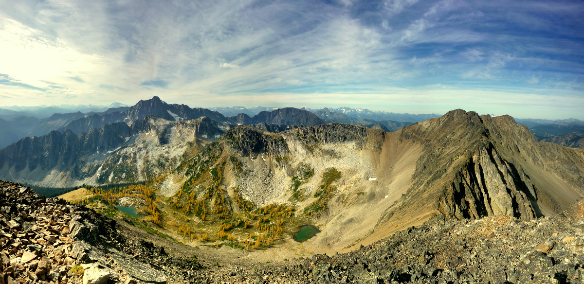
2. Three Brothers Mountain via the Heather Trail
Snapshot
Itinerary
From the Upper Alpine parking lot the trail leaves the southwest end of the lot and follows a wide path through subalpine fir to the open ridge. After about 1 km the route emerges into the famous Heather Trail meadows, a continuous corridor of wildflowers in mid-summer — paintbrush, lupine, valerian, western anemone, arnica and glacier lily early in the season. The trail rolls along the broad alpine plateau, climbing onto Big Buck Mountain about 4.5 km from the trailhead, descending gently to the Buckhorn Camp area, then traversing the broad shoulders of the Three Brothers massif.
The signed side path to First Brother summit climbs the obvious rocky cone on the right and is the conventional turnaround for day hikers (about 10 km in, 750–800 m cumulative gain). Strong parties continue across the meadows toward Second and Third Brother and the descent toward Kicking Horse Camp; the full Heather Trail finishes at Nicomen Lake (21 km one-way per BC Parks) and is normally walked as a backpack rather than a day hike. Return is by the same route, with the option to detour to the Bonnevier viewpoint near the trailhead on the way back.
Why it is essential
The Heather Trail is the single most-cited day hike in Manning Park and is regularly described by BC Parks, regional tourism bodies and provincial hiking guides as one of the finest alpine wildflower walks in the province. The Three Brothers area has been protected since 1931 (the original Three Brothers Mountain Reserve, predating the park itself). The combination of a road-served high trailhead, an effectively continuous flowering meadow, and a long open ridge with panoramic views makes it a must-include for any catalogue of Canadian Cascade hiking.
Equipment
- Mountain hiking equipment: boots, weatherproof shell, warm layer.
- Sun protection — the ridge is fully exposed for hours.
- 2+ litres of water; food for a long day.
- Trekking poles useful on the long return.
- Bear spray recommended; thunderstorm contingency planning (no shelter on the ridge).
Hazards and notes
- The route is straightforward to follow but is fully exposed to weather for almost its entire length.
- Lightning is the primary objective hazard in July and August; there is no shelter on the ridge.
- Wildflower-season weekends generate heavy use; the Blackwall Road can have queues and parking can fill by mid-morning.
- Dogs allowed on leash; camping at Buckhorn, Kicking Horse and Nicomen requires a BC Parks backcountry reservation.
- The Blackwall Road is usually open from mid-June or July, depending on snowmelt — check BC Parks alerts before driving up.
GPX / KML links
| Source | URL | Format / access | Reuse status |
|---|---|---|---|
| BC Parks — E.C. Manning Park Hiking Trail Guide | nrs.objectstore.gov.bc.ca | PDF (descriptive, no GPX) | BC Crown copyright; facts reusable |
| OpenStreetMap — Heather Trail ways | openstreetmap.org | OSM XML / GPX export | ODbL; reusable with OSM attribution |
| AllTrails — Three Brothers via Heather Trail | alltrails.com | Web; GPX behind paywall | Proprietary; cross-check only |
External links
- BC Parks — E.C. Manning Park
- Vancouver Trails — Three Brothers Mountain
- Off Track Travel — The Heather Trail, Manning Park
- Best Hikes BC — Three Brothers Mountain
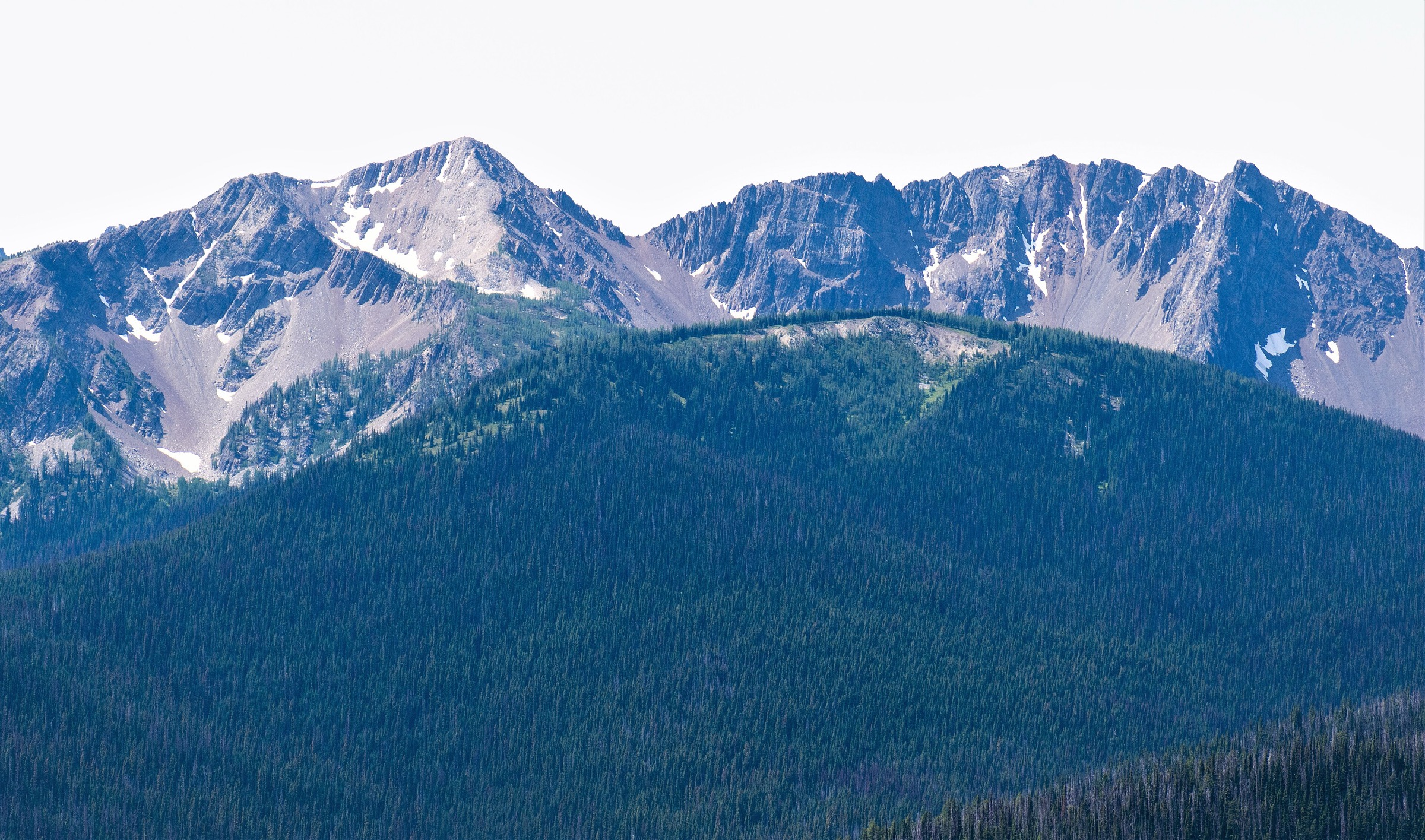
3. Skyline I to Snow Camp Mountain
Snapshot
Itinerary
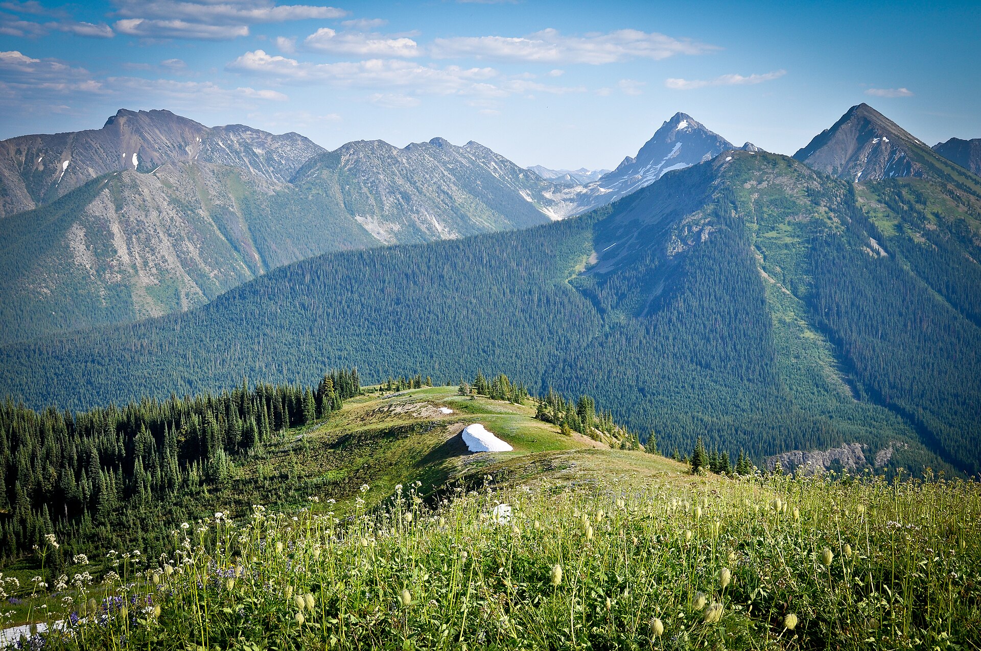
From Strawberry Flats the trail climbs steadily through subalpine forest, gaining the ridgeline above Lightning Lake within the first 3–4 km. Once on the ridge the route opens out and continues westward along the broad crest with views south to Frosty Mountain and the Hozameen Range, and north to the Three Brothers plateau. The trail traverses below the summit of Snow Camp Mountain at about 2,050 m; an obvious unmarked side path leads to the top.
Strong parties continue west along Skyline I toward Lone Goat Mountain or descend on the South Gibson Trail back to Strawberry Flats to make a loop of approximately 20.5 km. Day hikers commonly turn around at or near Snow Camp.
Why it is essential
Skyline I provides the high western counterpart to the Heather Trail. Where the Heather walks the eastern plateau, Skyline traverses the ridge directly above Lightning Lake with continuous views south into the Hozameen and North Cascades. It is the principal long ridge walk accessible from the Lightning Lake / Gibson Pass side of the park and complements the other selections by representing the western alpine.
Equipment
- Mountain hiking equipment: sturdy boots, weatherproof shell, warm layer, sun protection.
- Trekking poles recommended; navigation backup.
- Ample water (no reliable on-route source on the ridge).
- Microspikes for early-season snow patches; bear-aware food storage.
Hazards and notes
- The ridge is exposed to weather; thunderstorm risk is high on July and August afternoons.
- Snow lingers on north-facing sections into July.
- The South Gibson loop variant has a steeper descent that can be hard on knees.
- Dogs on leash; no permits required for the day hike.
- Cell coverage on the ridge is unreliable.
GPX / KML links
| Source | URL | Format / access | Reuse status |
|---|---|---|---|
| BC Parks — E.C. Manning Park Hiking Trail Guide | nrs.objectstore.gov.bc.ca | PDF (descriptive, no GPX) | BC Crown copyright; facts reusable |
| OpenStreetMap — Skyline Trail ways | openstreetmap.org | OSM XML / GPX export | ODbL; reusable with OSM attribution |
| Trailforks — Skyline I/II | trailforks.com | Community trace | Trailforks terms apply; GPX may require account |
External links
- BC Parks — E.C. Manning Park
- A walk and a lark — Skyline Trail to Lone Goat Mountain
- AllTrails — Skyline I Trail
- Trailforks — Skyline I/II
4. Lightning Lake Loop
Snapshot
Itinerary
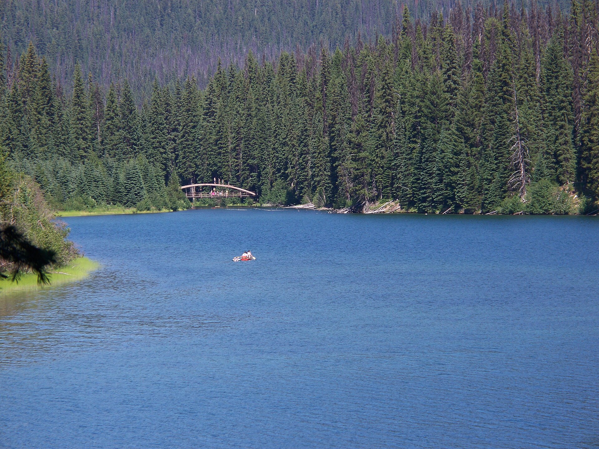
From the Lightning Lake day-use area the trail follows the north shore of the lake westward through Douglas-fir and Engelmann spruce forest. After about 2.5 km the route reaches the Rainbow Bridge over the lake’s narrows; turning back here makes a 6 km circuit. The full loop continues along the south shore to the west end of the lake and the Lightning Lakes Chain Trail junction, then returns along the north shore.
The path is flat to gently undulating throughout, with frequent lake views, beaver workings and, in early summer, abundant birdlife. Canoe and rowboat rentals are available at the day-use area, and Rainbow Bridge is a popular swimming and photo spot.
Why it is essential
Lightning Lake Loop is the most-walked trail in Manning Park and the natural entry-level route for the catalogue. It anchors the selection at the easy end of the difficulty range, gives a representative sample of the park’s lower-elevation lake and forest landscape, and is the only route here readily accessible to families and walkers not prepared for full alpine conditions. It is also the trail that most visitors to Manning Park actually do.
Equipment
- Trail shoes or boots; weatherproof layer; water and snacks.
- Sun protection and insect repellent (mosquitoes can be heavy in June).
- Bear-aware practice.
- Snowshoes in winter for the year-round circuit.
Hazards and notes
- Few objective hazards on the trail itself.
- Bears, including black bears with cubs, frequent the shoreline in summer; keep food sealed and do not approach wildlife.
- The lake remains cold even in summer; swimmers should be cautious.
- Dogs on leash; no permits required for day use.
- Park interpretive programs run from the day-use area in peak season.
GPX / KML links
| Source | URL | Format / access | Reuse status |
|---|---|---|---|
| BC Parks — E.C. Manning Park Hiking Trail Guide | nrs.objectstore.gov.bc.ca | PDF (descriptive, no GPX) | BC Crown copyright; facts reusable |
| OpenStreetMap — Lightning Lake ways | openstreetmap.org | OSM XML / GPX export | ODbL; reusable with OSM attribution |
| Trailforks — Lightning Lake Chain Trail | trailforks.com | Community trace | Trailforks terms apply |
External links
- BC Parks — E.C. Manning Park
- Wikipedia — Lightning Lake
- Vancouver Trails — Lightning Lake Loop
- A walk and a lark — Lightning Lake loop in Manning Park
5. Monument 78 — Pacific Crest Trail Northern Terminus
Snapshot
Itinerary
From the Windy Joe / PCT parking area the trail follows the Similkameen River south, then bears right at the signed Pacific Crest Trail junction (the left fork is the Windy Joe Mountain trail). The PCT contours through dense subalpine forest on the west side of the Castle Creek valley, climbing gently over rolling terrain. After a long, mostly shaded approach the trail descends slightly to Monument 78 Camp, the BC Parks-designated backcountry camp on the Canadian side.
From the camp a short final section reaches the small clearing on the international boundary where Monument 78, a metal obelisk that has marked the 49th parallel since the 1860s, stands. About one metre south, inside Pasayten Wilderness in the United States, is the newer wooden Pacific Crest Trail Northern Terminus monument. Return is by the same route, with the optional 600 m detour up Windy Joe Mountain (1,853 m) for views on the way back.
Why it is essential
Monument 78 is the official northern end of the 4,265 km Pacific Crest Trail and an internationally recognised hiking landmark. It is the only place in Canada where one can reach a major long-distance trail terminus on a day walk, and it is included here as the culturally and historically important route. While many PCT thru-hikers reach the monument as the final day of a five-month walk, fit Canadian day hikers regularly do the round trip in one long day from the Windy Joe parking lot.
Equipment
- Mountain hiking equipment: boots, weatherproof shell, warm layer.
- Headtorch (likely needed for any late finish); navigation backup.
- 2+ litres of water plus a filter for the longer day; ample food.
- Bear spray and bear-aware food storage strongly recommended (this is one of the wilder corners of Manning Park).
Hazards and notes
- The principal hazard is day-length: even fit parties finish close to dark in shoulder season.
- Snow patches on the higher benches can persist into July.
- Cross-border legal restrictions: there is no border crossing facility at the monument. Hikers are not legally permitted to cross south into the United States here unless they hold a valid PCT southbound or northbound entry permit from US Customs and Border Protection arranged in advance.
- Northbound PCT thru-hikers entering Canada must report to Canada Border Services Agency (CBSA) in advance under the current PCT entry permit program; rules change — confirm directly with PCTA and CBSA before any cross-border use.
- Dogs on leash; backcountry camping at Monument 78 Camp requires BC Parks backcountry registration.
- No cell coverage on the route.
GPX / KML links
| Source | URL | Format / access | Reuse status |
|---|---|---|---|
| BC Parks — E.C. Manning Park Hiking Trail Guide | nrs.objectstore.gov.bc.ca | PDF (descriptive, no GPX) | BC Crown copyright; facts reusable |
| OpenStreetMap — Pacific Crest Trail (Canadian section) | openstreetmap.org | OSM XML / GPX export | ODbL; reusable with OSM attribution |
| PCTA — Directions to the Northern Terminus | pcta.org | Web reference | PCTA terms; no GPX |
| AllTrails — Northern Terminus PCT | alltrails.com | Web; GPX behind paywall | Proprietary; cross-check only |
External links
- BC Parks — E.C. Manning Park
- PCTA — Getting to and from the Northern Terminus
- PCTA — Making the new PCT Northern Terminus Monument
- Backcountry BC — Pacific Crest Trail (Manning Park)
External links
| Source | URL |
|---|---|
| BC Parks — E.C. Manning Provincial Park | bcparks.ca |
| BC Parks — E.C. Manning Park Hiking Trail Guide (PDF) | nrs.objectstore.gov.bc.ca |
| BC Parks — Skagit Valley Provincial Park | bcparks.ca |
| Wikipedia — Frosty Mountain | en.wikipedia.org |
| Wikipedia — Lightning Lake | en.wikipedia.org |
| Wikipedia — Skagit Valley Provincial Park | en.wikipedia.org |
| Wikimedia Commons — E.C. Manning Provincial Park category | commons.wikimedia.org |
| PCTA — Northern Terminus directions | pcta.org |
| Vancouver Trails — Manning Park region | vancouvertrails.com |
| Off Track Travel — Heather Trail | offtracktravel.ca |
| Happiest Outdoors — Frosty Mountain Larches | happiestoutdoors.ca |
| Best Hikes BC | besthikesbc.ca |
| Trailforks — Skyline I/II | trailforks.com |
| Trailforks — Lightning Lake Chain Trail | trailforks.com |