Regional overview
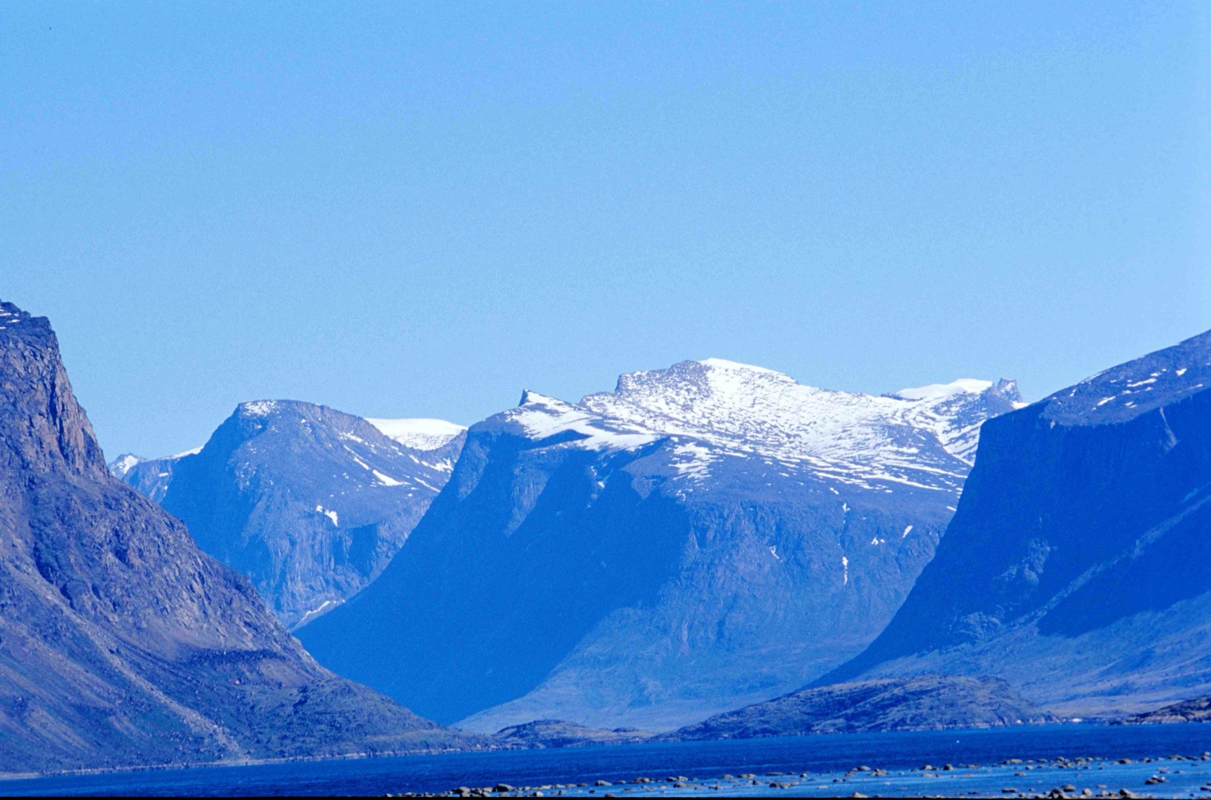
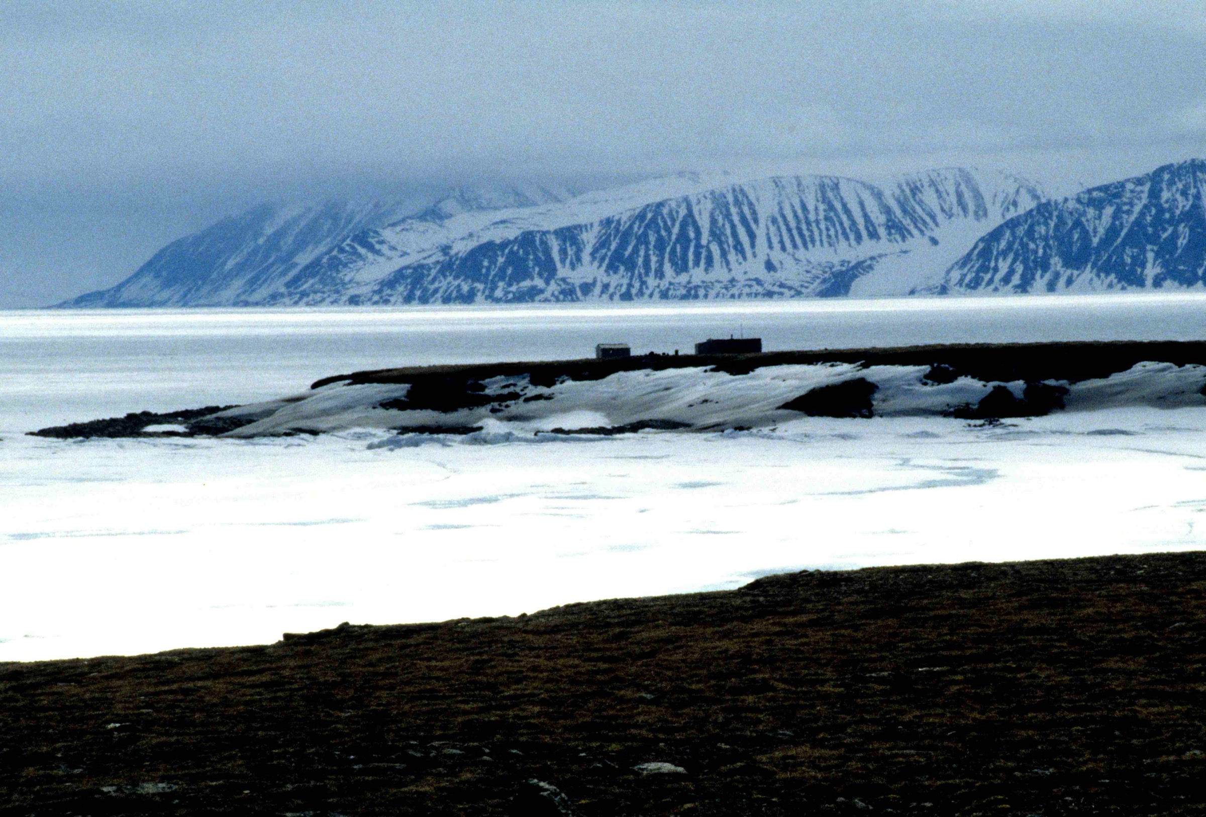
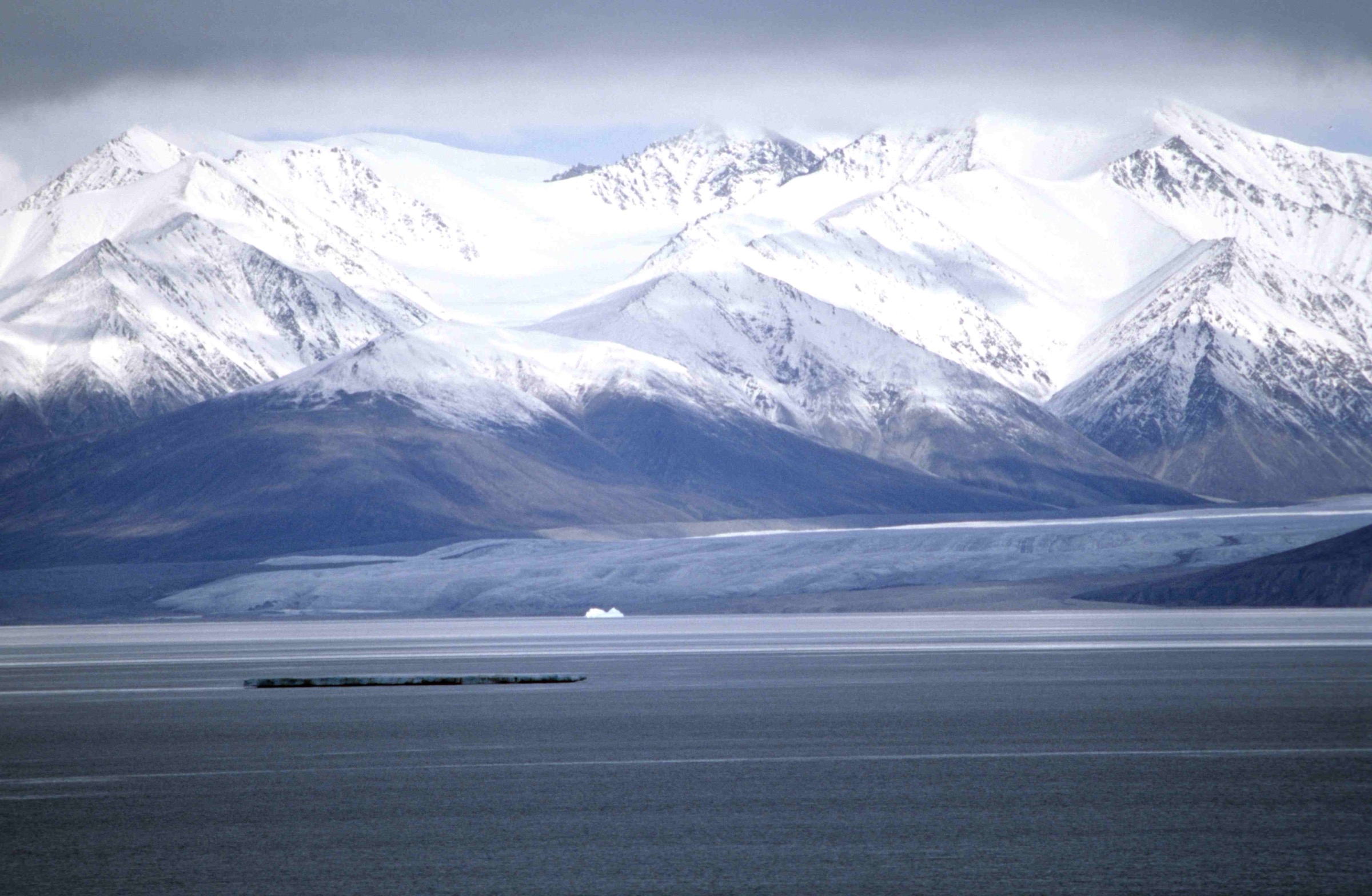
Bylot Island lies off the northern tip of Baffin Island in Nunavut, separated from the Inuit community of Pond Inlet (Mittimatalik) by the 25 km-wide Eclipse Sound. The uninhabited island sits almost entirely within Sirmilik National Park (Parks Canada) and is at the same time a Migratory Bird Sanctuary established in 1965. Its interior is dominated by the Byam Martin Mountains, which rise above 1,900 m at Angilaaq Mountain (1,951 m) and feed an icefield system with at least sixteen named glaciers, including the Sirmilik, Aktineq and Kaparoqtalik. The lower ground is mostly polar-desert tundra crossed by glacial outwash plains; the south-western Qarlikturvik valley supports one of the world’s largest breeding colonies of greater snow geese.
There are no roads, no settlements, no marked trails, no waymarks and no maintained infrastructure on Bylot Island. All walking happens within guided expeditions arranged through licensed outfitters in Pond Inlet. Visitors land by boat in summer (typically late July to early September) or by snowmobile across the sea ice in spring (typically late March to early June), and walk on foot from base camps. Parks Canada’s own visitor materials and operator itineraries describe wildlife viewing, tundra walks, glacier-foot exploration and short coastal scrambles rather than named trails. The phrase used by Parks Canada is unambiguous: “there are no designated travel routes” inside the park.
Access requires a mandatory three-hour orientation and registration session at the Nattinnak Visitor Centre / Parks Canada office in Pond Inlet, booked at least 48 hours ahead. Parks Canada strongly recommends travelling with an experienced Inuit guide who carries polar bear deterrents, and most outfitters require this in practice; Bylot is core polar bear habitat and the species is present year-round. Firearms cannot be carried by visitors inside a Canadian national park, so the deterrent role is fulfilled by the licensed guide. A satellite phone (Iridium network preferred) is strongly recommended; there is no cell coverage and no rescue infrastructure on the island. Bylot Island Migratory Bird Sanctuary regulations also apply, particularly around the snow goose colony and the seabird cliffs at Cape Graham Moore and Cape Hay during the nesting season.
The hiking season is short. By early September snow returns; by mid-September the park is effectively closed to walking visitors. Tundra terrain is uneven, frequently wet, often hummocky, and crossed by braided melt-water channels that swell during the day in summer. Glacier interiors are crevassed and are excluded from this catalogue: they are alpinist objectives, not day-hikes.
Selection rationale
Bylot Island does not contain five established, named day-hikes in the sense the catalogue specification contemplates. There are no Parks Canada-published day-hike routes, no signed trails, no AllTrails / Komoot / Wikiloc tracks of meaningful quality, and no public GPX files for this island. The five entries below are walking opportunities that recur across Parks Canada visitor materials, licensed-outfitter itineraries, American Alpine Club expedition reports and the Bylot Island Field Station ecological literature. Each is presented as a realistic day on foot for a visitor on an organised, guided trip, and each is labelled Candidate only. No published statistics exist; distances, ascents and times are cautious estimates. Together the five cover the realistic spread of terrain on the island: a coastal seabird-cliff walk, a tundra wildlife walk on the goose-colony plain, a glacier-foot walk in the Byam Martin foothills, a historical landing-point walk at Button Point, and a second, larger glacier-foot walk below the Sirmilik Glacier.
Summary table
| # | Hike | Country | Route type | Distance | Gain | Max elevation | Difficulty |
|---|---|---|---|---|---|---|---|
| 1 | Cape Graham Moore seabird-cliff walk | Canada | Out-and-back, exploratory | ~6-10 km | ~150-300 m | ~250 m | Moderate, exposed |
| 2 | Qarlikturvik valley tundra walk | Canada | Loop, exploratory | ~8-12 km | ~100-200 m | ~150 m | Easy-Moderate |
| 3 | Aktineq glacier-foot walk | Canada | Out-and-back, exploratory | ~6-10 km | ~200-400 m | ~400 m | Moderate |
| 4 | Button Point historical landing walk | Canada | Out-and-back, exploratory | ~4-8 km | ~50-150 m | ~150 m | Easy-Moderate |
| 5 | Sirmilik Glacier outwash and lateral moraine walk | Canada | Out-and-back, exploratory | ~8-14 km | ~200-400 m | ~400 m | Moderate |
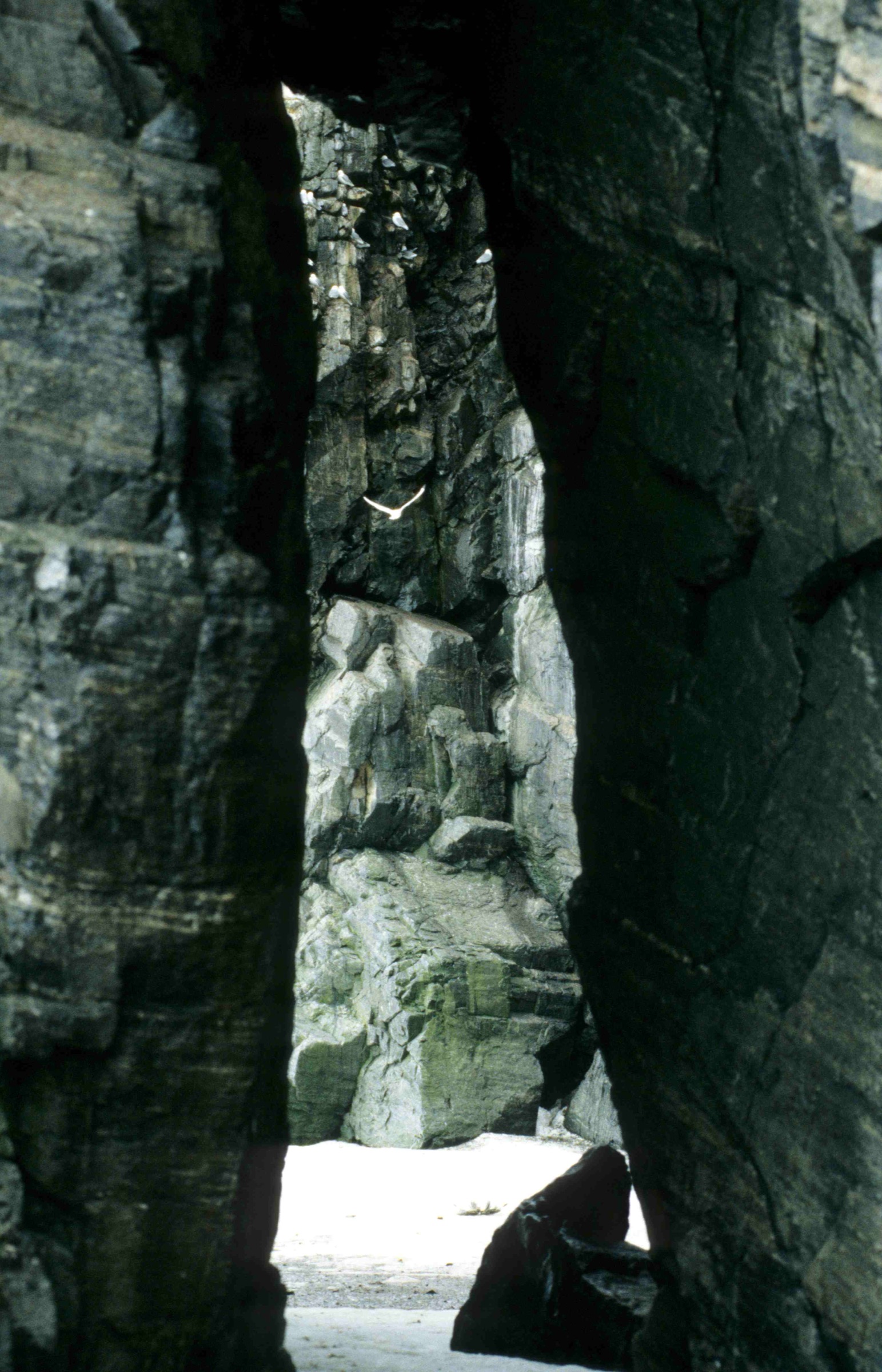
1. Cape Graham Moore Seabird-Cliff Walk
Snapshot
Itinerary
Outfitters such as Polar Sea Adventures, Black Feather and Arctic Kingdom describe Cape Graham Moore as a landing target on summer boat itineraries from Pond Inlet. The cape forms the south-eastern tip of Bylot Island, jutting into Baffin Bay and Lancaster Sound, and its cliffs hold one of the largest black-legged kittiwake and thick-billed murre colonies in the Canadian Arctic. After landing on a shingle beach at the foot of the cape, the walk climbs a steep tundra and scree slope to the cliff-top plateau. From the plateau an exploratory traverse follows the cliff-top southwards and northwards above the seabird colonies, with retreat to the landing by the same line of ascent. Walking is on bare frost-shattered rock, lichen-tundra and patchy snow, with several shallow melt-water channels to step across. There is no trail and no cairned line; the guide chooses the route on the day.
Why it is essential
The cliffs at Cape Graham Moore are the single most concentrated seabird gathering on Bylot Island and one of the most important seabird sites in the eastern Canadian Arctic, holding more than 10 percent of the Canadian population of thick-billed murres and 25 percent of black-legged kittiwakes during the breeding season. It is the only walking objective on Bylot that combines a famous landform, a major wildlife spectacle, and a recurring landing point used by both summer boat operators and spring snowmobile parties. It represents the coastal-cliff character of the Byam Martin / Bylot landscape better than any other accessible walk.
Equipment
Standard mountain hiking equipment, plus sturdy boots for wet tundra and frost-shattered rock, insulated jacket and windproof shell (summer cliff-top temperatures often near freezing), hat, gloves and buff, a satellite phone carried by the party, polar bear deterrents carried by the licensed Inuit guide, binoculars, NTS 1:250,000 sheet 38 B (no larger-scale published mapping), compass and GPS, and a full day’s drinking water as no reliable surface water is available on the cliff-top.
Hazards and notes
Polar bears are present along the south-east coast year-round; an experienced Inuit guide carrying deterrents is required in practice and strongly recommended by Parks Canada. The cliff edge is sheer, unfenced and friable in places. Bylot Island Migratory Bird Sanctuary regulations apply: the colonies must not be disturbed, and Environment and Climate Change Canada approval may be needed for any deliberate close approach during the nesting season. Weather can deteriorate within an hour; sea fog can close the cape entirely and prevent return by boat. Parks Canada orientation, registration and de-registration are mandatory.
GPX / KML links
| Source | URL | Format / access | Reuse status |
|---|---|---|---|
| Route-file status | No published GPX | Unresolved | Approximate landing 72.85°N, 76.12°W |
External links
- Parks Canada — Sirmilik National Park: Hiking and skiing
- Important Bird Areas Canada — site NU068 (Cape Graham Moore)
- Wikipedia — Bylot Island Migratory Bird Sanctuary
2. Qarlikturvik Valley Tundra Walk
Snapshot
Itinerary
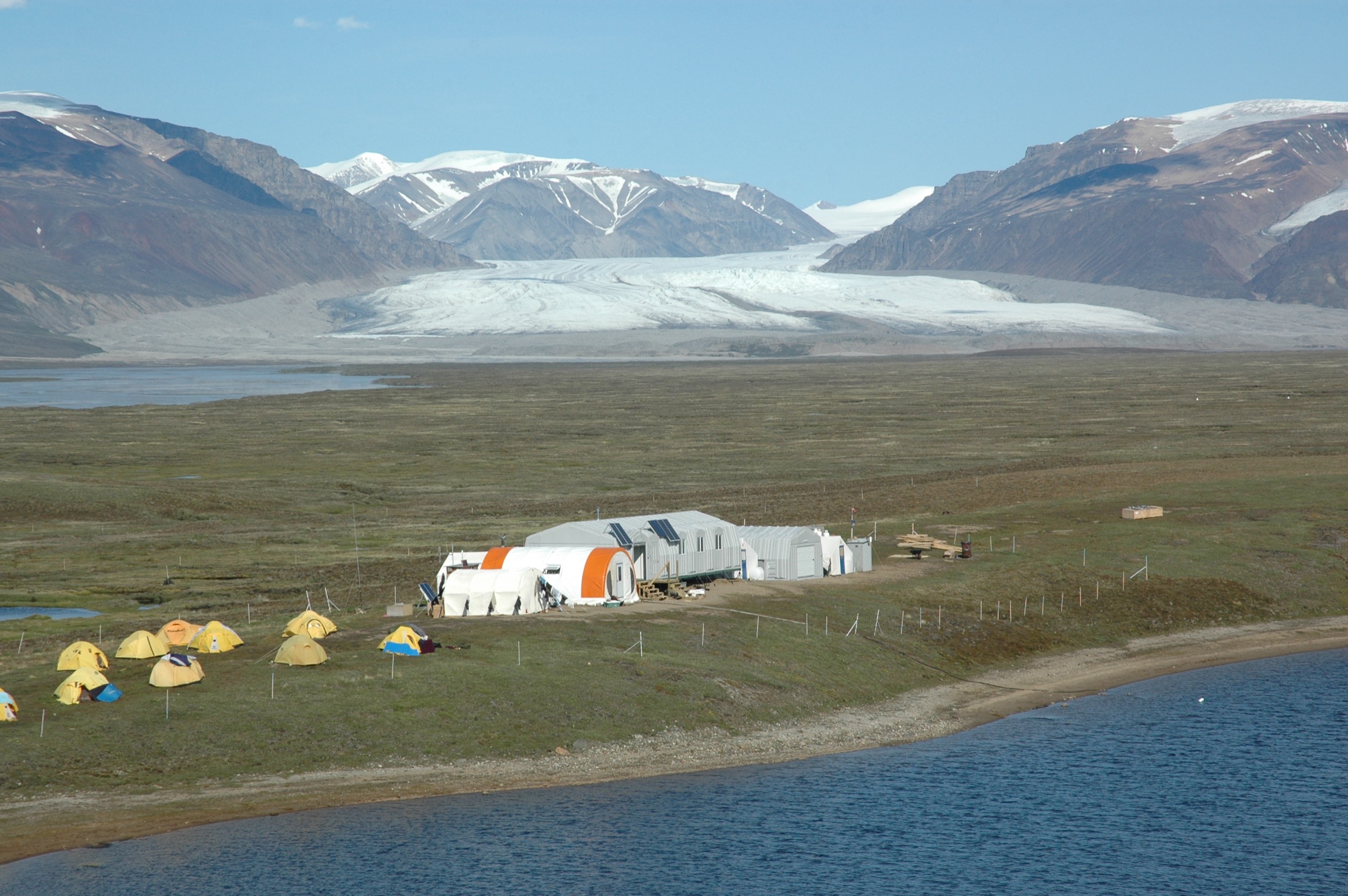
The Qarlikturvik valley is a 70 km² glacial valley at the south-western end of Bylot Island. Its wetlands support one of the world’s largest breeding colonies of greater snow geese, studied since the late 1980s by the Centre d’études nordiques (Université Laval) field station. After landing, the walk follows the lower outwash plain inland into the valley, threading between polygonal patterned ground, shallow ponds and the braided melt-water channels that drain the Aktineq system. The aim is to gain a low ridge on one flank for an overview of the wetland, the colony from a distance, and the glaciated headwall, then to loop back on a parallel line. Walking is consistently on mossy and grassy tundra with frequent wet sections; waterproof boots are necessary. There is no trail; the guide and visitor route around boggy ground and around any goose family groups encountered.
Why it is essential
The Qarlikturvik valley is the iconic ecological signature of Bylot Island, and the colony is the headline reason the island holds both Migratory Bird Sanctuary and National Park status. It is also the most realistic, lower-elevation tundra walk available within a one-day visit window: Parks Canada and operator materials consistently describe “broad river valleys” and “flat tundra walks from a base camp, perfect for bird and wildflower viewing” in this part of the island. No other walk on Bylot puts the visitor as squarely inside the island’s defining landscape.
Equipment
Standard mountain hiking equipment, plus waterproof boots and gaiters (tundra here is consistently wet), serious insect protection (mosquitoes are intense in July), insulated and windproof layers, binoculars, a satellite phone carried by the party, polar bear deterrents carried by the licensed Inuit guide, and NTS 1:250,000 sheet 38 B / 48 A with compass and GPS.
Hazards and notes
Polar bears occur on the southern coast and have been recorded crossing the south-west plain; guide-led travel is effectively required. Stream crossings increase through the afternoon as melt accelerates; plan the return for cooler conditions. Tundra hummocks hide deep wet holes; ankle injury risk is non-trivial. Migratory Bird Sanctuary regulations and Parks Canada wildlife disturbance rules prohibit close approach to nesting geese; the licensed guide will choose a route well outside the active colony. Mosquitoes can be debilitating in mid-July. The CEN Bylot Island Field Station in the valley is a working research camp and is not open to casual visitors.
GPX / KML links
| Source | URL | Format / access | Reuse status |
|---|---|---|---|
| Route-file status | No published GPX | Unresolved | Approximate valley-mouth landing 73.15°N, 80.0°W |
External links
- Parks Canada — Sirmilik National Park: Hiking and skiing
- Centre d’études nordiques — Bylot Island Field Station
- Wikipedia — Bylot Island
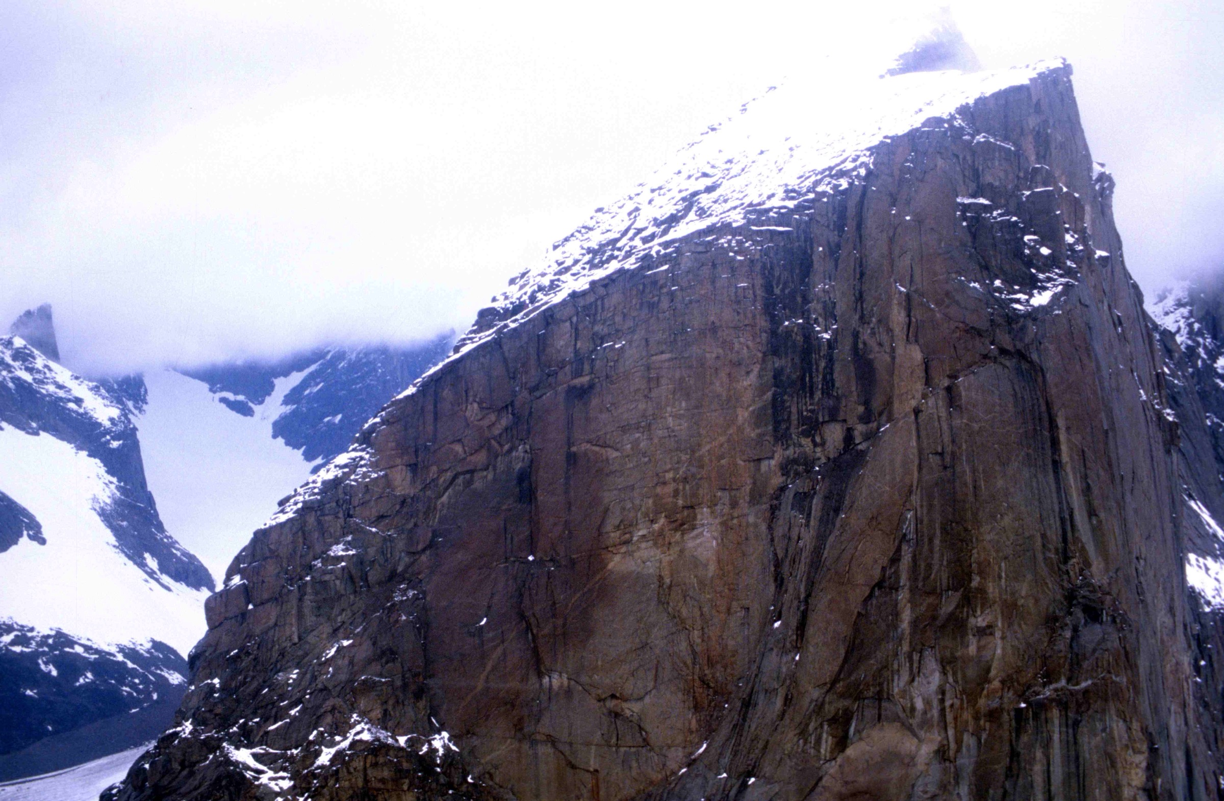
3. Aktineq Glacier-Foot Walk
Snapshot
Itinerary
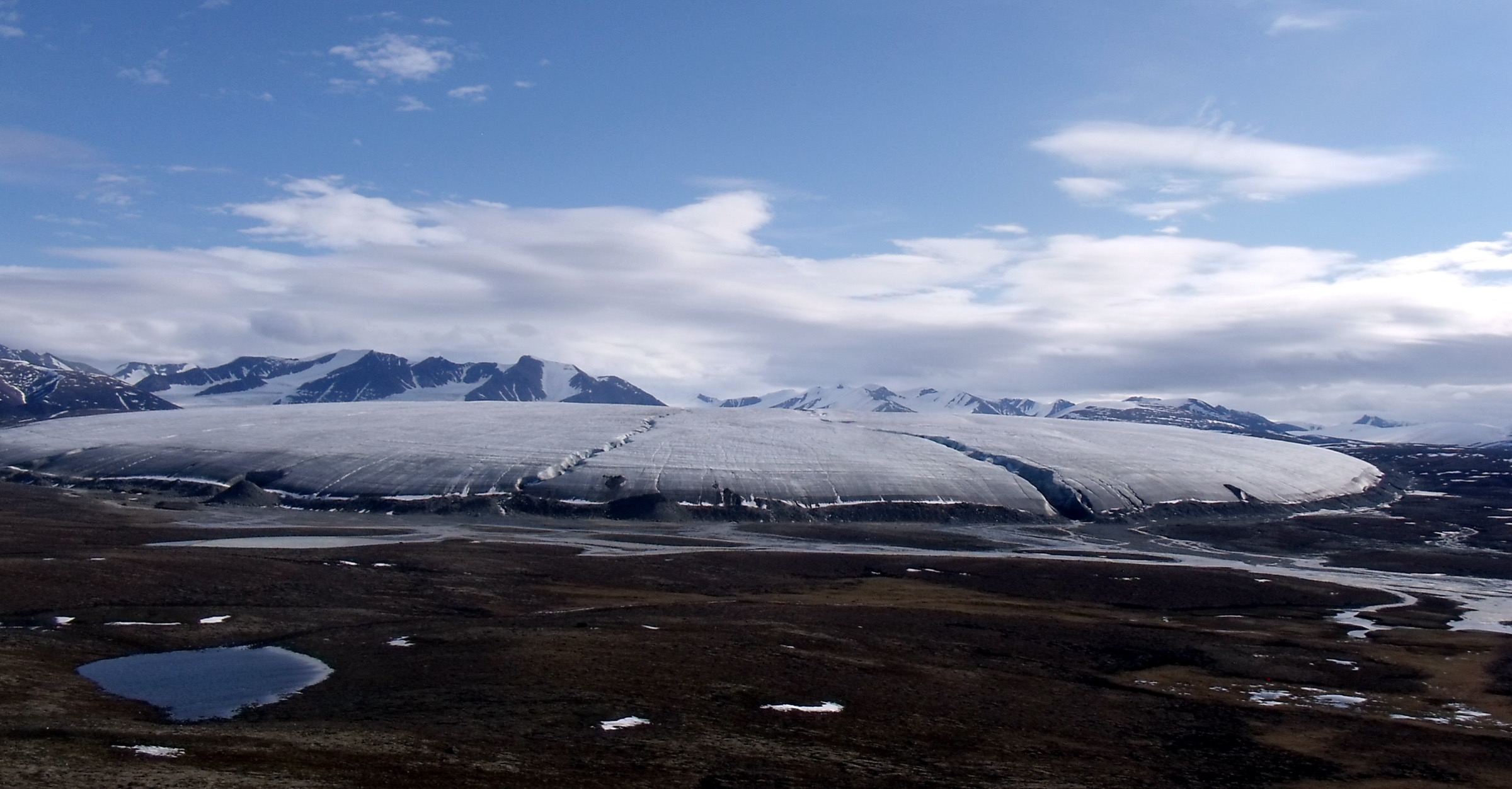
This is the day-walk most often referenced in expedition trip reports as “a walk to the glacier from camp”. From a base on the outwash plain, the route climbs gently up the proglacial flats, picking a line through braided melt-water streams and patches of frost-shattered bedrock to gain the most recent lateral moraine of the Aktineq glacier system. The high point is the moraine crest itself, from which the snout, the heavily crevassed lower icefall, and the snow-and-ice-clad Byam Martin peaks above can be seen. The walk does not step onto glacier ice. Return is by the line of ascent, or by a parallel braid further down-valley if water levels permit.
Why it is essential
Bylot Island has at least sixteen named glaciers, and Parks Canada’s visitor description identifies glacier-foot walking as the defining hiking experience of the island: “most hikes on Bylot Island will put you up-close to numerous ancient glaciers”. The Aktineq system sits closest to the south-western base-camp areas used by the research station and by commercial trips, and is consistently named in ski-expedition reports and operator literature. The walk gives the most accessible representation of the glacier-meets-tundra contact that defines the southern flank of the Byam Martin Mountains.
Equipment
Mountain hiking equipment, plus sturdy boots with good ankle support, trekking poles strongly recommended for moraine and stream crossings, insulated and windproof layers with gaiters, a satellite phone carried by the party, polar bear deterrents carried by the licensed Inuit guide, and NTS 1:250,000 mapping with compass and GPS. A helmet is not normally required on the standard outwash-and-moraine line.
Hazards and notes
Polar bears are present on the southern coast and have been recorded inland; guide-led travel is required. Melt-water streams swell dramatically through the afternoon and can become impassable; plan the turnaround conservatively. Lateral moraine slopes are very loose and prone to collapse; do not undercut. The glacier itself is crevassed and is not part of this walk; any step onto ice converts the day into a roped glacier route outside the scope of this catalogue. Sea fog can roll in along the south coast and obscure the route back to camp; carry a bearing back to camp from the moraine crest.
GPX / KML links
| Source | URL | Format / access | Reuse status |
|---|---|---|---|
| Route-file status | No published GPX | Unresolved | Approximate Aktineq glacier-foot area 73.2°N, 79.0°W |
External links
- Parks Canada — Sirmilik National Park: Hiking and skiing
- Wikipedia — Byam Martin Mountains
- Wikipedia — Kaparoqtalik Glacier
4. Button Point Historical Landing Walk
Snapshot
Itinerary
Button Point is the southeasternmost corner of Bylot Island, immediately south of Cape Graham Moore. A Hudson’s Bay-era trading post operated here for several years after 1910 and the surface remains of that station, together with older Thule and Dorset cultural sites, give the landing point its historical interest. The day walk lands on a long shingle beach, follows it along the shore past the trading-post relicts, then climbs a short tundra slope onto the low coastal ridge behind the point. From the ridge the view extends north-east along the cliffs towards Cape Graham Moore and south across Lancaster Sound to the northern coast of Baffin Island. Return is by the line of ascent. The walk is shorter and lower than the Cape Graham Moore option and is more commonly described in Inuit-guided boat trips as a half-day cultural stop than a full day on foot, but it can be extended along the coast as conditions allow.
Why it is essential
Button Point is the only walking objective on Bylot Island that combines cultural and historical material — trading-post remains and earlier archaeological features — with a recurring, named landing point. It carries the Inuit and post-contact human history of the island in a way no other day-walk option does, and is one of the few places where the walking is genuinely at sea level on a beach rather than on glacier-foot moraine or high tundra. It complements rather than duplicates the Cape Graham Moore cliff-top walk above it.
Equipment
Standard hiking equipment, plus waterproof boots (shingle and surf at the landing), insulated and windproof layers, a satellite phone carried by the party, polar bear deterrents carried by the licensed Inuit guide, binoculars, and NTS 1:250,000 mapping with compass and GPS.
Hazards and notes
Polar bears regularly patrol this shoreline; the guide will scan before landing and during the walk. Cultural and archaeological remains at Button Point are protected by the Canada National Parks Act and by the Migratory Bird Sanctuary Regulations; nothing must be touched, moved or removed. Surf and tide can complicate the boat landing; the operator may shift to a nearby beach. Sea fog can close the landing and prevent return; carry overnight contingency gear.
GPX / KML links
| Source | URL | Format / access | Reuse status |
|---|---|---|---|
| Route-file status | No published GPX | Unresolved | Approximate landing 72.78°N, 76.0°W |
External links
- Parks Canada — Sirmilik National Park: Plan your visit
- The Canadian Encyclopedia — Bylot Island
- Wikipedia — Bylot Island
5. Sirmilik Glacier Outwash and Lateral Moraine Walk
Snapshot
Itinerary
The Sirmilik Glacier is the namesake feature of the national park — in Inuktitut, Sirmilik means “place of glaciers” — and is one of the major outlet glaciers of the Byam Martin icefield. From a base camp on the proglacial plain, the walk follows the broad outwash floor of the valley up to and along the recent lateral moraine, traversing on its inner side to gain a viewpoint over the icefall and the Byam Martin peaks beyond. The going is consistently rough: braided melt-water channels, polished bedrock benches, and loose moraine. There is no trail. Ski-expedition reports describe the walk as a typical rest-day objective for parties already established on the south-western tundra. As with the Aktineq option the walk does not step onto glacier ice; doing so converts it into a roped glacier route.
Why it is essential
The Sirmilik Glacier is the eponymous landform of the park and is consistently picked out by Parks Canada visitor material, by Black Feather and Adventures.com operator itineraries, and by Université Laval glaciological literature as the most visually dominant glacier of the southern Byam Martin flank. It is the natural companion piece to the Aktineq walk: where Aktineq represents the closest glacier-foot from the standard south-western base camp, Sirmilik represents the largest and most photographed glacier visible from the same broad approach.
Equipment
Mountain hiking equipment, plus sturdy boots, trekking poles strongly recommended, insulated and windproof layers with gaiters, a satellite phone carried by the party, polar bear deterrents carried by the licensed Inuit guide, NTS 1:250,000 mapping with compass and GPS, and extra food plus a bivouac layer for the long return.
Hazards and notes
Polar bears can range deep into the proglacial valleys; guide-led travel is required. Melt-water channels swell sharply in the afternoon; plan the turnaround for cooler hours. Loose moraine and unstable polished bedrock benches reward careful pace. Glacier ice is crevassed; do not step onto it on a day-hike. Weather windows can close fast.
GPX / KML links
| Source | URL | Format / access | Reuse status |
|---|---|---|---|
| Route-file status | No published GPX | Unresolved | Approximate Sirmilik proglacial area 73.3°N, 78.5°W |
External links
- Parks Canada — Sirmilik National Park: Hiking and skiing
- Wikipedia — Sirmilik National Park
- Wikipedia — Byam Martin Mountains
Missing data / follow-up work
- Region does not support the spec as written. Bylot Island has no established day-hike trails. The five entries above are walking opportunities described in guided-trip itineraries, expedition reports and Parks Canada visitor materials. They are not waymarked, not signposted and not published routes. Every entry is labelled Candidate only, which is the honest reading.
- No published GPX, KML, GeoJSON, OSM relations or AllTrails / Komoot / Wikiloc tracks of meaningful quality exist for any of the five candidates. This is unlikely to change: the absence is a feature of the place, not a research gap. Coordinates given are landing-point approximations only.
- Distances, ascents and times are estimates. No primary source publishes statistics for any of these walks. Ranges have been kept deliberately wide.
- Photo coverage is moderate. All five candidates are paired with at least one Wikimedia Commons image (CC BY-SA 2.5 / 4.0 and CC BY 2.0). The Cape Graham Moore image is portrait-oriented; a landscape-orientation alternative would be preferable in production. No licence-compatible image was located that specifically depicts the snow goose colony at the resolution target; the research station and a general from-sea-ice view stand in for the Qarlikturvik valley. Targeted follow-up on Flickr Creative Commons under “Bylot Island” and “snow goose Nunavut” tags is recommended.
- Polar bear safety, mandatory orientation and licensed-outfitter requirements need re-checking each season against Parks Canada bulletins. These rules can change with conservation review of the park.
- Bylot Island Migratory Bird Sanctuary regulations are reviewed periodically (most recently amended in 2025); any deliberate close approach to colonies during the breeding season may require Environment and Climate Change Canada permission.
- Sea ice break-up date governs the boat-access season and is unpredictable from year to year. Spring snowmobile access typically ends in early to mid-June; summer boat access typically begins in mid- to late July. Always confirm with Pond Inlet operators before booking.
- Inuit Impact and Benefit Agreement obligations for Sirmilik National Park apply to all visitor activity; respect for Inuit Qaujimajatuqangit and Inuit traditional land use is expected. Trips arranged through Pond Inlet-based outfitters meet this requirement by design.
External links
| Resource | Link |
|---|---|
| Parks Canada — Sirmilik National Park | parks.canada.ca |
| Parks Canada — Sirmilik: Hiking and skiing | parks.canada.ca |
| Environment and Climate Change Canada — Bylot Island Migratory Bird Sanctuary | canada.ca |
| Centre d’études nordiques — Bylot Island Field Station | cen.ulaval.ca |
| Important Bird Areas Canada — site NU068 (Cape Graham Moore) | ibacanada.com |
| The Canadian Encyclopedia — Bylot Island | thecanadianencyclopedia.ca |
| Wikipedia — Bylot Island | en.wikipedia.org |
| Wikipedia — Sirmilik National Park | en.wikipedia.org |
| Wikipedia — Bylot Island Migratory Bird Sanctuary | en.wikipedia.org |
| Wikipedia — Byam Martin Mountains | en.wikipedia.org |
| Wikipedia — Kaparoqtalik Glacier | en.wikipedia.org |
| Wikimedia Commons — Category: Bylot Island | commons.wikimedia.org |