Regional overview
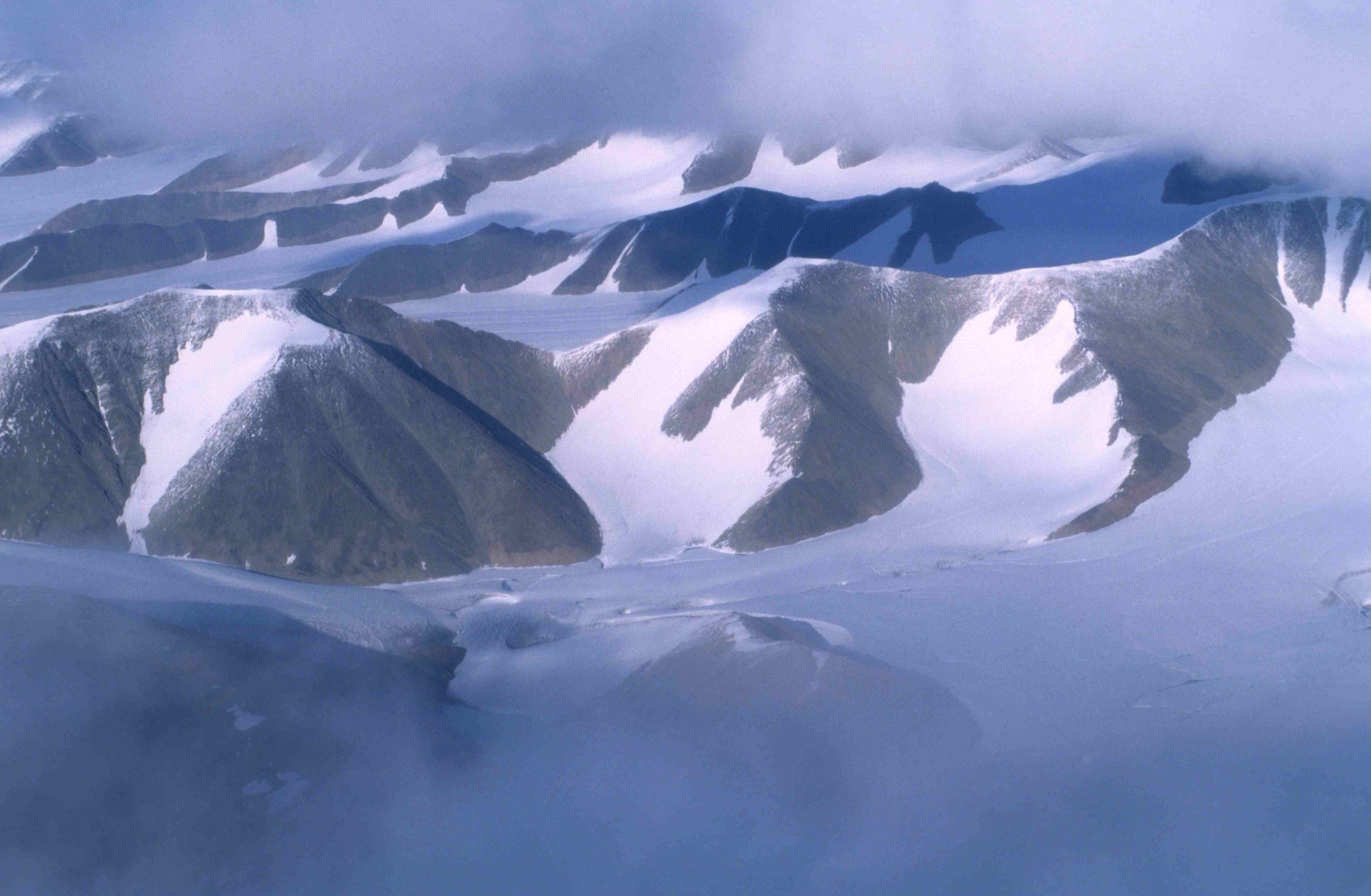
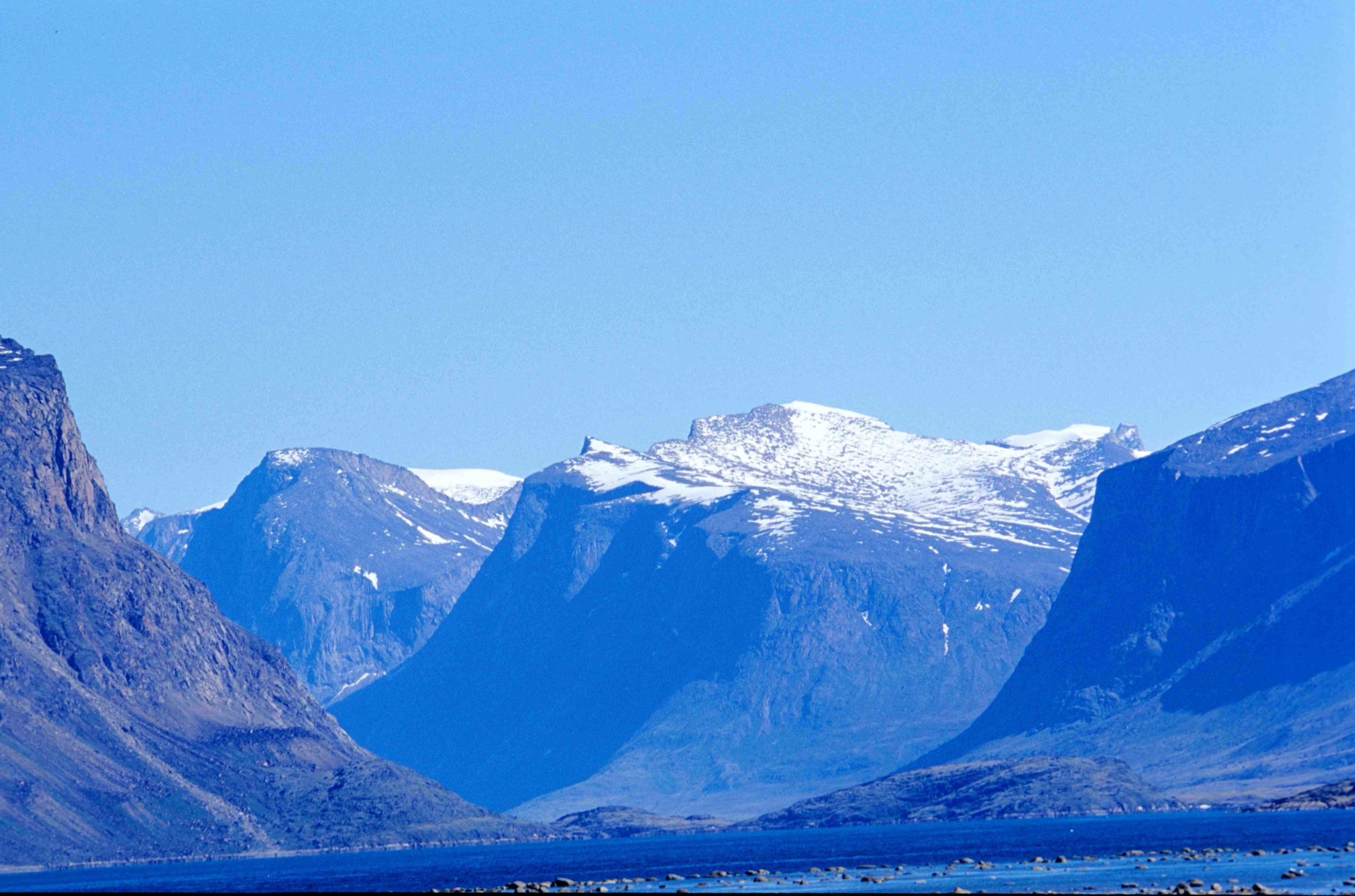
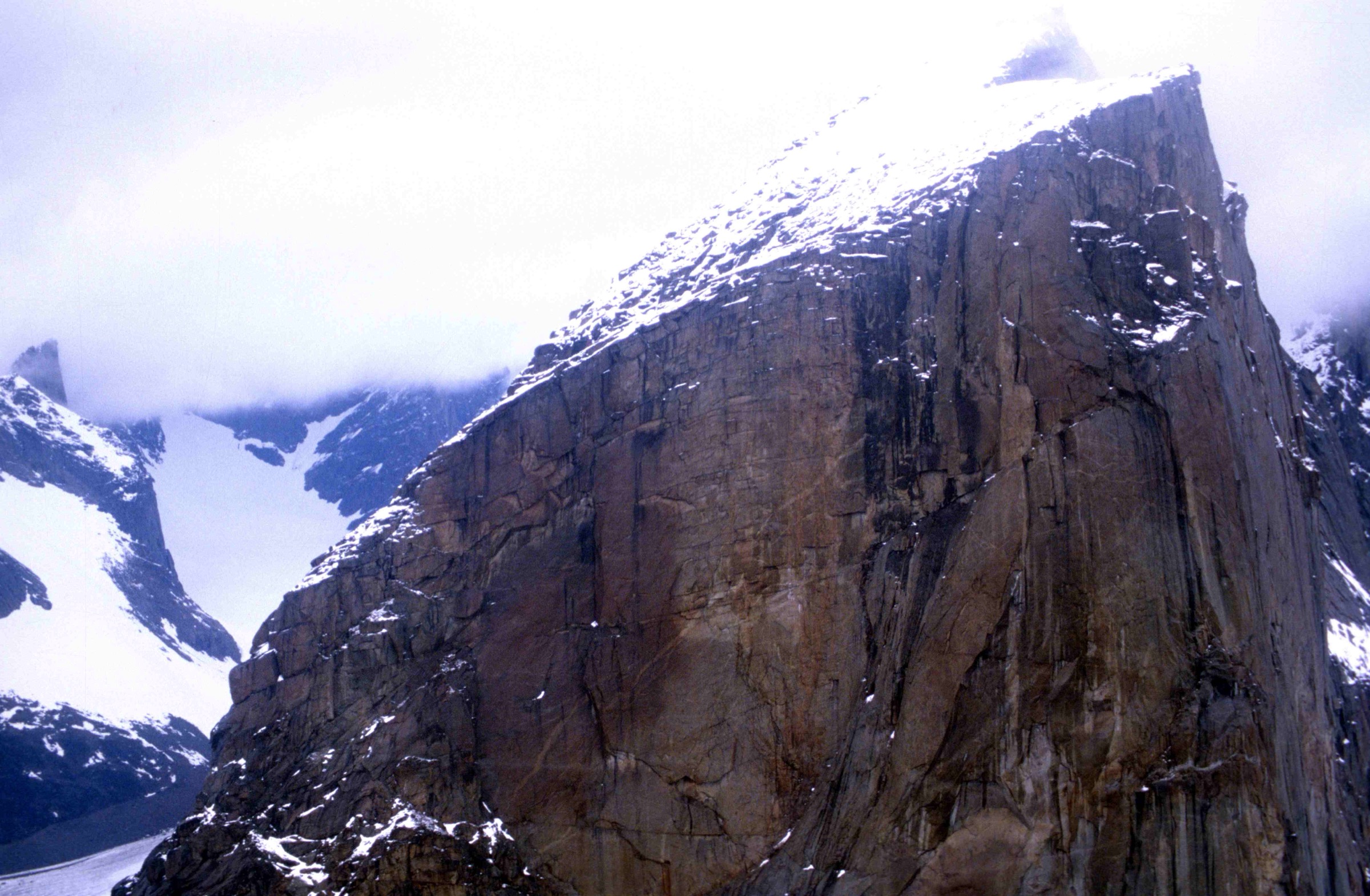
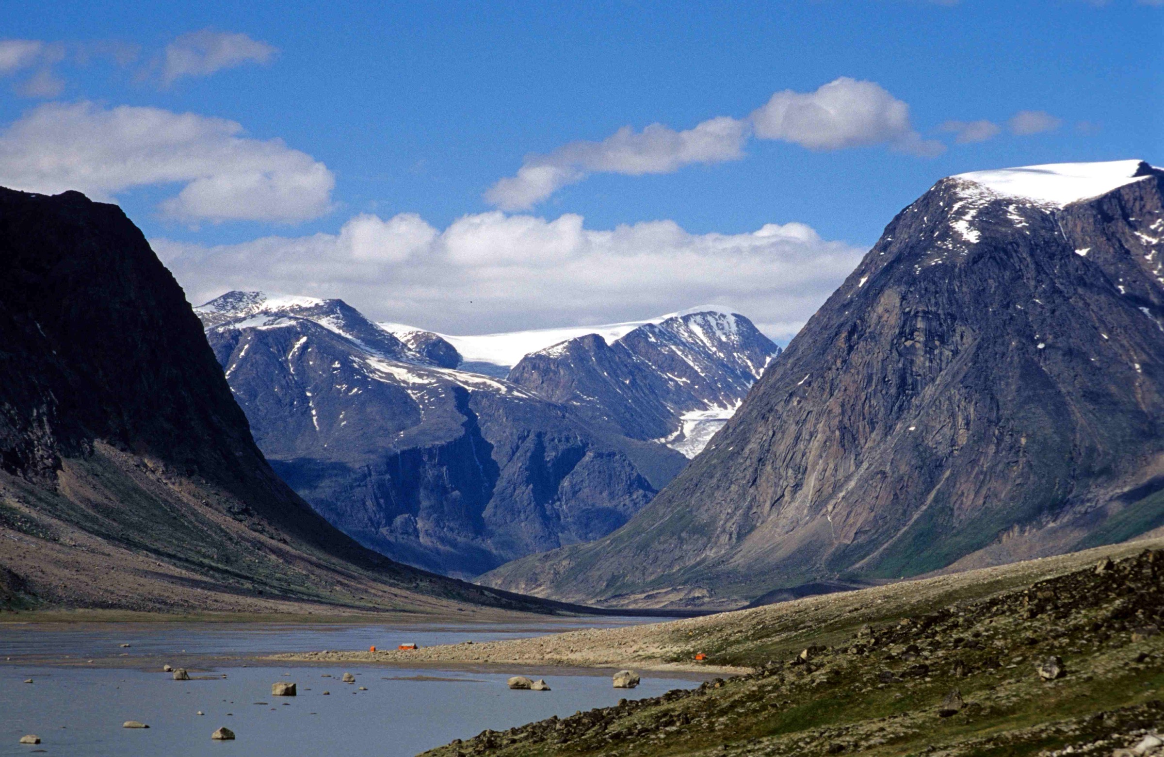
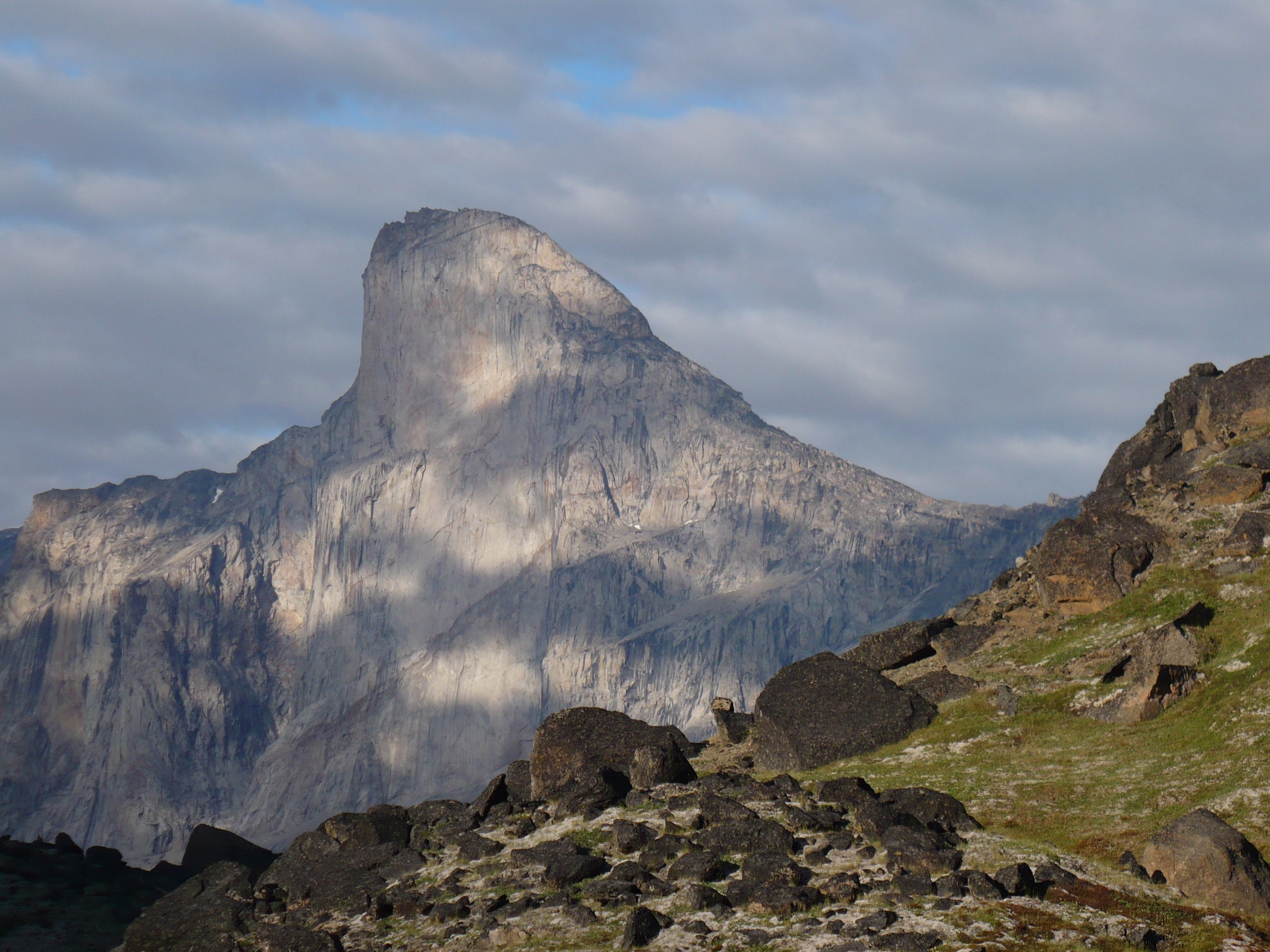
Auyuittuq National Park covers roughly 21,470 km² of the southern Cumberland Peninsula on Baffin Island in Nunavut, straddling the Arctic Circle. The park is administered by Parks Canada with the support of the hamlets of Pangnirtung to the south and Qikiqtarjuaq to the north. Its defining feature is Akshayuk Pass, a 97 km glacial corridor running between Pangnirtung Fjord and North Pangnirtung Fjord, framed by the granite walls of the Baffin Mountains and the 6,000 km² Penny Ice Cap. Iconic landmarks include Mount Thor (1,675 m, with the world’s largest pure vertical drop) and Mount Asgard (2,015 m, twin cylindrical towers), but neither is a feasible day-hike from any trailhead.
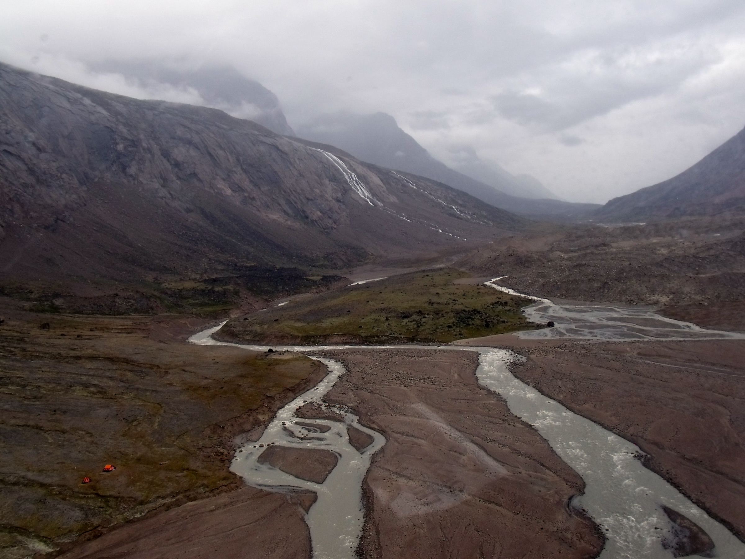
The terrain is treeless Arctic tundra, glacial outwash, moraine, polished bedrock and braided rivers fed by side glaciers. There are no maintained trails; route-finding follows river gravels, cairns and the high benches of the Weasel and Owl valleys. Nine emergency shelters spaced along the pass provide refuge from extreme weather and from polar bears, but are not for general overnight use. Snow-free walking is generally restricted to a short window from late June through mid-August. River levels rise sharply through the afternoon as glacial melt accelerates, and rainfall can render the Weasel and Owl rivers impassable for days at a time. Winds in the pass have been measured above 175 km/h.
Access is by motorboat from Pangnirtung in summer (approximately 45 minutes to the Overlord landing, roughly 28-30 km up Pangnirtung Fjord) or by boat from Qikiqtarjuaq into North Pangnirtung Fjord (a longer ride of around two hours). In winter and shoulder seasons travel is by snowmobile or ski. No road reaches the park; both communities are served by scheduled flights from Iqaluit on Canadian North. There is no cellular coverage anywhere in the park.
All visitors are legally required to register, attend a mandatory orientation, and de-register at the Parks Canada visitor centre in Pangnirtung or Qikiqtarjuaq before and after a trip. Polar bears can be encountered in any part of the pass and are most often reported near the coasts; carrying bear deterrents and ideally a portable electric fence for camp is strongly recommended. A satellite communicator is treated by Parks Canada as essential, not optional. True day-hikes in the strict sense are scarce: most candidates are short out-and-back walks from the Overlord area into the lower pass, the single guided Ulu Peak day trip operated by Parks Canada, or hikes on the outskirts of Pangnirtung itself.
Selection rationale
Within Auyuittuq there is no large menu of fully self-contained day-hikes, so the selection below combines one peak day-hike from the village of Pangnirtung (Mount Duval) that needs neither boat charter nor guide, one Parks Canada-guided day-hike (Ulu Peak) that is the only formally scheduled day-trip inside the park, and three out-and-back day-hikes from the Overlord trailhead up the lower Akshayuk Pass — each turning around at a recognised waypoint (Crater Lake, Windy Lake, Schwartzenbach Falls / Arctic Circle). The base of Mount Thor, Summit Lake, Mount Asgard and the Owl River valley are explicitly excluded because none can be reached and returned to a trailhead in a single day on foot.
Summary table
| # | Hike | Country | Route type | Distance | Gain | Max elevation | Difficulty |
|---|---|---|---|---|---|---|---|
| 1 | Mount Duval from Pangnirtung | Canada | Out-and-back | ~8.5 km | ~650-700 m | ~670-850 m | Strenuous |
| 2 | Overlord to Crater Lake | Canada | Out-and-back | ~12-14 km | ~150 m | ~120 m | Moderate |
| 3 | Overlord to Windy Lake | Canada | Out-and-back | ~28-30 km | ~250 m | ~180 m | Strenuous |
| 4 | Schwartzenbach Falls / Arctic Circle viewpoint | Canada | Out-and-back | ~30-32 km | ~250 m | ~200 m | Strenuous |
| 5 | Ulu Peak guided day-hike | Canada | Out-and-back (guided) | Not published | Not published | Not published | Easy-Moderate |
1. Mount Duval from Pangnirtung
Snapshot
Itinerary
The route begins at the small reservoir on the slope above Pangnirtung, reached in roughly 15-20 minutes on foot from the visitor centre. There is no formed trail. The line of ascent climbs north-east up the open tundra slope behind the reservoir, then weaves through progressively larger boulder fields and scree as the angle steepens. The mountain rises directly from the head of Pangnirtung village, so navigation is straightforward in clear weather: keep the village and fjord behind and below, gain the broad summit shoulder, and trend left to the highest point. The summit gives a panorama down the full length of Pangnirtung Fjord toward Cumberland Sound and north-east toward the entrance of Auyuittuq National Park. Descent retraces the line of ascent; in poor visibility care is needed not to drift onto steeper ground to the west or south-west.
Why it is essential
Mount Duval is the only routine day-hike in the wider Auyuittuq area that requires neither a boat charter nor a guide. It is the standard objective for visitors waiting on park orientation or weather windows, and gives the only easily reached high viewpoint over Pangnirtung Fjord and the southern approach to the park. It is the de facto introduction to the scale of Baffin’s landscape.
Equipment
Sturdy boots with ankle support for the boulder fields, weatherproof shell and warm layer (conditions change rapidly even in July), hat and gloves outside the warmest weeks, water (no reliable refill on the upper mountain), food, map and compass with GPS or satellite communicator, bear deterrent (polar bears are occasionally seen near Pangnirtung), sun protection for 24-hour daylight on reflective snow patches, and trekking poles for the descent.
Hazards and notes
Off-trail boulder terrain makes ankle injuries the most common incident. Sources disagree on summit elevation: PeakVisor lists 670 m while Wikipedia and Lonely Planet cite 850 m; neither figure is from an authoritative cartographic source. The route is outside the national park, so no park registration is required for Mount Duval itself, but bear awareness still applies — check at the Parks Canada visitor centre for any current bear activity around the reservoir. Snow can persist on the upper boulder fields into early July. Weather can change in minutes; descend if cloud closes on the summit ridge. Community dogs sometimes follow hikers up; this is not a controlled trail.
GPX / KML links
| Source | URL | Format / access | Reuse status |
|---|---|---|---|
| No official GPX | — | — | None published by Parks Canada or community |
| OpenStreetMap (base terrain only) | openstreetmap.org near Mount Duval | OSM data (ODbL) | Geometry reusable under ODbL; route must be hand-derived |
Trailhead (reservoir area): approximately 66.146° N, 65.703° W. Summit: 66.1546° N, 65.6375° W.
External links
2. Overlord to Crater Lake (lower Akshayuk Pass)
Snapshot
Itinerary
A boat charter from Pangnirtung delivers walkers to the Overlord landing at the head of Pangnirtung Fjord, the southern entrance to Auyuittuq. The lower pass follows the broad gravel flats of the Weasel River, with the river itself braided across the valley floor and the granite walls of the southern Baffin Mountains rising to either side. The route heads broadly north on river benches and braided gravels, picking the driest line and avoiding unbridged side channels where possible. Cairns mark the most-used line in places but there is no maintained trail. Crater Lake sits on the west side of the Weasel, a small circular pond often described as greenish-blue and reached after roughly 6-7 km of valley walking from Overlord. It makes a natural turn-around for a long day-walk. After Crater Lake the valley continues toward Windy Lake and Schwartzenbach Falls; a same-day return generally requires turning back here. The return retraces the line of ascent down-valley to the Overlord landing for the booked boat pickup.
Why it is essential
This is the shortest practical day on foot inside Auyuittuq National Park that gives the full lower-pass character: the Weasel River, towering granite walls, side glaciers spilling from the Penny Ice Cap, and the first named landmark beyond the park entrance. It is the standard taster walk used by visitors who cannot commit to the multi-day traverse.
Equipment
Sturdy waterproof boots and gaiters for gravel, glacial silt and frequent shallow side channels, weatherproof shell with warm insulating layer, hat and gloves (essential even in July), trekking poles for braided gravels and stream crossings, NTS 1:250,000 sheets 26-I and 26-O with compass and GPS, satellite communicator (strongly recommended by Parks Canada), bear deterrent, sun protection and a mosquito head net in July, water and food for a long day (river water available with treatment), and completed Parks Canada registration before departure.
Hazards and notes
Mandatory Parks Canada orientation and registration before entry; de-registration on exit. River crossings on the Weasel side channels can rise dramatically through the afternoon as glacial melt peaks — plan to cross channels early and turn back if water is above mid-thigh or moving fast. There is no cell coverage anywhere in the park; satellite communication is essential. Polar bears can be encountered anywhere, with the lower fjord and Overlord beach area particularly bear-prone. Weather can shift to freezing whiteout in any month; carry full Arctic layers. Boat charter is weather-dependent and a change in fjord conditions can leave walkers stranded at Overlord overnight, so carry emergency gear accordingly. Dogs are not permitted in the park.
GPX / KML links
| Source | URL | Format / access | Reuse status |
|---|---|---|---|
| No official GPX | — | — | Parks Canada does not publish GPX for Auyuittuq routes |
| OpenStreetMap (Weasel River corridor) | openstreetmap.org near Overlord | OSM data (ODbL) | Geometry reusable under ODbL |
| Komoot community route to Schwartzenbach Falls / Windy Lake | komoot.com | GPX (account export) | Cross-check only; Komoot ToS restrict redistribution |
Overlord landing: approximately 66.50° N, 65.50° W. Crater Lake is not published as a precise coordinate by Parks Canada.
External links
- Parks Canada — Auyuittuq National Park, Hiking
- Parks Canada — River crossings safety
- Wikipedia — Akshayuk Pass
3. Overlord to Windy Lake
Snapshot
Itinerary
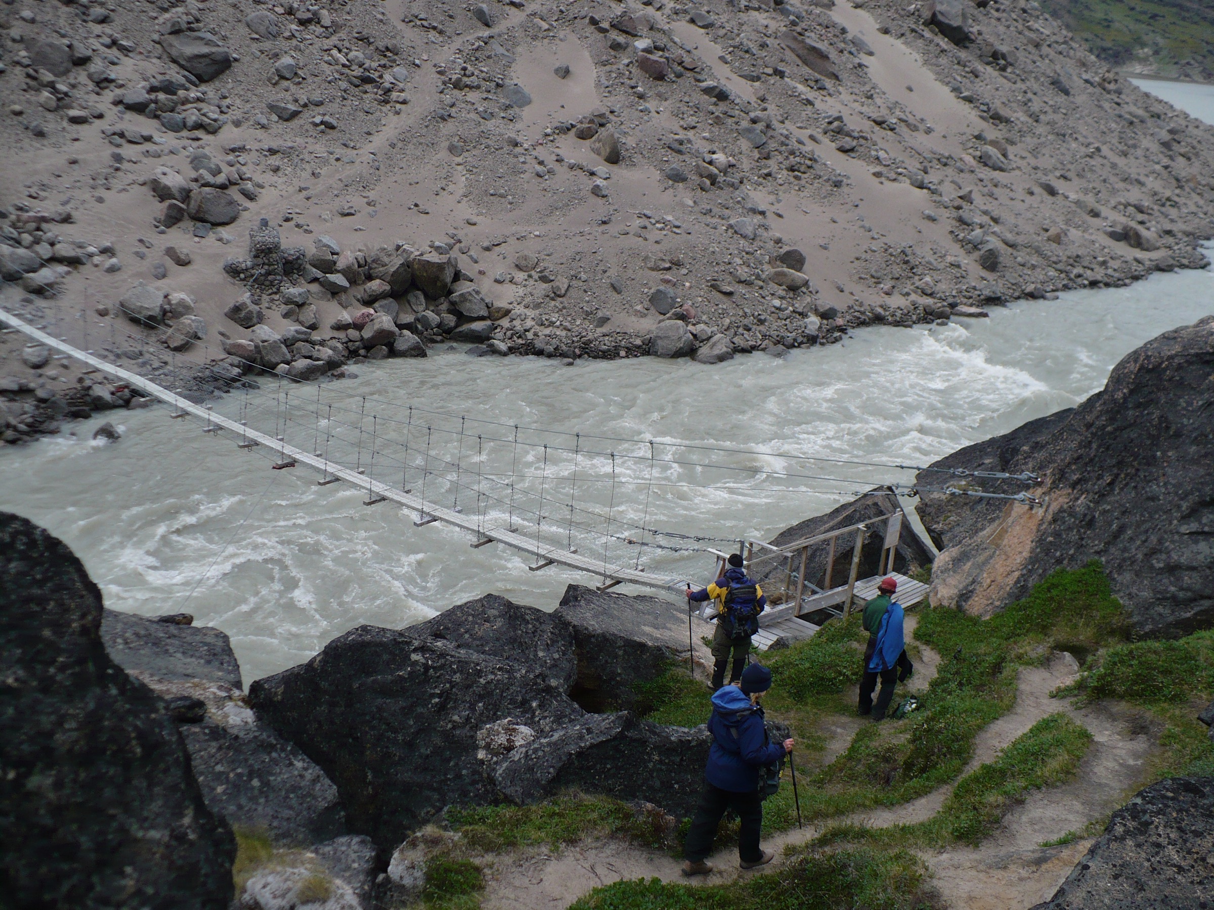
From the Overlord landing the route follows the Weasel River corridor described in Hike 2, continuing past Crater Lake on the west side. Beyond Crater Lake the valley widens, with cliffs of the Breidablik and Asgard outliers rising on the east side. Walking is on river gravels and tundra benches with cairns marking the most-used line in places. Windy Lake sits at the foot of the lower pass, where the washed-out bridge site (the 2007 bridge was destroyed by the 2008 flood) marks the previous river crossing. From the shelter area there are open views up-valley toward Schwartzenbach Falls and Mount Thor, although the falls themselves remain a further 30-40 minutes upstream and Mount Thor’s base sits well beyond. Return to Overlord retraces the line of ascent. The full 24-hour daylight of July makes the long day mathematically possible, but timing is dictated by the booked boat pickup; confirming a flexible pickup window with the outfitter is essential.
Why it is essential
This is the deepest one-day penetration into Auyuittuq that is realistically possible from the south entry without committing to an overnight inside the park. It delivers most of the named features of the lower Akshayuk Pass — Crater Lake, the open Weasel River gravels, the first sight lines toward Thor and the Penny Ice Cap — in a single very long day.
Equipment
As Hike 2, plus a headtorch (despite midsummer daylight, needed for any shoulder-season trip), spare batteries for the satellite communicator, an emergency bivvy or shelter in case of boat delay, extra food, and a dry change of clothing in a waterproof bag.
Hazards and notes
The 28-30 km return distance plus river-gravel walking makes this a very demanding day; a slower pace than expected is the rule, not the exception. River channels in the lower Weasel can be impassable in late July and early August during peak melt, with Parks Canada specifically flagging the last week of July and first week of August as peak-risk. Windy Lake takes its name from violently funnelled katabatic winds off the surrounding ice; speeds above 100 km/h are routine and the previous bridge was destroyed in a flood. The Windy Lake shelter is for emergency use only. Polar bear risk is present along the entire valley. No cell coverage; satellite communicator essential. Mandatory Parks Canada registration and orientation, with de-registration on exit.
GPX / KML links
| Source | URL | Format / access | Reuse status |
|---|---|---|---|
| No official GPX | — | — | Parks Canada does not publish GPX for the pass |
| Parks Canada shelter-to-shelter distance table | parks.canada.ca | Tabular (Crown copyright) | Distances reusable; geometry must be hand-derived |
| Komoot community route to Windy Lake | komoot.com | GPX (account export) | Cross-check only |
| OpenStreetMap base terrain | openstreetmap.org near Windy Lake | OSM data (ODbL) | Reusable with ODbL attribution |
Parks Canada shelter split used here: Windy Lake to Overlord = 14.6 km one-way.
External links
- Parks Canada — Auyuittuq National Park, Hiking
- Parks Canada — Polar bear safety
- Wikipedia — Akshayuk Pass
4. Schwartzenbach Falls / Arctic Circle Viewpoint from Overlord
Snapshot
Itinerary
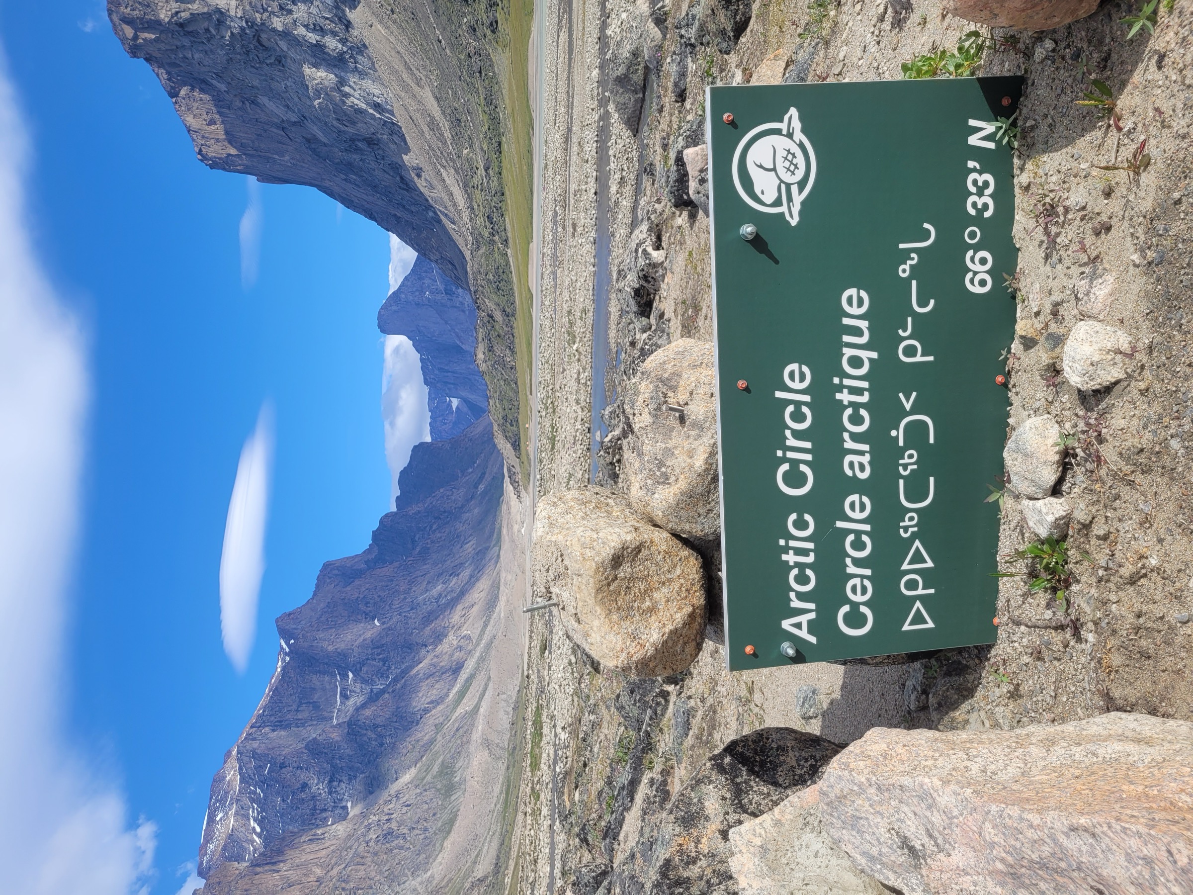
From the Overlord landing the route follows the Weasel River corridor north past Crater Lake and then past Windy Lake (see Hikes 2 and 3). Above Windy Lake the valley narrows briefly and a marked Arctic Circle sign sits on the east side of the river. Continuing north, the Schwartzenbach Falls (Inuktitut: Qulitasaniakvik) drop in a 520 m tiered horsetail down the western wall of the valley, fed by a hanging glacier from the Penny Ice Cap. This is the tallest waterfall north of the Arctic Circle and the tallest in Canada outside British Columbia. The route does not cross to the falls’ base; the standard viewpoint is from the opposite (east) side of the Weasel River. The marked turnaround for a long day-walk is the Arctic Circle sign and the falls viewpoint together. Return is by the same route to Overlord. The combination of full daylight and the 30-32 km distance puts this firmly at the limit of a day-hike; most outfitters present it as a two- or three-day overnight from a base camp at Overlord or Windy Lake. Same-day completion is genuinely possible but requires very strong walkers and a flexible boat pickup.
Why it is essential
The Arctic Circle marker and Schwartzenbach Falls are the two most photographed waypoints inside Auyuittuq that are reachable on foot from the Overlord trailhead. The combination — symbolic latitude crossing plus the tallest waterfall in the Canadian Arctic — defines the iconic Auyuittuq image for the majority of visitors.
Equipment
As Hike 3, with particular emphasis on reliable footwear for long gravel walking and short water crossings, trekking poles, an emergency bivvy and extra calories, and a confirmed flexible boat-pickup window.
Hazards and notes
Distance and unbridged side channels make this a candidate-only true day-hike; most outfitters and trip reports describe it as a 2-3 day return from Overlord. River crossings on the Weasel and side channels can rise sharply through the day. Polar bear risk along the full corridor. No cell coverage; satellite communicator essential. Mandatory Parks Canada registration and orientation before entry.
GPX / KML links
| Source | URL | Format / access | Reuse status |
|---|---|---|---|
| No official GPX | — | — | Parks Canada does not publish GPX for the pass |
| Parks Canada distance table | parks.canada.ca | Tabular (Crown copyright) | Distances reusable; geometry must be hand-derived |
| Komoot community route to Schwartzenbach Falls | komoot.com | GPX (account export) | Cross-check only |
| OpenStreetMap base terrain | openstreetmap.org near Schwartzenbach Falls | OSM data (ODbL) | Reusable with ODbL attribution |
External links
- Parks Canada — Auyuittuq National Park, Hiking
- Wikipedia — Schwartzenbach Falls
- World Waterfall Database — Schwartzenbach Falls
5. Ulu Peak Guided Day-Hike
Snapshot
Itinerary
Parks Canada operates this guided day-trip from the visitor centre in Pangnirtung. A motorboat leaves Pangnirtung at 09:00, travels approximately one hour up Pangnirtung Fjord, and disembarks at the Ulu Peak landing area near the southern entrance to Auyuittuq National Park. From the landing a Parks Canada guide leads an off-trail hike onto the lower slopes of Ulu Peak. The terrain crosses variable tundra, mud, sand, and slippery rocks; the route is described as easy to moderate and suitable for walkers of average fitness. The group returns by boat to Pangnirtung in time to be back at the visitor centre by approximately 17:00. Disembarkation can be tricky (Parks Canada’s own description) with potential drops of a metre or more between boat and shore. The guide handles interpretation of Inuit culture, geography and wildlife.
Why it is essential
This is the only formally scheduled, guided, single-day trip into Auyuittuq National Park, and is suitable for visitors without backcountry experience. It is the only day-trip in the catalogue that includes Parks Canada interpretation of local Inuit culture and that does not depend on self-organised charter logistics. For visitors who cannot commit to a self-supported day in the Akshayuk Pass corridor, this is the realistic essential.
Equipment
Per Parks Canada’s published kit list: layered clothing, waterproof outer shell, insulated and water-resistant boots, sunglasses, sunscreen, hat, buff, gloves or mittens, and own food and drinks for the day. Park entry is free for the 2026 season (June 19 to September 7); the outfitter boat fee is paid separately (cash or e-transfer).
Hazards and notes
Minimum group size is two and the trip must be booked by 10:00 the Friday before via the Parks Canada office in Pangnirtung (867-473-2500) or Nunavut.info@pc.gc.ca. The trip is contingent on weather and may be cancelled on short notice. Expect a temperature range of 0-15 °C with potentially high wind. The mandatory park orientation is delivered as part of the trip, though separate registration is still completed at the visitor centre. Polar bear and river-crossing hazards still apply; a Parks Canada-licensed guide carries the necessary deterrents. The trip runs only on advertised dates (in 2026: 4, 11, 19 and 25 July; 1, 8, 15, 22 and 29 August).
GPX / KML links
| Source | URL | Format / access | Reuse status |
|---|---|---|---|
| No GPX published | — | — | Parks Canada does not publish a route file for this guided trip |
| Parks Canada Ulu Peak product page | parks.canada.ca | HTML (Crown copyright) | Facts reusable; geometry must be derived from on-the-ground tracks |
External links
- Parks Canada — Discover Ulu Peak
- Parks Canada — Auyuittuq guided day trips
- Parks Canada — Auyuittuq National Park
Missing data / follow-up work
- No official GPX exists for any route inside the park. Parks Canada publishes the shelter-to-shelter distance table but no machine-readable geometry. The Akshayuk Pass is not currently visible as a named Waymarked Trails relation, and OSM contains only base terrain and approximate corridor data. New route geometry needs to be derived from Parks Canada’s distance splits plus OSM and field GPS tracks from trip reports.
- No licence-compatible photograph of Mount Duval itself, Crater Lake, Schwartzenbach Falls or Ulu Peak was located on Wikimedia Commons. The Pangnirtung Fjord, Akshayuk Pass aerial, Windy Lake bridge, Mount Thor and Arctic Circle sign images are stand-in setting views; targeted Flickr Creative Commons searches and operator outreach are the next step.
- A higher-resolution Mount Asgard image is also outstanding; the available Commons file (BrettA343, CC BY-SA 4.0) is only 1,440 × 960 px and falls below the project’s 2,000 px floor.
- Mount Duval summit elevation is reported inconsistently (670 m on PeakVisor, 850 m on Wikipedia / Lonely Planet); NTS 1:50,000 sheet verification is needed.
- The Overlord trailhead coordinate (~66.50° N, 65.50° W) is taken from third-party sources; Parks Canada has not published a precise pin.
- Same-day feasibility of the Schwartzenbach Falls / Arctic Circle return is borderline. Outfitter literature treats it as a multi-day trip from Overlord; same-day completion is included here as a candidate-only option for very strong hikers and requires field verification with current river conditions.
- River-crossing conditions are highly seasonal and day-dependent; any published distance or time should be treated as the dry-conditions minimum.
- Boat charter logistics (current operators, costs, weather-cancellation policy) need confirmation each season directly with the Pangnirtung visitor centre.
- Polar bear activity reports for the season (April 2025 saw a polar bear injure a skier inside the park) should be checked each year before publication.
External links
| Resource | Link |
|---|---|
| Parks Canada — Auyuittuq National Park | parks.canada.ca |
| Parks Canada — Auyuittuq Hiking (shelter distance table) | parks.canada.ca |
| Parks Canada — Plan your visit | parks.canada.ca |
| Parks Canada — Safety and guidelines | parks.canada.ca |
| Parks Canada — Polar bear safety | parks.canada.ca |
| Parks Canada — River crossings | parks.canada.ca |
| Parks Canada — Discover Ulu Peak | parks.canada.ca |
| Hamlet of Pangnirtung — Auyuittuq page | pangnirtung.ca |
| Travel Nunavut — Auyuittuq National Park | nunavuttourism.com |
| Wikipedia — Auyuittuq National Park | en.wikipedia.org |
| Wikipedia — Akshayuk Pass | en.wikipedia.org |
| Wikipedia — Schwartzenbach Falls | en.wikipedia.org |
| Wikipedia — Mount Thor | en.wikipedia.org |
| Wikipedia — Mount Asgard | en.wikipedia.org |
| Wikipedia — Mount Duval (Nunavut) | en.wikipedia.org |
| PeakVisor — Auyuittuq National Park | peakvisor.com |
| World Waterfall Database — Schwartzenbach Falls | worldwaterfalldatabase.com |
| Wikimedia Commons — Category: Auyuittuq National Park | commons.wikimedia.org |