Regional overview
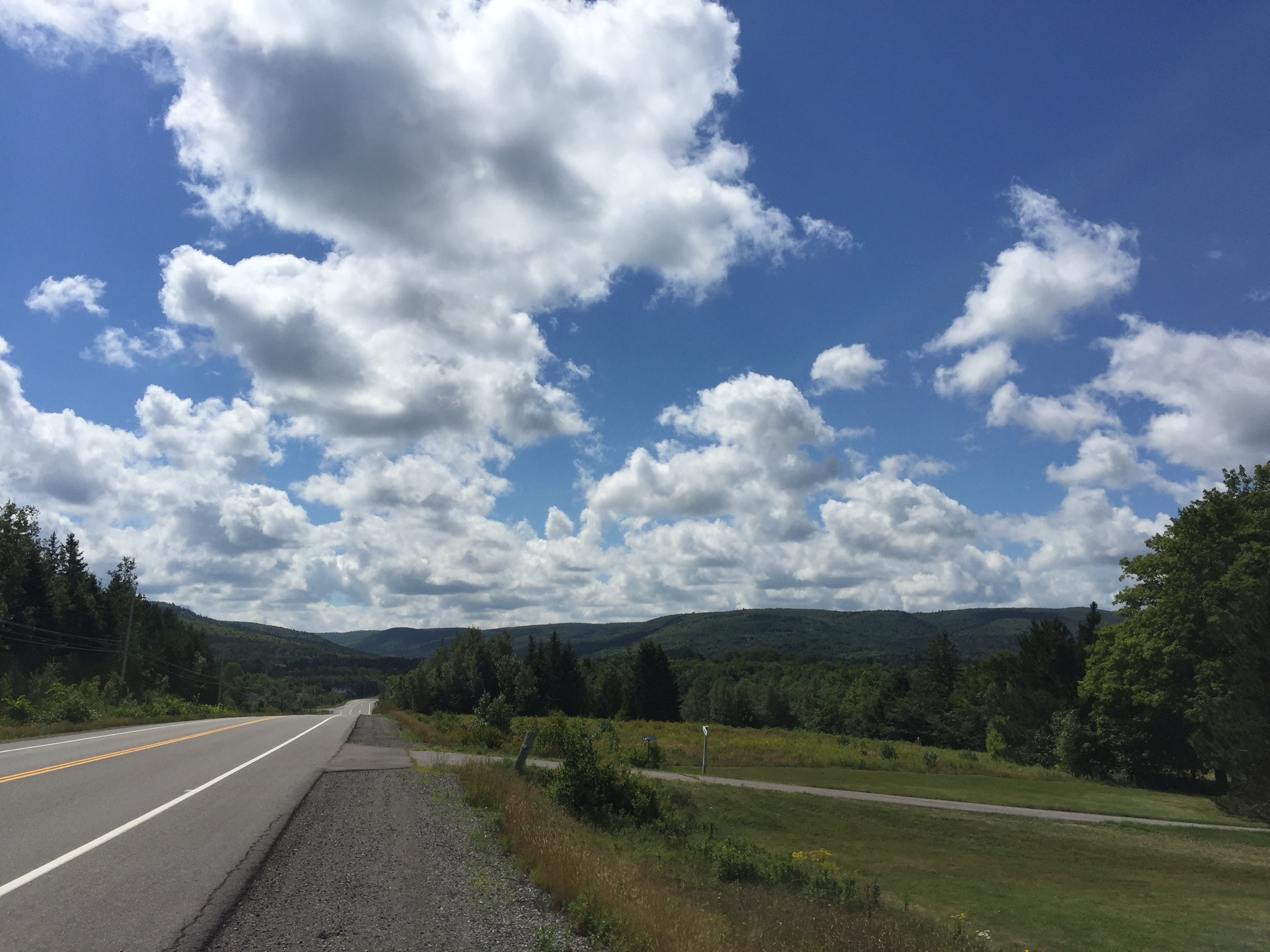
The Cobequid Mountains form the upland spine across the north of mainland Nova Scotia, running roughly east-west for some 120 km from the Cumberland County coast near Parrsboro and Cape Chignecto through Wentworth, Earltown and Nuttby to the Pictou hinterland. Geologically they belong to the northern Appalachians, an eroded Carboniferous and late-Devonian massif draped in glacial till, with Nuttby Mountain (about 365 m) historically cited as the high point of the mainland province. A re-survey in 2017 found that an unnamed summit near Higgins Mountain in the Wentworth Valley Wilderness Area is marginally higher at roughly 365 m, but the difference is well within survey error and Nuttby remains the conventional benchmark.
Relief is gentle: long rolling ridges of Acadian mixed forest — sugar maple, yellow birch, red spruce, eastern hemlock and white ash — drop steeply on the southern flank into the Bay of Fundy basin and more gradually on the northern side towards the Northumberland Strait. The signature day-hike experience is therefore short and concentrated rather than alpine: deep V-shaped valleys carved by the Economy, Great Village, Diligent, Wallace and Wentworth rivers cut through Carboniferous-age sandstones and shales, producing dozens of waterfalls — Economy, Wards, Wentworth, Jane’s, Horse Pasture Brook, Annandale — most reached by short steep trails of 2 to 10 km. The main hiking nodes are the Kenomee Wilderness Area at Economy on the Glooscap Trail (Route 2), Ski Wentworth and the Wentworth Valley Wilderness Area on Highway 4, the Gully Lake to Nuttby trail system near Earltown on Route 311, and the Parrsboro Shore from Wharton west to Cape Chignecto.
Best conditions run from late May to mid-October. Spring brings the fullest flow at the waterfalls but also persistent mud and blackflies; high summer (late June to early September) is reliably warm and the rivers drop; late September to mid-October produces the most spectacular hardwood colour. Winter snow is significant — Ski Wentworth and the surrounding ridges typically hold cover from December into March — but the trails are unmaintained for winter use and best left to snowshoers. Black bear and coyote are present in low densities and tick-borne Lyme disease is now well established across northern Nova Scotia, so long trousers, repellent and a careful body check after every walk are essential year-round. Wet sandstone at the waterfall canyons (Economy, Wards, Wentworth) is dangerously slippery, and Wards Falls in particular has a true flash-flood slot canyon that should be avoided after heavy rain.
Selection rationale
The five entries together cover the full character of the range. The Nuttby Mountain Lookout marks the symbolic high point of mainland Nova Scotia. Economy Falls with the Devil’s Bend loop is the showcase day-walk of the Kenomee Wilderness and the largest waterfall hike accessible in the Cobequids. Wards Falls is the iconic slot-canyon scramble of the Parrsboro Shore, with ladders, wooden bridges and an old-growth hemlock approach. The Wentworth Valley Lookoff above Ski Wentworth gives the best short-walk ridge panorama of the central Cobequids and represents the summer-trail offering of the ski-area corridor. Rogart Mountain Trail from Sugar Moon Farm in Earltown is a representative full forest loop with seventeen interpretive stops, a waterfall and the culturally important Maple Country setting on Route 311. Together they cover summit, waterfall, slot canyon, ridge balcony and forest loop.
Summary table
| # | Hike | Country | Route type | Distance | Gain | Max elevation | Difficulty |
|---|---|---|---|---|---|---|---|
| 1 | Nuttby Mountain Lookout from Old Nuttby Road | Canada | Out-and-back | 7 km | 180 m | 365 m | Easy-Moderate |
| 2 | Economy Falls and Devil’s Bend loop | Canada | Loop | 9 km | 280 m | 230 m | Moderate |
| 3 | Wards Falls Trail (Diligent River slot canyon) | Canada | Out-and-back | 6.3 km | 150 m | 130 m | Moderate |
| 4 | Wentworth Valley Lookoff above Ski Wentworth | Canada | Out-and-back | 3.4 km | 145 m | 340 m | Moderate |
| 5 | Rogart Mountain Trail from Sugar Moon Farm | Canada | Loop | 6.2 km | 185 m | 320 m | Moderate |
1. Nuttby Mountain Lookout from Old Nuttby Road
Snapshot
Itinerary
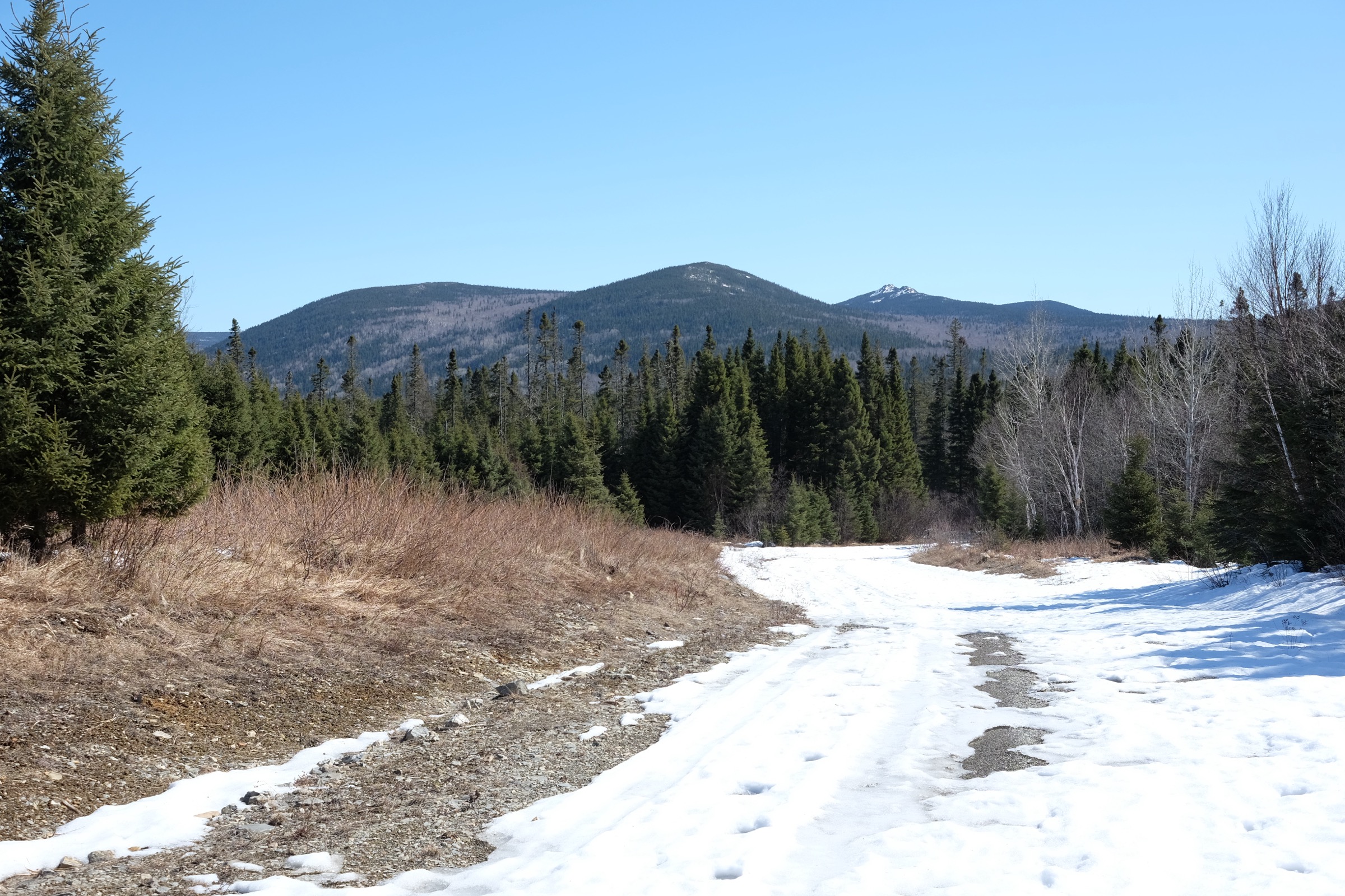
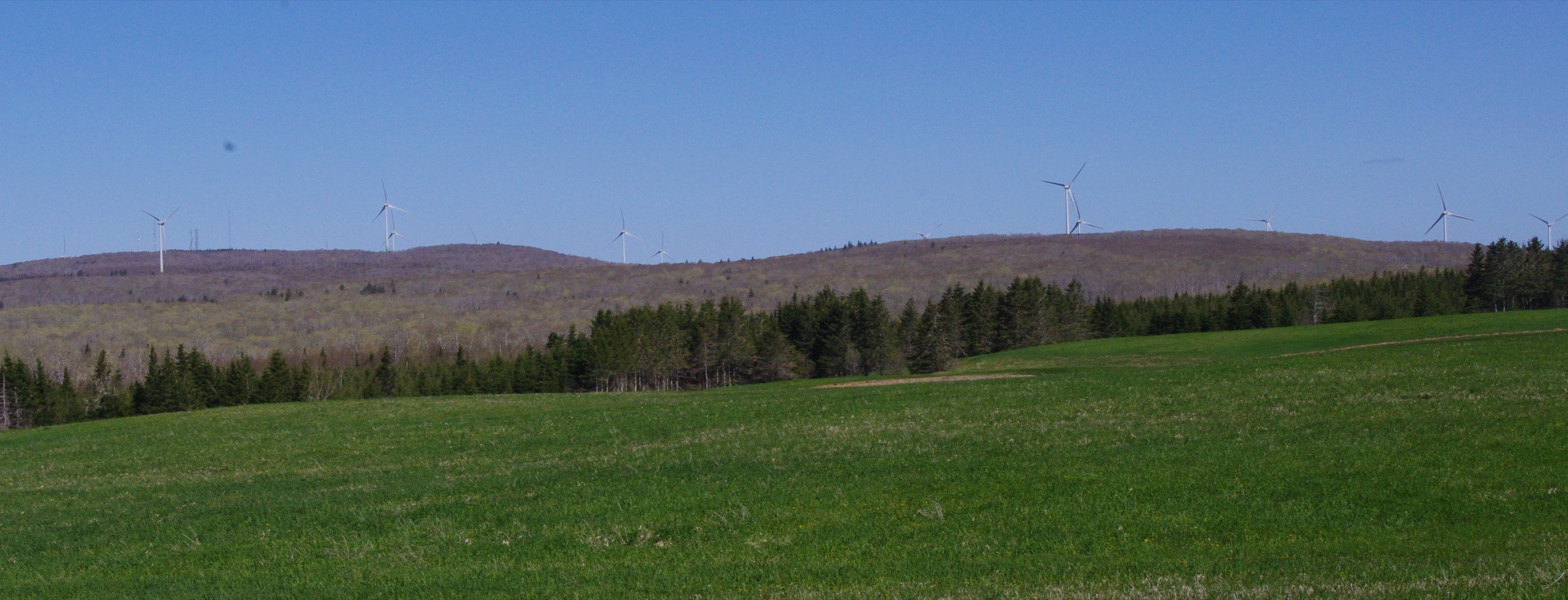
From the lower gate at the intersection of Old Nuttby Road and the Wind Energy Road, the route follows a wide gravel service road that climbs steadily through mixed Acadian forest. The first 2 km are the most enclosed; views open as the road passes the lower turbines of the 50.6 MW Nuttby Wind Farm. At about 3.5 km the road tops out at an open clearing on the summit ridge with the four concrete footings of the 1937-2013 fire-lookout tower still visible. Views extend north over Tatamagouche Bay and the Northumberland Strait, and south across the Cobequid Mountains towards Truro and the Salmon River valley. A shorter alternative from the upper junction with Wind Energy Road shortens the walk to about 1 km return with a 90 m gain.
Why it is essential
Nuttby Mountain has been the textbook high point of mainland Nova Scotia for generations of Maritimers, and the summit clearing — with its surviving fire-tower footings and panoramic view over both the Bay of Fundy slope and the Northumberland Strait slope of the Cobequid divide — is the natural symbolic objective of the range. It is also the only summit in the Cobequids genuinely accessible to walkers of all abilities.
Equipment
Standard hiking equipment: trail shoes or light boots, layered clothing for the exposed summit ridge, water, sun protection, insect repellent (blackflies in late May and June, ticks throughout). No technical kit is required.
Hazards and notes
Active wind-farm maintenance vehicles use the access road; walk on the verge and listen for traffic. Ticks are abundant in the grassy verges and tall vegetation around the summit clearing. The summit ridge is exposed to wind and weather changes very quickly in autumn and early spring. Black bear and coyote are present in the surrounding forest but rarely encountered on the road.
GPX / route file
| Source | URL |
|---|---|
| SummitPost: Nuttby Mountain, Nova Scotia | summitpost.org |
| Peakbagger: Nuttby Mountain, Nova Scotia | peakbagger.com |
| PeakVisor: Nuttby Mountain | peakvisor.com |
External links
2. Economy Falls and Devil’s Bend loop
Snapshot
Itinerary
The route starts at the Economy Falls trailhead at the end of Economy River Road, north of the village of Economy on Route 2. A short steep descent — partly on wooden staircases — drops 60 m in under 750 m to the base of Economy Falls, where the Economy River plunges over a step in the Cobequid Escarpment. The Cobequid Escarpment Trail then crosses the river on a suspension bridge above the falls and climbs to the rim, joining the Devil’s Bend Trail which follows the eastern lip of the gorge through mature mixed forest. Devil’s Bend traces the cliff edge with periodic look-offs into the canyon, then loops back inland to rejoin the main trail above the falls and return to the trailhead. Cliffs of around 50 m line the gorge below the look-offs.
Why it is essential
Economy Falls is the largest waterfall reliably accessible by short trail in the Cobequids, and the Kenomee Wilderness around it is the showcase protected area of the central range: 6,000 hectares of mature Acadian forest with deep gorges, four named waterfalls, and the most extensive maintained trail network in the mountains. The combined Economy Falls / Escarpment / Devil’s Bend loop sees the headline waterfall, the rim panoramas and the canyon interior in one moderate day.
Equipment
Standard hiking equipment: sturdy shoes or light boots with grip for wet roots and the wooden staircase, weatherproof shell, layers, water (2 L), insect repellent for blackflies and mosquitoes, and tick protection. Trekking poles are useful on the staircase descent in wet conditions.
Hazards and notes
The wooden staircase to the falls is steep and slippery when wet or icy. The Cobequid Escarpment rim is unguarded and drops up to 50 m into the gorge — keep dogs on lead and supervise children. Carry a paper map: the Kenomee Canyon multi-day loop branches off Devil’s Bend and signage can be confused after windfall. The wider Economy River Wilderness Area is governed by the Nova Scotia Wilderness Areas Protection Act; no motorised use, no camping outside designated sites. Black bear sign is common in spring.
GPX / route file
| Source | URL |
|---|---|
| Trailforks: Economy Falls Trail | trailforks.com |
| Trailforks: Devil’s Bend Trail | trailforks.com |
| Trailforks: Cobequid Escarpment Trail | trailforks.com |
| AllTrails: Economy Falls and Cobequid Escarpment Loop | alltrails.com |
External links
- Tourism Nova Scotia — Devil’s Bend Trail
- Hike Nova Scotia — Kenomee Trail System
- Canada Trails — Hiking the Kenomee Trails
3. Wards Falls Trail (Diligent River slot canyon)
Snapshot
Itinerary
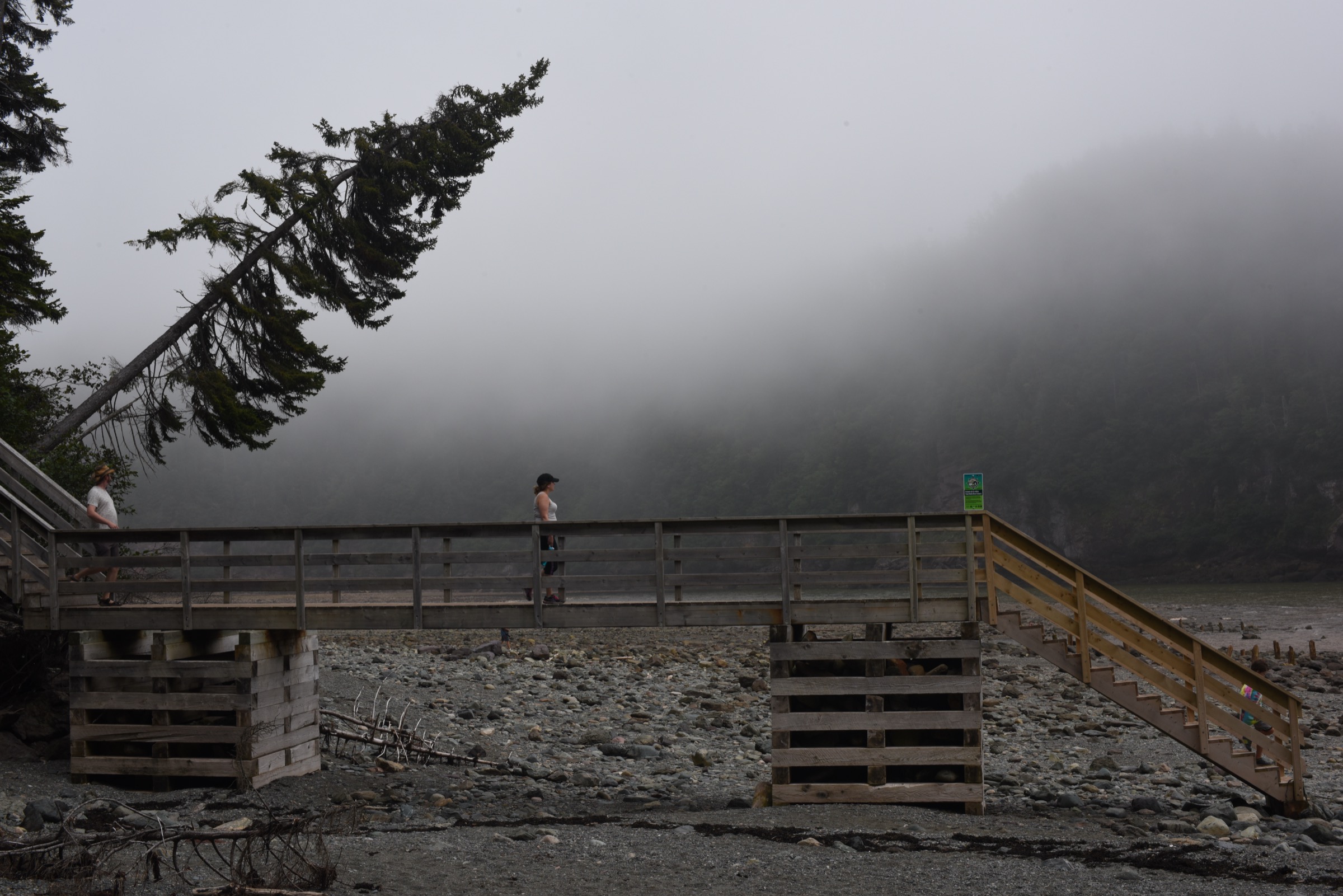
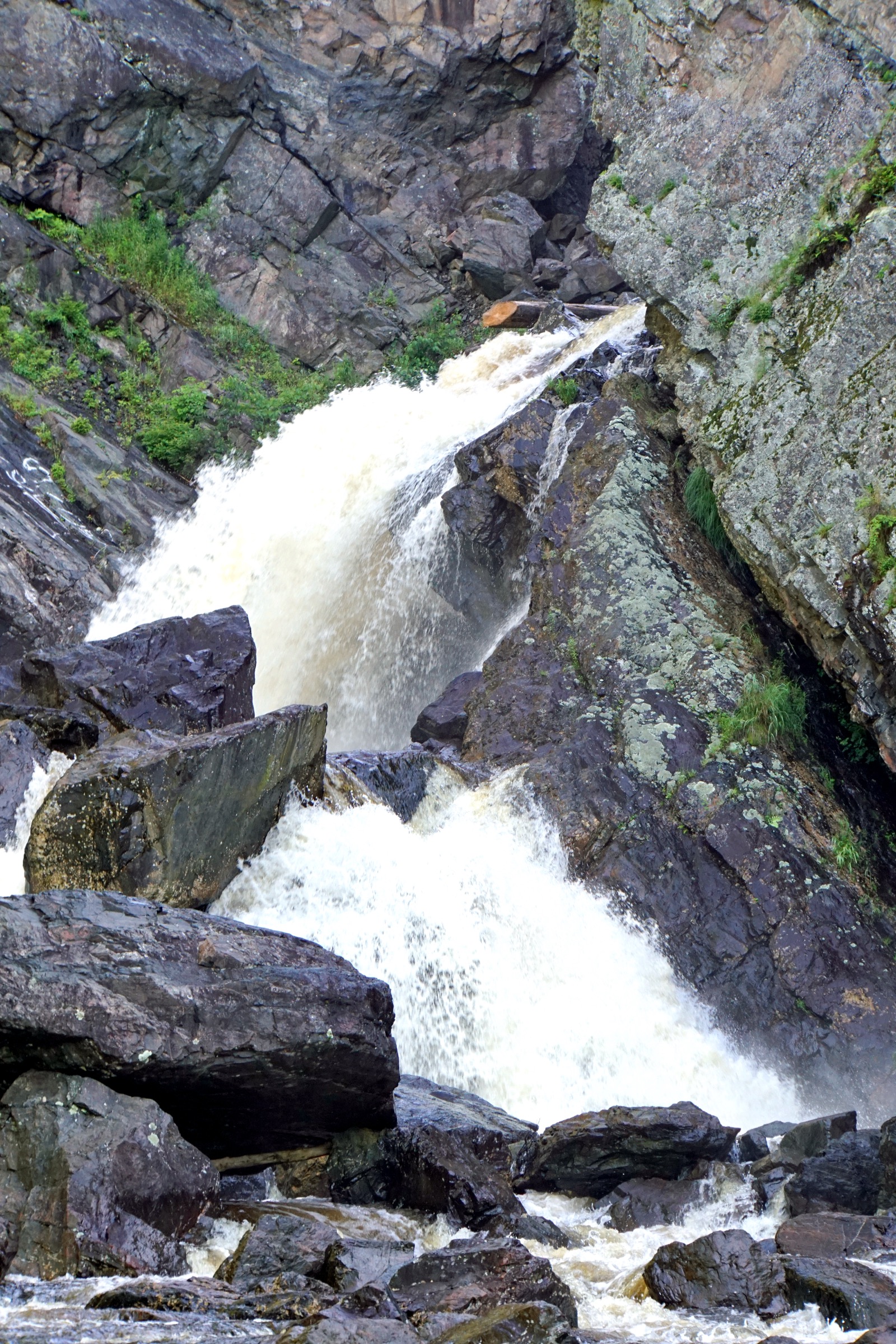
The route follows the Diligent River upstream from the small Route 209 trailhead through an exceptional stand of old-growth eastern hemlock and yellow birch — the hemlock crowns reach 30 m and the forest floor is carpeted in moss. The trail crosses the river ten times on a sequence of wooden bridges, some of them deliberately springy. After about 3 km the path reaches the foot of Wards Falls, a curtain drop down a vertical sandstone slot, with a small cave hollowed out behind it. The optional upper section squeezes through the slot canyon proper above the lip of the falls: a wedged-log scramble and a metal ladder give access to a tight chasm of polished red sandstone walls that rise 10 to 15 m on either side. Return is by the same route. The trail crosses private land owned by a local logging company that maintains the bridges.
Why it is essential
Wards Falls is the most distinctive geological hike in the Cobequids and one of the very few true slot canyons in Atlantic Canada. The combination of old-growth hemlock approach, ten river crossings, a curtain falls and the squeeze canyon above produces a route quite unlike any other in the range. It is the standard hike of the Parrsboro Shore.
Equipment
Standard hiking equipment: sturdy shoes or boots with strong grip (the wet bridges and the slot canyon scramble are unforgiving), quick-dry trousers, weatherproof shell, water, insect repellent, tick protection. Bring an extra pair of socks if planning the upper canyon: wet feet are essentially guaranteed.
Hazards and notes
Flash-flood risk in the slot canyon is genuine and the slot should not be entered after heavy rain or during forecast thunderstorms — water rises rapidly and there is no escape from the canyon floor. Wet sandstone in the canyon and on the bridges is treacherously slick. The ladder above the falls is exposed; the upper scramble is unsuitable for small children or anyone uncomfortable with confined-space climbing. Ticks are common in the hemlock litter. Maintained by a local logging company on private land; respect closures and signed restrictions.
GPX / route file
| Source | URL |
|---|---|
| AllTrails: Ward Falls | alltrails.com |
| Trailpeak: Diligent River Canyon (Wards Fall) | trailpeak.com |
External links
- Tourism Nova Scotia — Ward’s Falls Hiking Trail
- Saltscapes Magazine — Free Fallin’ (Wards Falls feature)
- Waterfalls of Nova Scotia — Wards Falls, Wharton, Cumberland County
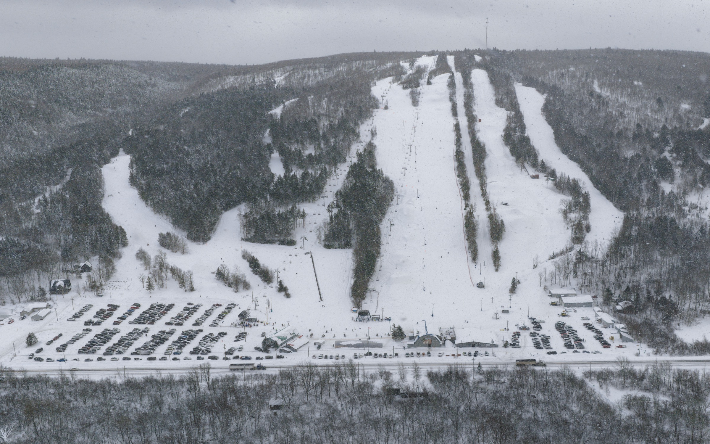
4. Wentworth Valley Lookoff above Ski Wentworth
Snapshot
Itinerary
From a small Highway 4 lay-by opposite Ski Wentworth, the path enters a tall maple-birch hardwood forest typical of the Wentworth Valley Wilderness Area and climbs in a sustained zig-zag up the western valley wall. The grade is consistent throughout — there are no flat sections — and the surface is leaf-littered roots and small stones that can be very slick when damp. At the top, a small wooden platform sits at the lip of the ridge with an unobstructed view eastwards across the glacial trough of the Folly Gap to Higgins Mountain (one of the contenders for mainland Nova Scotia’s true high point) and along the Wentworth Valley north to Wentworth Centre. Ski Wentworth’s runs are visible on the opposite slope. The descent retraces the ascent. The Ski Wentworth resort itself maintains a separate set of summer hiking trails on its lift-served slopes north of the lookoff, including the Wentworth Falls and Horse Pasture Brook Falls short walks.
Why it is essential
The Wentworth Valley is the lowest and most dramatic pass through the Cobequid Mountains and the headline ridge view of the range. The lookoff is the only short walk that opens a true balcony panorama of the central Cobequids, and it pairs naturally with the Ski Wentworth corridor of summer waterfall trails for a full day in the valley. It also sits on the doorstep of the unnamed peak now contesting Nuttby for mainland-Nova-Scotia high-point status.
Equipment
Standard hiking equipment: trail shoes with good grip, layers, weatherproof shell (the lookoff is exposed), water, insect repellent. Trekking poles are useful on the descent in wet leaf litter.
Hazards and notes
The hardwood leaf litter is genuinely slippery when wet, especially on the descent. The lookoff platform is railed but the cliff drop immediately beyond is unguarded. Ticks are well established in the Wentworth Valley hardwoods; check after every walk. Bear sign is occasional; coyote tracks are common. The Wentworth Valley Wilderness Area is protected mainland moose habitat — stay on the trail.
GPX / route file
| Source | URL |
|---|---|
| AllTrails: Wentworth Lookoff | alltrails.com |
| AllTrails: Wentworth area trails | alltrails.com |
| Ski Wentworth: Hiking trails | skiwentworth.ca |
External links
- Nova Scotia Protected Areas — Wentworth Valley Wilderness Area
- Wikipedia — Wentworth Valley
- Wikipedia — Ski Wentworth
5. Rogart Mountain Trail from Sugar Moon Farm
Snapshot
Itinerary
The loop begins behind Sugar Moon Farm — a working maple sugar camp on Alex MacDonald Road in Earltown — and climbs north-east through a managed stand of sugar maple and yellow birch, gaining height steadily over the first 2 km. Seventeen interpretive sites along the trail explain Acadian forest ecology and the cultural history of maple production in the area. The high point of the loop sits at about 320 m on a low ridge of Rogart Mountain with informal look-offs through the canopy. The trail then descends to a short side spur to Jane’s Waterfall — a slim drop over Carboniferous sandstone, named for the local maple-syrup farmer’s daughter — before turning south through a brook valley and returning to the farm. Refreshment at the Sugar Moon pancake house is the customary finish.
Why it is essential
The Rogart Mountain Trail is the most representative northern-slope forest loop in the Cobequids and the cultural anchor of the Maple Country corridor on Route 311. The combination of a substantial mature-hardwood loop, a named waterfall, an extensive interpretive programme and the working sugar camp at the trailhead gives it a character no other Cobequid hike matches. Maintained by the Cobequid Eco-Trails Society, it also represents the largest community-built trail in the range and the connection to the much larger Gully Lake-to-Nuttby trail system that extends to the east.
Equipment
Standard hiking equipment: trail shoes or light boots, layers, weatherproof shell, water, snacks, insect repellent, tick protection. The trail is well marked; a paper map is useful where the Sugar Moon loop joins the wider Cobequid Eco-Trails network.
Hazards and notes
The descent towards Jane’s Waterfall is steep and the rocks at the waterfall lip are slick. Blackflies are intense in late May and June. Ticks are abundant in the hardwood litter — long trousers and a careful body check are essential. Black bear and coyote are present in the surrounding wilderness; carry a noise source if walking alone in spring. Trail is on a mixture of private land and the recently expanded Gully Lake Wilderness Area; stay on the marked route.
GPX / route file
| Source | URL |
|---|---|
| Cobequid Eco-Trails: Rogart Mountain Trail | cobequidecotrails.ca |
| AllTrails: Rogart Mountain Trail | alltrails.com |
| Trailforks: Rogart Mountain Trail | trailforks.com |
| Tourism Nova Scotia: Rogart Mountain Trail | novascotia.com |
External links
- Sugar Moon Farm — Trails
- Cobequid Eco-Trails Society — Our Trails
- Hike Nova Scotia — Gully Lake to Nuttby Trail System
External links
| Source | URL |
|---|---|
| Wikipedia — Cobequid Mountains | en.wikipedia.org |
| Wikipedia — Nuttby Mountain | en.wikipedia.org |
| Wikipedia — Wentworth Valley | en.wikipedia.org |
| Wikipedia — Ski Wentworth | en.wikipedia.org |
| Wikipedia — Economy, Nova Scotia | en.wikipedia.org |
| Nova Scotia Protected Areas — Wentworth Valley Wilderness Area | novascotia.ca |
| Nova Scotia Protected Areas — Gully Lake Wilderness Area | novascotia.ca |
| Tourism Nova Scotia — Devil’s Bend Trail | novascotia.com |
| Tourism Nova Scotia — Ward’s Falls Hiking Trail | novascotia.com |
| Tourism Nova Scotia — Rogart Mountain Trail | novascotia.com |
| Tourism Nova Scotia — Ski Wentworth | novascotia.com |
| Ski Wentworth — Summer hiking trails | skiwentworth.ca |
| Cobequid Eco-Trails Society — Our Trails | cobequidecotrails.ca |
| Cobequid Eco-Trails Society — Rogart Mountain Trail detail | cobequidecotrails.ca |
| Sugar Moon Farm — Trails | sugarmoon.ca |
| Hike Nova Scotia — Kenomee Trail System | hikenovascotia.wordpress.com |
| Hike Nova Scotia — Gully Lake to Nuttby Trail System | hikenovascotia.wordpress.com |
| Canada Trails — Hiking the Kenomee Trails | canadatrails.ca |
| AllTrails — Economy Falls and Cobequid Escarpment Loop | alltrails.com |
| AllTrails — Ward Falls | alltrails.com |
| AllTrails — Wentworth Lookoff | alltrails.com |
| AllTrails — Rogart Mountain Trail | alltrails.com |
| AllTrails — Best trails in Wentworth | alltrails.com |
| Trailforks — Economy Falls Trail | trailforks.com |
| Trailforks — Devil’s Bend Trail | trailforks.com |
| Trailforks — Cobequid Escarpment Trail | trailforks.com |
| Trailforks — Rogart Mountain Trail | trailforks.com |
| Trailpeak — Diligent River Canyon (Wards Falls) | trailpeak.com |
| Saltscapes Magazine — Free Fallin’ (Wards Falls feature) | saltscapes.com |
| Waterfalls of Nova Scotia — Wards Falls | nswaterfalls.blogspot.com |
| SummitPost — Nuttby Mountain, Nova Scotia | summitpost.org |
| Peakbagger — Nuttby Mountain | peakbagger.com |
| PeakVisor — Nuttby Mountain | peakvisor.com |
| Wikimedia Commons — Cobequid Mountains files | commons.wikimedia.org |
| Wikimedia Commons — Colchester County, Nova Scotia | commons.wikimedia.org |