Regional overview
The Lewis Hills are an ophiolite-and-peridotite massif on the west coast of insular Newfoundland, sitting between Stephenville to the south and Corner Brook to the north, on the south side of the Bay of Islands. They form the southernmost of the four Bay of Islands Ophiolite massifs — Lewis Hills, Blow Me Down Mountains, North Arm Hills/Gregory Mountains, and the Tablelands in Gros Morne National Park — exposing mantle peridotite that weathers to a rusty, almost plant-free barren. The high point, The Cabox (812–814 m), is the highest summit on the island of Newfoundland and the highest Appalachian summit in Canada north of Quebec’s Chic-Chocs. The massif is undulating high plateau, cut by deep “gulches” (Molly Ann Gulch is the best known), with stunted tuckamore forest below, then bog, then open peridotite barren above roughly 500 m. Caribou, arctic hare, and ptarmigan are the typical wildlife of the upper plateau.
The Lewis Hills sit outside any national or provincial park. They lie within the Cabox Aspiring Geopark project area but have no enforced trail network, no marked summit paths, and no maintained backcountry shelters. Almost all walking on the massif is by the International Appalachian Trail Newfoundland and Labrador (IATNL) backcountry routes — the Lewis Hills Trail traverse (Fox Island River to Serpentine Valley, about 32 km, normally 2–3 days) and the Cabox Summit loop (about 26.5 km from Cold Brook Road, normally a long day or 1 night). Road access is on rough logging roads: Cold Brook Road from Stephenville in the south (about 28–29 km from Route 460 to the trailhead) and Logger School Road from Mount Moriah / Benoit’s Cove in the north. A high-clearance vehicle is generally needed; logging roads change condition seasonally and have no signage or services. Frequencies of road maintenance vary; check locally before driving in.
The practical hiking season is roughly late June to early October. Snow can linger in the gulches and on north-facing slopes well into July; the upper plateau is exposed and prone to fast weather changes, with sustained winds over 100 km/h recorded in Molly Ann Gulch. There is no cell coverage on the massif and effectively no chance of casual rescue: parties should carry a satellite communicator (Garmin inReach, Zoleo, or equivalent), full navigation backup (paper map, compass, downloaded topo), and be self-sufficient. Black bears, moose, and biting insects (blackfly, mosquito) are all present; cool-season caribou herds use the upper plateau. The area is also subject to active logging access — be aware of working trucks on the approach roads.
Public, legally reusable route geometry for Lewis Hills day-hikes is thin. Most published descriptions are by IATNL volunteers, by the Cabox Aspiring Geopark, or by local guiding businesses (Gros Morne Outdoor Company / Lewis Hills Trek), and no official GPX/KML downloads are offered by IATNL or by Newfoundland and Labrador Tourism for the core Lewis Hills routes. Community tracks exist on Wikiloc, AllTrails, and Trailforks but are not always licence-clean. Most of the five candidates below are accordingly retained as Candidate only or Route verified, media pending.
Selection rationale
The five hikes represent the main day-hiking possibilities associated with the Lewis Hills massif: the high summit (The Cabox), the standard signed gateway viewpoint near Stephenville (Erin Mountain), a day section of the IATNL Lewis Hills Trail / traverse, the closest analogous ophiolite ridge experience in the sister Blow Me Down Mountains massif immediately to the north, and a coastal walk on the Port au Port Peninsula that provides a paid-trail, all-weather alternative when the high plateau is closed by weather. One requested option, “Blow Me Down peak/area within the Lewis Hills group”, does not correspond to a separate Lewis-Hills summit in checked sources — Blow Me Down Mountains are a distinct massif to the north — and the Blow Me Down Mountain Trail is retained as the closest verifiable equivalent, clearly flagged as a sister-massif route. A “Gallants Trail” was searched for but could not be verified in IATNL, ParksNL, NL Tourism, or community trail databases in this pass.
Summary table
| # | Hike | Country | Route type | Distance | Gain | Max elevation | Difficulty |
|---|---|---|---|---|---|---|---|
| 1 | The Cabox via IATNL Cabox Summit loop | Canada | Loop (long day or 1 night) | 26.5–27 km | ~450–500 m | 812–814 m | Strenuous; wilderness route |
| 2 | Erin Mountain Trail, Barachois Pond Provincial Park | Canada | Out-and-back | 6–7.1 km | ~300 m | ~340 m | Moderate |
| 3 | Lewis Hills Trail — IATNL day section from Cold Brook Road | Canada | Out-and-back day section | 10–15 km return | 400–700 m | ~700–812 m | Strenuous; unmarked wilderness |
| 4 | Blow Me Down Mountain Trail — IATNL day section (sister massif) | Canada | Out-and-back day section | 10–18 km return | 500–700 m | ~600 m | Strenuous; unmarked wilderness |
| 5 | Boutte du Cap “La Marche des Miettes” (Bread Crumb Trail), Cape St. George | Canada | Loop / out-and-back | ~7.4 km | ~250 m | Coastal headland | Moderate |
1. The Cabox via IATNL Cabox Summit loop
Snapshot
Itinerary
The route leaves the end of Cold Brook logging road on the southeast flank of the massif and climbs through stunted forest and bog, opening out onto the open peridotite plateau within the first few kilometres. The loop crosses bog, rock outcrops, small ponds, and a sequence of low hills, with The Cabox itself a broad, gently rounded high point rather than a sharp summit. There is no signed path on the plateau; only occasional cairns and the worn trace of animal trails. Routefinding is by map, compass, and GPS, working between identifiable knolls and lakes. Wind exposure on the summit plateau is significant. The return leg drops back through bog and forest to the logging road.
Why it is essential
The Cabox is the highest summit on the island of Newfoundland and the highest Appalachian point in Canada north of Quebec, which alone makes it the defining objective of any Newfoundland Appalachian list. The peridotite-barren landscape is unusual on a global scale and shared only with the Tablelands of Gros Morne, the Blow Me Down Mountains, and the North Arm Hills.
Equipment
Mountain hiking equipment: sturdy boots, weatherproof shell (jacket and trousers), warm layer plus spare insulating layer, hat and gloves outside high summer, full sun protection. Map (NTS topographic), compass, GPS with downloaded route, satellite communicator (Garmin inReach / Zoleo or equivalent). 3 L water minimum (refilling possible at plateau ponds with filtration). Headtorch and spare batteries. Insect head net. Bear-aware food storage if camping. Permit not required, but access is across active logging roads — pull off for trucks.
Hazards and notes
- Weather changes very fast; sustained winds over 100 km/h have been recorded in Molly Ann Gulch.
- Snow may persist on the plateau and in gulches into July.
- No cell coverage on the massif; no maintained shelters; no easy bail-out — carry a satellite communicator and treat navigation in mist as the principal risk.
- Cold Brook Road is rough — high-clearance vehicle recommended; condition can change after rain or in early season.
- Routefinding in mist is genuinely difficult and parties have been benighted; do not commit to the loop without GPS, paper map, and compass.
- The Cabox summit elevation is reported as 812 m by IATNL and 814 m by Wikipedia / NL Tourism — both are commonly cited; the spec retains both figures.
Routes and maps
| Source | URL |
|---|---|
| IATNL — Cabox Summit page (text route description and trailhead coordinates; no GPX download published) | iatnl.org |
| IATNL — Cabox Summit details and directions (trailhead coordinates N48.76643 W58.41304) | iatnl.org |
| Trailpeak — Cabox (community track) | trailpeak.com |
| OpenStreetMap area query — Lewis Hills | openstreetmap.org |
External links
- IATNL — Cabox Summit
- IATNL — Cabox Summit description
- IATNL legacy site — Lewis Hills Trail
- Wikipedia — Lewis Hills
- Wikipedia — The Cabox
- Cabox Aspiring Geopark — Lewis Hills Massif
- Newfoundland and Labrador Tourism — Lewis Hills Trail
- Outdoors & On the Go — Lewis Hills Traverse trip report
2. Erin Mountain Trail, Barachois Pond Provincial Park
Snapshot
Itinerary
The trail begins inside Barachois Pond Provincial Park, climbing gently from the campground area on boardwalk and well-graded path through mixed boreal forest (spruce, fir, larch, aspen). After roughly a third of the climb, a side spur reaches a lookout over Barachois Pond and the campground. The upper half of the trail is steeper and uses extensive wooden stairs and boardwalk sections to climb the flank of the mountain. The summit area is a rocky lookout at about 340 m, with views west across Bay St. George and the Gulf of St. Lawrence, southwest to the Port au Port Peninsula, and northwest to the Lewis Hills massif on the opposite side of the valley. Return is by the same route.
Why it is essential
Erin Mountain is the only properly signed, maintained, low-commitment hike in close proximity to the Lewis Hills, and its summit gives the standard “viewpoint of the Lewis Hills” panorama. It is the gateway day-walk for visitors based in Stephenville and a sensible weather alternative when the high plateau is closed in by cloud or wind. Geologically it sits on the Long Range side of the valley, not on the Lewis Hills ophiolite, but it is the only convenient signed-trail viewpoint of the massif itself.
Equipment
Standard hiking equipment: hiking shoes or trail runners (boots not strictly required), weatherproof layer, warm layer, water (1–1.5 L), food, sun protection. Insect repellent and head net in summer. ParksNL day-use pass required.
Hazards and notes
- Wooden stairs and boardwalk become slick when wet, snowy, or icy; not recommended outside the open park season without proper footwear.
- Black bear and moose are present in the park; standard wildlife awareness applies.
- A ParksNL day-use pass is required for park entry.
Routes and maps
| Source | URL |
|---|---|
| AllTrails — Erin Mountain Trail | alltrails.com |
| Trailforks — Erin Mountain Trail | trailforks.com |
| ParksNL — Barachois Pond Provincial Park (map PDF) | parksnl.ca |
External links
- ParksNL — Barachois Pond Provincial Park
- Newfoundland and Labrador Tourism — Erin Mountain Trail
- Wikipedia — Barachois Pond Provincial Park
- The Canadian Encyclopedia — Barachois Pond Provincial Park
- Bob’s Newfoundland — Erin Mountain Trail field notes
3. Lewis Hills Trail — IATNL day section from Cold Brook Road
Snapshot
Itinerary
The Lewis Hills Trail is the IATNL backcountry route that crosses the massif from Fox Island River (south, with the practical road access at the end of Cold Brook Road) to Blue Brook in Serpentine Valley (north, accessed via Logger School Road). As a day hike, parties commonly walk from the Cold Brook trailhead onto the plateau, ascend toward the higher central ground, and return the same way without committing to the full traverse and pickup logistics. The early kilometres are wet, crossing bog and small streams through stunted forest; the trail then opens onto a series of low ridges and shallow valleys on the open peridotite barren, characteristically reddish-brown underfoot, with sparse vegetation and small ponds. Only short segments are flagged with IATNL markers; most travel is by line of sight between cairns and identifiable plateau features. The day section can be extended to take in The Cabox itself (see Hike 1) for parties with full daylight, navigation gear, and a strong margin for weather.
Why it is essential
The Lewis Hills Trail is the only published through-route across the Lewis Hills, and a day section from Cold Brook Road is the most realistic way to experience the open peridotite barren and high gulches without committing to a full multi-day traverse and shuttle.
Equipment
Mountain hiking equipment, plus: paper map, compass, GPS with downloaded route, satellite communicator, full waterproof shell, warm layer, hat and gloves outside high summer, 3 L water, insect protection, headtorch. Bear-aware food storage if extending into late afternoon.
Hazards and notes
- Unmarked wilderness route across open plateau — mist navigation is the principal hazard.
- Sustained high winds and rapidly changing weather; snow possible into July in shaded gulches.
- No cell coverage on the massif; satellite communicator strongly recommended and no casual rescue is realistic.
- Cold Brook Road is a working logging road; condition and access can vary.
Routes and maps
| Source | URL |
|---|---|
| IATNL — Lewis Hills Trail description | iatnl.org |
| IATNL — Lewis Hills Trail details & directions | iatnl.org |
| IATNL legacy site — Lewis Hills Trail | iatnl.com |
| Trailpeak — Lewis Hills alternate route to Cabox (community track) | trailpeak.com |
| Wikiloc area search — Lewis Hills | wikiloc.com |
| OpenStreetMap — Lewis Hills | openstreetmap.org |
External links
- IATNL — Lewis Hills Trail description
- IATNL — Lewis Hills Trail details & directions
- Newfoundland and Labrador Tourism — Lewis Hills Trail
- Cabox Aspiring Geopark — Lewis Hills Massif
- Viajar a pie — Newfoundland IAT Section 1: Lewis Hills & Blow-me-Down
- Canada Trails — Hiking the Lewis Hills
- Gros Morne Outdoor Company — Lewis Hills Trek in-depth
4. Blow Me Down Mountain Trail — IATNL day section (sister massif, north of Lewis Hills)
Snapshot
Itinerary
The IATNL Blow Me Down Mountain Trail crosses the Blow Me Down Mountains west of Corner Brook, rising to about 600 m at Blow Me Down Head with panoramic views of the outer Bay of Islands from Lark Harbour westward. As a day hike, parties commonly walk in from one of the northern coastal access points — Blow-Me-Down Brook Trail (about 5 km past Frenchman’s Cove) or Copper Mine to Cape Trail (at the entrance to York Harbour) — climb steeply through coastal forest onto the open peridotite plateau, and return the same way. The plateau is similar in character to the Lewis Hills: rusty barren rock, scattered ponds, exposed wind, and intermittent IATNL markers. Recent work by the Cabox Aspiring Geopark and OBIEC (Outer Bay of Islands Enhancement Committee) has improved the East Blow Me Down trail on the eastern side of York Harbour.
Why it is essential
The Blow Me Down Mountains are the immediate northern neighbour of the Lewis Hills and share their ophiolite character, with shorter and somewhat better-organised approach trails. Including a Blow Me Down day-section gives the catalogue a more achievable second peridotite-plateau option for visitors who cannot commit to The Cabox loop. The full Blow Me Down crossing is also frequently combined with the Lewis Hills in the multi-day IATNL “Lewis Hills / Blow Me Down trek”. Note: there is no separately named “Blow Me Down peak” within the Lewis Hills themselves — the Blow Me Down Mountains are a distinct massif to the north, and this entry is retained as the closest verifiable proxy.
Equipment
Mountain hiking equipment, plus: paper map, compass, GPS, satellite communicator, full waterproof shell, warm layer, hat and gloves outside high summer, 2–3 L water, insect protection, headtorch.
Hazards and notes
- Routefinding on the upper plateau is similar in difficulty to the Lewis Hills — mist navigation is the principal hazard.
- Coastal weather can close in fast; the upper plateau is fully exposed.
- No cell coverage on the upper plateau; carry a satellite communicator.
- Access roads are paved (Route 450) but the trailheads themselves are basic.
- Do not confuse with Cape Blow Me Down Trail / Bottle Cove on the outer Bay of Islands coast — those are short, well-signed coastal walks, not the IATNL mountain route.
Routes and maps
| Source | URL |
|---|---|
| IATNL — Blow Me Down Mountain Trail | iatnl.com |
| IATNL — Exploring the Western Blow Me Downs | iatnl.org |
| IATNL — A Lewis Hills / Blow-Me-Down Trek | iatnl.org |
| Trailpeak — Blow-Me-Down to Lewis Hills Traverse | trailpeak.com |
| OpenStreetMap — Blow Me Down Mountains | openstreetmap.org |
External links
- IATNL — Blow Me Down Mountain Trail
- IATNL — A Lewis Hills / Blow-Me-Down Trek
- IATNL — Blow Me Down Traverse
- Cabox Aspiring Geopark — Blow Me Down Massif
- Cabox Aspiring Geopark — East Blow Me Down trail update
- Everoutdoor — Blow Me Down hikes
- Canada Trails — Hiking the Blow-Me-Down Mountains
5. Boutte du Cap “La Marche des Miettes” (Bread Crumb Trail), Cape St. George
Snapshot
Itinerary
The trail leaves Boutte du Cap Park at the southwestern tip of the Port au Port Peninsula, near the traditional French bread oven (“Four à Pain”) that gives the route its local name (“La Marche des Miettes” — the Bread Crumb Trail). The path follows the cliff line along the cape, with views west and south across the Gulf of St. Lawrence, before reaching kittiwake colonies that are reported as the largest in western Newfoundland. The route undulates above sea cliffs through windswept dwarf pine, juniper, and berry scrub before returning to the park. The headland also hosts the only Acadian Monument in Newfoundland.
Why it is essential
The Cape St. George coastal route is the most reliable signed, low-commitment walk in the wider Lewis Hills / Bay St. George catchment. It is included as a coastal weather-alternative for visitors when the high Lewis Hills plateau is closed by wind or cloud, and as a representative cultural and seabird-cliff walk for the Port au Port Peninsula. It is not on the Lewis Hills massif itself, but it sits within the same drive-day from Stephenville.
Equipment
Standard hiking equipment: hiking shoes or light boots, weatherproof layer (cliff exposure to Atlantic wind), warm layer, water (1.5 L), food, sun protection, binoculars for seabirds. Keep well back from cliff edges, particularly with children.
Hazards and notes
- Unfenced sea cliffs; high winds; do not approach edges in wet or icy conditions.
- Seabird colonies are sensitive; do not disturb nesting kittiwakes.
- No services on the trail; nearest facilities at Cape St. George village.
- Camping is available in the park from late June to end September per local reports; confirm current dates with the town of Cape St. George before relying on them.
Routes and maps
| Source | URL |
|---|---|
| AllTrails — La Marche des Miettes | alltrails.com |
| OpenStreetMap — Cape St. George | openstreetmap.org |
| Wikimedia Commons category — Cape St. George (per-file licence check required before reuse) | commons.wikimedia.org |
External links
- AllTrails — La Marche des Miettes
- Wikipedia — Cape St. George, Newfoundland and Labrador
- Bobs Newfoundland — Port au Port / Cape St. George trails
- Come Explore Canada — Cape St. George
- Bucket List Bri — Road Tripping the Port-au-Port Peninsula
Missing data / follow-up work
- No official GPX/KML files are published by IATNL, ParksNL, or Newfoundland and Labrador Tourism for the Lewis Hills routes. Community tracks on Wikiloc, AllTrails, Trailforks, and Trailpeak exist but are not licence-clean for direct re-publication; coordinates would have to be re-derived from a public-source map (OpenTopoMap / OSM / NTS) and field knowledge.
- Cumulative elevation gain for the Cabox Summit loop is not published by IATNL; the figure given is an estimate based on the published trailhead elevation (~360 m) and summit elevation (812–814 m) plus plateau undulation.
- The Cabox elevation varies in sources (812 m on IATNL Cabox Summit page; 814 m on Wikipedia / NL Tourism); both are commonly cited and the discrepancy is preserved here rather than resolved.
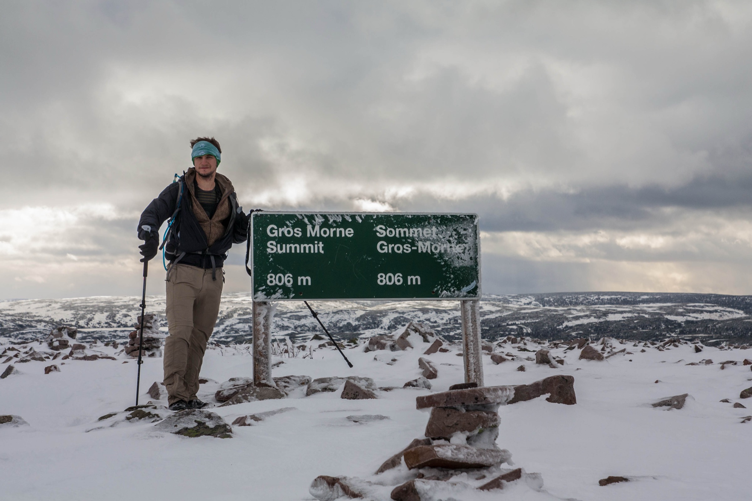
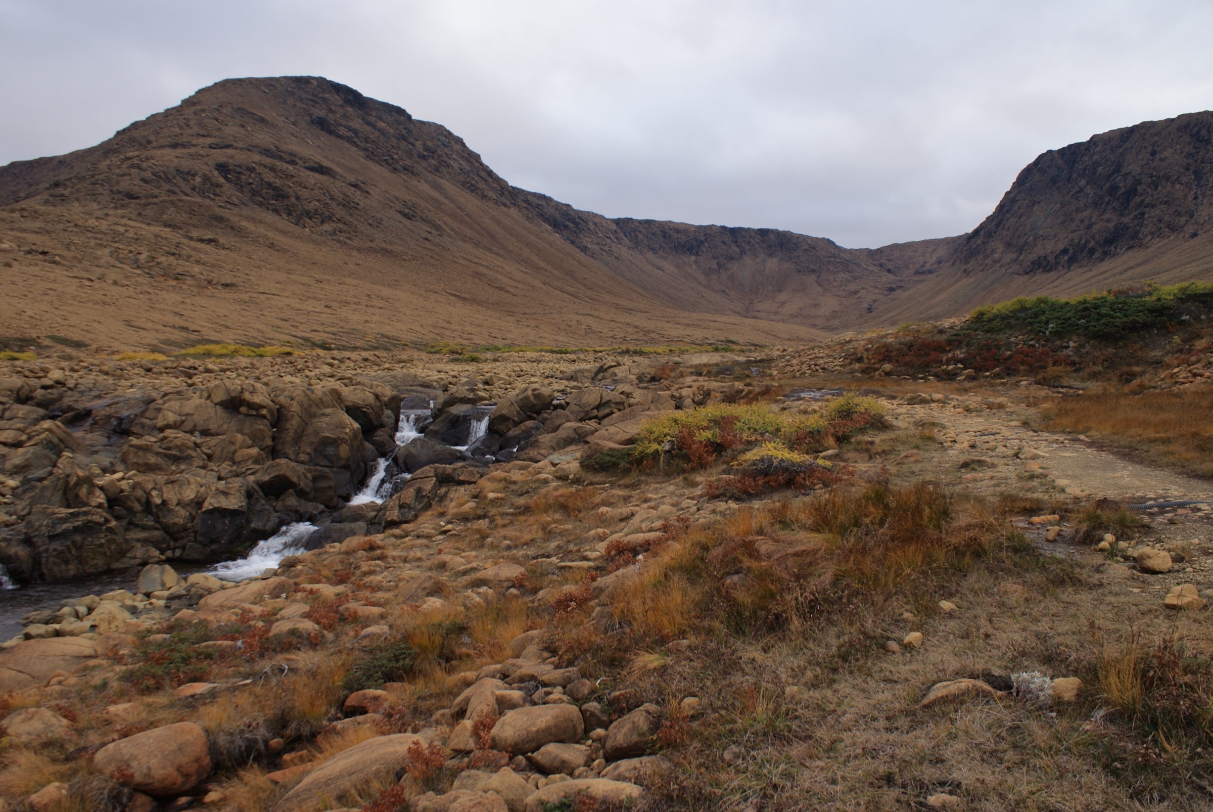
- No licence-compatible route photo was verified for The Cabox, the Lewis Hills Trail, the Blow Me Down Mountain Trail, Erin Mountain, or Boutte du Cap. The cover image used here is a Tablelands geological-context proxy (sister Bay of Islands Ophiolite massif in Gros Morne, not the Lewis Hills themselves). A second pass should target Wikimedia Commons and Flickr Creative Commons specifically for Lewis Hills, Cabox, Stephenville-area, Bay of Islands ophiolite, Cape St. George, and Boutte du Cap, and verify per-file licences.
- The requested “Blow Me Down peak/area within the Lewis Hills group” does not correspond to a separately named summit within the Lewis Hills in checked IATNL, Cabox Geopark, Wikipedia, or PeakVisor sources. Hike 4 above is the Blow Me Down Mountains sister-massif route, clearly flagged.
- A “Gallants Trail” was searched for via IATNL, ParksNL, NL Tourism, AllTrails, Trailforks, Wikiloc, and OpenStreetMap and could not be verified in this pass. Gallants is a small community on Route 450 east of Corner Brook; if a community-maintained trail exists there it is not in mainstream trail databases and would need local confirmation.
- Cold Brook Road and Logger School Road are active logging roads with no maintained signage; current driveability should be confirmed locally (e.g. via IATNL or a Stephenville/Corner Brook outdoor outfitter) before any trip.
- Cell coverage is effectively absent on the massif; satellite communicator is strongly recommended for any party on the plateau.
External links
| Source | URL |
|---|---|
| IATNL primary | iatnl.org |
| IATNL legacy | iatnl.com |
| IATNL — Cabox Summit | iatnl.org |
| IATNL — Cabox Summit description | iatnl.org |
| IATNL — Cabox Summit details & directions | iatnl.org |
| IATNL — Lewis Hills Trail description | iatnl.org |
| IATNL — Lewis Hills Trail details & directions | iatnl.org |
| IATNL — Blow Me Down Mountain Trail | iatnl.com |
| IATNL — A Lewis Hills / Blow-Me-Down Trek | iatnl.org |
| IATNL — Exploring the Western Blow Me Downs | iatnl.org |
| IATNL — Blow Me Down Traverse | iatnl.org |
| Cabox Aspiring Geopark | caboxgeopark.org |
| Cabox Aspiring Geopark — Lewis Hills Massif | caboxgeopark.org |
| Cabox Aspiring Geopark — Blow Me Down Massif | caboxgeopark.org |
| Cabox Aspiring Geopark — East Blow Me Down trail update | caboxgeopark.org |
| Newfoundland and Labrador Tourism | newfoundlandlabrador.com |
| Newfoundland and Labrador Tourism — Lewis Hills Trail | newfoundlandlabrador.com |
| Newfoundland and Labrador Tourism — Erin Mountain Trail | newfoundlandlabrador.com |
| ParksNL | parksnl.ca |
| ParksNL — Barachois Pond Provincial Park | parksnl.ca |
| Wikipedia — Lewis Hills | en.wikipedia.org |
| Wikipedia — The Cabox | en.wikipedia.org |
| Wikipedia — Barachois Pond Provincial Park | en.wikipedia.org |
| Wikipedia — Blow Me Down Provincial Park (separate from the IATNL Blow Me Down Mountain Trail) | en.wikipedia.org |
| Wikipedia — Cape St. George, Newfoundland and Labrador | en.wikipedia.org |
| Wikimedia Commons — Cape St. George category | commons.wikimedia.org |
| Gros Morne Outdoor Company — Lewis Hills Trek in-depth | grosmorneoutdoor.ca |
| Lewis Hills Trek (commercial guide site) | lewishills.ca |
| Viajar a pie — Newfoundland IAT Section 1: Lewis Hills & Blow-me-Down | viajarapie.info |
| Canada Trails — Hiking the Lewis Hills | canadatrails.ca |
| Canada Trails — Hiking the Blow-Me-Down Mountains | canadatrails.ca |
| Everoutdoor — Cabox Aspiring Geopark / Blow Me Down | everoutdoor.ca |
| Outdoors & On the Go — Lewis Hills Traverse trip report | outdoorsandonthego.com |
| OpenStreetMap | openstreetmap.org |
| Wikiloc | wikiloc.com |
| AllTrails | alltrails.com |
| Trailforks | trailforks.com |
| Trailpeak | trailpeak.com |