Regional overview
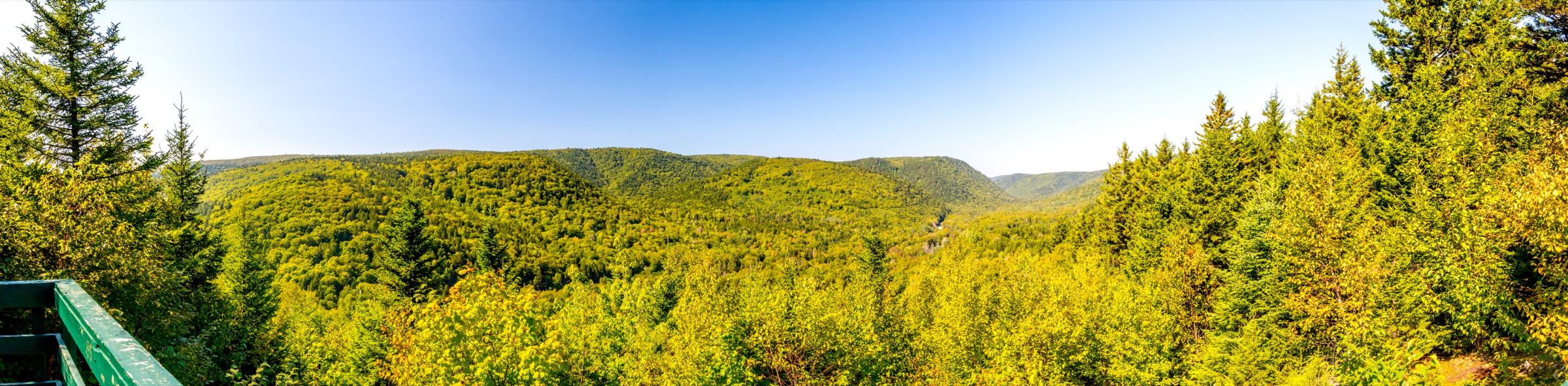
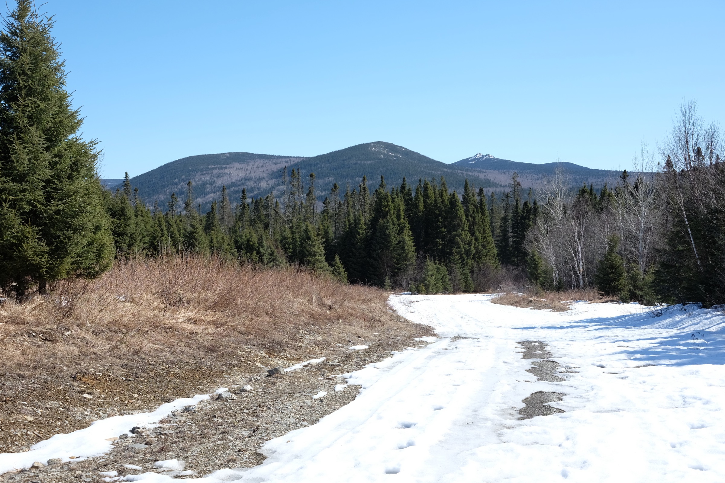
The Fundy Highlands form the southeastern edge of the New Brunswick uplands, where a sandstone and conglomerate escarpment rises sharply from the Bay of Fundy between the village of Alma and the mouth of the Saint John River. The range is the northeasternmost outpost of the Appalachian Mountains in Canada; it tops out at modest elevations of around 350 m on the inner plateau, but the proximity to sea level and the steepness of the seaward slope give the coastline an outsized vertical character. Deeply incised river valleys — the Point Wolfe, Upper Salmon, Goose, and Big Salmon — cut north-south through the uplands and have carved a string of waterfalls into the sandstone before reaching the Bay. Acadian mixed forest of red spruce, balsam fir, sugar maple, and yellow birch covers the inland plateau, while sea caves, exposed conglomerate cliffs, and cobble beaches define the shore.
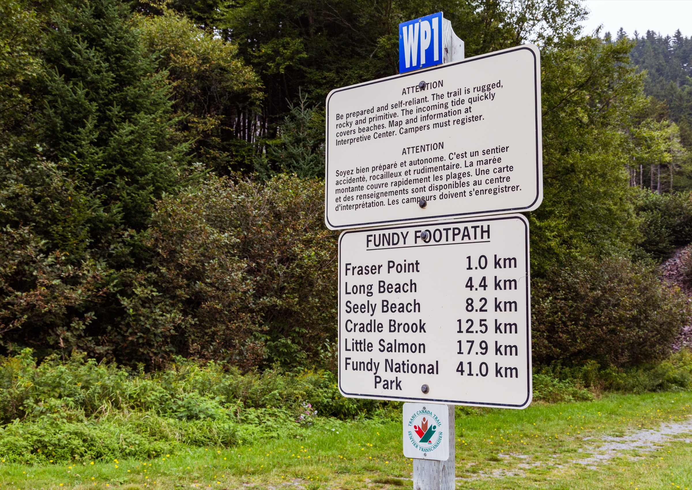
Two protected areas anchor the hiking on the Fundy Highlands. Fundy National Park, established in 1948 and managed by Parks Canada, covers 207 km² of coastal escarpment, river valleys, and inland plateau between Alma and Point Wolfe. The park’s trail network, signposted from the visitor centres at the East Gate (Alma) and the headquarters area, gives the canonical menu of half-day and short day walks to waterfalls, coastal headlands, and the Goose River beach. Immediately west of the park boundary, the Fundy Trail Provincial Park and its 30-km Fundy Trail Parkway, opened in stages between 1998 and 2021, run along the coastal cliffs to the Big Salmon River and form the eastern gateway to the long-distance Fundy Footpath. The Footpath itself is a 41-km wilderness backpacking route between the Big Salmon River Interpretive Centre and Goose River, stewarded by the Fundy Hiking Trail Association; its eastern day-section from Big Salmon River out to Long Beach Brook and back is the most accessible stand-alone day-hike on the route.
The Bay of Fundy has the highest tides in the world, with a vertical range of up to 16 m at Hopewell Cape and 11 to 12 m at Alma. The tidal cycle is the dominant variable on any coastal walk in the region: cobble beaches and intertidal flats that are dry at low water are entirely submerged six hours later, and several routes — including the eastern Fundy Footpath day-section and the Goose River beach — require checking the published tide tables before committing to the shore. The walking season runs from June through mid-October. Black flies and mosquitoes are intense from late May through early July, and ticks are now established in southern New Brunswick with attendant Lyme-disease risk. Black bear and moose are present throughout the highlands; the park advises bear-aware food storage at all backcountry sites.
Selection rationale
The five hikes cover the canonical Fundy National Park trail menu and extend along the immediate coastal corridor west of the park into the Fundy Trail Parkway. The selection deliberately spans the short flagship waterfall walk (Dickson Falls), the inland waterfall hike to New Brunswick’s tallest cascade (Third Vault Falls), a half-day coastal-cliff loop with intertidal beach access (Matthews Head), the longest single-day coastal traverse inside the national park to a backcountry beach (Goose River), and the stand-alone day-section of the Fundy Footpath from the Big Salmon River Interpretive Centre to Long Beach. Together they cover the park’s waterfall character, its coastal escarpment, and the wilder coastal Footpath corridor west of the boundary, without overlapping the sister Caledonia Highlands article that handles inland uplands and the Hopewell Cape area.
Summary table
| # | Hike | Country | Route type | Distance | Gain | Max elevation | Difficulty |
|---|---|---|---|---|---|---|---|
| 1 | Goose River Trail | Canada | Out-and-back | 15.8 km | 430 m | 200 m | Hard |
| 2 | Third Vault Falls Trail | Canada | Out-and-back | 7.4 km | 220 m | 280 m | Moderate |
| 3 | Dickson Falls Trail | Canada | Loop | 1.5 km | 50 m | 130 m | Easy |
| 4 | Matthews Head Trail | Canada | Loop | 4.5 km | 215 m | 175 m | Moderate |
| 5 | Fundy Footpath: Big Salmon River to Long Beach | Canada | Out-and-back | 9 km | 380 m | 140 m | Moderate-Hard |
1. Goose River Trail

Snapshot
Itinerary
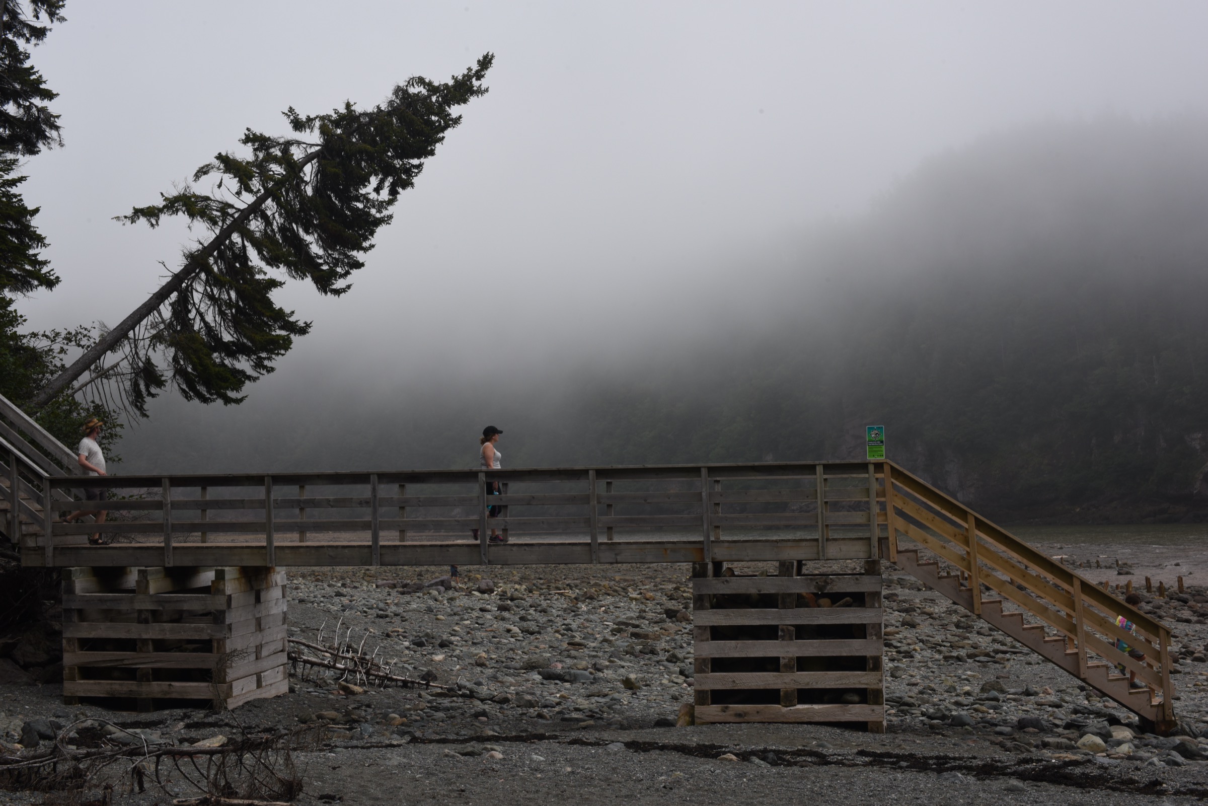
The trail leaves the Point Wolfe parking lot at the southwestern end of the public road network in Fundy National Park, crosses the historic Point Wolfe covered bridge area, and joins what was historically the Coppermine and old Goose River road through Acadian forest of red spruce, balsam fir, and white birch. After a steady climb to the inland plateau, the route follows the coastal escarpment westward, with occasional clearings giving glimpses across the Bay of Fundy to Nova Scotia on clear days. Past the upper Goose River branch the path descends to sea level, drops to Goose River beach, and ends at a backcountry campsite that also marks the eastern terminus of the long-distance Fundy Footpath. Return is by the same route; the climb back to the plateau from Goose River beach is the most strenuous single section of the day.
Why it is essential
This is the longest and wildest day-hike inside Fundy National Park and the only walk in the park network that reaches a true backcountry coastal beach. It links the historic Point Wolfe logging and milling area, the inland Acadian forest plateau, and the wilderness coast at Goose River, and it ends at the formal eastern terminus of the Fundy Footpath, giving the most complete single-day view of the coastal escarpment.
Equipment
Mountain hiking equipment: sturdy boots, weatherproof shell, warm layer, navigation backup, headtorch, ample water and food, insect repellent, and tick protection. Bear-aware food storage is required for any food carried on the trail. Treat or filter any water taken from brooks.
Hazards and notes
Several brook crossings on the route depend on bridges that have been washed out or rebuilt after storm damage; Parks Canada updates trail status seasonally and closures are common in spring and after major rain events. The descent to and ascent from Goose River beach is steep and slippery when wet. Black bear and moose are present along the corridor. The Goose River beach itself is tidal — keep camp and gear well above the high-water line, which the Bay of Fundy reaches quickly. Mobile coverage is unreliable in the interior.
GPX / route file
| Source | URL |
|---|---|
| AllTrails: Goose River Trail | alltrails.com |
| Trailforks: Goose River | trailforks.com |
External links
2. Third Vault Falls Trail
Snapshot
Itinerary
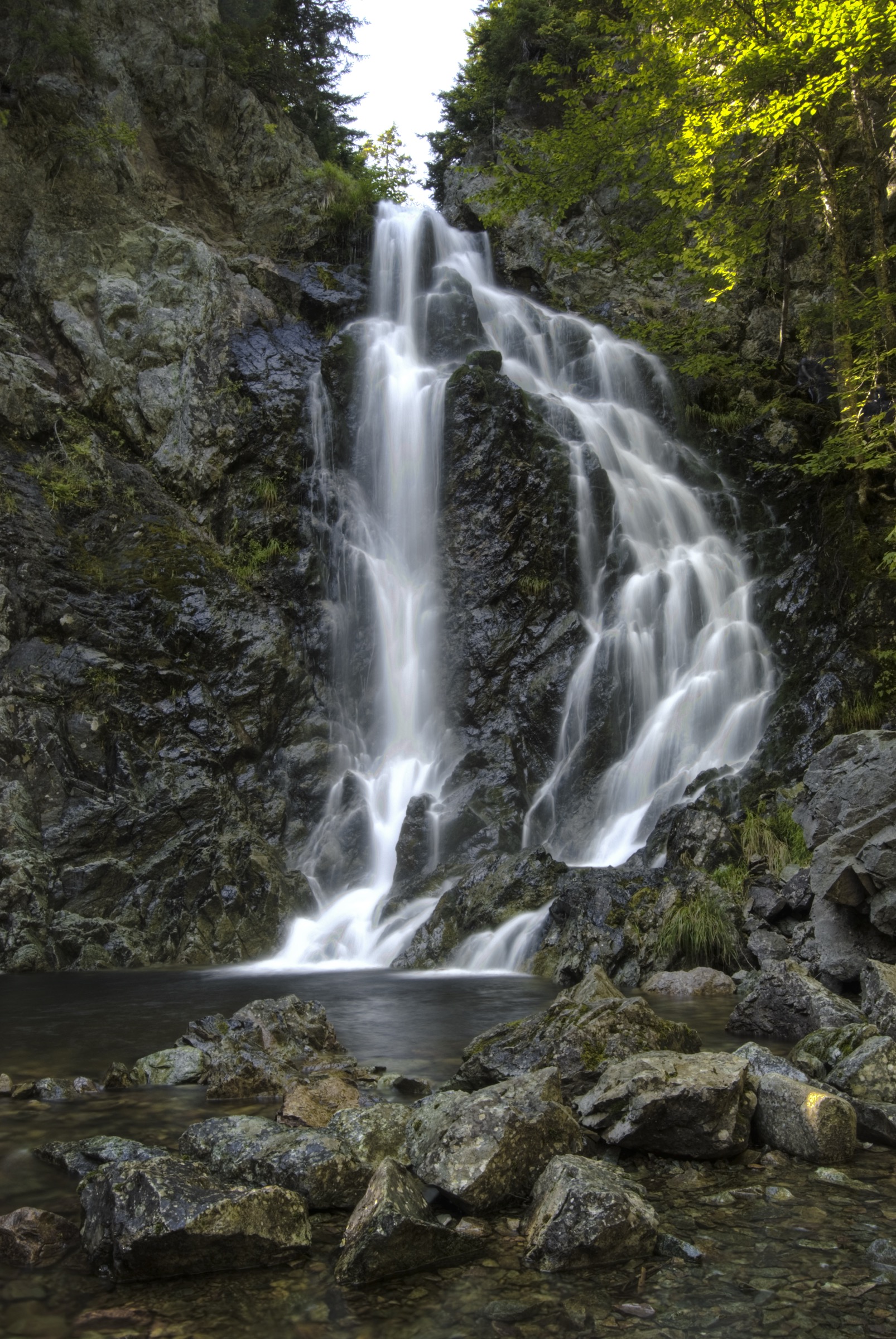
The trail leaves the Laverty Road trailhead on the inland plateau and runs almost flat through mixed hardwood and softwood stands for the first half, crossing several small brooks on wooden footbridges. About 2 km in, the route tilts downhill, then steepens sharply through a series of stepped sections cut into the slope, dropping into a narrow ravine carved by the Third Vault Brook. The trail ends in a natural amphitheatre at the base of the falls, where the brook drops 16 m over a sandstone cliff into a shallow plunge pool. Return is by the same line; the climb back to the plateau is the only sustained effort of the day.
Why it is essential
Third Vault Falls is the tallest waterfall in Fundy National Park and the tallest in southern New Brunswick. The amphitheatre at its base is the single most dramatic enclosed waterfall setting in the region, and the moderate length and gentle plateau approach make it the most accessible route in the area to a substantial cascade. It complements Dickson Falls by offering a much wilder, less-trafficked equivalent on the opposite side of the park.
Equipment
Standard hiking equipment: hiking shoes or boots, weatherproof layer, warm layer, water, snacks, insect repellent, and tick protection. Trekking poles are useful for the steep descent into the falls amphitheatre.
Hazards and notes
The descent to the falls is slick when wet, particularly on the wooden steps near the base. The plunge pool is shallow and full of submerged rocks; the falls themselves are not safe for swimming or for climbing on the wet sandstone above. Black flies are intense in June. The trailhead is on an unpaved park road that can be muddy after rain.
GPX / route file
| Source | URL |
|---|---|
| AllTrails: Third Vault Falls Trail | alltrails.com |
External links
- Parks Canada — Third Vault Falls Trail
- Hiking NB — Third Vault Falls Trail
- Tourism New Brunswick — Best waterfalls
3. Dickson Falls Trail
Snapshot
Itinerary
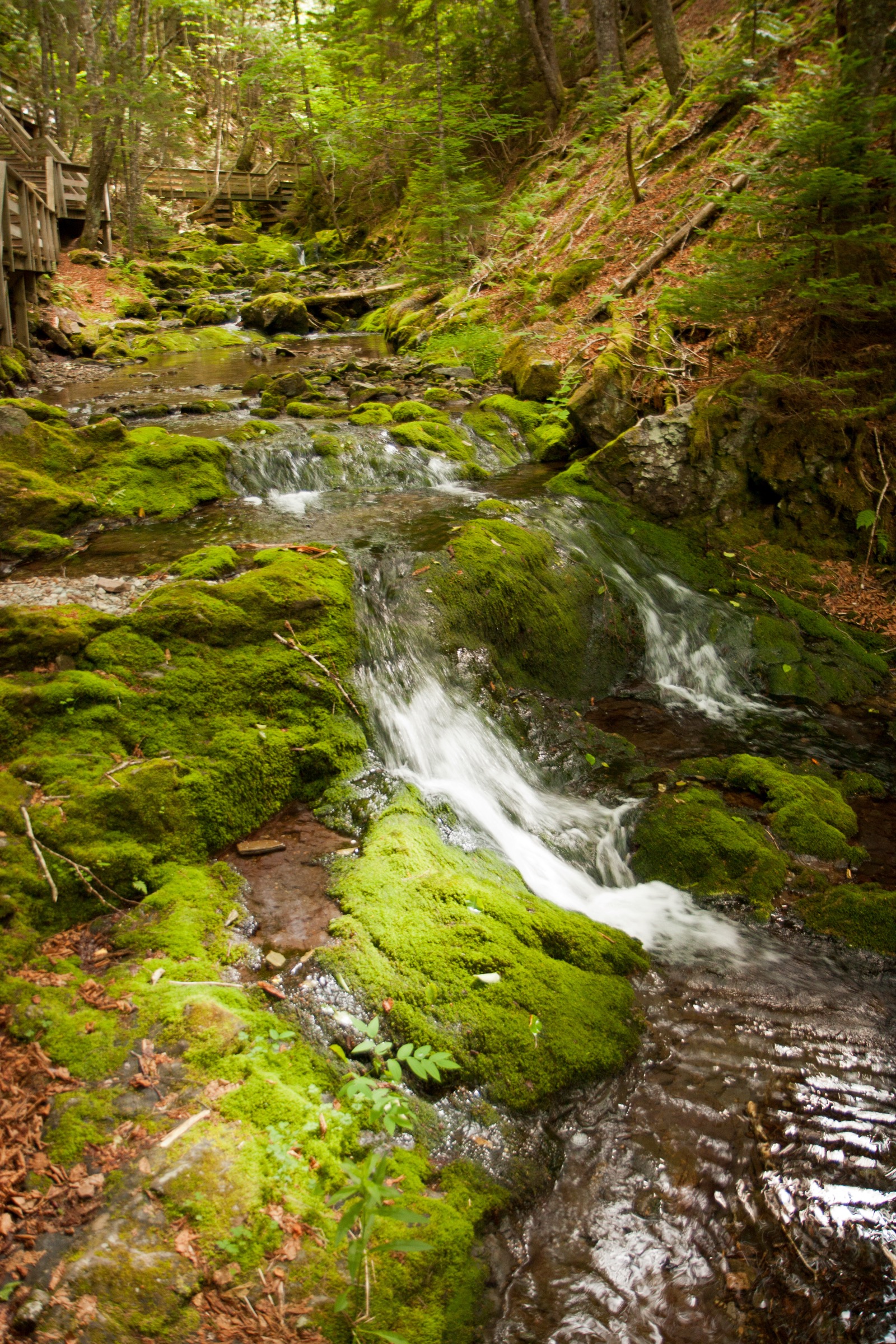
The loop drops from the Point Wolfe Road car park along a packed gravel and boardwalk path into the cool, mossy ravine of Dickson Brook. A series of wooden staircases and railed walkways follow the brook downstream past the main falls, where the water drops in two staggered tiers over a moss-covered sandstone face. The return half of the loop climbs gently along the opposite side of the ravine through hemlock and balsam fir back to the trailhead. The route is signposted from the visitor centre and is the most heavily walked path in the park.
Why it is essential
Dickson Falls is the most photographed waterfall in Fundy National Park and the standard introductory walk for visitors arriving at the park headquarters. The wooden walkway and short loop format make it accessible to most walkers, including families with young children, and the mossy ravine environment is one of the best examples of a humid Acadian forest microclimate on the lower Fundy coast.
Equipment
No special equipment required. Comfortable walking shoes, sun protection, and insect repellent in midsummer are sufficient. The wooden walkways are slippery when wet; use care after rain.
Hazards and notes
The trail is busy in summer, particularly between 10:00 and 16:00. The wooden boardwalks and stairs are very slick after rain. The brook can rise quickly in storms but the loop itself stays well above flood level. National park entry fees apply.
GPX / route file
| Source | URL |
|---|---|
| AllTrails: Dickson Falls Trail | alltrails.com |
External links
4. Matthews Head Trail
Snapshot
Itinerary
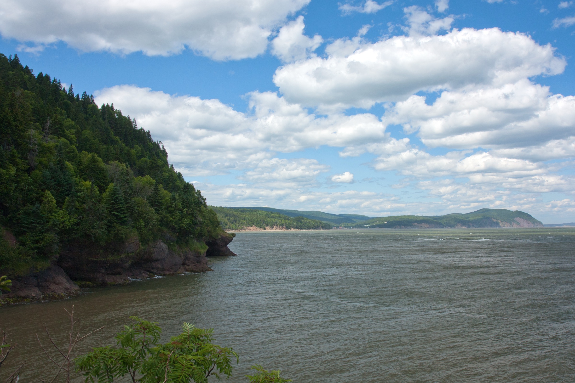
The loop leaves the trailhead car park on the inland plateau, crosses an open meadow, and drops through a coastal spruce forest to the cliff edge above Herring Cove. A series of short side spurs lead to railed lookouts over the cove and the Bay of Fundy, with views east towards Owl’s Head and west along the escarpment. The trail then descends to the back of Herring Cove beach, where walkers can extend the route by walking out onto the cobble beach at low tide. The return half climbs back through the coastal forest and along the rim to the trailhead. The full loop combines plateau forest, exposed conglomerate sea cliffs, and intertidal shoreline in a single half-day.
Why it is essential
Matthews Head is the canonical coastal cliff loop on the Fundy National Park side of the highlands. It is the only signposted park loop that combines the exposed seaward escarpment with direct beach access at Herring Cove, and the lookouts over the cove give the clearest illustration in the park of the tidal range that defines the Bay of Fundy.
Equipment
Standard hiking equipment: trail shoes or light boots, weatherproof layer, warm layer for the wind on the cliffs, water, sun protection, insect repellent, and tick protection. A tide table is useful if planning the Herring Cove beach extension.
Hazards and notes
The cliff lookouts above Herring Cove are partially railed but the surrounding edges drop straight to the rocks below — keep well back, particularly with children. Falling rocks from the cliffs above are a real hazard for anyone walking along the base of the escarpment at low tide. Herring Cove beach is fully submerged at high water; rising tides cut off return access along the cobble beach within an hour either side of high tide. Black flies are intense in June.
GPX / route file
| Source | URL |
|---|---|
| AllTrails: Matthews Head Trail | alltrails.com |
| AllTrails: Matthews Head from Herring Cove | alltrails.com |
External links
5. Fundy Footpath: Big Salmon River to Long Beach
Snapshot
Itinerary
The route starts at the Big Salmon River Interpretive Centre at the eastern end of the Fundy Trail Parkway. A 60-m suspension bridge over the Big Salmon River carries walkers onto the western end of the Fundy Footpath itself; the formal start of the long-distance trail then climbs the escarpment east of the river through Acadian mixed forest. The path runs along the cliff edge with periodic openings looking down to cobble beaches and sea stacks, drops steeply to cross several small brooks, and reaches Long Beach Brook after roughly 4.5 km. Long Beach itself is the next named bay east of Big Salmon River and is a recognised camping and turnaround point on the eastern day-section. Return is by the same line.
Why it is essential
This is the canonical stand-alone day-hike on the Fundy Footpath, the most-walked entry to the long-distance trail, and the only practical way to sample the genuinely wild coastal Footpath corridor without committing to the full 41-km, multi-day route. It also gives the clearest contrast in the region between the engineered Fundy Trail Parkway corridor and the rough, unmaintained-style Footpath underfoot east of the suspension bridge.
Equipment
Mountain hiking equipment: sturdy boots, weatherproof shell, warm layer, headtorch, navigation backup, ample water and food, insect repellent, and tick protection. A tide table is essential if the planned turnaround includes any walking on the cobble beaches. Bear-aware food storage is advised for any lunch carried on the trail.
Hazards and notes
The Fundy Footpath has multiple river and brook crossings; even the eastern day-section requires fording or rock-hopping small brooks that can rise rapidly after rain. The climbs in and out of brook valleys are steep and slippery, with exposed roots and clay underfoot. The cobble beaches between Big Salmon River and Long Beach are tidal — rising water can cut off return access within an hour either side of high tide, and the tidal range at this point on the bay routinely exceeds 8 to 10 m. Falling rocks from the cliffs above are a real hazard on any beach section. The Fundy Hiking Trail Association registers Footpath hikers and publishes current trail status; checking before departure is strongly recommended.
GPX / route file
| Source | URL |
|---|---|
| Komoot: Fundy Footpath — Big Salmon River to Long Beach | komoot.com |
External links
- Fundy Trail Provincial Park — points of interest
- Hiking NB — Fundy Footpath
- Wikipedia — Fundy Footpath
- Stonehammer UNESCO Global Geopark — Fundy Trail
External links
| Source | URL |
|---|---|
| Parks Canada — Fundy National Park | parks.canada.ca |
| Parks Canada — Fundy National Park trails | parks.canada.ca |
| Parks Canada — Goose River Trail | parks.canada.ca |
| Parks Canada — Third Vault Falls Trail | parks.canada.ca |
| Parks Canada — Dickson Falls Trail | parks.canada.ca |
| Parks Canada — Coppermine Trail | parks.canada.ca |
| Parks Canada — Caribou Plain Trail | parks.canada.ca |
| Fundy Trail Provincial Park — NB Parks | nbparks.ca |
| Fundy Trail Provincial Park — points of interest | parcsnbparks.ca |
| Hiking NB — Fundy National Park trails index | hikingnb.ca |
| Hiking NB — Fundy Footpath | hikingnb.ca |
| Hiking NB — Fundy Trail Provincial Park | hikingnb.ca |
| Hiking NB — Goose River Trail | hikingnb.ca |
| Hiking NB — Third Vault Falls Trail | hikingnb.ca |
| Hiking NB — Dickson Falls Trail | hikingnb.ca |
| Hiking NB — Matthews Head Trail | hikingnb.ca |
| Hiking NB — Coppermine Trail | hikingnb.ca |
| Hiking NB — Caribou Plain Trail | hikingnb.ca |
| AllTrails — Fundy National Park trails | alltrails.com |
| AllTrails — Goose River Trail | alltrails.com |
| AllTrails — Third Vault Falls Trail | alltrails.com |
| AllTrails — Dickson Falls Trail | alltrails.com |
| AllTrails — Matthews Head Trail | alltrails.com |
| AllTrails — Coppermine Trail | alltrails.com |
| Komoot — Fundy Footpath: Big Salmon River to Long Beach | komoot.com |
| Trailforks — Goose River | trailforks.com |
| Stonehammer UNESCO Global Geopark — Fundy Trail | stonehammergeopark.com |
| Tourism New Brunswick — Best waterfalls | tourismnewbrunswick.ca |
| Wikipedia — Fundy National Park | en.wikipedia.org |
| Wikipedia — Fundy Footpath | en.wikipedia.org |
| Wikipedia — Bay of Fundy | en.wikipedia.org |
| Wikimedia Commons — Fundy National Park category | commons.wikimedia.org |