Regional overview
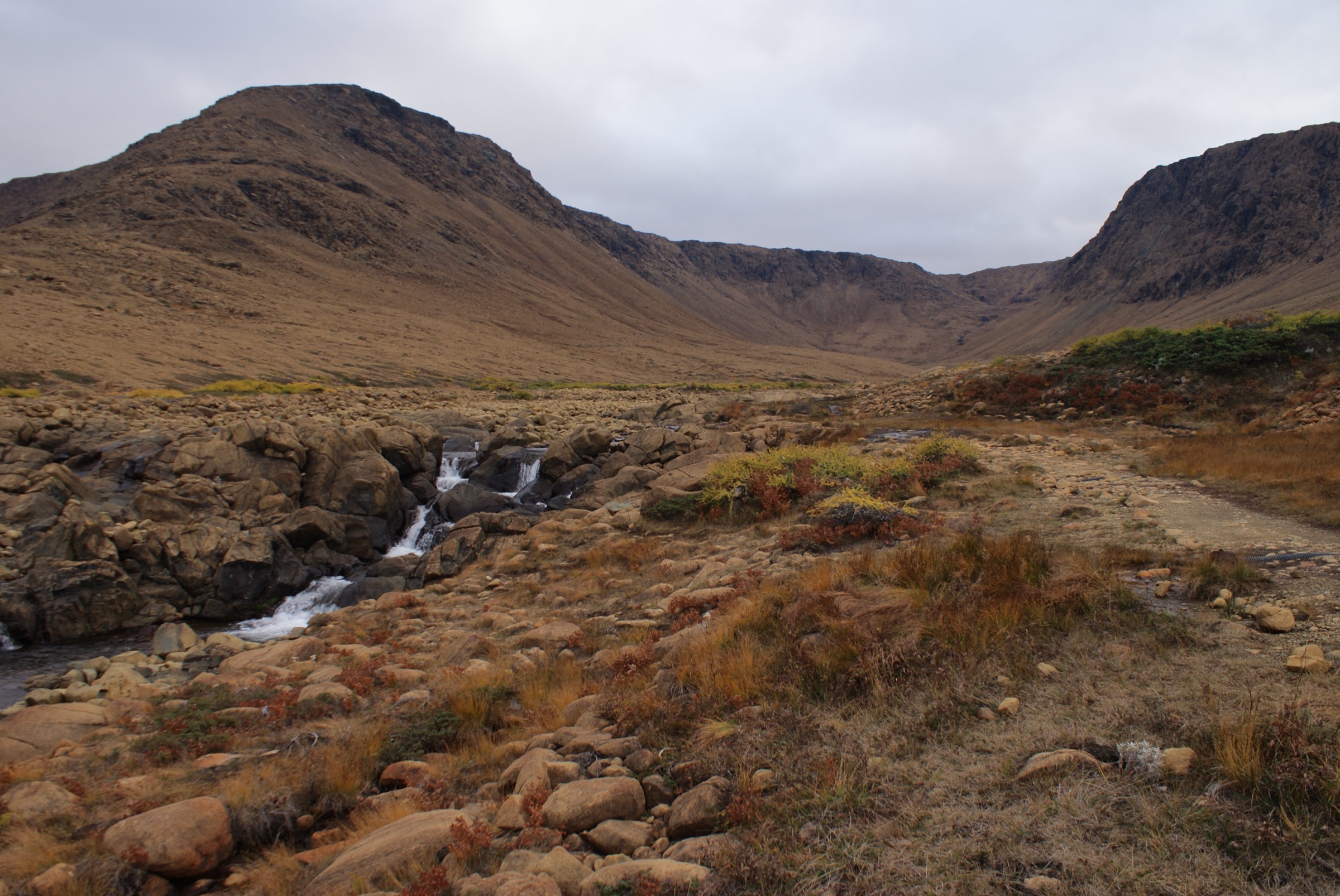
The Long Range Mountains form the northernmost extension of the Appalachian chain, running roughly 500 km up the west coast of the island of Newfoundland from Cape Ray to the tip of the Great Northern Peninsula. The range is built on deeply eroded Precambrian granites and gneisses, capped in places by Ordovician ophiolite sequences that pushed slices of the Earth’s mantle to the surface. The hiking interest is concentrated inside Gros Morne National Park, designated a UNESCO World Heritage Site in 1987 for its role in demonstrating the theory of plate tectonics and for the dramatic landlocked fjords, glacial cirques and serpentine barrens that fill the park.
The principal hiking centres are Rocky Harbour on the park’s coastal side (close to the trailheads for Gros Morne Mountain, Western Brook Pond, Bakers Brook Falls, Berry Hill and the Coastal Trail) and Woody Point on the south arm of Bonne Bay (close to the Tablelands, Green Gardens and Lookout Hills). Trails range from short coastal-plain boardwalks to a strenuous summit scramble on Gros Morne Mountain (806 m) and demanding unmarked traverses into the backcountry. Outside the national park boundary, the range continues north up the peninsula and is also accessed by the International Appalachian Trail Newfoundland (IATNL), which follows the Long Range’s spine.
The hiking season is short. Most marked Parks Canada trails are usable from late June to mid-October; lingering snow in gullies and on the alpine plateau, plus a seasonal closure of the Gros Morne Mountain summit (typically May 1 to June 30 for ptarmigan and caribou calving), restrict early-season options. Weather on the coast is highly variable, with fog, rain and strong onshore winds even in midsummer. Several signature experiences require a separate fee — most notably the BonTours boat cruise on Western Brook Pond, which is the standard way to view the fjord cliffs — and the Long Range Traverse (multi-day, permit-controlled) is explicitly excluded from this catalogue.
Access is from Deer Lake Regional Airport via Route 430 (the Viking Trail). There is no public bus service inside the park; DRL Coachlines connect Deer Lake to the wider provincial network, and local shuttle operators (Martin’s Transportation, Viking 430) link Deer Lake, Rocky Harbour and Woody Point on a seasonal schedule. Black bear and moose are present throughout the park; standard bear-aware food handling applies in the backcountry.
Selection rationale
Five hikes are chosen to cover the full range of landscapes within the Long Range Mountains and to balance scenic, geological and coastal interest:
- Gros Morne Mountain (James Callaghan) Trail — the iconic summit of the range and the park’s headline strenuous day-hike, with views over Ten Mile Pond and the Long Range plateau.
- Tablelands Trail — the geological pilgrimage of the park, walking on exposed mantle peridotite that is central to the UNESCO designation.
- Western Brook Pond Trail (with the BonTours fjord cruise) — the only practical day-hike access to the park’s most photographed feature, the landlocked freshwater fjord beneath 650 m cliffs.
- Green Gardens Trail — the coastal counterpart to the Tablelands, descending from serpentine barrens through boreal forest to volcanic sea cliffs, stacks and meadows.
- Lookout Hills (Lookout) Trail — a short, steep panoramic hike from the Discovery Centre giving the best single overview of Bonne Bay, the Tablelands and Gros Morne Mountain.
The Long Range Traverse, Snug Harbour as a stand-alone overnight, North Rim Traverse, and routes on The Cabox and the Lewis Hills are intentionally excluded (multi-day, separate region, or both). Bakers Brook Falls and the Coastal/Berry Hill trails were considered strong candidates but were judged less essential than the five above.
Summary table
| # | Hike | Country | Route type | Distance | Gain | Max elevation | Difficulty |
|---|---|---|---|---|---|---|---|
| 1 | Gros Morne Mountain (James Callaghan) Trail | Canada | Loop (with out-and-back approach) | 16–17 km | ~750–800 m | 806 m | Strenuous |
| 2 | Tablelands Trail | Canada | Out-and-back | ~4 km | ~50–80 m | ~280 m | Easy |
| 3 | Western Brook Pond Trail (+ fjord cruise) | Canada | Out-and-back (boat-assisted) | ~6 km (trail) | ~30 m | ~50 m | Easy (boat tour separate fee) |
| 4 | Green Gardens Trail (Wallace Brook trailhead) | Canada | Out-and-back | 9–9.5 km | ~300–415 m | ~310 m | Moderate |
| 5 | Lookout Hills (Lookout) Trail | Canada | Loop | ~5 km | ~360 m | ~405 m | Moderate (short, steep) |
1. Gros Morne Mountain (James Callaghan) Trail

Snapshot
Itinerary
From the trailhead on Route 430 the path crosses coastal lowlands and climbs steadily through balsam fir forest on a graded track with stone steps and boardwalks, gaining around 200 m over 4 km to a viewing area at the base of the mountain’s eastern face. This first section is sometimes signposted as the Approach Trail and is the official turnaround point during the spring summit closure.
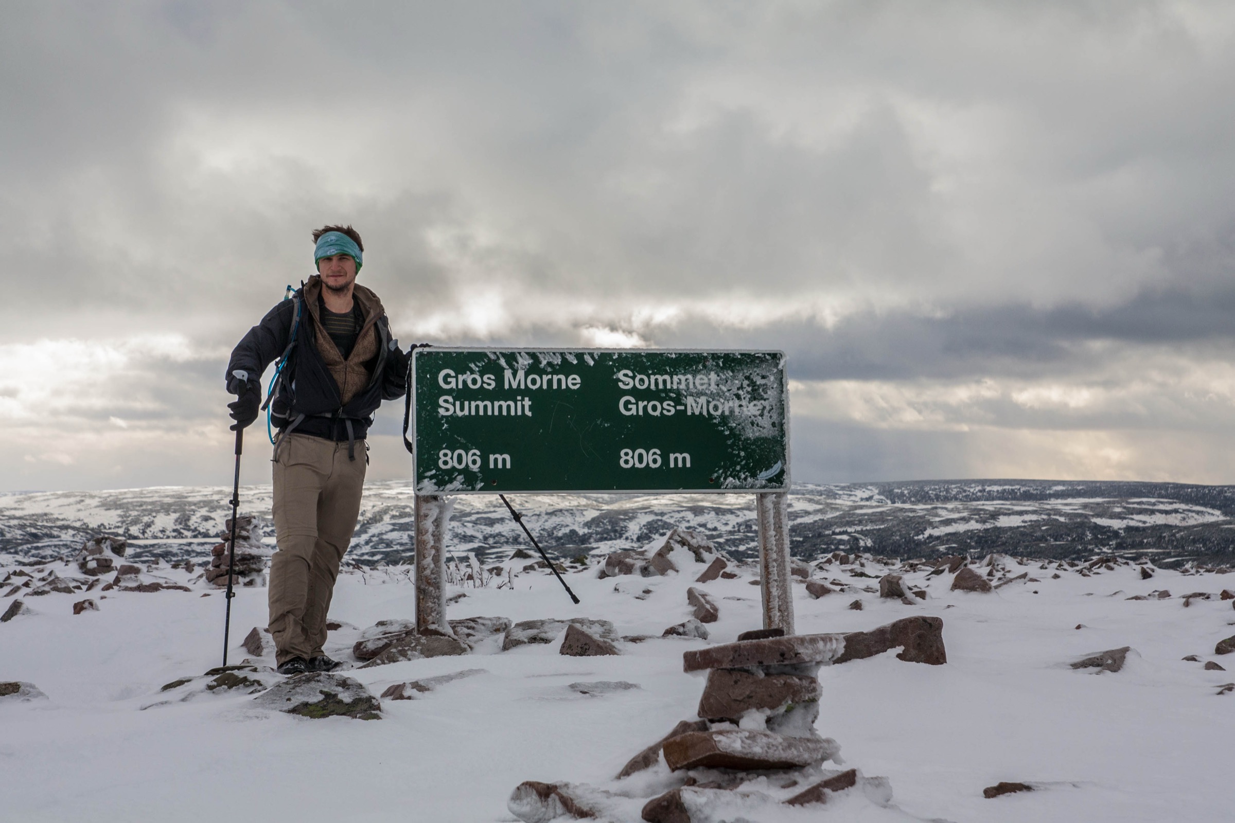
From the base, the loop begins. The ascent climbs a steep boulder gully (often called “the gully” or “the wall”), gaining roughly 400 m in about 1 km of loose talus with no marked path beyond the orange-and-yellow cairns. The gradient eases on reaching the broad summit plateau, an exposed arctic-alpine tableland scattered with quartzite blocks. A line of cairns leads roughly 1 km north-east across the plateau to the summit cairn at 806 m, with views over Ten Mile Pond, Bonne Bay, the East Arm, and the Long Range plateau to the north.
The descent follows the plateau rim northward, then drops sharply into Ferry Gulch, a steep but walkable scree and turf slope above a small backcountry pond, before re-entering forest and rejoining the approach trail. Park staff strongly recommend completing the loop in the counter-clockwise direction described above; downclimbing the gully is discouraged because of rockfall risk to other hikers.
Why it is essential
Gros Morne Mountain is the namesake summit of the national park, the second-highest peak in Newfoundland, and the only Long Range summit reachable by a marked day-hike. The combination of a serious gully scramble, arctic-alpine plateau, and twin fjord-style views over Ten Mile Pond and Bonne Bay makes it the single most representative hike in the range.
Equipment
- Sturdy boots with good ankle support (loose talus in the gully)
- Trekking poles strongly recommended for the descent into Ferry Gulch
- Weatherproof and warm layers; the summit plateau is exposed and routinely 10 °C colder than the trailhead
- Hat and gloves outside high summer
- 2–3 L water (no reliable water on the upper mountain)
- Navigation backup (map, compass or GPS); fog frequently obscures cairns
- Headtorch for late finishes
Hazards and notes
- Seasonal closure: the summit loop above the Approach Trail is closed annually from approximately 1 May to 30 June for caribou calving and ptarmigan; only the 4.5 km approach is open during that window.
- Rockfall in the ascent gully is the major objective hazard; do not descend the gully.
- The plateau is fully exposed to wind, fog and lightning; storms can move in quickly off the Gulf of St. Lawrence.
- Snow patches may linger in the gully and on the north-facing plateau into early July.
- Dogs are permitted on leash on this trail under Parks Canada rules; check current notices.
- A Parks Canada day pass or annual pass is required.
Routes and maps
| Source | URL |
|---|---|
| Parks Canada — Gros Morne Mountain | parks.canada.ca |
| AllTrails — Gros Morne Mountain Trail | alltrails.com |
| OpenStreetMap ways (Gros Morne Mountain Trail / James Callaghan) | openstreetmap.org |
External links
- Parks Canada — Gros Morne Mountain
- Newfoundland and Labrador Tourism — Gros Morne Mountain Trail
- Wikipedia — Gros Morne (Newfoundland)
2. Tablelands Trail

Snapshot
Itinerary
The trail leaves the Route 431 car park opposite the Tablelands and follows a graded gravel former roadbed that skirts the base of the massif. Within minutes the surroundings change abruptly: to the north, boreal forest and bog; to the south, an almost lifeless ochre slope of peridotite, a rock so high in heavy metals and so low in nutrients that only specialist plants (including pitcher plants and a sparse community of serpentine endemics) can colonise it.
After about 1.5 km the path enters Winterhouse Brook Canyon, a U-shaped glacial trough cut into the ultramafic rock. The maintained trail ends at a small viewpoint where the canyon walls close in and a small stream tumbles over slabs. Beyond this point an unofficial off-trail route continues up the canyon and onto the Tablelands plateau — that variant is not part of this entry and adds significant distance and elevation.
Interpretive panels along the route explain the obduction of oceanic mantle onto continental crust during the Taconic orogeny, the feature for which Gros Morne was inscribed on the UNESCO list.
Why it is essential
The Tablelands are the single feature most often cited in the park’s World Heritage justification: a working outdoor example of plate tectonics where visitors physically walk on exposed Earth’s mantle. No other hike of comparable accessibility in the Appalachian chain offers the same geology.
Equipment
- Standard hiking shoes; the surface is mostly graded gravel
- Weatherproof and warm layer (the canyon is exposed and breezy)
- Water and sun protection (no shade on the open peridotite)
- Map or interpretive leaflet from the Discovery Centre
Hazards and notes
- The exposed peridotite has very little shade and reflects strong sunlight; in poor weather the same exposure means wind and cold.
- Stay on the maintained path; serpentine flora are slow-growing and easily damaged.
- A Parks Canada day pass is required.
- Dogs permitted on leash.
Routes and maps
| Source | URL |
|---|---|
| Parks Canada — Hiking, Gros Morne | parks.canada.ca |
| OpenStreetMap way (Tablelands Trail) | openstreetmap.org |
| Trailforks — Tablelands unmarked route | trailforks.com |
External links
- Parks Canada — Hiking, Gros Morne
- Wikipedia — Long Range Mountains
- Wikipedia — Gros Morne National Park
3. Western Brook Pond Trail (with the BonTours fjord cruise)

Snapshot
Itinerary
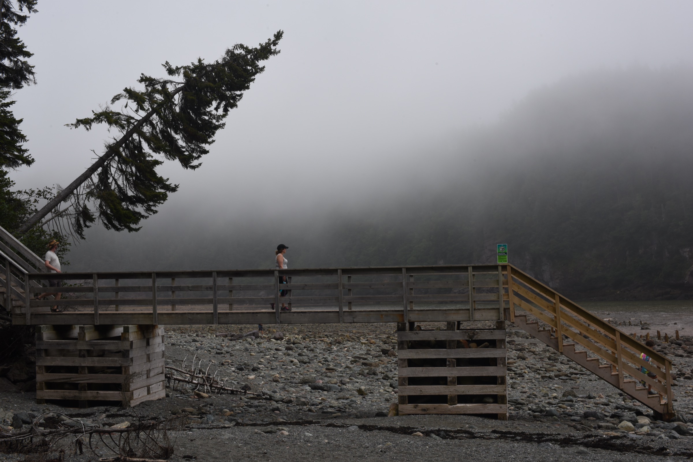
The trail leaves the car park on Route 430 and crosses a coastal lowland of bog and stunted fir, on long stretches of boardwalk that protect the fragile peat. After about 3 km the path reaches the small dock at the western end of Western Brook Pond, the most photographed of the park’s landlocked fjords. The trail itself is flat and easy; most parties allow 45 minutes to an hour each way.
The standard experience is to combine the walk with the BonTours boat cruise on the pond — a ~2 hour catamaran trip ticketed separately. The cruise enters the gorge between cliffs of Precambrian granite-gneiss rising more than 600 m above the water and passes a series of waterfalls, including Pissing Mare Falls (one of the highest in eastern North America). The boat returns to the same dock.
For walkers wanting a longer day, the Snug Harbour route branches north from the Western Brook Pond trail. It is described separately by Parks Canada as a primitive, unmarked, often muddy 9 km return route that requires fording Western Brook to reach a backcountry campsite near the mouth of the gorge. Snug Harbour is included here as an extension only; it is not the standard day for first-time visitors.
Why it is essential
Western Brook Pond is the defining image of Gros Morne and one of the most recognised landscapes in Atlantic Canada. The boat cruise is the only practical way to see the fjord walls at scale, and the short approach trail is the only route to reach it.
Equipment
- Standard hiking shoes; the trail is mostly boardwalk
- Weatherproof layer (open coastal plain, no shelter)
- Warm layer for the boat (it is much colder on the water)
- Sun protection
- Boat-tour ticket (book ahead in July/August; sells out)
- Cash/card for the cruise fee (separate from the park pass; ~CAD $99 adult for 2026 season per BonTours)
Hazards and notes
- Separate boat-trip fee: the BonTours Western Brook Pond cruise is ticketed separately from the Parks Canada day pass (~CAD $99 adult for 2026 season per BonTours); book ahead in July/August as sailings sell out.
- Boat cruises are weather-dependent and cancel in high wind.
- The trail is exposed to wind and to mosquitoes/blackflies in early summer; insect repellent recommended.
- A Parks Canada day pass is required in addition to the boat fee.
- Dogs are not permitted on the boat; check current trail-side dog rules with Parks Canada.
- For the Snug Harbour extension: unmarked, requires Western Brook ford; only suitable for experienced backcountry hikers in summer low-water conditions.
Routes and maps
| Source | URL |
|---|---|
| Parks Canada — Western Brook Pond | parks.canada.ca |
| BonTours — Western Brook Pond Tour | bontours.ca |
| AllTrails — Western Brook Pond | alltrails.com |
| OpenStreetMap way (Western Brook Pond Trail) | openstreetmap.org |
External links
- Parks Canada — Western Brook Pond
- Parks Canada — Snug Harbour
- BonTours — Western Brook Pond Tour
- Wikipedia — Western Brook Pond
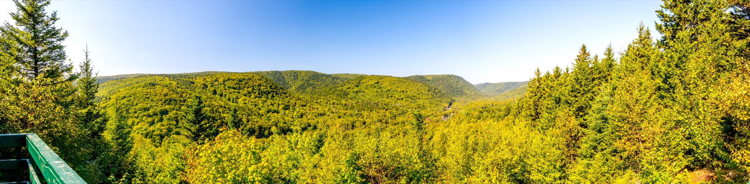
4. Green Gardens Trail (Wallace Brook trailhead)
Snapshot
Itinerary
The Wallace Brook trailhead on Route 431 sits on the open serpentine barrens at the western edge of the Tablelands massif. The path crosses a short stretch of barren ground before dropping into balsam fir forest and descending steadily towards the coast. After about 4 km it emerges abruptly onto the lush green cliff-top meadows that give the route its name, where Carboniferous volcanic rocks (in marked contrast to the ultramafic Tablelands behind) support thick grass and grazing animals from the small inholding community traditions of the past.
A short side path drops down onto the beach at Old Man Cove, with views of basalt sea stacks and small caves. Parties with time and fitness can continue along the coastal section past Wallace Brook and on to Steve’s Cove. The historic loop with a second trailhead has been altered in recent years; Parks Canada signage should be confirmed at the trailhead before relying on a loop variant.
The return climb is the harder half of the day, gaining around 300 m back to the plateau.
Why it is essential
Green Gardens is the coastal counterpart to the Tablelands and shows the geological contrast that defines southern Gros Morne: mantle peridotite at the trailhead, volcanic basalt at the sea, and a fertile meadow cap on top. It is also the only essential day-hike in the range that ends at the open Atlantic-facing coast.
Equipment
- Sturdy hiking shoes or boots; the descent and return climb are continuous
- Weatherproof and warm layers; coastal weather changes quickly
- Trekking poles helpful for the return climb
- 2 L water; no treated water on the route
- Insect repellent in early summer
- Tick awareness (low risk but increasing in Newfoundland)
Hazards and notes
- Sea cliffs at the meadows are unfenced; stay back from the edge, especially in wet or windy conditions.
- The return climb is the steepest part of the day; allow extra time on hot afternoons.
- Cattle have historically grazed parts of the meadows; close any gates as found.
- A Parks Canada day pass is required.
- Verify trailhead status on the Parks Canada website; the second (Long Pond) trailhead has been periodically closed.
Routes and maps
| Source | URL |
|---|---|
| Parks Canada — Green Gardens Trail | parks.canada.ca |
| AllTrails — Green Gardens Trail | alltrails.com |
| Trailforks — Green Gardens | trailforks.com |
| OpenStreetMap way (Green Gardens Trail) | openstreetmap.org |
External links
- Parks Canada — Green Gardens Trail
- Newfoundland and Labrador Tourism — Green Gardens Trail
- Wikipedia — Gros Morne National Park
5. Lookout Hills (Lookout) Trail
Snapshot
Itinerary
The trail leaves directly from the Discovery Centre car park on the southern shore of Bonne Bay. Switchbacks climb steeply through balsam fir forest, gaining about 300 m in the first 1.5 km. As the gradient eases, the trail emerges onto a small subalpine plateau where the forest gives way to crowberry and partridgeberry barrens.
A short loop on the plateau passes a wooden viewing platform on Partridgeberry Hill at around 405 m. The platform gives one of the best single panoramas in the park: directly north over the East Arm and South Arm of Bonne Bay (a true coastal fjord), east across the bay to Gros Morne Mountain, west to the Tablelands plateau, and south over the inner Lookout Hills. The route returns to the car park on the same switchback descent.
Why it is essential
For walkers without time or fitness for the full Gros Morne Mountain ascent, Lookout Hills delivers the most complete summary view of the Long Range Mountains within the park in a half day. It pairs naturally with the Tablelands Trail and the Discovery Centre’s geological exhibits.
Equipment
- Hiking shoes with grip; the descent is steep on roots
- Trekking poles helpful
- Weatherproof and warm layer (the platform is exposed)
- Water and sun protection
- Map of Bonne Bay viewpoints (available at the Discovery Centre)
Hazards and notes
- The trail is short but the gradient is sustained; mind footing on the descent.
- The viewing platform is fully exposed; lightning risk in unstable weather.
- A Parks Canada day pass is required.
- Dogs permitted on leash.
- Discovery Centre opening hours are seasonal; the trailhead car park is generally accessible outside those hours.
Routes and maps
| Source | URL |
|---|---|
| Parks Canada — Hiking, Gros Morne | parks.canada.ca |
| AllTrails — Lookout Trail | alltrails.com |
| OpenStreetMap way (Lookout Trail) | openstreetmap.org |
External links
- Parks Canada — Hiking, Gros Morne
- Newfoundland and Labrador Tourism — Lookout Trail
- Wikipedia — Gros Morne National Park
External links
| Source | URL |
|---|---|
| Parks Canada — Gros Morne National Park (hiking) | parks.canada.ca |
| Parks Canada — Gros Morne National Park (geology) | parks.canada.ca |
| Parks Canada — Gros Morne Mountain | parks.canada.ca |
| Parks Canada — Green Gardens Trail | parks.canada.ca |
| Parks Canada — Western Brook Pond | parks.canada.ca |
| Parks Canada — Snug Harbour | parks.canada.ca |
| Newfoundland and Labrador Tourism — trail attractions | newfoundlandlabrador.com |
| International Appalachian Trail Newfoundland (IATNL) | iatnl.org |
| IAT/SIA Council — Newfoundland | iat-sia.org |
| BonTours — Western Brook Pond cruise | bontours.ca |
| AllTrails — Gros Morne Mountain Trail | alltrails.com |
| AllTrails — Green Gardens Trail | alltrails.com |
| AllTrails — Lookout Trail | alltrails.com |
| AllTrails — Western Brook Pond | alltrails.com |
| Trailforks — Tablelands unmarked route | trailforks.com |
| Trailforks — Green Gardens | trailforks.com |
| Wikipedia — Long Range Mountains | en.wikipedia.org |
| Wikipedia — Gros Morne National Park | en.wikipedia.org |
| Wikipedia — Western Brook Pond | en.wikipedia.org |
| Wikipedia — Gros Morne (Newfoundland) | en.wikipedia.org |
| The Canadian Encyclopedia — Long Range Mountains | thecanadianencyclopedia.ca |
| Wikimedia Commons — Category: Gros Morne, Newfoundland | commons.wikimedia.org |
| Wikimedia Commons — Category: Gros Morne National Park | commons.wikimedia.org |
| Wikimedia Commons — Category: Western Brook Pond | commons.wikimedia.org |
| Wikimedia Commons — Category: Bonne Bay, Newfoundland and Labrador | commons.wikimedia.org |