Regional overview
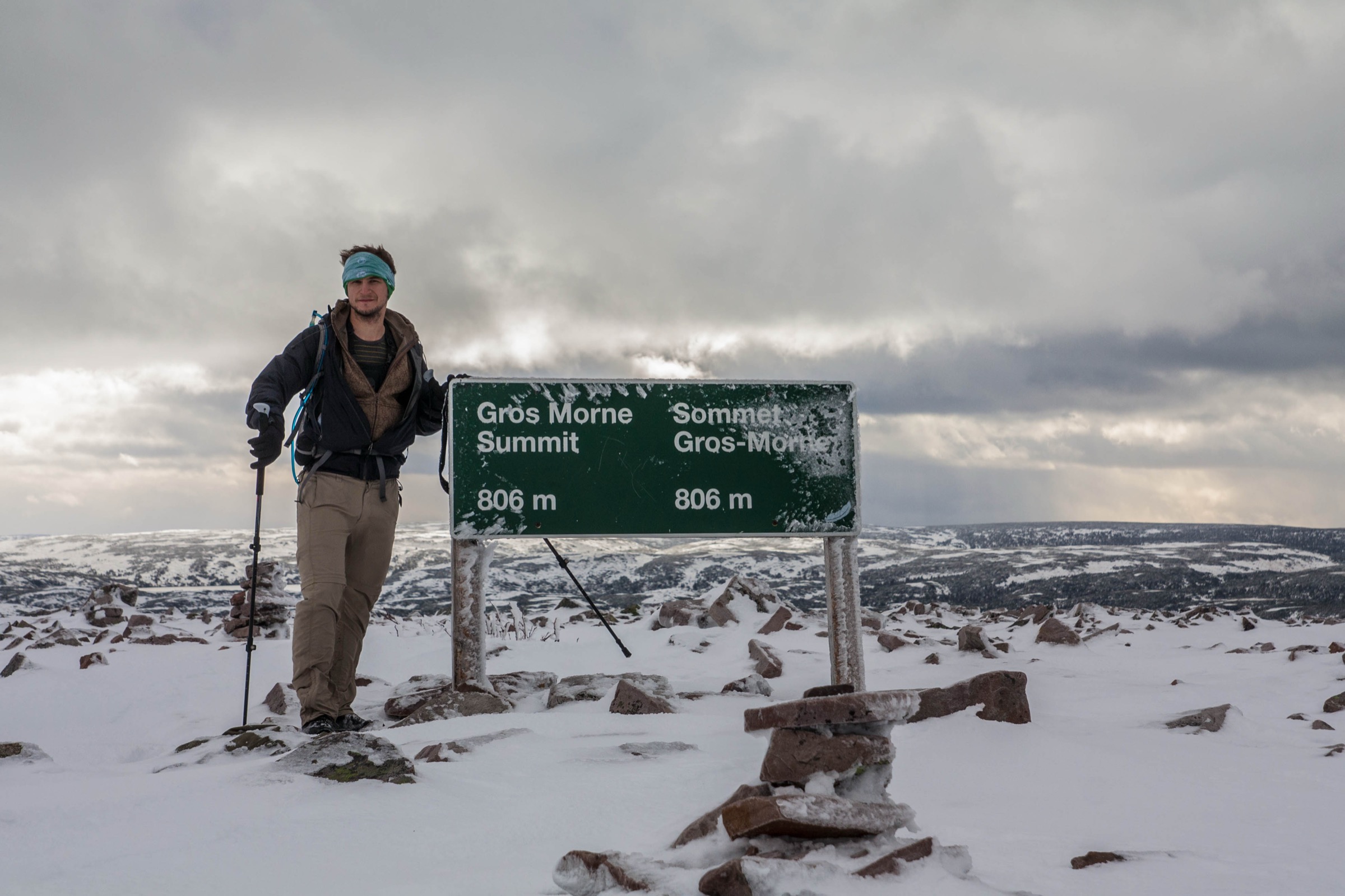
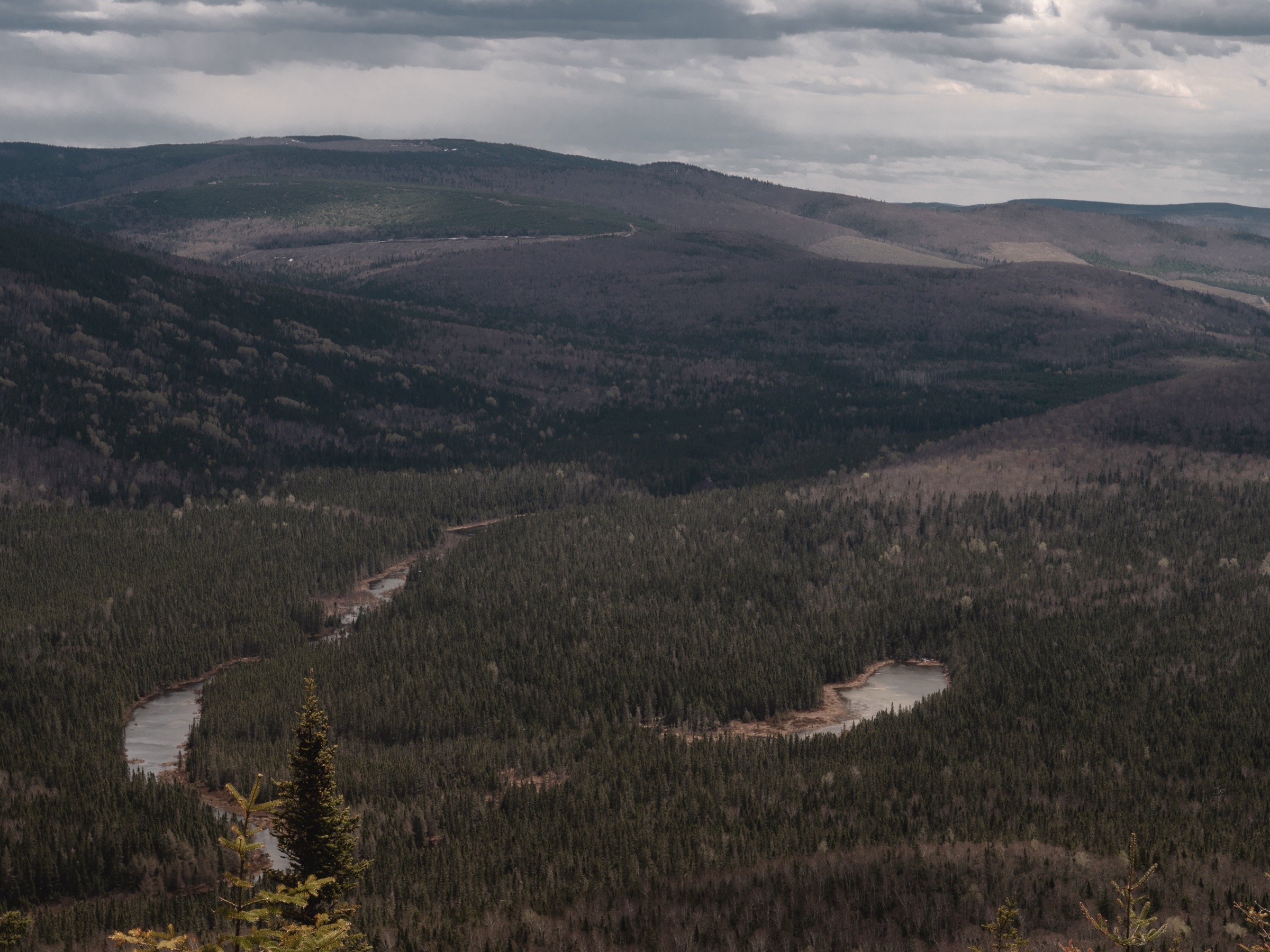
The New Brunswick Highlands rise in the remote interior of Restigouche and Northumberland counties, where the geological grain of Quebec’s Notre-Dame Mountains — itself the structural continuation of the Gaspé Chic-Chocs — crosses the provincial border and forms the highest ground in the Maritime Provinces. Mount Carleton Provincial Park, established in 1970 and covering 174 km² around the headwaters of the Nepisiguit River, protects the core of this upland. The park encloses four named summits over 560 m — Mount Carleton (820 m, the highest peak in the Maritimes), Mount Head (792 m), Mount Sagamook (777 m), and Mount Bailey (564 m) — together with the chain of glacial lakes (Nictau, Bathurst, Teagues, the Nepisiguit lakes) that drain east towards the Bay of Chaleur.
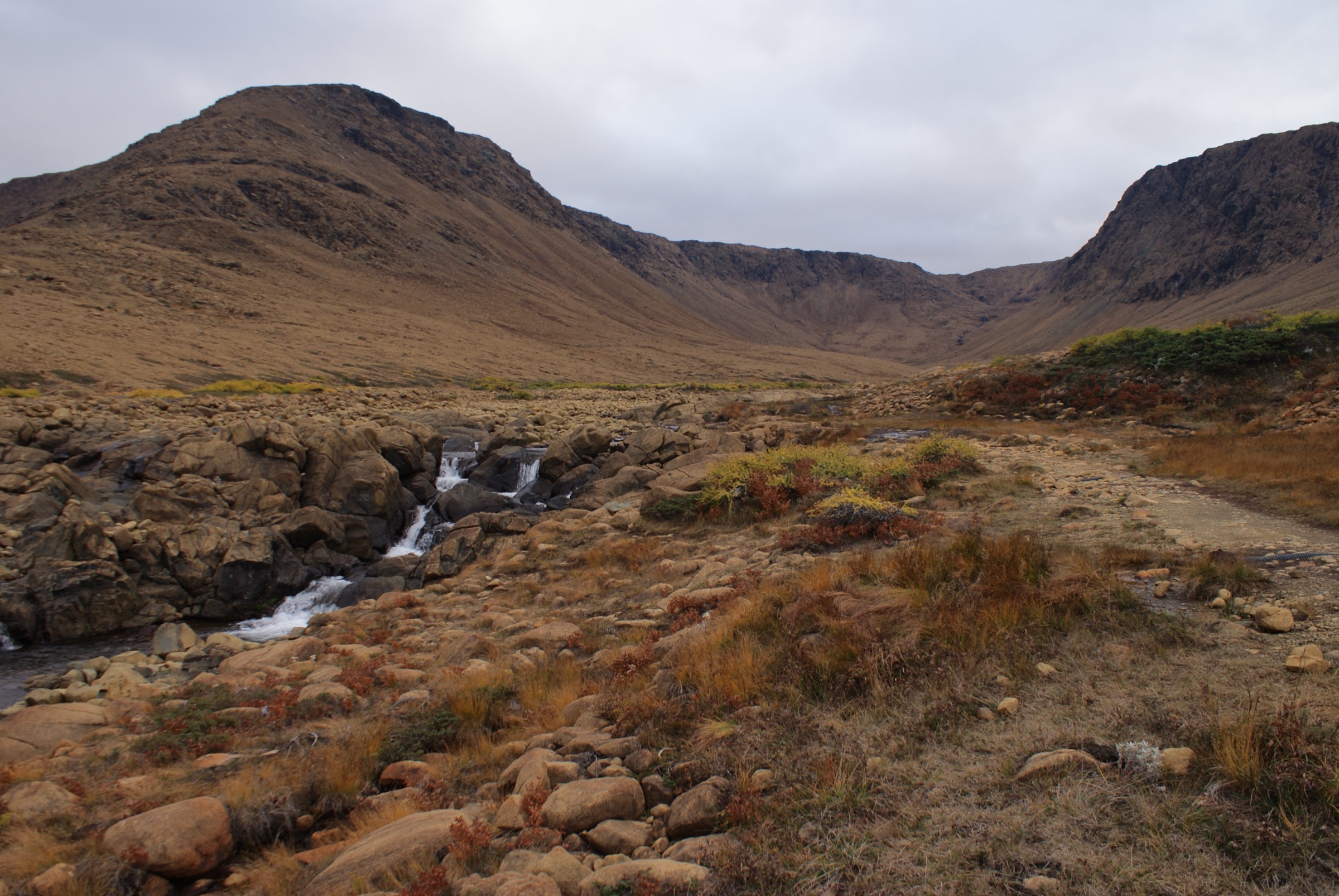
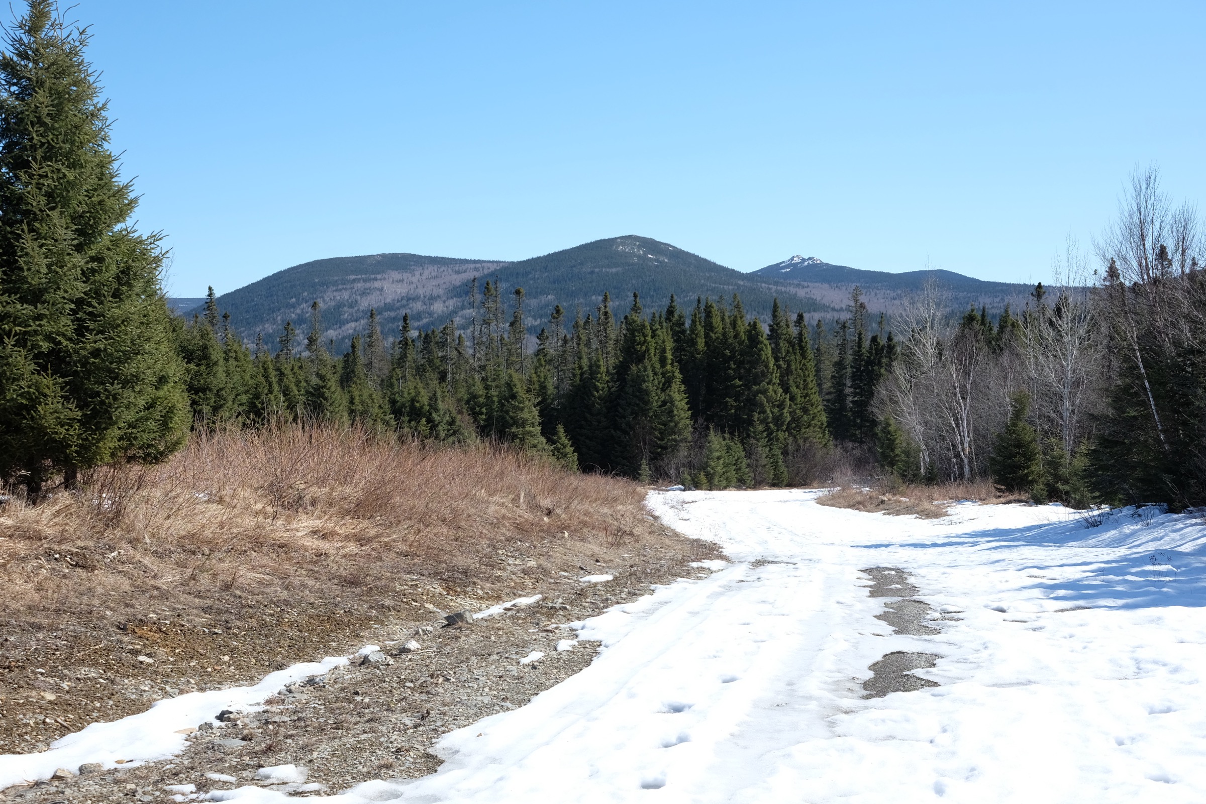
Geologically, these are erosional remnants of resistant Devonian igneous rock left standing after the Mesozoic peneplain was uplifted and dissected through the Cenozoic. The forest cover is northern Appalachian: mixed spruce, fir, white birch, sugar maple, and stands of red pine on dry south-facing slopes. The Canadian section of the International Appalachian Trail crosses the park, and the 147-km Nepisiguit Mi’gmaq Trail — re-opened along its full length in 2018 — has its western terminus at Bathurst Lake inside the park. Access is by paved road to Saint-Quentin, then 40 km on Route 385 to the south gate; there is no public transport, and the nearest town with services is Saint-Quentin or Kedgwick.
The hiking season is tied to the park’s gate calendar: the standard summer operating period runs from mid-May to mid-October, with 08:00–20:00 gate hours in the shoulder season and 08:00–22:00 in high summer. North-facing aspects on Sagamook and Head can hold snow into the first week of June, and the summit boulder fields of Mount Carleton frequently retain ice patches in late spring. Mount Carleton Provincial Park was designated a Dark-Sky Preserve by the Royal Astronomical Society of Canada in 2009 — the first in eastern Canada — and the annual late-July star party draws astronomers from across the Maritimes. Hazards are typical of the Acadian forest interior: black bear, moose (especially on dawn and dusk lakeside trails), blackfly and mosquito pressure peaking in June, and a real Lyme-disease risk from ticks on grassy edge habitat. Mobile coverage is intermittent to absent inside the park, and the closest hospital is more than an hour away in Saint-Quentin or Campbellton.
Selection rationale
The five entries cover the iconic summit (Mount Carleton loop, the highest peak in the Maritimes), the steepest and most visually rewarding standalone ascent (Mount Sagamook over Big Nictau Lake), the long combined traverse linking the three highest summits (Sagamook–Head–Carleton, the so-called Maritime Crown), an alternative shorter peak hike accessible from the south end of the park (Mount Bailey), and a representative lower-elevation lake walk that gives a feel for the boreal red-pine character of the eastern lakes (Pine Point on Bathurst Lake). The combination spans the full range of commitment levels offered by the park, from a half-hour family walk to a long mountain traverse.
Summary table
| # | Hike | Country | Route type | Distance | Gain | Max elevation | Difficulty |
|---|---|---|---|---|---|---|---|
| 1 | Mount Carleton summit loop | Canada | Loop | 10 km | 420 m | 820 m | Moderate-Hard |
| 2 | Mount Sagamook Trail | Canada | Loop | 6 km | 400 m | 777 m | Hard |
| 3 | Sagamook–Head–Carleton traverse (Maritime Crown) | Canada | Loop | 17 km | 900 m | 820 m | Hard |
| 4 | Mount Bailey Trail | Canada | Loop | 7.5 km | 420 m | 564 m | Moderate |
| 5 | Pine Point Trail (Bathurst Lake) | Canada | Loop | 2.4 km | 70 m | 280 m | Easy |
1. Mount Carleton summit loop
Snapshot
Itinerary
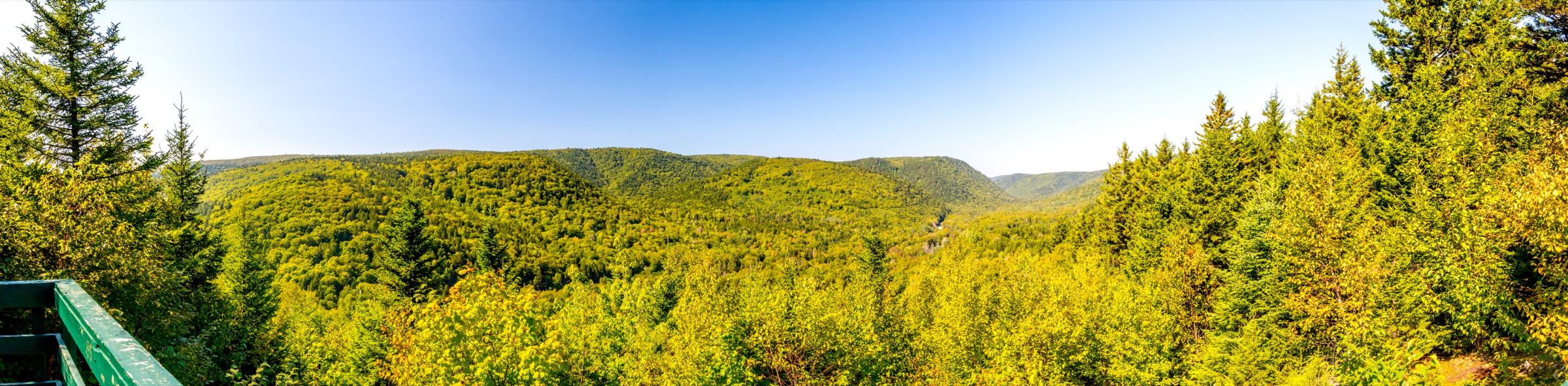
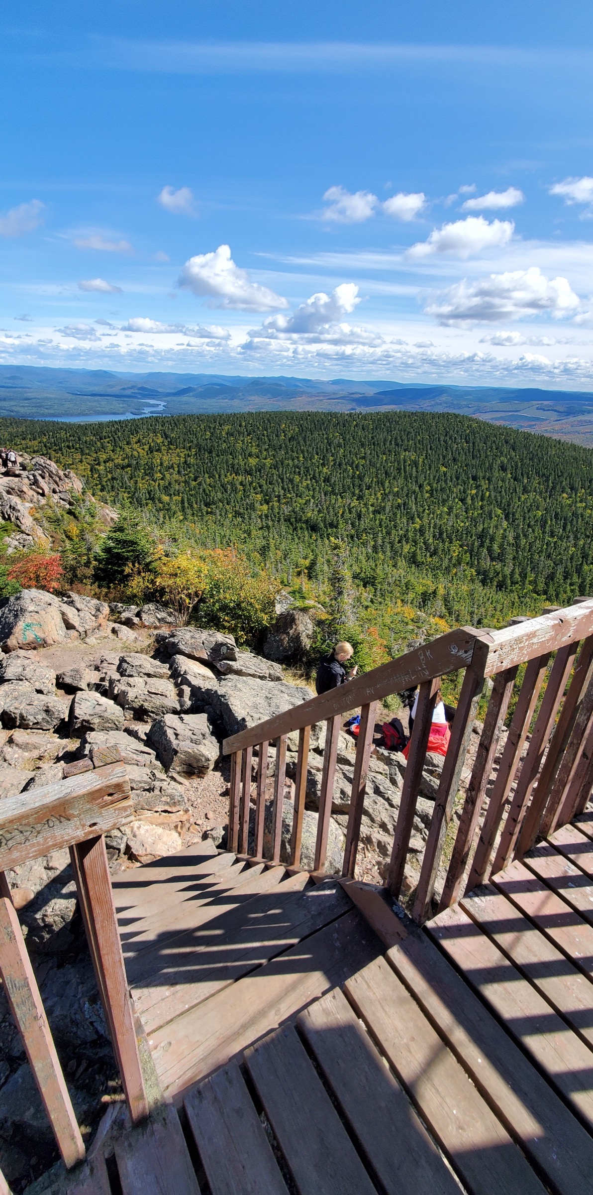
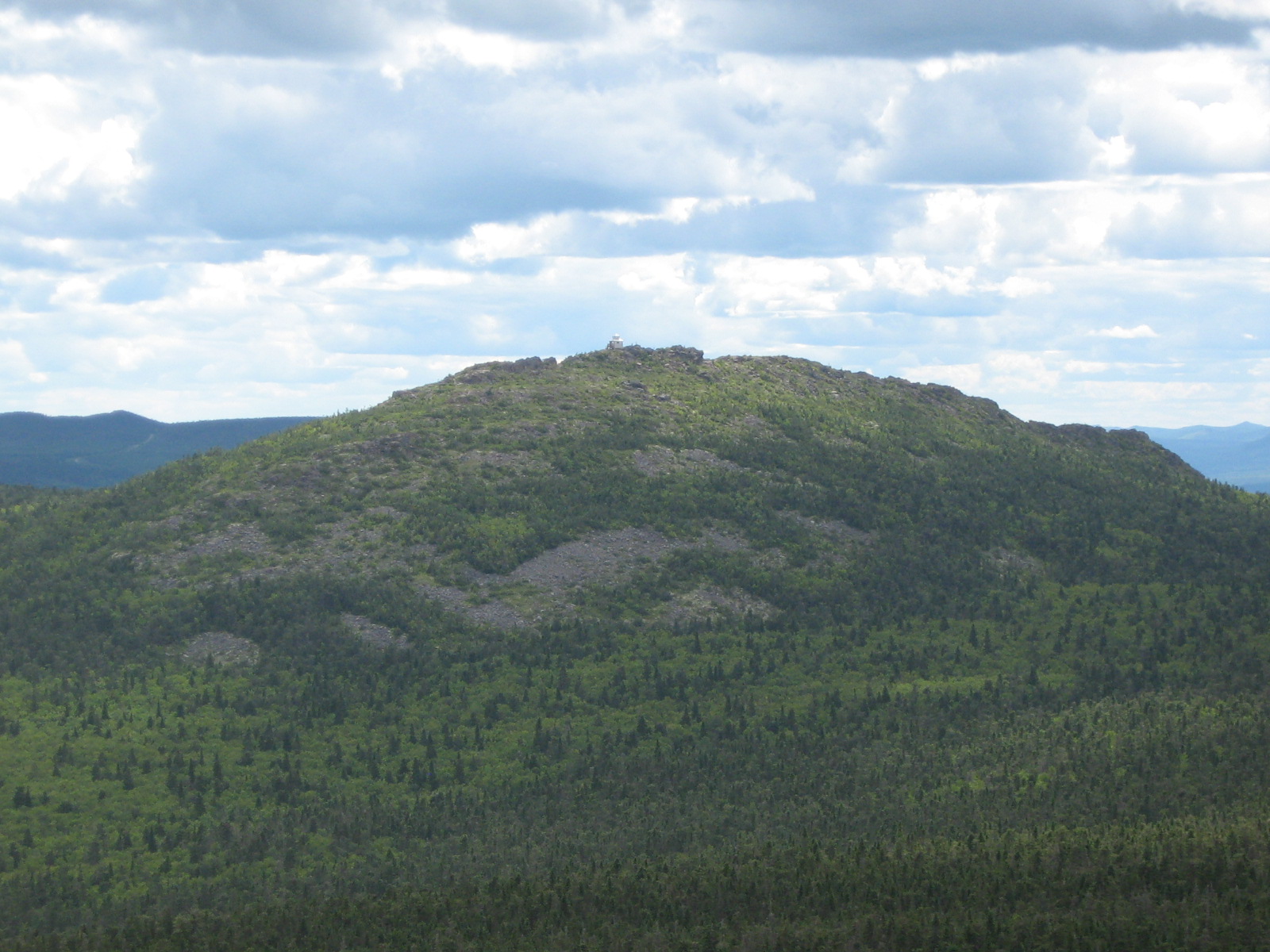
The trail leaves the marked car park at roughly 400 m and climbs steadily through mixed Acadian forest of yellow birch, sugar maple, balsam fir, and white spruce. After roughly 3 km the loop splits at a signed junction; most parties take the more direct south-eastern arm to the summit ridge and return down the longer northern arm. The final 400 m onto the summit cone steepens into rocky steps and exposed bedrock above tree line, with cairns marking the route across a boulder field. The summit plateau holds the abandoned steel fire tower and a 360-degree panorama across the inner highlands — Mount Head and Sagamook to the north-west, the Nepisiguit lakes to the east, and on clear days the silhouette of the Chic-Chocs visible far to the north across the Restigouche valley. Descent follows the broader, gentler loop arm back through hardwood forest to the trailhead.
Why it is essential
Mount Carleton is the high point of the Maritime Provinces and the unambiguous headline objective of the New Brunswick Highlands. The loop combines a representative cross-section of upland Acadian forest, an above-tree-line summit dome with the historic 1930s fire tower, and the long-range view that defines the range. No other day-hike in the Maritimes reaches a higher summit on a marked trail.
Equipment
Standard mountain hiking kit: sturdy boots with ankle support, weatherproof shell, warm layer for the exposed summit, sun protection, plenty of water (no reliable on-route water above 500 m), insect repellent (blackfly pressure peaks late May through June), tick-aware clothing on lower sections, and a printed map or downloaded offline map — mobile coverage is unreliable inside the park.
Hazards and notes
The summit boulder field is exposed to wind and quickly turns greasy when wet; the rock steps below the summit dome become genuinely slippery in rain or after late-lying snow. Black bear and moose are present in the park, and food should not be left in the car park overnight. Tick checks are mandatory after every hike in this region. Park gates close in the evening (20:00 in the shoulder season, 22:00 in high summer) and the loop must be timed to exit before closing.
GPX / route file
| Source | URL |
|---|---|
| AllTrails: Mount Carleton Summit Trail | alltrails.com |
| Trailforks: Mt. Carleton Loop Trail | trailforks.com |
| Hiking NB: Mount Carleton Trail | hikingnb.ca |
External links
- Wikipedia — Mount Carleton
- Wikipedia — Mount Carleton Provincial Park
- NB Parks — Mount Carleton Provincial Park
- PeakVisor — Mount Carleton
2. Mount Sagamook Trail
Snapshot
Itinerary
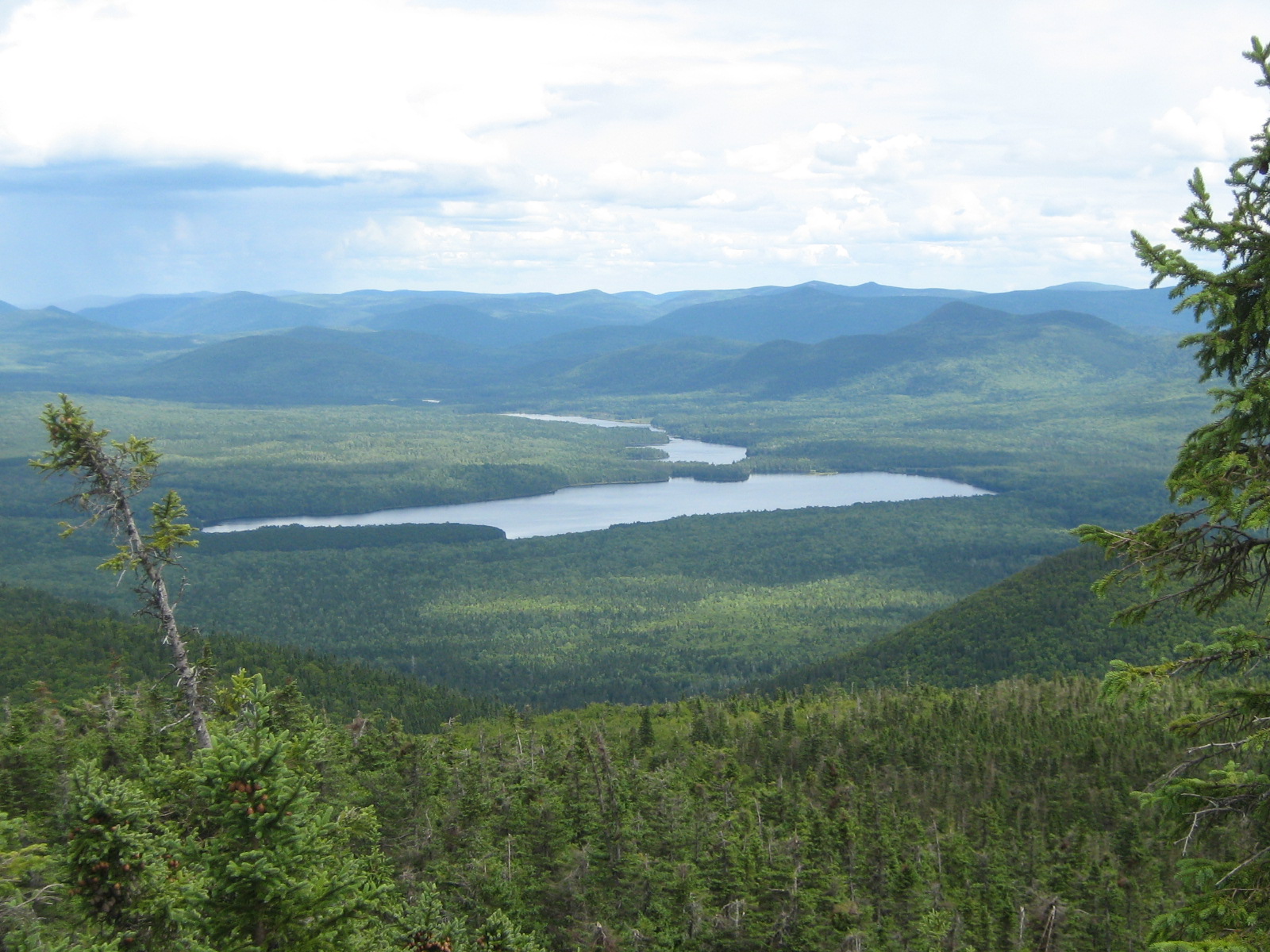
The loop begins at the Sagamook trailhead north of Nictau Lake and the more direct (clockwise) variant climbs the eastern arm hard and fast: roughly 400 m of vertical in 2.3 km, with sustained gradient over roots, slabs, and brief hand-on-rock scrambling. The upper trail breaks above tree line on a rocky shoulder where the iconic viewpoint looks down nearly vertically onto Big Nictau Lake and the heart-shaped island at its centre, with Mount Carleton and Mount Head rising across the inner basin. The summit cairn sits a short distance further on through scrubby spruce. The descent follows the longer (3.5 km) western arm back through forest to close the loop. Most parties prefer this clockwise direction to take the steep ground uphill and save knees on the descent.
Why it is essential
Sagamook gives the single best view in the park — the bird’s-eye drop onto Big Nictau Lake is the image most often used to represent the New Brunswick Highlands. The hike is short by mountain standards but unusually steep for the region, and is widely considered the standout short day-hike in the park.
Equipment
Mountain hiking equipment: sturdy boots, trekking poles strongly recommended for the descent, weatherproof shell, sun protection, plenty of water, insect repellent, tick protection. Avoid trail shoes — the steep rooty steps near the top demand grip and ankle support.
Hazards and notes
The viewpoint slabs above Nictau Lake are unguarded and drop directly into the lake basin; supervise children carefully. The steep east arm is genuinely dangerous when wet or when snow lingers, and the trail should be avoided in icy conditions. Black bear sign is regularly reported on the lower forest; carry bear-aware food storage and make noise on blind corners. Cellular coverage is absent.
GPX / route file
| Source | URL |
|---|---|
| AllTrails: Mount Sagamook Loop | alltrails.com |
| Trailforks: Sagamook Hiking Trail | trailforks.com |
| Hiking NB: Mount Sagamook Trail | hikingnb.ca |
External links
- Off Track Travel — Mount Sagamook Hiking Guide
- PeakVisor — Sagamook Mountain
- NB Parks — Mount Carleton Provincial Park
3. Sagamook–Head–Carleton traverse (Maritime Crown)
Snapshot
Itinerary
The classic counter-clockwise direction starts from the Sagamook trailhead, climbs the steep east arm to the Sagamook viewpoint and summit (777 m), then drops into the high col and follows the inter-summit ridge south-east. The Mount Head Trail crosses the broad open plateau between Sagamook and Carleton; a short signed side trail (1.7 km return) reaches the summit of Mount Head (792 m). From Head, the route descends slightly and climbs onto the open boulder summit of Mount Carleton (820 m) via the upper section of the standard summit loop. Descent follows the main Mount Carleton loop arm back to the Mount Carleton trailhead. From there, the connection back to the Sagamook trailhead is along the park access road; some parties leave a bicycle or pre-arrange a shuttle to avoid the road walk.
Why it is essential
This is the only day-length route that strings together the three highest summits in the Maritime Provinces — the so-called Maritime Crown. It is the regional equivalent of a national-park three-summit traverse and gives a full day’s exposure to the open ridge country that defines the inner park, with the best chance of long-range views to the Quebec Notre-Dame line on the horizon.
Equipment
Full mountain hiking kit: sturdy boots, trekking poles, weatherproof shell, warm insulating layer, hat and gloves outside midsummer, headtorch for the long-day buffer, navigation backup (printed map and offline GPS), substantial food and water (3-4 litres recommended; no reliable on-route water above the lakes), insect repellent, tick protection, and bear-aware food storage. A bicycle stashed at the Mount Carleton trailhead is the standard logistics solution for closing the loop.
Hazards and notes
The full traverse is a long, committing day with exposed summits and limited bailout options between the peaks. Weather can change rapidly above tree line and the open plateau is fully exposed to wind. Snow patches can persist on north aspects of Sagamook and Head into mid-June. Mobile coverage is absent. Start at first light to clear all three summits with sufficient margin to descend before park gates close. Inform park staff of intended route at the gate.
GPX / route file
| Source | URL |
|---|---|
| AllTrails: Mount Sagamook, Mount Head and Mount Carleton via Bald Mountain Brook Trail | alltrails.com |
| Fastest Known Time: La Loop des 4 sommets du Parc Provincial du Mont Carleton | fastestknowntime.com |
| AllTrails: Mount Carleton, Mount Head, Mount Sagamook via Dry Brook Trail | alltrails.com |
External links
- Adventure Report — Mount Sagamook to Mount Carleton bike-and-hike
- Hikers Movement — Hiking Mount Carleton: The Highest Peak in the Maritimes
- NB Parks — Mount Carleton Provincial Park
4. Mount Bailey Trail
Snapshot
Itinerary
The trail leaves the Mount Bailey trailhead near the south end of the park, climbs steadily through mixed forest, and reaches a signed loop junction. The summit spur breaks off the loop and climbs directly to the rocky 564-m crown of Bailey, with a short scrambly final step onto the open summit slabs. The 360-degree view from the top takes in Nictau Lake and the main Carleton–Head–Sagamook block to the north, the wooded southern lobe of the park, and the broad Tobique watershed to the south. The loop is then closed on the gentler western arm back through hardwood forest to the trailhead.
Why it is essential
Mount Bailey is the most accessible summit in the park: lower than the three big peaks, less steep than Sagamook, and reliably clear of snow earlier in the season. It is the right choice for a half-day mountain hike, for parties acclimatising before tackling Carleton or the traverse, and for moose and deer spotting along the lower forest sections. The summit view gives the best overview of the inner highland block from below.
Equipment
Standard hiking shoes or light boots, weatherproof shell, warm layer, sun protection, water, insect repellent, tick protection. Trekking poles useful on the steep summit spur descent.
Hazards and notes
The summit slabs are exposed and slippery when wet. Moose are regularly seen on the lower forest sections, particularly at dawn and dusk; keep distance and do not approach. Tick checks remain essential at all elevations in this region.
GPX / route file
| Source | URL |
|---|---|
| AllTrails: Mount Bailey Summit Trail | alltrails.com |
| Hiking NB: Mount Bailey Trail | hikingnb.ca |
| Fastest Known Time: Mount Bailey Trail | fastestknowntime.com |
External links
- Trail Peak — Mount Bailey, Mount Carleton Provincial Park
- Tourism Chaleur — The Gateway to Mount Carleton
5. Pine Point Trail (Bathurst Lake)
Snapshot
Itinerary
The trail starts from a small loop car park near the Armstrong Brook campground road, follows a dirt track to a former boat launch on Bathurst Lake, and splits into the main loop. The left-hand arm climbs a low hill into a distinctive stand of red pine that regenerated after the 1933 forest fire, then drops into a small ravine and traverses a mixed-forest ridge before descending to the lake shore. The return arm follows the shoreline of Bathurst Lake around the namesake point, with informal viewpoints across the water towards the inner park and the Nepisiguit headwaters. The walk closes through a pure red pine grove back to the car park.
Why it is essential
Pine Point is the representative lower-elevation walk of the park: short enough for any visitor, dry and reliable underfoot, and showing the fire-regenerated red pine ecology that is otherwise easy to miss on the high summit routes. It is also the natural pairing with a paddle on Bathurst Lake or a stay at Armstrong Brook campground, and serves as a soft introduction to the Nepisiguit Mi’gmaq Trail, whose western terminus lies just along the lake shore.
Equipment
Standard hiking equipment: trail shoes, sun protection, water, insect repellent, tick protection. No mountain gear needed.
Hazards and notes
The lake-shore section can be muddy after rain. Bears use the lake-edge corridor; make noise on blind sections and respect any temporary closures from the park office. The walk pairs well with a sunset stop on the Bathurst Lake shore for the dark-sky preserve; bring a head-torch and warm layer for the walk back to the campground.
GPX / route file
| Source | URL |
|---|---|
| AllTrails: Pine Point Loop | alltrails.com |
| Hiking NB: Pine Point Trail | hikingnb.ca |
External links
- Wikipedia — Nepisiguit Mi’gmaq Trail
- Tourism Chaleur — Complete Guide to the Nepisiguit Mi’gmaq Trail
- NB Parks — Mount Carleton Provincial Park
External links
| Source | URL |
|---|---|
| NB Parks — Mount Carleton Provincial Park | parcsnbparks.ca |
| Wikipedia — Mount Carleton | en.wikipedia.org |
| Wikipedia — Mount Carleton Provincial Park | en.wikipedia.org |
| Wikipedia — Nepisiguit Mi’gmaq Trail | en.wikipedia.org |
| Hiking NB — Mount Carleton Park trail index | hikingnb.ca |
| Hiking NB — Mount Carleton Trail | hikingnb.ca |
| Hiking NB — Mount Sagamook Trail | hikingnb.ca |
| Hiking NB — Mount Bailey Trail | hikingnb.ca |
| Hiking NB — Pine Point Trail | hikingnb.ca |
| Hiking NB — Williams Falls Trail | hikingnb.ca |
| Hiking NB — Nepisiguit Mi’gmaq Trail | hikingnb.ca |
| AllTrails — Mount Carleton Summit Trail | alltrails.com |
| AllTrails — Mount Sagamook Loop | alltrails.com |
| AllTrails — Mount Bailey Summit Trail | alltrails.com |
| AllTrails — Pine Point Loop | alltrails.com |
| AllTrails — Sagamook, Head and Carleton via Bald Mountain Brook | alltrails.com |
| AllTrails — Mount Carleton Provincial Park trails index | alltrails.com |
| Trailforks — Mt. Carleton Provincial Park | trailforks.com |
| Trailforks — Mt. Carleton Loop Trail | trailforks.com |
| Fastest Known Time — Maritime Crown four-summits loop | fastestknowntime.com |
| Trans Canada Trail — Sentier Nepisiguit Mi’gmaq Trail | tctrail.ca |
| Tourism Chaleur — The Gateway to Mount Carleton | tourismchaleur.ca |
| Tourism Chaleur — Complete Guide to the Nepisiguit Mi’gmaq Trail | tourismchaleur.ca |
| Off Track Travel — Mount Sagamook Hiking Guide | offtracktravel.ca |
| PeakVisor — Mount Carleton | peakvisor.com |
| PeakVisor — Mount Carleton Provincial Park | peakvisor.com |
| RASC — Mount Carleton Dark-Sky Preserve | rasc.ca |
| Wikimedia Commons — Mount Carleton Provincial Park category | commons.wikimedia.org |
| Wikimedia Commons — Mount Carleton category | commons.wikimedia.org |