Regional overview
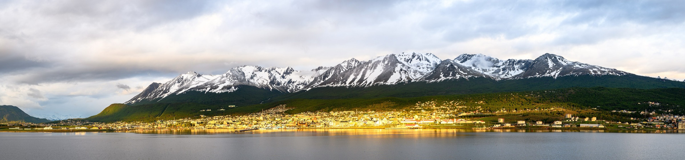
Ushuaia sits between the Beagle Channel and the southern Fuegian Andes, with short but serious mountain terrain rising directly from the city edge. The Martial Mountains and neighbouring valleys offer glacier remnants, peat bogs, lenga forest, alpine lakes and high viewpoints without the long road approach required for many Patagonian ranges. The walking character is compact, wet and weather-sensitive: distances can look modest, but mud, steep forest, rock, snow patches and fast-changing conditions often define the day.
The main hiking zones are the Glaciar Martial protected area above town, the Tierra Mayor and Carbajal valleys along Route 3, and the Andorra / Oveja backcountry north-west of Ushuaia. These are not all inside one protected area, so access rules vary. Some paths start from public roads, others from municipal or private access points, and several demanding routes require mandatory registration or strong local condition checks.
The practical hiking season is spring to autumn, with December-March offering the most reliable long-day conditions. Winter and shoulder seasons can still be attractive, but snow, ice, frozen bogs, short daylight and avalanche/icefall hazard change the character of routes such as Martial, Vinciguerra and Laguna del Caminante. The weather can shift from calm to sleet and gale in minutes.
Selection rationale
The five routes cover the essential non-national-park Ushuaia mountain experiences: the city glacier viewpoint at Martial, the emblematic turquoise lake of Laguna Esmeralda, the steeper facing-lake viewpoint of Laguna Turquesa, the more serious glacier-and-lake route to Vinciguerra / Laguna de los Tempanos, and the long backcountry traverse to Laguna del Caminante. More technical objectives such as Ojo del Albino, high summits and ridge scrambles are excluded because they commonly require scrambling, glacier judgement, guide support or conditions beyond normal day hiking.
Summary table
| # | Hike | Country | Route type | Distance | Gain | Max elevation | Difficulty |
|---|---|---|---|---|---|---|---|
| 1 | Glaciar Martial / Circuito de las Nubes | Argentina | Out-and-back / managed trail variant | 6.2-6.4 km | 513-520 m | About 850 m at Mirador de los Condores | Hard |
| 2 | Laguna Esmeralda | Argentina | Out-and-back | 9.0 km | 220 m official | Moderate | |
| 3 | Laguna Turquesa | Argentina | Out-and-back | 4.0 km official; AllTrails variants may be longer | 330 m official | Moderate | |
| 4 | Glaciar Vinciguerra / Laguna de los Tempanos | Argentina | Out-and-back | 14.0 km official | 660 m on AllTrails | About 725 m at Laguna de los Tempanos (secondary sources) | Hard |
| 5 | Laguna del Caminante via Andorra / Cañadón de la Oveja | Argentina | Long loop / traverse | 24.4-25.0 km | 500 m APN; 800 m Ushuaia tourism | Hard |
1. Glaciar Martial / Circuito de las Nubes
Snapshot
Itinerary
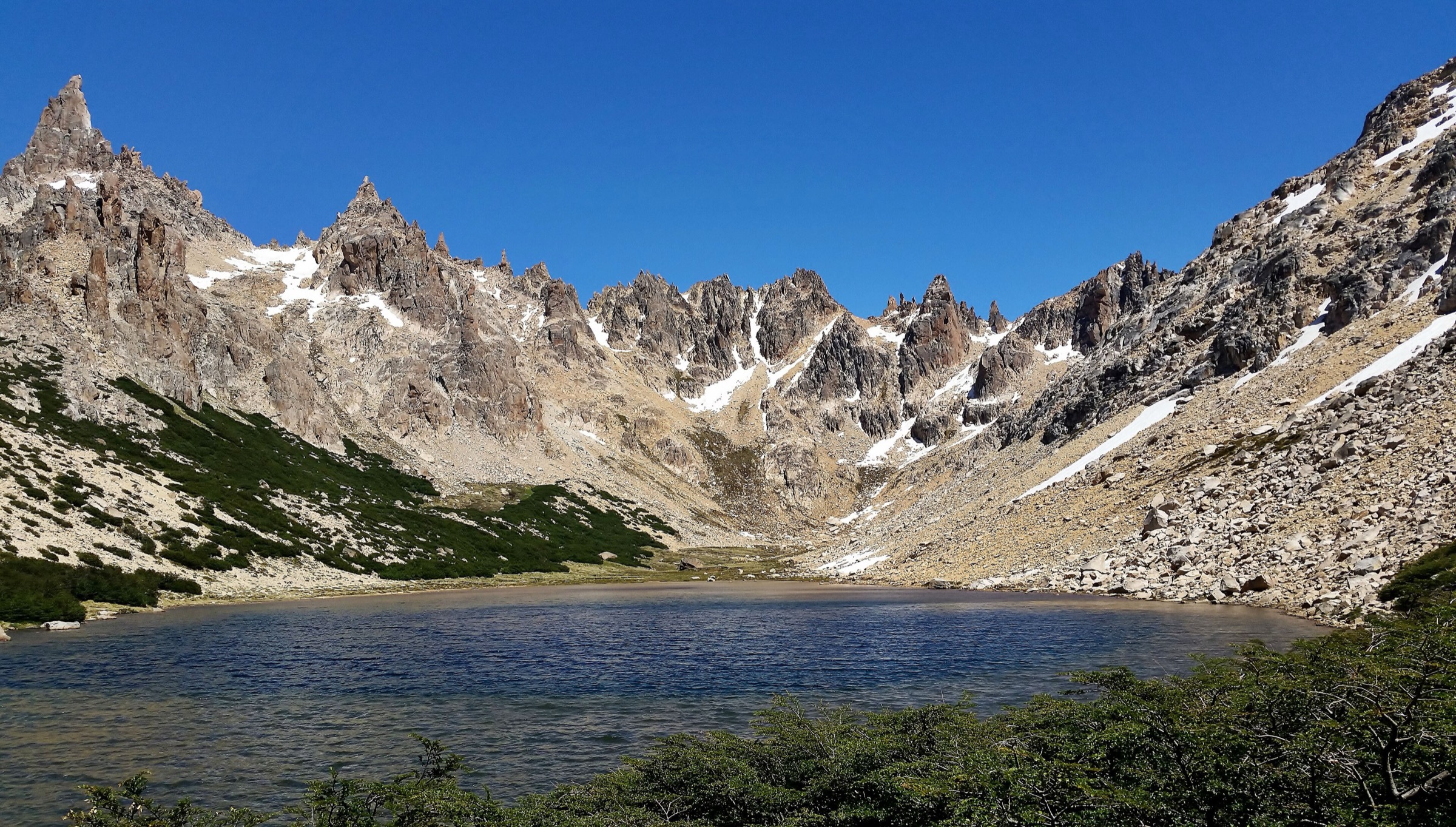
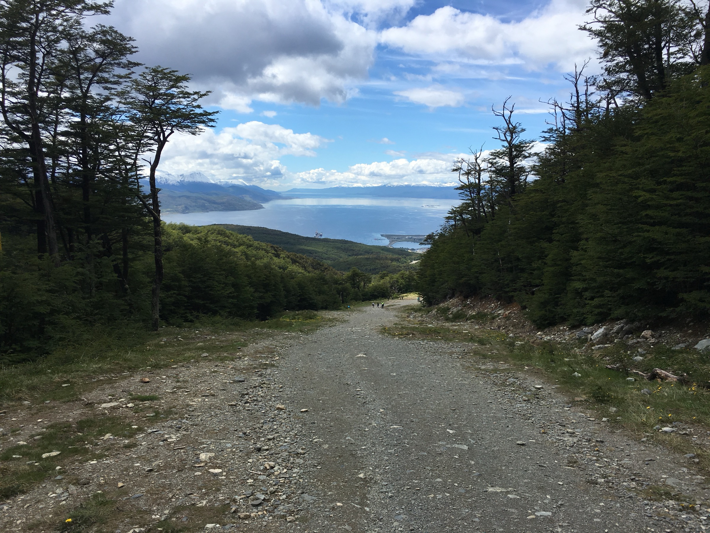
The route starts from the Cerro Martial / Refugio Base area above Ushuaia. Lower official circuits pass through Nothofagus forest beside Arroyo Buena Esperanza and climb toward glacier viewpoints. The Circuito de las Nubes continues on the Martial trail and then uses the frontal moraine route to reach the Mirador de los Condores at about 850 m, close to the remnant Glaciar Martial.
Official Ushuaia tourism information lists the Circuito de las Nubes as 6.2 km with 520 m of ascent and about 150 minutes walking time from Refugio Base. AllTrails records the broader Glaciar Martial route as 6.4 km out-and-back with 513 m of ascent. The disabled Circuito de los Vientos is not included because the official page marks it as not enabled.
Why it is essential
Glaciar Martial is Ushuaia’s signature mountain walk. It is close to the city, gives direct views over the Beagle Channel and shows the remnant-glacier landscape that defines the Martial Mountains above town.
Equipment
- Hiking shoes or boots
- Waterproof/windproof shell and warm layer
- Gloves and hat
- Water and snacks
- Sun protection
- Offline map/GPS
- Trekking poles
- Microspikes for snow or icy shoulder-season conditions
Hazards and notes
- Upper moraine terrain can be rocky, slippery and exposed to wind.
- Snow and ice can make the route substantially more serious.
- Stay on enabled official circuits; the Circuito de los Vientos is marked not enabled by Ushuaia tourism.
- Dogs are discouraged/prohibited in the official protected-area recommendations; follow current local rules.
GPX / KML links
| Source | URL | Format / access | Reuse status |
|---|---|---|---|
| AllTrails: Glaciar Martial | alltrails.com | Source map / route via AllTrails account | AllTrails terms apply; direct GPX not retrieved |
| Ushuaia tourism: Glaciar Martial | turismoushuaia.com | Official route / access page | Route-file terms not stated |
| OpenStreetMap: Glaciar Martial search | openstreetmap.org | Map / search | OSM data is ODbL |
External links
- Ushuaia tourism — Glaciar Martial
- Ushuaia tourism — Senda Glaciar Martial
- AllTrails — Glaciar Martial
2. Laguna Esmeralda
Snapshot
Itinerary
The trail starts beside Route 3, where a large parking area marks the entrance about 18 km from Ushuaia. It crosses lenga forest, peat bog and wetter valley ground before climbing gently toward Laguna Esmeralda, a glacial lake below the surrounding Fuegian peaks. The official Ushuaia tourism page gives 9 km return, 220 m of ascent and 4-5 hours return.
The path is one of the most visited day hikes near Ushuaia and is generally straightforward in summer, but wet bogs and churned mud are common. In winter, the same route can become a snow walk requiring very different footwear and navigation judgement.
Why it is essential
Laguna Esmeralda is the emblematic easy-to-moderate lake hike outside Ushuaia. It represents the Tierra Mayor valley landscape: forest, peat bog, glacial water and the compact mountains east of the Martial/Vinciguerra backcountry.
Equipment
- Hiking shoes or boots that tolerate mud
- Waterproof/windproof layer and warm layer
- Water and food
- Sun protection
- Offline map/GPS
- Gaiters for wet conditions
- Insulated boots, poles and traction in winter
Hazards and notes
- Mud, bog crossings, ice, snow and sudden weather changes are the main hazards.
- Stay on the established path to reduce peatland damage.
- The official tourism page recommends using a specialised agency for greater safety, especially for inexperienced walkers or winter conditions.
GPX / KML links
| Source | URL | Format / access | Reuse status |
|---|---|---|---|
| Ushuaia tourism: Laguna Esmeralda | turismoushuaia.com | Official route page | Route-file terms not stated |
| AllTrails: Laguna Esmeralda search | alltrails.com | Source-map candidates | AllTrails terms apply |
| OpenStreetMap: Laguna Esmeralda search | openstreetmap.org | Map / search | OSM data is ODbL |
External links
3. Laguna Turquesa
Snapshot
Itinerary
The trail starts from Route 3 on the opposite side of the Tierra Mayor valley from Laguna Esmeralda. The official Ushuaia page describes a clearly delimited route with no major junctions, climbing steeply through forest before emerging above the tree line. From the upper slopes, the view opens across the valley toward Laguna Esmeralda and the surrounding mountains.
The lake sits above the forest in a short alpine basin. The official route statistics are 4 km return, 330 m of ascent and about 3 hours return. AllTrails and user routes may include extra exploration around or above the lake, which explains longer variants found in secondary sources.
Why it is essential
Laguna Turquesa is the steep counterpart to Laguna Esmeralda. It gives a higher, more compressed mountain experience from the same access corridor and a useful viewpoint back across the Tierra Mayor valley.
Equipment
- Hiking boots or shoes with good grip
- Waterproof/windproof shell and warm layer
- Gloves and hat in cool weather
- Water and food
- Sun protection
- Offline map/GPS
- Trekking poles for the descent
Hazards and notes
- The climb is short but consistently steep.
- Mud, wet roots, snow and ice can make footing poor.
- The lake is exposed above the forest and wind can be strong.
- Stay on the clear tread to limit erosion.
GPX / KML links
| Source | URL | Format / access | Reuse status |
|---|---|---|---|
| Ushuaia tourism: Laguna Turquesa | turismoushuaia.com | Official route page | Route-file terms not stated |
| AllTrails: Sendero Laguna Turquesa | alltrails.com | Source map / route via AllTrails account | AllTrails terms apply; direct GPX not retrieved |
| OpenStreetMap: Laguna Turquesa search | openstreetmap.org | Map / search | OSM data is ODbL |
External links
4. Glaciar Vinciguerra / Laguna de los Témpanos
Snapshot
Itinerary
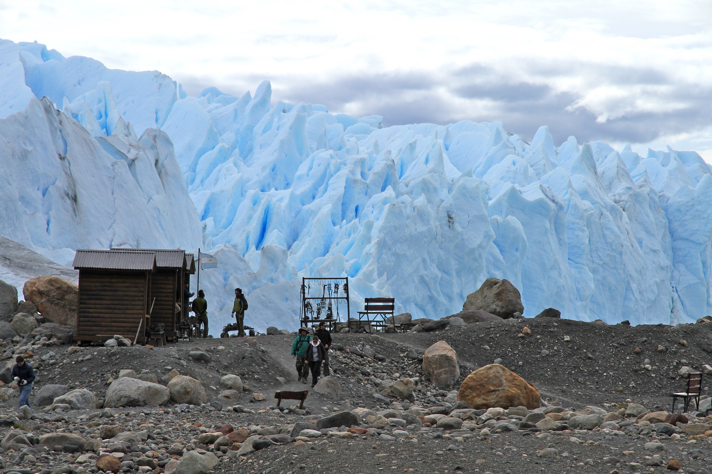
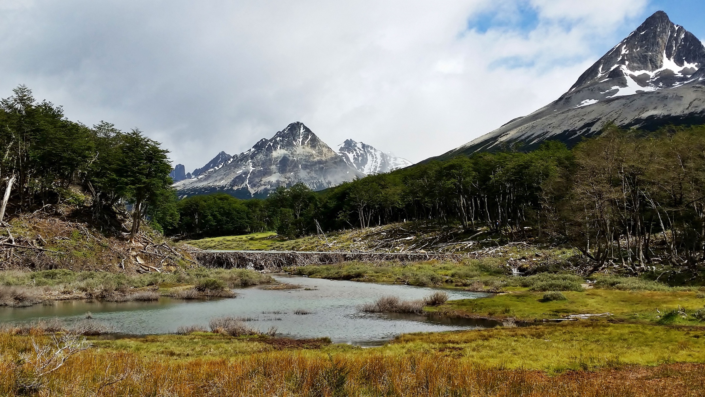
The route starts in the Valle de Andorra north of Ushuaia. It crosses peatland and wet valley ground before entering lenga forest and climbing steadily beside the drainage toward the upper basin. The final section reaches Laguna de los Témpanos, a glacial lake below Glaciar Vinciguerra, where ice, moraine and steep slopes form a more serious mountain environment than the lower valley suggests.
Ushuaia tourism lists the route as 14 km return. AllTrails records the Vinciguerra Glacier — Laguna de los Témpanos trail as a hard route with 660 m of elevation gain and a 4.5-5 hour moving estimate, though real walking times often extend with mud, weather and rest time. The glacier and associated peatlands are scientifically important; sources describe the area as part of the southernmost Ramsar wetland complex.
Why it is essential
Vinciguerra is the key serious glacier day hike near Ushuaia. It is longer, wilder and more alpine than Martial or Esmeralda, reaching a glacial lake basin that shows the rapid transition from city-edge forest to Fuegian mountain ice.
Equipment
- Waterproof boots
- Trekking poles
- Waterproof/windproof shell, warm layers, gloves and hat
- Food and water
- Headtorch
- Offline map/GPS and navigation backup
- Microspikes for snow or ice
Hazards and notes
- The route has serious hazards: saturated peat, mud, steep forest, rock, snow, ice, rapidly worsening weather and potentially unstable glacier margins or ice caves.
- Do not enter ice caves or climb onto glacier ice without appropriate guide support and conditions.
- A June 2026 news report described a fatal incident during adverse conditions on the Vinciguerra route; current status should be confirmed with local authorities and guides before publication or travel.
GPX / KML links
| Source | URL | Format / access | Reuse status |
|---|---|---|---|
| Ushuaia tourism: Glaciar Vinciguerra / Laguna Témpanos | turismoushuaia.com | Official route page | Route-file terms not stated |
| AllTrails: Sendero Glaciar Vinciguerra y Laguna de los Témpanos | alltrails.com | Source map / route via AllTrails account | AllTrails terms apply; direct GPX not retrieved |
| OpenStreetMap: Glaciar Vinciguerra search | openstreetmap.org | Map / search | OSM data is ODbL |
External links
- Ushuaia tourism — Glaciar Vinciguerra / Laguna de los Témpanos
- AllTrails — Glaciar Vinciguerra y Laguna de los Témpanos
- Wikipedia — Glaciar Vinciguerra y turberas asociadas
- AS — June 2026 Vinciguerra accident report
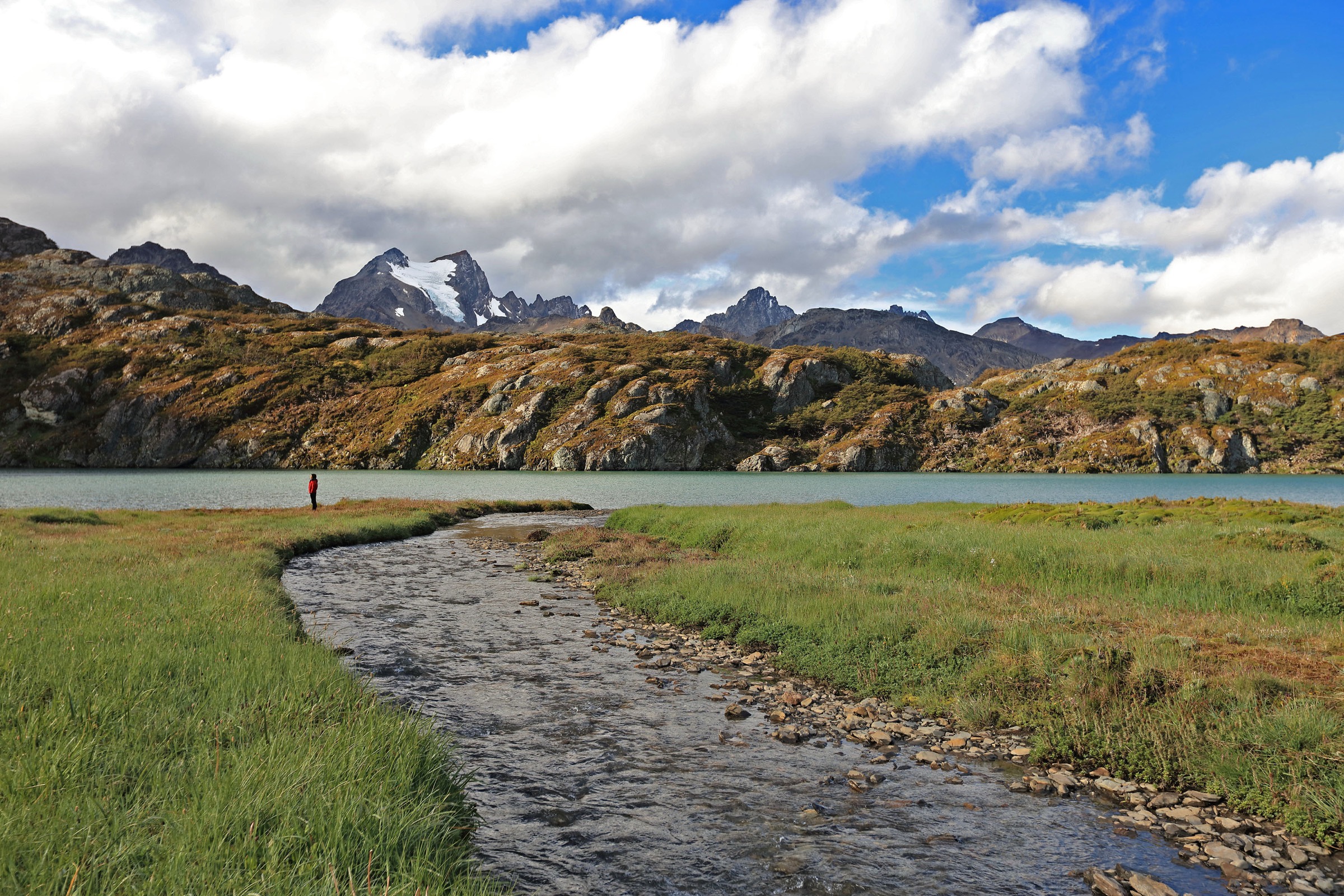
5. Laguna del Caminante via Andorra / Cañadón de la Oveja
Snapshot
Itinerary
Laguna del Caminante is reached from either the Andorra valley or the Cañadón de la Oveja side of Ushuaia. The route crosses forest, peat bog and higher mountain terrain before reaching the lagoon. Argentina National Parks lists the route at 24.4 km, 9 hours and 500 m total elevation gain, with start coordinates for both Andorra and Oveja access points. Ushuaia tourism lists 25 km for the full loop, 800 m of ascent and states that the full circuit is normally a two-day outing, with about 5 hours one way to the lagoon.
For catalogue purposes, this is a long, fit-walker day hike only in favourable summer conditions and with early start, registration and local condition confirmation. The official two-day recommendation should be retained in public-facing safety text.
Why it is essential
Laguna del Caminante is the most important long non-technical Ushuaia backcountry route. It extends the catalogue beyond short road-access lakes and reaches the wilder forest, peatland and alpine terrain between the Martial/Vinciguerra mountains and the Tierra del Fuego National Park boundary.
Equipment
- Waterproof boots
- Trekking poles
- Waterproof/windproof shell, warm layers, gloves and hat
- Food, water treatment or sufficient water
- Headtorch
- Offline map/GPS and navigation backup
- Emergency insulation
- Overnight equipment for the official two-day full-loop plan
Hazards and notes
- Mandatory registration is required according to Ushuaia tourism.
- APN states the route is open December-March and has avalanche risk while snow remains on the summits, requiring daily verification with provincial Civil Protection.
- Expect bogs, mud, wet feet, fading light, complex exits and no quick services.
- No fires are allowed at the lagoon camp.
GPX / KML links
| Source | URL | Format / access | Reuse status |
|---|---|---|---|
| Argentina National Parks: Senderos del Parque Nacional Tierra del Fuego | argentina.gob.ar | Official route page | Route-file terms not stated |
| Ushuaia tourism: Laguna del Caminante | turismoushuaia.com | Official municipal tourism page | Route-file terms not stated |
| OpenStreetMap: Laguna del Caminante search | openstreetmap.org | Map / search | OSM data is ODbL |
External links
Missing data and follow-up
- No official GPX/KML downloads were found for these routes in this pass.
- Laguna Esmeralda, Laguna Turquesa and Laguna del Caminante maximum elevations need a route-geometry cross-check before publication.
- Laguna del Caminante has conflicting elevation-gain figures: 500 m from APN and 800 m from Ushuaia tourism.
- Vinciguerra current safety status should be checked locally, especially after June 2026 accident reporting and during snow/ice conditions.
- No licence-compatible Wikimedia Commons images were located for Laguna Turquesa or Glaciar Vinciguerra in this pass.
- Local transfer/taxi/shuttle timetables from Ushuaia were not verified.
External links
| Source | URL |
|---|---|
| Ushuaia tourism — Glaciar Martial | turismoushuaia.com |
| Ushuaia tourism — Senda Glaciar Martial | turismoushuaia.com |
| Ushuaia tourism — Laguna Esmeralda | turismoushuaia.com |
| Ushuaia tourism — Laguna Turquesa | turismoushuaia.com |
| Ushuaia tourism — Glaciar Vinciguerra / Laguna de los Témpanos | turismoushuaia.com |
| Ushuaia tourism — Laguna del Caminante | turismoushuaia.com |
| Argentina National Parks — Tierra del Fuego trails | argentina.gob.ar |
| AllTrails — Glaciar Martial | alltrails.com |
| AllTrails — Sendero Laguna Turquesa | alltrails.com |
| AllTrails — Glaciar Vinciguerra y Laguna de los Témpanos | alltrails.com |
| Wikipedia — Glaciar Vinciguerra y turberas asociadas | es.wikipedia.org |
| AS — June 2026 Vinciguerra accident report | as.com |