Regional overview
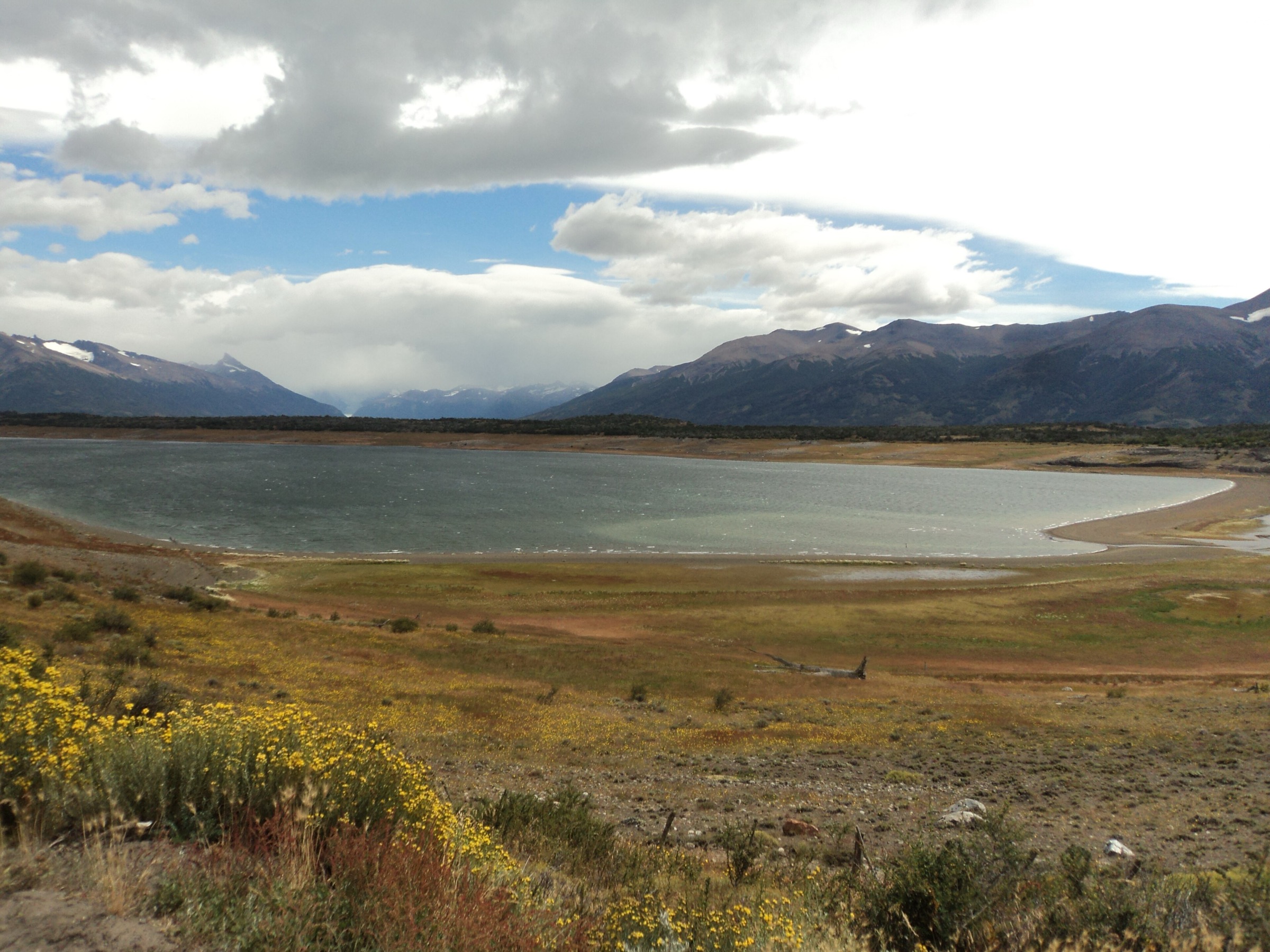
El Calafate is the southern access base for Parque Nacional Los Glaciares and the main settlement for visits to Lago Argentino, Glaciar Perito Moreno, Lago Roca, Glaciar Upsala and the steppe-and-lake landscapes south of the Southern Patagonian Icefield. The walking character is different from El Chaltén: fewer classic town-to-mountain trails, more vehicle or boat access, managed glacier viewpoints, open Patagonian steppe, bird reserves and tour-dependent routes to remote glacier basins.
The core walking zones are the Perito Moreno Glacier walkways on Península de Magallanes, the Lago Roca / Cerro Cristal sector, boat-access routes around Estancia Cristina and Upsala Glacier, the dry ridges and badlands above El Calafate, and the Laguna Nimez wetland near town. The region is exposed to strong wind, intense sun, cold rain and rapid temperature changes. Some routes are physically simple but logistically controlled by park entry, boat schedules, private land, road conditions or guided tour operations.
The main visitor season is spring to autumn, with summer offering the widest range of tours and road access. Winter can still allow some lowland visits, but snow, ice, short daylight and reduced services affect practical day-hiking choices.
Selection rationale
The selection balances the essential glacier-viewing infrastructure at Perito Moreno with one strenuous official-area mountain viewpoint at Cerro de los Cristales, the remote boat-access Upsala / Cañadón de Fósiles hike at Estancia Cristina, a steppe-ridge walk above El Calafate at Cerro Huyliche, and Laguna Nimez as the essential lowland wetland circuit. Glacier ice treks are excluded because they require operator equipment and are not ordinary day hikes; they are noted only as separate guided activities.
Summary table
| # | Hike | Country | Route type | Distance | Gain | Max elevation | Difficulty |
|---|---|---|---|---|---|---|---|
| 1 | Perito Moreno Glacier Walkways | Argentina | Managed walkway network / out-and-back variants | 4.7 km | 223 m | 298 m | Moderate |
| 2 | Cerro de los Cristales / Cerro Cristal from Lago Roca | Argentina | Out-and-back | 10.1 km | 1,045 m | 1,268 m | Hard |
| 3 | Estancia Cristina — Cañadón de Fósiles — Mirador Glaciar Upsala | Argentina | Loop / guided day route | 22.2 km | 1,028 m | 564 m | Hard |
| 4 | Cerro Huyliche / Balcones de El Calafate | Argentina | Out-and-back | 13.7 km | 761 m | 1,101 m | Hard |
| 5 | Reserva Laguna Nimez circuit | Argentina | Interpretive loop / wetland circuit | Approx. 2.5-3.0 km | Low | Low | Easy |
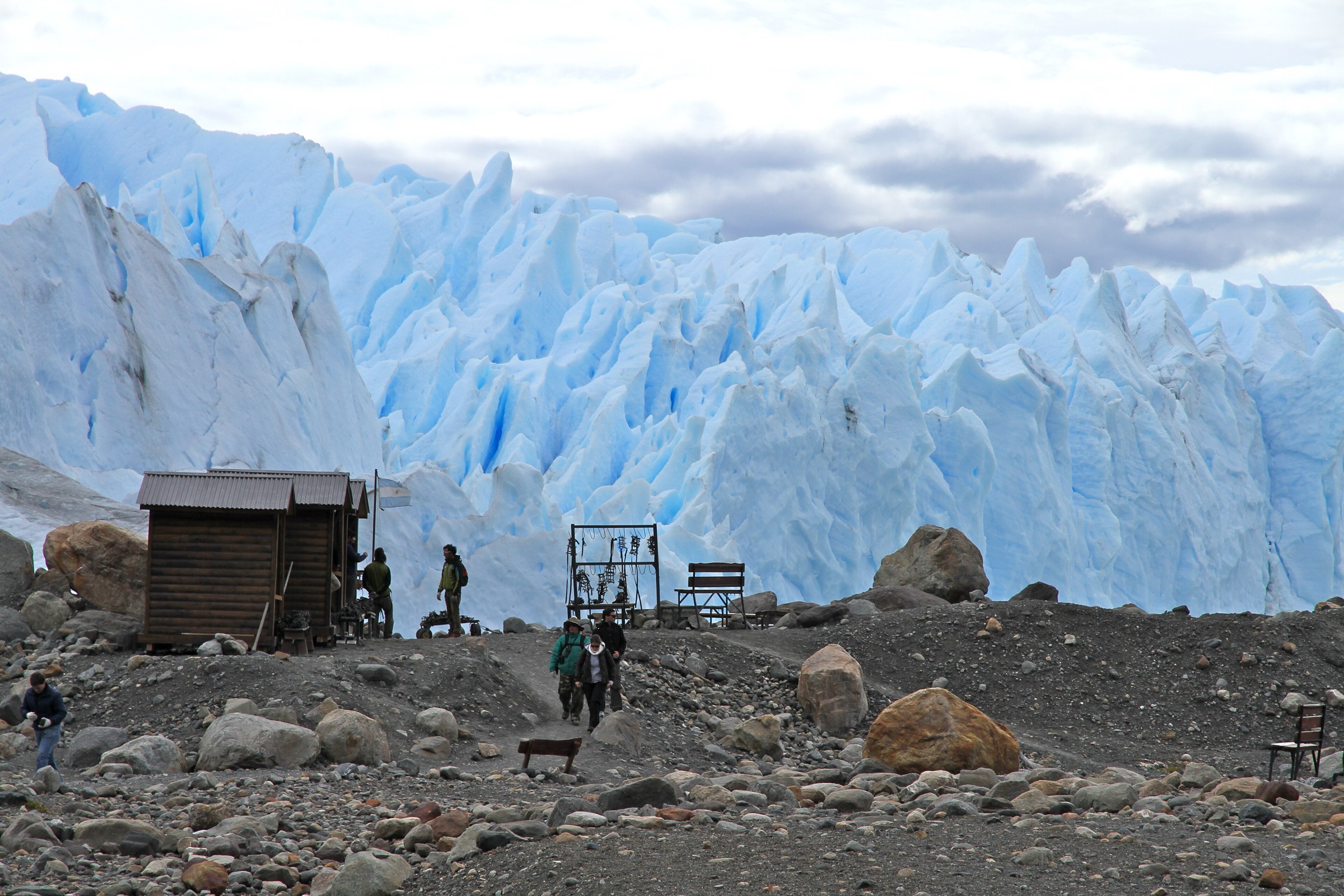
1. Perito Moreno Glacier Walkways
Snapshot
Itinerary
The walk starts in the Perito Moreno visitor area and uses the signed metal walkway and balcony system facing the glacier front. Multiple colour-coded branches allow short or longer combinations, with views over the Canal de los Témpanos, Lago Argentino and the glacier terminus. AllTrails records a 4.7 km route with 223 m of ascent, but the practical distance depends on which balconies and side branches are included.
The official national-park activity page describes the Perito Moreno glacier area as reached from El Calafate by RP 11 and managed through the Río Mitre / Península de Magallanes access sector. The walkway floor is metal grating and stairs, so footing and step tolerance matter even though the route is not a wild mountain trail.
Why it is essential
This is the essential El Calafate walk and the most accessible legal way to experience the Perito Moreno Glacier without stepping onto ice. It represents the glacier-viewing identity of southern Los Glaciares better than any other short route.
Equipment
- Comfortable walking or light hiking shoes
- Windproof/waterproof jacket and a warm layer
- Gloves and hat in cool weather
- Sunglasses and sunscreen
- Water and camera protection from wind-driven rain
Hazards and notes
- Metal stairs and grating can be slippery in rain, frost or snow.
- Stay behind barriers because calving ice and waves are hazardous below the viewpoint system.
- Park entry fees apply.
- Boat trips and ice treks are separate activities and not part of this day-hike entry.
GPX / KML links
| Source | URL | Format / access | Reuse status |
|---|---|---|---|
| AllTrails: Sendero Glaciar Perito Moreno | alltrails.com | Source map / downloadable route via AllTrails account | AllTrails terms apply; direct GPX not retrieved |
| Argentina National Parks: Los Glaciares activities | argentina.gob.ar | Official activity/access page | Government website; route-file reuse terms not stated |
External links
- AllTrails — Sendero Glaciar Perito Moreno
- Argentina National Parks — Los Glaciares activities
- El Calafate tourism — Los Glaciares National Park
2. Cerro de los Cristales / Cerro Cristal from Lago Roca
Snapshot
Itinerary
The hike starts from the Lago Roca / RP15 side of Los Glaciares and climbs steeply from the lake-and-steppe zone toward Cerro de los Cristales, also commonly called Cerro Cristal. The route gains more than 1,000 m in about 5 km, reaching a high viewpoint over Lago Roca, the southern part of Lago Argentino, Glaciar Perito Moreno and, in clear weather, the wider Patagonian and Chilean border ranges.
AllTrails records 10.1 km out-and-back, 1,045 m of ascent and a maximum elevation of 1,268 m. This is a physically demanding mountain day compared with the managed Perito Moreno walkways and should be treated as a steep summit-view route rather than a casual viewpoint stroll.
Why it is essential
Cerro de los Cristales is the key strenuous day hike in the El Calafate / Lago Roca side of Los Glaciares. It gives a high land-based panorama of the glacier-and-lake system rather than the close frontal view from Perito Moreno.
Equipment
- Mountain hiking boots or shoes
- Trekking poles
- Waterproof/windproof shell and warm layers
- Sun protection, gloves and hat
- 2 litres or more of water, plus food
- Offline map/GPS and headtorch
Hazards and notes
- The route is steep, exposed to wind and sun, and may have loose or muddy sections.
- Snow or ice can make the upper slope much more serious.
- Water availability was not verified; carry enough from the start.
- Confirm whether park entry, campsite access or local permissions are required before walking.
GPX / KML links
| Source | URL | Format / access | Reuse status |
|---|---|---|---|
| AllTrails: Cerro de los Cristales | alltrails.com | Source map / downloadable route via AllTrails account | AllTrails terms apply; direct GPX not retrieved |
| OpenStreetMap search: Cerro Cristal Lago Roca | openstreetmap.org | Map geometry cross-check | OSM data is ODbL |
External links
- AllTrails — Cerro de los Cristales
- Argentina National Parks — Los Glaciares activities
- El Calafate tourism — Los Glaciares National Park
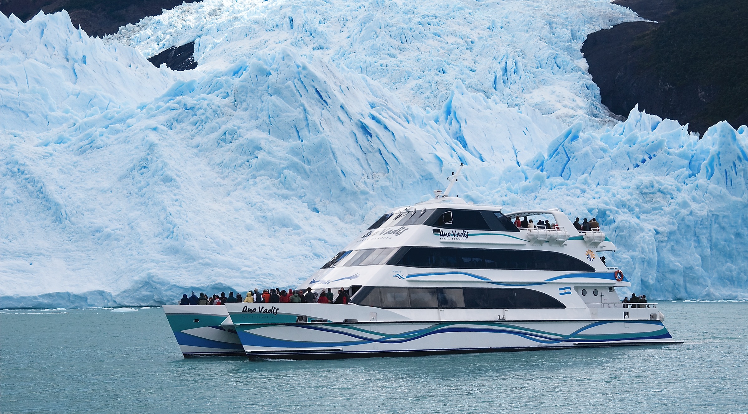
3. Estancia Cristina — Cañadón de Fósiles — Mirador Glaciar Upsala
Snapshot
Itinerary
This remote day route starts at Estancia Cristina after a navigation on Lago Argentino. The hiking circuit crosses glacially shaped terrain and the Cañadón de Fósiles area, then reaches viewpoints toward Glaciar Upsala and the icefield-fed landscape of the western lake basin. AllTrails records a 22.2 km loop with 1,028 m of ascent and a maximum elevation of 564 m.
In practice, the route depends on boat access, local estate/tour logistics and current operator permissions. It should be catalogued as a day hike only where the provider itinerary legally allows the full walk and same-day return.
Why it is essential
This is the strongest El Calafate-region walking route for the Upsala Glacier side of Los Glaciares. It adds remoteness, fossils, wide glacial geology and boat-access scenery that the Perito Moreno walkway sector cannot provide.
Equipment
- Full mountain day kit: hiking boots, waterproof/windproof shell, warm layers
- Gloves, hat and sun protection
- Water, food and trekking poles
- Offline map/GPS and headtorch
- Spare insulation, because boat delays and wind exposure can extend the day
Hazards and notes
- Boat access, wind and weather are major controls.
- The route is long, exposed and partly remote from quick road evacuation.
- Stay with the legal guided itinerary where required.
- Do not attempt unofficial shortcuts across private land or closed park areas.
GPX / KML links
| Source | URL | Format / access | Reuse status |
|---|---|---|---|
| AllTrails: Mirador Glaciar Upsala — Cañadón de Fósiles | alltrails.com | Source map / downloadable route via AllTrails account | AllTrails terms apply; direct GPX not retrieved |
| OpenStreetMap search: Estancia Cristina Upsala | openstreetmap.org | Map geometry cross-check | OSM data is ODbL |
External links
- AllTrails — Mirador Glaciar Upsala / Cañadón de Fósiles
- Argentina National Parks — Los Glaciares activities
4. Cerro Huyliche / Balcones de El Calafate
Snapshot
Itinerary
The Cerro Huyliche / Balcones de El Calafate route climbs from the dry steppe and rock formations above town toward viewpoints over El Calafate, Lago Argentino and the surrounding plateau. AllTrails records a 13.7 km out-and-back with 761 m of ascent and a maximum elevation of 1,101 m.
Several commercial 4WD and viewpoint excursions use the broader Huyliche / Balcones area. The walking route therefore needs field confirmation for the exact legal foot access, private-land boundaries and whether the AllTrails line follows a permitted public path throughout.
Why it is essential
The route represents the steppe side of El Calafate: dry ridges, wind-shaped rock, views over Lago Argentino and a very different landscape from the wet forest and glacier termini inside the park.
Equipment
- Hiking footwear and windproof shell
- Warm layer
- Sun hat, sunglasses and sunscreen
- Water (more than distance alone suggests, because the route is exposed and dry) and food
- Offline map/GPS
Hazards and notes
- Exposure to wind and sun is significant.
- Loose gravel, eroded tracks and possible private-land restrictions are the main practical issues.
- Because independent access is less clearly documented than for the national-park trails, this route should be rechecked locally before publication.
GPX / KML links
| Source | URL | Format / access | Reuse status |
|---|---|---|---|
| AllTrails: Cerro Huyliche | alltrails.com | Source map / downloadable route via AllTrails account | AllTrails terms apply; legal alignment must be checked |
| OpenStreetMap search: Cerro Huyliche | openstreetmap.org | Map geometry cross-check | OSM data is ODbL |
External links
5. Reserva Laguna Nimez circuit
Snapshot
Itinerary
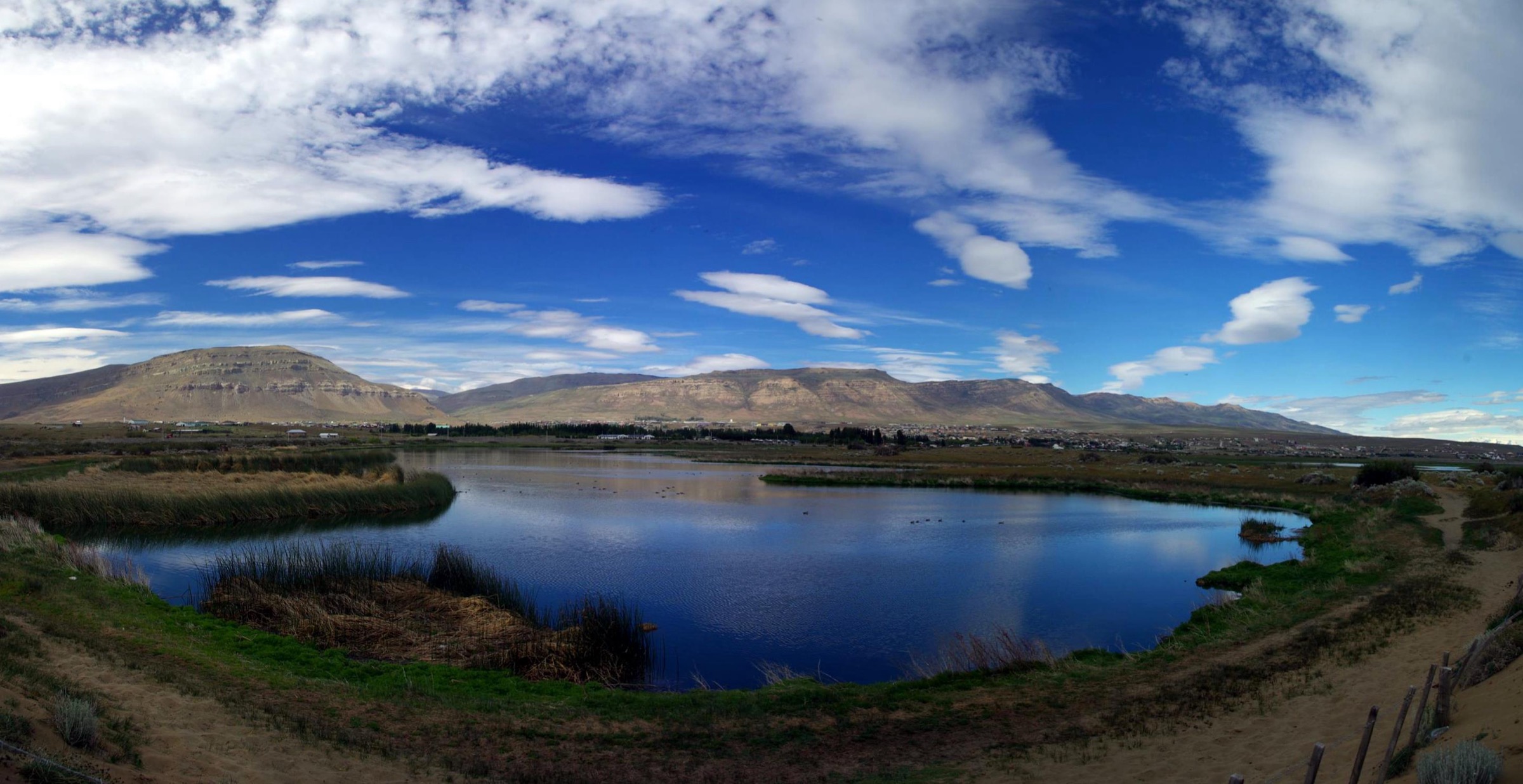
The Laguna Nimez reserve circuit starts near the El Calafate waterfront and follows an interpretive wetland route through lagoons, reedbeds, shoreline habitat and viewpoints toward Lago Argentino. The route is short and flat compared with the mountain hikes in the region, but it is a key walking site for flamingos, waterfowl, Patagonian steppe birds and environmental interpretation.
InterPatagonia describes signed trails laid out over more than 2,500 m, with an additional 500 m walk toward Lago Argentino and Redonda Bay after the circuit. The official reserve website should be used for current opening hours, fees and conservation rules.
Why it is essential
Laguna Nimez is the essential El Calafate town walk: a protected wetland circuit that can be done without transport and gives the catalogue a lowland ecological counterpoint to glaciers, summits and steppe ridges.
Equipment
- Comfortable walking shoes (waterproof footwear may help after rain or snowmelt)
- Windproof jacket and a warm layer
- Binoculars
- Sun protection and water
Hazards and notes
- Stay on signed paths and respect birding distances.
- Wind, mud and icy boardwalk or path sections may occur.
- This is a nature reserve circuit rather than a wilderness mountain route; opening hours and fees should be confirmed on the official reserve site before publication.
GPX / KML links
| Source | URL | Format / access | Reuse status |
|---|---|---|---|
| Reserva Laguna Nimez official site | lagunanimez.org | Official reserve information / route description | Reuse terms for map geometry not stated |
| InterPatagonia: Laguna Nimez Reserve | interpatagonia.com | Guide-style route description | Website terms not assessed for route geometry reuse |
External links
Missing data and follow-up
- Confirm current Los Glaciares entry fees, Perito Moreno walkway opening hours and any winter/maintenance closures before publication.
- Confirm independent legal access for Cerro Huyliche / Balcones de El Calafate; the walking line may intersect private or tour-managed terrain.
- Confirm exact Cerro de los Cristales trailhead parking, Lago Roca road status and whether any park permit category is required.
- Check Estancia Cristina operator rules, guiding requirements and boat schedules for the full Cañadón de Fósiles / Upsala day route.
- Select file-level Commons images and record exact authors/licences before final layout.
- Download or recreate GPX only after checking source terms and validating the legal route alignment.
External links
| Source | URL |
|---|---|
| Argentina National Parks — Los Glaciares activities | argentina.gob.ar |
| El Calafate official tourism portal | elcalafate.tur.ar |
| El Calafate tourism — Los Glaciares National Park | elcalafate.tur.ar |
| AllTrails — Sendero Glaciar Perito Moreno | alltrails.com |
| AllTrails — Cerro de los Cristales | alltrails.com |
| AllTrails — Mirador Glaciar Upsala / Cañadón de Fósiles | alltrails.com |
| AllTrails — Cerro Huyliche | alltrails.com |
| AllTrails — Santa Cruz routes | alltrails.com |
| Reserva Laguna Nimez official site | lagunanimez.org |
| InterPatagonia — Laguna Nimez Reserve | interpatagonia.com |