Regional overview
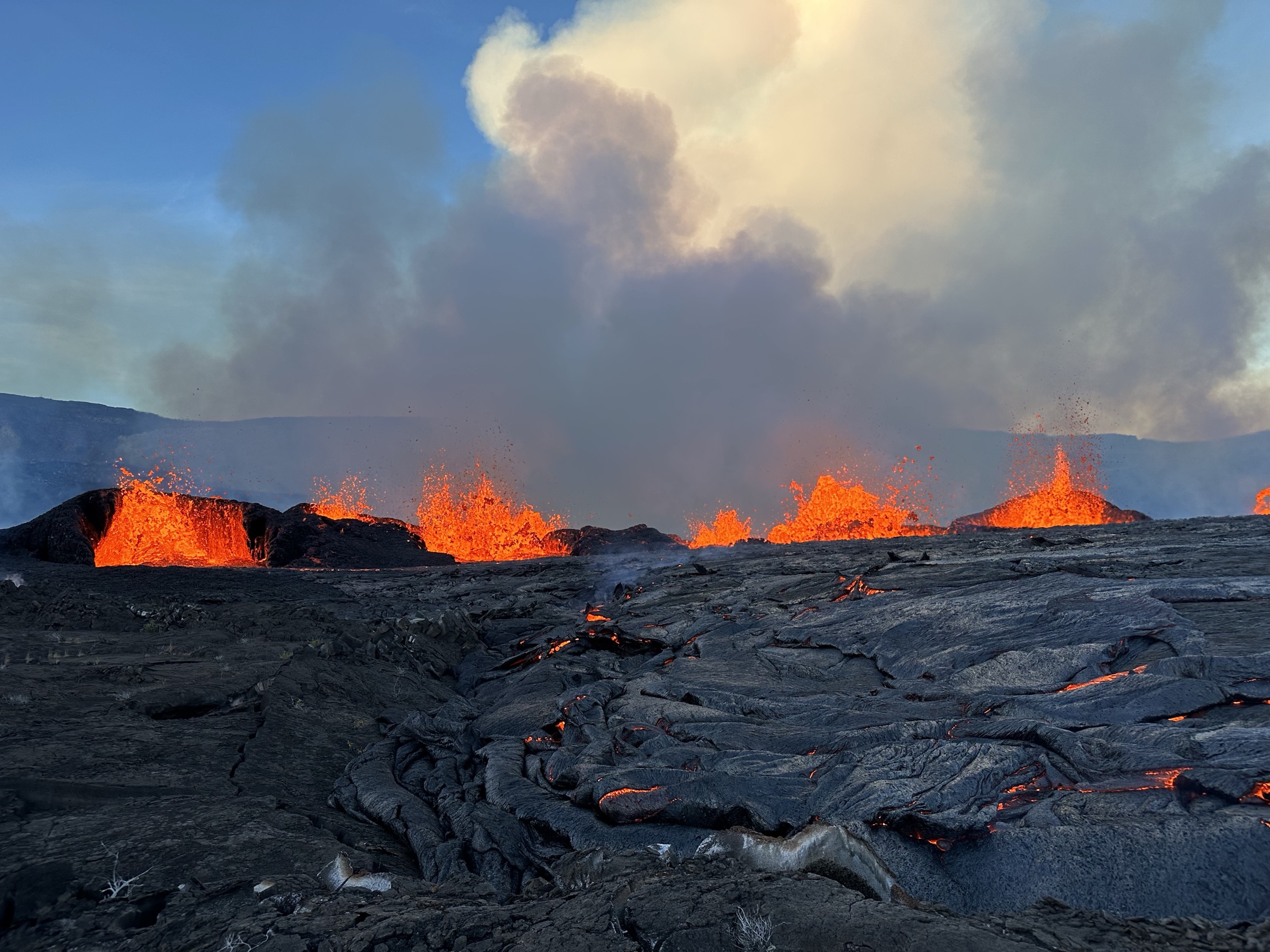
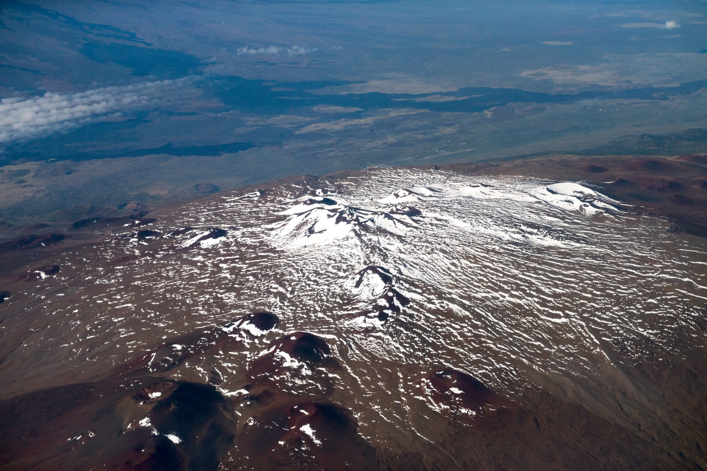
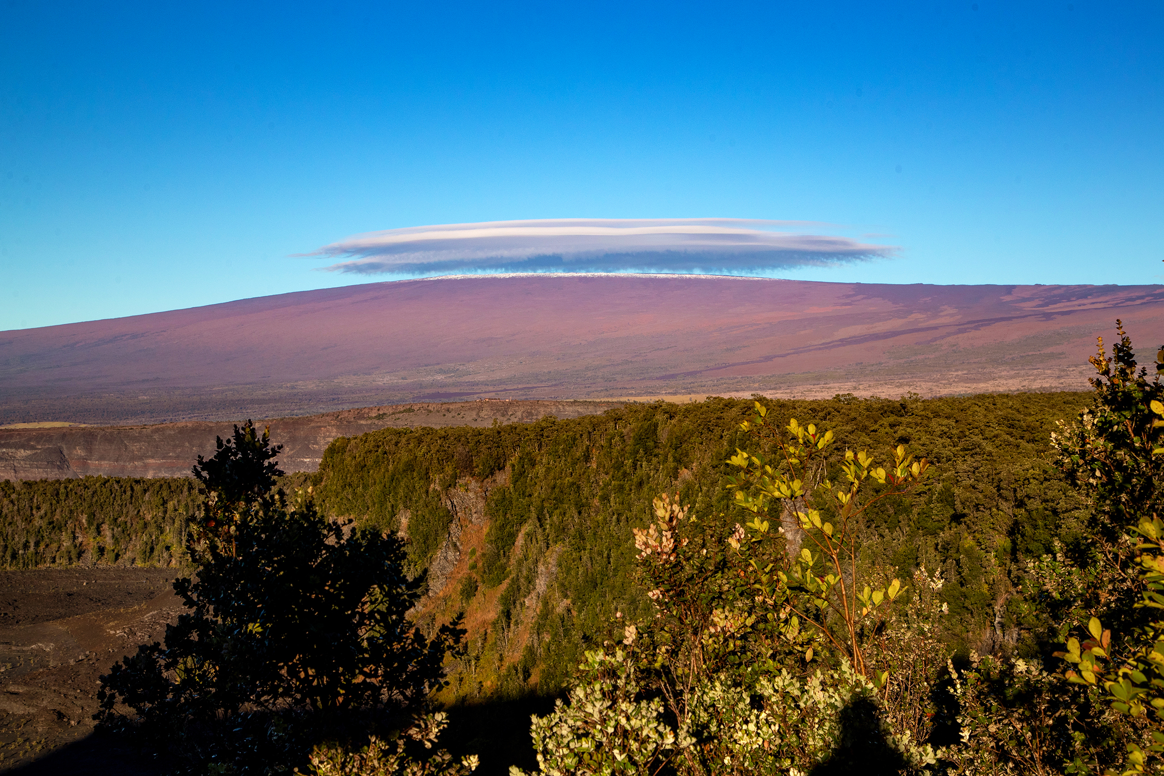
Mauna Loa is the largest active volcano on Earth by mass and volume — a single shield rising 4,170 m above sea level and another ~5,000 m from the Pacific floor, making the full edifice taller from base to summit than Mount Everest is from sea level to summit. The mountain dominates the south of Hawaiʻi Island and the bulk of Hawaiʻi Volcanoes National Park outside the busier Kīlauea visitor zone, with the Kahuku Unit on the southwest flank adding a separate landscape of ranch country, recent lava flows and high pasture above Kaʻū. The summit caldera, Mokuʻāweoweo, last erupted in November–December 2022 from a fissure on the Northeast Rift Zone, damaging the Mauna Loa Trail above Red Hill Cabin and closing the historic Buffalo Soldiers route to the summit cabin for the foreseeable future. Older lavas reach the coast in three directions, and the mountain has erupted on average every six years since systematic observation began in 1843.
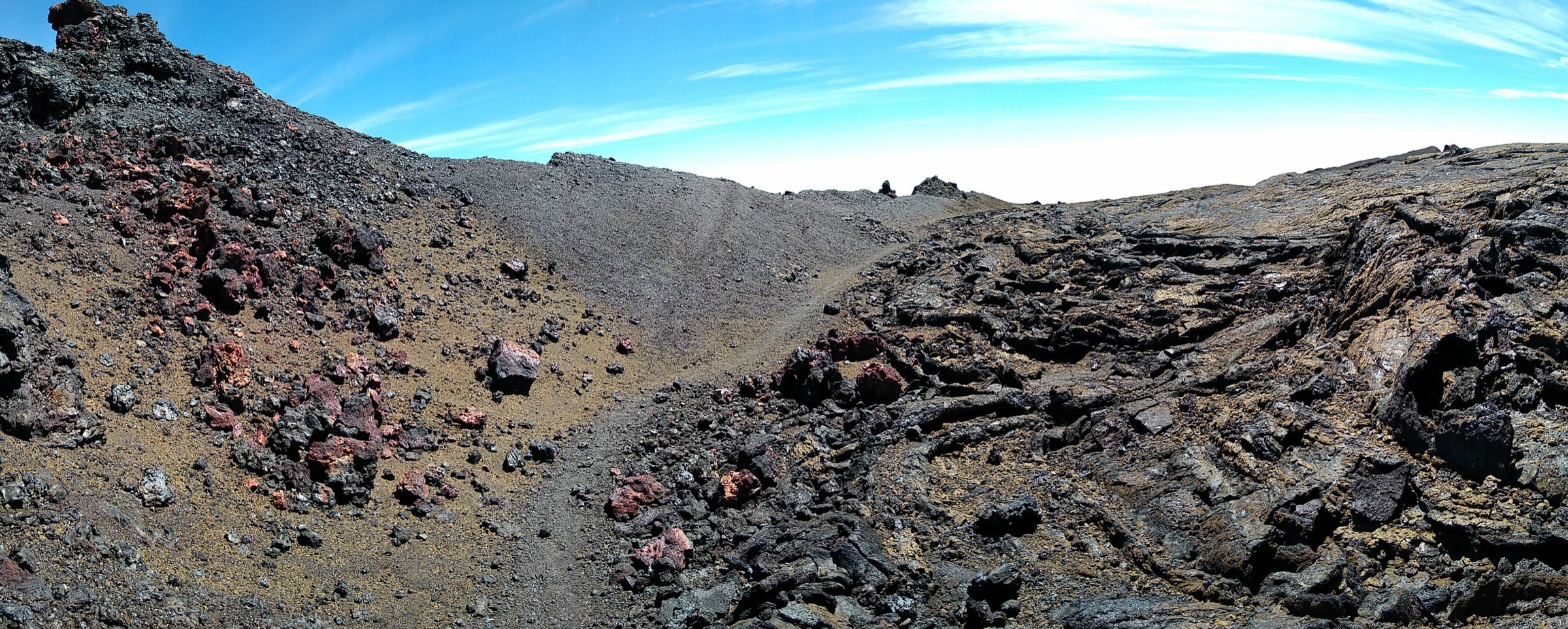
The hiking character on Mauna Loa is unlike anywhere else in the catalogue. The summit and upper-flank routes are open lava walks — basalt pāhoehoe and aʻā punctuated by cinder cones, ropy flows, and small cairns marking the route across otherwise pathless terrain. There is no canopy, no shelter, no surface water, and almost no signage above the trailhead. The lower-flank routes, by contrast, walk through kīpuka — older forested islands surrounded by younger lava — and through ranch country at Kahuku, with native ʻōhiʻa, koa, hapuʻu tree ferns and the rare endemic plants that survived around the volcano’s older flows. The contrast between bare summit lava and dense kīpuka forest is the defining experience of a Mauna Loa walking trip.
Three planning issues dominate every Mauna Loa day-hike. Altitude is the first: the Observatory Trail starts at 3,400 m and tops at 4,170 m, and altitude sickness is common in unacclimatised parties even on a fit, well-paced ascent. NPS guidance is to spend at least one night above 2,000 m before attempting the summit, and divers must wait 24 h after their last scuba dive before ascending. The second is weather: the summit is above the Hawaiian trade-wind inversion and routinely sees snow, freezing temperatures, blizzards and whiteouts any month of the year. The third is access: Mauna Loa Road and the Mauna Loa Observatory Road are both narrow and exposed, the ʻĀinapō Trail requires both NPS cabin permits and Kapāpala Ranch gate paperwork before any walk on it, and the Kahuku Unit is only open Thursday to Sunday on a 08:00–16:00 schedule. NPS publishes current closures and eruption status on the park’s Current Conditions page — check this immediately before travel.
Access is from Ellison Onizuka Kona International Airport (KOA) in 2–2.5 h to the park’s Kīlauea visitor centre, or from Hilo International Airport (ITO) in 45 minutes to the same gate. The Saddle Road (Daniel K. Inouye Highway) connects Hilo and Kona over the Mauna Kea / Mauna Loa col and is the access road for the Mauna Loa Observatory turnoff. There is no public transport that reaches any of the trailheads in this catalogue; every route assumes a private vehicle, and the Observatory Road in particular requires a vehicle with good ground clearance and brakes for the descent.
For neighbouring sub-regions of Hawaiʻi Island and the wider archipelago, see Hāmākua and Waipiʻo highlands on the wet windward side of Hawaiʻi Island, and Haleakalā on Maui (the only other Hawaiian summit that hosts high-altitude day walks on a working national-park trail network).
Selection rationale
Five day-hikes are presented across the active sectors of the mountain open to legal public day walking: the two classic high-altitude approaches (the Observatory Trail from the north flank and the Red Hill Cabin day from the park-road Mauna Loa Trail), the historic southern ʻĀinapō Trail day section, the compact Kīpukapuaulu old-growth forest loop on the lower flank, and the Palm Trail loop in the Kahuku Unit on the southwest slope. The set is built around altitude band and route character rather than length: two open-lava high routes, one historic mid-altitude trail, one rare kīpuka forest loop, and one ranch-landscape loop in the park’s separate Kahuku district.
The Mauna Loa summit via the Mauna Loa Trail / Red Hill Cabin as a single multi-day push and the summit cabin as a destination are both excluded as out of scope: the route above Red Hill Cabin is closed by eruption damage at the time of writing, and the full Buffalo Soldiers / Mauna Loa Trail summit attempt is a backcountry overnight rather than a day-hike under this catalogue’s standards. Kīlauea and the Crater Rim / Halemaʻumaʻu routes sit on a separate volcanic edifice and are covered by the Kīlauea catalogue rather than this Mauna Loa entry. The lower Bird Park (Kīpukapuaulu) is included; the Tree Molds short walk on the same Mauna Loa Road is left as a roadside add-on rather than a separate entry.
Summary
| # | Hike | Trailhead | Route type | Distance | Gain | Max elevation | Difficulty |
|---|---|---|---|---|---|---|---|
| 1 | Mauna Loa Summit via Observatory Trail | Mauna Loa Observatory Road | Out-and-back | 20.6 km | 866 m | 4,170 m | Hard |
| 2 | Puʻuʻulaʻula / Red Hill Cabin via Mauna Loa Trail | Mauna Loa Road Lookout Shelter | Out-and-back | 24.2 km | 1,028 m | 3,059 m | Hard |
| 3 | ʻĀinapō Trail to Halewai / ʻĀinapō Cabin | ʻĀinapō Road (Kapāpala Ranch access) | Out-and-back | 8.6 km | ~520 m | 2,362 m | Moderate–Hard |
| 4 | Kīpukapuaulu Loop | Bird Park, Mauna Loa Road | Loop | 1.9 km | ~50 m | ~1,260 m | Easy |
| 5 | Palm Trail Loop, Kahuku Unit | Kahuku Unit visitor contact area | Loop | 4.2 km | ~95 m | ~750 m | Easy–Moderate |
1. Mauna Loa Summit via Observatory Trail
Snapshot
Itinerary
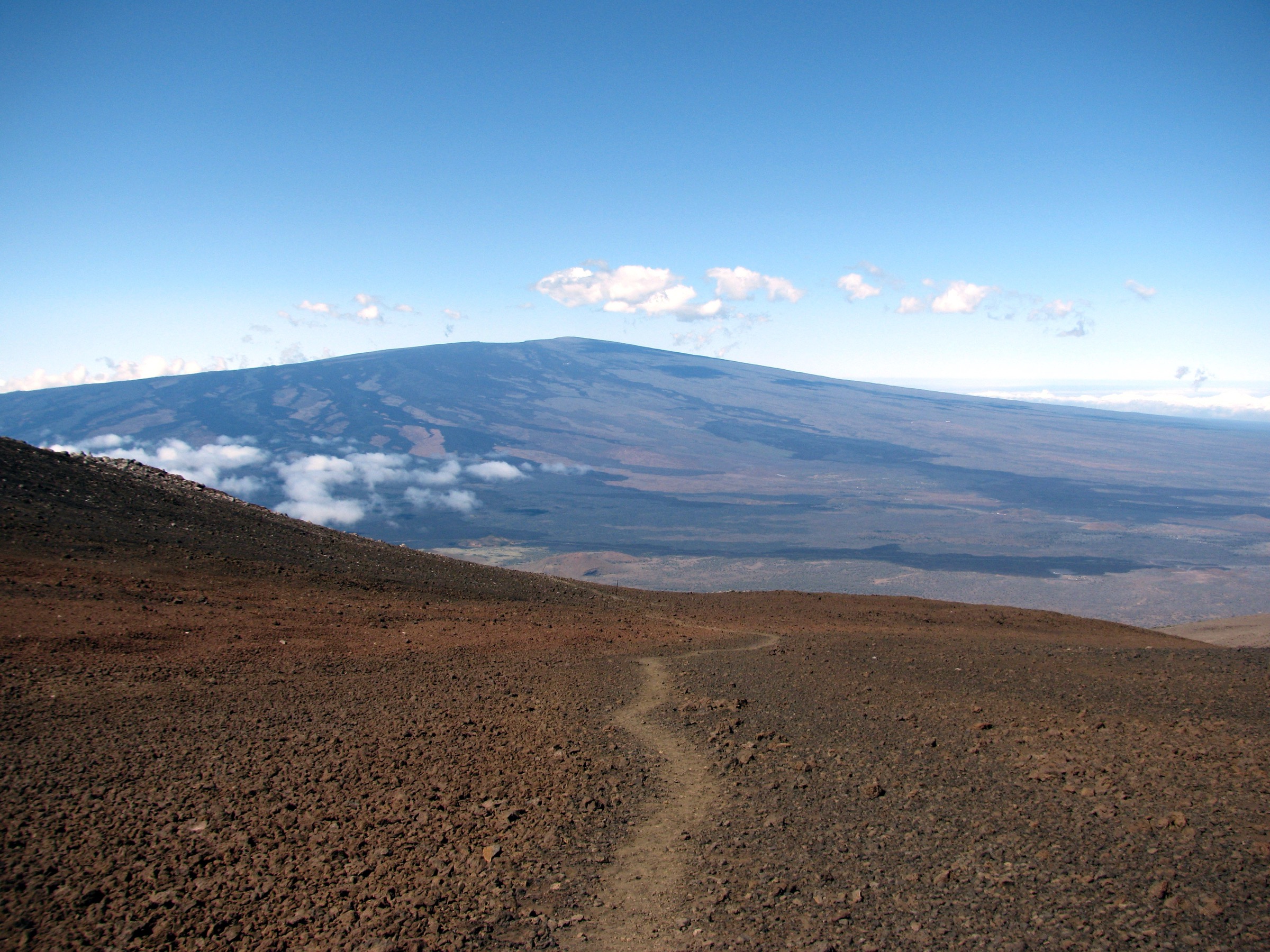
The trailhead sits at the end of the Mauna Loa Observatory Road, which leaves the Saddle Road (Daniel K. Inouye Highway) at ~3,000 m and climbs the north flank of the mountain to a small parking apron just below the NOAA Mauna Loa Observatory — the carbon-dioxide measurement station that has run continuously since 1958. The observatory facility itself is closed to the public; the trail starts from the parking apron west of the buildings. From here the Observatory Trail climbs 5.9 mi / 9.5 km south-south-west across open pāhoehoe lava on a cairned route to the Mauna Loa Summit Cabin at the North Pit. From the cabin the Summit Trail continues 0.8 km / 0.5 mi south to the true summit and Mokuʻāweoweo rim at 4,170 m, with views down into the 3 km × 5 km caldera and across to the South Pit and the Northeast and Southwest Rift Zones. NPS lists the one-way distance as 6.4 mi / 10.3 km to the summit itself; the standard return is 12.8 mi / 20.6 km. Return is by the same line — there is no loop option and no through-route, and the descent is the route’s most demanding section after a long day at altitude.
Why it is essential
The Observatory Trail is the only day-hike option for reaching the true summit of Mauna Loa: the alternative Mauna Loa Trail / Buffalo Soldiers route is currently closed by eruption damage above Red Hill Cabin, and would in any case be a 36 km / 1,500 m+ day if open. Standing on the rim of Mokuʻāweoweo — the summit caldera of the largest active volcano on Earth — is the defining experience of a Hawaiʻi mountain trip, and there is no comparable summit objective anywhere else in the Pacific.
Equipment
- Full high-altitude day kit: insulated mid-layer, waterproof / windproof shell, warm hat, gloves
- Sturdy boots — the lava is sharp and twists ankles on uneven aʻā sections
- 3–4 L water (no resupply anywhere on the route)
- High-SPF sun protection, lip protection and sunglasses (UV at 4,170 m is extreme)
- Headlamp with spare batteries — descents routinely run into dusk
- Offline map and GPS — the route is cairned but easy to lose in cloud
- Map, compass, emergency food, first aid kit
- Microspikes if snow is forecast or visible on the upper flank
Hazards and notes
- Altitude sickness is the single most common reason parties turn around; descent is the only reliable cure. Spend at least one night above 2,000 m before attempting the summit, and turn back at the first sign of serious headache, ataxia or persistent nausea.
- The summit is above the Hawaiian trade-wind inversion and can be in cloud, snow or hurricane-force wind on a day that is calm and warm at the coast — check the Mauna Loa Observatory weather feed immediately before travel.
- The lava is sharp; a fall here cuts gloves, trouser fabric and skin in a way that less hostile rock does not.
- Divers must wait at least 24 h after their last scuba dive before ascending — the standard altitude/dive interval rule.
- NPS advises that children under 16, pregnant hikers and people with significant cardiac or respiratory conditions seek medical advice before attempting the route.
- There is no cell coverage above the Observatory Road junction; tell someone your turn-around time and stick to it.
2. Puʻuʻulaʻula / Red Hill Cabin via Mauna Loa Trail
Snapshot
Itinerary
The route starts at the Mauna Loa Road Lookout Shelter at ~2,030 m, the public terminus of the narrow paved Mauna Loa Road that climbs from the park’s Kīlauea Visitor Center. From the trailhead the Mauna Loa Trail climbs steadily south-west across open lava and koa woodland, leaving the trees within the first hour and emerging onto the bare upper flank for the remaining 9–10 km of the ascent. The trail follows the original line cut by the 25th Infantry Buffalo Soldiers in 1915, and the route is still marked with stone cairns built by the same regiment. After 12.1 km the trail reaches Puʻuʻulaʻula (Red Hill) Cabin at 3,059 m — a small Forest Service-style backcountry shelter named for the iron-red cinder cone that sits beside it. The cabin sits in a saddle with views east to Mauna Kea and south down the long flank. Return is by the same line. The trail continues from Red Hill toward the Mauna Loa Summit Cabin (~17.5 km / 1,330 m further), but this upper section is closed at the time of writing because of damage from the 2022 Northeast Rift Zone eruption — verify status with NPS before assuming a connection to the summit.
Why it is essential
The Mauna Loa Trail is the historic line of ascent of the mountain — the route used since 1915 to reach the summit cabin — and the day version to Red Hill Cabin is the only realistic option for walkers who want the full Mauna Loa experience (open lava, altitude, historic trail) without the logistics of the Observatory approach. Red Hill is also the easiest 3,000 m+ summit-style objective in the catalogue: lower, longer and gentler than the Observatory Trail summit, with a comparable cinder-cone-and-lava finish.
Equipment
- Sturdy boots — the lava is sharp and the trail is rough underfoot for most of the climb
- Trekking poles for the descent
- Wind shell and insulated mid-layer (Red Hill is above the trade-wind inversion in most conditions)
- 3–4 L water — no resupply at the trailhead; water at Red Hill Cabin is rainwater catchment and must be treated
- Headlamp with spare batteries — slower parties finish in dusk
- Offline map; the route is cairned but the cairns can be hidden by fog
- High-SPF sun protection
- Light gloves and warm hat even in summer
Hazards and notes
- The upper Mauna Loa Trail (above Red Hill Cabin) is closed because of trail damage from the 2022 eruption — verify the current status on the NPS Mauna Loa hiking page before assuming any onward connection.
- Overnight use of Red Hill Cabin or the surrounding backcountry sites requires a permit from NPS; day walkers do not need a permit but should follow the same conditions check.
- Route-finding in cloud is hard above the treeline — the cairns are widely spaced and easy to miss in poor visibility.
- Altitude is a real factor at Red Hill (3,059 m) even though it is below the summit; the same 24-h post-dive rule applies.
- Mauna Loa Road is narrow, with limited passing places; expect 30–40 minutes from the park entrance to the trailhead.
- No cell coverage above ~1,500 m on Mauna Loa Road; carry a paper backup of route notes.
3. ʻĀinapō Trail to Halewai / ʻĀinapō Cabin
Snapshot
Itinerary
The ʻĀinapō Trail is the historic Hawaiian route up Mauna Loa from the south, used by ahupuaʻa residents and high-status travellers for centuries before Western contact and re-cut in 1840 for the United States Exploring Expedition. The trail starts on ʻĀinapō Road within the Kapāpala Forest Reserve, reached by a permit-only gate on Kapāpala Ranch land — the gate code and access window are issued by the State of Hawaiʻi’s camping permit system, and walkers must hold both the NPS ʻĀinapō Cabin permit and the State / Ranch access paperwork before driving in. From the trailhead the route climbs north through native koa and ʻōhiʻa forest on the cooler windward edge of the mountain, gaining ~520 m over 4.3 km to Halewai / ʻĀinapō Cabin at 2,362 m. The cabin is a stabilised historic CCC-era shelter set on a forested bench with views east toward Mauna Kea and Kīlauea; it is a destination in its own right rather than a way-station. The full ʻĀinapō Trail continues from the cabin to the Mauna Loa Summit Cabin (~17 km, ~1,800 m further), but this upper section is a backcountry overnight rather than a day route. Return is by the same line.
Why it is essential
ʻĀinapō is the culturally and historically grounded approach to Mauna Loa: the trail that Hawaiian travellers used to reach Mokuʻāweoweo for centuries, the route the first Western scientific expedition followed, and the only line up the mountain that walks through living native forest for its entire length. Including the day section to the cabin gives the catalogue a route that the park-road approaches cannot match — a forested southern-flank counterpoint to the bare lava of the Observatory Trail and the Buffalo Soldiers Trail.
Equipment
- High-clearance 4WD (mandatory on the upper ʻĀinapō Road) and the gate code printed in two places
- Sturdy boots
- Rain shell and warm layer — the south flank is the wettest side of Mauna Loa
- 2.5 L water — no surface water on the route, rainwater catchment at the cabin only
- Insect repellent in summer
- Offline map and a printed copy of the State / Ranch access instructions
- Headlamp with spare batteries
- First aid kit and emergency food — the route is remote and self-rescue is the realistic plan
Hazards and notes
- Do not attempt the approach without both the NPS cabin permit and the Kapāpala Ranch gate paperwork — the access road is on private and state-managed land and is gated.
- The route is remote with no cell coverage; tell someone your turn-around time before leaving the Saddle Road.
- High-clearance 4WD is required for ʻĀinapō Road; rental cars with low clearance routinely strand on the upper sections.
- Weather on the south flank changes faster than on the north — rain, fog and chilling wind are normal even on a clear-coast day.
- Native forest is fragile; clean boots before and after the walk to reduce the spread of Rapid ʻŌhiʻa Death (Ceratocystis fungal infection of native ʻōhiʻa).
- Treat all water at the cabin; the rainwater catchment is not maintained as a potable supply.
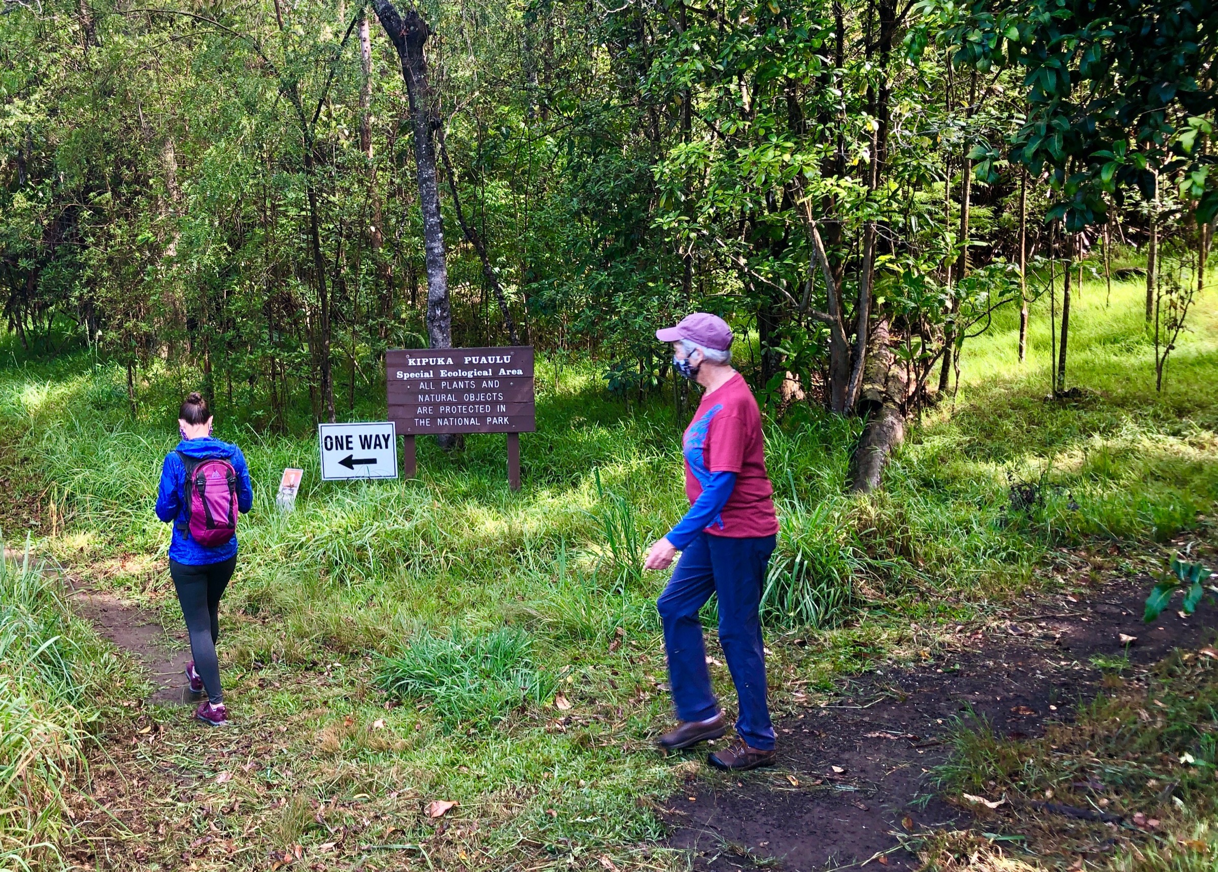
4. Kīpukapuaulu Loop
Snapshot
Itinerary
The loop walks through Kīpukapuaulu, an old-growth forest island ~40 hectares in area surrounded by younger ʻAilāʻau and Keaiwa lava flows. The kīpuka sits ~3 km up Mauna Loa Road from the Kīlauea park gate at ~1,250 m. The route is a compact self-guided interpretive walk: a graded path leads through stands of mature koa, ʻōhiʻa lehua and the rare endemic Hawaiian mints (Phyllostegia and Stenogyne) that survived around the kīpuka’s older flows. Native forest birds — ʻapapane, ʻiʻiwi, ʻamakihi and the rare ʻakiapōlāʻau — are heard more often than seen. The loop returns to the trailhead through a stretch of lowland mesic forest. The site’s nickname Bird Park dates from the early twentieth century and is still in common use in NPS literature.
Why it is essential
Kīpukapuaulu is the ecological counterpoint to the bare summit lava on the rest of the catalogue. The site is one of the best-preserved examples of pre-contact native Hawaiian forest accessible to the public, and the walk illustrates the role of kīpuka in conserving the islands’ endemic plant and bird species through repeated volcanic resurfacing. As a recovery or shoulder-time walk between the high routes it is the most useful entry in the catalogue.
Equipment
- Walking shoes (clean boots before arrival — see below)
- Light rain layer
- 1 L water
- Insect repellent
- Binoculars for the birds
- The NPS-provided self-guide leaflet if available at the trailhead
Hazards and notes
- Clean boots and trekking poles before and after the walk to reduce the spread of Rapid ʻŌhiʻa Death — the fungal infection that has killed millions of ʻōhiʻa across the island. The NPS-provided shoe-brush station at the trailhead must be used.
- Stay on the trail — the kīpuka’s rare plants are vulnerable to trampling.
- Wet leaf litter is slippery; trekking poles or sturdy soles are useful after rain.
- Same-day status should be confirmed with NPS — a secondary trail database showed a closure flag during the source research pass, although the official NPS page did not.
- No cell coverage in the kīpuka.
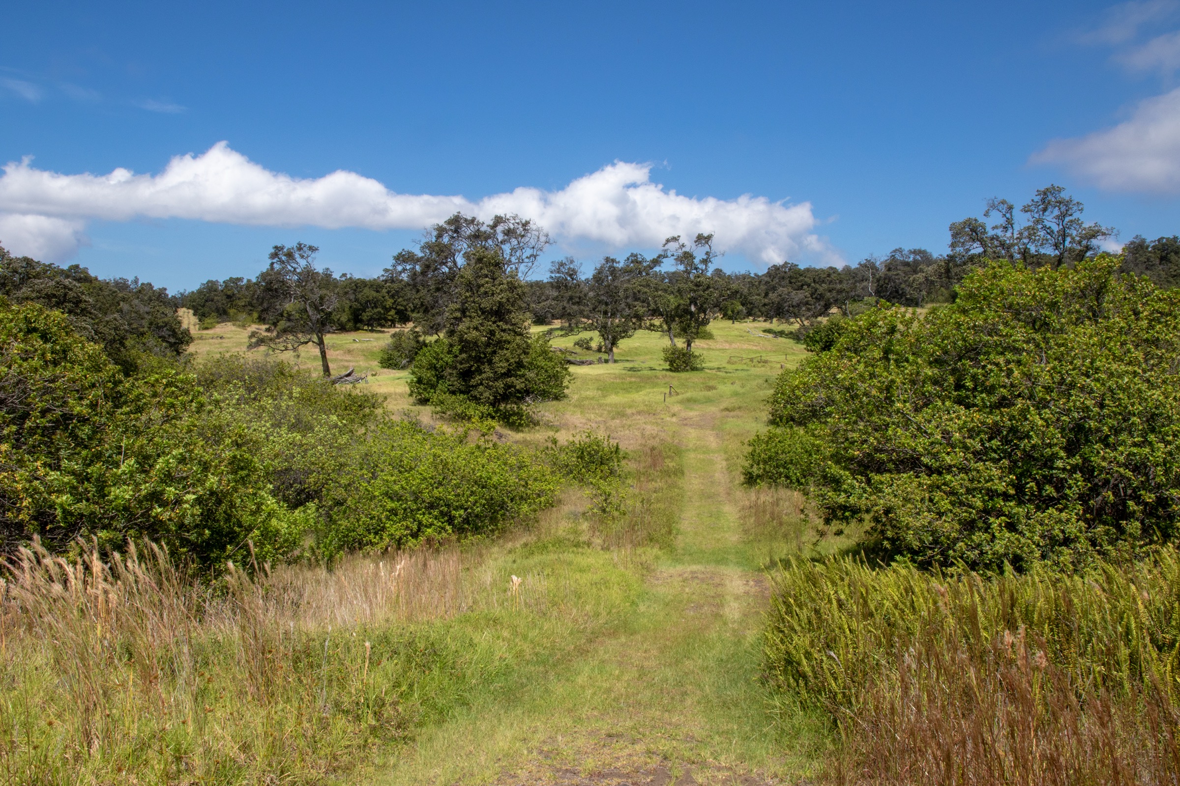
5. Palm Trail Loop, Kahuku Unit
Snapshot
Itinerary
The Kahuku Unit sits on Mauna Loa’s south-west flank above Kaʻū, ~70 km by road from the main Kīlauea park entrance. The unit was added to Hawaiʻi Volcanoes National Park in 2003 from the former 47,000-hectare Kahuku Ranch, and the trail network walks through the ranch’s former pasture, lava flows of various ages, and stands of native koa and ʻōhiʻa returning on the older flows. The Palm Trail loop starts from the visitor contact area at ~600 m, climbs gently north-east through former pasture to a high point in the western corner of the unit, and returns via a chain of lava flows and the eponymous fan-palm grove (loulu, Pritchardia) — the only native palm in Hawaiʻi, surviving here in a small grove around an older kipuka. Views west over Kaʻū to Pohue Bay and south down the flank are uninterrupted on a clear day. Return is on the same loop.
Why it is essential
The Palm Trail is the southwest-flank face of Mauna Loa — the side most walkers never see. The Kahuku Unit landscape is unlike anywhere else in the park: rolling ranch country, recent lava with native vegetation returning at different speeds, and the only accessible loulu palm grove in the catalogue. The walk is also the easiest way to see what a quieter national-park district feels like, with a fraction of the visitor pressure of the Kīlauea summit zone.
Equipment
- Hiking shoes or light boots
- Sun hat and high-SPF sun protection — the route is exposed
- 2 L water
- Light rain layer
- Snack — there are no services in or near the Kahuku Unit
- Map / NPS-provided trail leaflet if available at the visitor contact
Hazards and notes
- The Kahuku Unit is only open Thursday to Sunday, 08:00–16:00, at the time of writing — verify current hours and any seasonal program closures with NPS before travel.
- There are no services at the Kahuku Unit beyond a basic visitor contact area; carry everything you need, including extra water.
- The trail is exposed to sun and wind; afternoons in summer can be hot.
- The route shares the unit with cattle on some former ranch tracks; respect cattle and stay on the marked trail.
- Lava surfaces are sharp; a fall on aʻā cuts in a way that less hostile rock does not.
- Kahuku is the closest unit of the park to active flank activity; check current eruption status before travel.
Routes excluded as out of scope
The following sit inside or adjacent to Mauna Loa but fall outside a day-hike entry, are too duplicative of the five above, or are better understood as overnights or technical / closed routes.
- Mauna Loa Summit Cabin via the Mauna Loa Trail. The full Buffalo Soldiers route from the Mauna Loa Road trailhead to the summit (~58 km return, ~2,400 m total) is a backcountry overnight under NPS guidance and is currently affected by 2022 eruption damage above Red Hill Cabin. The day version to Red Hill Cabin is covered as entry 2.
- Full ʻĀinapō Trail to the summit. The continuation from ʻĀinapō Cabin to Mokuʻāweoweo is a backcountry overnight and not a realistic day-hike from the southern trailhead.
- Kīlauea summit and crater rim routes. Halemaʻumaʻu, Crater Rim Drive trail and the Kīlauea Iki loop sit on a separate volcanic edifice and are covered by the Kīlauea entry.
- Mauna Kea summit routes. The Humuʻula Trail and Mauna Kea Visitor Information Station routes are on the neighbouring summit and covered by the Mauna Kea entry where one exists.
- Lower park interpretive walks (Tree Molds, Pu’uloa Petroglyphs, Devastation Trail, Sulphur Banks). Short roadside or interpretive walks better visited as an add-on to the longer entries above than as separate catalogue items.
- Kahuku Unit — Kona, Glover and Puʻu o Lokuana trails. Strong alternatives to the Palm Trail within the same Kahuku Unit, but editorially redundant with entry 5 and better used as variations on a return visit.
Further reading
| Source | URL |
|---|---|
| Hawaiʻi Volcanoes National Park — official site | nps.gov/havo |
| NPS — Mauna Loa hiking | nps.gov/havo |
| NPS — current conditions and eruption status | nps.gov/havo |
| NPS — day hikes | nps.gov/havo |
| NPS — Kahuku Unit | nps.gov/havo |
| NPS — backcountry permits (Red Hill / Summit / ʻĀinapō cabins) | nps.gov/havo |
| Hawaiʻi Trails — ʻĀinapō Trail | hawaiitrails.ehawaii.gov |
| Hawaiʻi Trails — ʻĀinapō Road | hawaiitrails.ehawaii.gov |
| Hawaiʻi camping permit system | camping.ehawaii.gov |
| Kapāpala Ranch — Forest Reserve access | kapapalaranch.com |
| USGS Hawaiian Volcano Observatory — Mauna Loa status | usgs.gov |
| NOAA Mauna Loa Observatory — current weather | gml.noaa.gov |
| AllTrails — Mauna Loa via Observatory Trail and Summit Trail | alltrails.com |
| AllTrails — Kīpukapuaulu Trail | alltrails.com |
| Wikipedia — Mauna Loa | en.wikipedia.org |
| Wikipedia — Hawaiʻi Volcanoes National Park | en.wikipedia.org |
| Wikimedia Commons — Mauna Loa category | commons.wikimedia.org |
| OpenStreetMap (ODbL 1.0) | openstreetmap.org |