Regional overview
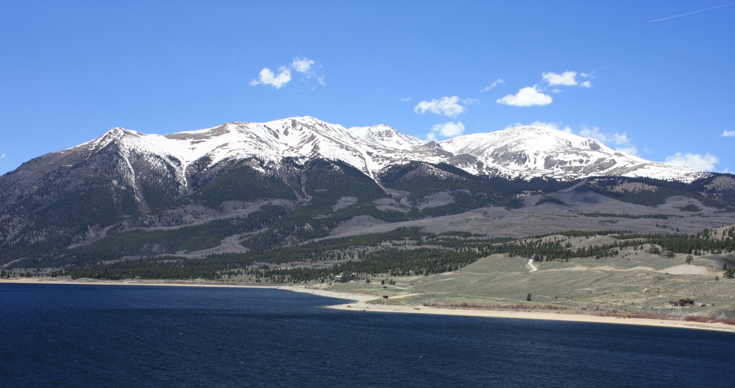
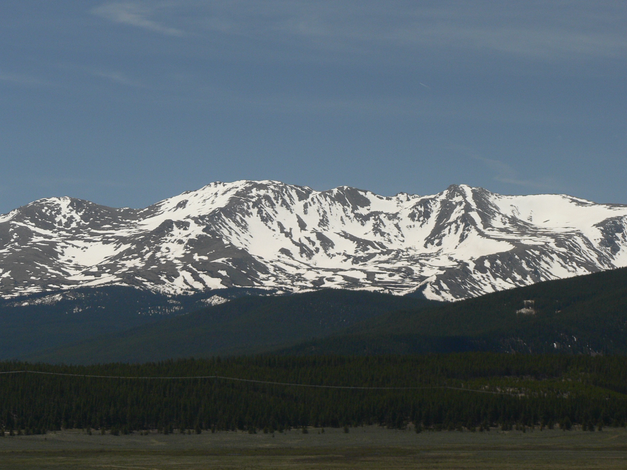
The northern Sawatch Range around Leadville is the highest concentrated walking landscape in the Rocky Mountains. Mount Elbert (4,401 m) and Mount Massive (4,396 m) — the first and second highest summits in Colorado, and the two highest non-Alaskan summits in the United States — rise within 8 km of each other on either side of the Halfmoon Creek drainage, west of the silver-mining town of Leadville at 3,094 m. From Leadville the range falls south to the Twin Lakes basin and west into the Mount Massive Wilderness (110 km², 1980) and the Holy Cross Wilderness (487 km², 1980) on the Continental Divide; eastward, the Mosquito Range across the Arkansas valley gives the basin a second high horizon that frames almost every view.
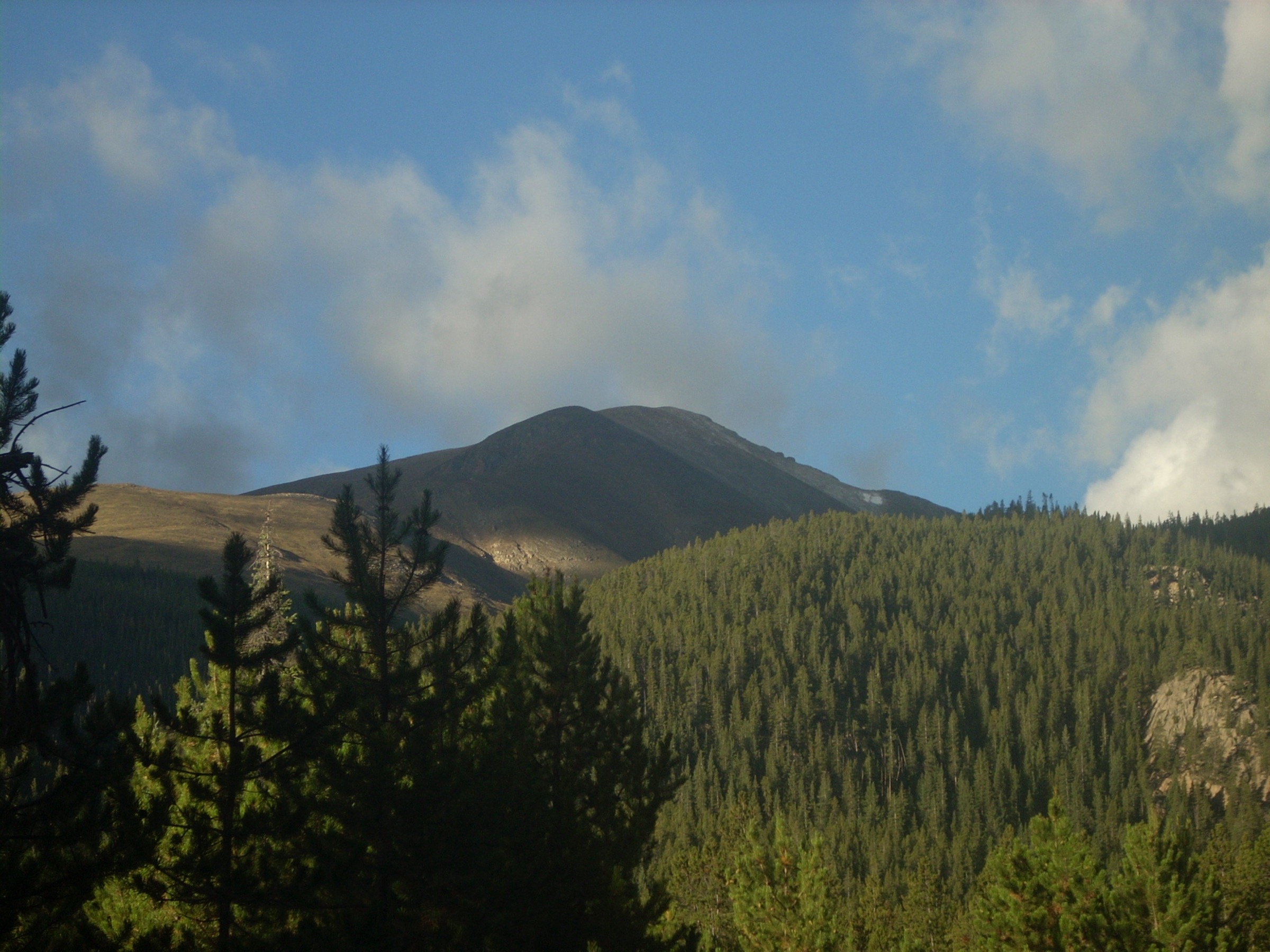
The walking character is dominated by long fourteener ascents on tundra and talus, broad summit ridges with no shelter, subalpine fir and Engelmann spruce on the lower approaches, and rough Forest Service road access to the upper trailheads. Trailheads on Halfmoon Road, the Turquoise Lake / Hagerman Pass corridor, and the Homestake Road sit between 2,800 and 3,200 m — high enough that altitude is a planning issue from the carpark forward. The two signature summits are the natural anchor of any day-hiking trip; the rest of the catalogue gives shorter and lower counterpoints in the same drainage.
The walking season at altitude runs July to September. Mount Elbert and Mount Massive routinely hold deep summer snow on the upper slopes into the first half of July, and the Fancy Pass headwall in the Holy Cross Wilderness keeps a cornice until the same date in cold years. By the second week of October fresh snow has usually returned to the divide and the upper Forest Service roads (notably the upper Halfmoon and Homestake access) start to close. The lower Twin Lakes shoreline, the Interlaken trail and the Turquoise Lake basin stay walkable from May to early November in normal years, but late-spring mud and shoulder-season ice are both common on the shaded sections.
The two principal hazards are altitude and weather. Trailheads start near 3,000 m, summits sit above 4,000 m, and serious altitude illness is realistic in unacclimatised parties. Front Range thunderstorm rules apply across the Sawatch: be off summit ridges and exposed passes by lunchtime, especially in late July and August, and treat any building cumulus as a signal to descend. The third planning issue is road access: the upper Halfmoon, Homestake and Hagerman Pass roads are all rough and slow, and the Mount Massive Southwest Slopes statistics in particular assume the road is driven to the upper start.
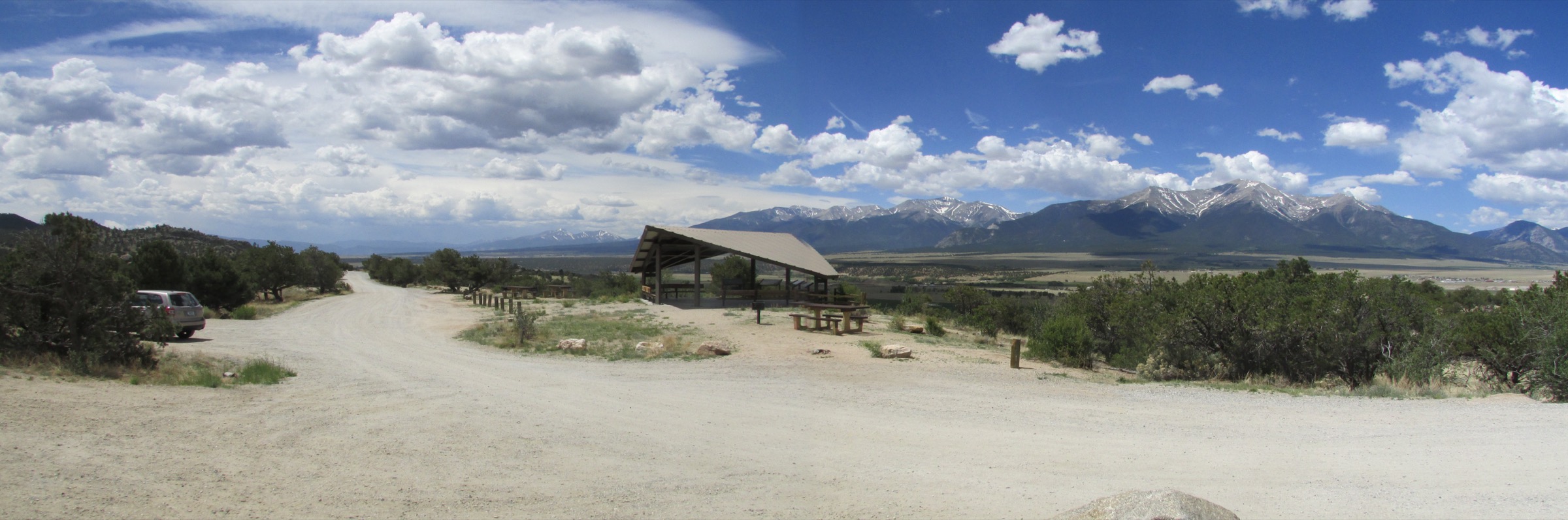
Access is from Denver International Airport in 3–3.5 h via I-70 west and US 24 south through Minturn and Tennessee Pass to Leadville, or in 2.5–3 h from Colorado Springs Municipal Airport via Wilkerson Pass and US 24. Leadville has a small Greyhound stop on the Bustang Outrider service from Glenwood Springs and Denver, but there is no public transport to any of the upper trailheads in this catalogue — every hike here assumes a private vehicle.
For neighbouring sub-regions of the Colorado Rockies, see Indian Peaks (the northern Front Range divide above Boulder and Nederland) and Pikes Peak (the southern Front Range high point). The Collegiate Peaks south and west of Twin Lakes, and the Elk Mountains around Aspen, are covered separately.
Selection rationale
Five day-hikes are presented across the major access lines of the Leadville Sawatch: two summit fourteeners from Halfmoon Road (Mount Elbert by the Northeast Ridge and Mount Massive by the Southwest Slopes), one alpine lake-and-pass loop in the Holy Cross Wilderness on Homestake Road (Missouri Lakes and Fancy Pass), one moderate subalpine lake hike from the Turquoise Lake basin (Timberline Lake), and one historic lakeside walk at Twin Lakes (Interlaken). The set is built around route type and altitude rather than length: two summit fourteeners, one tundra pass loop, one short wilderness lake, and one near-flat historic walk. The mix gives a working catalogue that does not require all five days to be hard fourteener efforts.
Collegiate Peaks routes further south — Mount Yale, Mount Harvard, Huron Peak and the Browns Pass loop — are excluded to avoid overlap with the separate Collegiate Peaks entry. The North Halfmoon Lakes and French Pass options on the same Halfmoon corridor are excluded as duplicative of the Mount Massive line, and the Holy Cross Mountain itself (a separate fourteener with a much longer approach) is excluded as a better overnight than a day from this entry’s nominal road heads.
Summary
| # | Hike | Trailhead | Route type | Distance | Gain | Max elevation | Difficulty |
|---|---|---|---|---|---|---|---|
| 1 | Mount Elbert — Northeast Ridge | North Elbert (Halfmoon Road) | Out-and-back | 15.7 km | 1,339 m | 4,401 m | Hard |
| 2 | Mount Massive — Southwest Slopes | North Halfmoon Creek | Out-and-back | 12.9 km | 1,219 m | 4,396 m | Hard |
| 3 | Missouri Lakes and Fancy Pass | Missouri Lakes (Homestake Road) | Loop | 14.2 km | 794 m | 3,773 m | Hard |
| 4 | Timberline Lake Trail #1495 | Timberline Lake (Turquoise Lake) | Out-and-back | 7.1 km | 265 m | 3,310 m | Moderate |
| 5 | Interlaken Historic District | Twin Lakes (south shore) | Out-and-back | 7.6 km | 13 m | 2,826 m | Easy |
1. Mount Elbert — Northeast Ridge
Snapshot
Itinerary
From the North Elbert Trailhead at 3,060 m on Halfmoon Road, the route walks briefly on the Colorado Trail corridor, then turns south-west onto the North Mount Elbert Trail (#1484). The first 3 km climb steadily through Engelmann spruce and lodgepole pine, gaining ~450 m to the treeline at ~3,500 m. From here the trail emerges onto the broad east shoulder of the mountain and the work becomes purely a long tundra and talus grind: a steady angled traverse leads onto the Northeast Ridge proper at ~3,800 m, and the ridge itself climbs in two stages — a benched lower section through a chain of false summits, then a steeper finishing pitch with cairned switchbacks on coarse blocky talus. The summit at 4,401 m is a broad rocky plateau marked by a benchmark plaque and a small wind shelter. On a clear day the panorama extends north over Mount Massive, west across the Holy Cross and Sawatch ranges, south down the long Sawatch crest toward the Collegiate Peaks, and east across the Arkansas valley to the Mosquito Range. Return is by the same line; the South Mount Elbert Trail from Lake County Road 24 is a common but separate descent for cars left at both ends.
Why it is essential
Mount Elbert is the highest summit in Colorado and in the entire Rocky Mountain system. The Northeast Ridge is the standard Leadville approach and the shortest of the four reasonable lines to the summit, and the only one that starts directly off Halfmoon Road without a rough four-wheel-drive segment. As the unavoidable anchor hike of any day-walking trip to the Sawatch, no other route in the catalogue carries the same editorial weight.
Equipment
- Sturdy boots and trekking poles — the talus is loose for the upper hour
- Wind shell and insulated mid-layer (summit gusts of 50–80 km/h are routine even in July)
- Hat and gloves outside midsummer
- 2.5–3 L water — no resupply above the trailhead
- High-SPF sun protection — UV at 4,400 m is severe
- Offline map and GPS — cairns are sparse above the false summits
- Headtorch — slower parties finish in dusk
- Microspikes if snow remains on the upper ridge
Hazards and notes
- Altitude illness is the single biggest hazard; spend at least one night at Leadville (3,094 m) before attempting the summit.
- Lightning risk above 3,800 m is severe in late July and August — start at 04:30, aim to be on the summit by 09:00 and off the ridge by 12:00.
- The upper ridge has no shelter for the final 4 km; even minor weather changes can become serious very quickly.
- Halfmoon Road is rough and slow; allow 30–40 minutes for the 8 km from US 24 and check current conditions in shoulder seasons.
- Parking at the North Elbert Trailhead fills by 05:30 on summer weekends — arrive earlier or use the lower overflow.
- Dogs are permitted but should be on a hand-held leash on the upper ridge for both wildlife and rockfall reasons.
2. Mount Massive — Southwest Slopes
Snapshot
Itinerary
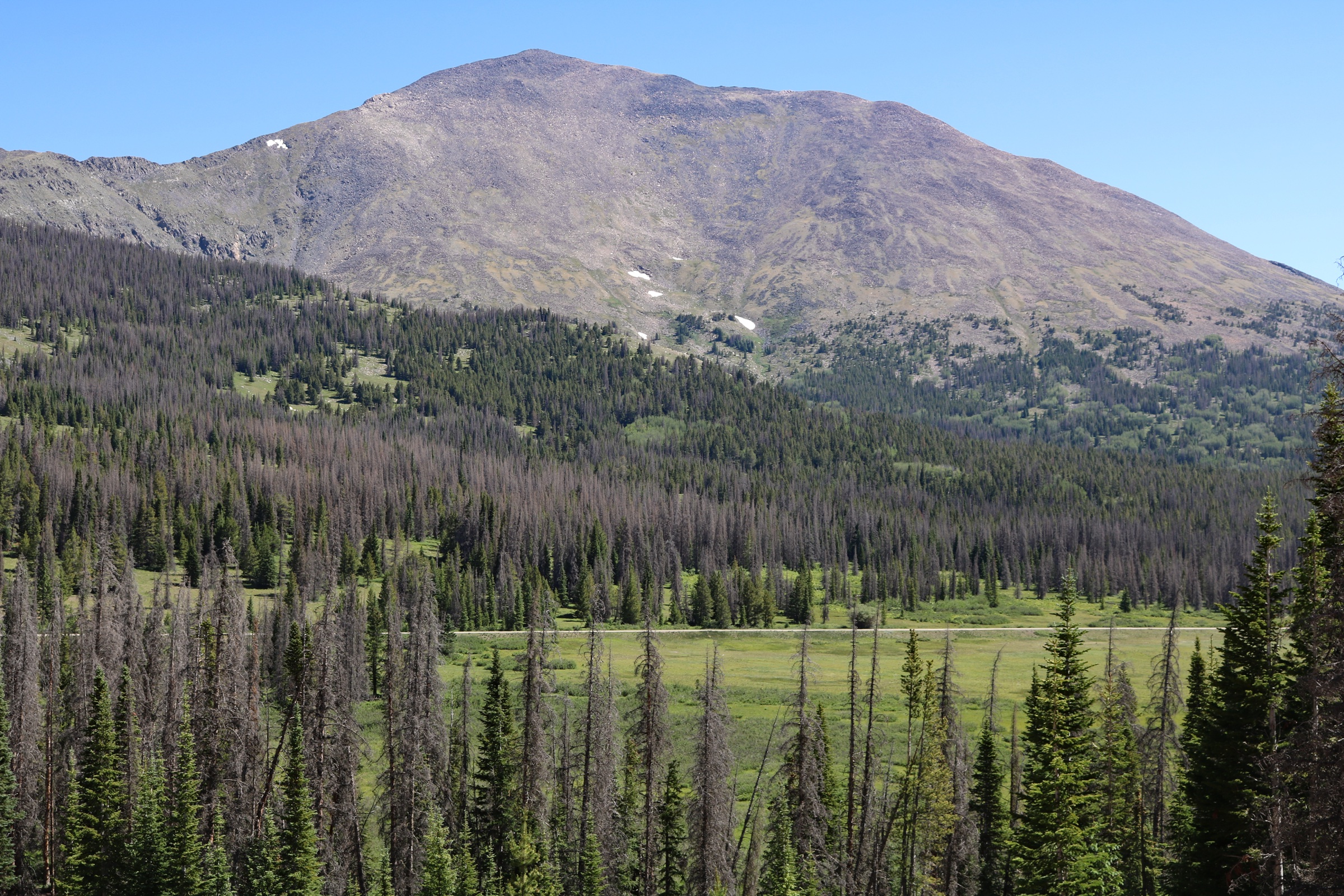
From the North Halfmoon Creek Trailhead at ~3,160 m, the route follows the North Halfmoon Creek trail north-east for ~1.5 km through subalpine forest, then leaves the creek and turns east up open slopes to gain the broad south-west shoulder of the mountain. The trail is intermittent on the lower meadows and well-cairned higher up; the Class 2 finish climbs through one short rock band of ~30 m and joins the main south summit ridge at ~4,300 m. From here the summit ridge runs north for ~600 m over a string of subsidiary high points to the main summit at 4,396 m — the second highest in Colorado and only ~5 m lower than Mount Elbert directly across the valley. The view east is dominated by Mount Elbert; the view west drops into the upper Halfmoon Creek basin and the Holy Cross Wilderness. Return is by the same line.
Why it is essential
Mount Massive is Colorado’s second-highest summit and the great northern counterpart to Mount Elbert above Leadville. The mountain is named for its long summit ridge — five separate named points above 4,300 m, no other Colorado fourteener has the same horizontal extent — and the south-west approach is the shortest of the practicable lines to the top. Including Mount Massive alongside Mount Elbert gives the entry both of Colorado’s defining high summits in a single trip.
Equipment
- Mountain boots with edging support — the upper rock band needs proper footing
- Trekking poles for the lower trail; stow them for the rock band
- Wind shell, insulated layer, hat and gloves
- 2.5 L water — Halfmoon Creek is reliable on the lower trail but treat before drinking
- High-SPF sun protection
- Offline map; the cairns thin out on the summit ridge
- Headtorch
- Microspikes if snow remains on the south-west slope
Hazards and notes
- The upper Halfmoon Road is rougher than the North Elbert access — high-clearance is strongly preferred and the last 4 km can be impassable to passenger cars after rain.
- If the road cannot be driven to the upper start, the day becomes substantially longer than the listed route statistics; allow an additional 6 km / 270 m of road walking.
- Altitude, lightning and exposure are the same as for Mount Elbert; the same 04:30 start applies on summer weekends.
- The Class 2 rock band loosens through the day as parties move over it — wear a helmet if others are above you.
- Mount Massive Wilderness restrictions apply from the wilderness sign onward: hand-held leash for dogs, no group sizes over 15, no campfires above treeline.
- Verify current Forest Service orders before travel — seasonal fire bans are common in late summer.
3. Missouri Lakes and Fancy Pass
Snapshot
Itinerary
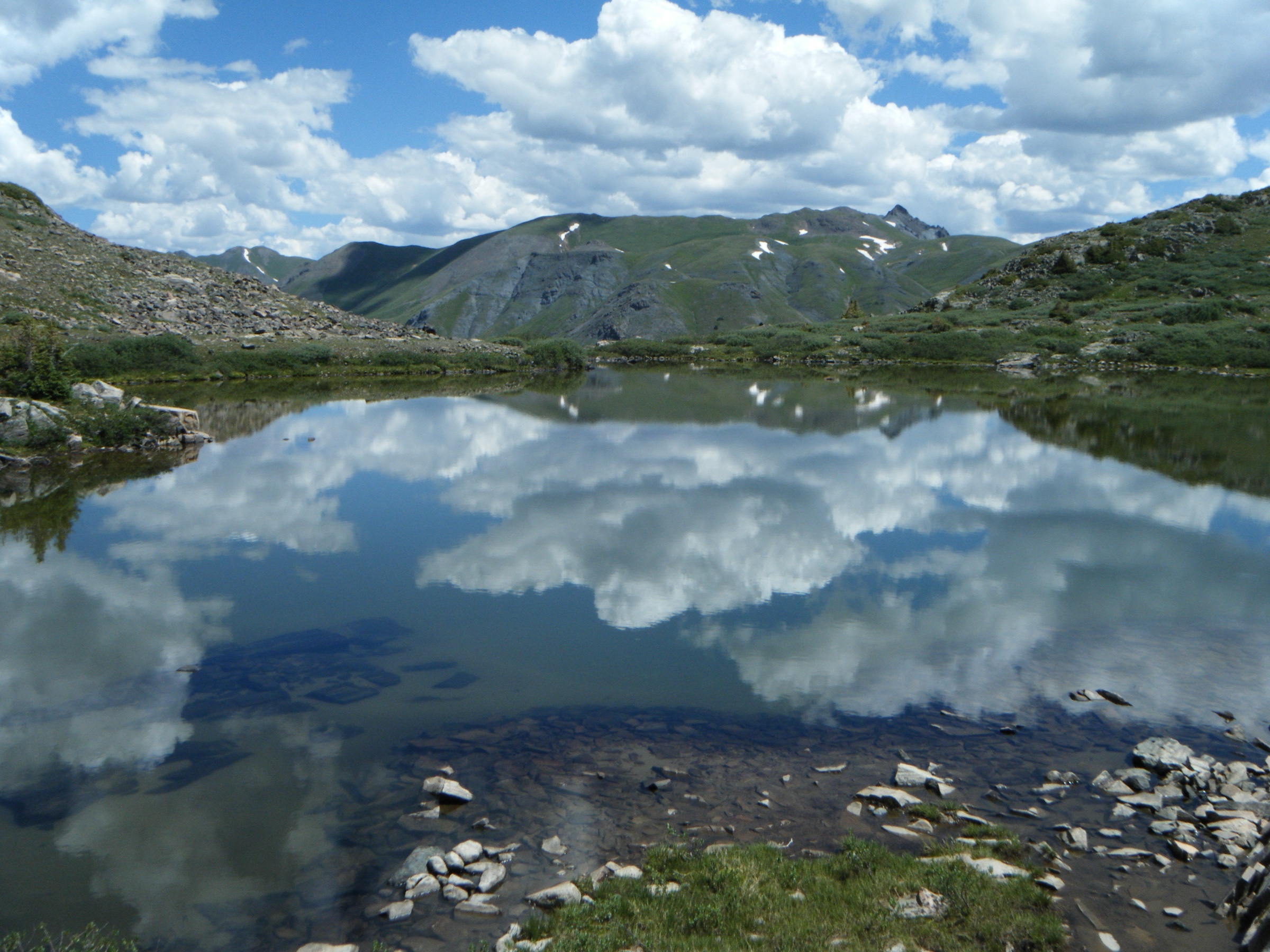
From the Missouri Lakes / Fancy Pass Trailhead at ~3,160 m on the upper Homestake Road, the loop walks counter-clockwise: south-west on the Missouri Lakes Trail through forest and meadow, reaching the lower Missouri Lake at ~3 km and the upper lakes of the basin shortly after, set under the rocky north faces of Treasure Vault Mountain and Fancy Mountain. The trail crosses the Missouri Pass alpine bench at ~3,690 m, drops briefly into the headwaters of the next drainage, and joins the Treasure Vault Lake corridor. From Treasure Vault the route climbs again on the Fancy Pass Trail to Fancy Pass at 3,773 m — the loop’s high point on the Continental Divide-adjacent ridge — before descending steeply past Fancy Lake and the Fancy Creek corridor back to the trailhead. The pass section is the technical crux: the headwall above Treasure Vault is steep, blocky and exposed, and holds snow into mid-July. Snow on the pass changes the day from a hard hike to a small mountaineering exercise.
Why it is essential
This is the strongest lake-and-pass loop in the Leadville orbit. The route covers the most concentrated alpine lake landscape in the Holy Cross Wilderness — Missouri Lakes, Treasure Vault Lake and Fancy Lake in one circuit — and crosses two distinct alpine passes for a true cirque-to-cirque day. As the only loop entry in the catalogue, it adds a route type that the out-and-back summit hikes cannot give.
Equipment
- Mountain hiking boots with good edging support
- Trekking poles — the Fancy Pass descent is steep and loose
- Wind shell, insulated layer, hat and gloves
- 2.5 L water with a treatment plan — refills at Missouri Lakes and Treasure Vault are reliable
- High-SPF sun protection
- Offline map and a printed track; the loop is not always signed at trail junctions
- Headtorch
- Microspikes or a light ice axe if snow remains on Fancy Pass; do not attempt the headwall on hard snow without skills and gear
Hazards and notes
- Snow on the Fancy Pass headwall is the principal seasonal hazard — verify conditions with the Forest Service before mid-July.
- Lightning exposure is severe on both passes; aim to be off the high ground by 13:00 in summer.
- The Homestake Road is unpaved and slow; allow 40–50 minutes from US 24.
- Holy Cross Wilderness rules apply: hand-held leash for dogs, group-size limit of 15, no fires above treeline; check the current Forest Service order before travel.
- The route is often walked as a backcountry overnight — day walkers should expect to see camps at Missouri Lakes and Treasure Vault and respect the no-camping-near-water rule.
- Mosquito pressure in the lower meadows is intense in July; carry repellent.
4. Timberline Lake Trail #1495
Snapshot
Itinerary
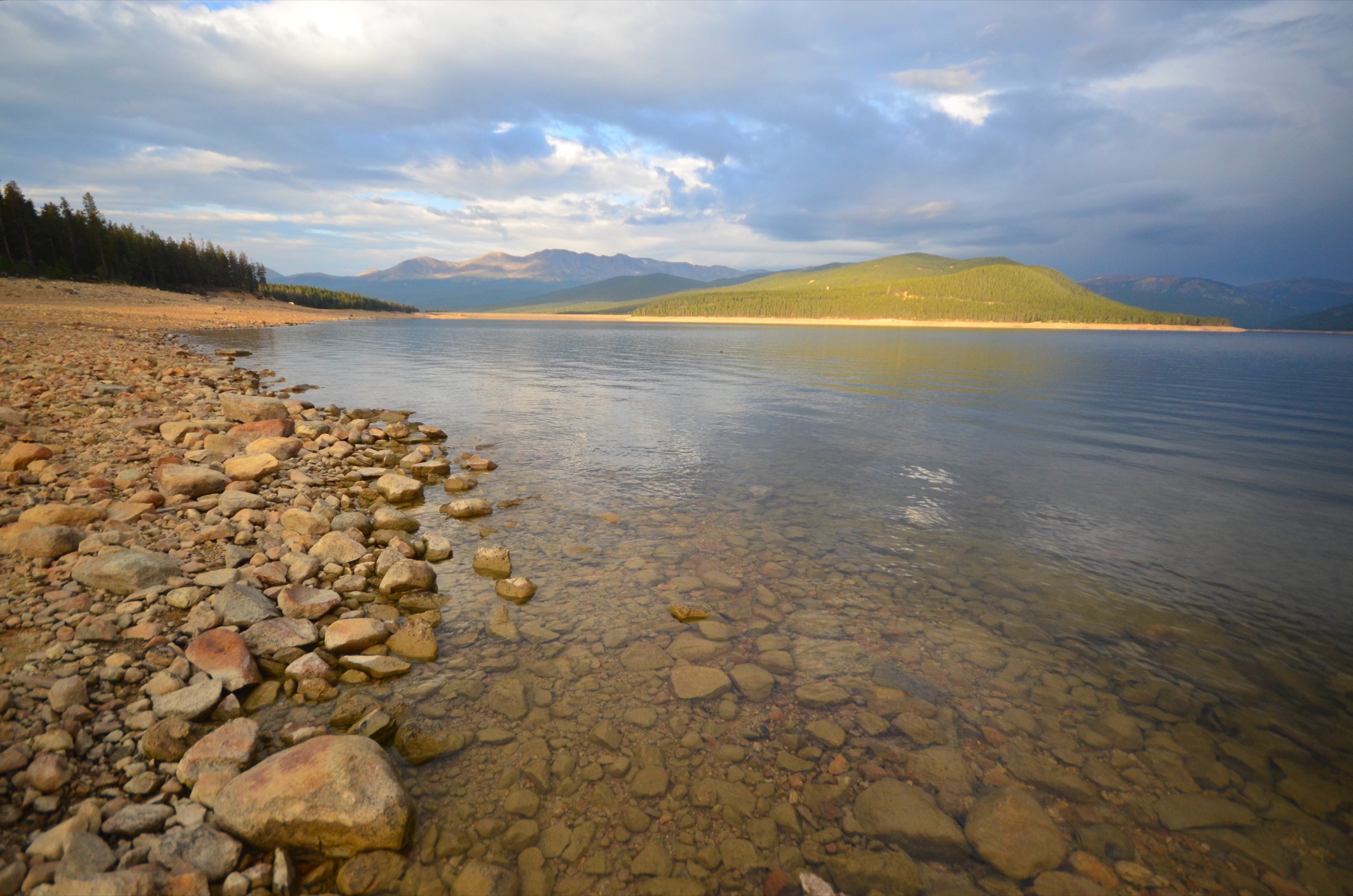
From the Timberline Lake Trailhead at the western end of Turquoise Lake, the route walks west-south-west on USFS Trail #1495 through subalpine spruce and fir, climbing along the Timberline Lake outlet stream. The trail is well-graded throughout: a steady angle of 7–8 % brings it onto the wilderness boundary at ~1.5 km and into the upper basin at ~3 km, ending at Timberline Lake (3,310 m) at the foot of Galena Mountain. The lake is a classic subalpine cirque tarn — a band of open meadow on the north shore, talus on the south, and a horizon dominated by the Continental Divide ridge. The trail is designated foot traffic only by the Forest Service; mountain bikes and stock are not permitted. Return is by the same line.
Why it is essential
Timberline Lake is the cleanest moderate wilderness lake hike in the Leadville orbit. The trail’s short length and modest gain make it the best half-day option in the catalogue, suitable as an acclimatisation walk before Elbert or Massive or as a recovery day afterwards. The Turquoise Lake basin around the trailhead is itself a worthwhile destination, with a Forest Service campground network and a paved loop road around the reservoir.
Equipment
- Hiking shoes or light boots
- Weatherproof layer and a warm mid-layer
- 1.5 L water with a treatment plan
- Trekking poles helpful on the steeper switchbacks
- Sun protection
- Insect repellent in July
- Offline map; cell coverage on Hagerman Pass Road is intermittent
Hazards and notes
- Mosquito pressure in the lower forest is intense from late June through July.
- Wet trail sections persist into mid-July in cold years.
- Snow can linger on the upper switchbacks until early July.
- The trail is foot-traffic only by Forest Service designation — mechanised use is not permitted.
- Holy Cross Wilderness rules apply: dogs on hand-held leash, no group sizes over 15, no fires above treeline.
- Bears are present in the Turquoise Lake basin; store food appropriately at trailheads.
5. Interlaken Historic District
Snapshot
Itinerary
From the Twin Lakes south shore access off Lake County Road 25, the route follows the Colorado Trail / Interlaken trail corridor east along the south shore of Twin Lakes through aspen and lodgepole pine. The trail is near-flat — Twin Lakes sits at 2,813 m and the route gains only ~13 m to its maximum — and at ~3.7 km arrives at the Interlaken Historic District, a late-nineteenth-century lakeside resort that became cut off from the through road when Twin Lakes Reservoir was enlarged in the 1930s. The surviving buildings include the Inter-Laken Hotel (1879) and the Dexter Cabin, both stabilised but unrestored, with interpretive signage describing the original resort layout. Views across the lakes to Mount Elbert and the Sawatch crest are uninterrupted on a clear day. Return is by the same line.
Why it is essential
The Interlaken walk gives the catalogue a near-flat, low-altitude historic counterpoint to the four mountain routes. The Interlaken Historic District is one of the better-preserved late-Victorian resort sites in the central Rockies, and the route’s south-shore corridor is the only good vantage in the region from which to read the relationship between Twin Lakes, the Mount Elbert massif and the southern Sawatch in a single panorama. As a recovery or shoulder-season day it is the most useful entry in the catalogue.
Equipment
- Comfortable hiking shoes
- Weatherproof outer layer
- 1 L water and snacks
- Sun protection
- A warm layer in shoulder seasons — exposed lakeshore is windy
- Light traction if shoulder-season ice is present
- Camera — the lakeside light is some of the best in the region
Hazards and notes
- The historic structures are protected cultural resources; do not climb on or remove material from buildings.
- Reservoir-side ground is muddy after spring melt and through summer afternoon storms.
- Sun and wind exposure across the lake is more intense than the easy gradient suggests.
- The trail is shared with mountain bikes on the Colorado Trail segments — listen for bells.
- Vehicle parking at the Dexter Point and trail access points is informal and limited.
Routes excluded as out of scope
The following sit inside or adjacent to the Leadville Sawatch but fall outside a day-hike entry, are too duplicative of the five above, or are better understood as overnights or technical trips.
- Mount Elbert South / East routes. The South Mount Elbert Trail from CR 24 and the East Ridge from CR 110 are good alternatives to the Northeast Ridge but editorially redundant with entry 1.
- North Halfmoon Lakes from Halfmoon Creek. A strong subalpine lake basin on the same Halfmoon corridor, but covered better as a half-day add-on to entry 2 than as a separate entry.
- Mount of the Holy Cross. The eponymous summit of the Holy Cross Wilderness is a fourteener with a much longer approach from the Half Moon Pass Trailhead; better as an overnight than a day from this entry’s nominal road heads.
- Collegiate Peaks. The major fourteeners south of Twin Lakes — Mount Yale, Mount Harvard, Huron Peak, Mount Belford and Mount Oxford — are covered by the separate Collegiate Peaks entry.
- Hagerman Pass and the Hagerman Tunnel. A historic mining and railway route on the same Hagerman Pass Road as Timberline Lake, but as a vehicle-friendly route at altitude it sits outside the day-hike catalogue.
- Continental Divide Trail through the Holy Cross Wilderness. A canonical Sawatch overnight, not a realistic day-hike from any local trailhead.
Further reading
| Source | URL |
|---|---|
| USFS Mount Massive Wilderness — official page | fs.usda.gov |
| USFS Holy Cross Wilderness — official page | fs.usda.gov |
| USFS Timberline Lake Trail #1495 | fs.usda.gov |
| COTREX — Mt. Elbert Northeast Ridge | trails.colorado.gov |
| Visit Leadville Twin Lakes — Mount Elbert Northeast Trail | leadvilletwinlakes.com |
| 14ers.com — Mount Elbert Northeast Ridge | 14ers.com |
| 14ers.com — Mount Massive Southwest Slopes | 14ers.com |
| AllTrails — Missouri Lakes and Fancy Lakes Loop | alltrails.com |
| AllTrails — Timberline Lake Trail | alltrails.com |
| Wikipedia — Mount Elbert | en.wikipedia.org |
| Wikipedia — Mount Massive | en.wikipedia.org |
| Wikipedia — Holy Cross Wilderness | en.wikipedia.org |
| Wikipedia — Interlaken Resort District | en.wikipedia.org |
| Wikipedia — Twin Lakes Historic District | en.wikipedia.org |
| Wikimedia Commons — Mount Elbert category | commons.wikimedia.org |
| OpenStreetMap (ODbL 1.0) | openstreetmap.org |