Regional overview
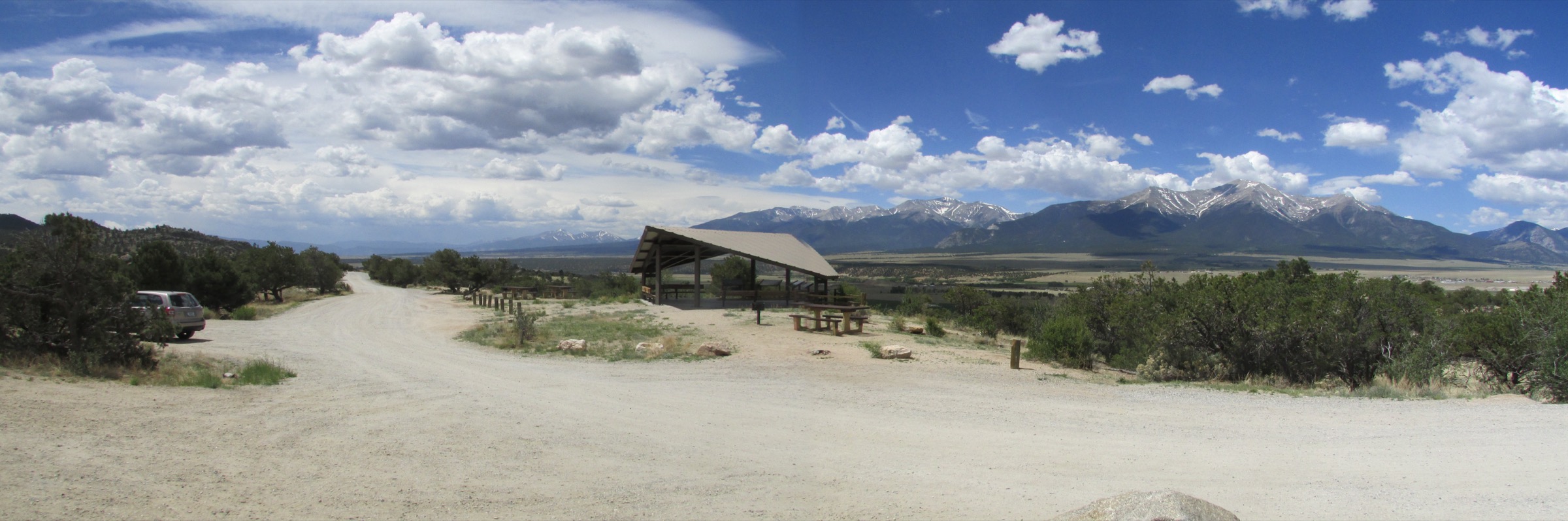
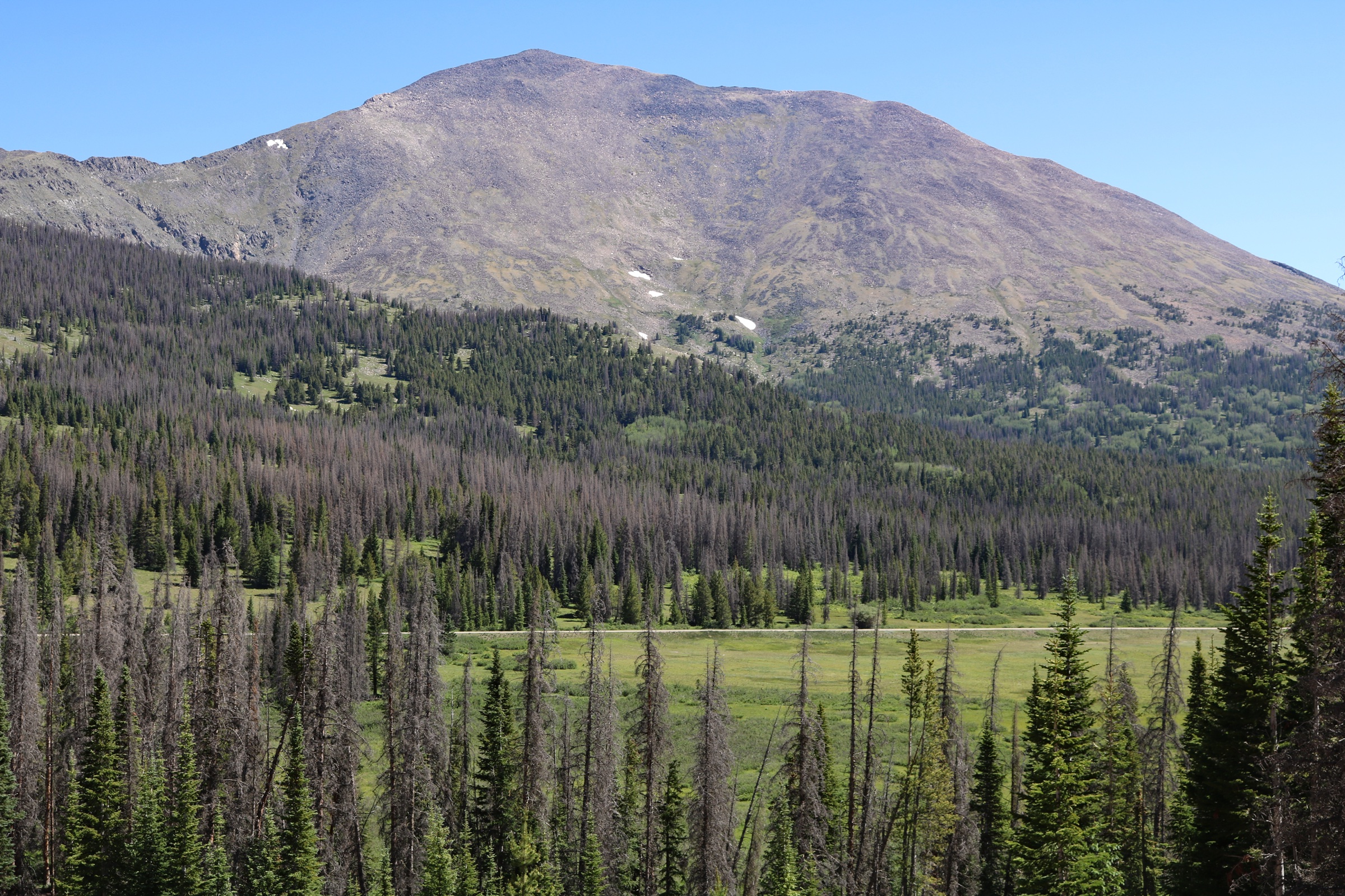
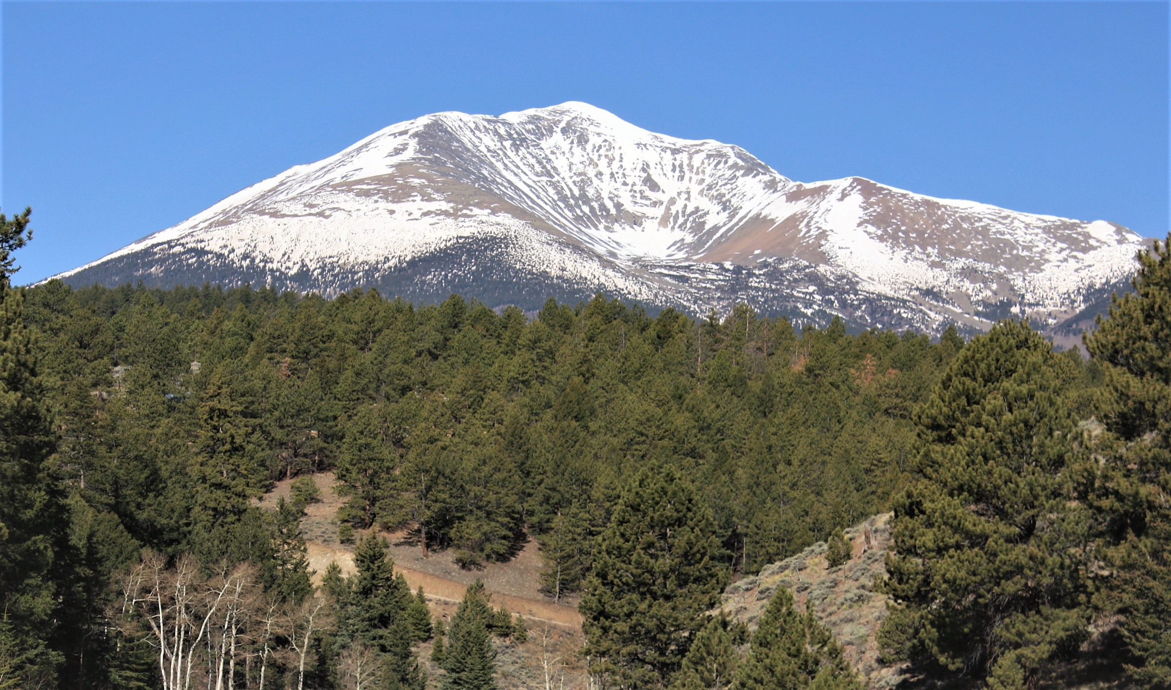
The Monarch Pass region sits on the southern Sawatch crest, where US 50 crosses the Continental Divide at 3,448 m between Salida and Poncha Springs on the Arkansas valley side and Gunnison on the western slope. The pass itself is a high, wind-scoured saddle on the divide, framed to the north by the broad alpine ridge that carries the Monarch Crest segment of the Continental Divide Trail and to the south by Mount Ouray (4,260 m) — the dominant high summit of the southern Sawatch and the natural anchor of any day-hiking trip to the area.
Hiking here is high, open and exposed. The walking landscape is tundra ridges above 3,300 m, old mining roads up the lake basins on the Salida side, short steep climbs into glacial lake cirques off US 50, and long traverses on the Continental Divide Trail above treeline. Access is unusually convenient for Colorado alpine terrain because three of the five hikes below start within minutes of the pass itself, and the Marshall Pass road on the southern side gives a second high road head at 3,300 m. The trade-off is that almost every route in this catalogue sits above treeline for most of its length, and afternoon thunderstorm exposure dominates summer planning.
The walking season at altitude runs June to September. The upper Continental Divide Trail north and south of Monarch Pass usually clears of significant snow by the first week of July in a normal year, and the Boss Lake and Hunt Lake corridor on the South Arkansas drainage can hold snow into early June. By mid-October fresh snow has typically returned to the divide and the Forest Service roads up the South Arkansas (FR 230 and the Monarch Lodge access) start to deteriorate for the season. The lower Waterdog Lakes basin is the shortest and most reliable shoulder-season option in the cluster.
The two principal hazards are altitude and weather. Trailheads start at or above 3,000 m, the Continental Divide Trail crest stays above 3,500 m for most of its length, and Mount Ouray is a 4,260 m off-trail summit; serious altitude illness is realistic on the higher routes. Colorado thunderstorm rules apply across the southern Sawatch: be off summit ridges and exposed passes by lunchtime, especially in late July and August, and treat any building cumulus as a signal to descend. A third planning issue is road access: Forest Road 230 above US 50 toward Boss Lake, and the upper access toward Hunt Lake, are rough and may require high-clearance or four-wheel-drive; the walking distances below assume the lower access where the road is uncertain.
Access is from Colorado Springs Municipal Airport in 2.5–3 h via US 24 west and US 285 south through South Park to Poncha Springs, then west on US 50 over the pass; or from Denver International Airport in 3.5–4 h via US 285 south. There is no scheduled public transport across Monarch Pass; the Monarch Crest shuttle operates seasonally for the popular high-divide mountain-bike traverse and may serve walkers on a case-by-case basis, but every hike in this catalogue assumes a private vehicle or two-car logistics.
For neighbouring sub-regions of the Colorado Rockies, see Mount Elbert and Leadville (the northern Sawatch fourteeners), Holy Cross Wilderness (the western Sawatch divide above Minturn), and the Collegiate Peaks immediately north of Monarch Pass. The San Juan Mountains south-west across Gunnison are covered separately.
Selection rationale
Five day-hikes are presented across the major access lines of the Monarch Pass region: one off-trail high summit on the divide (Mount Ouray), one Continental Divide Trail traverse along the Monarch Crest (CDT Section 49: Marshall Pass to Monarch Pass), one short alpine-lake climb directly off US 50 (Waterdog Lakes), one moderate reservoir-and-lake walk in the South Arkansas drainage (Boss Lake), and one longer lake-basin hike continuing into the same corridor (Hunt Lake). The set is built around route type and altitude rather than length: one off-trail summit, one above-treeline traverse, one short alpine cirque, and two graded lake-basin walks.
The list favours routes close to Monarch Pass rather than expanding broadly into the wider Salida, Collegiate Peaks or Gunnison hiking areas. Collegiate Peaks summits to the north and San Juan routes to the south-west are excluded as better suited to their own catalogues, and the Monarch Crest segment north of Monarch Pass toward Marshall Mountain is left to the longer Colorado Trail / CDT throughline rather than treated as a separate day.
Summary
| # | Hike | Trailhead | Route type | Distance | Gain | Max elevation | Difficulty |
|---|---|---|---|---|---|---|---|
| 1 | Mount Ouray (off-trail) | Marshall Pass area | Out-and-back | 10.5 km | 968 m | 4,260 m | Hard |
| 2 | CDT Section 49: Marshall Pass → Monarch Pass | Marshall Pass | Point-to-point | 18.0 km | 510 m | 3,650 m | Hard |
| 3 | Waterdog Lakes Trail | US 50 near Monarch Park CG | Out-and-back | 5.3 km | 327 m | 3,473 m | Moderate |
| 4 | Boss Lake Trail | US 50 / FR 230 access | Out-and-back | 8.4 km | 379 m | 3,324 m | Moderate |
| 5 | Hunt Lake Trail | US 50 opposite Monarch Lodge | Out-and-back | 12.2 km | 586 m | 3,511 m | Moderate |
1. Mount Ouray (off-trail)
Snapshot
Itinerary
From the Marshall Pass area at ~3,300 m, the route leaves the road on open alpine terrain and works north and west toward the broad south-east shoulder of Mount Ouray. There is no signed or maintained Forest Service trail to the summit, and the line is a completely off-trail ascent — route-finding is by direct line over tundra, grass slopes and increasingly steep talus. The climb gains the south ridge at ~4,000 m and finishes up steeper blocky talus to the summit at 4,260 m, a broad alpine top with a wide southern Sawatch panorama: the Continental Divide running north toward Monarch Pass and the Collegiate Peaks, the Sangre de Cristo Range to the south-east across the upper Arkansas valley, and the San Juan Mountains far to the south-west. Descent is by the same general line; an attentive eye for the gain ridge and the chosen tundra slope above the road is essential, because there is no trail to follow back.
Why it is essential
Mount Ouray is the dominant high summit immediately south of Monarch Pass and one of the landmark mountains of the southern Sawatch. It gives the catalogue a serious off-trail summit day, and its character — no marked route, no Forest Service trail signs, navigation entirely on the walker — distinguishes it sharply from the signed lake and Continental Divide routes that make up the rest of the cluster.
Equipment
- Full alpine day kit and conservative weather judgement
- Sturdy boots and trekking poles for steep grass and talus
- Wind shell and insulated mid-layer (summit gusts of 50–80 km/h are routine)
- Hat and gloves outside high summer
- 2.5–3 L water — no resupply above the start
- High-SPF sun protection — UV at 4,200 m is severe
- Offline map and GPS with spare power, plus a printed map and compass
- Headtorch — slower parties finish in dusk
Hazards and notes
- This is not suitable as a first off-trail mountain route. Navigation, steep grass and talus, storms, altitude and the retreat decision are the core hazards.
- Lightning risk above 3,800 m is severe in late July and August — start early, aim to be off the summit by mid-morning and well below the upper slopes by lunchtime.
- The route is explicitly off-trail; cairns or visible boot tread cannot be relied on to guide return.
- Marshall Pass road condition varies seasonally — check current Forest Service and county updates before driving the upper access.
- Dogs are permitted but should be on a hand-held leash on the upper slopes for both wildlife and rockfall reasons.
- Mount Ouray sits inside grazing and dispersed-use country — current rules and any local closures should be checked locally before travel.
2. CDT Section 49: Marshall Pass to Monarch Pass
Snapshot
Itinerary
From Marshall Pass at 3,300 m on the south side of Mount Ouray, the Continental Divide Trail (concurrent here with the Colorado Trail) heads north along the open ridgeline. The first 4 km climb gently through scattered spruce and onto open tundra, then break out onto the high divide proper with views east into the Arkansas valley and west across the upper Tomichi Creek drainage. The line stays above 3,500 m for most of the day, dipping briefly to cross saddles and rising over rounded tundra summits on the way north. After ~12 km the trail crests the high point at ~3,650 m and begins the descending traverse toward Monarch Pass, dropping through subalpine fir and engelmann spruce in the last 3 km to the highway at the Monarch Crest store at 3,448 m. Total walking is roughly 18 km, and the day depends on a shuttle or two-car arrangement at either end.
Why it is essential
The Monarch Crest is the defining walking line of the pass region, and the Marshall Pass to Monarch Pass section is the single most representative day on it. It gives a direct Continental Divide experience without committing to a multi-day CDT itinerary, and the day’s high tundra ridges and long open views are not duplicated elsewhere in this catalogue.
Equipment
- Windproof and waterproof shell layers — there is no shelter above treeline for most of the day
- Warm insulated mid-layer
- Sun protection, hat and gloves
- 2–3 L water or a reliable treatment plan; the divide is dry
- Food for a long day; lunch eaten low rather than on the high point
- Offline map and GPS — the trail is well-marked but conditions can erase visibility in minutes
- Headtorch
- Confirmed shuttle or two-car logistics for the start/finish
Hazards and notes
- Lightning is the single biggest hazard on this route — be off the highest sections by mid-morning during the July to August monsoon and treat building cumulus as a signal to descend.
- Wind is consistent and often strong on the open divide; expect 40–60 km/h gusts even on otherwise calm days.
- Water is unreliable on the crest — fill at the start or plan a treatment stop at one of the lower saddles.
- Mountain bikes use this section as part of the popular Monarch Crest descent; expect groups, particularly on weekends.
- Confirm dog rules, dispersed-use restrictions and any seasonal closures locally before travel.
3. Waterdog Lakes Trail
Snapshot
Itinerary
From the US 50 parking area near the Monarch Park Campground road, the trail climbs steeply into the lodgepole pine forest on the south side of the highway. The route crosses Waterdog Creek twice in the first kilometre — both crossings are usually straightforward by midsummer but can be wet and slippery in runoff — then turns south-east up the basin on rough, rocky tread. After ~2.5 km the trail emerges at Lower Waterdog Lake at 3,473 m, a small alpine tarn ringed by talus and lingering snowfield. There is no designated trail to the upper second lake; the lower lake is the selected objective. Return is by the same line.
Why it is essential
Waterdog Lakes is the compact alpine-lake hike of the Monarch Pass region — short enough to do in a half day, steep enough to feel like a proper alpine objective, and close to the pass without requiring a high traverse. It is the obvious shoulder-season or acclimatisation day for the cluster.
Equipment
- Trail shoes or light boots with grip for the rocky and sometimes wet tread
- Trekking poles helpful for the creek crossings and the steep upper section
- Warm and wind layers — the lake basin holds cold air even in midsummer
- Rain shell — afternoon storms build quickly off the divide
- Sun protection
- 1.5 L water, snacks
- Offline map and GPS — the trailhead sign is easy to miss from US 50
Hazards and notes
- Steep rocky tread can be loose and uneven; descend with care.
- Both creek crossings may be wet or awkward in early-season high water.
- Roadside parking on US 50 is informal — park well clear of the highway and watch for fast highway traffic on the walk-in.
- Lingering snow on the upper slopes into late June can make the final approach to the lake icy.
- High elevation — even at 3,473 m, altitude is a real factor for unacclimatised parties straight off the I-25 corridor.
4. Boss Lake Trail
Snapshot
Itinerary
From the US 50 / FR 230 access corridor, the route climbs steadily beside the Middle Fork South Arkansas River through spruce-fir forest on what is largely an old road bed. The grade is mostly even with one steeper section above the lower meadows. When FR 230 is open and driveable for 4WD, the walking distance can be shortened by starting from a higher trailhead; the catalogue figure of 8.4 km uses the route from the lower access. The route ends at Boss Lake Reservoir at 3,324 m, a small impounded lake set against the southern flank of the Continental Divide. Return is by the same line.
Why it is essential
Boss Lake is the most accessible alpine-lake objective near Monarch Pass and a useful moderate option between the short Waterdog Lakes outing and the longer Hunt Lake walk further up the same corridor. It is a good first day in the region for parties acclimatising to altitude.
Equipment
- Sturdy trail shoes or light boots
- Trekking poles for the upper grade
- Warm and wind layers
- Rain shell — afternoon storms are common in summer
- Sun protection
- 1.5–2 L water, snacks
- Offline map and GPS
Hazards and notes
- Road condition is the main planning variable — if FR 230 is rough or gated, treat the route as a road walk rather than a drive.
- Snow lingers into early June in some years and the lower meadows are wet through the runoff window.
- High-elevation thunderstorms build quickly; aim to be off the upper sections by early afternoon.
- The reservoir is part of an active water management system; respect any signed restrictions on the dam and outlet structures.
- Dispersed-use rules and seasonal fire bans should be checked locally before travel.
5. Hunt Lake Trail
Snapshot
Itinerary
From the US 50 / Monarch Lodge access on the south side of the highway, the route enters the same broad corridor as the Boss Lake walk and follows the Boss Lake / Hunt Lake trail south through spruce-fir forest. The line passes the Boss Lake Reservoir area at ~3,324 m, then continues higher into the basin on rougher tread. The upper section climbs onto open subalpine slopes below the Continental Divide and reaches Hunt Lake at 3,511 m, a small lake set in a cirque against the divide ridge. The lake is the catalogue objective; total walking is roughly 12.2 km out and back. Return is by the same line, and the most committing part of the day is the climb out of the Hunt Lake cirque back over the access ridge.
Why it is essential
Hunt Lake is the longer lake-basin walk of the Monarch Pass cluster, extending past the easier Boss Lake objective into a more remote divide-side setting. It is the natural pairing with the CDT Marshall–Monarch traverse for parties who want two long days in the region.
Equipment
- Sturdy footwear with grip for rough upper tread
- Trekking poles
- Warm and wind layers
- Waterproof shell
- Sun protection
- Water treatment for the streams in the basin
- 2 L water carried, snacks
- Offline map and GPS
- Headtorch — slower parties may finish in twilight
- Microspikes useful in early season when snow lingers high in the basin
Hazards and notes
- Heavy snow may persist until late May or early June; check current conditions before committing to the upper basin.
- Rough road access is the main pre-walk planning issue; if the upper access is closed, the walking distance and time go up significantly.
- Altitude, lightning and exposure are the same as for the other higher routes — be off the open upper slopes by early afternoon.
- Catch-and-release fishery restrictions and any Greenback Cutthroat recovery rules in the basin should be confirmed with Colorado Parks and Wildlife before any angling activity.
- Dispersed-use rules and seasonal fire bans should be checked locally before travel.
Routes excluded as out of scope
The following sit inside or adjacent to the Monarch Pass region but fall outside a day-hike entry, are too duplicative of the five above, or are better understood as overnights or technical trips.
- CDT Section 49 northbound continuation toward Marshall Mountain. A natural extension of the divide traverse but better as part of a longer CDT throughline than a separate day from Monarch Pass.
- Monarch Crest mountain-bike traverse to Silver Creek / Rainbow Trail. The popular shuttle descent on the same divide section, but a mountain-bike route rather than a day-hike.
- Mount Ouray from the Salida side / north ridge variants. Alternative lines to the same summit, but editorially redundant with entry 1.
- Bushnell Lakes and the broader San Isabel lake basins south-east of the pass. Strong objectives but outside the immediate Monarch Pass cluster.
- Collegiate Peaks fourteeners north of US 50. Mount Shavano, Tabeguache Peak and the Antero group sit just north of the catalogue area and are better covered by their own entry.
Further reading
| Source | URL |
|---|---|
| USFS Salida Ranger District — San Isabel National Forest | fs.usda.gov |
| Continental Divide Trail Coalition — explore the trail | continentaldividetrail.org |
| Monarch Crest shuttle / reservation reference | monarchcrest.com |
| AllTrails — Mount Ouray | alltrails.com |
| AllTrails — CDT Section 49: Marshall Pass to Monarch Pass | alltrails.com |
| AllTrails — Waterdog Lakes Trail | alltrails.com |
| AllTrails — Boss Lake Trail | alltrails.com |
| AllTrails — Hunt Lake Trail | alltrails.com |
| Wikipedia — Monarch Pass | en.wikipedia.org |
| Wikipedia — Marshall Pass | en.wikipedia.org |
| Wikipedia — Mount Ouray | en.wikipedia.org |
| Wikipedia — Continental Divide Trail | en.wikipedia.org |
| Wikimedia Commons — Monarch Pass | commons.wikimedia.org |
| OpenStreetMap (ODbL 1.0) | openstreetmap.org |