Regional overview
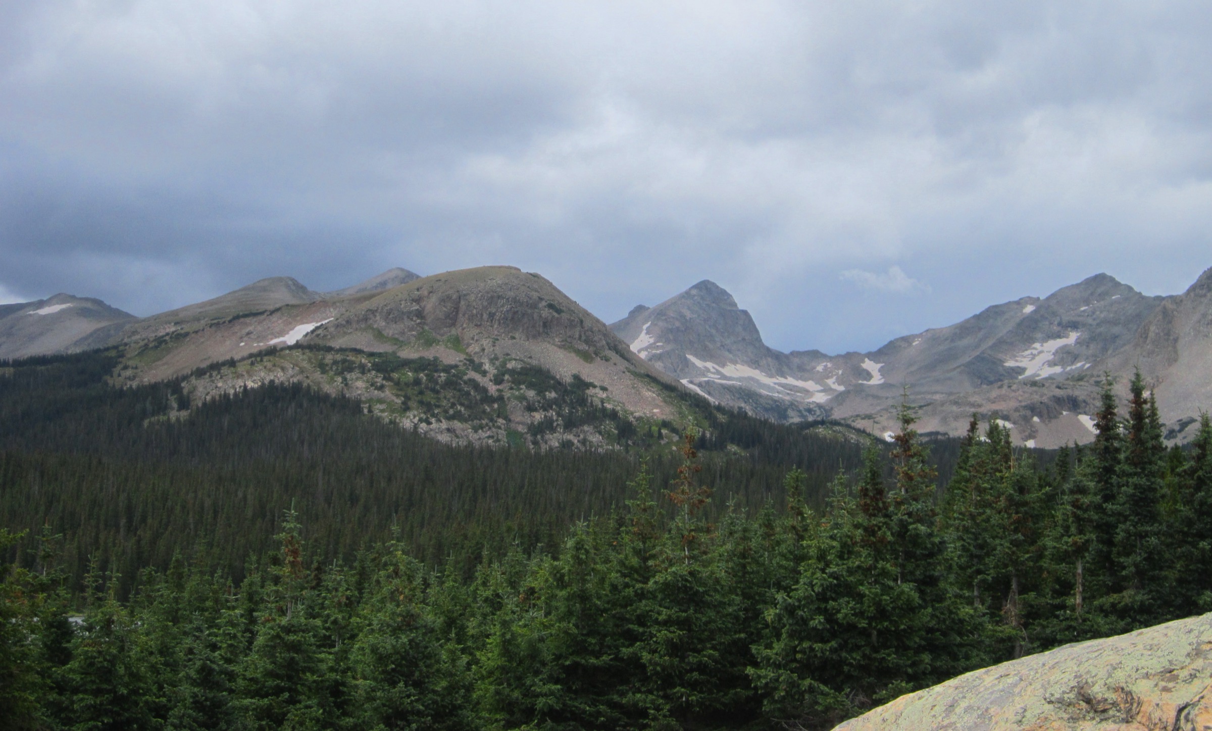
The Pikes Peak region covers the southern Front Range around Colorado Springs, Manitou Springs, Green Mountain Falls, Divide, North Cheyenne Cañon and the western and southern flanks of Pikes Peak itself. The walking character ranges from town-accessible foothill trails to long timberline ascents, granite outcrops, montane forest, decomposed-granite paths, high ridges and the 4,302 m summit of Pikes Peak, the southernmost of Colorado’s most recognisable fourteeners.
The core hiking season is late spring through autumn for mid-elevation trails, and usually July to September for the highest summit objectives. Snow, ice and wind can affect Pikes Peak well outside winter, while afternoon thunderstorms are a major summer hazard above treeline. Several trailheads have parking pressure, local restrictions, seasonal road issues, or private/municipal land boundaries, so access should be checked before travel rather than assumed from older guidebooks.
The region’s distinctive feature is contrast. Barr Trail gives one of the most famous non-technical fourteener ascents in Colorado from a working mountain town, while The Crags, Pancake Rocks, Mount Rosa and Catamount Trail show the more forested, rocky and reservoir-side character of the western and northern Pikes Peak massif. The combination is a complete picture of the southern Front Range in five routes. For higher and wilder Colorado day-hikes further west, see the Elk Mountains Maroon Bells–Snowmass day-hikes entry and the San Juan Ouray, Silverton and Telluride day-hikes entry.
Selection rationale
These five hikes balance the region’s iconic summit route, a classic western-slope crag viewpoint, a distinctive rock-formation hike, a quieter high summit on the southern side of the massif, and a historic Green Mountain Falls reservoir route. The selection avoids duplicating multiple short Colorado Springs foothill walks and keeps the focus on the Pikes Peak mountain region. Distances run from a 7 km half-day on The Crags to a 39 km Barr Trail summit day; maximum elevations span 2,817 m at the Catamount reservoirs to 4,302 m on Pikes Peak, so altitude is the controlling fitness factor on two of the five.
Summary table
| # | Hike | Country | Route type | Distance | Gain | Max elevation | Difficulty |
|---|---|---|---|---|---|---|---|
| 1 | Pikes Peak via Barr Trail | USA | Out-and-back | 38.9 km | 2,269 m | 4,302 m | Very hard |
| 2 | The Crags Trail #664 | USA | Out-and-back | 7.3–8.0 km | 244–249 m | ~3,170 m | Moderate |
| 3 | Pancake Rocks | USA | Out-and-back | 9.5 km | 363 m | Unresolved | Moderate–hard |
| 4 | Mount Rosa from Frosty Park | USA | Out-and-back | 11.1–12.2 km | 535–572 m | 3,521 m | Hard |
| 5 | Catamount Trail to South Catamount Reservoir | USA | Out-and-back / point-to-point variant | 7.9–9.7 km | 459–518 m | ~2,817 m | Moderate–hard |
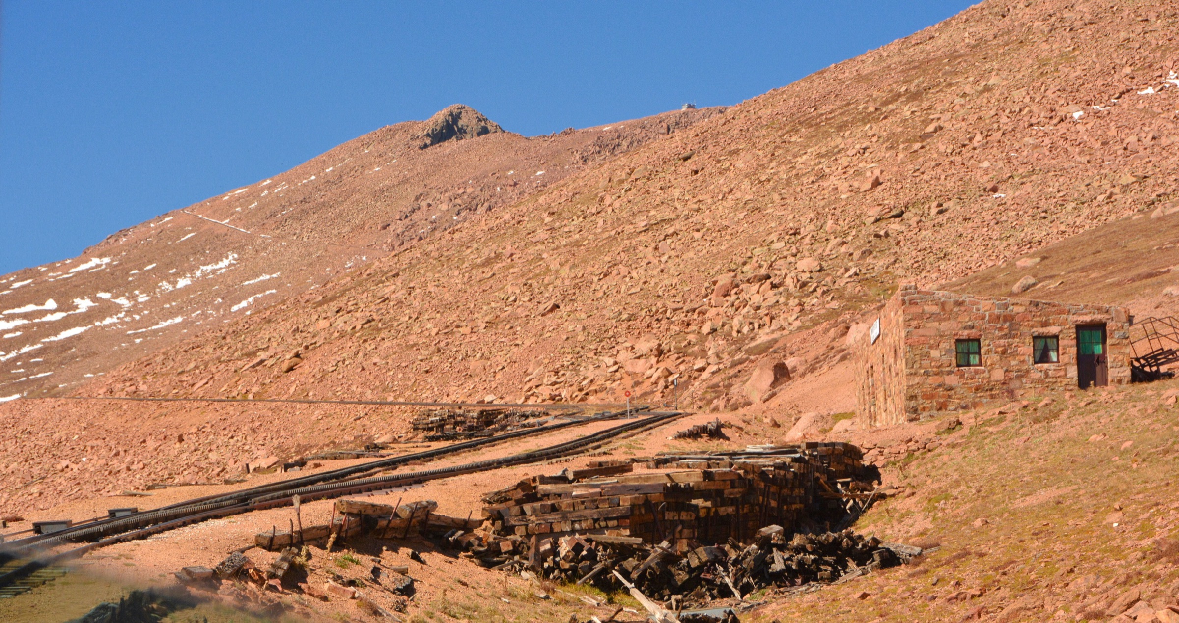
1. Pikes Peak via Barr Trail
Snapshot
Itinerary
Barr Trail starts at the upper edge of Manitou Springs and climbs steadily through forested lower slopes, the long Ws switchbacks, the open shoulder at Barr Camp country and then into open alpine terrain on the upper mountain, finishing at the Pikes Peak summit at 4,302 m. AllTrails records the full route as a 38.9 km out-and-back with 2,269 m of elevation gain. Visit Colorado Springs describes the trail as an advanced route because of the long distance and the major altitude gain from Manitou Springs to the summit.
The day-hike version is a very long undertaking and is at the upper edge of the distance range for this catalogue, but it is included because it is the defining foot ascent of Pikes Peak. Strong parties sometimes arrange a one-way descent by the cog railway or by vehicle from the summit, but those logistics depend on operating seasons, ticket availability and weather, and should not be assumed.
Why it is essential
Barr Trail is the classic pedestrian route to Pikes Peak, one of Colorado’s most recognisable fourteeners and a landmark of the southern Front Range. It represents the region’s biggest vertical journey, from a working mountain town at roughly 2,000 m to the alpine summit, and is the route that defines the mountain’s foot-hiking identity.
Equipment
Full mountain day kit: sturdy boots, trekking poles, waterproof/windproof shell, warm insulating layer, hat and gloves outside midsummer, sun protection, food for a full day, 3–4 litres of water or a reliable treatment plan, offline map/GPS, navigation backup and a headlamp. Microspikes may be required when snow or ice remains on the upper mountain.
Hazards and notes
Altitude illness, dehydration, fatigue, exposure above treeline, lightning, hail, snow, strong wind and navigation problems in poor visibility are the main issues. The summit is reachable by road and railway, but that does not reduce the seriousness of the hiking route. Early starts are standard in summer to limit thunderstorm exposure on the upper mountain.
GPX / route file
| Source | URL | Format / access | Reuse status |
|---|---|---|---|
| AllTrails — Pikes Peak via Barr Trail | alltrails.com | Source map / downloadable route via AllTrails account | AllTrails terms apply; direct GPX not retrieved; source-map reference only |
| USDA Forest Service — Pikes Peak Ranger District | fs.usda.gov | Official recreation district page | No route-file licence stated; official context only |
Further reading
- USDA Forest Service — Pikes Peak Ranger District
- Visit Colorado Springs — Barr Trail / Pikes Peak
- Pikes Peak Region Attractions — Hiking Pikes Peak
- AllTrails — Pikes Peak via Barr Trail
2. The Crags Trail #664
Snapshot
Itinerary
The Crags Trail climbs from the western side of Pikes Peak through spruce-fir forest and meadow terrain toward a cluster of granite outcrops and viewpoints over the upper Pikes Peak massif. The Forest Service describes the trail to The Crags as a moderately difficult 2.5-mile route with about 800 ft of elevation change, while Colorado Mountain Club material gives a 4.54-mile round trip with 818 ft of gain. The route is shorter and less committing than the Pikes Peak summit trails, but it still reaches high mountain terrain and can be snowy, windy or muddy depending on season.
Why it is essential
The Crags is the classic western-slope Pikes Peak day-hike: short enough for a half day, but highly representative of the granite, forest and open-view terrain that distinguishes the massif from the lower Colorado Springs foothills. It is the natural companion to Barr Trail when the summit is out of reach.
Equipment
Standard hiking equipment: hiking shoes or boots, weatherproof layer, warm layer, water, food, sun protection and map/GPS. Traction may be useful during spring, autumn or after storms.
Hazards and notes
Snow, ice, mud, exposed viewpoints and afternoon thunderstorms are the main hazards. Forest roads near the trailhead may be affected by snow or seasonal maintenance conditions. Stay on durable surfaces around the crag viewpoints to limit fragile alpine-edge wear.
GPX / route file
| Source | URL | Format / access | Reuse status |
|---|---|---|---|
| Colorado Mountain Club — The Crags Trail | cmc.org | Source route page | Route-file licence not stated; no GPX downloaded; source-map/statistics reference only |
| USDA Forest Service — Pikes Peak Ranger District | fs.usda.gov | Official trail listing / recreation page | No GPX terms stated; official route context only |
Further reading
- USDA Forest Service — Pikes Peak Ranger District
- USDA Forest Service — Pikes Peak wildflowers / Crags Trail access note
- Colorado Mountain Club — The Crags Trail
3. Pancake Rocks
Snapshot
Itinerary
The route climbs from the Horsethief Park side of the Pikes Peak massif through forest and rocky terrain to the distinctive layered granite outcrops known as Pancake Rocks. Visit Colorado Springs lists the hike as 5.88 miles round trip with 1,191 ft of elevation gain and a moderate-to-difficult rating. Some databases combine Pancake Rocks with the lower Horsethief Falls or other variants, producing longer distances and larger elevation-gain figures; this entry uses the Visit Colorado Springs Pancake Rocks statistics for the core out-and-back hike.
Why it is essential
Pancake Rocks gives the catalogue a distinctive geological hike rather than another summit objective. The layered granite formations and the western Pikes Peak forest setting are a compact, memorable expression of the region’s bedrock character.
Equipment
Standard hiking equipment: sturdy footwear, weatherproof layer, water, food, sun protection and map/GPS. Trekking poles help on steeper or loose sections.
Hazards and notes
Snow, ice, mud, loose gravel, cliff-edge behaviour around viewpoints and afternoon thunderstorms are the main hazards. Route statistics vary where sources combine Pancake Rocks with Horsethief Falls, and the exact high-point elevation remains unresolved in published material.
GPX / route file
| Source | URL | Format / access | Reuse status |
|---|---|---|---|
| Visit Colorado Springs — Pancake Rocks | visitcos.com | Official tourism route description | No downloadable route-file terms stated; source route/statistics only |
| AllTrails — Pancake Rocks and Horsethief Falls Trail | alltrails.com | Source map / route variant | AllTrails terms apply; direct GPX not retrieved; variant source-map reference only |
Further reading
4. Mount Rosa from Frosty Park
Snapshot
Itinerary
The Mount Rosa route uses the Frosty Park side of the Pikes Peak massif and climbs from forest-road terrain toward the 11,553 ft (3,521 m) summit. Colorado Mountain Club describes Mount Rosa as a moderate 6.9-mile hike with 1,755 ft of elevation gain, while AllTrails records a 7.6-mile route with 1,876 ft of gain. The route gives a quieter high summit than Pikes Peak and broad views across the southern Front Range when visibility is good.
Why it is essential
Mount Rosa adds a high but less-commercial summit to the Pikes Peak selection. It is historically and geographically tied to the massif, but feels more remote than the main Pikes Peak access corridors, and gives a strong day option for parties who want altitude without the Barr Trail commitment.
Equipment
Full mountain day kit: sturdy boots, trekking poles recommended, warm layer, rain/wind shell, sun protection, map/GPS, navigation backup, food, water and a headlamp. Carry traction if snow or ice remains on the upper sections.
Hazards and notes
Forest-road access, lingering snow, lightning, wind, altitude and navigation are the main issues. The summit is high enough for sudden cold changes. Road conditions can materially change the difficulty and the practical start point.
GPX / route file
| Source | URL | Format / access | Reuse status |
|---|---|---|---|
| Colorado Mountain Club — Mount Rosa | cmc.org | Source route page | Route-file licence not stated; no GPX downloaded; source-map/statistics reference only |
| AllTrails — Mount Rosa Trail | alltrails.com | Source map / route page | AllTrails terms apply; direct GPX not retrieved; source-map reference only |
Further reading
5. Catamount Trail to South Catamount Reservoir
Snapshot
Itinerary
Catamount Trail climbs from Green Mountain Falls toward the Catamount reservoir country on the north side of Pikes Peak. Visit Colorado Springs describes it as a roughly 6-mile round trip with about 1,700 ft of elevation gain; Manitou Springs material lists a 4.90-mile out-and-back with 1,506 ft of gain; Hiking Project describes a 2.3-mile point-to-point segment climbing from Green Mountain Falls toward South Catamount Reservoir. The route is therefore best treated as a source-dependent hike with several possible turnaround points. The essential character is the climb from the town into forested Pikes Peak reservoir terrain.
Why it is essential
Catamount Trail represents the Green Mountain Falls side of the Pikes Peak region, combining historic resort-town access, forested climbing and reservoir views rather than a major summit. It complements the higher routes and gives the catalogue a town-to-water-feature option.
Equipment
Standard hiking equipment: sturdy shoes or boots, water, food, weatherproof layer, warm layer, sun protection and map/GPS. Carry traction if snow or ice is present.
Hazards and notes
Route variants, municipal/utility land boundaries, access rules near the reservoirs, parking constraints, ice and afternoon thunderstorms require attention. The exact permitted continuation to reservoir areas should be checked locally before departure rather than assumed from older maps.
GPX / route file
| Source | URL | Format / access | Reuse status |
|---|---|---|---|
| Visit Colorado Springs — Catamount Trail | visitcos.com | Official tourism route description | No downloadable route-file terms stated; source route/statistics only |
| Manitou Springs — Catamount Trail | manitousprings.org | Local tourism route description | No route-file licence stated; source route/statistics only |
| Hiking Project — Catamount Trail (Green Mountain Falls) | hikingproject.com | Source map / route page | Hiking Project / Adventure Projects terms apply; direct GPX not retrieved; source-map reference only |
Further reading
- Visit Colorado Springs — Catamount Trail
- Manitou Springs — Catamount Trail
- Hiking Project — Catamount Trail, Green Mountain Falls
Missing data / follow-up work
- Direct GPX/KML files were not downloaded for any route; all route references are source maps or official/source pages.
- Route-specific licence-compatible photos were not found for The Crags, Pancake Rocks, Mount Rosa or Catamount Trail in this pass. The only contextual Wikimedia candidate for The Crags is below the 2,000 px floor used for this site.
- Pancake Rocks maximum elevation remains unresolved between sources.
- Catamount Trail statistics vary between sources because of different endpoints and access variants.
- Barr Trail practical logistics depend on current Manitou Springs parking, shuttle, cog railway, summit-road and weather arrangements.
- Forest-road access for The Crags, Pancake Rocks and Mount Rosa should be checked for seasonal closures, snow and maintenance before travel.
Further reading
| Source | URL |
|---|---|
| USDA Forest Service — Pikes Peak Ranger District | fs.usda.gov |
| USDA Forest Service — Pikes Peak wildflowers / Crags Trail access note | fs.usda.gov |
| Visit Colorado Springs — hiking pages | visitcos.com |
| Pikes Peak Region Attractions — Hiking Pikes Peak | pikes-peak.com |
| Colorado Mountain Club — route pages | cmc.org |
| AllTrails — route pages | alltrails.com |
| Hiking Project — route pages | hikingproject.com |
| Wikimedia Commons — Category: Pikes Peak | commons.wikimedia.org |
| Wikipedia — Pikes Peak | en.wikipedia.org |