Regional overview
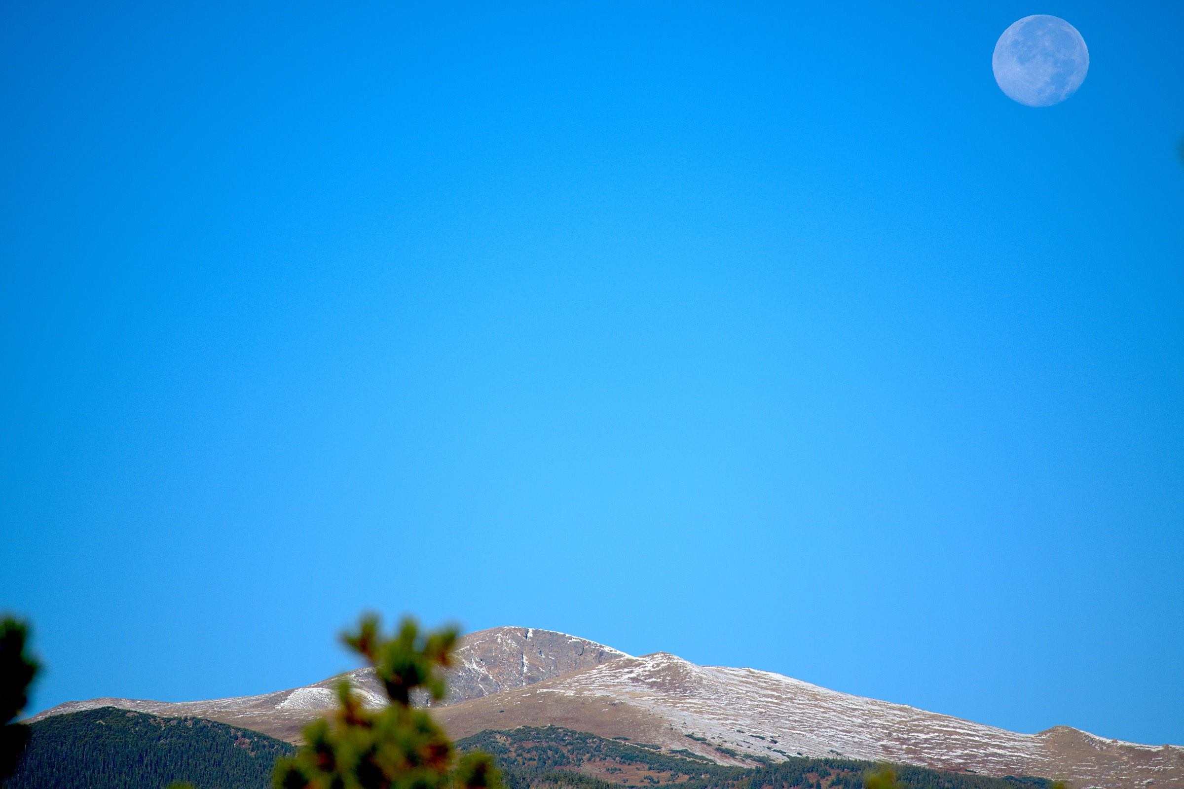
This Front Range sector covers the high divide around James Peak (4,058 m / 13,310 ft), Berthoud Pass (3,446 m), Guanella Pass (3,571 m), Echo Lake (3,229 m) and the Mount Blue Sky high country. The summit historically and still commonly called Mount Evans (4,348 m / 14,265 ft) was officially renamed Mount Blue Sky in 2023 by the US Board on Geographic Names; older route pages, the surrounding Mount Evans Wilderness, the Mount Evans Scenic Byway road, and many Wikimedia image titles still use the former name. This page uses Mount Blue Sky for the mountain and the recreation area, and preserves “Mount Evans” only where it appears in a source title or proper name still in use.
The hiking character is high, wind-scoured and road- and parking-dependent to a degree unusual for Colorado wilderness. All five featured routes top out above 3,500 m (11,480 ft) and three exceed 4,000 m (13,120 ft) — thirteener tundra ridges, two of Colorado’s most-walked Fourteeners, and a long but non-technical alpine lake basin. The summer ridges are exposed to wind, lightning and rapid weather change; the surrounding passes are paved or semi-paved but the trailhead parking is the most common access constraint of any Front Range area.
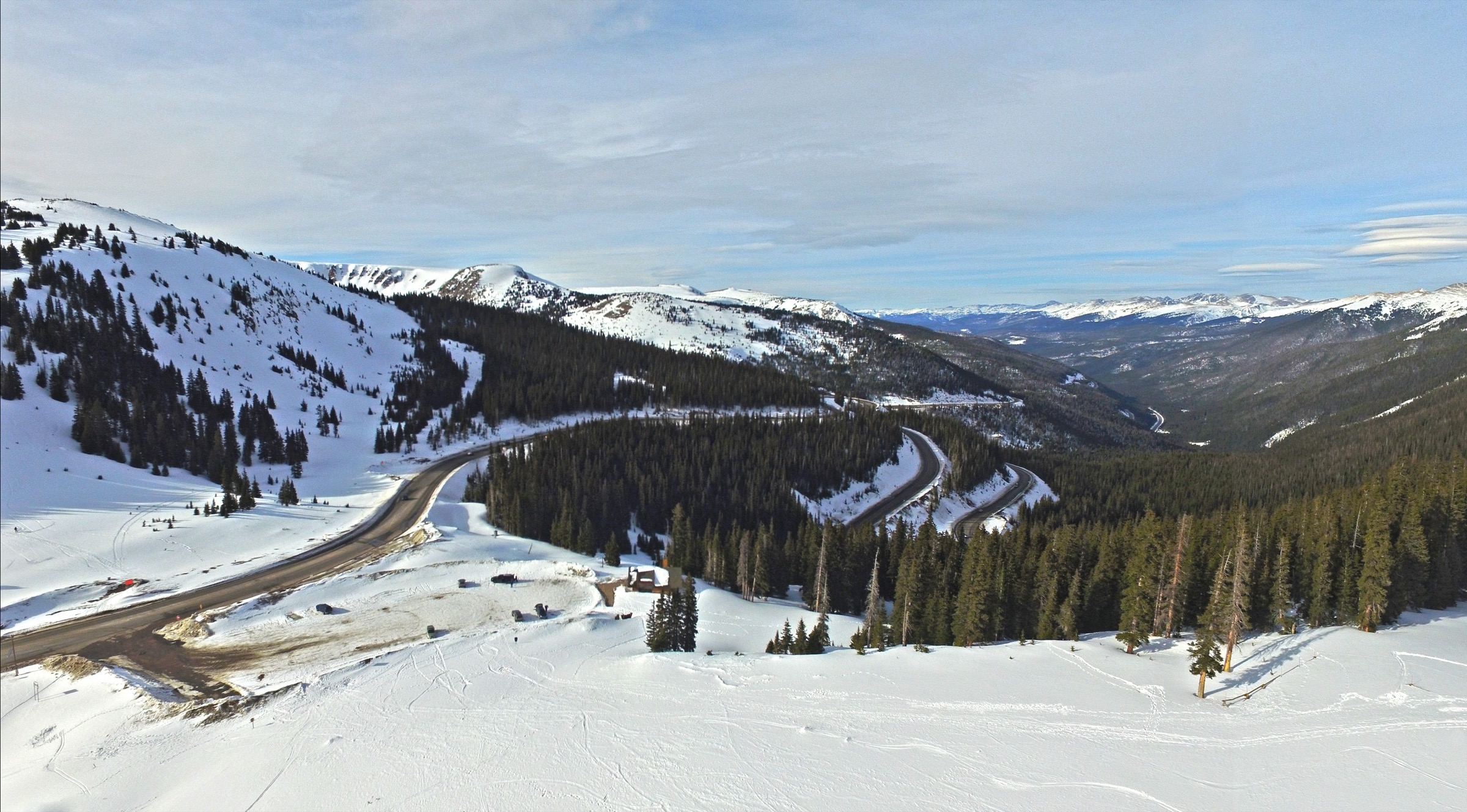
Mount Blue Sky access in 2026 is governed by a Recreation.gov timed-ticket reservation system for vehicle and motorcycle entry to the Mount Blue Sky Recreation Area. Tickets must be purchased before arrival — Recreation.gov notes explicitly that there is no cell service at the welcome station. The 2026 page also lists specific event closures of Mount Blue Sky Road / CO Highway 5 on 28 June, 11 July and 25 July 2026, with reservations on those dates only available for the 15:00 and 17:00 time slots. Weather can close the road at any time. The Guanella Pass road and the upper section of US 40 over Berthoud Pass are subject to the usual Colorado seasonal road-condition variability — check CDOT before driving.
The walking season runs June to October for most of these routes, with July and August the most settled summer months. Snow can persist into July on north-facing aspects (the St. Mary’s snowfield being the most visible example) and the Mount Blue Sky summit road is itself only open during the timed-ticket season. Afternoon thunderstorms are the dominant summer hazard above treeline — the standard turnaround on all five routes is by 12:00–13:00 in monsoon weeks. Mobile signal is absent across most of the Mount Blue Sky Recreation Area and patchy elsewhere on the divide.
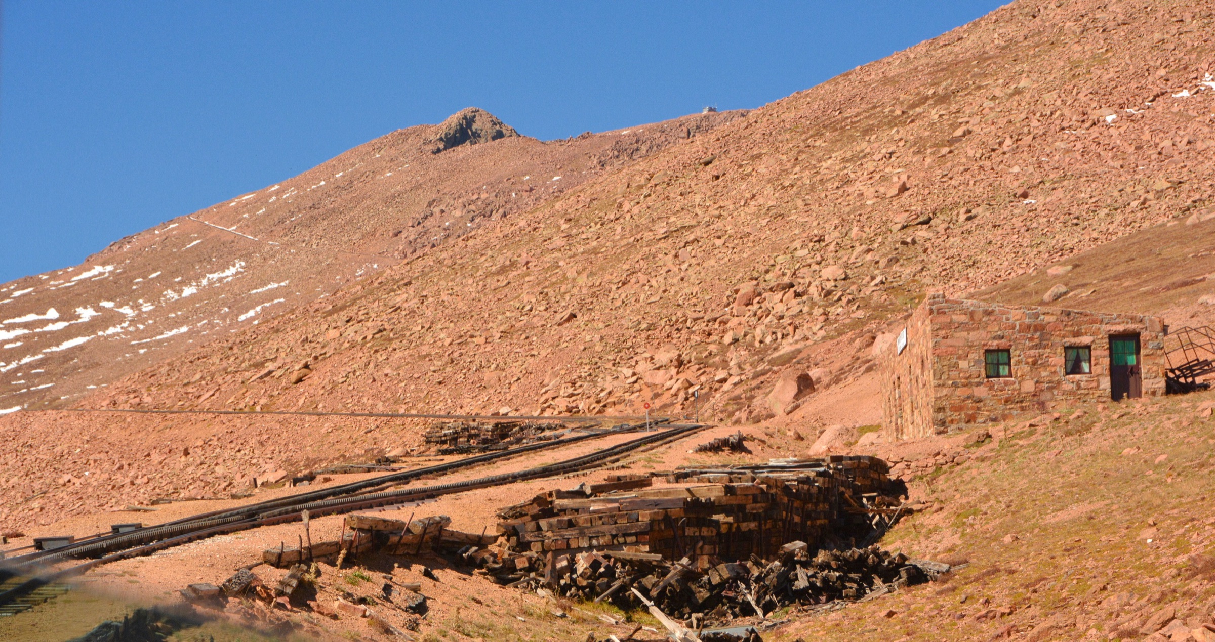
For the wider Front Range context, see the companion entry on the Pikes Peak region day-hikes for the southern Front Range counterpart around Manitou Springs and Pike National Forest.
Selection rationale
Five day-hikes are presented, covering the region’s defining identities: James Peak via St. Mary’s Glacier for the classic thirteener summit on its iconic snowfield approach, Mount Flora from Berthoud Pass for the most efficient sub-4,000 m Continental Divide ridge day, Chicago Lakes from Echo Lake for the great cirque-lake walk below the Mount Blue Sky north face, Mount Bierstadt for Colorado’s most-walked beginner-friendly Fourteener at Guanella Pass, and Mount Blue Sky and Mount Spalding from Summit Lake for the short but serious alpine linkup that uses the highest paved trailhead on the Front Range.
The set deliberately balances effort and access: a long snowfield approach (James Peak), a high-Divide tundra walk (Flora), a forested lake basin (Chicago Lakes), and two summit days that contrast the longest-drive-to-shortest-hike spectrum on the eastern slope (Bierstadt, Spalding). Route stats are taken from AllTrails source maps; access context for Mount Blue Sky is from Recreation.gov. Verification status is flagged per hike where a direct GPX or current official trail-detail page is unresolved. Multi-day backpacks, the Grays and Torreys traverse south of Guanella Pass, and ski/snowshoe variants of the same routes are out of scope as summer day-hikes.
Summary
| # | Hike | Start | Route type | Distance | Gain | Max elevation | Difficulty |
|---|---|---|---|---|---|---|---|
| 1 | James Peak via St. Mary’s Glacier | St. Mary’s Glacier trailhead | Out-and-back | 13.2 km | 900 m | 4,058 m | Hard |
| 2 | Mount Flora Trail | Berthoud Pass | Out-and-back | 10.3 km | 546 m | 4,007 m | Moderate |
| 3 | Chicago Lakes Trail | Echo Lake | Out-and-back | 15.3 km | 664 m | 3,590 m | Hard |
| 4 | Mount Bierstadt Trail | Guanella Pass | Out-and-back | 11.7 km | 835 m | 4,287 m | Hard |
| 5 | Mount Blue Sky and Mount Spalding | Summit Lake | Out-and-back | 9.0 km | 631 m | 4,344 m | Hard |
1. James Peak via St. Mary’s Glacier
Snapshot
Itinerary
From the St. Mary’s Glacier trailhead a short, steep approach climbs through spruce-fir to the St. Mary’s Lake and snowfield — the small but persistent perennial snowfield long called St. Mary’s Glacier — at roughly 3,200 m. Cross above the basin on the established line (snow boots / microspikes useful in early summer) and follow the rising tundra slope west toward the broad lower flank of James Peak. The middle section is on open alpine grass and rock with a steady grade; the upper route turns up the south-east ridge to the broad summit plateau. AllTrails records 13.2 km out-and-back with 900 m of gain and the summit at 4,058 m. Return is by the same route — the snowfield crossing is the most likely slip-and-fall section in either direction.
Why it is essential
James Peak is the defining summit of this Front Range sector and the St. Mary’s approach is the most visually iconic line on the eastern slope of Colorado short of the Indian Peaks: a perennial snowfield, an alpine lake, sustained tundra and a sharp Continental Divide summit in a single day from a Denver-accessible trailhead. The route is also the standard introduction to glacier-margin walking for Front Range hikers building toward bigger objectives.
Equipment
- Sturdy mountain footwear with grippy soles
- Microspikes or light traction, especially in early summer; snowshoes if the snowfield is fresh and soft
- Waterproof shell and warm insulation layer
- Gloves and hat (wind on the summit plateau is sustained)
- Sun protection — sunscreen, lip balm, brimmed hat or buff, UV sunglasses (snow reflects strongly)
- 2+ litres of water (no reliable refill above the trailhead in summer)
- Food for the full day
- Offline map / GPS and paper backup
- Trekking poles for the snowfield and the tundra descent
Hazards and notes
- Afternoon thunderstorms — turn around by 11:00–12:00 if morning weather is unstable.
- The St. Mary’s snowfield is steeper than it looks from below and ices over in shoulder season; falls have happened. Treat it as glacier-margin terrain, not a walk-up snowbank.
- High wind on the summit plateau is the norm; a wind shell and full insulation are not optional in any season.
- Altitude — drive up from Denver (1,600 m) the same morning at your peril; one acclimatisation night helps significantly.
- Parking is private, paid and enforced — confirm current St. Mary’s POA visitor rules and fees before driving up.
- Dogs must be leashed in the St. Mary’s POA area and on the National Forest trail above.
2. Mount Flora Trail
Snapshot
Itinerary
From the Berthoud Pass parking area the route picks up the open switchbacks that climb past Colorado Mines Peak, then turns east onto the increasingly open tundra ridge that runs to Mount Flora. The ridge stays at or above treeline for most of the day, with long views back over the Berthoud Pass corridor and out across the James Peak Wilderness to the north. The summit gives a broad Continental Divide panorama: James Peak and the Indian Peaks to the north, Grays and Torreys to the south, the Williams Fork range to the west. AllTrails records 10.3 km out-and-back with 546 m of gain and the summit at the canonical 4,007 m.
Why it is essential
Mount Flora is the most efficient high-Continental-Divide day in the region: a paved-trailhead start at 3,446 m, a sustained alpine ridge, and a summit just above 4,000 m without the length or the lightning-magnet exposure of the Fourteeners. It is the route to take on a day with marginal weather windows or a late start, and the canonical introduction to ridge-walking on this section of the Divide.
Equipment
- Sturdy mountain footwear with grippy soles
- Wind-resistant shell and warm insulation
- Gloves and hat — wind on this ridge is sustained even in July
- Sun protection
- 1.5–2 litres of water (no reliable refill on the ridge)
- Snack and lunch
- Offline map / GPS, paper backup
- Trekking poles
Hazards and notes
- Sustained wind on the open ridge — Berthoud Pass is one of the windiest road crossings in Colorado, and the Mount Flora ridge inherits that.
- Lightning exposure above treeline; turn around early if storms build.
- Lingering snow on north aspects into mid-June in heavier years.
- Avalanche terrain in winter and spring — the ridge is not a casual snowshoe objective.
- Treat the route as exposed alpine even when the parking lot is full of day-trippers in shorts.
- Dogs must be leashed.
- Check CDOT for current US 40 / Berthoud Pass road status before driving.
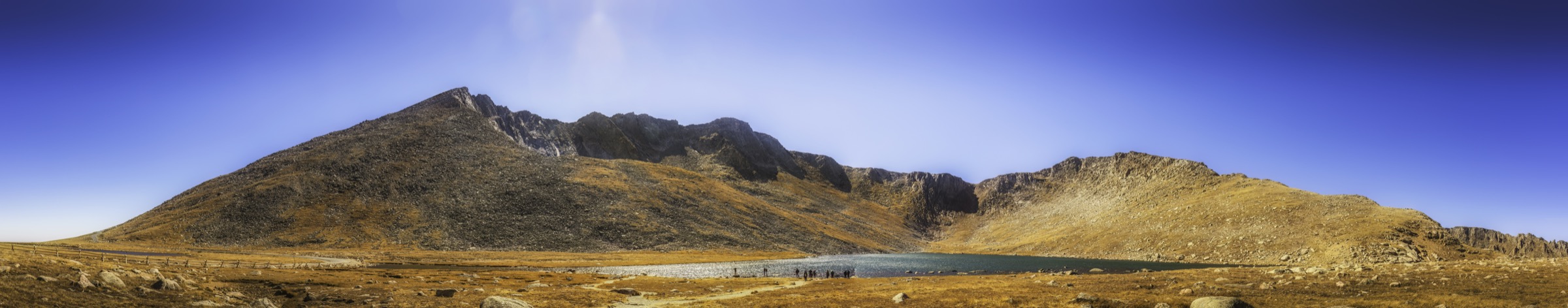
3. Chicago Lakes Trail
Snapshot
Itinerary
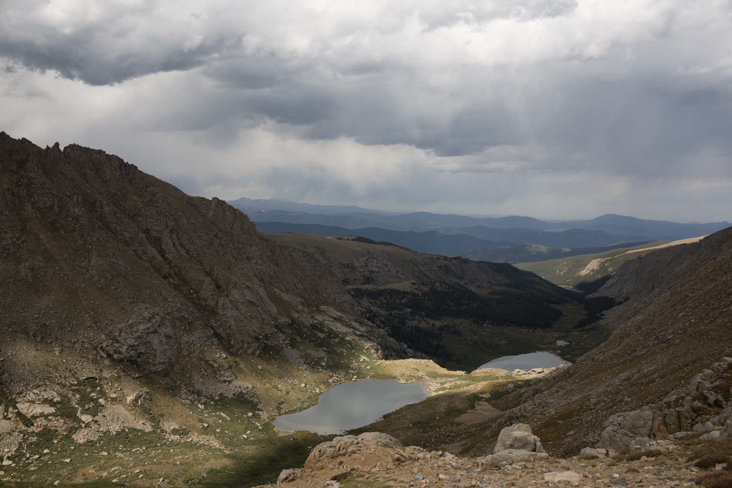
From Echo Lake the trail drops briefly and then climbs west into the Chicago Lakes drainage, passing through mixed conifer with intermittent views toward Mount Warren and Mount Spalding. A reservoir-side traverse leads to the Lower Chicago Lake at ~3,460 m, then a steeper benched section continues to the Upper Chicago Lake under the great north wall of Mount Blue Sky. The selected day-hike variation turns around at the upper lake and returns by the same route, rather than continuing the longer through-line to Summit Lake. AllTrails records 15.3 km out-and-back with 664 m of gain and the upper objective at 3,590 m.
Why it is essential
Chicago Lakes is the principal lake-basin hike on the Mount Blue Sky side of the region — a complete mountain-cirque day with no exposed scrambling and no timed-ticket access requirement. It gives the Mount Blue Sky north-face experience without needing the summit road, and it is the answer when the high summits are storm-bound or the Mount Blue Sky timed tickets are sold out.
Equipment
- Hiking shoes or light boots
- Rain shell and warm layer
- Sun protection (the lake basin is partly open)
- 2+ litres of water and treatment for refills
- Food for the day
- Offline map / GPS, paper backup
- Trekking poles for the steeper benched section
- Insect repellent in July
Hazards and notes
- Thin air from a high start — the trailhead is already at 3,229 m, well above acclimatisation altitudes for sea-level visitors.
- Steep and rocky sections above the Lower Lake; wet rock is slippery.
- Afternoon thunderstorms build fast over Mount Blue Sky; the upper basin offers no shelter.
- Wildlife — moose, bighorn sheep and bear all use the drainage; standard food-storage practice.
- Echo Lake crowding at peak times — start early to secure parking.
- Dogs must be leashed.
4. Mount Bierstadt Trail
Snapshot
Itinerary
From the Guanella Pass trailhead the route drops briefly onto the willow-and-meadow flats north of the parking lot, crosses Scott Gomer Creek on the engineered boardwalk and trail bridges, then begins the long, steady climb up the broad west flank of Mount Bierstadt. The middle section is sustained tundra walking on a well-graded trail; the upper 100–150 m of ascent crosses a boulder field with mild scrambling to the small summit cap. Views from the top reach to Grays and Torreys to the west and to Mount Blue Sky and the Sawtooth ridge to the north-east. AllTrails records 11.7 km out-and-back with 835 m of gain and the summit at the canonical Fourteener elevation. Return is by the same route.
Why it is essential
Mount Bierstadt is Colorado’s most-walked beginner Fourteener and the standard first Fourteener for hikers based in Denver — a paved trailhead, a graded trail and a non-exposed summit boulder section. It still gives a true high Front Range summit day with serious altitude, wind and lightning exposure, and it is the route by which most Front Range hikers learn how the high-summit weather window actually works.
Equipment
- Sturdy mountain footwear with grippy soles
- Waterproof shell and warm insulation layer
- Gloves and hat
- Sun protection
- 2+ litres of water (no refill above the trailhead)
- Food for the day plus reserves
- Offline map / GPS, paper backup
- Headlamp (dawn-start days finish late if pace slips)
- Light traction (microspikes) in shoulder season; the summit boulders ice up early
Hazards and notes
- Afternoon thunderstorms — Bierstadt’s summit pulls strikes; the canonical turnaround is 11:00–12:00.
- Crowding is real — a typical July weekend sees 500+ summit attempts.
- Boulder section near the top requires care, especially on descent and especially when wet.
- Altitude — the trailhead is already at 3,571 m; sleep at altitude the night before if possible.
- Dogs must be leashed and may struggle on the upper boulders.
- Roadside parking is increasingly restricted; if the lot is full, return another day rather than parking illegally.
5. Mount Blue Sky and Mount Spalding from Summit Lake
Snapshot
Itinerary
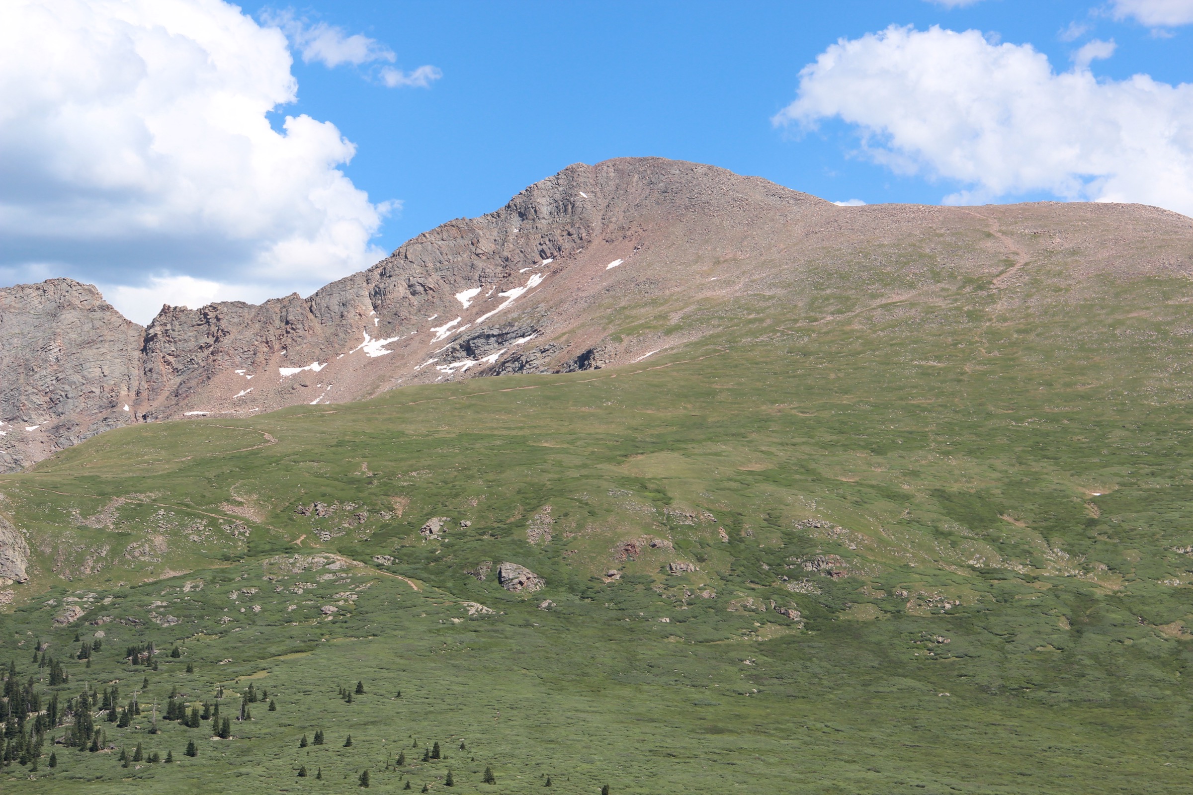
From the Summit Lake trailhead at ~3,925 m the route climbs north-west onto the Mount Spalding ridge, crossing open alpine tundra and a short Class-2 scramble over rock benches to the Spalding summit at ~4,205 m. The line then turns south-east and follows the linking ridge over a series of bumps and saddles to the Mount Blue Sky summit at 4,348 m. Staying on the intended ridge line matters — drifting north drops into more strenuous Class-3 terrain on the Sawtooth side. AllTrails records 9.0 km out-and-back with 631 m of gain for the linkup. Return is by the same ridge.
Why it is essential
This is the region’s signature Mount Blue Sky summit hike — a short-mileage but high-consequence alpine linkup from the highest paved trailhead on the Front Range. It gives the Fourteener summit experience in a fraction of the distance of the standard western approaches, with the trade-off that timed-ticket access and weather windows are both more constrained. It is also the only featured route on this page that is fundamentally gated by an active reservation system, which makes planning matter.
Equipment
- Sturdy mountain footwear with grippy soles
- Windproof and warm layers (full kit even in August)
- Gloves and hat
- Sun protection — extreme UV at 4,000+ m
- 1.5–2 litres of water
- Food for the day
- Offline map / GPS, paper backup
- Trekking poles for the Spalding ridge
- Helmet optional for parties concerned about loose rock on the Class-2 sections
Hazards and notes
- No cell service at the welcome station or anywhere on the upper road — purchase the timed ticket in advance.
- Road closures — Mount Blue Sky Road can close at any time for weather; the 2026 Recreation.gov page also lists scheduled event closures on 28 June, 11 July and 25 July 2026.
- Class-2 scrambling on the Spalding ridge — loose volcanic rock requires careful footing.
- Route-finding off the ridge can drop hikers into Class-3 terrain; stay high.
- Wind at 4,300+ m can be punishing; bring a serious wind shell.
- Lightning exposure is severe — the only safe response is to get off the ridge fast, which means starting at the morning gate opening.
- Dogs must be leashed.
Routes excluded as out of scope
The following sit inside or adjacent to the James Peak / Mount Blue Sky country but fall outside this day-hike entry, or duplicate routes covered elsewhere.
- Grays Peak and Torreys Peak from Stevens Gulch. Adjacent Fourteener pair south of Guanella Pass — a major day in their own right, with a different trailhead network; covered separately in future Front Range entries.
- Mount Blue Sky summit by road only. Drivable to the high parking via the Mount Blue Sky Scenic Byway; out of scope as a non-hiking access.
- The Sawtooth traverse (Bierstadt to Mount Blue Sky). Class-3 ridge connection between the two Fourteeners; not a beginner day-hike and not the standard route on either summit.
- St. Vrain and Indian Peaks Wilderness routes north of James Peak. A distinct sub-region — Arapaho Glacier, Pawnee Pass, Mount Audubon — out of scope here.
- Ski / snowshoe variants of the same lines (St. Mary’s Glacier in winter, Berthoud Pass backcountry, Guanella Pass closed-road approaches). Winter objectives rather than summer day-hikes.
Further reading
| Source | URL |
|---|---|
| Recreation.gov — Mount Blue Sky timed entry | recreation.gov |
| US Forest Service — Mount Blue Sky / Scenic Byway recreation area | fs.usda.gov |
| US Forest Service — Arapaho and Roosevelt National Forests | fs.usda.gov |
| Colorado Department of Transportation — travel and road conditions | codot.gov |
| St. Mary’s Property Owners Association — visitor information | stmaryspoa.com |
| Wikipedia — James Peak (Colorado) | en.wikipedia.org |
| Wikipedia — Mount Flora | en.wikipedia.org |
| Wikipedia — Mount Blue Sky | en.wikipedia.org |
| Wikipedia — Mount Bierstadt | en.wikipedia.org |
| Wikipedia — Berthoud Pass | en.wikipedia.org |
| Wikipedia — Guanella Pass | en.wikipedia.org |
| AllTrails — James Peak Trail | alltrails.com |
| AllTrails — Mount Flora Trail | alltrails.com |
| AllTrails — Chicago Lakes Trail | alltrails.com |
| AllTrails — Mount Bierstadt Trail | alltrails.com |
| AllTrails — Mount Evans and Mount Spalding Loop | alltrails.com |
| 14ers.com — Mount Bierstadt | 14ers.com |
| 14ers.com — Mount Blue Sky (Mt. Evans) | 14ers.com |