Regional overview
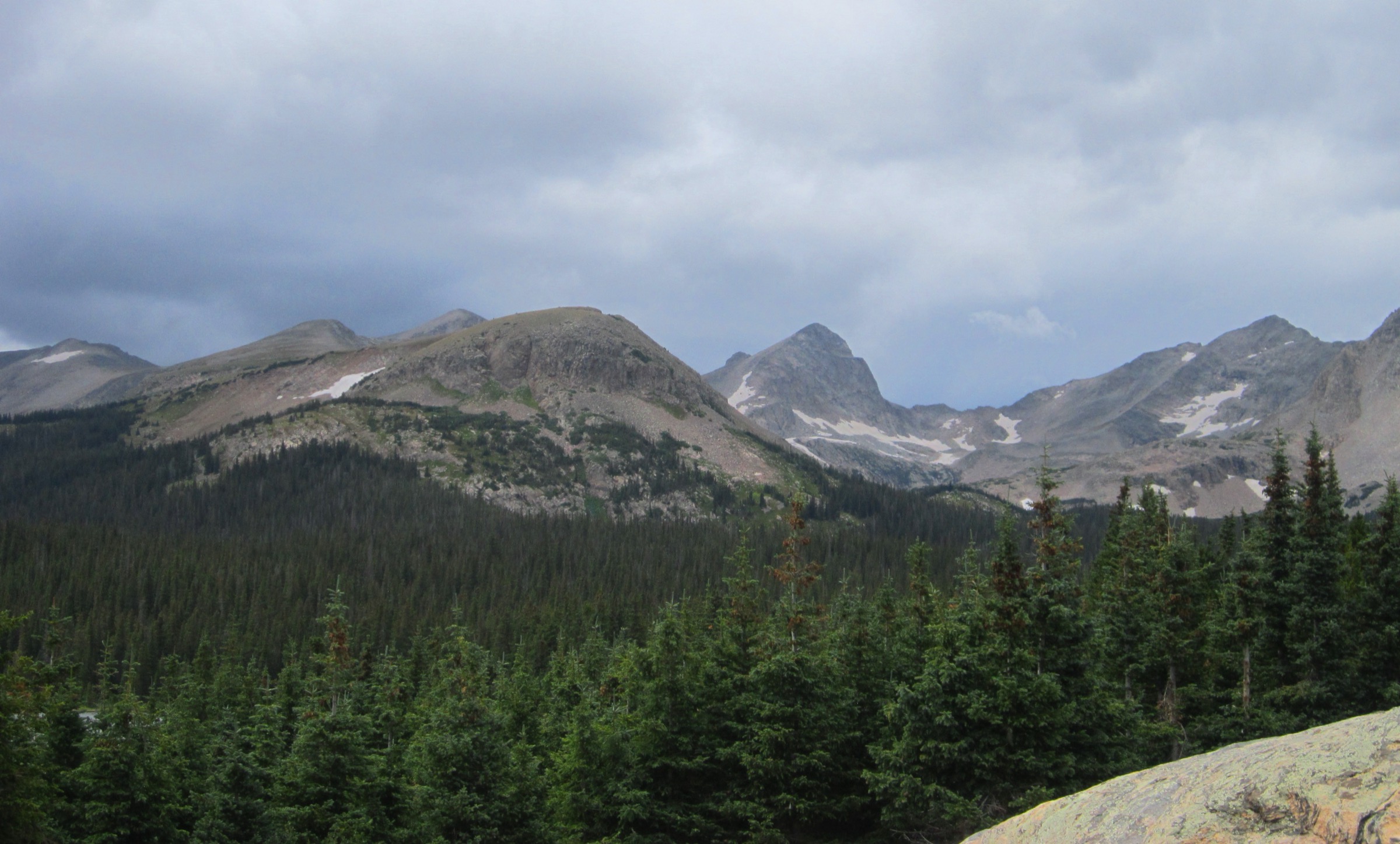
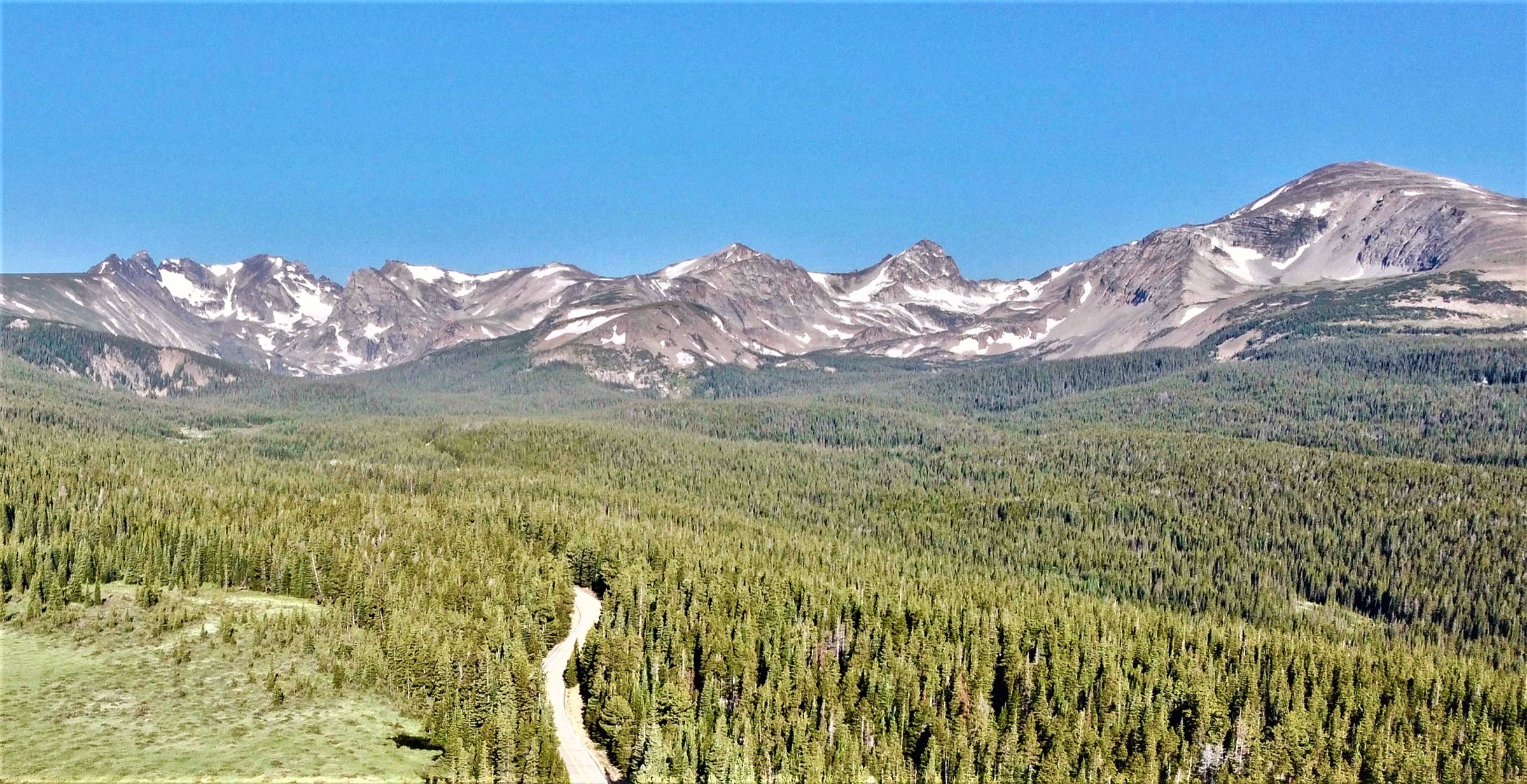
The Indian Peaks are the high, serrated stretch of the Colorado Front Range that fills the Continental Divide between Rocky Mountain National Park to the north and the James Peak Wilderness to the south — roughly the divide between Boulder County and Grand County, immediately west of the towns of Boulder and Nederland. The range carries an unbroken row of thirteeners and upper-twelves — South Arapaho, North Arapaho, Apache, Navajo, Pawnee, Mount Audubon, Mount Toll, Paiute, and on south to Devils Thumb and King Lake — with the Arapaho Glacier (4,030 m basin) as its largest remaining body of ice and the Lone Eagle Peak cirque above Crater Lake as its most photographed alpine scene. The walking character is glacier-polished basins, serrated thirteener ridges, tundra passes on the divide itself, and long forest approaches from a small number of very busy trailheads.
The Indian Peaks Wilderness (1978, ~310 km²) sits inside the Arapaho and Roosevelt National Forests with a small western fringe in the Arapaho National Recreation Area above Lake Granby. The headline trailheads are Brainard Lake (Long Lake and Mitchell Lake gates) on the north side, Hessie above Eldora on the central east side, Fourth of July above the same road on the south-east, and Monarch Lake at the west end on the Grand County side. All four are managed for crowding and parking pressure: Recreation.gov runs timed-entry parking reservations at Brainard Lake from 12 June to 1 October 2026, with the upper Long Lake and Mitchell Lake parking areas scheduled to open from 1 July; Boulder County runs the free Hessie Shuttle from Nederland on Fridays, weekends and holidays from 22 May to 11 October 2026; Monarch Lake on the west side requires a current Arapaho National Recreation Area or Interagency Pass displayed in any vehicle parked at the trailhead. Dogs must be on a hand-held leash everywhere inside the wilderness, and overnight backcountry use requires a permit during the summer season — both rules are enforced by Forest Service patrols at the popular trailheads.
The walking season at altitude runs July to early October. Snow lingers in the Brainard Lake basin and the upper Cascade Creek valley into the first or second week of July in normal years; by late October fresh snow has typically returned to the divide. The Front Range thunderstorm rule applies — be off summit ridges by lunchtime, especially in late July and August, and treat any building cumulus as a signal to descend. The lower forest approaches (Hessie, the Monarch Lake shoreline, the Fourth of July road) stay walkable from June to mid-November in normal years, although ice and a hard freeze can shut the upper road sections any time from October.
Access is from Denver International Airport in 1.5–2 h to all of the eastern trailheads, via Boulder and Nederland on US 36 and Colorado 119. The west-side Monarch Lake trailhead is 2.5–3 h from Denver via Granby and Lake Granby (US 40 over Berthoud Pass), or via the long unpaved Caribou Pass and Arapaho Pass routes for those crossing the divide from Eldora. There is no bus service to any of the trailheads themselves — the Hessie Shuttle is the single public-transport option in the region, running on summer weekends and holidays from the Nederland RTD park-and-ride.
For neighbouring sub-regions of the Colorado Front Range, see Pikes Peak (the southern Front Range high point and its surrounding crag and meadow trails). Rocky Mountain National Park, the James Peak Wilderness and the Elk Mountains further west are covered separately.
Selection rationale
Five day-hikes are presented across the major access points of the wilderness: two from the Brainard Lake side (Isabelle Glacier and Mount Audubon), one from the Fourth of July road (South Arapaho Peak), one from the Hessie shuttle road (the Devils Thumb and King Lake divide loop), and one from the Monarch Lake side (Mirror Lake under Lone Eagle Peak). The set is built around route type rather than length: a glacier-basin out-and-back (Isabelle), a thirteener summit (Audubon), a high-summit fourteener-style ridge with glacier viewpoint (South Arapaho, 4,081 m), a long divide pass loop (Devils Thumb–King Lake), and a long west-side approach to a signature cirque (Mirror Lake).
Four of the five sit between 12 and 15 km, the comfortable range for a hard Front Range day. The Devils Thumb–King Lake loop at 24.9 km and the Mirror Lake out-and-back at 25.4 km push the upper limit of a day; both are retained because they are the canonical full-day forms of their respective objectives, and Mirror Lake in particular is the only realistic way to reach the Lone Eagle Peak cirque without an overnight permit. Other major lines — Pawnee Pass, the Pawnee–Buchanan loop, Lake Dorothy, Mount Toll, and the full Continental Divide traverse — are excluded as either better as overnight trips, too duplicative of the five chosen, or in the case of Pawnee Pass too similar to Isabelle Glacier on the same trail corridor.
Summary
| # | Hike | Trailhead | Route type | Distance | Gain | Max elevation | Difficulty |
|---|---|---|---|---|---|---|---|
| 1 | Isabelle Glacier via Pawnee Pass Trail | Long Lake (Brainard) | Out-and-back | 14.3 km | 502 m | 3,653 m | Hard |
| 2 | Mount Audubon | Mitchell Lake (Brainard) | Out-and-back | 12.6 km | 817 m | 4,030 m | Hard |
| 3 | South Arapaho Peak via Arapaho Pass | Fourth of July | Out-and-back | 13.7 km | 990 m | 4,081 m | Hard |
| 4 | Devils Thumb Pass and King Lake | Hessie | Loop | 24.9 km | 1,048 m | 3,690 m | Hard |
| 5 | Mirror Lake and Crater Lake via Cascade Creek | Monarch Lake | Out-and-back | 25.4 km | 722 m | 3,162 m | Hard |
1. Isabelle Glacier via Pawnee Pass Trail
Snapshot
Itinerary
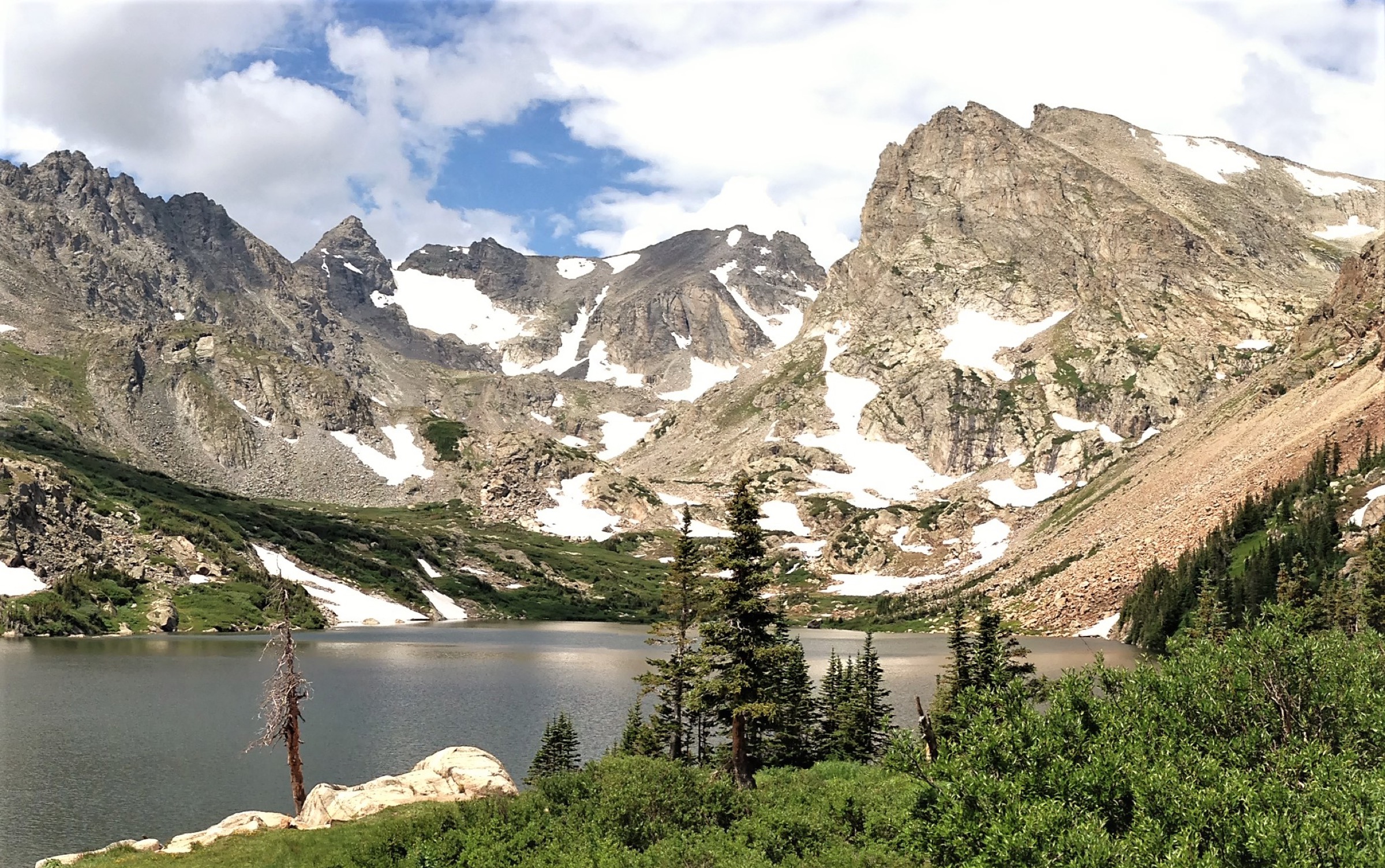
From the Long Lake Trailhead the route walks 0.5 km on the connector path to the Pawnee Pass Trail, then follows the north shore of Long Lake (3,170 m) through a corridor of subalpine fir and Engelmann spruce. Past the lake, the trail climbs into the upper basin and reaches Lake Isabelle (3,266 m) at 3.4 km — the first canonical viewpoint, with the headwall of Navajo, Apache and Shoshoni peaks rising on the divide. From Lake Isabelle the trail leaves the Pawnee Pass line and climbs north-west on the Isabelle Glacier Trail through a chain of small unnamed tarns and the talus apron below the Isabelle Glacier itself, finishing at a marked viewpoint at ~3,650 m above the glacier tongue. The return is by the same line; the Jean Lunning Trail on the south shore of Long Lake can be substituted on the way back to make the lower section a small loop.
Why it is essential
Isabelle Glacier is the most accessible major glacier-basin day-hike in the Front Range. The route covers two named-lake objectives, a short stretch of true alpine tundra, and a direct view of the largest active body of ice in the Indian Peaks. It is short enough to be combined with a road-side stop at Mitchell Lake the same day for parties holding both upper-trailhead permits, and it is the single best route in the wilderness for first-time Indian Peaks visitors.
Equipment
- Sturdy hiking shoes or light boots
- Insulated mid-layer and wind shell (10–12 °C cooler at the viewpoint than at the trailhead)
- 1.5–2 L water
- Sun protection — exposure is severe above Lake Isabelle
- Offline map; cell coverage is intermittent past Long Lake
- Microspikes and trekking poles if snow remains in the upper basin (typically June and early July)
- Cash or printed Recreation.gov reservation for timed-entry parking
Hazards and notes
- The upper basin holds snow into July; route-finding above Lake Isabelle becomes harder when the trail is buried.
- Afternoon thunderstorms — start before 07:30 and aim to be off the upper basin by 13:00.
- Mud is extensive in the lower forest after spring melt; expect wet feet without good gaiters.
- Dogs must be on a hand-held leash everywhere inside Indian Peaks Wilderness; this rule is actively enforced at Brainard.
- Timed-entry reservations sell out for summer weekends a fortnight or more in advance.
- Cell service is unreliable from Long Lake onward; download the offline map at home.
2. Mount Audubon
Snapshot
Itinerary
From the Mitchell Lake Trailhead the route follows the Beaver Creek Trail north-west for 0.4 km, then turns right onto the Mount Audubon Trail. The first 3 km climb steadily through subalpine forest before the trail emerges onto the tundra shoulder at ~3,500 m. From here the angle eases briefly across a broad alpine bench before the trail attacks the south-east face of Mount Audubon on a long traverse and a steep, partly cairned talus finish. The summit at 4,030 m is a broad bouldery dome with a small wind shelter and 360° views — south to Pawnee, Apache and the Arapahos, north into Rocky Mountain National Park, and west across the divide to Mount Toll and Paiute. Return is by the same line.
Why it is essential
Mount Audubon is the most accessible high summit in the Indian Peaks — the only thirteener within striking range from the Brainard Lake parking area as a non-technical day-hike — and the only Indian Peaks summit on the catalogue that does not require glacier-edge or scramble travel. The combination of a short, well-graded approach and a genuine 4,000 m summit gives the route a thirteener-style payoff in roughly half the time of South Arapaho Peak from Fourth of July.
Equipment
- Sturdy boots — talus is loose on the final 300 m
- Trekking poles for the descent
- Wind shell and insulated layer (gusts on the summit are routinely 40–60 km/h)
- 2 L water — no resupply above the Beaver Creek junction
- Offline map
- Sun and lip protection; UV exposure is intense
- Light gloves and a hat even in midsummer
Hazards and notes
- Final talus is cairned but not benched; navigation is harder in fog or snow.
- Lightning is the principal hazard above 3,500 m; descend immediately at the first thunderclap.
- Snow lingers on the upper traverse into mid-July in cold years; ice axe is occasionally useful.
- The Mount Audubon trail is one of the busiest summit routes in the wilderness on summer weekends — start by 06:30 for a quiet upper tundra.
- Dogs must be on a hand-held leash; this is enforced at the Mitchell Lake gate.
3. South Arapaho Peak via Arapaho Pass Trail
Snapshot
Itinerary
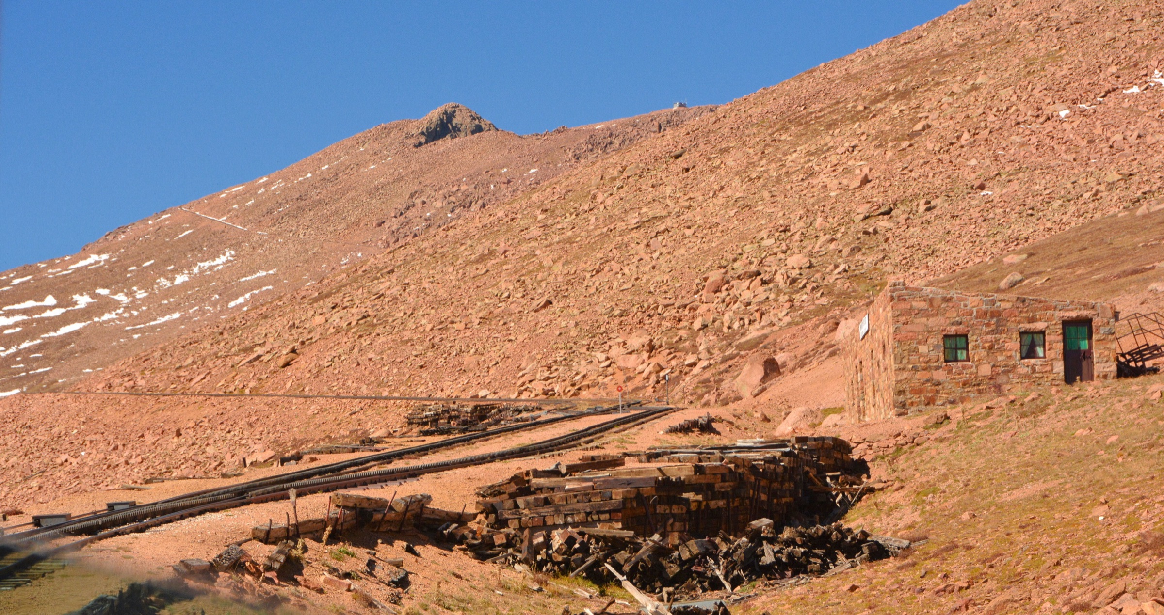
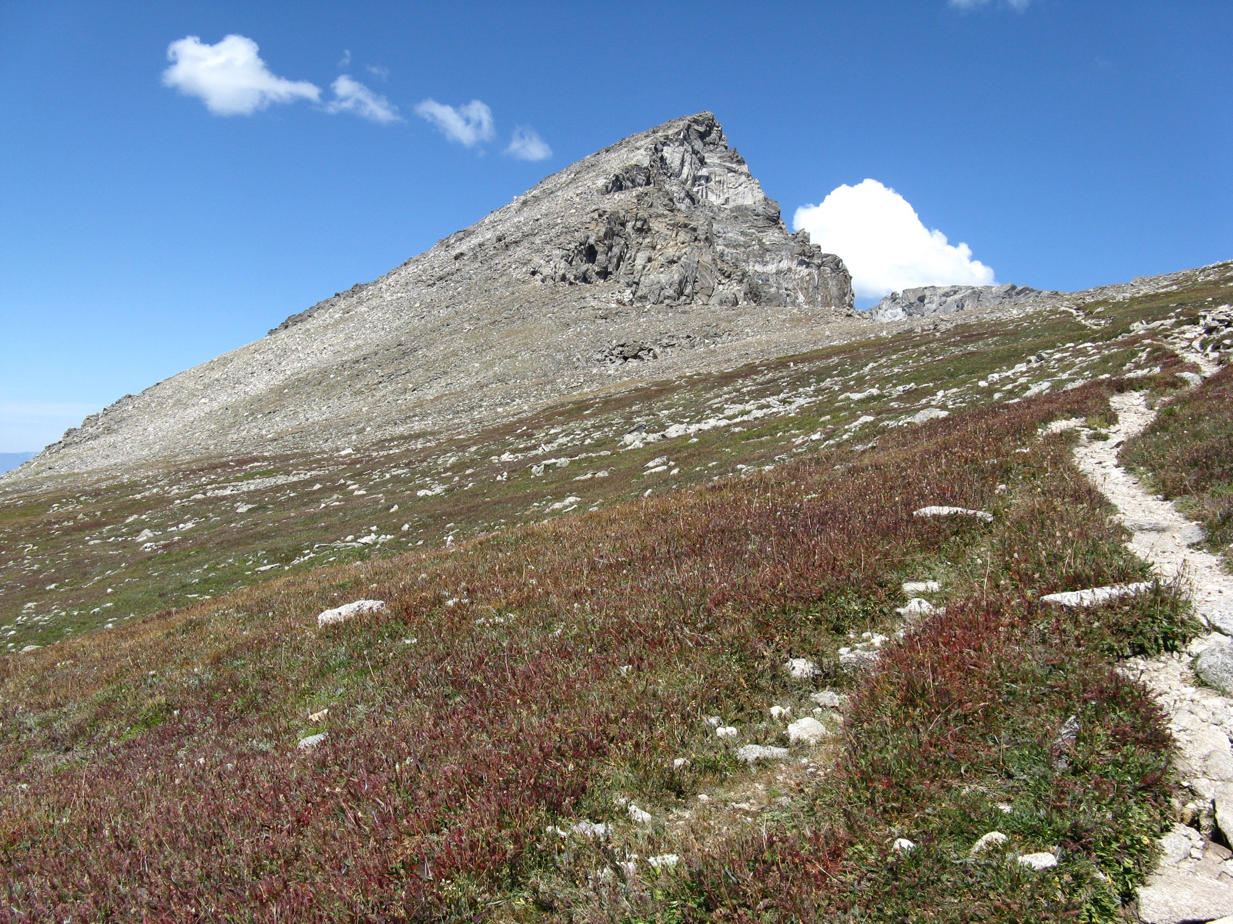
From the Fourth of July Trailhead at 3,170 m the route climbs west on the Arapaho Pass Trail through subalpine spruce and a long wildflower meadow that holds running water until late August. At 3 km the trail passes the remnants of the Fourth of July Mine (early-twentieth-century silver workings, now a stabilised historical site) and crosses onto the Arapaho Glacier Trail, which trends north-east on a gentle alpine grade to a saddle at ~3,800 m. From the saddle the south-east ridge of South Arapaho Peak rises in a Class 2 talus and scree pitch — the route is cairned but never benched, and the final 200 m of climb above the false summit holds the route’s only technically interesting section. The summit at 4,081 m sits directly above the Arapaho Glacier with a frank view of the North Arapaho Peak knife-edge — the standard onward Class 3 traverse is not part of the day described here. Return is by the same line.
Why it is essential
South Arapaho Peak is the classic high-summit objective of the Indian Peaks Wilderness — the only summit on the catalogue that crosses 4,000 m by a clean walking-and-scrambling route from a single trailhead, and the only one that gives a direct, plan view of an active Colorado glacier (the Arapaho Glacier, the largest remaining ice body in the Indian Peaks). The Fourth of July Mine adds an unusual layer of late-Victorian mining history to an otherwise pure alpine day.
Equipment
- Mountain boots with edging support — the upper ridge is loose
- Trekking poles for the lower trail; stow them for the summit talus
- Helmet optional and party-dependent on the final talus
- Wind shell and warm hat — wind on the summit is routinely the strongest in the catalogue
- 2.5 L water — water above the mine is unreliable by late August
- Offline map; cell signal stops well below the saddle
Hazards and notes
- The upper ridge is loose Class 2 with frequent rock-on-rock movement; helmet is sensible if hikers are above you.
- Lightning risk above 3,800 m is severe — start at 06:00 in late July and August.
- Fourth of July Road is rough and slow; allow 45 min for the 8 km from Eldora and a high-clearance vehicle is helpful but not always necessary.
- Parking at the trailhead is very limited — arrive by 07:30 on weekends.
- The road closes from the upper hairpin in winter; cross-country travel from the lower closure adds 5 km each way.
4. Devils Thumb Pass and King Lake Loop
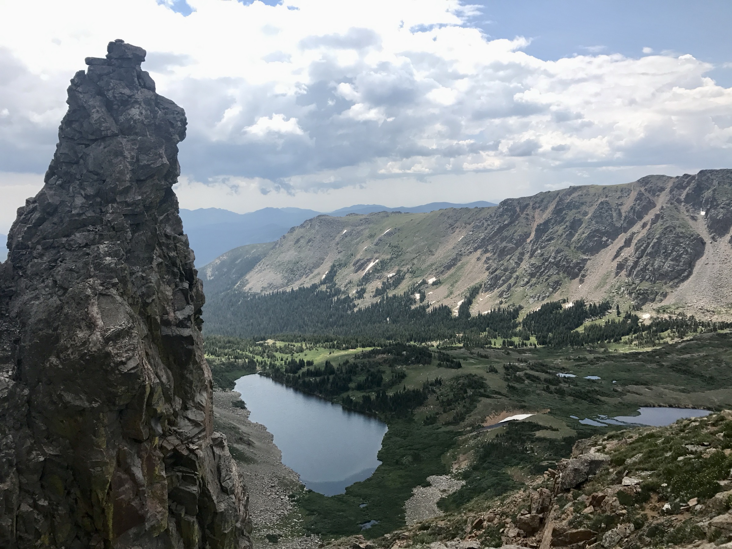
Snapshot
Itinerary
From the Hessie Trailhead the loop walks north-west up the old Hessie road, crosses the south fork of Boulder Creek at the Hessie footbridge, and joins the Devils Thumb Trail through forest and meadow past the Devils Thumb Lake at ~3,500 m. From the lake the trail climbs the exposed tundra headwall on long traverses to Devils Thumb Pass (3,690 m) on the Continental Divide — the literal high point of the loop, with the Devils Thumb rock spire to the south and a long view west into the headwaters of the Fraser River. The loop then turns south along the divide for ~1 km before dropping east into the King Lake basin on the King Lake Trail, passing King Lake itself, Betty Lake and Bob Lake in a chain of glacial benches. The descent continues through the forested South Boulder Creek valley past Woodland Lake and the Lost Lake spur trail back to Hessie. The loop is most commonly walked counter-clockwise — up Devils Thumb, down King Lake — both because of the gentler descent gradient and because the pass is more exposed in the morning than the King Lake side.
Why it is essential
The Devils Thumb–King Lake loop is the catalogue’s full Continental Divide day at Indian Peaks. The route covers two distinct alpine cirques, one sustained tundra pass at 3,690 m, and a circuit of named lakes that includes the most photographed sections of the Hessie trail network. Walked in a day it is the closest the wilderness comes to a proper Front Range hut-to-hut without huts. Done as an overnight (which is the more common pattern) it loses the unbroken divide-walking feel that makes it essential as a day.
Equipment
- Long-day kit: hard-shell jacket, insulated layer, gloves, hat
- Sturdy boots with good edging support — the King Lake descent has loose, wet rock
- Trekking poles
- 3 L water capacity with a filter — Devils Thumb Lake and the King Lake outlet are reliable refills
- Headlamp — even with a 06:00 start, slower parties can finish in dusk
- Offline map and printed route notes
- Microspikes if walking before mid-July or after late September
- Food for 9 h on the trail; the loop has no resupply
Hazards and notes
- The Devils Thumb Pass section is fully exposed for over an hour each way; descend immediately at the first thunderclap.
- Snow lingers on the pass headwall into mid-July; the trail is not always visible under snow.
- Moose are common in the upper South Boulder Creek meadows; give 50 m and step well off the trail.
- The Hessie footbridge is in moving water until late July; check Boulder County’s seasonal status.
- Parking on the Fourth of July Road below Hessie is heavily restricted; the Hessie Shuttle is the practical access on summer weekends.
- Dogs must be on a hand-held leash; rangers are common at Devils Thumb Lake on summer weekends.
5. Mirror Lake and Crater Lake via Cascade Creek
Snapshot
Itinerary
From the Monarch Lake Trailhead at the east end of Lake Granby (2,440 m), the route follows the Cascade Creek Trail along the north shore of Monarch Lake and into the lower Cascade Creek valley. The first 5 km cross a series of beaver-pond benches and a string of waterfalls and cascades on the creek itself — the route name is literal — through a fire-edge mosaic of lodgepole pine, aspen and wildflower meadow. At ~6 km the trail joins the Pawnee Pass corridor at the Crater Lake Trail junction and turns south-east, climbing more steeply through subalpine forest to Mirror Lake (3,140 m) at 11.5 km and Crater Lake (3,162 m) at the route’s turning point. Lone Eagle Peak (3,711 m) rises directly out of the Crater Lake headwall in the only Matterhorn-style alpine arête in the Indian Peaks. Return is by the same line. The route is sometimes used as a backcountry overnight, but the route described here is the standard long day.
Why it is essential
The Mirror Lake and Crater Lake amphitheatre under Lone Eagle Peak is the most photographed alpine scene in the Indian Peaks Wilderness, and the only way to reach it without an overnight permit is this long day from Monarch Lake. The route also captures the entirely different character of the west side of the wilderness — gentler grades, more lakes, lower altitude, and a fire-and-forest mosaic that has no parallel on the Brainard or Hessie side of the divide. At 25.4 km it is the longest entry in the catalogue and sits just above the usual day-hike guideline; it is retained because the cirque is the canonical Indian Peaks day objective for fit walkers and the alternative — an overnight — requires a wilderness permit that often sells out months in advance.
Equipment
- Long-day kit: shell, insulated layer, hat, gloves
- Trail-running shoes or lightweight boots — the trail is well-graded
- Trekking poles
- 3 L water with a filter — Cascade Creek is reliable
- Insect repellent — mosquito pressure in the lower beaver-pond section is intense June–July
- Bear-safe food storage
- Headlamp — at this length the round trip often finishes in dusk
- Offline map; the route is well-signed but cell coverage is gone past Cascade Creek
Hazards and notes
- The route’s length is the principal hazard — turn around at a hard time, not at a hard place.
- Storms move in from the west earlier in the day at Monarch than at Brainard; aim to be off the upper Crater Lake bench by 14:00.
- Bears are present in the Cascade Creek valley; keep food sealed and use the bear lockers at Monarch Lake.
- Trail conditions early in the season include high creek crossings on the Cascade Creek tributaries; check Forest Service status.
- The Monarch Lake parking lot fills by 07:00 on summer weekends; arrive earlier or use weekday access.
- Dogs must be on a hand-held leash inside the wilderness boundary at ~2 km from the trailhead.
Routes excluded as out of scope
The following sit inside or adjacent to the Indian Peaks Wilderness but fall outside a day-hike entry, are too duplicative of the five chosen above, or are better understood as overnight or technical trips.
- Pawnee Pass and the Pawnee–Buchanan loop. Pawnee Pass shares its first 5 km with the Isabelle Glacier route in entry 1 and is the standard backcountry traverse line across the divide; better as an overnight, and editorially redundant with Isabelle Glacier as a day.
- Mount Toll and Blue Lake from Mitchell Lake. A strong alternative to Mount Audubon from the same trailhead, but covered better as a half-day add-on to entry 2 than as a separate entry.
- North Arapaho Peak from South Arapaho. The continuation onward from entry 3 is a Class 3 traverse with sustained exposure; not a day-hike under this catalogue’s standards.
- Buchanan Pass and the Buchanan Pass loop. A canonical Indian Peaks overnight, not a realistic day-hike from any trailhead.
- Caribou Pass, Lake Dorothy and Arapaho Pass. Excellent alternatives to South Arapaho Peak from Fourth of July, but duplicative as a separate catalogue entry and better used as variations on entry 3.
Further reading
| Source | URL |
|---|---|
| USFS Indian Peaks Wilderness — official page | fs.usda.gov |
| Recreation.gov — Brainard Lake timed entry | recreation.gov |
| Boulder County — Hessie Shuttle | bouldercounty.gov |
| USFS Fourth of July Trailhead | fs.usda.gov |
| USFS Arapaho National Recreation Area (Monarch Lake) | fs.usda.gov |
| Colorado Mountain Club — Indian Peaks chapter | cmc.org |
| Wikipedia — Indian Peaks Wilderness | en.wikipedia.org |
| Wikipedia — South Arapaho Peak | en.wikipedia.org |
| Wikipedia — Mount Audubon | en.wikipedia.org |
| Wikipedia — Lone Eagle Peak | en.wikipedia.org |
| AllTrails — Isabelle Glacier Trail | alltrails.com |
| AllTrails — Mount Audubon Trail | alltrails.com |
| AllTrails — South Arapaho Peak | alltrails.com |
| AllTrails — Devils Thumb Pass and King Lake | alltrails.com |
| AllTrails — Mirror Lake and Crater Lake | alltrails.com |
| Wikimedia Commons — Indian Peaks Wilderness category | commons.wikimedia.org |
| OpenStreetMap (ODbL 1.0) | openstreetmap.org |