Regional overview
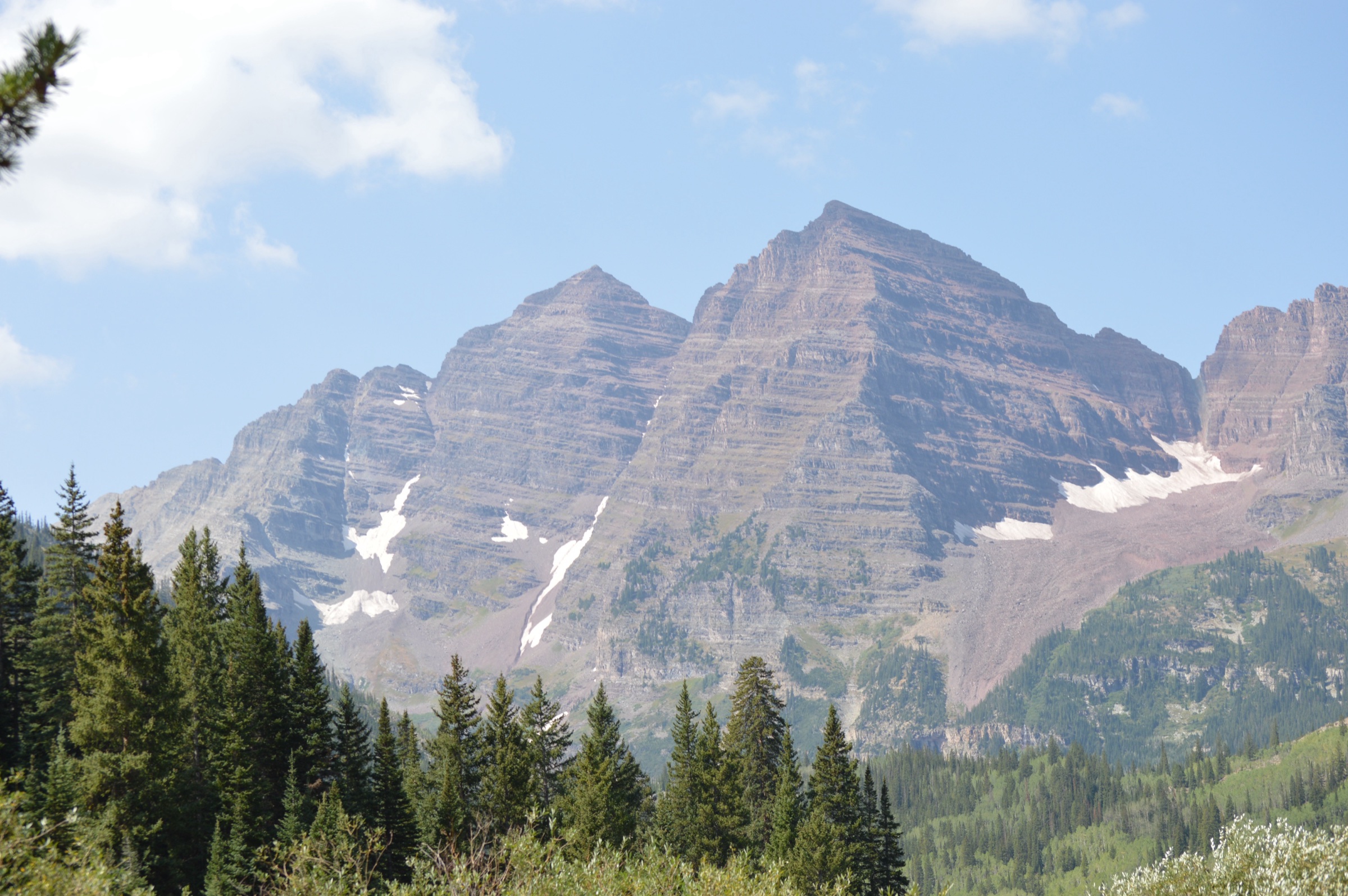
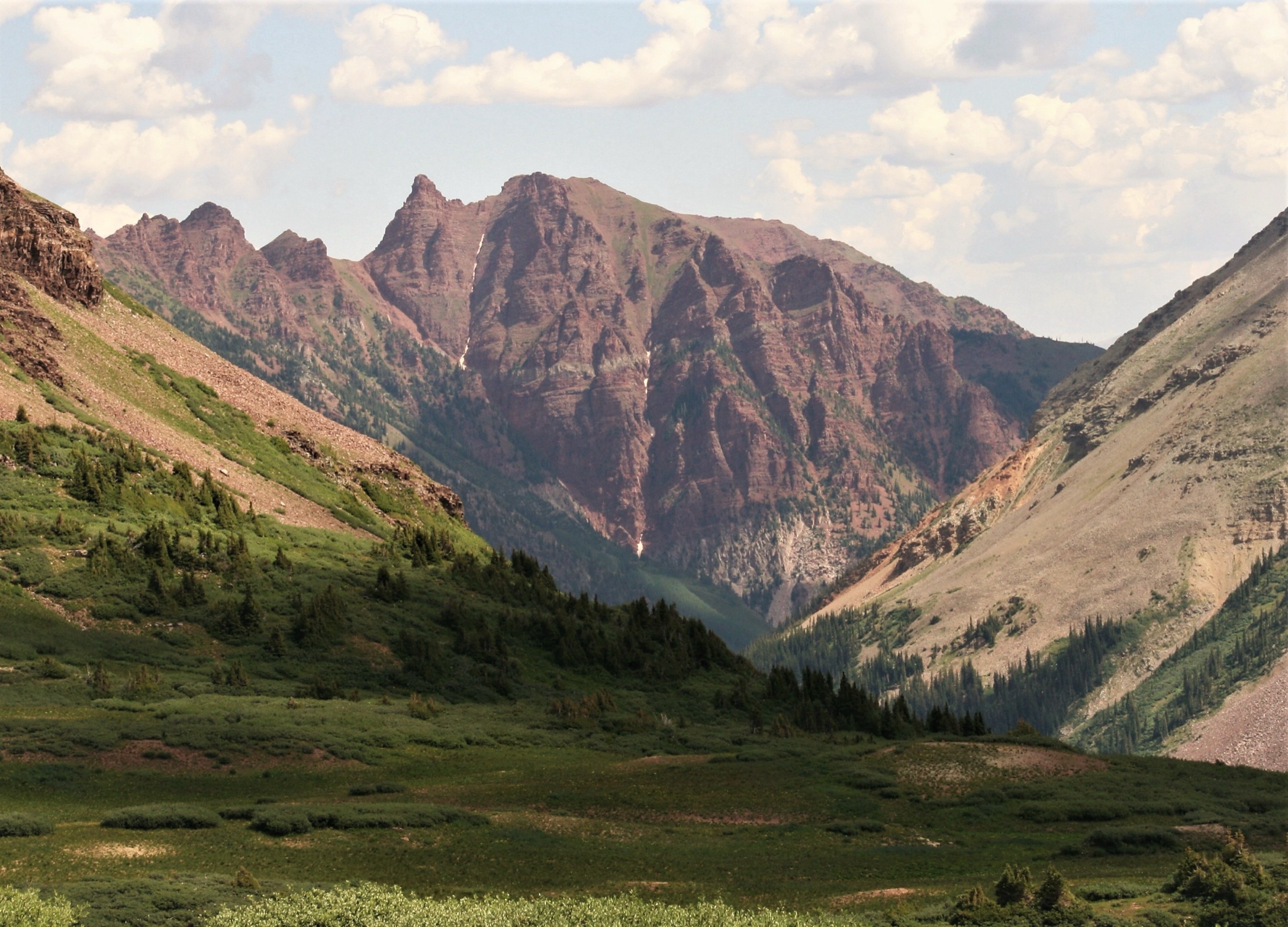
The Elk Mountains rise between Aspen on the east and Crested Butte on the west, taking in the Maroon Bells-Snowmass Wilderness, Castle Creek, Gothic, Schofield Pass and the Lake Irwin / Scarp Ridge country. The high backbone holds several Fourteeners — Maroon Peak, North Maroon Peak, Pyramid Peak, Snowmass Mountain, Capitol Peak and Castle Peak — and a dense network of glacial lakes, aspen-cloaked benches and wildflower basins between them. The walking is alpine in character throughout: loose rock, fast-changing weather, late-season snowfields on north aspects and high passes that link the Aspen and Crested Butte sides of the range in a single day for strong parties.
Aspen and Crested Butte sit only about 10 miles apart in a straight line, but the road distance is roughly 175 miles around the range — which is why the high passes (West Maroon, East Maroon, Frigid Air, Conundrum) are such a central feature of the local hiking culture. Crater Lake at the foot of the Bells, Cathedral Lake above Castle Creek and the Conundrum hot springs approach are the marquee Aspen-side objectives; Rustler’s Gulch, the Gothic valley and Scarp Ridge above Lake Irwin define the Crested Butte side. The wilderness interior itself is covered in the companion Maroon Bells–Snowmass day-hikes entry, and the wilder country north and west of Kebler Pass is treated separately in the Raggeds Wilderness day-hikes entry.
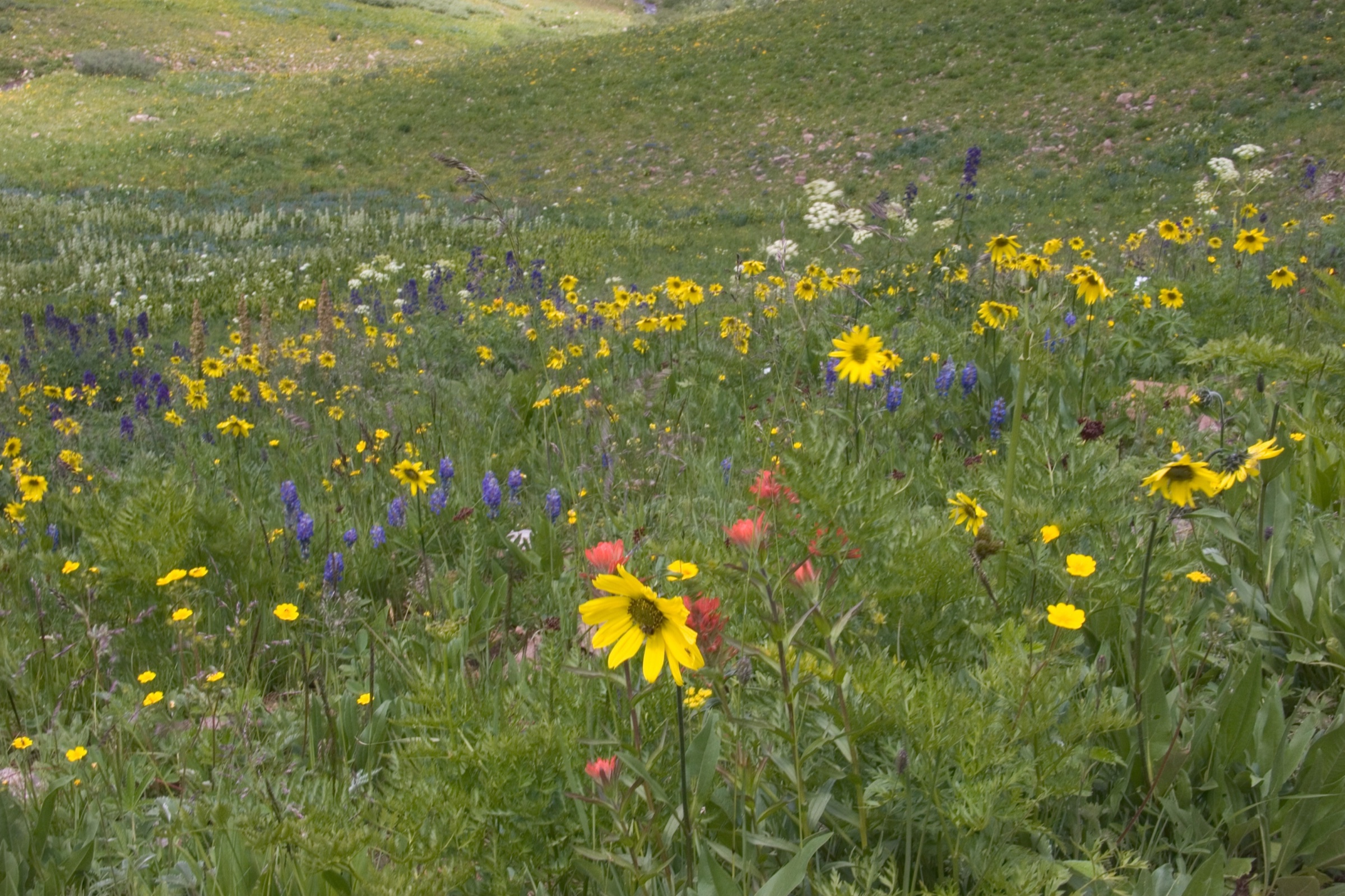
The normal walking season runs from late June or July through September, with lower forested trails extending into October. High passes and shaded basins can hold snow into July in heavier winters, and afternoon thunderstorms over the Continental Divide are nearly daily in July and August — early starts and a hard turnaround time above treeline are standard practice. Wildflowers are at their peak in mid-July to early August, which is also when both ends of the range see their busiest visitor numbers.
The Maroon Bells Scenic Area sits inside an actively managed corridor. From mid-May through October, the Maroon Creek Road is closed to private vehicles during the day, and access is by Roaring Fork Transportation Authority shuttle or pre-booked parking only. Reservations through the official Visit Maroon Bells portal are required well in advance for both. This directly affects Crater Lake and the Aspen-side start of the West Maroon Pass traverse. Camping in the Maroon Bells-Snowmass Wilderness is restricted to designated sites, campfires are prohibited, and dogs must be leashed near lakes and campsites. On the Crested Butte side, several access roads (Schofield Pass, the Lake Irwin area approaches to Scarp Ridge) are rough enough that high-clearance, often four-wheel-drive, vehicles are normal.
Selection rationale
These five routes cover the essential range of Elk Mountains day-hiking from both sides. Crater Lake is the short classic at the foot of the Bells. West Maroon Pass is the great Aspen-to-Crested Butte alpine traverse, the only point-to-point in the list. Cathedral Lake is the steep cirque-lake route from Castle Creek that sits outside the Maroon Bells reservation system. Rustler’s Gulch is a representative Crested Butte-side wildflower valley. Scarp Ridge is the compact high-viewpoint loop above Lake Irwin. Distances run from 6 km to 16.7 km and elevation gains from about 210 m to 685 m, but maximum elevations push above 3,800 m on West Maroon Pass, so altitude is the controlling fitness factor on the longer alpine days.
Summary table
| # | Hike | Country | Route type | Distance | Gain | Max elevation | Difficulty |
|---|---|---|---|---|---|---|---|
| 1 | Crater Lake, Maroon Bells | USA | Out-and-back | 6.0 km | 212 m | 3,100 m | Moderate |
| 2 | West Maroon Trail / West Maroon Pass | USA | Point-to-point | 16.7 km | 684 m | 3,811 m | Hard |
| 3 | Cathedral Lake Trail | USA | Out-and-back | 8.9 km | 630 m | 3,632 m | Hard |
| 4 | Rustler’s Gulch | USA | Out-and-back | 14.6 km | 549 m | 3,492 m | Moderate |
| 5 | Scarp Ridge Loop | USA | Loop | 6.3 km | 436 m | 3,672 m | Hard |
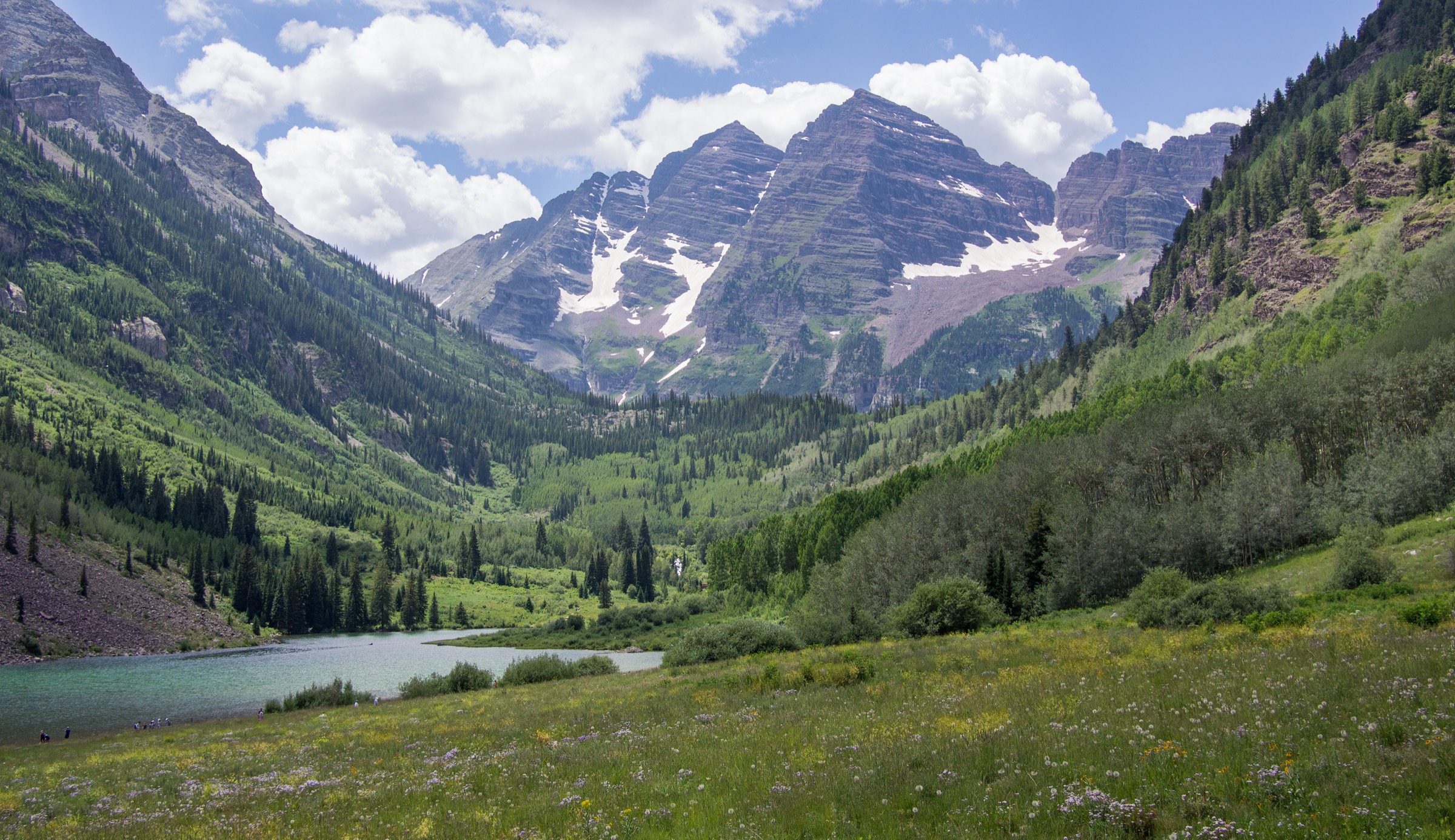
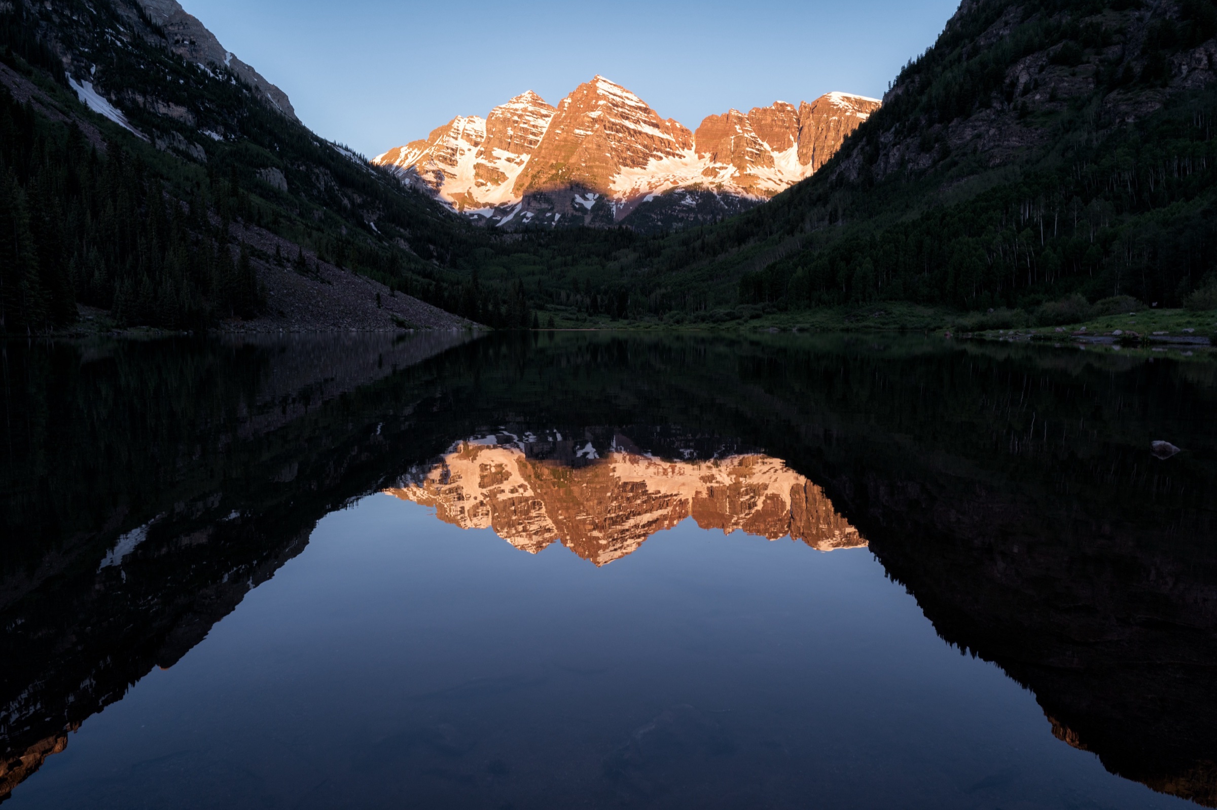
1. Crater Lake, Maroon Bells
Snapshot
Itinerary
From Maroon Lake the trail follows the Maroon-Snowmass / Crater Lake alignment south-west through aspen groves and rocky moraine terrain on the floor of the valley. The path is short but rough underfoot, with the Maroon Bells rising directly above. Crater Lake sits in a basin below the Bells, reached after about 3 km of gentle but stony walking. Return is by the same line back to Maroon Lake and the scenic-area facilities.
Why it is essential
This is the classic short Maroon Bells day-hike and the most direct way to stand at the foot of the most photographed alpine view on the Aspen side of the Elk Mountains.
Equipment
Sturdy hiking shoes are strongly recommended — the USFS describes the route as rocky and dry. Carry water (not available at the trailhead), sun protection, a rain shell and a warm layer, and a downloaded offline map. Trekking poles help on the loose sections.
Hazards and notes
Maroon Bells Scenic Area access requires current parking or shuttle reservations through the official portal — turning up without one is not viable in the managed season. Potable water is not available at the trailhead. Camping is restricted to designated sites in the wilderness, campfires are prohibited and dogs must be leashed around the lake and campsites. Early-season snow and ice can remain in shaded sections; afternoon thunderstorms are common in summer.
GPX / route file
| Source | URL | Format / access | Reuse status |
|---|---|---|---|
| USDA Forest Service — Crater Lake TH #1975 | fs.usda.gov | Official trailhead page | Source route verified; no GPX published |
| AllTrails — Crater Lake Trail | alltrails.com | Source map / downloadable route via AllTrails account | AllTrails terms apply; direct GPX not retrieved |
Further reading
- USDA Forest Service — Crater Lake TH #1975
- Visit Maroon Bells — reservations
- AllTrails — Crater Lake Trail
2. West Maroon Trail / West Maroon Pass
Snapshot
Itinerary
From Maroon Lake, the West Maroon Trail climbs the upper Maroon Creek valley through aspen and rock gardens, then breaks into open alpine basins of wildflowers and tundra before the final pull to West Maroon Pass at 3,811 m. The descent on the Crested Butte side drops through more wildflower country to the Schofield Pass road and the West Maroon trailhead area. The full line is point-to-point and requires either a vehicle shuttle, a commercial Aspen-Crested Butte shuttle service or two parties exchanging keys at the pass.
Why it is essential
West Maroon Pass is the classic non-technical high crossing between Aspen and Crested Butte and one of the great wildflower traverses in the Colorado Rockies. It combines a wilderness-quality alpine basin, a real high pass, and the historic mountain-town link that defines this part of the Elk Mountains.
Equipment
Full mountain day kit: sturdy boots, trekking poles, warm layer, rain shell, headtorch, downloaded offline map, water with treatment, food for a long day. A pre-arranged shuttle plan or contact at the Crested Butte end is part of the equipment list, not an optional extra.
Hazards and notes
Snow can make the pass serious into early or mid-summer; check current conditions before committing. Afternoon thunderstorms above 3,500 m are the headline exposure hazard — start early and be willing to turn back. Stream crossings and loose sections on the descent slow times late in the day. Maroon Bells access reservations apply at the Aspen end; without a confirmed shuttle or parking slot, the traverse cannot start.
GPX / route file
| Source | URL | Format / access | Reuse status |
|---|---|---|---|
| USDA Forest Service — West Maroon #1970 | fs.usda.gov | Official trail page | Source route verified; no GPX published |
| USDA Forest Service — Maroon Bells-Snowmass Wilderness | fs.usda.gov | Protected-area page | Area context; no GPX |
| AllTrails — Crested Butte to Aspen via West Maroon Pass | alltrails.com | Source map / downloadable route via AllTrails account | AllTrails terms apply; direct GPX not retrieved |
Further reading
- USDA Forest Service — West Maroon #1970
- Visit Maroon Bells — reservations
- AllTrails — Crested Butte to Aspen via West Maroon Pass
3. Cathedral Lake Trail
Snapshot
Itinerary
The trail leaves the Cathedral Lake trailhead off Castle Creek Road and climbs steadily out of the drainage on a forested lower section before breaking into steeper alpine terrain. A short switchback push gains the high cirque holding Cathedral Lake at 3,632 m beneath Cathedral Peak. Return is by the same line back to the trailhead.
Why it is essential
Cathedral Lake is one of the defining alpine-lake hikes on the Aspen side of the Elk Mountains: a compact but sustained climb to a high cirque, well outside the Maroon Bells reservation system and with a different range character than the Bells valley itself.
Equipment
Mountain hiking kit: sturdy boots, trekking poles, rain shell, warm layer, water with treatment, sun protection, downloaded offline map. Microspikes can help in early-season snow on the upper switchbacks.
Hazards and notes
The route is steep for its distance and the altitude is real — pace, hydration and an early start matter. Snow or ice can linger into early summer on north-facing benches. Parking at the trailhead is limited and fills early on summer weekends. Afternoon thunderstorms above 3,500 m are the main exposure risk in July and August.
GPX / route file
| Source | URL | Format / access | Reuse status |
|---|---|---|---|
| USDA Forest Service — Cathedral Lake Trailhead #1984 | fs.usda.gov | Official trailhead page | Source route verified; no GPX published |
| AllTrails — Cathedral Lake Trail | alltrails.com | Source map / downloadable route via AllTrails account | AllTrails terms apply; direct GPX not retrieved |
Further reading
4. Rustler’s Gulch
Snapshot
Itinerary
The route follows Rustler’s Gulch from the Schofield Pass Road access above Gothic into a broad alpine valley of meadows, stream crossings, waterfalls and views toward the surrounding Elk Mountains. The mapped day-hike variant continues to a turnaround in the upper basin and returns by the same line. Several stream crossings on the lower section dictate footwear choice on the day.
Why it is essential
Rustler’s Gulch is a representative Crested Butte-side wildflower and high-valley hike, less famous than West Maroon Pass but highly characteristic of the Gothic side of the Elk Mountains.
Equipment
Mountain hiking kit: waterproof footwear or sandals for stream crossings, trekking poles, rain shell, warm layer, downloaded offline map, water with treatment, food.
Hazards and notes
Stream crossings can be cold and high during the late-spring runoff and into early July. The access road from Gothic toward Schofield Pass is rough, and parking near the Rustler’s Gulch start is limited and may require a suitable vehicle depending on conditions. Early-season snow and avalanche debris can persist in the upper valley. The route falls within the Maroon Bells-Snowmass Wilderness, so wilderness rules (no bicycles, drones or motorised travel; group-size limits) apply.
GPX / route file
| Source | URL | Format / access | Reuse status |
|---|---|---|---|
| AllTrails — Rustler’s Gulch | alltrails.com | Source map / downloadable route via AllTrails account | AllTrails terms apply; direct GPX not retrieved |
| USDA Forest Service — Maroon Bells-Snowmass Wilderness | fs.usda.gov | Protected-area page | Area context; no individual GPX |
Further reading
5. Scarp Ridge Loop
Snapshot
Itinerary
The loop combines forest-road and trail sections to climb from the Lake Irwin high country onto Scarp Ridge. The ridge crest gives broad views over the Ruby Range, the West Elks and the Crested Butte country before the route returns to the start by connecting forest roads and trail. Distance is short but the ridge climb is sustained.
Why it is essential
Scarp Ridge is the compact high-viewpoint hike of the Crested Butte side: short, steep and unusually scenic for its distance, with a different feel than the wildflower-valley walks of Gothic.
Equipment
Mountain hiking kit: windproof and waterproof layer, warm layer, sturdy boots, trekking poles, downloaded offline map, sun protection. The ridge is exposed once gained.
Hazards and notes
The access road to the upper start may require high-clearance four-wheel-drive, and parking is limited. Ridge weather changes quickly, and afternoon thunderstorms are a serious hazard on the open crest — start early. There is no shelter once on the ridge; turn around if cells are building.
GPX / route file
| Source | URL | Format / access | Reuse status |
|---|---|---|---|
| USDA Forest Service — Scarp Trail #421 | fs.usda.gov | Official trail page | Source route verified; no GPX published |
| USDA Forest Service — Ridge 70 Trail #419 | fs.usda.gov | Official trail page | Source route verified; no GPX published |
| AllTrails — Scarp Ridge Trail to 421 Trail Loop | alltrails.com | Source map / downloadable route via AllTrails account | AllTrails terms apply; direct GPX not retrieved |
Further reading
- USDA Forest Service — Scarp Trail #421
- USDA Forest Service — Ridge 70 Trail #419
- AllTrails — Scarp Ridge Trail to 421 Trail Loop
Further reading
| Source | URL |
|---|---|
| USDA Forest Service — White River National Forest | fs.usda.gov |
| USDA Forest Service — Maroon Bells-Snowmass Wilderness | fs.usda.gov |
| USDA Forest Service — Grand Mesa, Uncompahgre and Gunnison NFs | fs.usda.gov |
| Visit Maroon Bells — reservations | visitmaroonbells.com |
| RFTA — Maroon Bells shuttle | rfta.com |
| Aspen Chamber Resort Association — Maroon Bells | aspenchamber.org |
| AllTrails — Maroon Bells-Snowmass Wilderness trails | alltrails.com |
| Wikimedia Commons — Category: Maroon Bells | commons.wikimedia.org |
| Wikipedia — Elk Mountains (Colorado) | en.wikipedia.org |