Regional overview
The West Elk Mountains are a quieter, more remote part of the Elk Mountains, centred on West Elk Wilderness, the Castles, Kebler Pass, Ohio Creek, Soap Creek, Rainbow Lake Road, and the Curecanti / Blue Mesa gateway. The terrain runs from volcanic pinnacles and long aspen valleys through spruce-fir forest to high ridges, alpine passes, and remote summits.
The season is generally July through September for high wilderness routes, with some lower Curecanti trails open earlier. Roads are a major planning factor: several trailheads are reached by long dirt roads, and some require high-clearance or 4WD in wet conditions.
For the more famous Elk Mountains classics on the eastern side of the range, see the companion Aspen and Crested Butte day-hikes, Maroon Bells–Snowmass day-hikes, and Raggeds Wilderness day-hikes entries.
Selection rationale
The selection balances rugged West Elk Wilderness routes with one accessible southern gateway hike: Mill-Castle / Storm Pass for the Castles, Rainbow Lake for West Elk Creek and South Baldy country, Three Lakes for a moderate lake loop, West Elk Peak for the range high point, and Curecanti Creek for the canyon-and-reservoir edge of the West Elk landscape.
Summary table
| # | Hike | Country | Route type | Distance | Gain | Max elevation | Difficulty |
|---|---|---|---|---|---|---|---|
| 1 | Mill-Castle Trail to Storm Pass | USA | Out-and-back | 24.1 km | 1,151 m | 3,797 m | Hard |
| 2 | Rainbow Lake Trail #449 | USA | Out-and-back | 16.7 km | 805 m | 3,500 m | Hard |
| 3 | Three Lakes Trail #843 | USA | Loop | 5.6 km | 158 m | 3,067 m | Moderate |
| 4 | West Elk Peak South Ridge | USA | Out-and-back | 16.1 km | 1,220 m | 3,973 m | Hard / Class 2 |
| 5 | Curecanti Creek Trail | USA | Out-and-back | 6.3 km | 263 m | 2,449 m | Moderate |
1. Mill-Castle Trail to Storm Pass
Snapshot
Itinerary
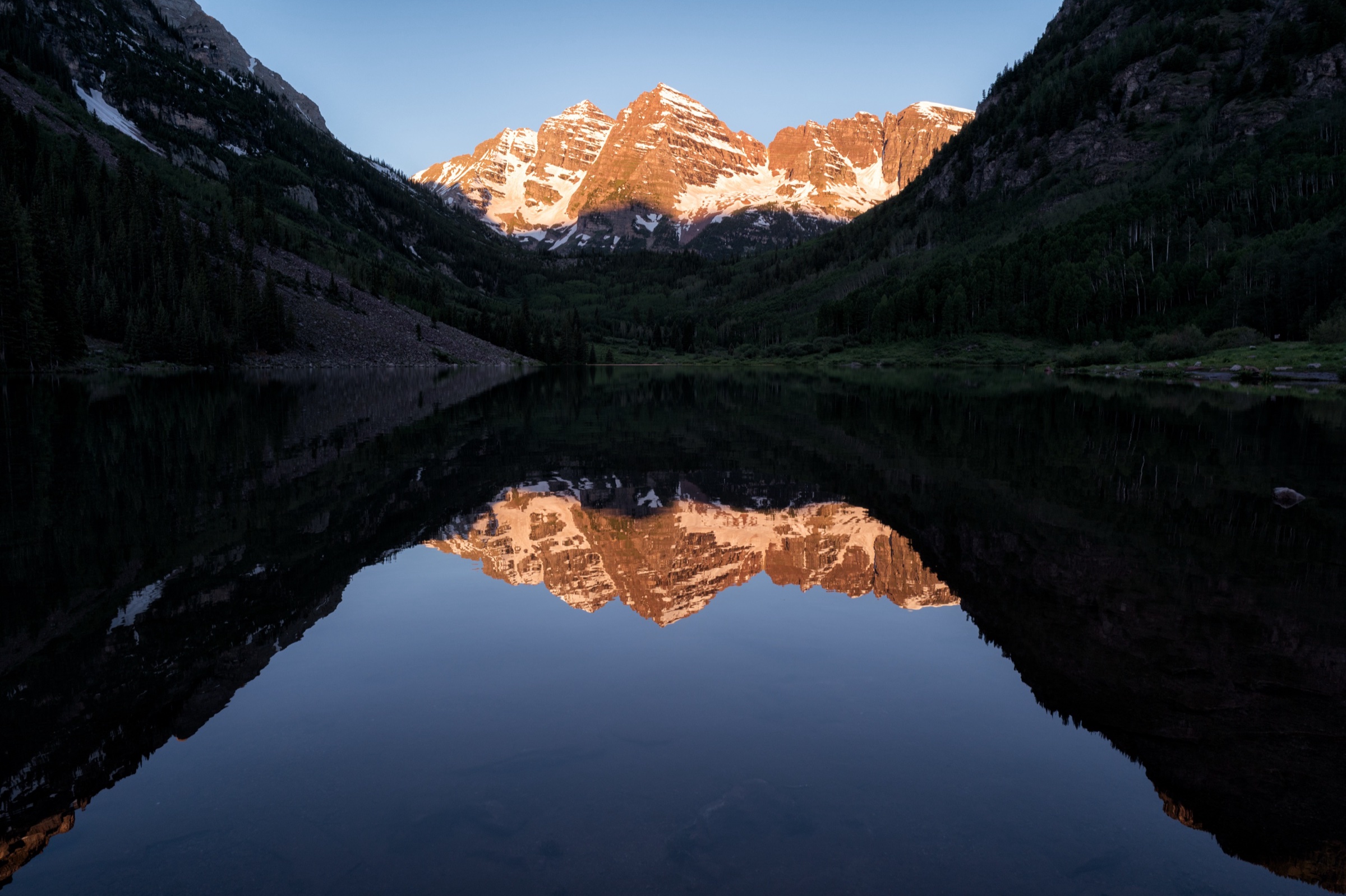
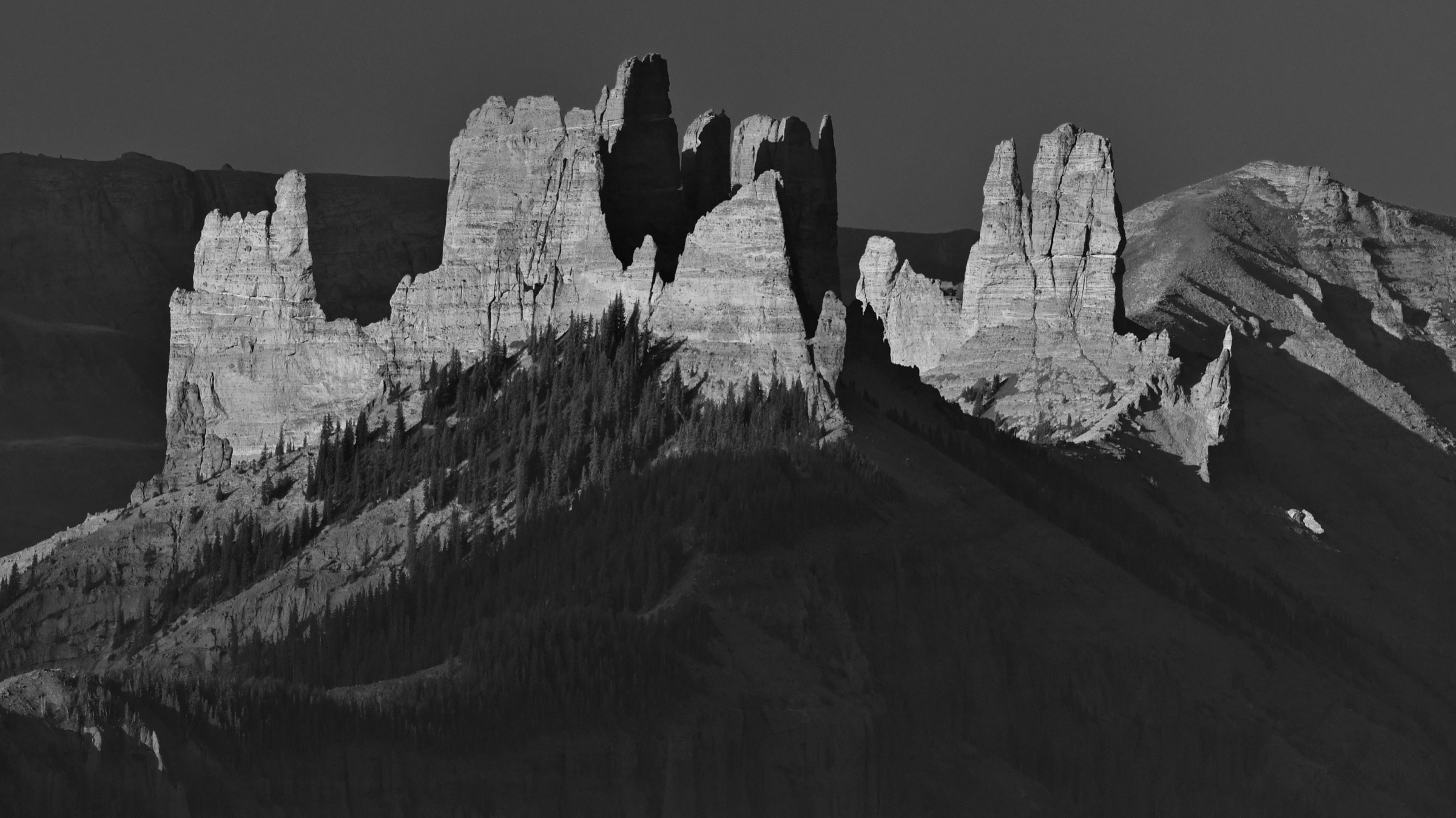
The route follows Mill-Castle Trail #450 from the Mill Creek Road trailhead into West Elk Wilderness. It crosses Mill Creek, passes below the rugged volcanic Castles (visible in the cover image above), climbs through forest and rocky switchbacks, then continues to Storm Pass before returning the same way.
Why it is essential
Mill-Castle is identified by the Forest Service as one of the most scenic trails in West Elk Wilderness and is the signature route for the Castles terrain.
Equipment
Mountain hiking equipment: sturdy boots, poles, headtorch, warm layer, rain shell, navigation backup, and enough food and water for a long day.
Hazards and notes
Mill Creek crossing can be treacherous during runoff or thunderstorms. The rocky switchbacks can be slippery in wet weather. This is a long high-country day with thunderstorm exposure and remote terrain.
GPX / KML links
| Source | URL | Format / access | Reuse status |
|---|---|---|---|
| USFS — Mill Castle #450 | fs.usda.gov | Official trail page | No GPX file; official source for route description |
| AllTrails — Storm Pass via Mill Castle | alltrails.com | Interactive route map | AllTrails terms; GPX reuse not verified; source/check only |
Further reading
2. Rainbow Lake Trail #449
Snapshot
Itinerary
Rainbow Lake Trail #449 starts at the end of Rainbow Lake Road and enters dense timber. It climbs toward open meadows and a ridge, then descends toward West Elk Creek, with access to the West Elk Rim and Sun Park trail network. The day-hike variant turns around before committing to a longer wilderness traverse.
Why it is essential
This is a core West Elk Wilderness trail, giving access to South Baldy / West Elk Creek country and the remote interior trail system.
Equipment
Mountain hiking equipment: boots, poles, rain shell, warm layer, navigation backup, and water treatment.
Hazards and notes
The road approach is long. Weather, snow, and remote navigation are the main issues. The full trail continues farther than the day-hike variant.
GPX / KML links
| Source | URL | Format / access | Reuse status |
|---|---|---|---|
| USFS — Rainbow Lake Trail #449 | fs.usda.gov | Official trail page | No GPX file; official source for route description |
| AllTrails — Rainbow Lake Trail #449 | alltrails.com | Interactive route map | AllTrails terms; GPX reuse not verified; source/check only |
Further reading
3. Three Lakes Trail #843
Snapshot
Itinerary
The loop starts near Lost Lake Campground and passes meadows, spruce-fir forest, Lost Lake, Dollar Lake side access, and open views toward East and West Beckwith. It returns to the campground area by the opposite side of the loop.
Why it is essential
Three Lakes is the accessible lake-and-aspen hike of the West Elk Mountains, useful as a shorter representative route among much longer wilderness days.
Equipment
Standard hiking equipment: sturdy shoes, rain shell, water, sun protection, and map/GPS.
Hazards and notes
The trail is popular and well marked, but rocky sections and wet ground are possible. Road access should be checked after storms and during early season.
GPX / KML links
| Source | URL | Format / access | Reuse status |
|---|---|---|---|
| USFS — Three Lakes #843 | fs.usda.gov | Official trail page | No GPX file; official source for route description |
| AllTrails — Three Lakes Trail | alltrails.com | Interactive route map | AllTrails terms; GPX reuse not verified; source/check only |
Further reading
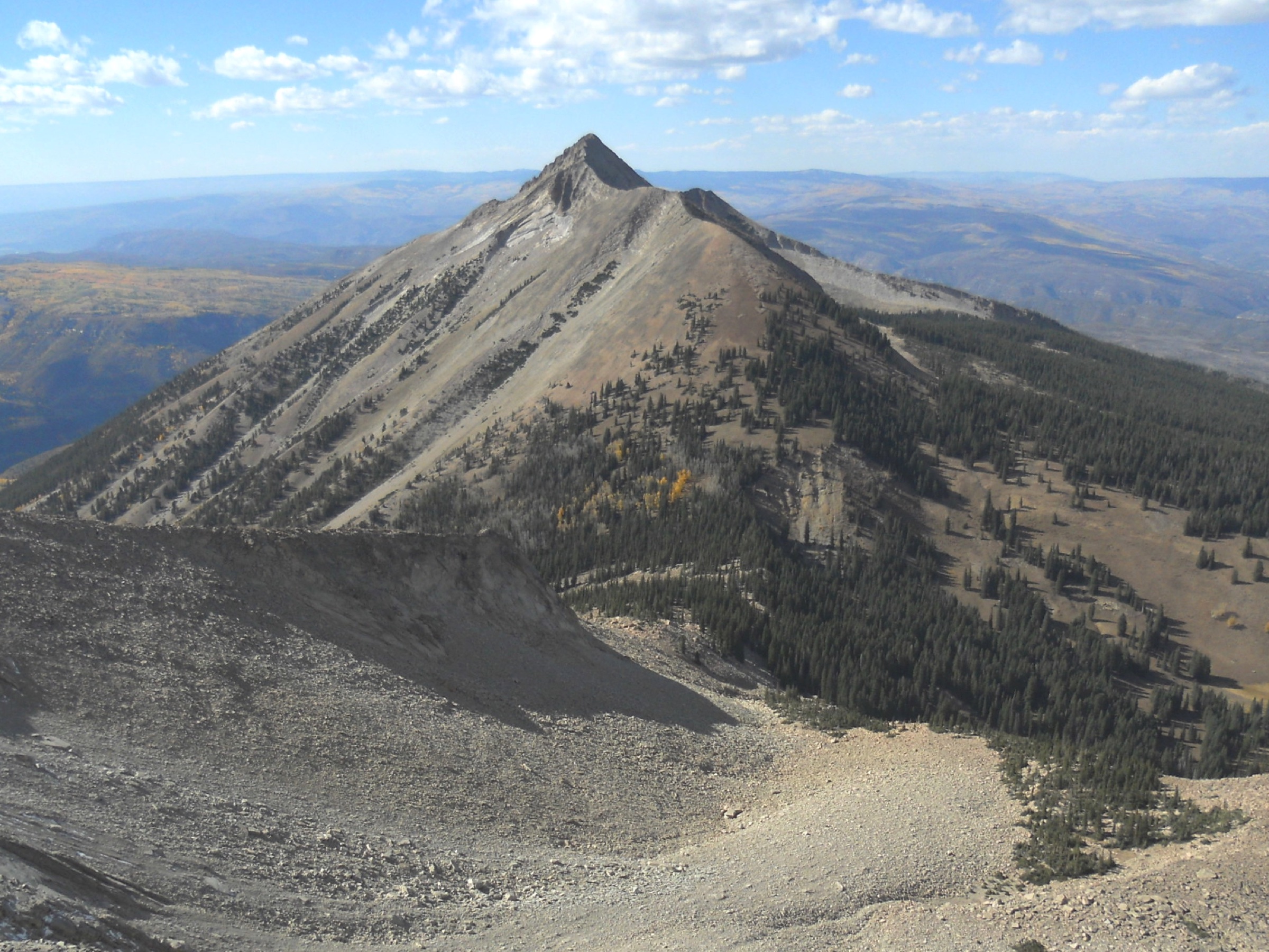
4. West Elk Peak South Ridge
Snapshot
Itinerary
The route starts at Rainbow Lake Trailhead and uses Rainbow Lake Trail before leaving the main trail system for the South Ridge approach to West Elk Peak. The summit is the high point of the West Elk Range and West Elk Wilderness. The return follows the same general line.
Why it is essential
West Elk Peak is the highest summit of both the West Elk Range and West Elk Wilderness, making it the natural summit representative for the region.
Equipment
Mountain hiking equipment plus scrambling-appropriate footwear: navigation backup, helmet optional for loose rock depending on conditions, rain shell, warm layer, headtorch, and an early start.
Hazards and notes
This is more serious than the maintained trail hikes. The Colorado Mountain Club describes Class 2 scrambling on the South Ridge approach. Routefinding, loose rock, altitude, lightning, snow remnants, and remoteness are the main hazards. This entry needs a dedicated GPX/topographic verification pass before any later edition of the catalogue.
GPX / KML links
| Source | URL | Format / access | Reuse status |
|---|---|---|---|
| Colorado Mountain Club — West Elk Peak | cmc.org | Route description | Site terms apply; no GPX found |
| USFS — Rainbow Lake Trail #449 | fs.usda.gov | Official trail page | No GPX file; approach source verified |
| USFS — West Elk Wilderness | fs.usda.gov | Official wilderness page | Land-manager context verified |
Further reading
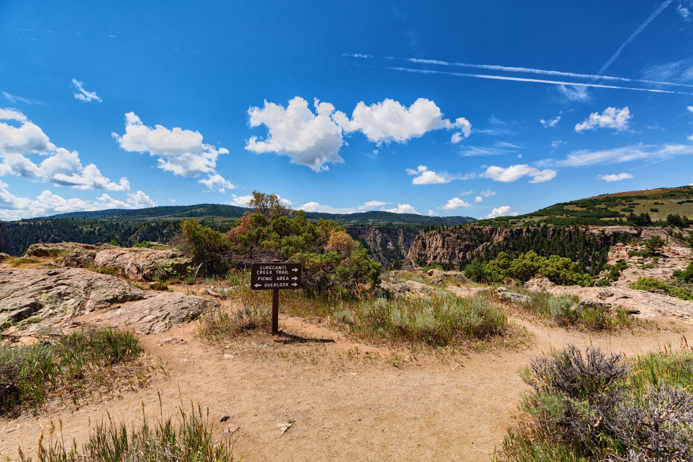
5. Curecanti Creek Trail
Snapshot
Itinerary
The trail descends from the high rim near CO-92 into Curecanti Creek canyon, following the creek toward Morrow Point Reservoir. It then climbs back to the trailhead by the same route.
Why it is essential
Although outside the high wilderness core, Curecanti Creek gives the West Elk catalogue a southern gateway route: canyon descent, reservoir views, waterfalls, and the Curecanti Needle landscape.
Equipment
Standard hiking equipment: sturdy shoes, water, sun protection, rain layer, and a warm layer outside midsummer.
Hazards and notes
The return climb is steeper than the outward descent. NPS notes limited or nonexistent cell service in parts of Curecanti and requires leashed pets. Summer heat and thunderstorms should be considered.
GPX / KML links
| Source | URL | Format / access | Reuse status |
|---|---|---|---|
| NPS — Curecanti hiking | nps.gov | Official trail source / map page | NPS public website; no GPX found |
| NPS — Curecanti conditions | nps.gov | Official conditions page | NPS public website; access/condition source |
| AllTrails — Curecanti Creek Trail | alltrails.com | Interactive route map | AllTrails terms; GPX reuse not verified; source/check only |
Further reading
Missing data / follow-up work
- No legally reusable GPX/KML files were verified.
- Rainbow Lake and Mill-Castle need route-specific open-licence photography; the cover image already shows the Castles, so Mill-Castle does not repeat that figure inline.
- West Elk Peak needs a dedicated route-geometry check before publication because the South Ridge approach includes Class 2 terrain.
- Curecanti Creek is included as a southern West Elk gateway hike; final catalogue taxonomy should confirm whether Curecanti routes belong in this West Elk Mountains entry or a separate Black Canyon / Curecanti entry.
Further reading
| Resource | Link |
|---|---|
| USFS — Mill Castle #450 | fs.usda.gov |
| USFS — Rainbow Lake Trail #449 | fs.usda.gov |
| USFS — Three Lakes #843 | fs.usda.gov |
| USFS — West Elk Wilderness | fs.usda.gov |
| Colorado Mountain Club — West Elk Peak | cmc.org |
| NPS — Curecanti hiking | nps.gov |
| NPS — Curecanti conditions | nps.gov |
| AllTrails — Storm Pass via Mill Castle | alltrails.com |
| AllTrails — Rainbow Lake Trail #449 | alltrails.com |
| AllTrails — Three Lakes Trail | alltrails.com |
| AllTrails — Curecanti Creek Trail | alltrails.com |