Regional overview
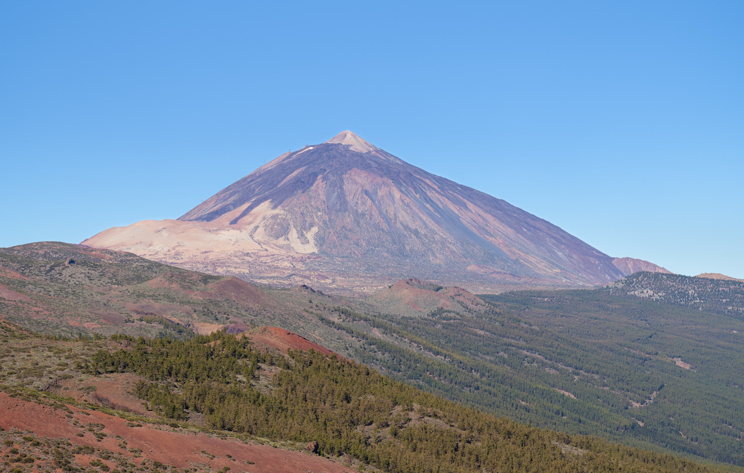
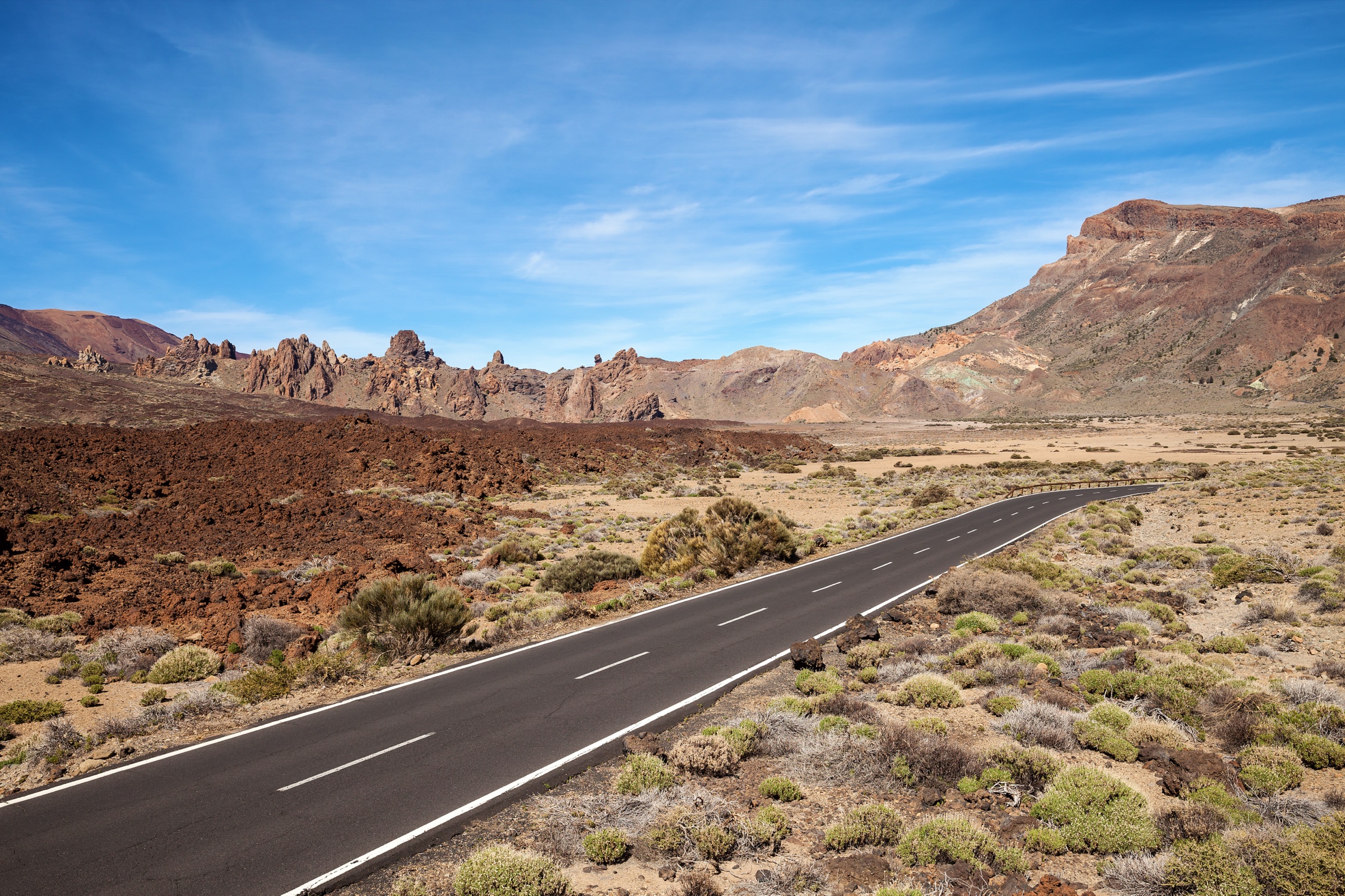
Tenerife’s Teide Massif is a high volcanic walking region centred on Teide National Park, the Las Cañadas caldera and the Teide–Pico Viejo complex. The headline number is Teide itself — at 3,715 m (12,188 ft) the highest summit on Spanish territory and the third-tallest volcanic structure on Earth measured from its ocean-floor base. The caldera around it sits between roughly 2,000 m and 2,300 m, walled to the south by the Guajara crags and floored by pumice, lava plains and a thin alpine-desert vegetation belt above the tree line. The classic marked Park trails (PNT — Parque Nacional del Teide) cross this landscape end-to-end, from short signature loops at Roques de García to long traverses under the caldera wall.
The hiking character is exposed, dry and altitude-sensitive. Sun, wind, ultraviolet load, sudden visibility loss, winter snow and ice at the top of the Park, and protected-area rules matter more than route-finding on the marked classics. Above 3,200 m the route to the actual Teide crater rim (Pico del Teide, PNT 10) requires a free permit reserved months in advance through the Park’s online system; the cable car (Teleférico del Teide) is the standard upper-mountain shuttle and runs roughly from El Portillo opening hours to early afternoon, weather permitting. This article does not include the permit-only summit cone itself — the five walks below all stop short of it.
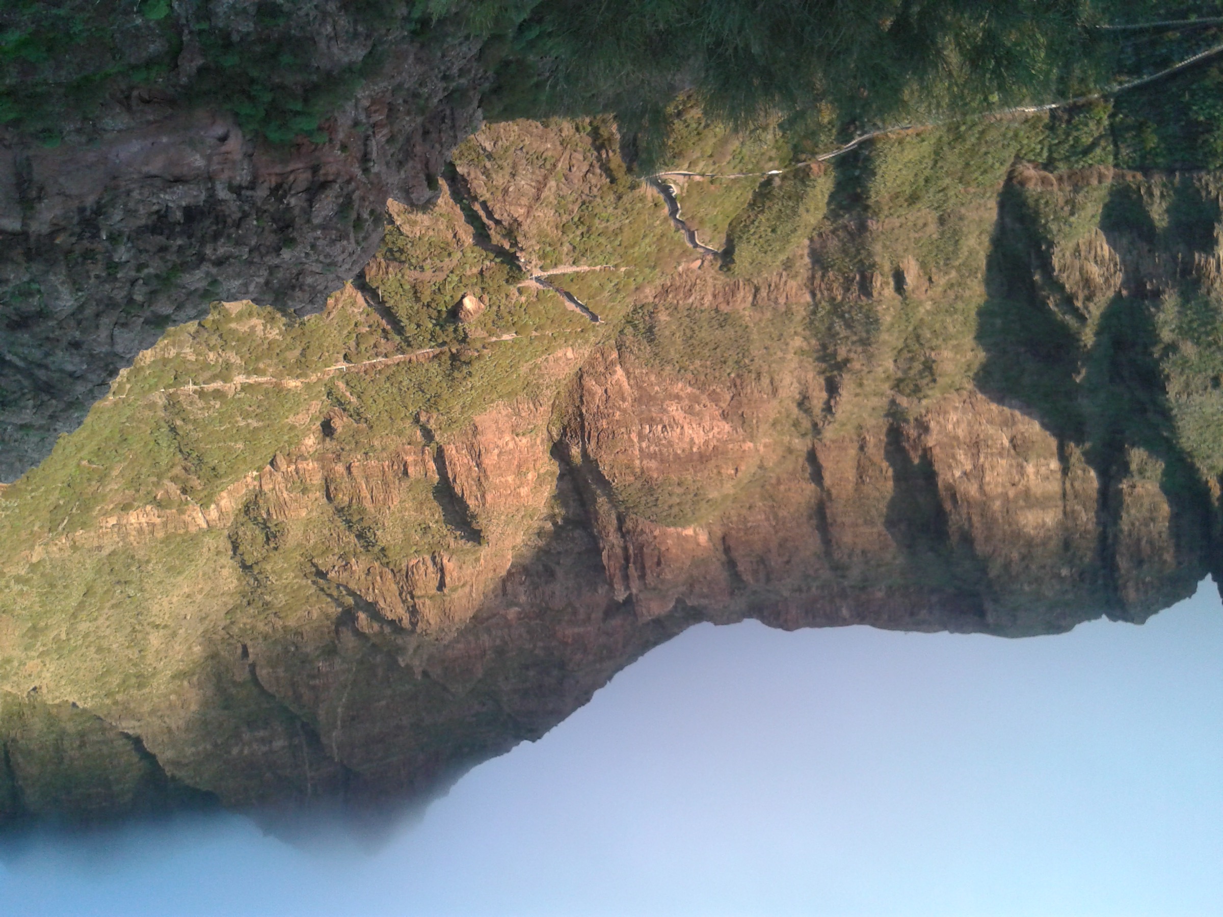
The fifth walk in the selection — the Camino del Barranco de Masca — sits outside the Teide caldera, on the Teno side of the island, but it belongs in any Tenerife day-hike catalogue. The ravine has been reopened under a managed-access model: visitors book a slot at the official Masca booking portal, descend with helmet and prescribed footwear, and (in the standard one-way version) leave the gorge by boat to Los Gigantes. From the December 2025 season, shared land transport from Santiago del Teide to the Masca trailhead is part of the booked package. Walking the ravine as an out-and-back is permitted but adds a strenuous reclimb under the same booking and safety regime.
The standard hiking season is year-round, with constraints. December to February can bring snow above 2,500 m and ice on the upper Teide trails; July and August add heat to an already shadeless landscape; transitional months (April–May, October–November) typically give the most stable combinations. Public transport into the Park is limited to TITSA buses 348 (Puerto de la Cruz–El Portillo–Parador) and 342 (Costa Adeje–Parador): both run once daily in each direction, which constrains the realistic point-to-point logistics on routes 1, 3 and 4 below. South-east across the archipelago, the Gran Canaria highlands day-hike catalogue covers Roque Nublo and the Cruz de Tejeda walking country on the sister island.
Selection rationale
The five walks were chosen to cover the sector’s defining landscapes without duplication:
- Montaña Blanca Trail (PNT 07) — the standard non-technical walking approach into the highest Teide landscape, stopping at La Rambleta before the permit-only summit cone.
- Roques de García (PNT 03) — the short signature lava-and-rock loop, the single most photographed corner of the Park.
- Teide–Pico Viejo (PNT 09) — the long high-altitude descent across the 1798 Narices del Teide eruption landscape, the only walk in the catalogue that crosses fresh historical lava at altitude.
- Siete Cañadas (PNT 04) — the classic east-side traverse of Las Cañadas, under the Guajara wall, the best day for absorbing the scale of the caldera floor.
- Camino del Barranco de Masca — Tenerife’s signature controlled ravine descent, in the Teno Massif rather than the Teide caldera, included for its place in any honest Tenerife day-hike selection.
Summary table
| # | Hike | Country | Route type | Distance | Gain | Max elevation | Difficulty |
|---|---|---|---|---|---|---|---|
| 1 | Montaña Blanca Trail (PNT 07) | Spain | Point-to-point | 8.3 km | 1,194 m | 3,536 m | Hard |
| 2 | Roques de García (PNT 03) | Spain | Loop | 3.5 km | 211 m | 2,187 m | Easy |
| 3 | Teide–Pico Viejo (PNT 09) | Spain | Point-to-point | 9.3 km | 109 m | 3,498 m | Hard |
| 4 | Siete Cañadas (PNT 04) | Spain | Point-to-point | 16.6 km | 585 m | 2,221 m | Moderate |
| 5 | Camino del Barranco de Masca | Spain | Controlled descent (or out-and-back) | 5.0 km one-way / 8.5 km out-and-back | 837 m out-and-back | ~750 m | Hard |
1. Montaña Blanca Trail (PNT 07)
Snapshot
Itinerary
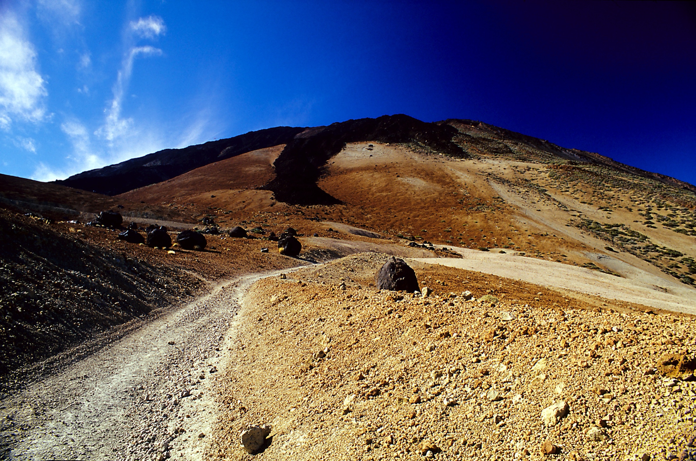
From the TF-21 trailhead the route follows the dirt access road up the lower flank of Montaña Blanca to the saddle that gives the trail its name, then turns onto the marked PNT 07 path. The next section is the signature stretch: a broad pumice slope strewn with Huevos del Teide — black volcanic bombs the size of beach balls, ejected from earlier eruptions and rolled to a stop on the white pumice surface. The path climbs steadily across this slope to the Refugio de Altavista mountain hut (3,260 m), the historical halfway point for guided sunrise ascents.
Above the refuge the gradient eases briefly, then the trail picks its way through a black lava field — a young flow with sharp, fragile crusts — to La Rambleta at 3,536 m. From La Rambleta a short signed link leads to the Mirador de la Fortaleza, the lookout above the northern caldera wall, and to the upper cable-car station. The walking route as catalogued ends here; access to the Pico del Teide rim above requires the separate online permit.
Why it is essential
This is the classic non-technical walking line into the highest Teide landscape — the most direct day-hike expression of the Park’s altitude, lava and pumice scale, without committing to the permit-only summit cone. The combination of the Huevos del Teide pumice slope, the Altavista refuge and the upper lava traverse to La Rambleta defines the way most people who walk Teide actually experience it.
Equipment
- Mountain boots; trekking poles for the long pumice climb
- Warm windproof layers — the temperature drops sharply above 3,000 m
- Strong sun and UV protection; the surface reflectivity is high
- 2.5–3 L of water; no on-route sources
- Headlamp if combining with a sunrise option from Altavista
- Park summit permit (if continuing onto PNT 10) printed or stored offline
Hazards and notes
- Altitude effects are real from about 3,000 m; pace conservatively and turn back at the first sign of severe headache or coordination loss.
- The young lava field above Altavista has fragile crusts — stay on the marked tread to avoid breakthroughs and ankle injuries.
- Cable-car operation at La Rambleta is weather- and wind-dependent and can shut without notice; plan an alternative descent.
- Snow and ice can persist on the upper pumice and lava well into spring; check Park conditions before committing.
Sources
- WebTenerife — Montaña Blanca–Pico Teide
- Teide National Park — official site
- Wikiloc — PNT 07 Montaña Blanca–La Rambleta
2. Roques de García (PNT 03)
Snapshot
Itinerary
The loop begins at the Mirador de La Ruleta directly across the TF-21 from the Parador. The signed PNT 03 path climbs briefly along the eastern flank of the Roques outcrop — a procession of weather-carved phonolite towers including the Roque Cinchado, the rock formation that appeared on the old Spanish 1,000-peseta note. The path crosses the saddle behind the main tower, then drops steeply onto the Llano de Ucanca, a flat pumice basin at the heart of the southern caldera.
The lower half of the loop crosses the basin under the western face of the Roques, then climbs back to La Ruleta past the smaller satellite towers. The loop is short but the second half — the Ucanca climb — is the only sustained effort. Most parties pause for the Roque Cinchado photograph at the high point of the loop before descending to the Parador.
Why it is essential
This is the compact signature walk of Teide National Park: short enough for any visitor, scenic enough to anchor a whole-Park day, and built around the single most photographed corner of the caldera. The combination of Roque Cinchado, the Ucanca basin floor and the open view to Teide makes it the obvious counterpoint to the long traverses.
Equipment
- Trail shoes or light boots
- Sun and wind protection
- 1.5 L of water
- Light insulation for the windier saddle
Hazards and notes
- The Ucanca descent and reclimb are loose underfoot in places; mind the surface, not the views.
- The Park is a UNESCO World Heritage site — stay on marked tread, do not collect pumice or volcanic bombs, do not climb on the rock towers.
- The TF-21 across from the trailhead is busy at midday; cross with care.
Sources
3. Teide–Pico Viejo (PNT 09)
Snapshot
Itinerary
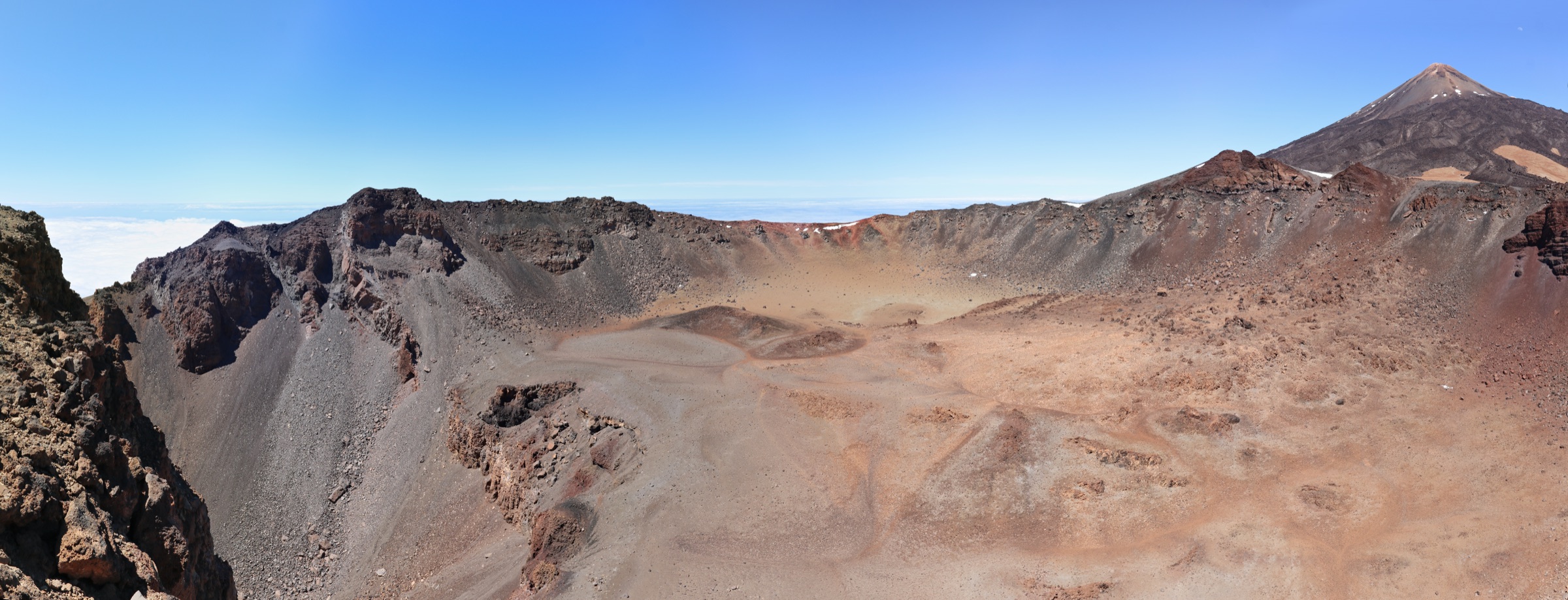
From the upper cable-car station the marked PNT 09 path contours away from the Teide cone toward the Mirador de Pico Viejo, a lookout directly above the dark crater of Pico Viejo — at roughly 800 m across, the largest crater in the Park and the source of the 1798 Narices del Teide eruption. From the lookout the trail descends steeply across the south-western lava field, then turns under the rim and traverses the broken upper lava toward the Degollada de Chahorra saddle.
Below the saddle the route picks its way down through the dark, friable Narices flow — a tongue of dark basalt that reached the TF-38 in 1798 — to the Mirador de las Narices del Teide, the signed trailhead at the TF-38. The route is largely descent, but the surface alternates between fine pumice and sharp aa lava, and the upper sections are exposed to strong wind. The drop from 3,498 m at La Rambleta to 1,977 m at the TF-38 is the largest single descent of any walk in this catalogue.
Why it is essential
PNT 09 is the major high-level descent through the Teide–Pico Viejo volcanic complex and the only walk in the selection that crosses a young historical lava flow — the 1798 Narices del Teide eruption — at altitude. As the long counterpoint to the short Roques loop and the climbing Montaña Blanca approach, it gives the most complete one-day reading of the upper Park.
Equipment
- Mountain boots with stiff soles for the loose lava
- Warm windproof layers; the upper section is always cold
- Strong sun and UV protection
- 2.5 L of water; no on-route sources
- Cable-car ticket booked in advance; pickup arranged from the TF-38 finish
Hazards and notes
- The net descent disguises a serious mountain day: altitude, wind, loose surfaces and isolation are the real hazards, not gradient.
- Cable-car interruptions are frequent; if the lift cannot run, the route is essentially impossible as a day-hike from La Rambleta.
- The single daily TITSA bus on the TF-38 is the practical pickup; missing it commits you to a long road walk or a paid transfer.
- The young lava surfaces near the Narices are sharp — falls cause severe abrasions.
Sources
- WebTenerife — Teide–Pico Viejo
- Teide Cable Car — operation and tickets
- Wikiloc — PNT 09 Teide–Pico Viejo–Mirador de Las Narices del Teide
4. Siete Cañadas (PNT 04)
Snapshot
Itinerary
From El Portillo, at the northern entrance to the Park, the marked PNT 04 path drops onto the floor of Las Cañadas and follows the old Camino de Chasna — the historic shepherds’ road across the caldera — eastward along the foot of the southern wall. The route crosses one cañada (a flat sub-basin of the caldera) after another, named in sequence: Cañada de los Guancheros, del Capricho, de Diego Hernández, de los Corderos and so on, all the way to Cañada Blanca near the Parador.
There is essentially no shade for the whole 16 km. The caldera wall — the Risco de Guajara on the south side, capped by the 2,718 m Guajara summit — stays in view for most of the day, while the Teide cone dominates the right shoulder. The trail is well marked with PNT 04 posts and stone cairns, with two-way connections to PNT 03 (Roques de García) and PNT 05 (Degollada de Guajara) at the southern margin if the day needs cutting short.
Why it is essential
This is the classic long traverse of Las Cañadas. Walking the whole caldera floor — under the Guajara wall, past the cañadas in sequence, with Teide always at one shoulder — is the best one-day way to absorb the scale of the caldera without committing to the high altitude of PNT 07 or PNT 09. It is also the only walk in the selection that can be done end-to-end on the once-daily TITSA bus service.
Equipment
- Trail shoes or light boots
- Strong sun and wind protection — there is no shade
- 2.5–3 L of water; no on-route sources
- Layered insulation for the open caldera wind
- Printed bus timetables; phone reception is patchy across the caldera
Hazards and notes
- The shadeless 16 km is the real danger; midsummer attempts should start at first light and finish before noon.
- Crossing the caldera in poor visibility is genuinely disorienting — the cañadas look alike and ground features are sparse. Carry a navigation backup.
- Winter snow can cover sections of the route briefly; the surface freezes hard overnight and softens by mid-morning.
- The Park bans bicycles and dogs on the PNT trails; rangers spot-check.
Sources
5. Camino del Barranco de Masca
Snapshot
Itinerary
The official one-way route checks visitors in at the Masca Visitors’ Centre in the village, where helmet, footwear and the booking record are verified, before dropping into the ravine on the marked path. The trail descends steeply through the upper basalt walls, crosses and re-crosses the streambed under shaded overhangs, and weaves between large boulders. The lower section opens into a tighter gorge with stone-and-cement steps cut into the rock and a series of short ledges before delivering the walker to the cobble beach at the mouth of the ravine.
From the beach a managed boat transfer runs to Los Gigantes for the standard one-way version; if the boat cannot operate (sea conditions, scheduling), or if the walker has booked the out-and-back option, the same path is climbed back to Masca village. The reclimb adds about 800 m of gain over the 4 km return and is the harder half of the day.
Why it is essential
Masca is Tenerife’s defining controlled ravine descent. The basalt walls, the streambed staircase, the boat finish at the Atlantic and the heavy managed-access model give a walk that has no equivalent elsewhere on the island. It is also the only walk in this selection outside the Teide caldera, and the only one that requires booking through a non-Park system.
Equipment
- Closed-toe hiking footwear with rigid sole — sandals and open shoes are refused at check-in
- Helmet — provided at the visitors’ centre or your own; required by the access rules
- Sun and wind protection
- 2 L of water; light food
- Waterproof bag for the boat transfer
- Booking confirmation, photo ID and the operator’s safety briefing acknowledgement
Hazards and notes
- The official safety material lists falls, rockfall, slippery rock and flash flooding as the primary risks; the route closes preemptively in storm forecasts.
- The lower gorge is the rockfall-prone section; do not stop under overhangs or shelter against the walls in poor weather.
- If the boat transfer cannot run, the return climb is unavoidable; commit only if you are fit enough to do it.
- Mobile signal in the ravine is effectively zero; trust the marked tread and stay with your party.
Sources
- Camino del Barranco de Masca — official booking
- Camino del Barranco de Masca — safety rules
- AllTrails — Camino del Barranco de Masca
Further reading
| Source | URL |
|---|---|
| WebTenerife — official trail catalogue | webtenerife.co.uk |
| Teide National Park — official site | miteco.gob.es |
| Teide Cable Car — operation and tickets | volcanoteide.com |
| Camino del Barranco de Masca — official site | caminobarrancodemasca.com |
| TITSA — public bus operator for Tenerife | titsa.com |
| Wikipedia — Teide | en.wikipedia.org |
| Wikipedia — Teide National Park | en.wikipedia.org |
| Wikipedia — Masca, Tenerife | en.wikipedia.org |
| Wikimedia Commons — Category: Teide | commons.wikimedia.org |
| OpenStreetMap (ODbL 1.0) | openstreetmap.org |