Regional overview
Gran Canaria’s highlands are a compact volcanic walking region of basalt plugs, pine plateaus, crater rims, ravines, cave-settlements, and old inter-village paths around Tejeda, Cruz de Tejeda, Roque Nublo, Pico de las Nieves, Bandama, Artenara, and Guayadeque. The best day hikes mix short iconic viewpoints with longer cultural and ravine routes.
The walking is generally non-technical but access-sensitive: heat, dry exposure, loose volcanic gravel, cloud, road logistics, protected-area rules, and reservation systems can affect otherwise straightforward routes. Route/source status was checked in this pass on 2026-06-12; official access pages and local transport should be rechecked before publication. North-west across the archipelago, the Tenerife and Teide massif day-hike catalogue covers the higher volcanic terrain on Spain’s tallest summit.
Selection rationale
The five hikes cover the island’s signature rock viewpoint, an official historic highland path, a crater-rim/descent loop, a long Tejeda-Artenara balcony circuit, and a ravine/cave-landscape walk.
Summary table
| # | Hike | Country | Route type | Distance | Gain | Max elevation | Difficulty |
|---|---|---|---|---|---|---|---|
| 1 | Roque Nublo | Spain | Out-and-back | 3.1 km | 186 m | 1,745 m | Moderate |
| 2 | Ruta de la Plata: Cruz de Tejeda - Llanos de la Pez | Spain | Point-to-point | 6.4 km | 346 m | 1,714 m | Moderate |
| 3 | Bandama Caldera | Spain | Loop | 3.2 km | 240 m | 463 m | Moderate |
| 4 | Cruz de Tejeda - Artenara - Juan Fernández - Lomo de los Santos | Spain | Loop | 20.1 km | 972 m | 1,725 m | Hard |
| 5 | Ermita de Guayadeque - Pasadilla via Barranco de Guayadeque | Spain | Out-and-back | 5.8 km | 248 m | 729 m | Moderate |
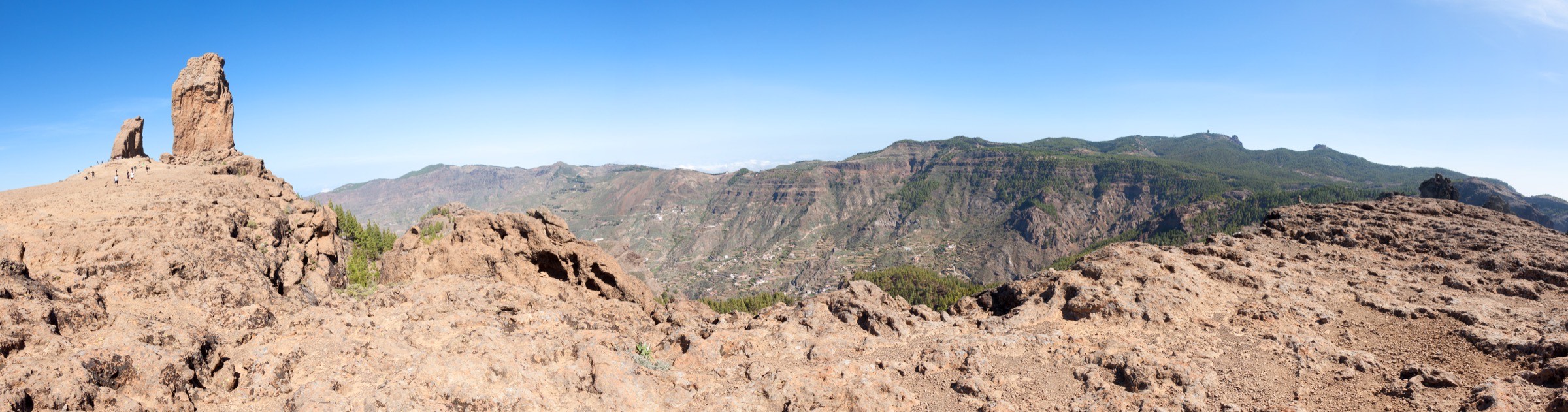
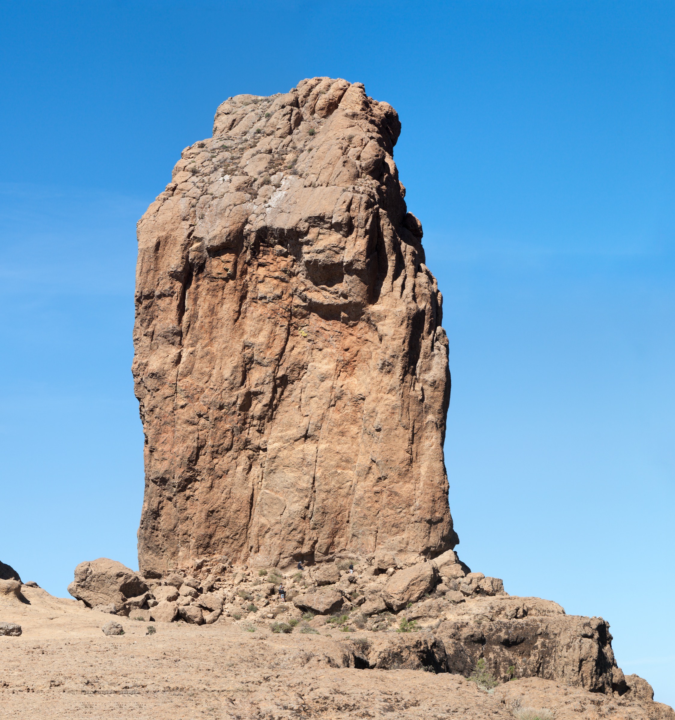
1. Roque Nublo
Snapshot
Itinerary
The short path climbs from the Roque Nublo access area through open pine and volcanic ground to the broad platform below Roque Nublo. The return follows the same route.
Why it is essential
Roque Nublo is Gran Canaria’s defining volcanic landmark and the most famous short walk in the central highlands.
Equipment
Trail shoes or light boots, sun protection, water, wind layer, and reservation/access confirmation where required.
Hazards and notes
The walk is short but exposed. Heat, crowding, loose volcanic ground, and low cloud are common practical issues. Access-control rules can change and should be treated as part of the route.
GPX / KML links
| Source | URL | Format / access | Reuse status |
|---|---|---|---|
| AllTrails trail details | alltrails.com | GPX/source route page via AllTrails | AllTrails terms apply; route stats verified; GPX reuse not confirmed |
| Official Roque Nublo reservation site | reservasroquenublo.com | Official access/booking page | Terms not fully checked; required access source, not a reusable route file |
| Cabildo de Gran Canaria access notice | grancanariajoven.grancanaria.com | Official access information | Terms not fully checked; context source, not a route file |
Further reading
- AllTrails — Roque Nublo
- Official Roque Nublo reservation site
- Cabildo de Gran Canaria — Roque Nublo access notice
2. Ruta de la Plata: Cruz de Tejeda - Llanos de la Pez
Snapshot
Itinerary
This day section follows the historic Ruta de la Plata from Cruz de Tejeda toward Llanos de la Pez, crossing highland pine and old stone-path terrain on the island’s interior crest. The wider official route continues by further stages toward Ventana del Nublo, Cruz Grande, and Tunte.
Why it is essential
Ruta de la Plata is the strongest historic highland route in this selection, representing the old crossing paths that connected Gran Canaria’s interior settlements.
Equipment
Trail shoes or boots, sun and wind protection, water, navigation backup, and a point-to-point transport plan.
Hazards and notes
The route is not long, but it is exposed to highland weather and logistics. Do not assume transport is available without checking current timetables.
GPX / KML links
| Source | URL | Format / access | Reuse status |
|---|---|---|---|
| Hello Canary Islands official route page | hellocanaryislands.com | Official route/source page | Website terms not fully checked; official route identity verified; reusable route-file status unresolved |
| AllTrails: Ruta de la Plata Etapa 1 | alltrails.com | GPX/source route page via AllTrails | AllTrails terms apply; secondary statistics verified; GPX reuse not confirmed |
Further reading
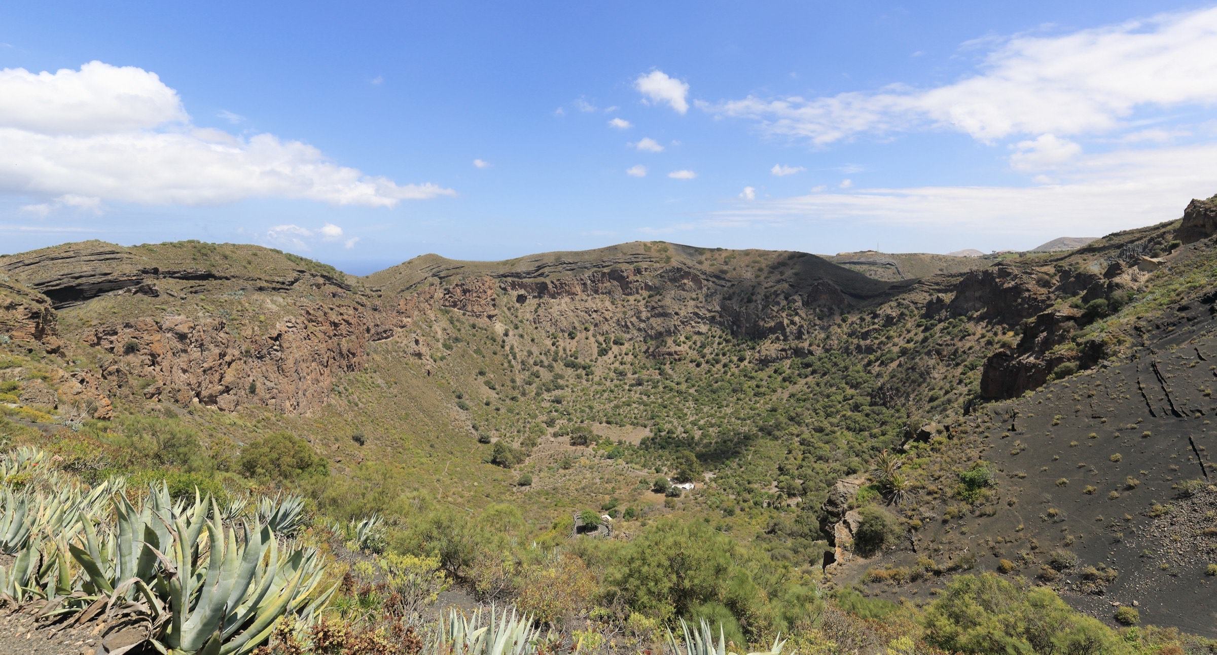
3. Bandama Caldera
Snapshot
Itinerary
The walk loops into and around the Caldera de Bandama volcanic crater area, with a steep loose start/finish and broad views into the roughly 200 m deep caldera.
Why it is essential
Bandama gives a compact crater-walk experience close to Las Palmas and adds a lower-elevation volcanic feature to the highland-heavy selection.
Equipment
Trail shoes or boots with grip, sun protection, water, and a light layer for wind.
Hazards and notes
Loose gravel, steep sections, heat, and post-rain slipperiness are the main issues. Stay on the established path to protect the caldera environment.
GPX / KML links
| Source | URL | Format / access | Reuse status |
|---|---|---|---|
| AllTrails trail details | alltrails.com | GPX/source route page via AllTrails | AllTrails terms apply; route stats verified; GPX reuse not confirmed |
Further reading
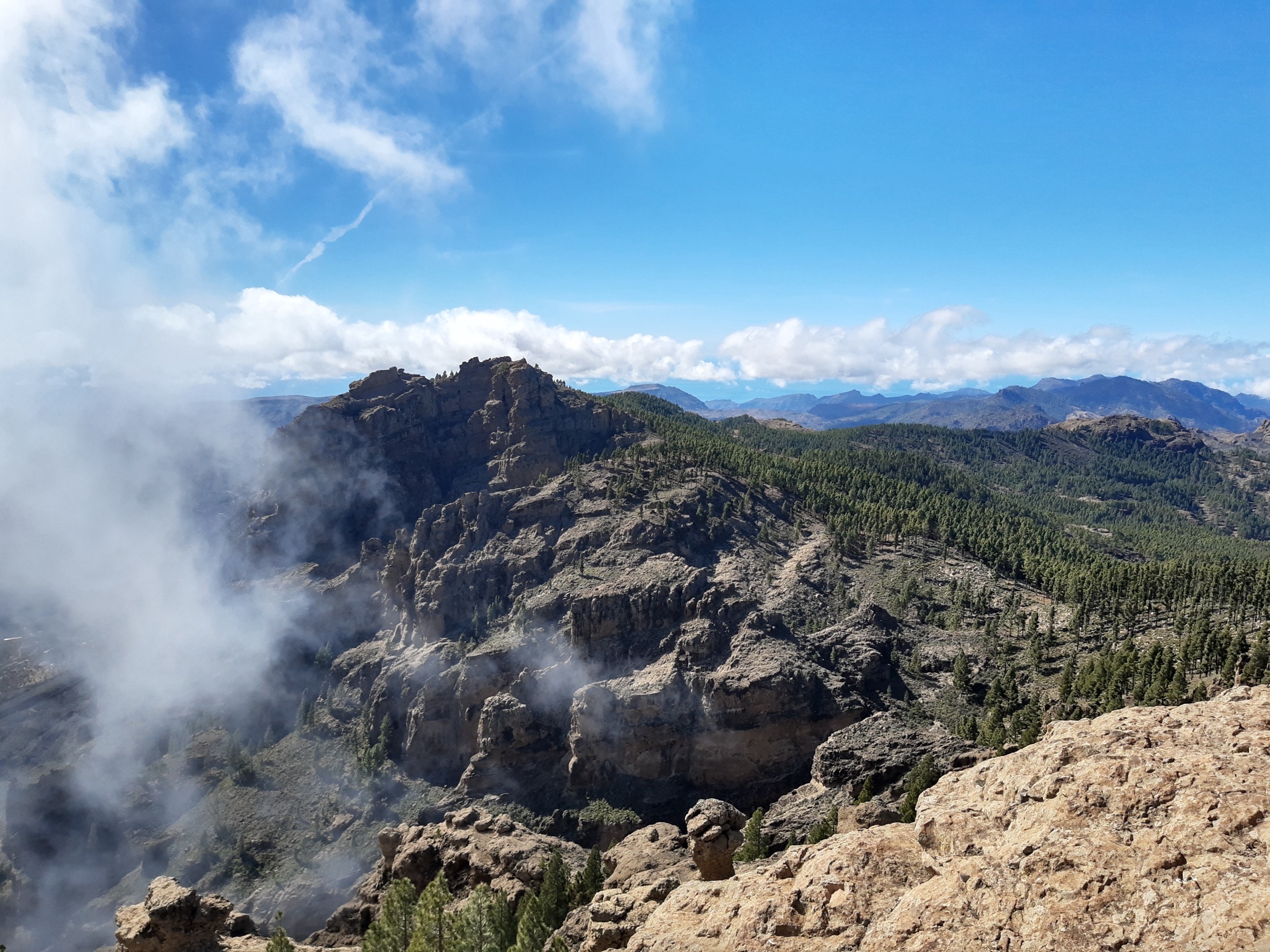
4. Cruz de Tejeda - Artenara - Juan Fernández - Lomo de los Santos
Snapshot
Itinerary
From the Cruz de Tejeda area, the route follows highland paths via Mirador de Degollada, Moriscos, Cuevas del Caballero, Montaña de Artenara, and Artenara, then returns by Juan Fernández and Lomo de los Santos. The mapped loop includes some paved-road walking on the return.
Why it is essential
This is the demanding balcony route in the set, linking Cruz de Tejeda and Artenara with broad views over the island’s central ravines and rock landmarks.
Equipment
Mountain footwear, sun and wind protection, enough water for a long dry route, navigation backup, and transport contingency if shortening the road return.
Hazards and notes
Length, ascent, heat exposure, road sections, and possible cloud/visibility changes make this a serious day. The road-walk return should be assessed before publication.
GPX / KML links
| Source | URL | Format / access | Reuse status |
|---|---|---|---|
| AllTrails trail details | alltrails.com | GPX/source route page via AllTrails | AllTrails terms apply; route stats verified; GPX reuse not confirmed |
Further reading
- AllTrails — Cruz de Tejeda - Artenara - Juan Fernández - Lomo de los Santos
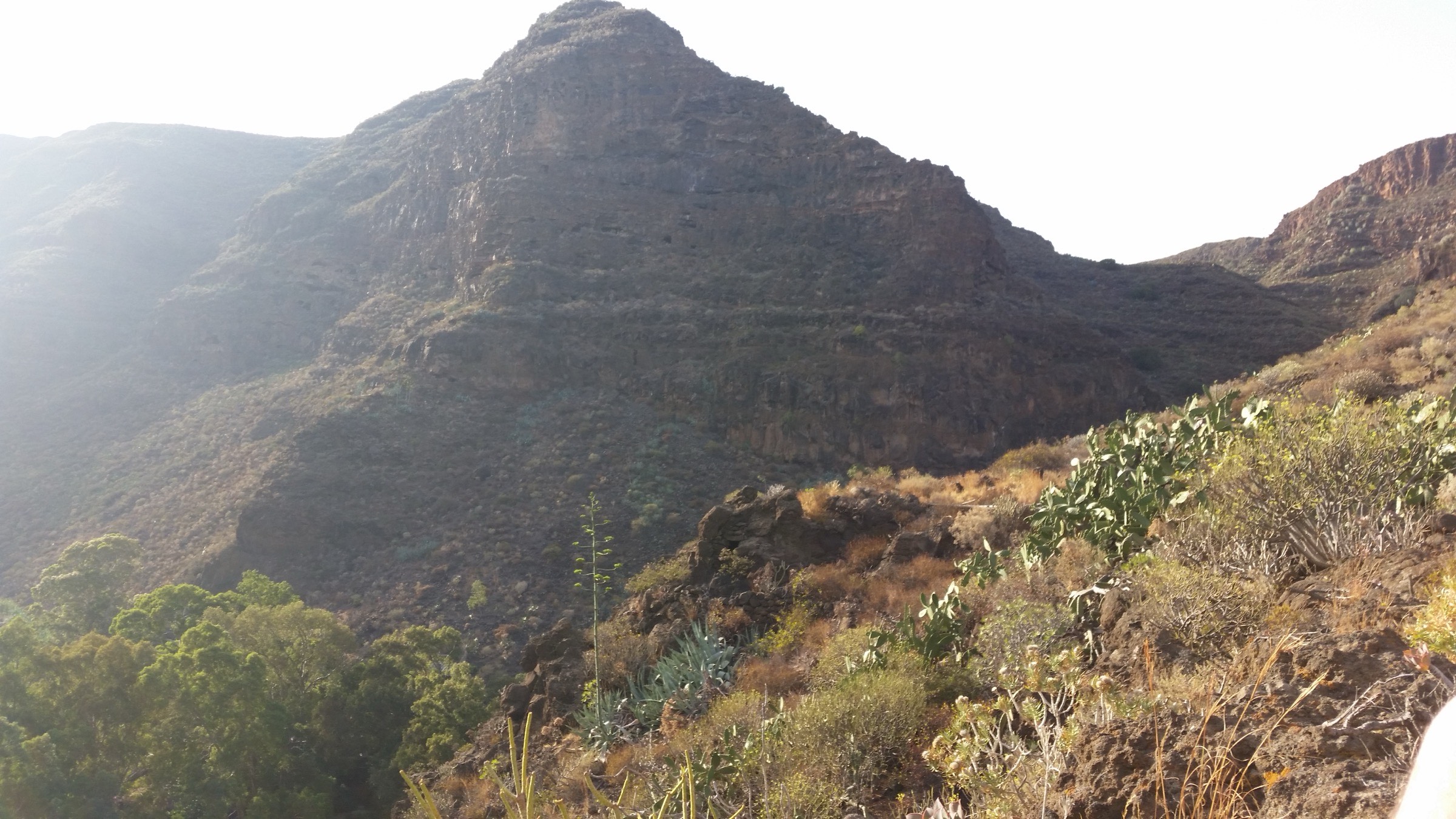
- Wikimedia Commons — Roque Nublo from Barranco de Tejeda
5. Ermita de Guayadeque - Pasadilla via Barranco de Guayadeque
Snapshot
Itinerary
The route starts by Ermita de Guayadeque and follows the Barranco de Guayadeque toward Pasadilla, passing cave-settlement and ravine scenery on a volcanic path with some narrow or loose sections.
Why it is essential
Guayadeque adds Gran Canaria’s cultural ravine landscape to the highland catalogue: caves, steep volcanic walls, and a more inhabited historical setting than the summit routes.
Equipment
Trail shoes or boots, sun protection, water, and navigation backup.
Hazards and notes
Loose rock, steep or narrow sections, heat, and ambiguous side paths are the main issues. The trailhead should be checked carefully against the mapped route.
GPX / KML links
| Source | URL | Format / access | Reuse status |
|---|---|---|---|
| AllTrails trail details | alltrails.com | GPX/source route page via AllTrails | AllTrails terms apply; route stats verified; GPX reuse not confirmed |
Further reading
- AllTrails — Ermita de Guayadeque to Pasadilla via Barranco de Guayadeque
- Wikimedia Commons — Barranco de Guayadeque image
Outstanding verification notes
- Recheck Roque Nublo reservation rules, local road restrictions, fire/weather closures, and bus/taxi logistics before publication.
- For most Gran Canaria routes in this pass, route geometry comes from AllTrails source pages; GPX reuse is not confirmed under AllTrails terms.
- Official reusable GPX/KML files were not found for Bandama, Cruz de Tejeda - Artenara, or Guayadeque in this pass.
Further reading
| Source | URL |
|---|---|
| Wikipedia — Gran Canaria | en.wikipedia.org |
| Wikipedia — Roque Nublo | en.wikipedia.org |
| Hello Canary Islands official hiking pages | hellocanaryislands.com |
| Roque Nublo official reservation page | reservasroquenublo.com |
| Cabildo de Gran Canaria — Roque Nublo access notice | grancanariajoven.grancanaria.com |
| Hello Canary Islands — Ruta de la Plata | hellocanaryislands.com |
| AllTrails — Roque Nublo | alltrails.com |
| AllTrails — Ruta de la Plata Etapa 1 | alltrails.com |
| AllTrails — Caldera de Bandama | alltrails.com |
| AllTrails — Cruz de Tejeda - Artenara loop | alltrails.com |
| AllTrails — Ermita de Guayadeque to Pasadilla | alltrails.com |