Regional overview
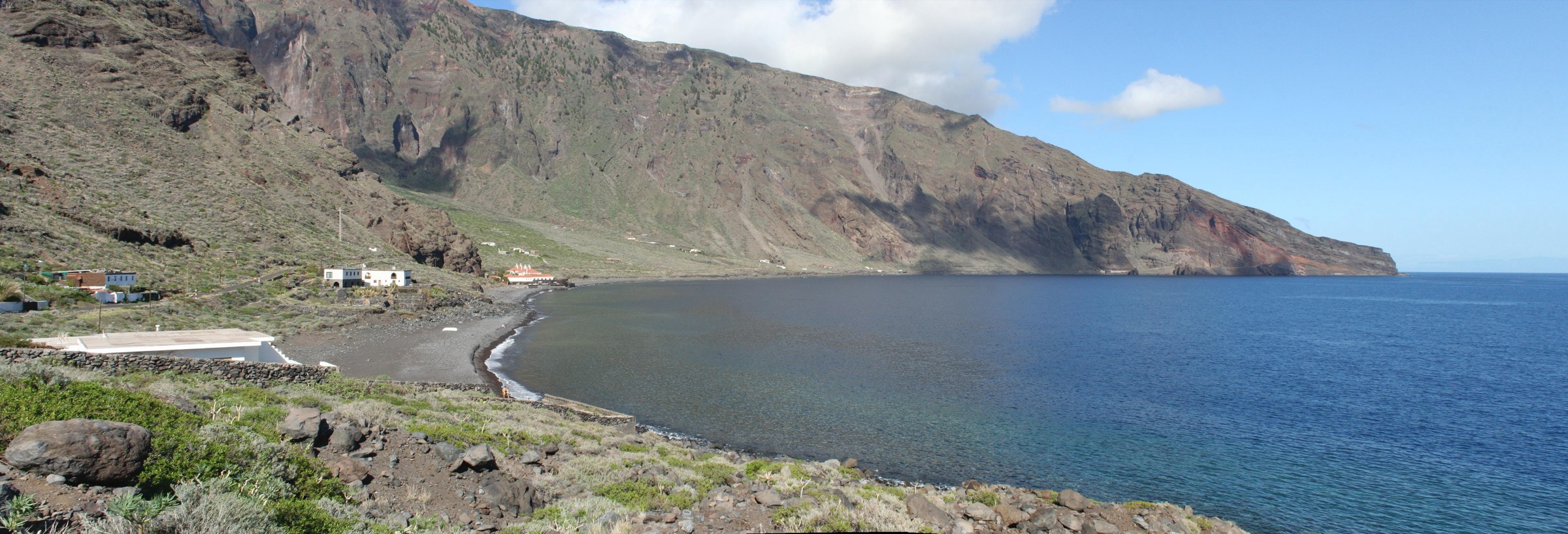
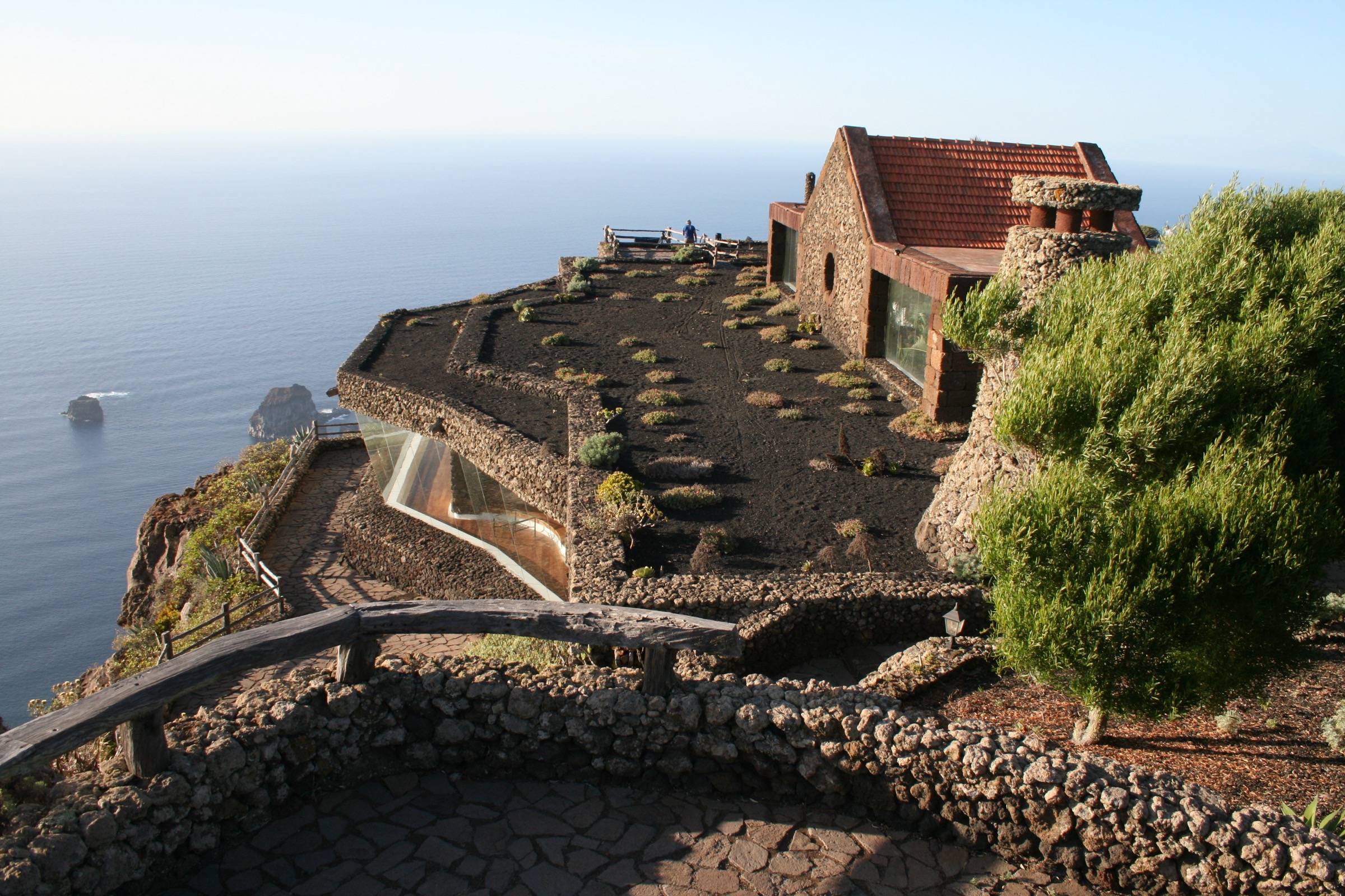
El Hierro is the smallest and westernmost of the main Canary Islands, a young shield volcano collapsed on its northern flank to form the broad amphitheatre of El Golfo. The island rises from sea-level cliffs to the summit of Pico de Malpaso at 1,501 m in just a few kilometres of horizontal distance, with a near-permanent north-east trade-wind cloud bank parked against the cliff lines. The combination of vertical relief, recent volcanism — including the 2011-2012 submarine eruption off La Restinga — and forest-to-desert transitions across short distances has made the island a UNESCO Global Geopark and a Biosphere Reserve.
Walking is the central activity for visitors. The Cabildo Insular maintains the PR-EH (Pequeño Recorrido) network across the island and the GR-131 long-distance traverse, also known as the Camino de la Virgen, follows the route of the quadrennial Bajada pilgrimage from the Ermita de los Reyes in the western La Dehesa to Valverde in the east. Trailheads typically demand a hire car: the TransHierro bus network connects the main villages but does not serve the highland passes or the western Dehesa plateau.
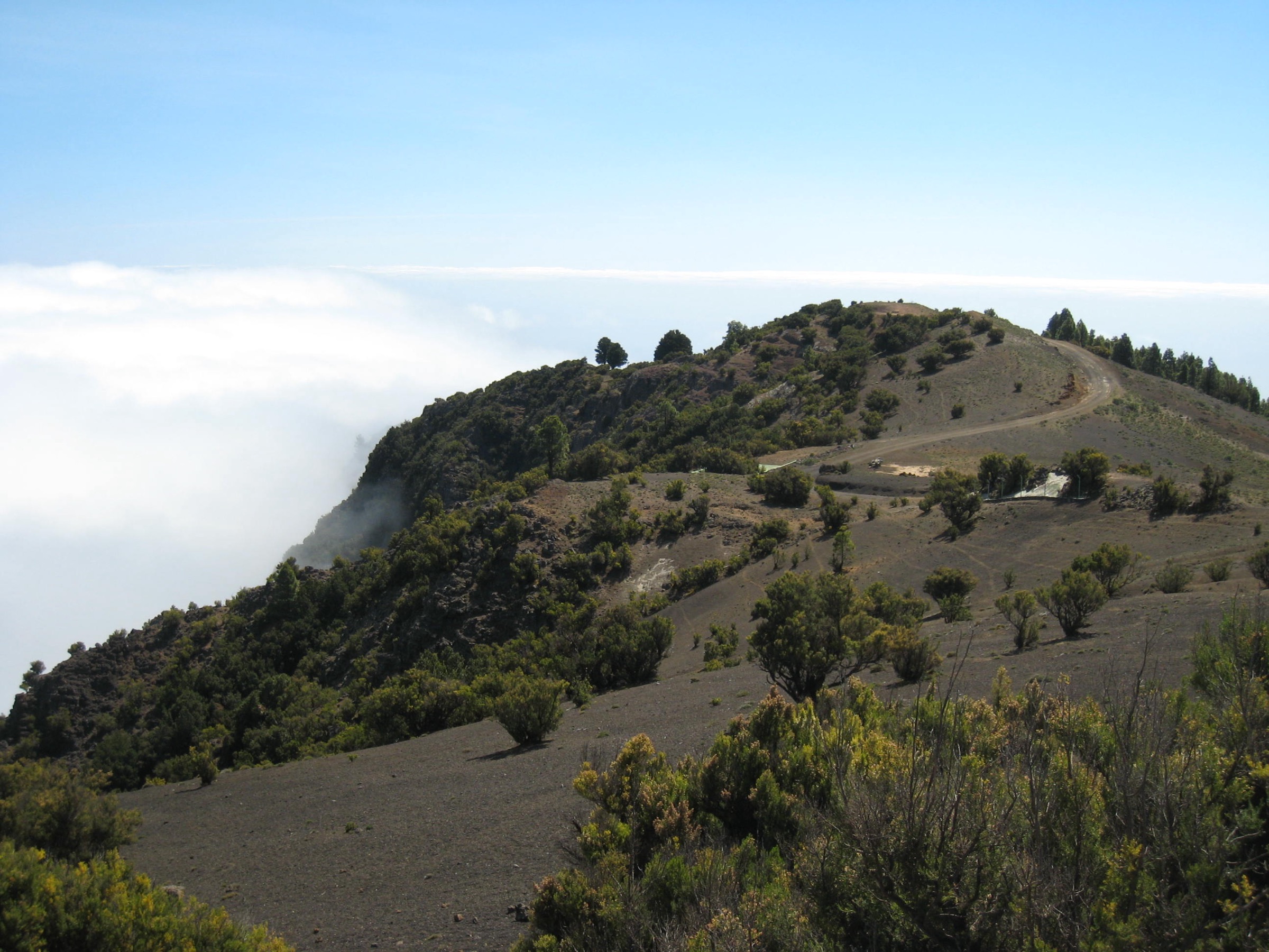
The island’s highland walking centres on three landscape types: the cliff balconies of the El Golfo amphitheatre (the Risco de Tibataje, Camino de Jinama and the Mirador de La Llanía), the laurel-and-pine highland forests around La Llanía and El Pinar, and the wind-sculpted Phoenicean juniper grove of El Sabinar at the western end. The 2011–12 eruption did not affect the highland trail network, but rockfall and seasonal closures should be confirmed at the Valverde tourist office before committing to a route.
Selection rationale
The selection covers the three landscape types and the cross-island traverse. The Camino de Jinama is the iconic cliff ascent from El Golfo to the highland edge. The Ruta de La Llanía is the easy laurel-forest loop that captures the El Brezal and Hoya de Fireba habitats. El Sabinar gives the wind-juniper grove that is the botanical symbol of the island. A signature stage of the Camino de la Virgen / GR-131 covers the long traverse. The Tibataje cliff-top balcony pairs naturally with the Jinama ascent for a circular two-day plan.
Summary table
| # | Hike | Country | Route type | Distance | Gain | Max elevation | Difficulty |
|---|---|---|---|---|---|---|---|
| 1 | Camino de Jinama (PR-EH 8) | Spain | Point-to-point | About 8 km | About 885 m | About 1,232 m | Hard |
| 2 | Ruta de La Llanía | Spain | Loop | About 7 km | About 170 m | About 1,300 m | Easy |
| 3 | El Sabinar circular (PR-EH 9) | Spain | Loop | About 7 km | About 500 m | About 795 m | Moderate |
| 4 | Camino de la Virgen / GR-131 Stage 3 | Spain | Point-to-point | About 27 km | About 1,200 m | About 1,500 m | Hard |
| 5 | Mirador de Jinama – Tibataje ridge | Spain | Point-to-point | About 10–12 km | About 250 m | About 1,300 m | Moderate |
Before you go
Required equipment
- Sturdy hiking boots with good grip; the cliff routes have steep, cobbled and loose-stone sections.
- Wind- and waterproof shell — the highland is windy year-round and cloud-wet much of the time.
- Sun protection, hat and 2–3 litres of water carry on the exposed routes; no reliable in-route water on any of the five hikes.
- Warm layer for the highland in winter and spring.
- Offline map or phone-loaded GPX; PR-EH waymarking is consistent but trail junctions in dense forest can be hard to identify.
- Headlamp for any long traverse; the GR-131 stage runs to a full day even for fit walkers.
Current access and safety notes
- No entry permits or fees for any of the trails.
- TransHierro bus services link the main villages but do not reach most trailheads; a hire car is in practice required for the highland routes.
- The Mirador de Roque de la Bonanza access path is reported closed due to rockfall; check with the Valverde tourist office before any coastal extension.
- Trade-wind cloud sits against the El Golfo cliff line most days; expect cool, damp conditions on the upper edge even when the lowland is hot.
- Mobile coverage on the highland and along the GR-131 traverse is patchy; carry navigation backup.
1. Camino de Jinama (PR-EH 8)
Snapshot
Itinerary
The Camino de Jinama is the historic royal road from El Golfo to the highland, used until the road tunnel opened in the 1960s. The path leaves La Frontera from the Iglesia de la Candelaria and climbs steadily through terraced cultivation toward the foot of the Risco de Tibataje cliff. The middle section uses an old cobbled trace with zig-zags engraved into the volcanic rock; the upper section traverses crumbling lava walls and short brezo thickets to the cliff edge at the Mirador de Jinama, near the village of San Andrés.
The Mirador gives the most complete single view of the El Golfo amphitheatre, with La Frontera, Charco Azul and the Roques de Salmor laid out below. From the top, a return descent of the same line is possible but most parties arrange a pickup at the Mirador or continue along the cliff-edge balcony toward the Tibataje route.
Why it is essential
The Camino de Jinama is the defining cliff ascent of El Hierro and the most direct way to experience the vertical scale of the El Golfo collapse from below. The route combines historic camino engineering with one of the great viewpoint finishes in the Canaries.
Equipment
Hiking boots with stiff soles, trekking poles, sun protection, hat, two to three litres of water, lightweight long sleeves and a wind layer for the top. An early start is essential in warmer months.
Hazards and notes
- Cliff exposure on the upper sections; the path edge is unfenced in places.
- Cobbled steps are slippery when wet.
- Rockfall risk increases in wet weather; check current conditions in Valverde.
- No water sources on the climb.
- One-way logistics are easier with a pre-arranged pickup at the Mirador.
GPX / KML links
| Source | URL | Format / access | Reuse status |
|---|---|---|---|
| Cabildo de El Hierro — Camino de Jinama trail page | elhierro.travel | Trail descriptor | Cabildo content |
| Waymarked Trails — El Hierro | waymarkedtrails.org | OSM-based map | OSM ODbL with attribution |
| Wikiloc search — Camino de Jinama | wikiloc.com | Search | User-uploaded; check per track |
External links
2. Ruta de La Llanía
Snapshot
Itinerary
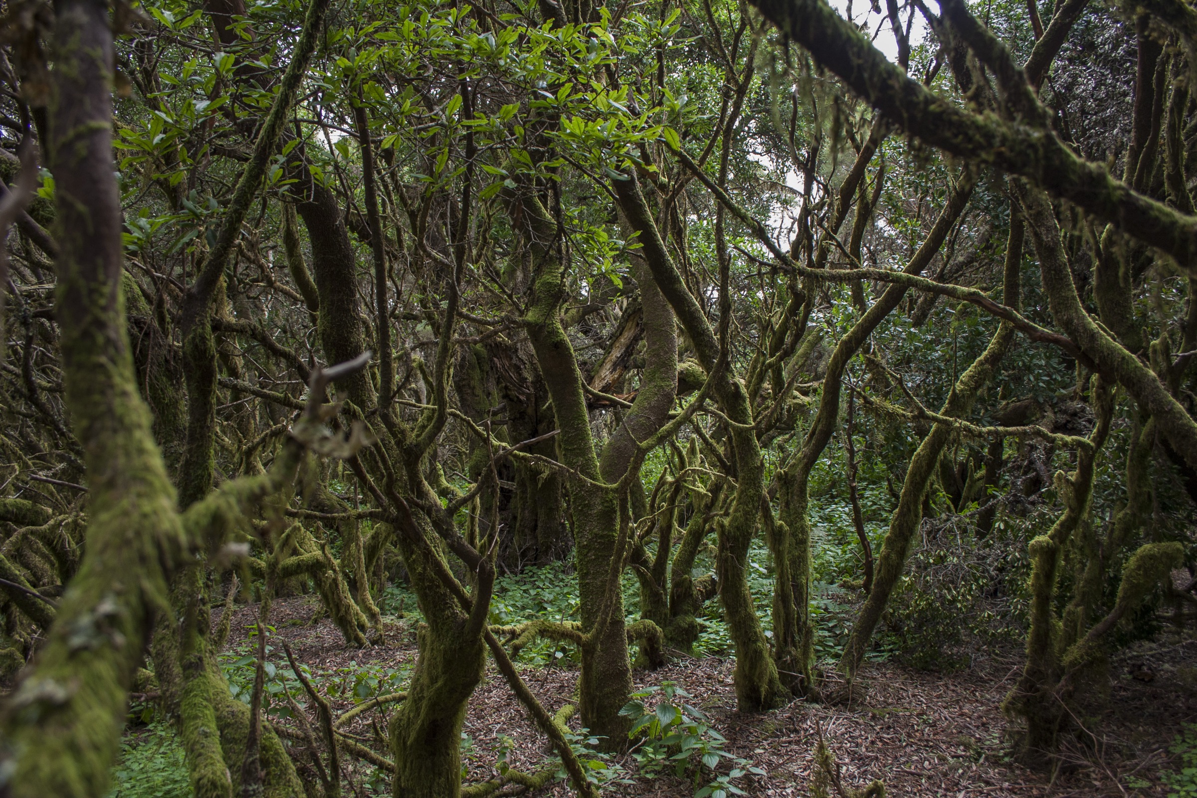
The loop starts at the Fuente de la Llanía on the HI-4 highland road. From the car park the path enters the El Brezal damp laurel-forest sector, with a marked interpretation panel sequence on the local geology and ecology. The route then crosses to the Hoya de Fireba, a collapsed crater on the central highland that is now ringed by laurels and Canarian pines.
The loop closes at the Mirador de la Llanía, with views north over the El Golfo amphitheatre and west toward the La Dehesa plateau. The trail is signed for three variants of different lengths; the 7 km full circuit covers all the principal viewpoints and the most varied forest interior.
Why it is essential
La Llanía is the easiest way to walk both El Hierro’s highland forest types — damp brezal laurel and dry Canarian pine — in a single short loop, and includes a major collapsed crater and a panoramic mirador over El Golfo.
Equipment
Standard hiking shoes, light wind layer, sun protection, one to two litres of water and a small day pack. Bring a warm layer in winter; the highland holds cool temperatures even at midday.
Hazards and notes
- Cloud and mist can wipe trail visibility on the longer variants; follow waymarks carefully.
- Cool wind at the rim; layer accordingly.
- No water on the route; carry capacity for the loop.
- Suitable for families with active children on the shorter variants.
GPX / KML links
| Source | URL | Format / access | Reuse status |
|---|---|---|---|
| Cabildo de El Hierro — Ruta de La Llanía trail page | elhierro.travel | Trail descriptor | Cabildo content |
| Waymarked Trails — El Hierro | waymarkedtrails.org | OSM-based map | OSM ODbL with attribution |
| Wikiloc search — La Llanía El Hierro | wikiloc.com | Search | User-uploaded; check per track |
External links
3. El Sabinar circular (PR-EH 9)
Snapshot
Itinerary
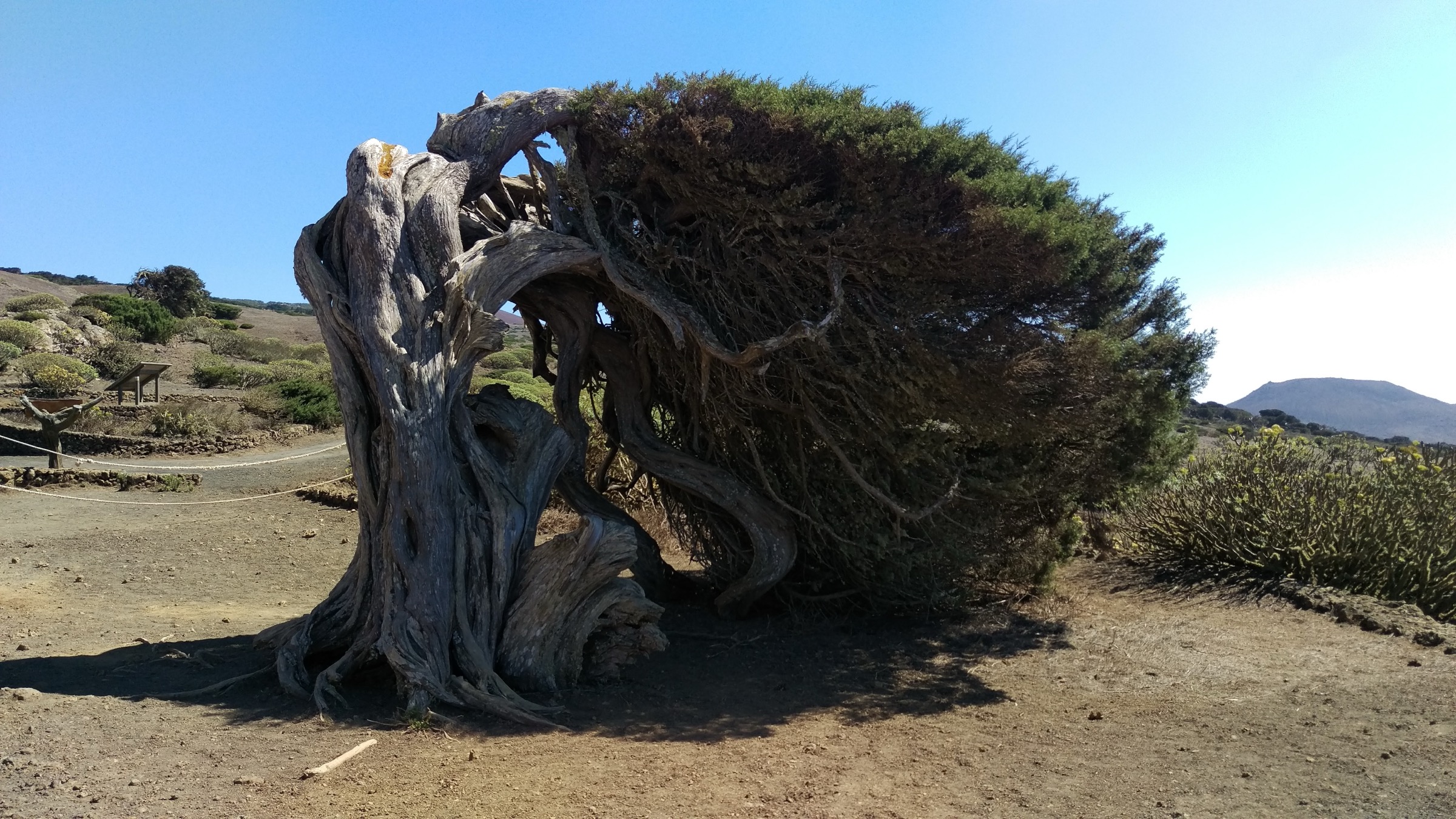
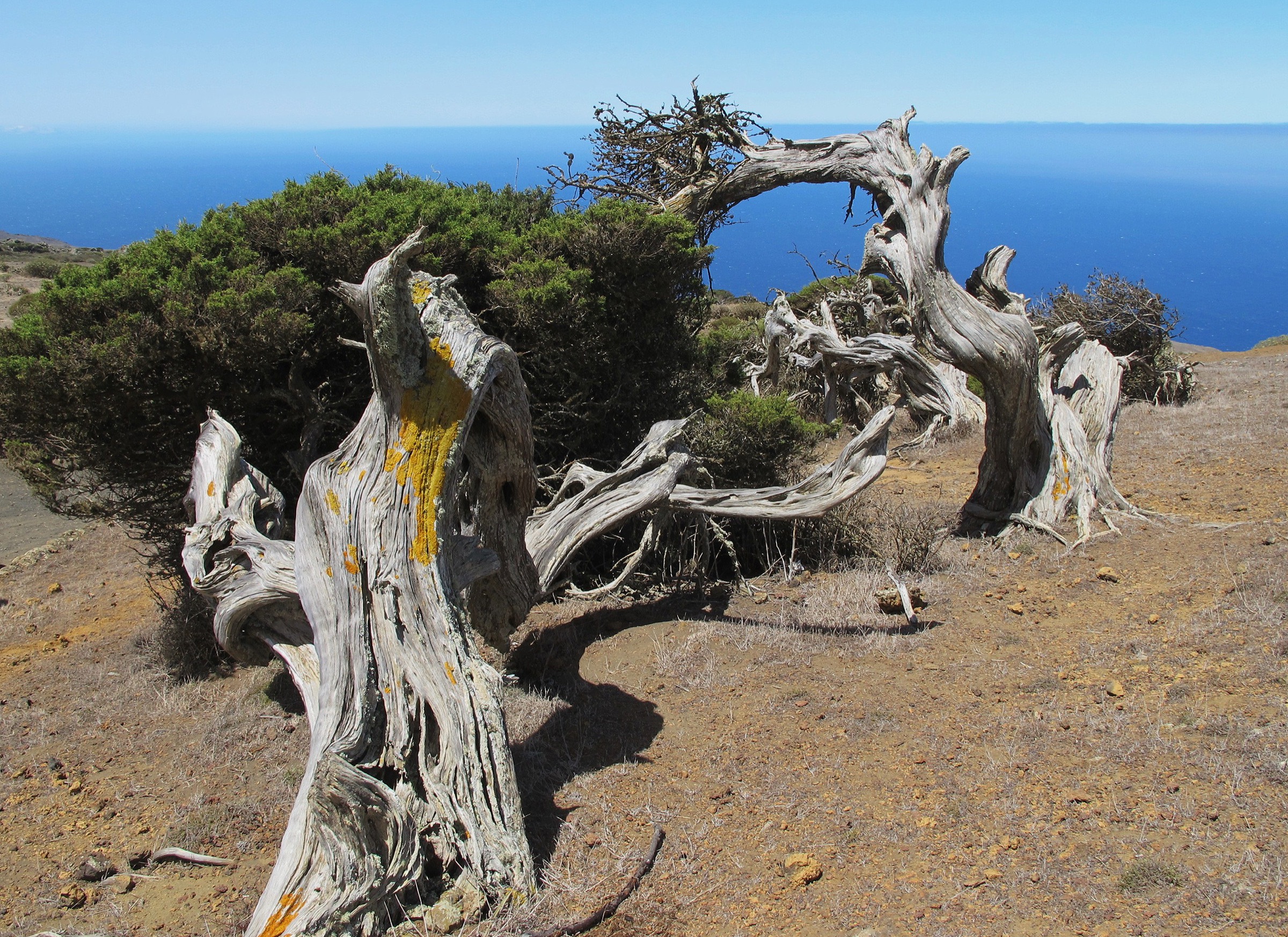
The loop starts at the Ermita de Nuestra Señora de los Reyes on the La Dehesa plateau and crosses dry pasture and abandoned terraces toward the open western edge of the island. The path enters the Sabinar proper, a grove of Phoenicean junipers (Juniperus turbinata canariensis) bent flat by the trade winds into wind-sculpted forms that have become the botanical symbol of El Hierro. The route loops past the Cueva del Caracol and a Tagoror pre-conquest council site near the ermita before climbing to El Miradero, the loop high point at around 795 m.
The descent returns through the juniper grove, with the option to extend down to the Mirador de Bascos for views over the El Golfo cliffs to the north. The trail is shadeless and notably exposed; afternoon wind on the plateau is a defining feature.
Why it is essential
The Sabinar grove is the most distinctive botanical landscape in El Hierro and one of the most photographed in the Canaries. The loop combines the windswept juniper grove, the ermita that anchors the Bajada de la Virgen pilgrimage, and the high viewpoint at El Miradero.
Equipment
Hiking boots, wind layer (essential), sun protection, hat, two litres of water and a small day pack. Trekking poles help on the climb to El Miradero.
Hazards and notes
- The plateau is wind-exposed; even calm coastal days can bring strong afternoon gusts.
- Open terrain offers no shade.
- No water sources on the loop.
- Respect the pre-conquest archaeological remains near the ermita.
GPX / KML links
| Source | URL | Format / access | Reuse status |
|---|---|---|---|
| Cabildo de El Hierro — El Sabinar / La Dehesa trail page | elhierro.travel | Trail descriptor | Cabildo content |
| Waymarked Trails — La Dehesa area | waymarkedtrails.org | OSM-based map | OSM ODbL with attribution |
| Wikiloc search — El Sabinar El Hierro | wikiloc.com | Search | User-uploaded; check per track |
External links
4. Camino de la Virgen / GR-131 — Stage 3
Snapshot
Itinerary
The traverse follows the historic pilgrimage route of the Bajada de la Virgen, held every four years since 1745, from Valverde across the central highland to the Ermita de los Reyes on the La Dehesa plateau. From Valverde the path climbs to the highland edge, passes near the Árbol Santo del Garoé site (a sacred laurel water-tree of the pre-conquest Bimbache people), and traverses the El Pinar Canarian pine forest. The middle section runs along the flanks of Pico de Malpaso, with optional detour to the summit at 1,501 m.
The route continues across the central highland through Sabinosa and the Mirador de Bascos area, descending finally to the Ermita de los Reyes. Many walkers split the stage into two days; as a single push it is one of the longest day-hikes in the Canaries.
Why it is essential
Stage 3 of the GR-131 covers the historic pilgrimage line, passes the geographic centre of the island, and grants the only one-day option to traverse El Hierro on foot. It combines pre-conquest cultural sites, the highest point of the island, and the Sabinar plateau finish.
Equipment
Mountain hiking equipment: sturdy boots, trekking poles, wind- and waterproof shell, warm layer, three to four litres of water carry, high-energy food, headlamp, and an offline GPX of the full stage. A pickup at the finish is essential.
Hazards and notes
- Length and elevation combined make this a serious day; do not attempt in poor weather.
- Cold and wet conditions on the upper ridge are common, even in spring.
- Limited water sources on the traverse; carry capacity for the full day.
- Mobile coverage is patchy on the highland.
- Confirm any seasonal closures with the Valverde tourist office before starting.
GPX / KML links
| Source | URL | Format / access | Reuse status |
|---|---|---|---|
| Ministerio — Caminos Naturales GR-131 El Hierro | caminosnaturales.es | GPX / KMZ / PDF | Spanish government data; attribution to MAPA |
| Cabildo de El Hierro — Camino de la Virgen / GR-131 | elhierro.travel | Trail descriptor | Cabildo content |
| Waymarked Trails — GR-131 | waymarkedtrails.org | OSM-based map | OSM ODbL with attribution |
External links
5. Mirador de Jinama – Tibataje cliff balcony
Snapshot
Itinerary
The walk follows the top edge of the Risco de Tibataje, the southern cliff line of the El Golfo amphitheatre, from the Mirador de Jinama eastward toward San Salvador and Erese. The path is a continuous balcony along the cliff edge, with the El Golfo valley, La Frontera, Charco Azul and the Roques de Salmor visible below for nearly the whole route.
The walk pairs naturally with the Camino de Jinama: the cliff ascent and the cliff-top balcony together cover the full vertical structure of the El Golfo collapse. No single Cabildo trail code applies to the full traverse; route verification is by Wikiloc tracks and local advice rather than an official PR-EH numbering.
Why it is essential
The Tibataje ridge gives the most sustained cliff-edge balcony in the Canaries, with continuous panoramic views over El Golfo. It is the natural complement to the Camino de Jinama and the most accessible high-elevation walking on the island.
Equipment
Hiking boots, wind layer, sun protection, hat, two litres of water carry, and an offline GPX of the chosen traverse. Trekking poles help on the descents at either end.
Hazards and notes
- The cliff edge is unfenced and drops sheer for around 1,000 m to the El Golfo valley; walkers nervous of exposure should stay back from the rim.
- Strong gusts on the ridge are common, especially in the afternoon.
- No water sources on the route.
- Car drop-off and pickup arrangements should be made in advance.
GPX / KML links
| Source | URL | Format / access | Reuse status |
|---|---|---|---|
| Cabildo de El Hierro — hiking index | elhierro.travel | Trail descriptor | Cabildo content |
| Waymarked Trails — Tibataje | waymarkedtrails.org | OSM-based map | OSM ODbL with attribution |
| Wikiloc search — Tibataje El Hierro | wikiloc.com | Search | User-uploaded; check per track |
External links
Missing data and follow-up work
- GR-131 total length — published figures range from 37.7 km to about 42 km depending on whether connection spurs are included; the Cabildo and Caminos Naturales pages should be confirmed at the visitor centre.
- PR-EH numerical codes — secondary sources disagree on some PR-EH numberings; confirm at the Valverde tourist office before printing.
- Pico de Malpaso standalone route — no widely documented standalone PR-EH ascent line; the summit is most often reached on the GR-131 stage or as a short side-trip from Hoya del Morcillo.
- La Llanía variant data — the 4.2 km and 5.6 km variants on the Cabildo page lack published elevation gain figures.
- Mirador de Roque de la Bonanza — current closure status due to rockfall should be checked before any coastal extension.
External links
| Source | URL |
|---|---|
| Cabildo de El Hierro — tourism | elhierro.travel |
| Cabildo de El Hierro — hiking | elhierro.travel |
| Ministerio — Caminos Naturales GR-131 El Hierro | caminosnaturales.es |
| Geoparque El Hierro (UNESCO) | geoparques.es |
| Wikipedia — El Hierro | en.wikipedia.org |
| Wikipedia — Pico de Malpaso | en.wikipedia.org |
| Wikipedia — Sabinar de El Hierro (es) | es.wikipedia.org |
| Waymarked Trails — El Hierro | waymarkedtrails.org |
| Wikiloc — El Hierro trails | wikiloc.com |