Regional overview
La Gomera is the second-smallest of the Canary Islands and the most heavily incised. A central highland plateau, capped by the Alto de Garajonay at 1,487 m, drops away on every side into deep radial barrancos that reach the Atlantic at the four main valley settlements of San Sebastián, Hermigua, Vallehermoso and Valle Gran Rey. The plateau itself is covered by the laurisilva — the cloud-fed laurel-and-fayal-brezal forest that gives Garajonay National Park its UNESCO World Heritage status. Outside the park, the island is a near-continuous landscape of basaltic ridges, volcanic plugs and terraced barranco walls.
Three trail networks overlap on the island. The national park maintains 18 numbered in-park routes, signed in green and white from the main road-edge laybyes. The Cabildo’s PR-LG (Pequeño Recorrido) network covers the rest of the island in yellow and white. Two long-distance paths run through: the GR-131 across the high plateau as part of the inter-island Canarian traverse, and the GR-132 around the coastline in roughly six to eight stages. Hiking is a year-round activity, with the cooler and clearer October-to-May window preferred for the longer cliff and barranco routes.
The 2012 wildfire burned around 18% of the national park; restoration plantings under the LIFE+ Garajonay Vive project have re-established the canopy across much of the affected zone, but bare summit ridges and patchy regeneration are still visible from the Pajarito and Alto de Garajonay viewpoints. No entry permit is required for hiking the park; guided activities and overnight stays are booked through the Juego de Bolas visitor centre.
Selection rationale
The selection covers the island’s signature walking themes: the summit of Garajonay reached from two different sides, a deep laurisilva descent through the Bosque del Cedro, a classic barranco-rim ascent above Vallehermoso to the Roque Cano viewpoint, and the cliff-edge plateau of La Mérica above Valle Gran Rey. The two Garajonay variants are kept because they offer very different experiences — a short summit loop from the road versus a longer through-forest approach from Laguna Grande — and either is recommended depending on time and weather.
Summary table
| # | Hike | Country | Route type | Distance | Gain | Max elevation | Difficulty |
|---|---|---|---|---|---|---|---|
| 1 | Alto de Garajonay from Pajarito | Spain | Loop | About 4.5 km | About 180 m | 1,487 m | Easy–moderate |
| 2 | Laguna Grande to Alto de Garajonay | Spain | Out-and-back | About 9.8 km | About 410 m | 1,487 m | Moderate |
| 3 | El Contadero to El Cedro | Spain | Point-to-point | 5.8 km | 551 m descent | About 1,200 m | Moderate |
| 4 | Vallehermoso – Roque Cano loop | Spain | Loop | About 10–11 km | About 600 m | About 750 m | Hard |
| 5 | La Mérica above Valle Gran Rey | Spain | Loop | About 13.8 km | About 900 m | About 857 m | Hard |
Before you go
Required equipment
- Sturdy hiking shoes or boots with good grip; wet basalt and laurel-forest leaf litter are slippery year-round.
- Wind- and waterproof shell — the panza de burro cloud bank can roll in within minutes on the high plateau.
- Sun protection, hat and 2–3 litres of water carry on the exposed cliff and ridge routes.
- Trekking poles recommended for the long descents (Vallehermoso loop, El Cedro, Arure side of La Mérica).
- Offline map (the Garajonay NP map or a phone-loaded GPX); cloud cover frequently scrubs trail visibility.
- Headlamp for the longer routes if starting late in the day; sunset around 18:00 in winter.
Current access and safety notes
- No permits or fees for hiking the national park; the Juego de Bolas visitor centre runs free guided walks (booking required).
- Trade-wind cloud regularly sits on the plateau between 800 and 1,400 m; expect cool, damp conditions even when the coast is hot.
- The 2012 burn zone left several PR-LG routes temporarily diverted; current waymarking should be followed over older guidebook descriptions.
- Cliff sections on La Mérica and the upper Roque Cano loop have no protective railings; the exposure is sustained.
- Public transport (Guaguas Gomera) connects the main towns but is sparse — typically three to five services a day on the most useful lines; plan trailhead access carefully.
- Mobile coverage is patchy on the plateau and in the deeper barrancos; carry a backup means of navigation.
1. Alto de Garajonay from Pajarito
Snapshot
Itinerary
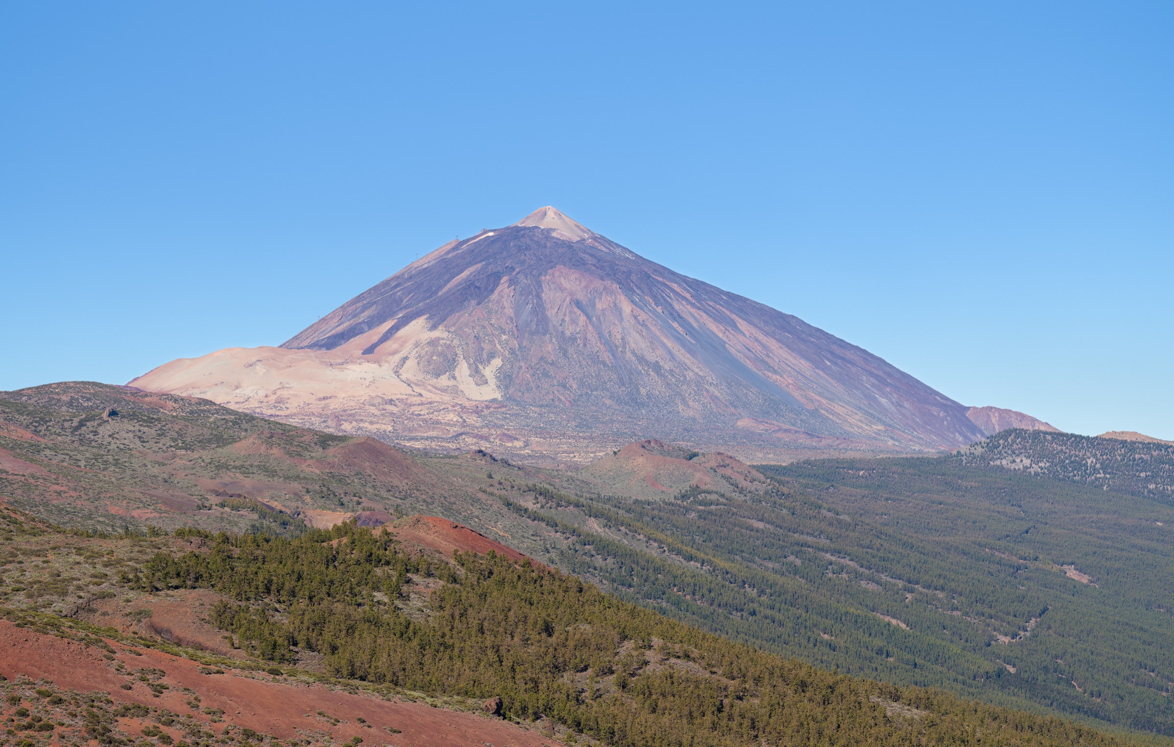
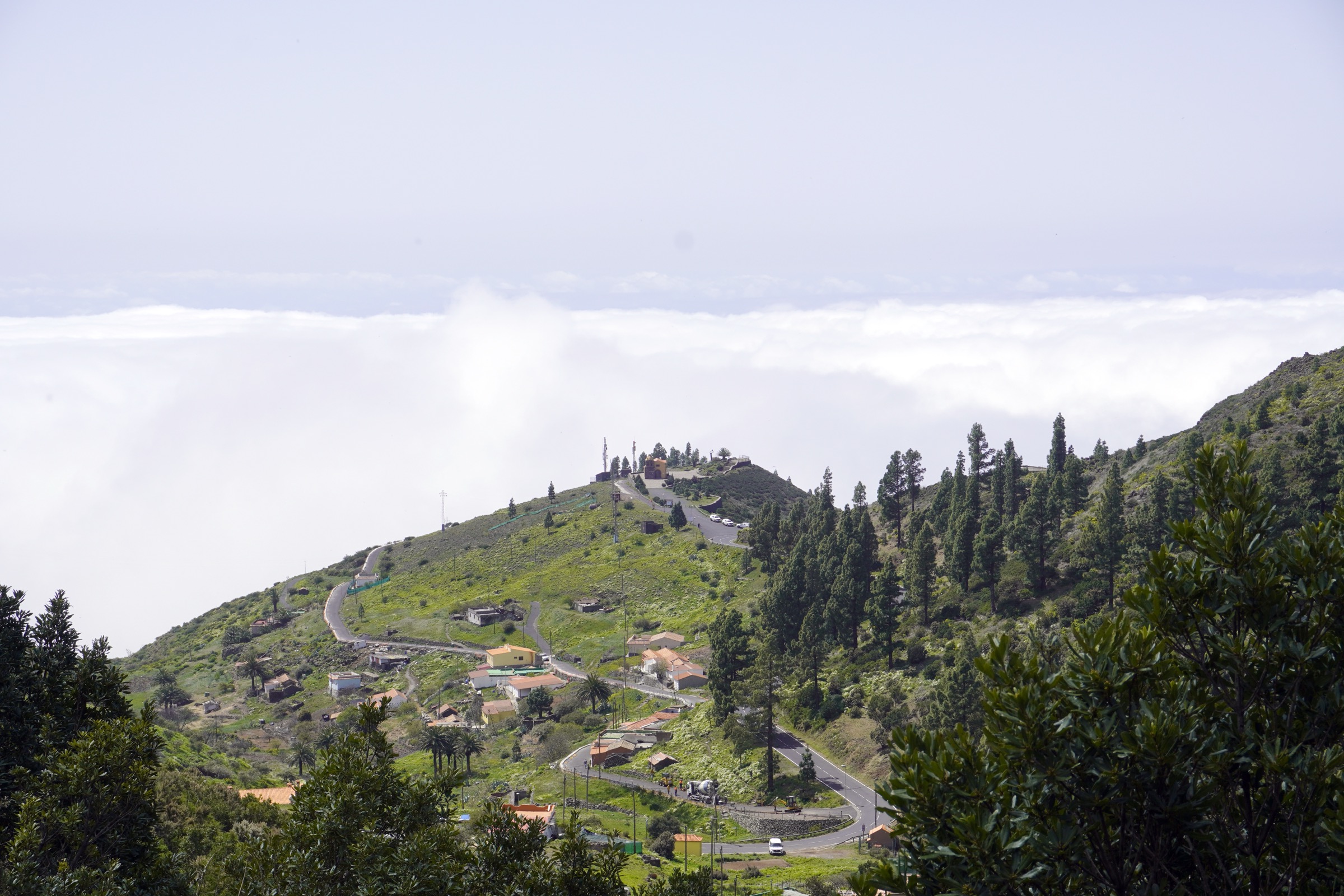
From the Pajarito layby on the TF-713 the path enters open fayal-brezal heath and climbs steadily through the regenerating 2012 burn zone to a broad shoulder beneath the summit. A short final pull leads to the cairn and orientation table on the Alto de Garajonay at 1,487 m, the highest point on the island. Views in clear conditions reach to Mount Teide on Tenerife, La Palma and El Hierro, with the green plateau of the national park spread out below.
The descent retraces the ascent line, optionally extended into the Igualero variant for a longer loop. The walking surface is well graded and the route is one of the most reliable summit options on the island in mixed weather.
Why it is essential
Alto de Garajonay is the highest point on La Gomera and the central feature of the national park. The summit gives the most complete single view of the laurisilva plateau and, on clear days, of three of the four neighbouring western Canaries.
Equipment
Standard hiking shoes, wind layer, sun protection, one to two litres of water and a small day pack are sufficient for the short summit option. Add a warm layer in winter for the cool plateau wind.
Hazards and notes
- The 2012 wildfire burn zone is regenerating but still exposed; treat plantings with care and stay on the signed path.
- Cloud cover can wipe summit visibility in minutes; do not rely on a long view.
- No water sources on the route.
- Free guided summit walks run from the Juego de Bolas visitor centre with prior booking.
GPX / KML links
| Source | URL | Format / access | Reuse status |
|---|---|---|---|
| Waymarked Trails — Garajonay area | waymarkedtrails.org | OSM-based map / GPX | OSM ODbL with attribution |
| Wikiloc search — Pajarito Alto de Garajonay | wikiloc.com | Search | User-uploaded; check per track |
External links
2. Laguna Grande to Alto de Garajonay
Snapshot
Itinerary
The route starts at the Laguna Grande recreation area, a former volcanic depression now used as the main hub for the Garajonay National Park. From the car park the path enters the laurisilva and climbs gradually through tall heather and laurel canopy, crossing several junctions with the wider park network. The middle section traverses regenerating burn zone with intermittent open views east toward Tenerife.
The path emerges on the open summit shoulder before the final pull to the cairn at 1,487 m. Descent retraces the ascent. The route is the favoured all-weather approach when the Pajarito side is closed in low cloud, because the forest cover offers shelter and easier navigation than the open ridge.
Why it is essential
Laguna Grande is the most-used starting point for in-park walks and offers the longest, most varied approach to the Garajonay summit. The route gives the best continuous immersion in the laurisilva canopy on any of the park’s signed in-park trails.
Equipment
Hiking boots, wind- and rain-resistant shell, warm layer for the summit, two litres of water carry, sun protection, and an offline map. The forest can be very wet underfoot.
Hazards and notes
- Cloud cover and damp forest floor can make junctions hard to identify; follow Ruta 14 markers carefully.
- No reliable water on the route.
- Limited mobile coverage on the upper section.
- The Laguna Grande area itself has restaurant and visitor facilities.
GPX / KML links
| Source | URL | Format / access | Reuse status |
|---|---|---|---|
| Waymarked Trails — Garajonay area | waymarkedtrails.org | OSM-based map / GPX | OSM ODbL with attribution |
| Wikiloc search — Laguna Grande Garajonay | wikiloc.com | Search | User-uploaded; check per track |
External links
3. El Contadero to El Cedro
Snapshot
Itinerary
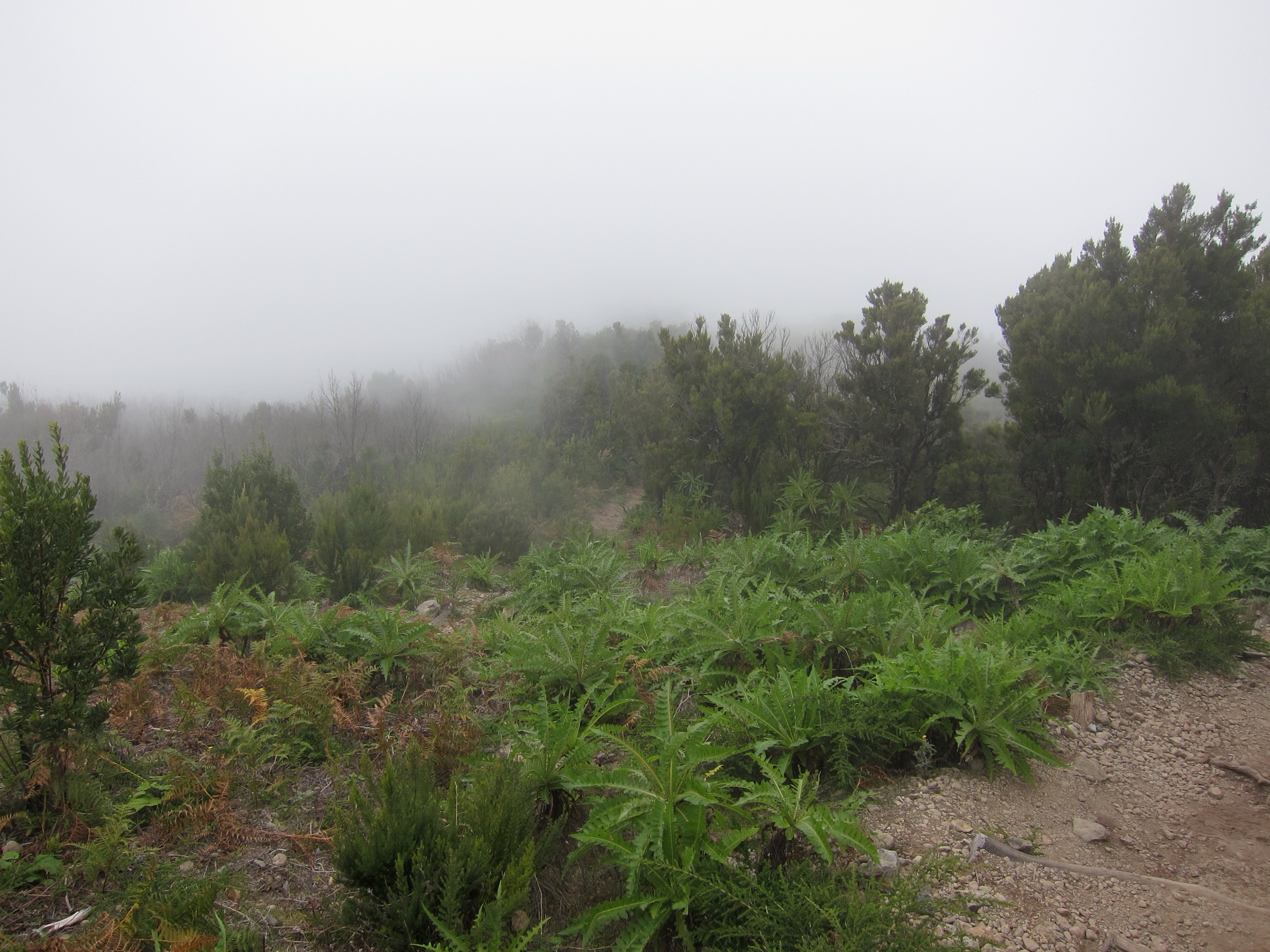
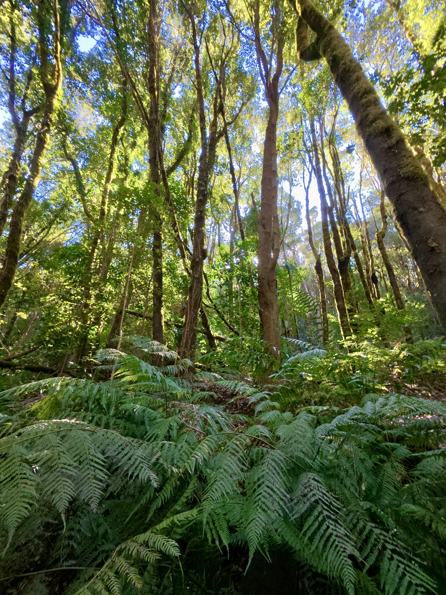
The walk starts at El Contadero, a signed national-park access point on the TF-713 near the Pajarito pass. From the car park, the path drops north into the Bosque del Cedro through one of the densest sections of laurisilva on the island. The forest floor is carpeted in moss and dead-leaf litter; the canopy of laurel, fayal and brezo holds permanent humidity from the trade-wind cloud.
The descent passes Las Mimbreras, drops along the upper El Cedro stream, and reaches the small hamlet of El Cedro after 5.8 km. Adding the loop variant via the Ermita de Lourdes lengthens the walk to roughly 6.3 km with around 273 m of ascent on the return leg. Most parties either arrange a pickup at El Cedro or continue down the Hermigua valley.
Why it is essential
El Contadero–El Cedro is the most-loved laurisilva descent in Garajonay, with year-round mist, stream and moss conditions that capture the laurel-forest experience at its richest. The Cabildo publishes its full statistics, giving it the most reliable route data in the catalogue.
Equipment
Hiking boots with good wet-rock grip, lightweight rain shell, trekking poles for the descent, two litres of water carry, and an extra layer for the cool forest. The El Cedro hamlet has a small café for the finish.
Hazards and notes
- Mossy steps and wet roots are slippery; expect to slow on the descent.
- Cloud cover can reduce visibility under the canopy; follow the signed path.
- The hamlet has limited services; check opening hours before counting on lunch there.
- Pick-up arrangements at El Cedro should be confirmed in advance.
GPX / KML links
| Source | URL | Format / access | Reuse status |
|---|---|---|---|
| Cabildo de La Gomera — Contadero–El Cedro trail page | lagomera.travel | Trail descriptor | Cabildo content; GPX via in-app links |
| Waymarked Trails — area | waymarkedtrails.org | OSM-based map | OSM ODbL with attribution |
| Wikiloc search — Contadero El Cedro | wikiloc.com | Search | User-uploaded; check per track |
External links
4. Vallehermoso – Roque Cano loop
Snapshot
Itinerary
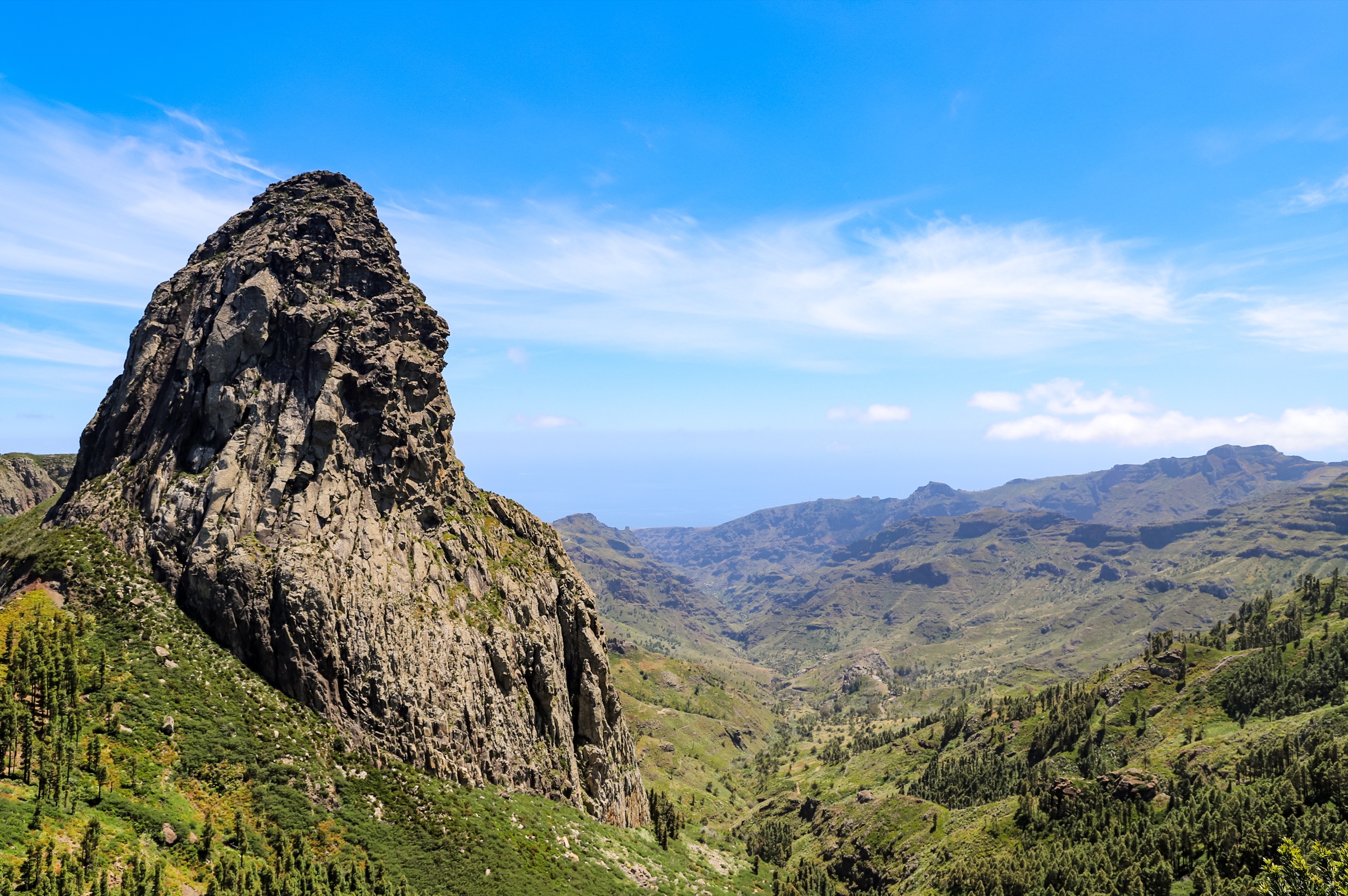
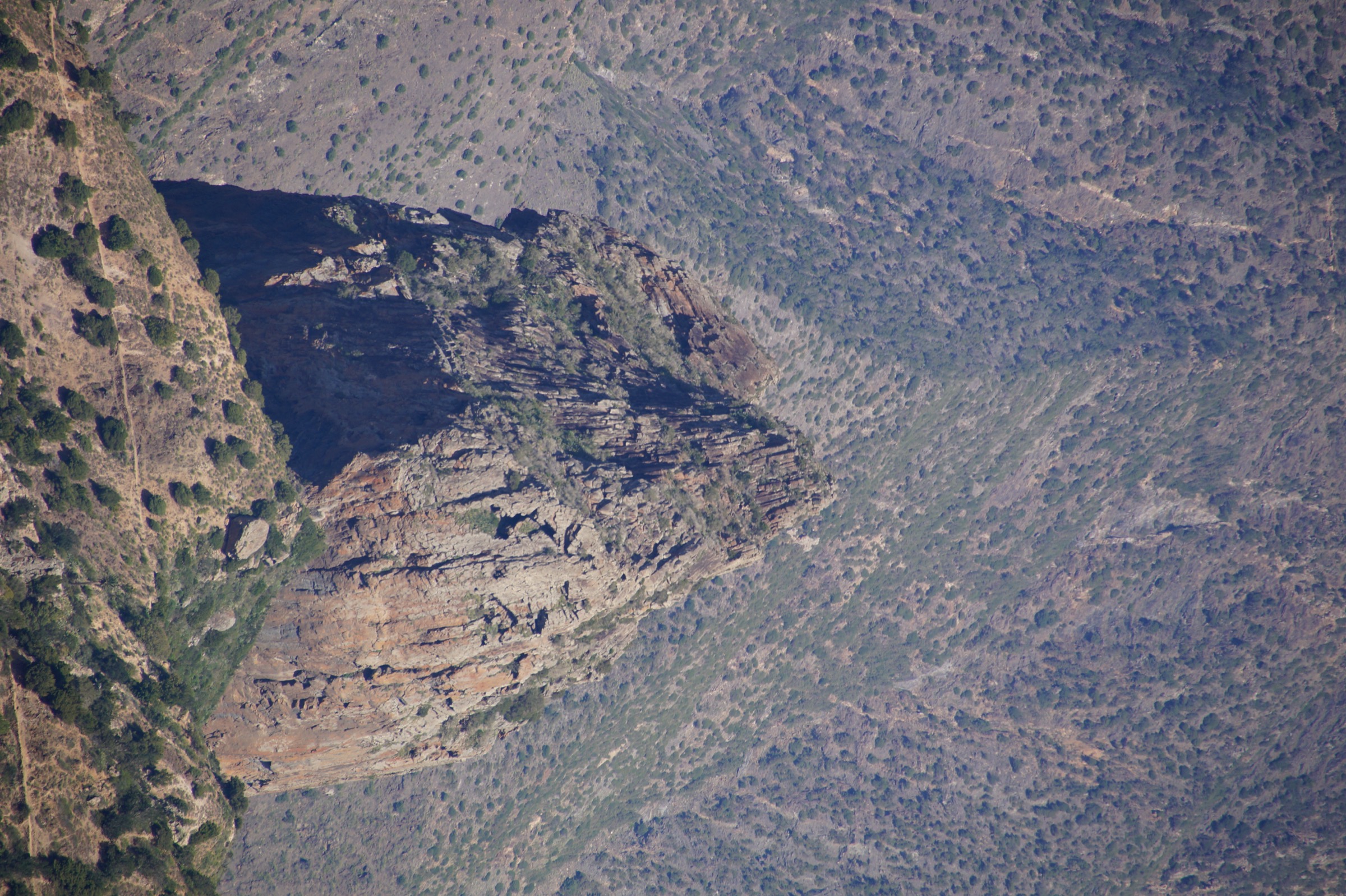
From central Vallehermoso the path climbs through terraced agricultural land toward the basaltic plug of Roque Cano, the volcanic neck that dominates the valley and appears on the municipal coat of arms. The route picks up the old camino through the hamlets of Garabato and El Tión, with regular viewpoints back across the village and out toward Los Órganos on the coast.
A higher traverse passes a series of viewpoints — Roque Blanco, the Roque Cano shoulder, and the Mirador Pilarica — before dropping back into Vallehermoso through dry barranco terraces. The full loop is around 10 to 11 km and combines barranco bottom, terraced hillside, basaltic ridge and viewpoint sections in roughly equal measure.
Why it is essential
Roque Cano is the signature volcanic feature of the northern La Gomera coast and the most visible landmark from Vallehermoso. The loop covers the full vertical profile of the barranco, with terrace cultivation, basaltic ridge, and panoramic viewpoints back across the village.
Equipment
Sturdy boots, sun protection, trekking poles, two to three litres of water carry, and a warm layer for the higher viewpoints in winter. Lightweight long sleeves help on the exposed terraces.
Hazards and notes
- The lower terraces are sun-exposed and have little shade.
- Loose stone on the descent line; trekking poles strongly recommended.
- Some sections cross active agricultural plots; follow waymarks and respect closed gates.
- Pickups at Vallehermoso are straightforward but bus service is infrequent.
GPX / KML links
| Source | URL | Format / access | Reuse status |
|---|---|---|---|
| Cabildo de La Gomera — Vallehermoso–Santa Clara loop | lagomera.travel | Trail descriptor | Cabildo content |
| Waymarked Trails — Vallehermoso | waymarkedtrails.org | OSM-based map | OSM ODbL with attribution |
| Wikiloc search — Roque Cano Vallehermoso | wikiloc.com | Search | User-uploaded; check per track |
External links
5. La Mérica above Valle Gran Rey
Snapshot
Itinerary
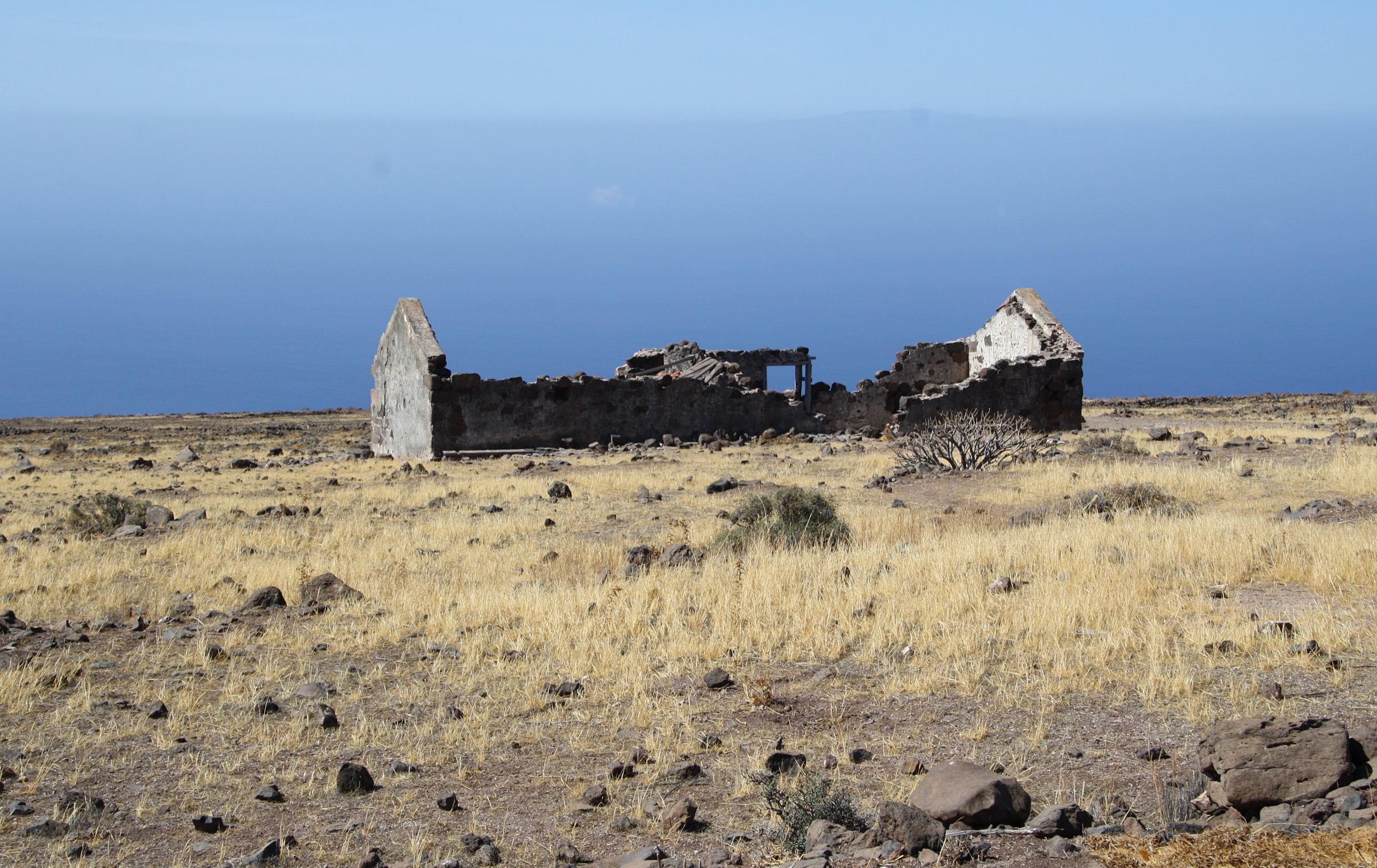
The route climbs the basaltic wall of La Mérica from sea level at Valle Gran Rey’s La Playa to the plateau at around 857 m. The ascent line uses an old camino with switchbacks engraved into the rock face; the basalt wall above the bay is around 700 m of effectively vertical relief. On the plateau the path traverses past abandoned threshing floors, ruined houses and dry-stone walls, with continuous views back across the valley to the laurel-covered ridges of the national park.
The descent in the loop variant drops down the south side of the plateau, returning to Valle Gran Rey through Borbalán. The Arure variant uses the upper village as a starting point and finishes with the long descent into the valley — a shorter ascent but a much more punishing knee-impact descent. Either option is the most demanding day-hike on La Gomera outside the national park.
Why it is essential
La Mérica is the defining basaltic plateau of the western coast and the most committing cliff-edge day-hike on La Gomera. The walk combines the longest single ascent on the island with the most dramatic continuous coastal exposure.
Equipment
Sturdy boots with stiff soles, trekking poles, sun protection, hat, three litres of water carry, lightweight long sleeves for the open plateau, and a wind layer. The ascent is shadeless; an early start is essential in warmer months.
Hazards and notes
- The cliff edge above La Playa has no railing and is sustained for several kilometres.
- The Arure descent is very steep and stony; falls are the main injury risk.
- No water sources on the plateau.
- Late starts in summer should be avoided; the ascent face holds the sun all afternoon.
GPX / KML links
| Source | URL | Format / access | Reuse status |
|---|---|---|---|
| Cabildo de La Gomera — GR-132 coastal stages | lagomera.travel | Trail descriptor | Cabildo content |
| Waymarked Trails — Valle Gran Rey area | waymarkedtrails.org | OSM-based map | OSM ODbL with attribution |
| Wikiloc search — La Mérica Valle Gran Rey | wikiloc.com | Search | User-uploaded; check per track |
External links
Missing data and follow-up work
- Official downloadable GPX — the Cabildo trail pages reference an in-app GPX download via the La Gomera Trails apps; a single open-licence GPX endpoint covering all PR-LG and in-park routes was not located in this pass.
- PR-LG numerical codes — several of the catalogue routes use national-park route numbers (Ruta 14, Ruta 17) rather than PR-LG codes; the parallel PR-LG numbering should be confirmed at the Juego de Bolas visitor centre.
- 2012 burn-zone diversions — some long-form Garajonay routes still differ from older guidebook descriptions; current waymarking is authoritative.
- Public transport timings — Guaguas Gomera schedules change seasonally; confirm departure and last-return times before booking a one-way trailhead.
External links
| Source | URL |
|---|---|
| Cabildo de La Gomera — hiking | lagomera.travel |
| Cabildo de La Gomera — Garajonay National Park | lagomera.travel |
| MITECO — Parque Nacional de Garajonay | miteco.gob.es |
| IUCN World Heritage Outlook — Garajonay | worldheritageoutlook.iucn.org |
| Wikipedia — Garajonay National Park | en.wikipedia.org |
| Wikipedia — La Gomera | en.wikipedia.org |
| Wikipedia — Alto de Garajonay | en.wikipedia.org |
| Wikipedia — Roque Cano | en.wikipedia.org |
| Waymarked Trails — La Gomera | waymarkedtrails.org |
| Wikiloc — La Gomera trails | wikiloc.com |