Regional overview
The Betancuria Massif is the ancient volcanic core of Fuerteventura, an eroded shield in the centre and west-centre of the island whose oldest exposed rocks — visible at Ajuy on the west coast — date to around 100 million years ago and are the oldest surface rocks anywhere in the Canary archipelago. The massif’s highest points cluster around the village of Betancuria, the island’s first capital, and reach 669 m at Morro Velosa and 708 m at Tegú / Gran Montaña. The entire massif is protected as the Parque Rural de Betancuria, a Special Area of Conservation in the Natura 2000 network.
Fuerteventura’s overall highest point — Pico de la Zarza at 807 m — sits on the Jandía peninsula at the south-western end of the island and belongs geologically to a separate massif. It is included in this catalogue because it is the only true mountain summit hike on the island and the natural complement to the Betancuria selection. The northern volcanoes around Calderón Hondo, and the sacred mountain of Tindaya, lie outside the massif and outside the scope of this entry.
Walking conditions are defined by the Atlantic trade-wind regime: cool, dry and reliable from late October to April, hot, windy and shadeless from May to September. There are no perennial streams; carrying enough water for the full day is the single most important planning factor, more so than waymark navigation. The Cabildo de Fuerteventura’s senderos network uses the SL (Sendero Local) and PR (Pequeño Recorrido) prefixes, with the cross-island GR-131 also touching the massif at the Betancuria–Pájara stage.
Selection rationale
The selection covers the massif’s signature themes: the panoramic viewpoint of the Mirador de Morro Velosa above Betancuria, the historic camino from Antigua across the central ridge, the pilgrimage valley of Vega de Río Palmas with its Arco de las Peñitas, the geological coastal cliffs of Ajuy, and the Jandía summit of Pico de la Zarza for the island highpoint. Pico de la Muda near La Matilla is excluded because it belongs to the northern Maxorata rather than the Betancuria Massif proper.
Summary table
| # | Hike | Country | Route type | Distance | Gain | Max elevation | Difficulty |
|---|---|---|---|---|---|---|---|
| 1 | Betancuria – Morro Velosa loop | Spain | Loop | About 7–8 km | About 350–400 m | About 675 m | Moderate |
| 2 | SL FV 29 Antigua – Betancuria | Spain | Point-to-point | About 9–11 km | About 400 m | About 570 m | Moderate |
| 3 | Vega de Río Palmas – Arco de las Peñitas | Spain | Out-and-back | About 4–5 km | About 150–200 m | About 350 m | Easy–moderate |
| 4 | Ajuy coastal cliffs and Caleta Negra | Spain | Out-and-back | About 3 km | About 80 m | About 80 m | Easy |
| 5 | Pico de la Zarza (PR FV 54), Jandía | Spain | Out-and-back | About 14 km | About 750–800 m | 807 m | Hard |
Before you go
Required equipment
- Sturdy hiking shoes or boots with good grip; loose volcanic scree is the dominant surface on the ridge routes.
- Sun protection, hat and at least 2 litres of water carry per person on any inland route; 3 litres on Pico de la Zarza.
- Wind layer; the trade wind blows almost constantly on exposed ridges and the Jandía summit.
- Lightweight long sleeves and trousers for sun protection on the shadeless plateau.
- Offline map or phone-loaded GPX; SL waymarking is in place but several junctions on the massif crisscross goat tracks.
- Trekking poles for the long descents on the Antigua–Betancuria and Pico de la Zarza routes.
Current access and safety notes
- All five routes lie within free public access; no permits or fees are required.
- Goat-grazing is widespread across the massif; expect crossings on every ridge route.
- Water sources are absent on every route; plan accordingly.
- Shade is effectively zero on the ridge and plateau routes; the Peñitas barranco offers fleeting palm shade only.
- Heavy rain is rare but can produce flash flooding in the Vega de Río Palmas barranco; check forecasts.
- Ajuy’s cliff edges are unfenced; do not approach the rim in large swell or wind.
- Tiadhe buses connect main villages but trailhead frequencies are low (often two to four services per day); plan return logistics carefully.
1. Betancuria – Morro Velosa loop
Snapshot
Itinerary
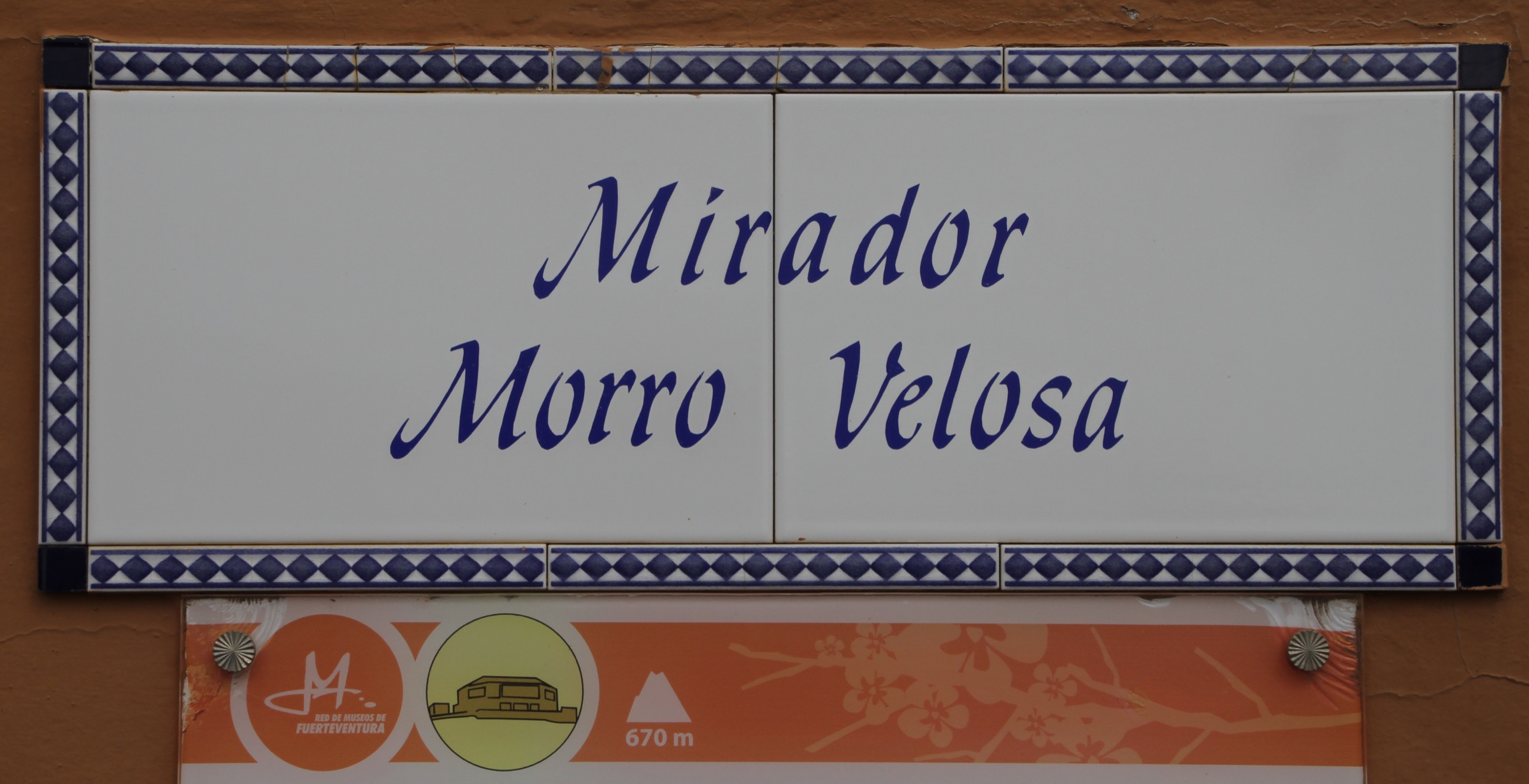
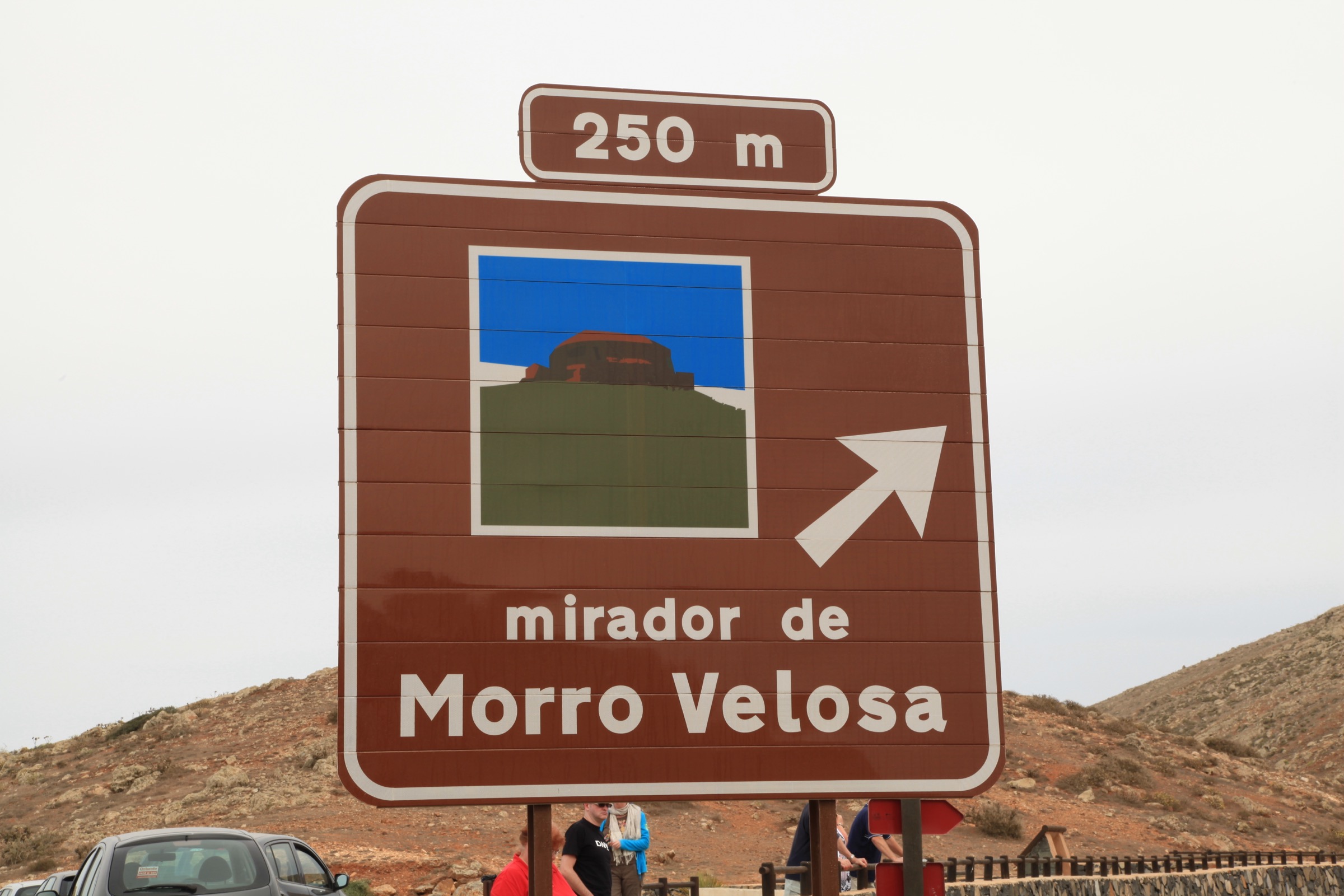
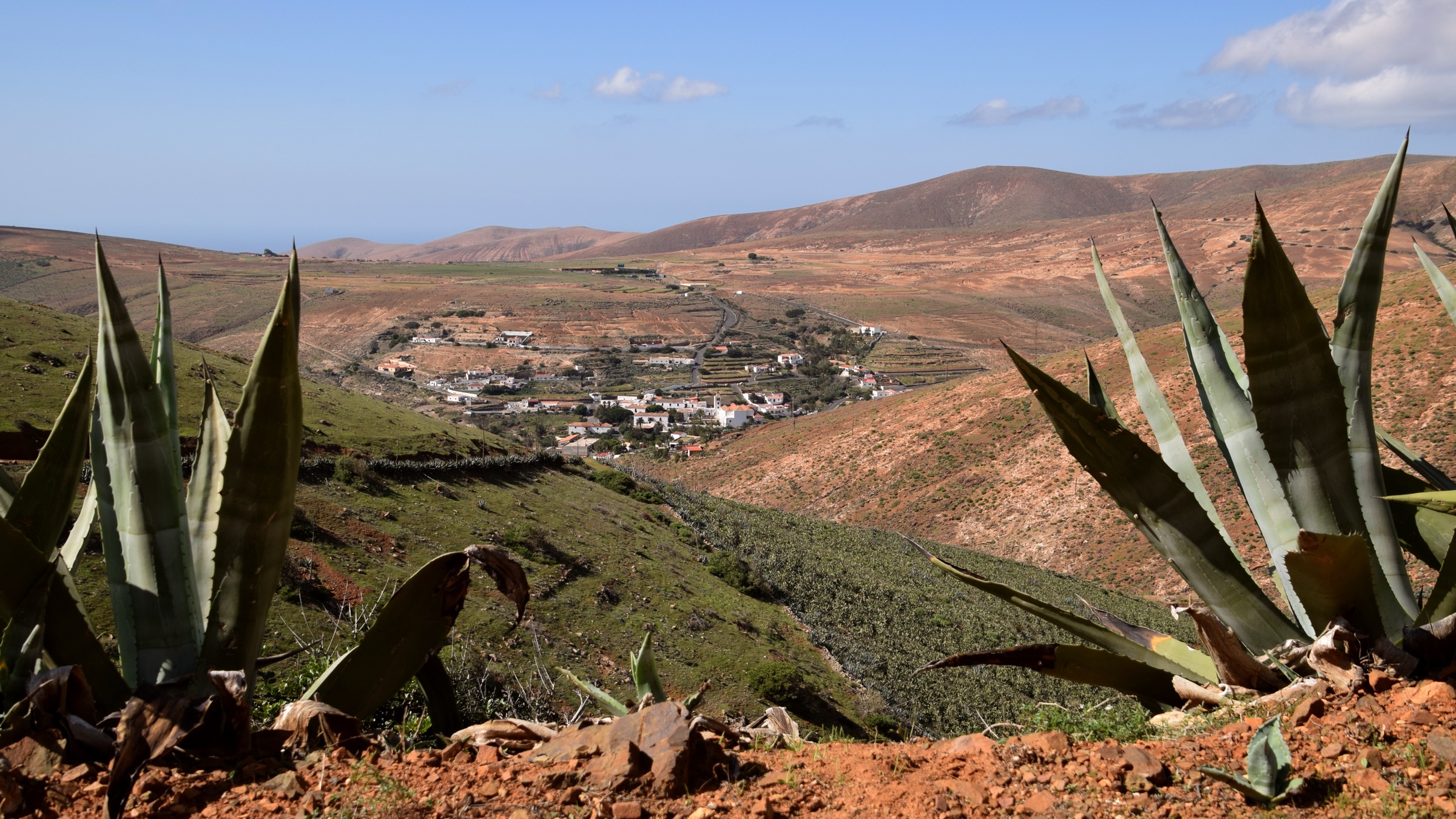
The loop climbs from the church plaza in Betancuria up the south side of the valley toward the Mirador de Morro Velosa, the César Manrique-styled lookout that crowns the massif’s north-western shoulder at around 675 m. The path uses old goat-herding caminos through scrub and short basalt outcrops, with the views opening westward over Vega de Río Palmas after the first kilometre.
A circuit option crosses the Tegetuno ridge and drops back into Betancuria from the north, with regular open views toward the Tegú massif and the Cofete coast on clear days. The Mirador itself, although primarily reached by car on the FV-30, is the trail’s natural high point and a good lunch stop. The descent retraces or loops back through the village.
Why it is essential
The Mirador de Morro Velosa is the single defining viewpoint of the Betancuria Massif and the loop is the most accessible way to reach it on foot. The walk captures the village, the ridge, and the panoramic view in roughly equal measure.
Equipment
Hiking shoes, wind layer, sun protection, two litres of water, trekking poles for the descent. Long sleeves help on the exposed upper section.
Hazards and notes
- Loose stone on the descent; trekking poles strongly recommended.
- No water sources on the loop.
- Goats and grazing dogs may cross the path.
- The Mirador building has limited hours; check before counting on a coffee stop.
GPX / KML links
| Source | URL | Format / access | Reuse status |
|---|---|---|---|
| Visit Fuerteventura — senderos index | visitfuerteventura.com | Trail directory | Cabildo content |
| Waymarked Trails — Betancuria area | waymarkedtrails.org | OSM-based map | OSM ODbL with attribution |
| Wikiloc search — Morro Velosa Betancuria | wikiloc.com | Search | User-uploaded; check per track |
External links
2. SL FV 29 — Antigua to Betancuria
Snapshot
Itinerary
The walk follows the historic camino from Antigua across the central ridge of the Betancuria Massif to the old capital at Betancuria. From the Molino centre in Antigua the path climbs through dry stone-walled goat enclosures and short volcanic outcrops to the Degollada de Marrubio pass at around 570 m, with views back across the central depression to Caldera de Gairía. The descent into the Betancuria valley uses an old cobbled trace through scattered ahulagas and tabaibas.
The official SL FV 29 designation covers only the Degollada Vieja segment; combined with the connecting trail through the Cuchillete de Buenavista the full Antigua-to-Betancuria walk is around 9 to 11 km. End-to-end logistics are straightforward because both villages are on the same Tiadhe line.
Why it is essential
The Antigua–Betancuria walk is the classic central-ridge traverse of the massif, on the historic camino that linked the island’s mid-eastern villages with the colonial capital. It captures the open, semi-arid character of the massif at its most expansive.
Equipment
Hiking boots, sun protection, wind layer, two to three litres of water carry, and trekking poles for the descent. Lightweight long sleeves help on the open ridge.
Hazards and notes
- No water sources on the route.
- Open exposure; no shade.
- Goat-grazed plateaux; expect crossings.
- Bus frequencies are limited; check return times before starting.
GPX / KML links
| Source | URL | Format / access | Reuse status |
|---|---|---|---|
| Visit Fuerteventura — senderos index | visitfuerteventura.com | Trail directory | Cabildo content |
| Waymarked Trails — Antigua–Betancuria | waymarkedtrails.org | OSM-based map | OSM ODbL with attribution |
| Wikiloc search — Antigua Betancuria | wikiloc.com | Search | User-uploaded; check per track |
External links
3. Vega de Río Palmas – Arco de las Peñitas
Snapshot
Itinerary
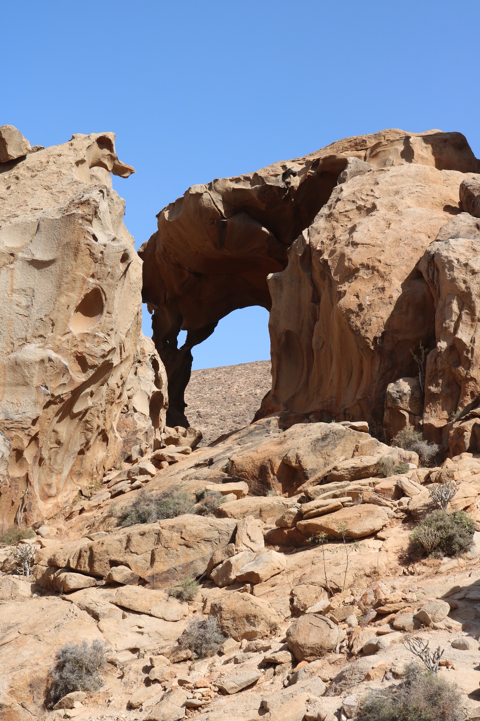
The walk leaves Vega de Río Palmas heading west into the Barranco de las Peñitas, with the Ermita de la Virgen de la Peña visible above the valley head. The path follows the barranco bed and passes the small Presa de las Peñitas reservoir, dry for most of the year. Below the dam the route enters a narrow gorge of rounded volcanic boulders before reaching the Arco de las Peñitas, a natural rock arch carved through the basalt.
The standard out-and-back returns the same way. Some parties extend the walk to the ermita on the southern valley shoulder, the focal point of the annual Virgen de la Peña pilgrimage held in mid-September.
Why it is essential
Vega de Río Palmas is the most visited inland village in Fuerteventura and the Arco de las Peñitas is its signature geological feature. The walk gives the most varied short outing in the Betancuria Massif, with valley, dam, narrow gorge and natural arch in a compact circuit.
Equipment
Hiking shoes with grip, sun protection, hat, two litres of water carry, and a head torch if extending past the Arco. Long sleeves help on the open valley.
Hazards and notes
- Slippery rocks below the dam.
- Minimal shade in the upper barranco.
- Rockfall under the Arco overhang; do not linger directly beneath.
- After rare heavy rain the barranco floods rapidly.
GPX / KML links
| Source | URL | Format / access | Reuse status |
|---|---|---|---|
| Visit Fuerteventura — senderos index | visitfuerteventura.com | Trail directory | Cabildo content |
| Waymarked Trails — Vega de Río Palmas | waymarkedtrails.org | OSM-based map | OSM ODbL with attribution |
| Wikiloc search — Arco de las Peñitas | wikiloc.com | Search | User-uploaded; check per track |
External links
4. Ajuy coastal cliffs and Caleta Negra caves
Snapshot
Itinerary
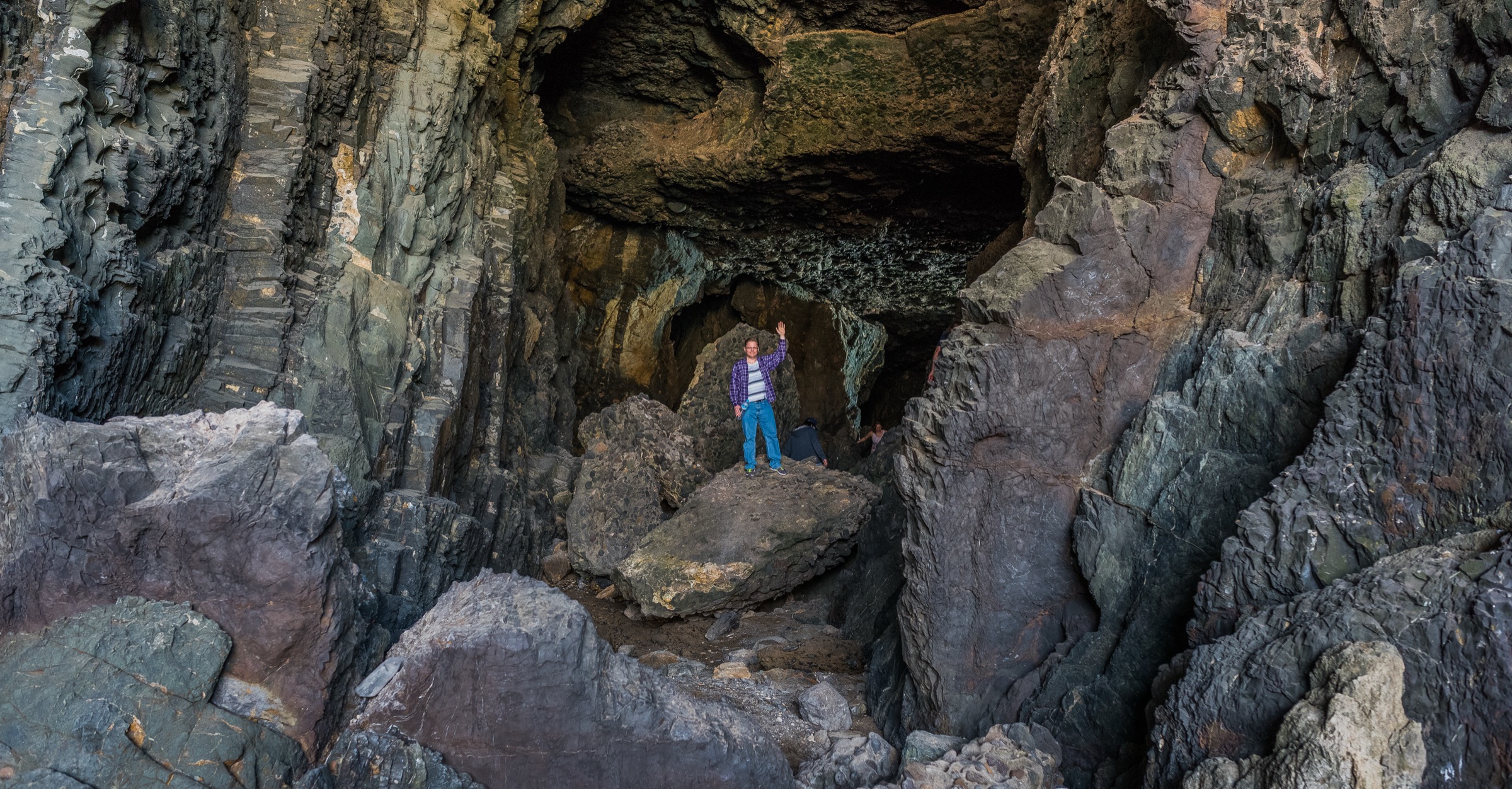
A signed coastal path climbs north from Playa de Ajuy along the cliff edge above the Atlantic. The route passes a series of viewpoints over the basalt and pyroclastic sequence that makes up the cliff line, ending at the Caleta Negra sea caves — large open chambers carved into the cliff base by wave action. Steps lead down to the cave entrances; the seaward chamber walls expose the oldest rock surface in the Canary archipelago, around 100 million years old.
Return is by the same coastal path. The short distance and modest ascent make the walk a typical half-day from any of the eastern resorts.
Why it is essential
Ajuy is the most accessible geological showcase in Fuerteventura and the only short coastal walk in the Betancuria Massif scope. The Caleta Negra caves and the surrounding cliff exposure cover the deepest rock history in the Canaries in under an hour and a half.
Equipment
Trail shoes with grip, sun protection, one to two litres of water, and a head torch for the cave interior. Long sleeves help in midsummer.
Hazards and notes
- Cliff edges are unfenced; do not approach the rim in strong wind or large swell.
- Sea spray on the cave-floor rocks; surfaces can be slippery.
- Surf exposure at the cave mouths; do not enter the water near the openings.
- The site is busy on weekends and holidays; an early start helps.
GPX / KML links
| Source | URL | Format / access | Reuse status |
|---|---|---|---|
| Visit Fuerteventura — senderos index | visitfuerteventura.com | Trail directory | Cabildo content |
| Waymarked Trails — Ajuy | waymarkedtrails.org | OSM-based map | OSM ODbL with attribution |
| Wikiloc search — Ajuy Caleta Negra | wikiloc.com | Search | User-uploaded; check per track |
External links
5. Pico de la Zarza (PR FV 54), Jandía
Snapshot
Itinerary
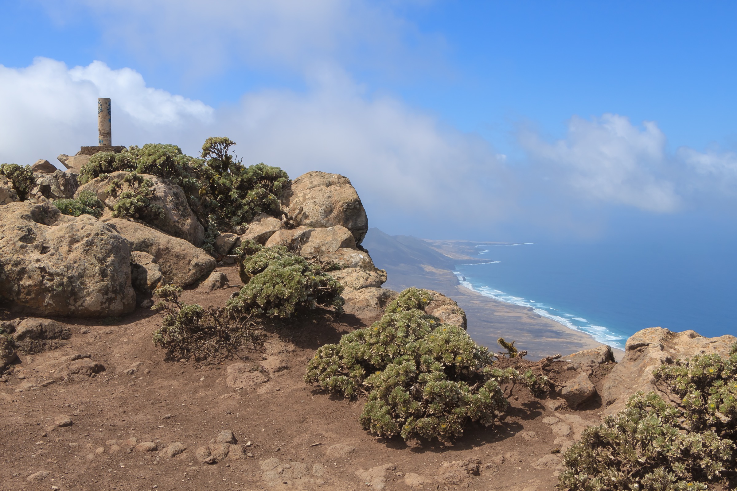
The route leaves the Morro Jable seafront, follows the Matorral road inland, and picks up the marked PR FV 54 path through dry barrancos toward the south face of the Jandía ridge. The climb is steady and shadeless throughout, working up the south flank to the summit ridge at around 800 m. The final approach traverses east along the ridge to the cairn at 807 m, with the cliff face dropping vertically on the north side to the Cofete beach.
The summit gives the most complete single view of Jandía: the south coast resorts, the long Cofete beach to the north, and on clear days the southern coast of Gran Canaria. Return is by the ascent line; the descent on tired legs is the most punishing part of the day.
Why it is essential
Pico de la Zarza is the only true mountain summit on Fuerteventura and the highest point on the island. The route is the standard ascent and one of the most-walked single-day mountain objectives in the Canaries.
Equipment
Sturdy boots, sun protection, hat, three litres of water carry, lightweight long sleeves and a wind layer. Trekking poles strongly recommended for the descent. An early start is essential in any month outside deep winter.
Hazards and notes
- No water on the route.
- No shade.
- Strong wind on the summit ridge is common.
- Cliff edge at the summit: the north face drops sheer to Cofete; stay back from the rim.
- The walk is long; pace early and conserve energy for the descent.
GPX / KML links
| Source | URL | Format / access | Reuse status |
|---|---|---|---|
| Ministerio — Caminos Naturales PR FV 54 (Jandía) | caminosnaturales.es | GPX / KMZ / PDF | Spanish government data; attribution to MAPA |
| Visit Jandía — Pico de la Zarza | visitjandia.es | Trail descriptor | Cabildo content |
| Waymarked Trails — Pico de la Zarza | waymarkedtrails.org | OSM-based map | OSM ODbL with attribution |
External links
- Visit Jandía — Pico de la Zarza
- Ministerio — Caminos Naturales Fuerteventura PR FV 54
- Wikipedia — Fuerteventura
Missing data and follow-up work
- Official SL FV PDF data — exact distance, elevation and time for SL FV 27 and SL FV 29 were not directly downloadable in this pass; tracked stats are based on consistent third-party sources.
- Morro Velosa loop signage — the loop is widely walked but its status as an officially signed Senderos de Fuerteventura route should be confirmed with the Betancuria tourist office.
- Gran Montaña / Tegú summit — no high-resolution licence-compatible photo was located on Commons; the 708 m highpoint of the Betancuria Massif remains a research candidate for inclusion in a later catalogue revision.
- Bus schedules — Tiadhe timetables change seasonally; verify return services before relying on bus transfers.
External links
| Source | URL |
|---|---|
| Visit Fuerteventura — senderos | visitfuerteventura.com |
| Ayuntamiento de Betancuria — senderismo | aytobetancuria.org |
| Visit Jandía — Pico de la Zarza | visitjandia.es |
| Ministerio — Caminos Naturales GR-131 Fuerteventura Etapa 5 | caminosnaturales.es |
| Ministerio — Caminos Naturales PR FV 54 (Jandía) | caminosnaturales.es |
| Wikipedia — Fuerteventura | en.wikipedia.org |
| Wikipedia — Betancuria Rural Park | en.wikipedia.org |
| Wikipedia — Pico de la Zarza | en.wikipedia.org |
| Waymarked Trails — Fuerteventura | waymarkedtrails.org |
| Wikiloc — Fuerteventura trails | wikiloc.com |