Regional overview
The Uzbek / Western Tian Shan catalogue region covers the western end of one of Asia’s great mountain systems, with the most practical day-hiking nodes around the Chimgan-Charvak-Ugam-Chatkal area of Uzbekistan, Sary-Chelek in western Kyrgyzstan, and Aksu-Zhabagly in southern Kazakhstan. Tajikistan is included in the broader user-supplied region string, but this pass did not find a stronger Tajik day-hike candidate inside the Western Tian Shan than the better documented Uzbekistan/Kyrgyzstan/Kazakhstan options.
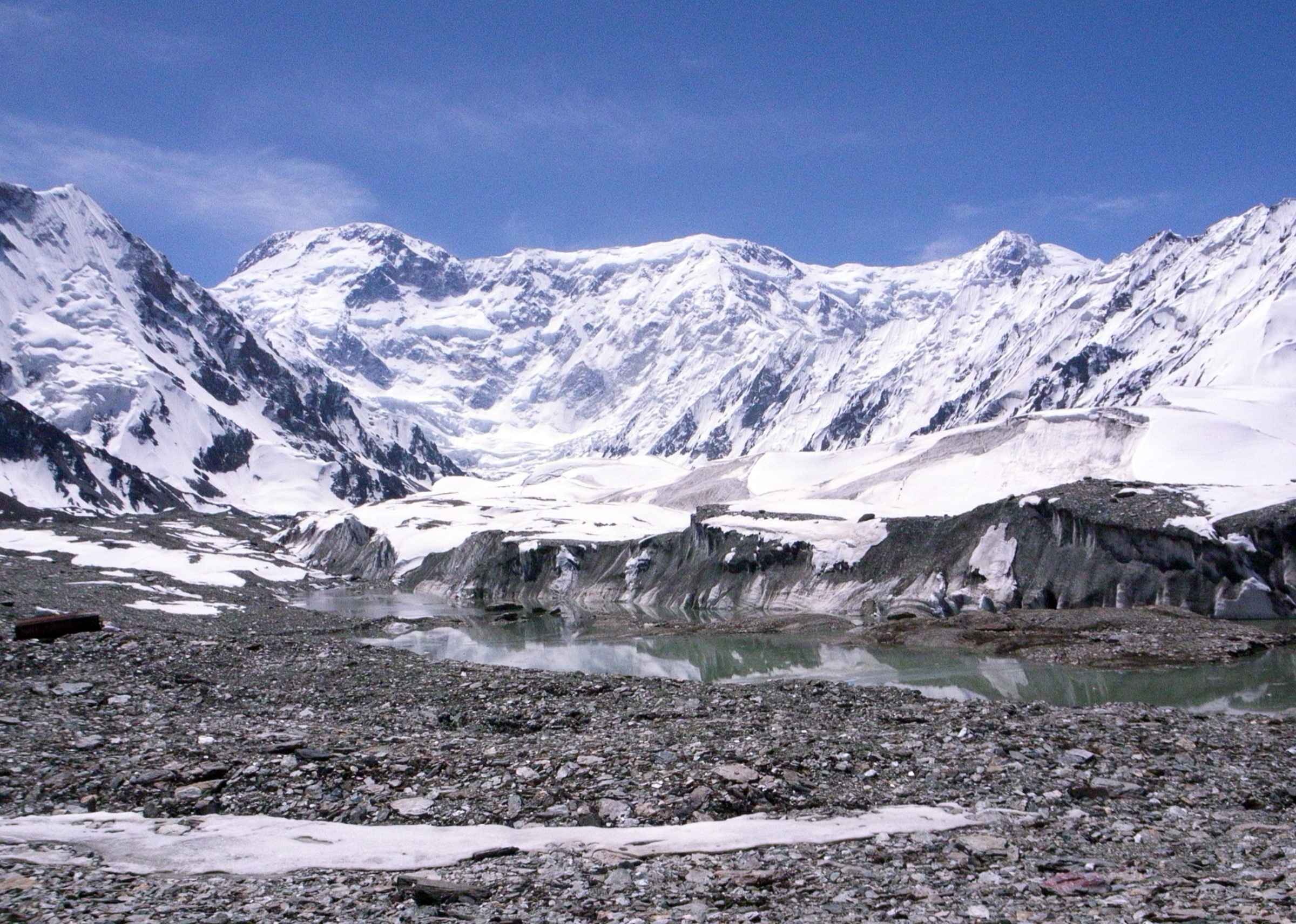
UNESCO’s Western Tien-Shan World Heritage page describes the transnational property as ranging from 700 m to 4,503 m and being globally important for biodiversity and wild relatives of cultivated fruit crops. The day-hike experience is correspondingly varied: dry ridges above Tashkent, narrow river gorges, juniper and walnut-fruit forests, lake basins, and strictly managed nature-reserve viewpoints.
Selection rationale
The final five emphasize the most recognisable day-hike settings: Little Chimgan as the readily mapped summit above the Chimgan resort area, Gulkam Gorge as the classic canyon/adventure route, Beldersay-Chet-Kumbel as the ridge-and-petroglyph day, Sary-Chelek panorama as the western Kyrgyz lake-forest representative, and Aksu Canyon as the Kazakh reserve component. Only Little Chimgan and Sary-Chelek have sufficiently precise public day-hike statistics in this pass; the others need local route-file confirmation before publication.
Summary table
| # | Hike | Country | Route type | Distance | Gain | Max elevation | Difficulty |
|---|---|---|---|---|---|---|---|
| 1 | Little Chimgan | Uzbekistan | Out and back | 6.3 km | 527 m | Approx. 2,097 m peak context | Hard |
| 2 | Gulkam Gorge via Sandy Pass | Uzbekistan | Point-to-point / loop variants | Not resolved; full-day route | Not resolved | Sandy Pass about 1,832 m | Hard |
| 3 | Beldersay / Chet-Kumbel ridge and petroglyphs | Uzbekistan | Loop / out-and-back variants | Not resolved; full-day route | Not resolved | Not resolved | Moderate-hard |
| 4 | Sary-Chelek lakes and panorama | Kyrgyzstan | Out and back / loop variant | 7.1 km from parking in Hiking.kg source | 760 m | Lake about 1,873 m; viewpoint higher | Hard |
| 5 | Aksu Canyon rim / reserve viewpoint | Kazakhstan | Out and back / guided reserve variant | Not resolved | Not resolved | Not resolved | Moderate |
1. Little Chimgan
Snapshot
Itinerary
The route climbs from the Chimgan resort area onto the Little Chimgan ridge, gaining height quickly above dry slopes and seasonal wildflowers. The summit area gives a compact but classic view over the Charvak-Chimgan pocket of the Western Tian Shan.
The mapped line is short, but the steepness and lack of shade make it more serious than the distance suggests. Start early in warm weather and descend before afternoon heat or thunderstorms.
Why it is essential
Little Chimgan is one of the most accessible Western Tian Shan summit walks from Tashkent, giving a fast entry into the Chatkal Range landscape without the larger commitment of Greater Chimgan.
Equipment
Grippy shoes, sun protection, wind layer, at least 2 litres of water in warm weather, offline route map, and trekking poles for the descent.
Hazards and notes
Loose rock, exposed slopes, no shade, heat, and spring storm cells are the main risks. Do not confuse this with Greater Chimgan; that higher peak is a more serious undertaking with different route demands.
GPX / KML links
| Source | URL | Format / access | Reuse status |
|---|---|---|---|
| AllTrails: Little Chimgan | alltrails.com | Source map / app route | AllTrails terms apply; GPX reuse not verified; statistics and source-map only |
| OpenStreetMap search | openstreetmap.org | Map/search | OSM data is ODbL; geometry cross-check only |
External links
- AllTrails — Little Chimgan
- Central Asia Travel — Chimgan Mountains context and Little/Greater Chimgan elevations
- UNESCO — Western Tien-Shan regional context
2. Gulkam Gorge via Sandy Pass
Snapshot
Itinerary
The classic route reaches the Gulkamsay drainage via the Sandy Pass area, then descends towards the narrow Gulkam Gorge. Central Asia Travel describes the gorge as passable with rope and an experienced guide; other local sources describe narrow sections, boulders, waterfalls, and riverbed travel.
Because published variants differ, this entry should not be treated as a single fixed GPX until a current local guide line is confirmed. A non-technical viewpoint/bypass version may be preferable for general walkers.
Why it is essential
Gulkam Gorge is the Western Tian Shan’s most distinctive Uzbekistan canyon walk: compact, dramatic, close to Tashkent, and very different from the open Chimgan summit ridges.
Equipment
Helmet and rope only if a qualified guide deems them necessary, plus grippy shoes, trekking poles, dry bag, water, sun protection, and warm layer. A local guide is strongly recommended for the gorge descent.
Hazards and notes
Flash floods, wet polished rock, boulder scrambling, fixed-rope reliance, waterfall bypasses, loose slopes, and navigation ambiguity are serious hazards. Do not enter the narrows in unstable weather or high water.
GPX / KML links
| Source | URL | Format / access | Reuse status |
|---|---|---|---|
| OpenStreetMap search | openstreetmap.org | Map/search | OSM data is ODbL; orientation only; no route relation selected |
| Uzbekistan.travel, Chimgan and Gulkam Narrows | uzbekistan.travel | Official tourism article | Site terms apply; context only; no route file found |
External links
- Central Asia Travel — Chimgan and Gulkam Gorge description
- Uzbekistan.travel — Chimgan and Gulkam Narrows
- Explorers.uz — Gulkam Canyon local description
3. Beldersay / Chet-Kumbel Ridge and Petroglyphs
Snapshot
Itinerary
The Beldersay candidate uses the high resort valley and ridge terrain around Chet-Kumbel, with possible petroglyph detours and broad views towards the Charvak basin. Visit Uzbekistan identifies a Beldersay Gorge day hike to ancient petroglyphs, but this pass did not confirm a reusable GPX or single standard distance.
For publication, define one exact start, whether the cableway is used, and whether the route visits the petroglyph area or only the ridge.
Why it is essential
Beldersay represents the Western Tian Shan’s ridge-and-cultural-landscape side: close to Tashkent, visually open, and connected to both mountain recreation and archaeological traces.
Equipment
Trail shoes, sun/wind protection, water, snacks, offline map, and warm layer outside midsummer.
Hazards and notes
Loose slopes, heat, possible cableway closures, unclear route variants, and fragile archaeological features are the key concerns. Petroglyphs should not be touched, marked, or used as rest spots.
GPX / KML links
| Source | URL | Format / access | Reuse status |
|---|---|---|---|
| OpenStreetMap search | openstreetmap.org | Map/search | OSM data is ODbL; orientation only |
External links
- Visit Uzbekistan — Uzbekistan hiking routes and Beldersay petroglyph day-hike context
- UNESCO — Western Tien-Shan context
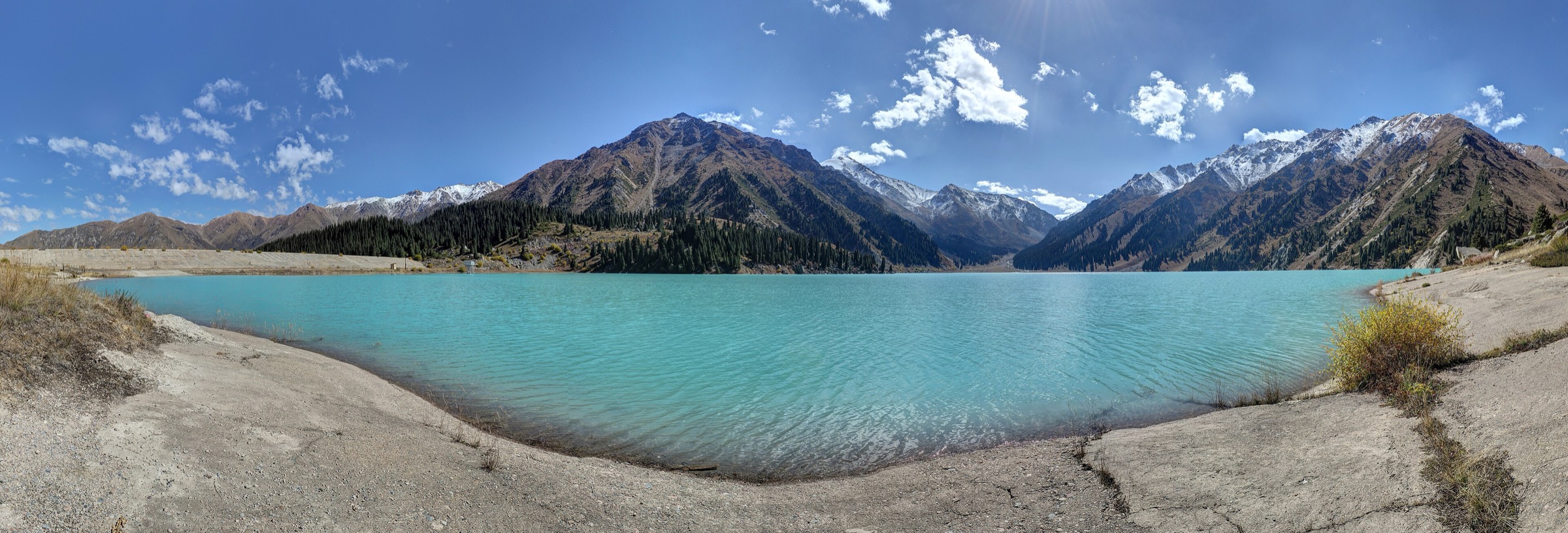
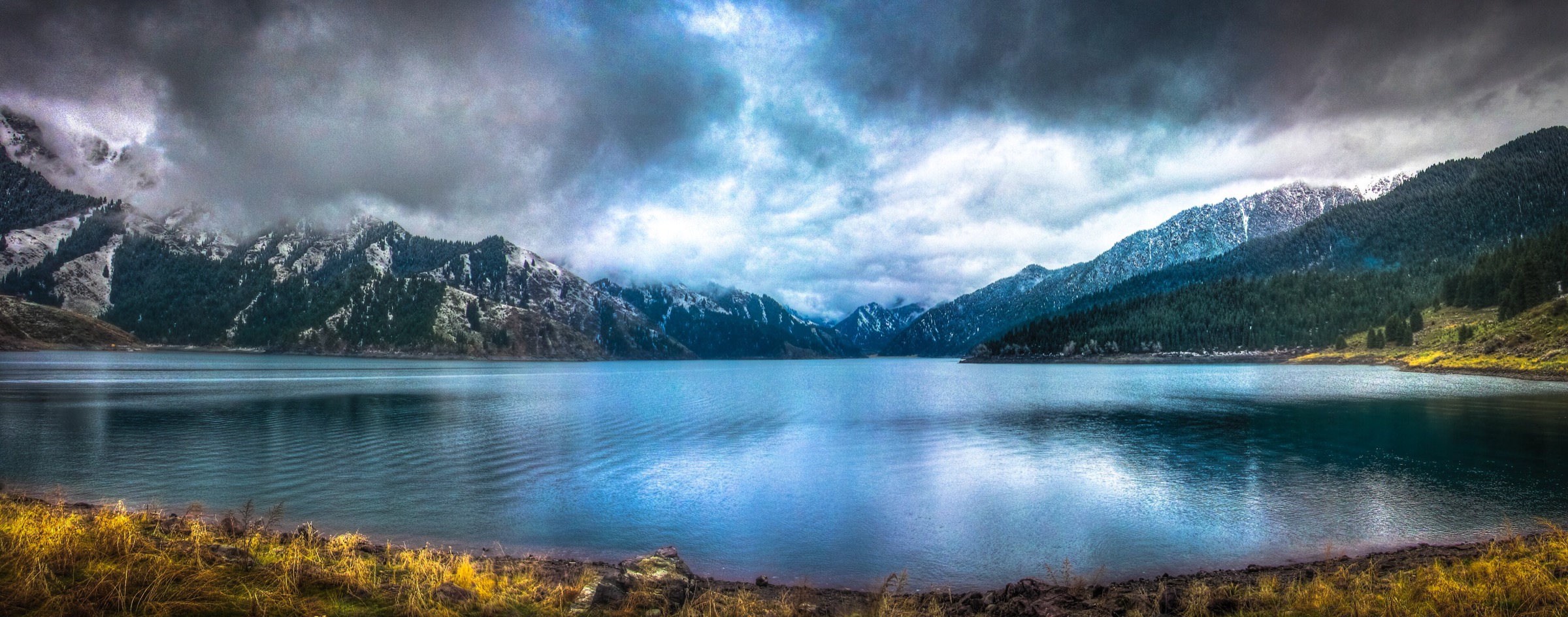
4. Sary-Chelek Lakes and Panorama
Snapshot
Itinerary
From the parking/lake access area, the route can be planned either as an easier lakeside exploration or as the harder climb to a panorama over the lake cluster. Hiking.kg reports a 7.1 km walk from parking with 760 m of gain for the panorama-oriented option.
Reserve access, road conditions, and permitted walking zones should be checked before setting the final line, especially outside the main summer/autumn season.
Why it is essential
Sary-Chelek is the western Kyrgyz counterpoint to Chimgan: lake, forest, and biosphere-reserve biodiversity rather than dry resort ridges. It adds walnut-fruit forest and remote lake scenery to the Western Tian Shan set.
Equipment
Mountain shoes, weatherproof layer, food, water, offline map, insect protection in season, and cash/documents for reserve access if required.
Hazards and notes
Remote access, steep viewpoint climbs, storms, muddy tracks, wildlife, and limited services are the main issues. The route should not be expanded into a multi-day reserve trek without permits and local information.
GPX / KML links
| Source | URL | Format / access | Reuse status |
|---|---|---|---|
| Hiking.kg Sary-Chelek guide | hiking.kg | Guide/source map | Site terms apply; route-file reuse not verified; statistics and route narrative only |
| OpenStreetMap search | openstreetmap.org | Map/search | OSM data is ODbL; geometry cross-check only |
External links
- Hiking.kg — Sary-Chelek route statistics and guide
- UNESCO MAB — Sary-Chelek Biosphere Reserve context
- Visit Kyrgyzstan — Sary-Chelek overview
5. Aksu Canyon Rim / Reserve Viewpoint
Snapshot
Itinerary
This candidate focuses on approved viewpoints or walking access around Aksu Canyon in Aksu-Zhabagly, Kazakhstan’s Western Tian Shan nature-reserve component. The canyon is widely described as deep and long, but this pass did not confirm a public, reusable day-hike GPX or standard visitor walking distance.
For publication, the reserve administration or a licensed local operator should define the exact allowed line, guide requirement, and seasonal access.
Why it is essential
Aksu Canyon adds Kazakhstan’s strict-reserve Western Tian Shan landscape to a region otherwise dominated by Uzbek and Kyrgyz routes. It is important for biodiversity, geology, and World Heritage representation.
Equipment
Sturdy shoes, sun/wind protection, binoculars, water, food, documents, and whatever the reserve or guide requires.
Hazards and notes
Reserve rules, cliff edges, heat, sudden weather, remote access, and lack of public route data are the primary concerns. Do not publish a self-guided GPS line until access rights and data licence are clear.
GPX / KML links
| Source | URL | Format / access | Reuse status |
|---|---|---|---|
| OpenStreetMap search | openstreetmap.org | Map/search | OSM data is ODbL; orientation only |
External links
External links
| Source | URL |
|---|---|
| UNESCO — Western Tien-Shan | whc.unesco.org |
| AllTrails — Little Chimgan | alltrails.com |
| Central Asia Travel — Chimgan Mountains | centralasia-travel.com |
| Uzbekistan.travel — Chimgan and Gulkam Narrows | uzbekistan.travel |
| Explorers.uz — Gulkam Canyon | explorers.uz |
| Visit Uzbekistan — Uzbekistan hiking routes | visituzbekistan.co |
| Hiking.kg — Sary-Chelek | hiking.kg |
| UNESCO MAB — Sary-Chelek Biosphere Reserve | unesco.org |
| Visit Kyrgyzstan — Sary-Chelek | visitkyrgyzstan.org |