Regional overview
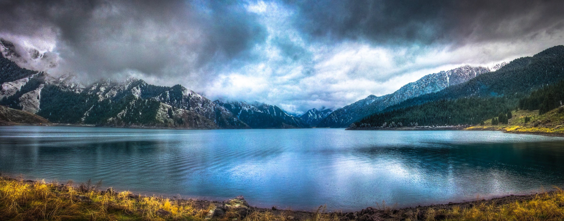
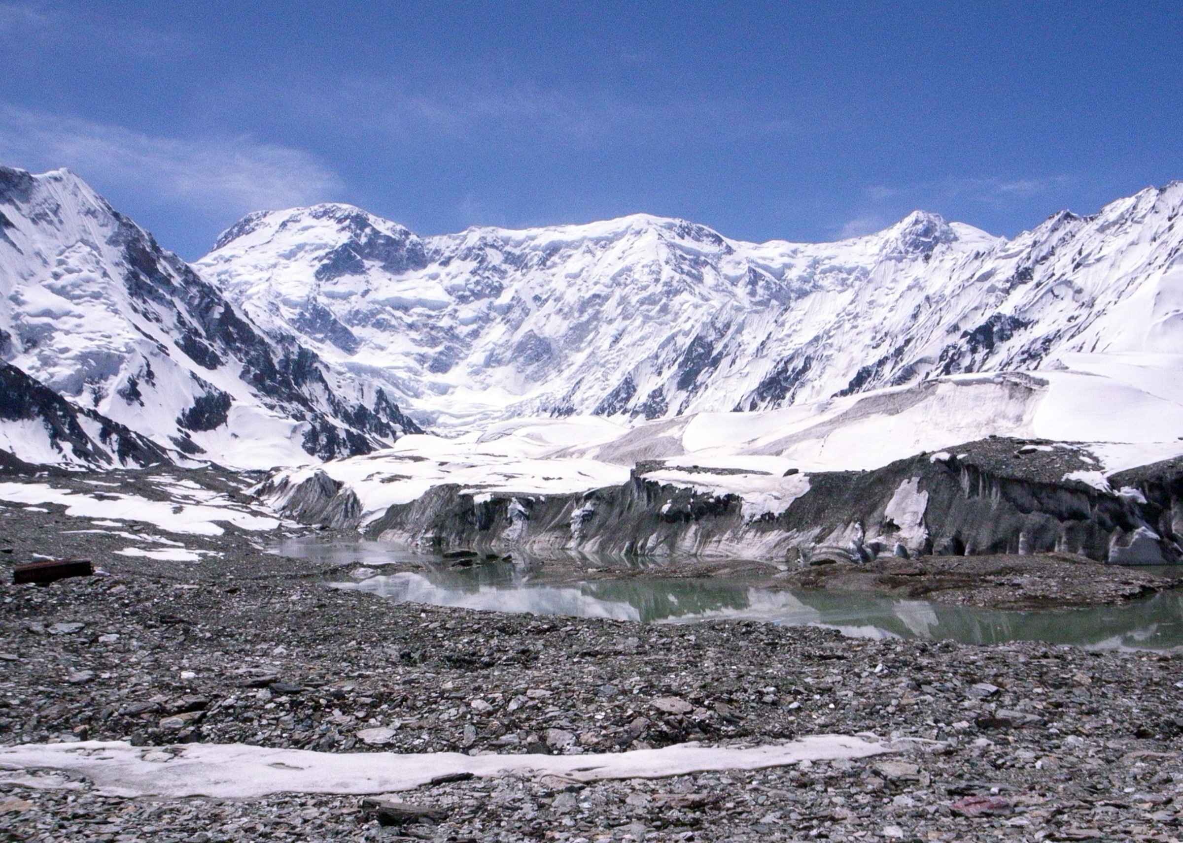
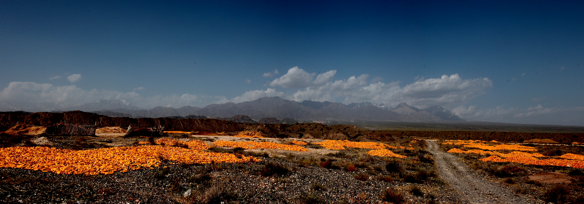
The Aksu-Tomur region sits on the southern side of the western Tian Shan around Wensu County, Aksu Prefecture and Tomur Peak / Jengish Chokusu, the highest summit of the Tian Shan. The walking landscape is dramatic but constrained: red-bed canyons, dry valleys, Kyrgyz cultural landscapes, ancient walnut groves, irrigated foothill villages and distant glacier-clad peaks. The high Tomur core is mountaineering and protected-area terrain, not a normal day-hiking zone; the realistic non-technical day walks are mainly in managed canyon, garden and village scenic areas around Wensu.
UNESCO identifies Tomur as one of the components of the Xinjiang Tianshan World Heritage property. The current day-hike catalogue therefore avoids glacier or summit objectives and focuses on accessible canyon and foothill walks. In this pass, no AllTrails trail candidates were returned near the Aksu-Tomur search area, and no official downloadable GPX/KML route files were found for the selected walks. Statistics are marked unresolved where sources verify the attraction but not the walking geometry.
Selection rationale
The five hikes below cover the essential visitor-scale walking character of the Aksu-Tomur area: the Wensu / Tianshan Tomur Grand Canyon, Bozidun canyon scenery, the ancient trees and springs of Tianshan Shenmu Garden, and the Tacun / Guiyuan Tianju cultural landscape beneath Tomur views. Exact distance and elevation data are sparse, so route-file work should be treated as a later manual mapping task rather than complete GPS extraction.
Summary table
| # | Hike | Country | Route type | Distance | Gain | Max elevation | Difficulty |
|---|---|---|---|---|---|---|---|
| 1 | Wensu Grand Canyon Valley 4 to Valley 3 traverse | China | Point-to-point / shuttle-assisted canyon walk | itinerary time about 3.5 hours | Significant descent noted; exact gain/loss unresolved | Moderate-hard | |
| 2 | Wensu Grand Canyon Valley 3 canyon-bottom walk | China | Out-and-back / local loop | Minor to moderate | Moderate | ||
| 3 | Tianshan Tomur Grand Canyon and Bozidun Canyon view walk | China | Shuttle-assisted canyon walk | Moderate | |||
| 4 | Tianshan Shenmu Garden ancient walnut and holy spring loop | China | Loop / scenic garden walk | time 2-3 hours | Minor | Easy | |
| 5 | Tacun / Guiyuan Tianju orchard and Tomur-view walk | China | Village and orchard walk | Minor | Easy-moderate |
1. Wensu Grand Canyon — Valley 4 to Valley 3 Traverse
Snapshot
Itinerary
Begin at Valley 4, where the published itinerary describes walking along a wooden plank walkway among the canyon’s red-bed rock formations for about one hour. Descend carefully from Valley 4 to Valley 3; the source notes a significant elevation change and the need to pay attention to safety. Spend about one hour exploring Valley 3 before returning or continuing to other valleys if current scenic-area rules, weather and fitness allow.
This route is one of the few clearly described walking itineraries found for the Aksu-Tomur area, but no official GPX/KML file or exact distance was found in this pass.
Why it is essential
The Wensu / Tomur canyon landscape is the region’s signature non-technical walking terrain. The Valley 4 to Valley 3 traverse gives walkers a close canyon experience instead of only a shuttle-window viewpoint.
Equipment
- Hiking shoes with grip
- Sun hat, sunglasses, sunscreen
- At least 1.5-2 litres of water per person in warm weather
- Snacks
- Light gloves for railings/rock if desired
- Offline map and a charged phone
Hazards and notes
- Avoid the canyon during heavy rain or storm forecasts because flash flooding and slippery plank roads are serious risks.
- Heat, sun exposure, loose sediment, steep steps/descents and limited escape options can make the walk harder than the distance suggests.
GPX / KML links
| Source | URL | Format / access | Reuse status |
|---|---|---|---|
| OpenStreetMap: Wensu Grand Canyon search | openstreetmap.org | Map / search | OSM data is ODbL |
| IntoTravelChina: Wensu Grand Canyon hiking itinerary | intotravelchina.com | Source page / route itinerary | Site terms apply; no route-file licence found |
External links
- IntoTravelChina — Wensu Grand Canyon hiking route
- China Daily — Tianshan Tomur Grand Canyon overview
- UNESCO World Heritage Centre — Xinjiang Tianshan
2. Wensu Grand Canyon — Valley 3 Canyon-Bottom Walk
Snapshot
Itinerary
This shorter canyon-bottom option focuses on Valley 3 without committing to the higher Valley 4 descent. The consulted itinerary describes spending about one hour exploring Valley 3 after descending from Valley 4; this entry isolates that section as a more manageable stand-alone day-walk component for visitors with less time or uncertain conditions.
Because the exact signed path, distance and elevation are not published in the consulted sources, this should be mapped locally before being treated as a finished route.
Why it is essential
Valley 3 is a practical canyon-floor experience in the Tomur red-bed landscape. It is useful as the moderate alternative to the more committing Valley 4 to Valley 3 traverse.
Equipment
- Trail shoes
- Sun protection
- Water and snacks
- Offline map
- Light rain shell (canyon weather can change quickly even in a dry climate)
Hazards and notes
- Do not enter narrow canyon sections during rain or when storms are forecast upstream.
- Follow open scenic-area paths and avoid climbing unstable sediment walls.
GPX / KML links
| Source | URL | Format / access | Reuse status |
|---|---|---|---|
| OpenStreetMap: Wensu Grand Canyon search | openstreetmap.org | Map / search | OSM data is ODbL |
| IntoTravelChina: Wensu Grand Canyon hiking itinerary | intotravelchina.com | Source page / route itinerary | Site terms apply; no route-file licence found |
External links
- IntoTravelChina — Wensu Grand Canyon hiking route
- China Daily — Tianshan Tomur Grand Canyon overview
3. Tianshan Tomur Grand Canyon and Bozidun Canyon View Walk
Snapshot
Itinerary
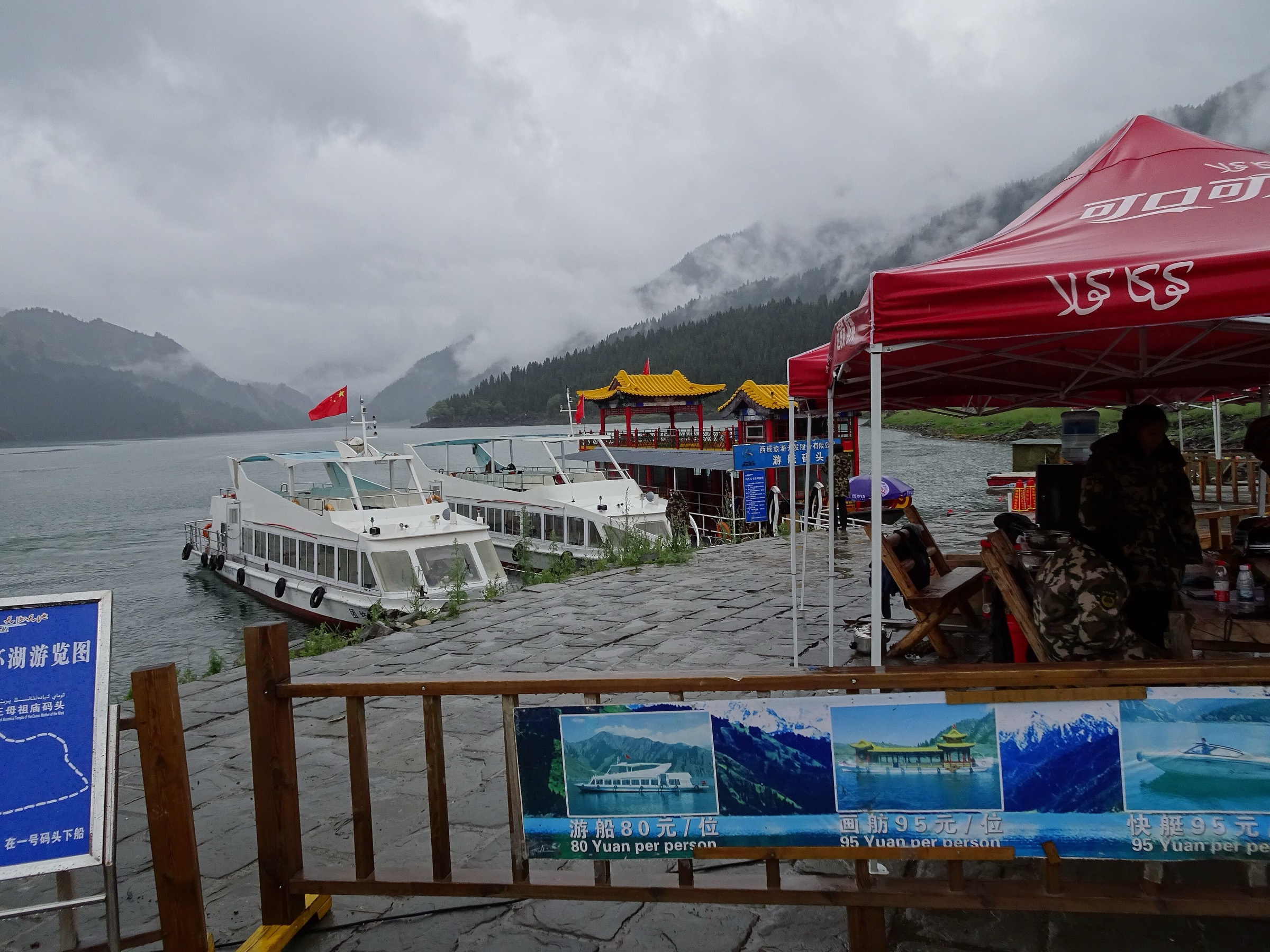
This route uses the managed Tianshan Tomur Grand Canyon scenic area to sample the broader canyon system, including Bozidun Canyon and Talang Valley where open. The China Daily / China Services page describes the scenic area as covering about 200 sq km within Tomur Peak National Nature Reserve, with scenic shuttles used to move visitors through canyon wonders and Kyrgyz cultural settings.
The walking portion needs on-site confirmation: the source verifies the landscape, shuttle access and component canyons, but not a downloadable walking route.
Why it is essential
This is the catalogue’s broader Tomur canyon entry. It links the Aksu-Tomur region to the red-bed canyon group described as the largest of its kind in China and gives a non-technical alternative to the inaccessible high Tomur glacier core.
Equipment
- Hiking shoes
- Sun protection
- Warm layer for shoulder seasons
- Water and snacks
- Offline map
- Identification / ticket documents as required
Hazards and notes
- Canyon flash floods, heat, loose sediment, restricted zones and shuttle dependence are the main issues.
- Check whether any side valleys are closed for conservation, construction or weather.
GPX / KML links
| Source | URL | Format / access | Reuse status |
|---|---|---|---|
| OpenStreetMap: Tomur Peak Xinjiang search | openstreetmap.org | Map / search | OSM data is ODbL |
| OpenStreetMap: Wensu Grand Canyon search | openstreetmap.org | Map / search | OSM data is ODbL |
| China Daily: Tianshan Tomur Grand Canyon | govt.chinadaily.com.cn | Official tourism / source page | No route-file licence found |
External links
4. Tianshan Shenmu Garden — Ancient Walnut and Holy Spring Loop
Snapshot
Itinerary
Start at the main entrance and follow the published sequence through the Sacred Tree, ancient tree group, Holy Water Spring, sand-therapy area and exit. The site is more cultural-nature walk than mountain trail, but it is an important lower-elevation counterpart to the Tomur canyon routes.
The guide identifies the ancient walnut group as about 1,300 years old and describes the site as suitable for all ages, including stroller and wheelchair-friendly access. Exact route length and elevation statistics were not found.
Why it is essential
Tianshan Shenmu Garden gives the Aksu-Tomur entry a living cultural landscape: ancient walnuts, springs and oasis-edge settlement rather than only dry canyon walls.
Equipment
- Comfortable walking shoes
- Sun protection
- Water
- Light layers
Hazards and notes
- Low technical risk.
- Heat, sun exposure, crowding and unclear current access are the main concerns.
- Stay on open paths around ancient trees and spring features.
- Mobility-friendly access should still be confirmed before travel because scenic-area conditions can change.
GPX / KML links
| Source | URL | Format / access | Reuse status |
|---|---|---|---|
| OpenStreetMap: Tianshan Shenmu Garden search | openstreetmap.org | Map / search | OSM data is ODbL |
| LoongWander: Tianshan Shenmu Garden | loongwander.com | Source page / scenic route | Site terms apply; no route-file licence found |
External links
5. Tacun / Guiyuan Tianju Orchard and Tomur-View Walk
Snapshot
Itinerary
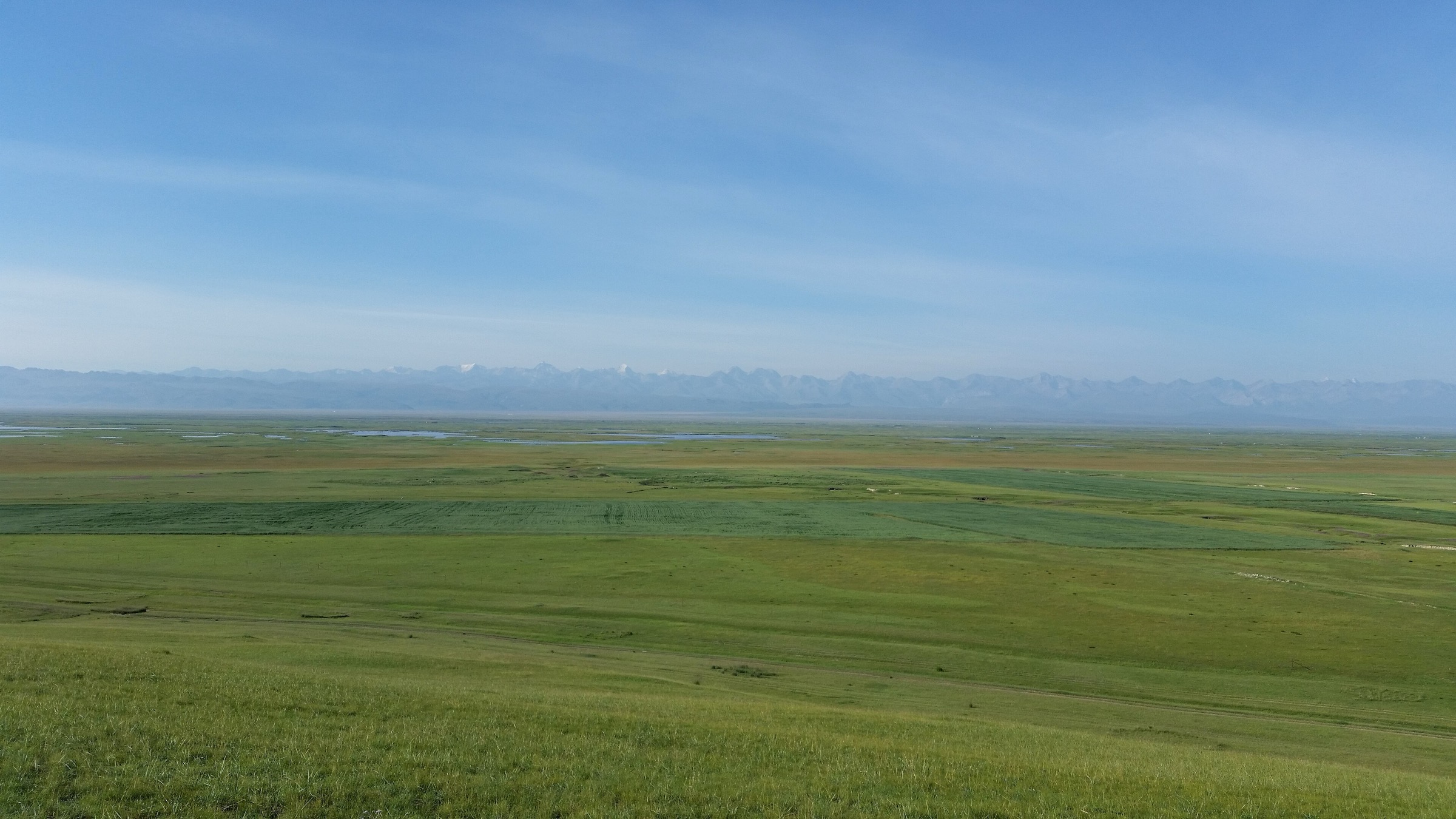
Walk the village and agricultural landscape around Tacun / Guiyuan Tianju, linking walnut gardens, apple orchards, rice fields, tulip fields, homestay lanes and open viewpoints towards Tomur Peak where visible. This is not a mountain summit hike; it is a foothill cultural walk within the same Aksu-Tomur tourism area.
Exact walking distance, elevation gain and public right-of-way details were not verified, so this route should be locally confirmed before publication as a formal trail.
Why it is essential
The Aksu-Tomur landscape is not only canyon geology. Tacun / Guiyuan Tianju adds the oasis, orchard and Kyrgyz/cultural foothill setting that makes the southern Tian Shan human landscape legible.
Equipment
- Comfortable shoes
- Sun protection
- Water
- Light rain layer
- Translation / offline map tool
Hazards and notes
- The main concerns are access permission, heat, dogs/livestock, irrigation channels, traffic on village roads and unclear path continuity.
- Respect farm boundaries and village privacy.
- This is best treated as a guided or locally supported walk until a verified route line is available.
GPX / KML links
| Source | URL | Format / access | Reuse status |
|---|---|---|---|
| OpenStreetMap: Guiyuan Tianju Tacun Wensu search | openstreetmap.org | Map / search | OSM data is ODbL |
| LoongWander: Guiyuan Tianju / Tacun | loongwander.com | Source page / attraction guide | Site terms apply; no route-file licence found |
External links
Missing data and follow-up
- No official GPX/KML downloads or clean walking-only route relations were found for the selected Aksu-Tomur hikes in this pass.
- Wensu / Tomur canyon route statistics are mostly missing except for itinerary timing and qualitative descent notes.
- Shenmu Garden and Tacun are important cultural/nature walks, but their distance/elevation statistics require local mapping or field confirmation.
- High Tomur glacier and summit terrain was intentionally excluded because it is protected/mountaineering terrain rather than a normal day-hiking objective.
- No specific licence-compatible image was verified for Tianshan Shenmu Garden in this pass.
External links
| Source | URL |
|---|---|
| IntoTravelChina — Wensu Grand Canyon hiking route | intotravelchina.com |
| China Daily — Tianshan Tomur Grand Canyon | govt.chinadaily.com.cn |
| UNESCO World Heritage Centre — Xinjiang Tianshan | whc.unesco.org |
| LoongWander — Tianshan Shenmu Garden | loongwander.com |
| LoongWander — Guiyuan Tianju / Tacun | loongwander.com |