Regional overview
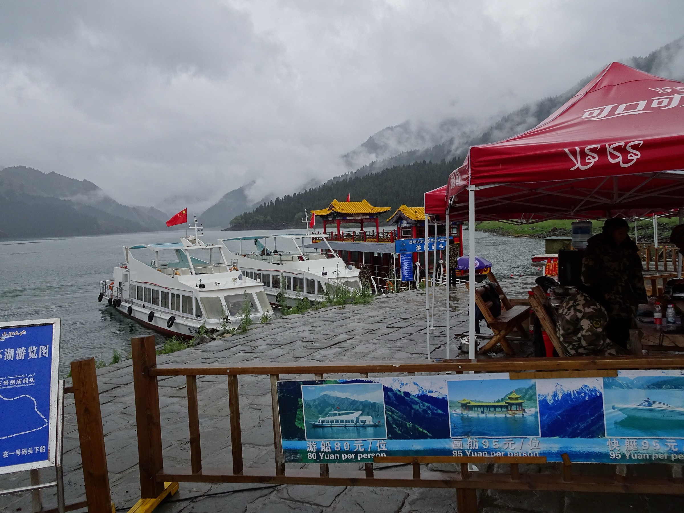
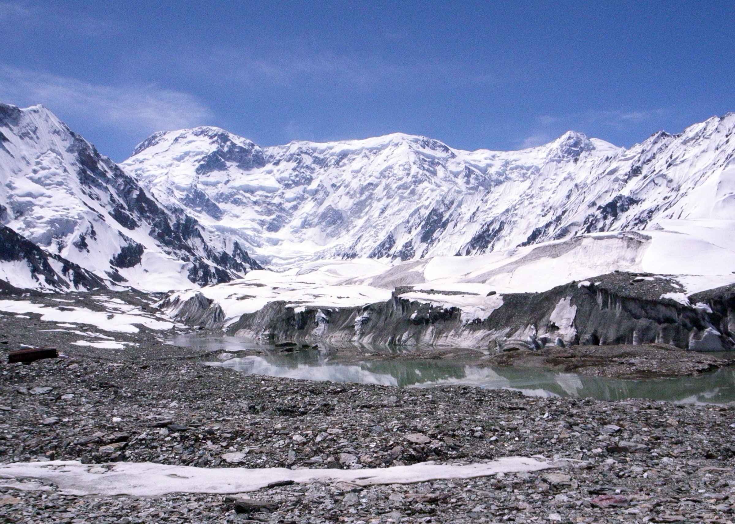
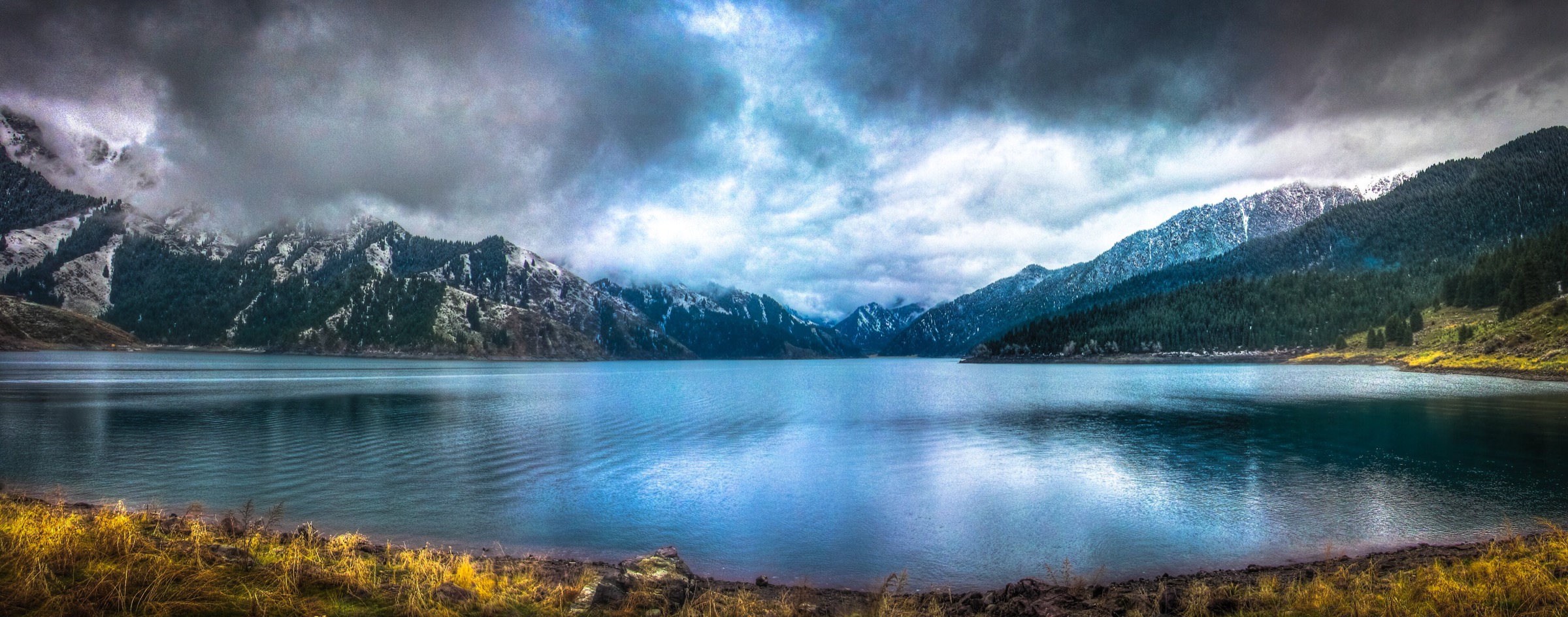
Bogda Shan is the eastern Tian Shan massif east of Urumqi, anchored by Bogda Peak at 5,445 m and the heavily visited Tianchi / Heavenly Lake scenic area on its north side. The walking character is a mix of managed Chinese scenic-area infrastructure, forested lake paths, short waterfall and temple walks, high cable-car viewpoints, and much more serious multi-day Bogda trekking routes beyond the day-hike scope.
Tianchi is part of the Xinjiang Tianshan UNESCO World Heritage serial property. UNESCO identifies Bogda as one of the four components of the property and describes Xinjiang Tianshan as a landscape of glacier-capped peaks, forests, meadows, clear lakes and rivers, and strong desert-mountain contrast. The core visitor area is ticketed and normally uses scenic buses between the entrance and lake area.
The normal walking season is late spring to early autumn. Snow, ice, avalanche-damaged paths, storm closures, and changing scenic-area access rules can affect the lake circuit and side trails. The more remote approaches towards Bogda Peak are alpine trekking terrain and are not treated here as ordinary day hikes.
Selection rationale
The five hikes below cover the region’s essential day-walking spectrum: the classic Tianchi lakeside circuit, the lower East Small Heavenly Lake waterfall walk, the west-bank cultural lakeside walk, the high Maya Mountain viewpoint, and the Denggan Mountain landform boardwalk. Only the Tianchi full circuit has strong public GPS statistics from a recorded Wikiloc route; the others are well-attested scenic-area walks but lack official GPX-grade statistics.
Summary table
| # | Hike | Country | Route type | Distance | Gain | Max elevation | Difficulty |
|---|---|---|---|---|---|---|---|
| 1 | Tianchi Lake full lakeside circuit | China | Loop | 14.3 km | 770 m | 2,043 m | Moderate-hard |
| 2 | East Small Heavenly Lake and waterfall walk | China | Out-and-back / short loop | Approx. 2-4 km | Approx. 100-250 m | Approx. 2,000 m | Easy-moderate |
| 3 | West-bank Queen Mother Temple walk | China | Out-and-back / lakeside linear walk | Approx. 3-5 km | Minor to moderate | Approx. 2,000 m | Easy-moderate |
| 4 | Maya Mountain lift-assisted summit-deck walk | China | Lift-assisted out-and-back | Approx. 3 km walking after cable car | 3,056 m | Moderate | |
| 5 | Denggan Mountain stone-forest boardwalk | China | Short loop / out-and-back | Approx. 2-4 km | Easy-moderate |
1. Tianchi Lake full lakeside circuit
Snapshot
Itinerary
The route circles Tianchi from the main lake area, following a mixture of lakeside paths, boardwalks, forest tracks and higher undulating sections above the shore. The circuit gives repeated views across the lake towards the Bogda range, with spruce forest, temple and side-valley scenery around the lake margin.
The strongest published statistics found in this pass are from the Wikiloc “Tianchi lake round hike” recording. The same Wikiloc description warns that the path around the lake had been closed after winter avalanche damage when recorded in May 2018, so current scenic-area path status must be checked before treating this as an available circuit.
Why it is essential
This is the most complete day walk at Heavenly Lake. It turns the standard viewpoint visit into a real circuit of the lake basin and gives the best single-day sense of the Bogda north-slope landscape.
Equipment
Mountain hiking equipment: sturdy hiking shoes or boots, waterproof/windproof layer, warm layer, water, food, sun protection, map/GPS backup, and trekking poles recommended. Carry gloves and a hat outside midsummer.
Hazards and notes
Avalanche-damaged or seasonally closed path sections are the key unresolved issue. Snow and ice can remain or return early at this elevation. Stay on open scenic-area paths and obey closures. The lake is in a ticketed scenic area with shuttle controls, so start times depend on current operating hours.
GPX / KML links
| Source | URL | Format / access | Reuse status |
|---|---|---|---|
| Wikiloc: Tianchi lake round hike | wikiloc.com | Route page / downloadable GPS track through Wikiloc | Wikiloc terms apply; source-map / route-file candidate; geometry should be checked against current open paths |
| OpenStreetMap: Tianchi Lake search | openstreetmap.org | Map/search | OSM data is ODbL; geometry cross-check only |
| Wikimedia Commons category: Tianchi Lake of Tian Shan | commons.wikimedia.org | Geotagged media category | Commons file licences vary; photo-location cross-check only |
External links
- Wikiloc — Tianchi lake round hike
- UNESCO World Heritage Centre — Xinjiang Tianshan
- China Discovery — Tianchi / Heavenly Lake
2. East Small Heavenly Lake and waterfall walk
Snapshot
Itinerary
The walk leaves the main Tianchi visitor area for the smaller lake and waterfall area east of the main basin. Published guide material identifies Little Heavenly East Lake as the easiest walking target from Tianchi, while Tianchi attraction guides describe the surrounding lake, waterfall and side-valley scenery as part of the scenic area.
Exact modern path geometry, distance and elevation gain were not found from an official source. Treat this as a short scenic-area walk that should be confirmed on the current Tianchi map at the visitor centre.
Why it is essential
This is the most accessible short natural side-walk at Heavenly Lake, giving a lower-commitment alternative to the full circuit while still showing the small-lake and waterfall landscape around the main basin.
Equipment
Standard hiking equipment: walking shoes with good grip, weatherproof layer, warm layer, water, snacks, sun protection and a phone/map backup.
Hazards and notes
Boardwalks and steps can be slippery after rain, snow or frost. Follow the signed scenic-area path and do not enter closed gullies. Official distance and gain remain unresolved.
GPX / KML links
| Source | URL | Format / access | Reuse status |
|---|---|---|---|
| OpenStreetMap: East Small Heavenly Lake search | openstreetmap.org | Map/search | OSM data is ODbL; geometry cross-check only; no route relation selected |
| Lonely Planet: Tian Chi Lake attraction page | lonelyplanet.com | Guide page | Site terms apply; no route-file licence found; confirms East Little Heavenly Lake as an easy walk target |
| China Discovery: Tianchi / Heavenly Lake | chinadiscovery.com | Attraction guide | Site terms apply; no route-file licence found; landmark and scenic-area cross-check only |
External links
3. West-bank Queen Mother Temple walk
Snapshot
Itinerary
From the main lake area, follow the signed lakeside trestle road towards the west bank and the Queen Mother Temple area. The route stays close to Tianchi’s shore for much of the way, with views back across the lake and towards the Bogda range. It can be walked as a simple out-and-back if the full lake circuit is closed or too long.
Xinjiang Travel describes a walk along the trestle road to the Queen Mother Temple on the west bank taking about 1.5 hours. Exact route distance and cumulative ascent were not found from an official source.
Why it is essential
This walk adds the main cultural element of Tianchi, linking the lake landscape with Queen Mother of the West traditions and the west-bank temple setting. It is also a practical shorter alternative to the full circuit.
Equipment
Standard hiking equipment: walking shoes, weatherproof layer, warm layer, water, snacks and sun protection. A headtorch is useful only for late-season short daylight margins, but walking after scenic-area hours should not be assumed possible.
Hazards and notes
The route is subject to scenic-area opening hours, crowding and path controls. Steps and boardwalks may be icy outside summer. Confirm whether the west-bank route is open before starting.
GPX / KML links
| Source | URL | Format / access | Reuse status |
|---|---|---|---|
| OpenStreetMap: Queen Mother Temple Tianchi search | openstreetmap.org | Map/search | OSM data is ODbL; geometry cross-check only |
| Xinjiang Travel: Heavenly Lake | xinjiangtravel.org | Attraction guide | Site terms apply; no route-file licence found; access and timing cross-check only |
External links
4. Maya Mountain lift-assisted summit-deck walk
Snapshot
Itinerary
The route uses the Maya Mountain cable car from the Tianchi scenic area to reach the high ridge above the lake. From the upper station, continue on the signed high-level path or plank-road section towards the summit viewing deck. The objective is the panorama over Tianchi, the forested basin and the Bogda range.
Travel of China cites Maya Mountain at 3,056 m and describes a 1.5 km walk to the summit deck after cable-car access. Into Travel China also identifies Mayashan as a high panoramic viewpoint over Heavenly Lake and Bogda Peak.
Why it is essential
Maya Mountain gives the highest normal visitor viewpoint in the Tianchi area without entering alpine climbing terrain. It is the clearest day-hike-style way to see the lake basin from above.
Equipment
Mountain hiking equipment: sturdy shoes, windproof/waterproof layer, warm layer, sun protection, water and snacks. Gloves and hat are recommended outside midsummer. Carry cash/card/phone payment for current cable-car ticketing.
Hazards and notes
At over 3,000 m, wind, cold, lightning and sudden weather changes are more serious than at the lake. The route is dependent on cable-car operations; do not assume access in storms, high winds or snow.
GPX / KML links
| Source | URL | Format / access | Reuse status |
|---|---|---|---|
| OpenStreetMap: Maya Mountain Tianchi search | openstreetmap.org | Map/search | OSM data is ODbL; geometry cross-check only |
| Travel of China: Tianchi Lake guide | travelofchina.com | Attraction guide | Site terms apply; no route-file licence found; elevation and walking-section cross-check only |
| Into Travel China: Heavenly Lake / Tianchi | intotravelchina.com | Attraction guide | Site terms apply; no route-file licence found; viewpoint and access cross-check only |
External links
5. Denggan Mountain stone-forest boardwalk
Snapshot
Itinerary
Denggan Mountain is identified by Tianchi guide material as one of the scenic areas around Heavenly Lake, about 4 km from the main lake area. China Discovery describes a zigzag wooden walking trail through unusual landforms and rock shapes. The day-hike version is a short boardwalk/viewpoint walk rather than a remote mountain route.
No official GPX, distance, elevation gain or current path map was found in this pass. It should remain a candidate route until a current Tianchi scenic-area map or GPS track is obtained.
Why it is essential
Denggan Mountain adds the region’s landform/stone-forest character to the lake, temple and high-viewpoint walks. It broadens the Bogda entry beyond the immediate Tianchi shoreline.
Equipment
Standard hiking equipment: walking shoes with grip, weatherproof layer, warm layer, water and sun protection.
Hazards and notes
The main unresolved issue is current public access and route geometry. Scenic-area shuttles, boardwalk repairs, snow and closures may determine whether this is walkable on a given day.
GPX / KML links
| Source | URL | Format / access | Reuse status |
|---|---|---|---|
| OpenStreetMap: Denggan Mountain Tianchi search | openstreetmap.org | Map/search | OSM data is ODbL; geometry cross-check only |
| China Discovery: Tianchi / Heavenly Lake | chinadiscovery.com | Attraction guide | Site terms apply; no route-file licence found; landmark and walking-trail cross-check only |
External links
- China Discovery — Tianchi scenic-area subdivisions and Denggan Mountain note
- UNESCO World Heritage Centre — Xinjiang Tianshan
External links
| Source | URL |
|---|---|
| UNESCO World Heritage Centre — Xinjiang Tianshan | whc.unesco.org |
| China Discovery — Tianchi / Heavenly Lake | chinadiscovery.com |
| Xinjiang Travel — Heavenly Lake | xinjiangtravel.org |
| Lonely Planet — Tian Chi Lake | lonelyplanet.com |
| Travel of China — Tianchi Lake | travelofchina.com |
| Into Travel China — Heavenly Lake of Tianshan | intotravelchina.com |
| Wikiloc — Tianchi lake round hike | wikiloc.com |