Regional overview
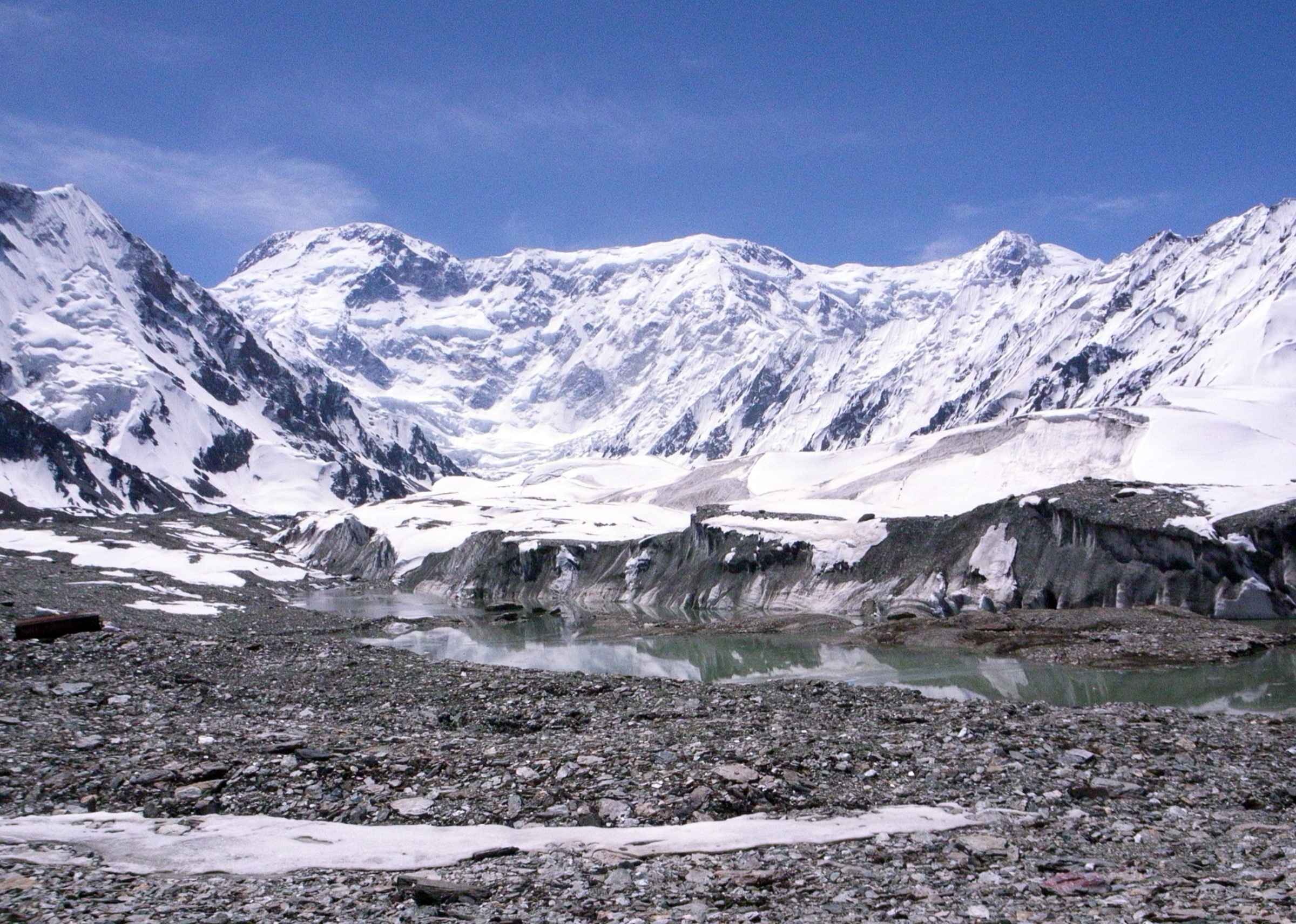
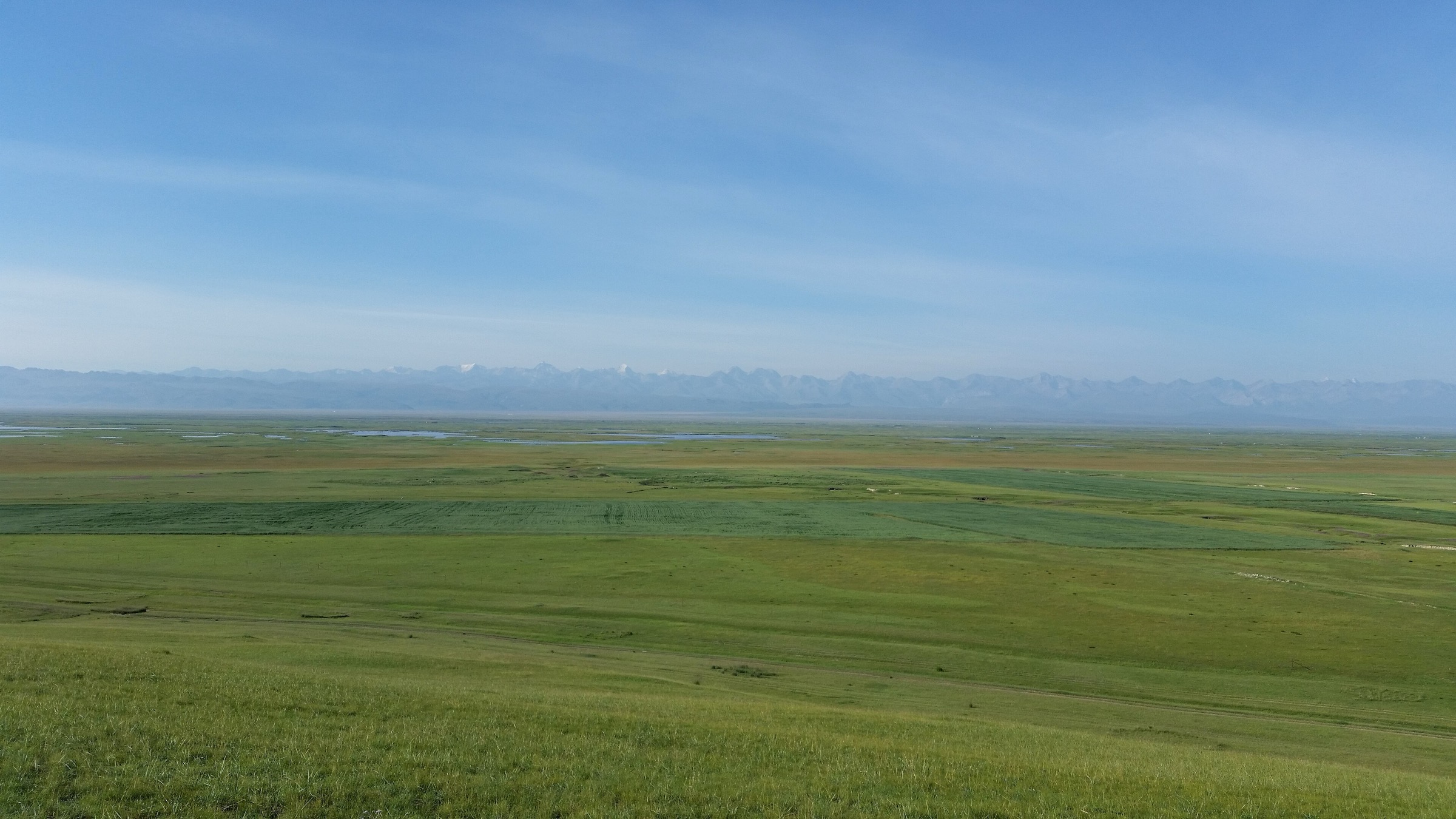
The Bayanbulak region is the high grassland heart of the central Xinjiang Tian Shan: broad alpine basins, meandering wetland rivers, swan habitat, Kazakh and Mongolian pastoral culture, spruce forest pockets, hot-spring valleys, and long views to snow peaks. The area’s best-known protected landscape is Bayinbukuke / Bayanbulak, one of the four components of the UNESCO-listed Xinjiang Tianshan serial property. In practical hiking terms, however, much of the region is not an open Western-style trail network. Key sites are reached through ticketed scenic areas, internal shuttle roads, boardwalks, viewpoints, and seasonal visitor controls.
Summer and early autumn are the normal walking seasons. The high grasslands sit around 2,500 m, and weather can be cold, windy, wet, or snowy outside the main season. Roads across the Tian Shan passes may be affected by snow or temporary controls. In this pass, AllTrails nearby searches around Bayanbulak, Aksu-Tomur, and Barkol-Hami returned no matching trail candidates, so the entries below rely on official/protected-area context, local scenic-area guides, open map searches, and open-licence media records rather than downloadable trail-database GPX tracks.
Selection rationale
The five hikes below represent the most useful day-walking targets in and around the Bayanbulak central Tian Shan grassland corridor: the iconic Nine Bends sunset viewpoint, the Swan Lake wetland route, and three forest, waterfall and high-meadow routes in nearby Gongnaisi National Forest Park. Exact pedestrian statistics remain unresolved for the managed scenic-area walks because published routes usually describe shuttle-assisted visitor itineraries rather than clean foot-only tracks.
Summary table
| # | Hike | Country | Route type | Distance | Gain | Max elevation | Difficulty |
|---|---|---|---|---|---|---|---|
| 1 | Bayanbulak Nine Bends and Basilik Viewing Platform | China | Shuttle-assisted out-and-back / viewpoint walk | Walking distance unresolved; scenic route total about 67 km by internal transport | About 2,500 m regional average | Easy-moderate | |
| 2 | Bayanbulak Swan Lake and Barun Kure wetland walk | China | Shuttle-assisted wetland walk | Walking distance unresolved; scenic route total about 67 km by internal transport | Minor | About 2,500 m regional average | Easy |
| 3 | Gongnaisi Banchan Valley, Forest Oxygen Bar and Fairy Lake | China | Out-and-back / local circuit | About 5 km | Park elevation range 1,600-2,400 m | Moderate | |
| 4 | Gongnaisi Arxian Hot Spring, Yikensala Waterfall and Banhu Viewpoint | China | Out-and-back / linear scenic route | About 8 km | Park elevation range 1,600-2,400 m | Moderate-hard | |
| 5 | Gongnaisi alpine meadow, virgin forest and glacier relics route | China | Out-and-back / linear mountain route | About 12 km | Park elevation range 1,600-2,400 m | Hard |
1. Bayanbulak Nine Bends and Basilik Viewing Platform
Snapshot
Itinerary
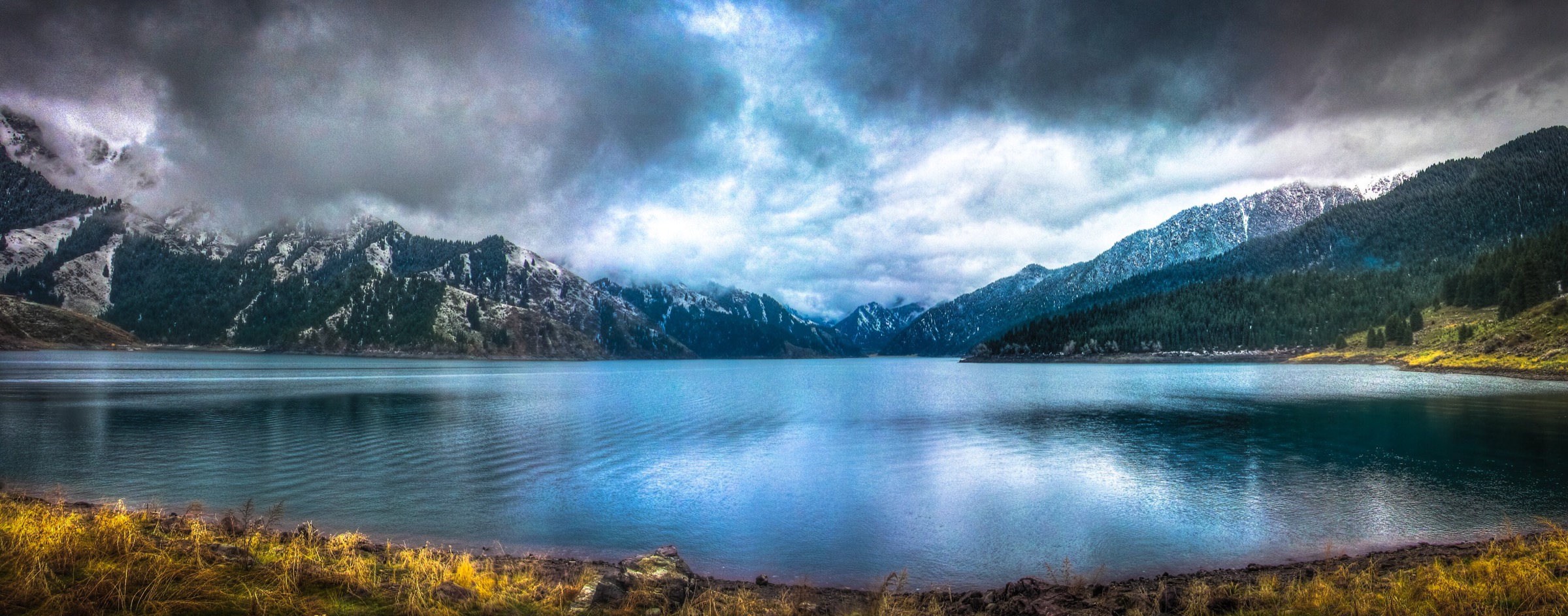
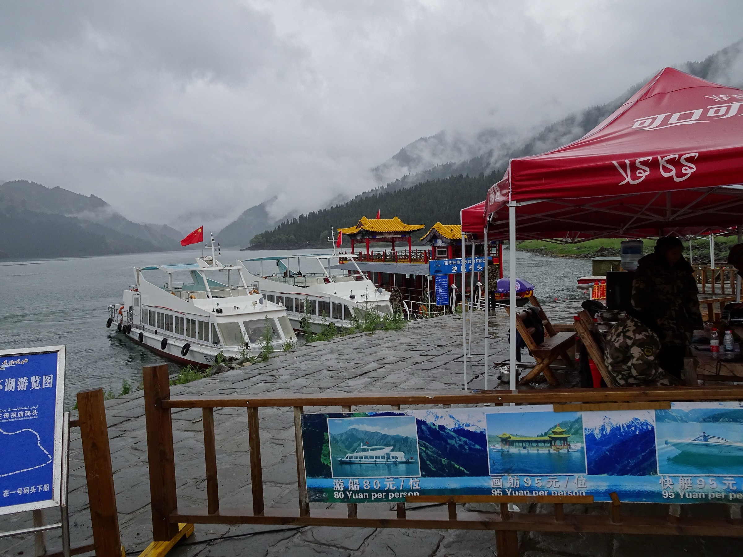
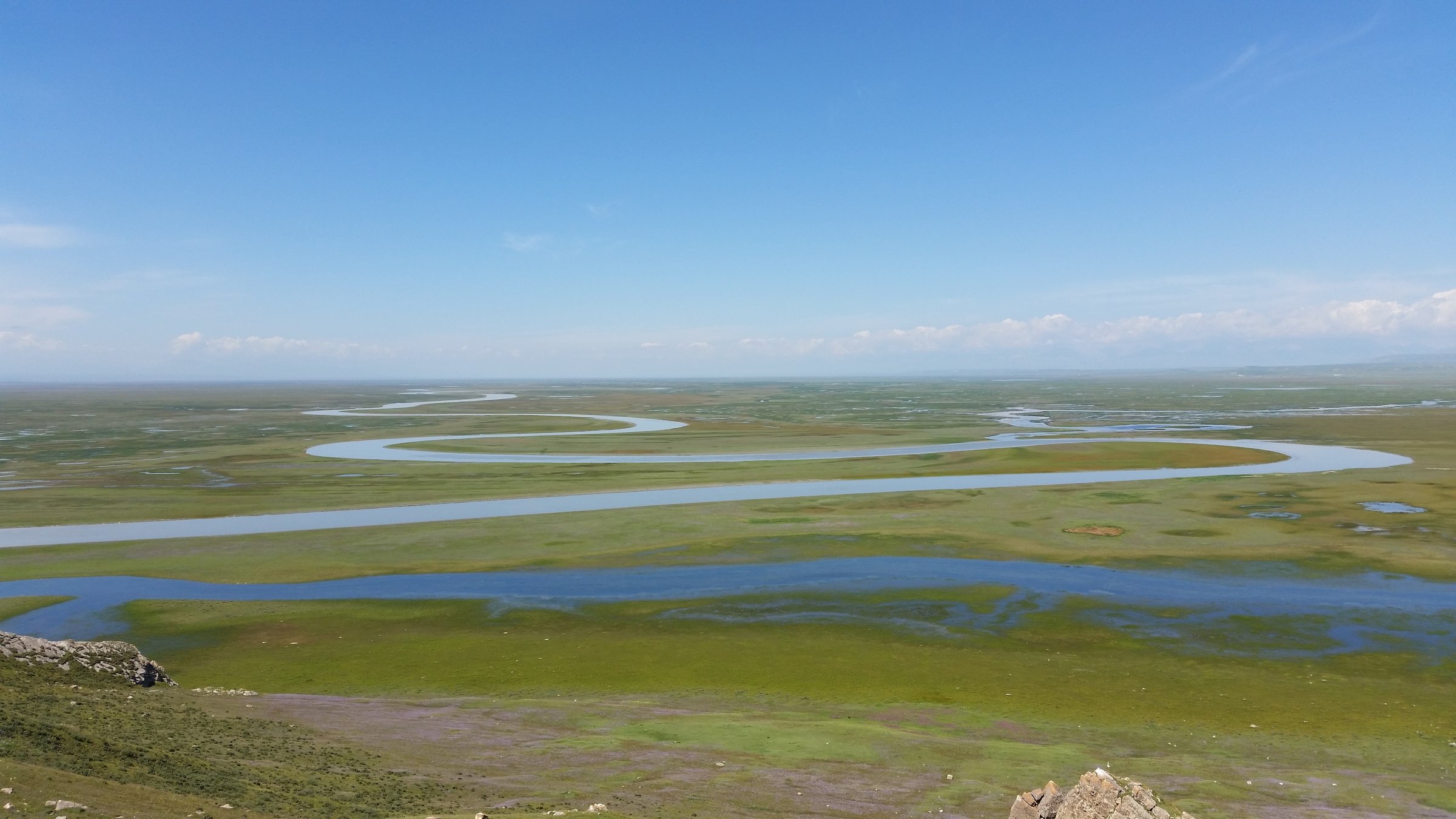
This is the classic Bayanbulak walk-and-viewpoint objective. From the visitor centre, use the current scenic-area transport system towards the Kaidu River wetland landscape and the Basilik Viewing Platform. The final pedestrian section is a constructed viewpoint approach rather than an open-country hike. From the platform, the Kaidu River’s bends, oxbows, meadows and wetland channels form the region’s defining panorama, especially in evening light.
The main unresolved item is the exact walking line. The local scenic-area guide verifies a visitor-centre route of about 67 km total when Swan Lake, Barun Kure and Basilik Viewing Platform are linked, but this figure is a transport itinerary rather than a GPX-grade walking distance.
Why it is essential
The Nine Bends and Eighteen Turns view is the signature Bayanbulak image and the clearest single expression of the central Tian Shan grassland-wetland landscape. It also represents the Bayinbukuke component of the UNESCO Xinjiang Tianshan property.
Equipment
Comfortable walking shoes, warm windproof layer, rain shell, sun hat, sunscreen, water, snacks and a headlamp if returning after sunset. Even in summer, carry insulation because the plateau can be cold and windy.
Hazards and notes
The main hazards are cold wind, storms, muddy or slippery boardwalks/steps, altitude effects around 2,500 m, crowding at sunset, and missing the final internal shuttle. Stay on authorised paths to protect wetland habitat.
GPX / KML links
| Source | URL | Format / access | Reuse status |
|---|---|---|---|
| OpenStreetMap search: Bayanbulak Nine Bends and Eighteen Turns | openstreetmap.org | Map/search | OSM data is ODbL; geometry cross-check only; no route relation selected |
| LoongWander: Bayanbulak Scenic Area | loongwander.com | Source page / scenic-area route | Site terms apply; no route-file licence found; landmark, access pattern and 67 km scenic route verification only |
External links
2. Bayanbulak Swan Lake and Barun Kure wetland walk
Snapshot
Itinerary
This lower-impact walking day focuses on Bayanbulak’s wetland side rather than the sunset panorama. From the visitor centre, follow the current shuttle sequence to Swan Lake and Barun Kure. Walking is likely on boardwalks, signed paths and short viewpoint approaches around the wetland margin. The landscape is open, exposed and slow-moving: lakes, marsh channels, grazing meadows and bird habitat.
The route should be treated as a managed nature walk. The exact boardwalk length was not verified in this pass, and the available published route distance describes the total scenic-area transport circuit rather than the walking portion.
Why it is essential
Swan Lake gives the catalogue the ecological counterpart to the Nine Bends viewpoint. It is the most direct way for walkers to experience Bayanbulak as a wetland and wildlife landscape rather than only as a scenic overlook.
Equipment
Comfortable shoes with grip, warm windproof layer, rain shell, sun protection, water and binoculars for birdwatching. In spring and autumn, add gloves and a hat.
Hazards and notes
Do not leave constructed paths in wetland areas. Weather can be harsh for an easy walk because of the exposed plateau setting. Mosquitoes may be present in warm wetland conditions. Bird habitat and swan protection rules should be followed strictly.
GPX / KML links
| Source | URL | Format / access | Reuse status |
|---|---|---|---|
| OpenStreetMap search: Bayanbulak Swan Lake | openstreetmap.org | Map/search | OSM data is ODbL; geometry cross-check only; no route relation selected |
| LoongWander: Bayanbulak Scenic Area | loongwander.com | Source page / scenic-area route | Site terms apply; no route-file licence found; landmark and route-sequence verification only |
External links
3. Gongnaisi Banchan Valley, Forest Oxygen Bar and Fairy Lake
Snapshot
Itinerary
The route described by the local scenic guide starts in Banchan Valley, continues through the Forest Oxygen Bar and an observation deck, and finishes around Fairy Lake before returning by the same route or a local circuit if open. This changes the regional flavour from open steppe to spruce forest, stream valley, meadow edges and lake scenery.
The distance and time are published, but elevation gain/loss and exact GPX geometry were not found in a reusable form during this pass.
Why it is essential
Gongnaisi adds the forested central Tian Shan to a Bayanbulak-focused selection. It balances wetland and grassland walks with a short, clear, day-hike-scale route in a national forest park.
Equipment
Light hiking boots or trail shoes, rain shell, warm layer, water, snacks, sun protection, basic first-aid kit and insect protection in summer.
Hazards and notes
Expect variable path condition, wet ground after rain, streamside slips and limited English signage. Mobile coverage may be unreliable. Confirm whether private vehicle, shuttle or guide arrangements are needed on the day.
GPX / KML links
| Source | URL | Format / access | Reuse status |
|---|---|---|---|
| OpenStreetMap search: Gongnaisi National Forest Park | openstreetmap.org | Map/search | OSM data is ODbL; geometry cross-check only; no route relation selected |
| LoongWander: Gongnaisi National Forest Park | loongwander.com | Source page / route guide | Site terms apply; no route-file licence found; route name, distance and time verification only |
External links
4. Gongnaisi Arxian Hot Spring, Yikensala Waterfall and Banhu Viewpoint
Snapshot
Itinerary
This longer Gongnaisi option links the Arxian Hot Spring area, Yikensala Waterfall and Banhu Viewing Platform. It is a water-and-viewpoint route through forested mountain terrain rather than the open Bayanbulak basin. The published distance and time make it one of the stronger day-hike candidates in the region, but detailed vertical statistics remain unresolved.
Why it is essential
The route adds waterfall and hot-spring scenery to the catalogue and gives the central Tian Shan entry a more energetic half-day to day walk than the managed Bayanbulak boardwalks.
Equipment
Hiking boots, trekking poles if trails are wet, rain shell, warm layer, water, food, sunscreen and a basic emergency kit. Carry a downloaded/offline map because route signage and mobile data should not be assumed.
Hazards and notes
Potential hazards include wet rock, streamside slips, muddy trails, sudden weather, altitude-related fatigue and limited rescue/communication options. Hot-spring areas may have fragile ground or access restrictions.
GPX / KML links
| Source | URL | Format / access | Reuse status |
|---|---|---|---|
| OpenStreetMap search: Gongnaisi National Forest Park | openstreetmap.org | Map/search | OSM data is ODbL; geometry cross-check only; no route relation selected |
| LoongWander: Gongnaisi National Forest Park | loongwander.com | Source page / route guide | Site terms apply; no route-file licence found; route name, distance and time verification only |
External links
5. Gongnaisi alpine meadow, virgin forest and glacier relics route
Snapshot
Itinerary
This is the most demanding Gongnaisi route identified in the consulted scenic guide. It links alpine meadow, virgin forest and glacier relics, giving a fuller mountain day than the shorter Banchan Valley and Arxian Hot Spring routes. The source provides a distance of about 12 km and an estimated time of 6-7 hours, but it does not publish elevation gain/loss or a reusable route file.
Use this as a fit-walker summer objective only after confirming current access, weather and path condition locally.
Why it is essential
This route adds the strongest mountain-hiking element to the Bayanbulak/Gongnaisi set: meadow, forest and glacial landform scenery in one long day.
Equipment
Hiking boots, trekking poles, rain shell, warm layer, sun protection, 2 litres or more of water, food, first-aid kit, offline map and emergency communication plan. Carry extra insulation because weather can change quickly in the upper forest and meadow zones.
Hazards and notes
This is the hardest route in the entry. Hazards may include fatigue, altitude, storms, muddy or poorly marked paths, stream crossings, snow patches outside high summer and limited rescue access. Do not continue into protected or unstable glacier terrain without explicit local permission.
GPX / KML links
| Source | URL | Format / access | Reuse status |
|---|---|---|---|
| OpenStreetMap search: Gongnaisi National Forest Park | openstreetmap.org | Map/search | OSM data is ODbL; geometry cross-check only; no route relation selected |
| LoongWander: Gongnaisi National Forest Park | loongwander.com | Source page / route guide | Site terms apply; no route-file licence found; route name, distance and time verification only |
External links
External links
| Source | URL |
|---|---|
| UNESCO World Heritage Centre — Xinjiang Tianshan | whc.unesco.org |
| LoongWander — Bayanbulak Scenic Area | loongwander.com |
| LoongWander — Gongnaisi National Forest Park | loongwander.com |