Regional overview
The Chinese Tian Shan cross Xinjiang from the Bogda peaks above Urumqi through Ili grasslands, glacier valleys, high basins, and lake country towards the Tomur / Khan Tengri sector. The walking character is highly varied: managed lake parks with shuttles and cableways, canyon boardwalks, high grassland viewpoint walks, long horse-and-hiking corridors, and severe glaciated backcountry where ordinary day hikers should not continue without guides and permits.
The UNESCO Xinjiang Tianshan World Heritage property recognises several landscape components, including Bogda / Tianchi, Kalajun-Kuerdening, Bayinbuluke, and Tomur. For a day-hike catalogue, the safest essential routes are the accessible scenic corridors rather than the major glacier passes. Xiata is included as a regulated glacier-valley day hike only to the allowed meadow / viewpoint zone, not as the historic pass crossing.
Summer and early autumn are the normal hiking seasons. Snow, high wind, altitude, strong sun, river levels, landslides, border-zone controls, and scenic-area transport rules all affect planning. Many routes require tickets and internal shuttles; exact walked distance can change when park transport systems are adjusted.
Selection rationale
The five hikes below cover the main Chinese Tian Shan experiences available as day walks: the iconic Bogda / Tianchi lake viewpoint, the Xiata glacier-valley corridor, Urumqi’s Tianshan Grand Canyon, the Kalajun high grasslands, and Sayram Lake’s high alpine-lake shore. They are selected for regional significance and feasible day-hike character, while avoiding technical glacier travel and multi-day Tian Shan traverses.
Summary table
| # | Hike | Country | Route type | Distance | Gain | Max elevation | Difficulty |
|---|---|---|---|---|---|---|---|
| 1 | Heavenly Lake / Tianchi and Maya Mountain viewpoint | China | Shuttle/lift-assisted lake and viewpoint walk | ca. 4–8 km walked depending variant | ca. 200–500 m walked; larger if avoiding lifts | ca. 1,900 m lake; up to ca. 3,000 m at Maya Mountain | Moderate |
| 2 | Xiata Ancient Trail to Flower Terrace / Muzart Glacier view | China | Shuttle-assisted out-and-back valley hike | 16 km return from General Bridge to Flower Terrace; glacier extensions not catalogued | ca. 300–700 m | ca. 2,700–3,100 m; exact unresolved | Hard |
| 3 | Tianshan Grand Canyon: Tianshui Lake, Green Dragon Bay and Swan Lake | China | Shuttle-assisted canyon / lake walk | ca. 5.5–8 km | Minor to moderate | ca. 2,000–2,048 m | Easy–moderate |
| 4 | Kalajun Grassland: Flower Terrace to Falcon Terrace | China | High grassland out-and-back / traverse | ca. 8–12 km; exact unresolved | ca. 200–400 m | ca. 2,500–2,800 m | Moderate |
| 5 | Sayram Lake West Sea / lakeshore viewpoint walk | China | Shuttle / self-drive assisted lakeshore walk | ca. 5–8 km selected sections | Minor; optional viewpoint climbs | ca. 2,073 m lake level | Easy–moderate |
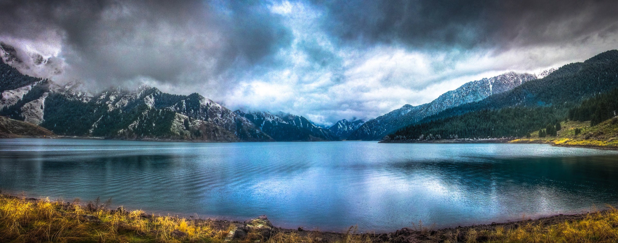
1. Heavenly Lake / Tianchi and Maya Mountain Viewpoint
Snapshot
Itinerary
The standard day walk starts after the Tianchi scenic-area shuttle reaches Heavenly Lake below the Bogda peaks. Short paths and boardwalks follow lake viewpoints, forested shore sections, temple areas, and waterfall or valley-side paths depending current opening. A more viewpoint-oriented version uses the Maya Mountain cableway / upper path system for a higher panorama over the lake and Bogda range, then returns to the lake shuttle system.
This is a managed scenic-area route, not an open Bogda backcountry approach. Bogda glacier and high-pass routes are excluded because they exceed normal non-technical day-hike constraints.
Why it is essential
Heavenly Lake is the iconic public face of the Bogda Mountains and one of the best-known Tian Shan landscapes in China: blue alpine water, spruce forest, and snow-peak backdrop in a single accessible walk.
Equipment
- Standard hiking equipment
- Warm layer
- Windproof shell
- Sun protection
- Water and snacks
- Gloves and hat outside midsummer
- Traction if visiting in icy periods
Hazards and notes
- Weather can close upper viewpoints
- Lake-edge paths may be icy in winter and crowded in holiday periods
- Do not continue beyond open scenic-area paths towards Bogda backcountry without appropriate permits, local guidance, and mountain equipment
GPX / KML links
| Source | URL | Format / access | Reuse status |
|---|---|---|---|
| OpenStreetMap search: Tianchi Heavenly Lake Xinjiang | openstreetmap.org | Map / search | OSM data is ODbL; geometry cross-check only |
| Waymarked Trails hiking map: Tianchi Xinjiang area | waymarkedtrails.org | OSM-derived map | OSM / Waymarked terms apply; source-map only |
External links
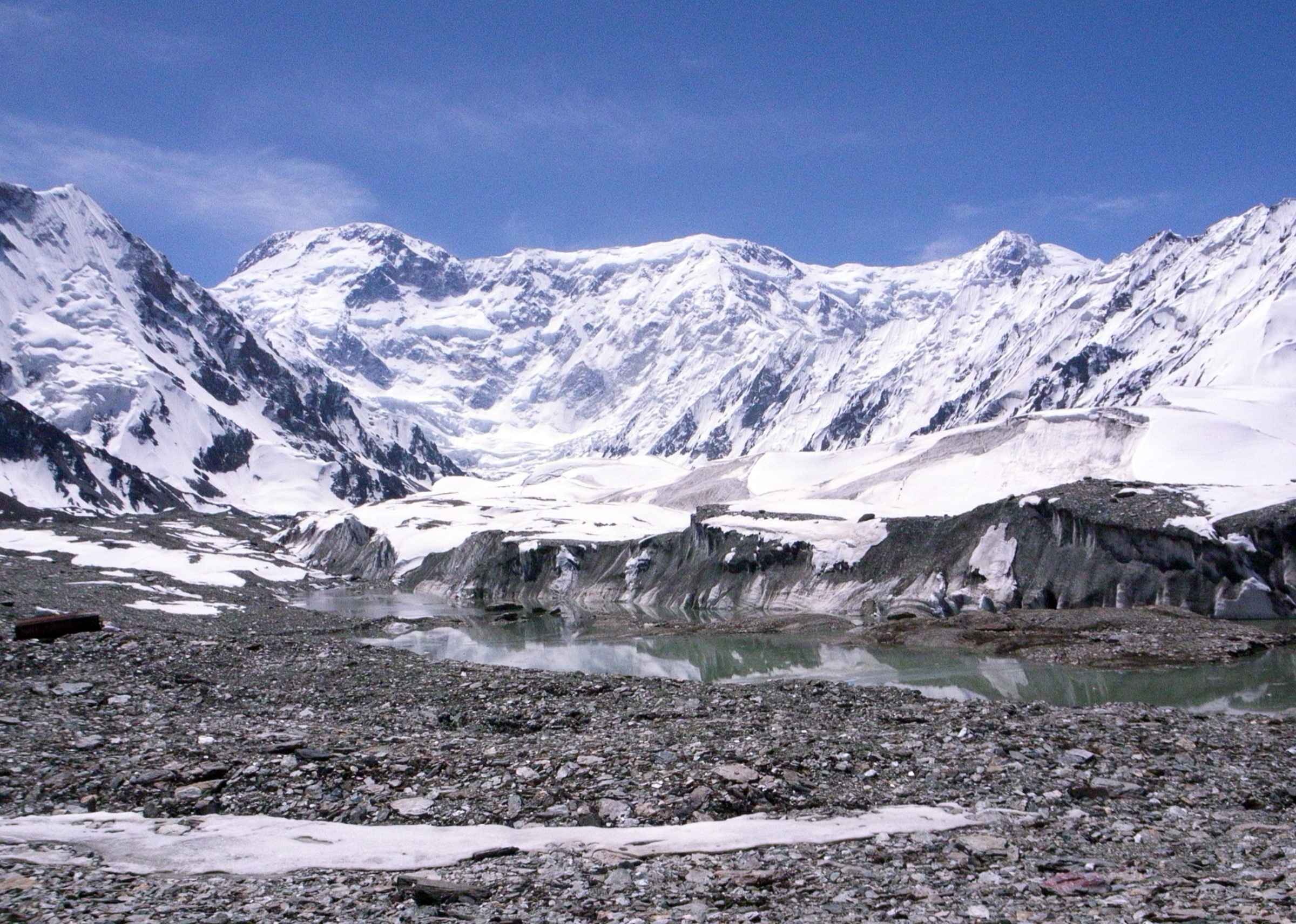
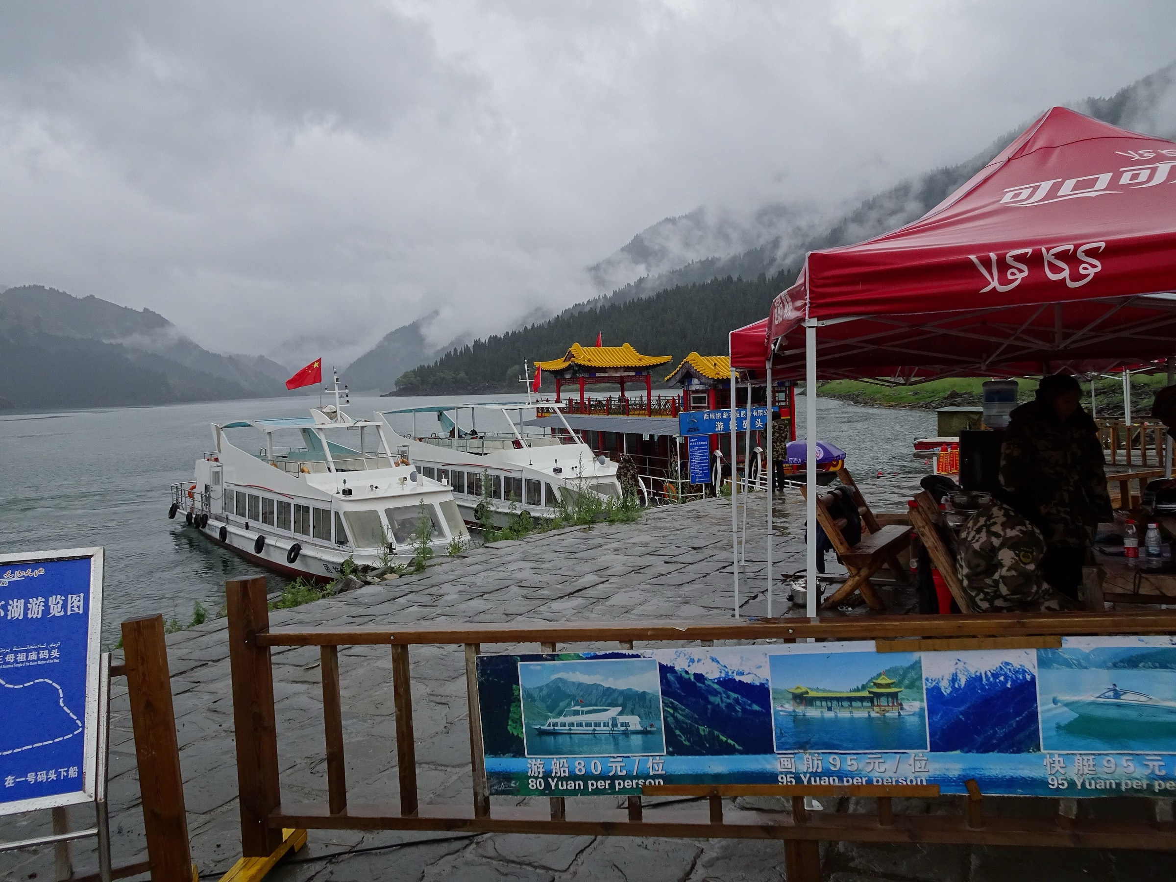
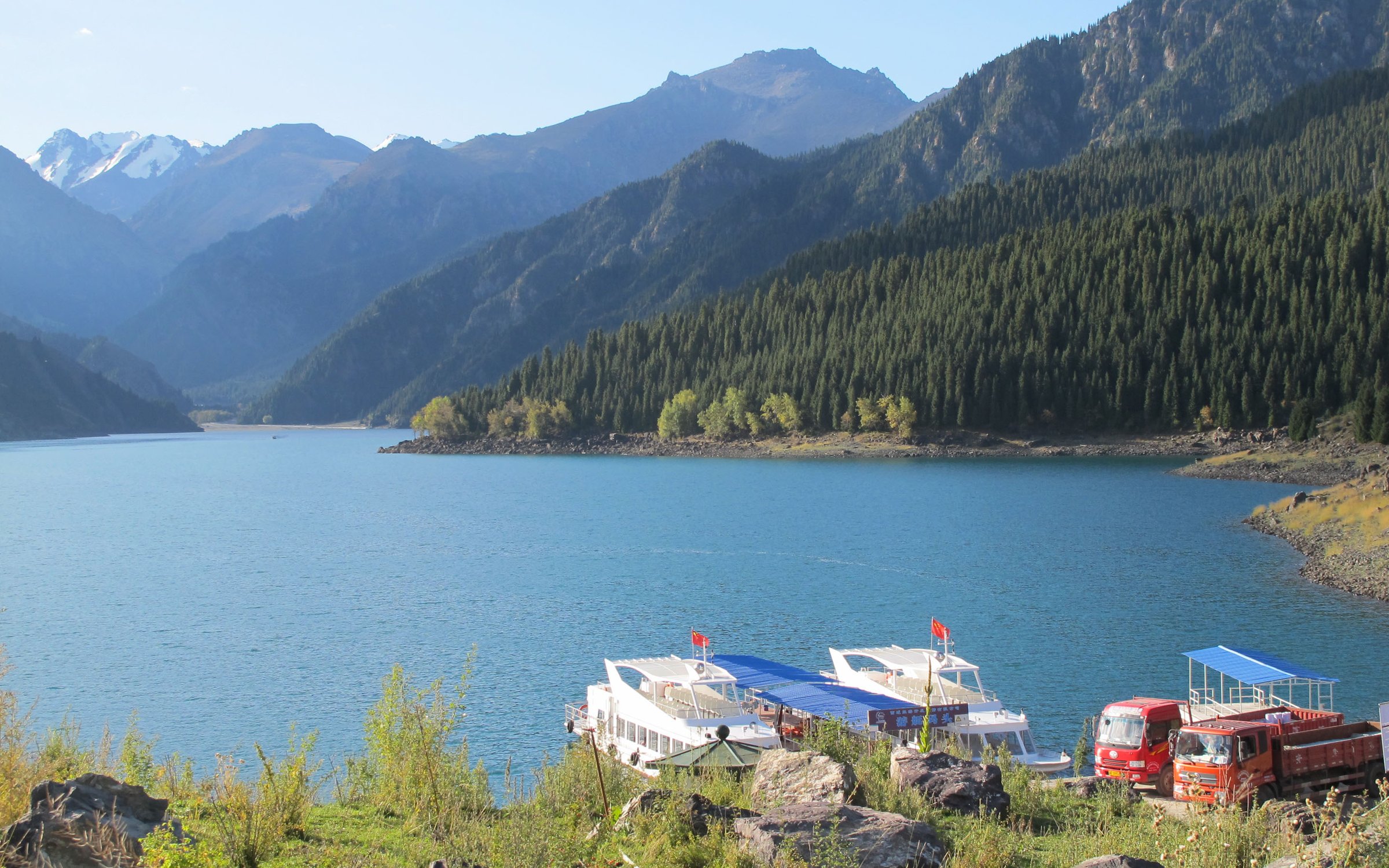
2. Xiata Ancient Trail to Flower Terrace / Muzart Glacier View
Snapshot
Itinerary
The regulated day-hike version begins after using the Xiata scenic-area transport system to reach the deeper valley. From the General Bridge area, the route follows the valley towards Flower Terrace through grassland, forest edges, river flats, and glacier-view meadows below the Muzart / Xiate high mountains. The return follows the same corridor.
The historic Xiata / Muzart Pass route is a difficult, hazardous multi-day crossing associated with glacier terrain, river danger, and restricted access. That crossing is not part of this day-hike entry.
Why it is essential
Xiata is one of the most dramatic non-technical glacier-valley day walks in the Chinese Tian Shan, combining snow peaks, meadows, rivers, and the historical memory of the Muzart route without requiring a pass crossing.
Equipment
- Sturdy boots
- Waterproof shell
- Warm layer
- Sun hat and sunglasses
- Water and food
- Trekking poles
- Offline map
- Headtorch
- Emergency layer
- Microspikes only if current local advice reports snow or ice on the allowed walking route
Hazards and notes
- Do not enter closed side valleys, glacier approaches, or river crossings
- Weather, river levels, shuttle operations, and scenic-area rules can change quickly
- Long-distance trekking may require a guide under current management
GPX / KML links
| Source | URL | Format / access | Reuse status |
|---|---|---|---|
| OpenStreetMap search: Xiata Ancient Trail | openstreetmap.org | Map / search | OSM data is ODbL; geometry cross-check only |
| LoongWander: Xiata Scenic Area | loongwander.com | Source page / route-section descriptions | Site terms apply; no route-file licence found |
External links
3. Tianshan Grand Canyon — Tianshui Lake, Green Dragon Bay and Swan Lake
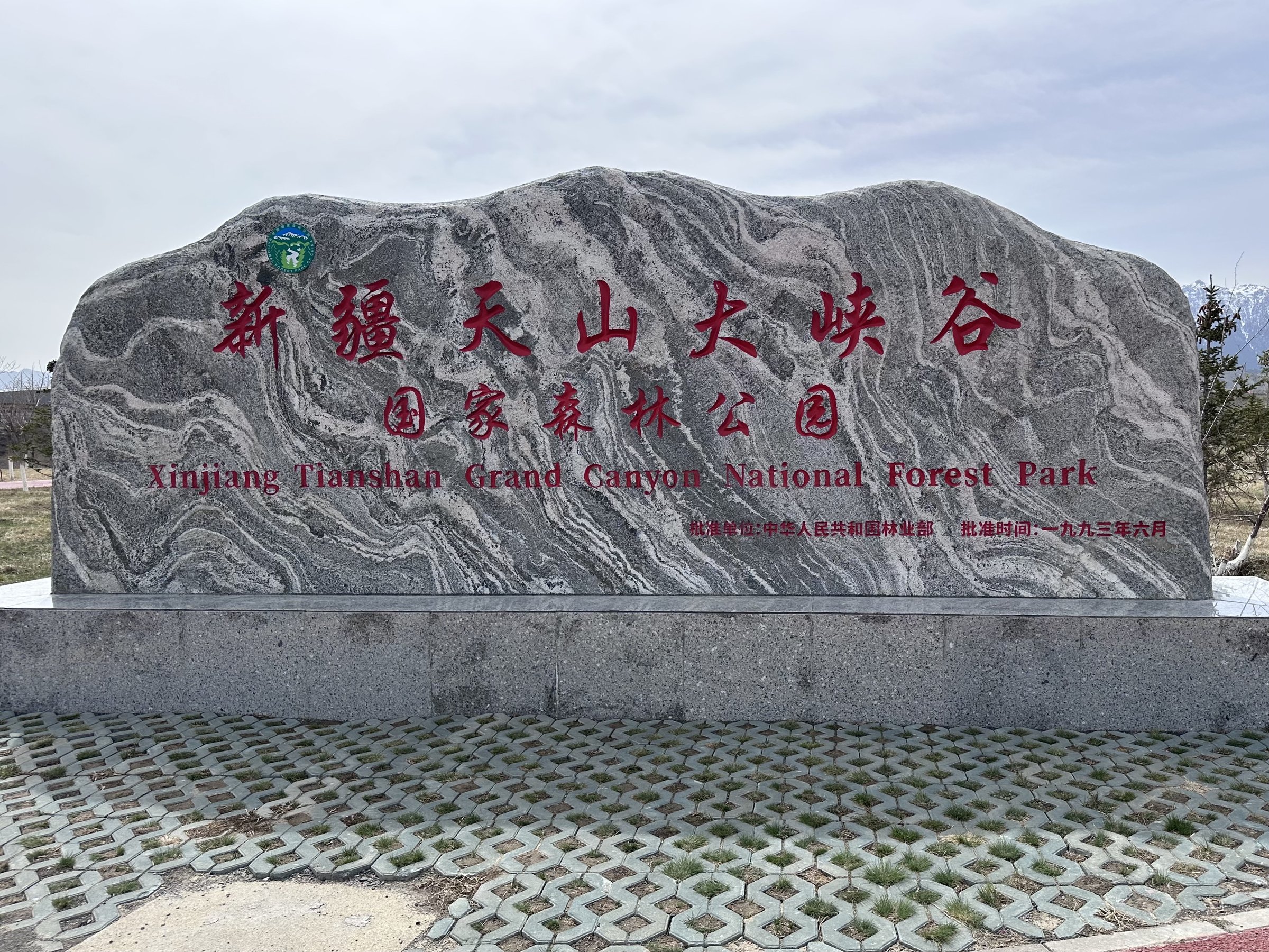
Snapshot
Itinerary
The walking day links the managed scenic stops of Tianshan Grand Canyon: Tianshui Lake, Green Dragon Bay, Zhaobi Mountain reservoir viewpoints, Swan Lake, and meadow or forest sections where paths are open. The canyon combines red cliffs, spruce forest, streams, lakes, and south-slope Tian Shan views.
Exact walked distance depends on current shuttle stops and whether the full lake-and-canyon chain is walked or split by internal transport.
Why it is essential
This is the most accessible Tian Shan canyon walk from Urumqi and provides a lower-altitude contrast to Heavenly Lake: red cliffs, forest, lakes, and Kazakh cultural landscape close to the city.
Equipment
- Walking shoes
- Warm layer
- Rain / wind shell
- Water and snacks
- Sun protection
- Traction in icy seasons
Hazards and notes
- Slippery boardwalks
- Sudden weather
- Winter ice
- Crowded shuttles and path closures
- Stay on open boardwalks and marked paths around lakes and cliff edges
GPX / KML links
| Source | URL | Format / access | Reuse status |
|---|---|---|---|
| OpenStreetMap search: Tianshan Grand Canyon Urumqi | openstreetmap.org | Map / search | OSM data is ODbL; geometry cross-check only |
| Waymarked Trails hiking map: Urumqi County Tian Shan | waymarkedtrails.org | OSM-derived map | OSM / Waymarked terms apply; source-map only |
External links
- China Daily — Tianshan Grand Canyon overview
- China Daily Xinjiang portal — Tianshan Grand Canyon notes
- TravelChinaGuide — Tianshan Grand Canyon
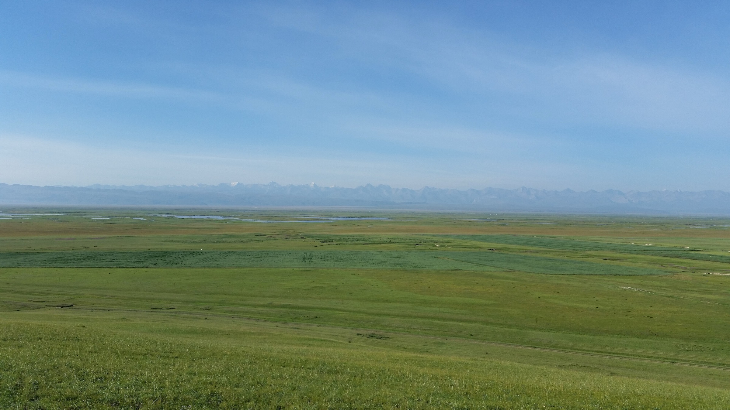
4. Kalajun Grassland — Flower Terrace to Falcon Terrace
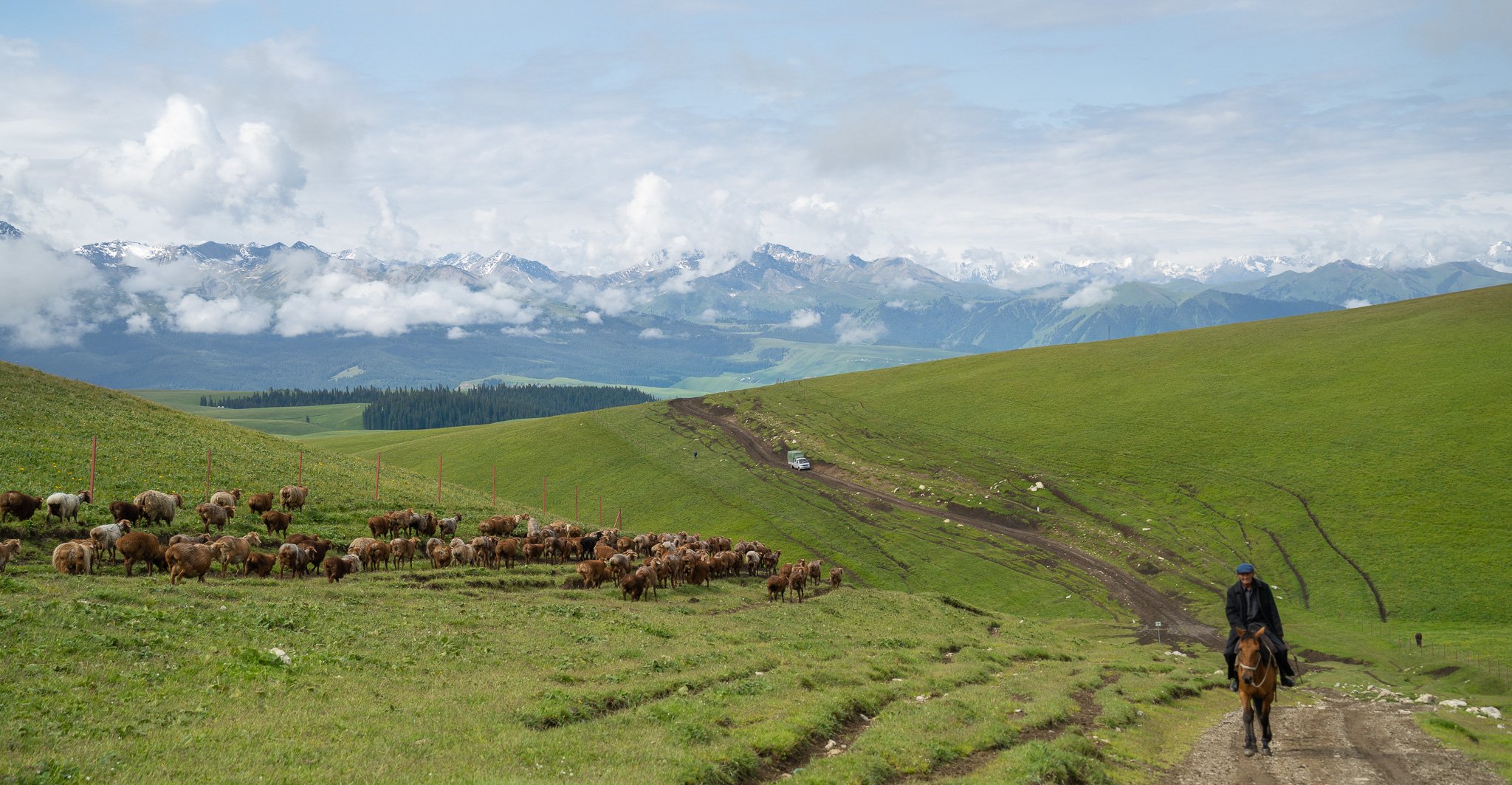
Snapshot
Itinerary
The day walk follows open high grassland between the Flower Terrace area and Falcon Terrace / East Kalajun viewpoints, using marked scenic-area paths or meadow tracks where walking is permitted. The route gives broad views across rolling grassland, flower meadows, ravines, forest edges, and distant snow peaks.
Because the public English sources describe Kalajun primarily as a scenic area rather than a fixed named footpath, exact route geometry and ascent remain unresolved.
Why it is essential
Kalajun is part of the Xinjiang Tianshan World Heritage landscape and is one of the best-known Ili high grassland areas. It represents the Chinese Tian Shan’s pastoral meadow character.
Equipment
- Standard hiking equipment
- Windproof layer
- Sun protection
- Water
- Warm layer
- Trekking poles for grass descents
Hazards and notes
- Weather and lightning
- Sun exposure
- Livestock tracks and unclear path permissions
- Avoid off-trail trampling in flower meadows and follow scenic-area instructions
GPX / KML links
| Source | URL | Format / access | Reuse status |
|---|---|---|---|
| OpenStreetMap search: Kalajun Grassland | openstreetmap.org | Map / search | OSM data is ODbL; geometry cross-check only |
| UNESCO World Heritage Centre: Xinjiang Tianshan | whc.unesco.org | Heritage-property source page | UNESCO page text licensing varies; landscape verification only |
External links
5. Sayram Lake West Sea / Lakeshore Viewpoint Walk
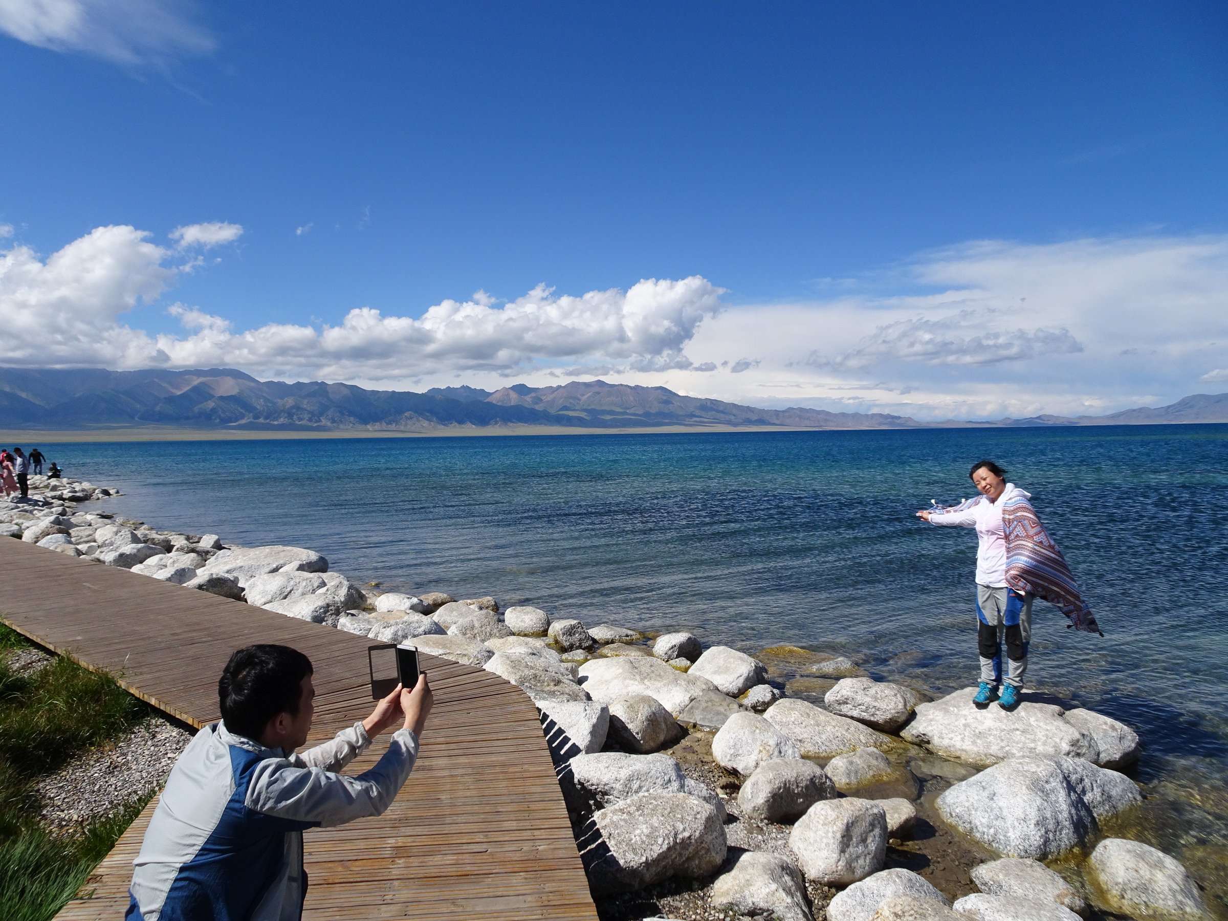
Snapshot
Itinerary
The selected day walk uses one of the scenic lake-shore sectors around West Sea / the S-bend grassland viewpoint area, combining lakeside boardwalks or tracks, short meadow sections, and optional low viewpoint climbs above the water. The route is intended as a walking segment inside a larger scenic-area visit rather than a full circuit of the lake.
Why it is essential
Sayram Lake is a major high Tian Shan lake on the northern edge of Xinjiang’s mountain corridor. A lakeshore viewpoint walk adds the alpine-lake and grassland character that balances the canyon, glacier-valley, and high-meadow hikes elsewhere in the entry.
Equipment
- Walking shoes
- Warm windproof layer
- Sun protection
- Water and snacks
- Rain layer
- Gloves and hat in shoulder seasons
Hazards and notes
- Strong wind and cold water
- Sudden weather
- Vehicle traffic on scenic roads
- Unclear legal walking sections
- Do not attempt a full lake circuit on foot as a day hike
GPX / KML links
| Source | URL | Format / access | Reuse status |
|---|---|---|---|
| OpenStreetMap search: Sayram Lake | openstreetmap.org | Map / search | OSM data is ODbL; geometry cross-check only |
| Waymarked Trails hiking map: Sayram Lake | waymarkedtrails.org | OSM-derived map | OSM / Waymarked terms apply; source-map only |
External links
Missing data and follow-up
- No official GPX/KML downloads were found for the selected Tian Shan routes.
- Kalajun and Sayram Lake walking lines need confirmation against current scenic-area maps.
- Tianchi / Maya Mountain walked distance depends strongly on lift and shuttle choices.
- Xiata access rules are changing; current guide requirements, river restrictions, and electric-cart endpoints need local confirmation.
- No licence-compatible Xiata-specific photo was found in this pass.
External links
| Source | URL |
|---|---|
| UNESCO World Heritage Centre — Xinjiang Tianshan | whc.unesco.org |
| China Daily — Tianshan Grand Canyon overview | chinadaily.com.cn |
| China Daily Xinjiang portal — Tianshan Grand Canyon notes | xinjiang.chinadaily.com.cn |
| TravelChinaGuide — Tianshan Grand Canyon | travelchinaguide.com |
| LoongWander — Xiata Scenic Area | loongwander.com |
| China Dragon Travel — Xiata Ancient Trail updated access notes | chinadragontravel.com |