Regional overview
The Trujillo and Táchira Andes form the south-western and western continuation of the Venezuelan Andes beyond the Mérida core. The walking landscape is varied: high paramo in Teta de Niquitao-Guirigay and General Juan Pablo Peñaloza, wet cloud forest and lagoons in Guaramacal, frontier paramo and sandstone walls in El Tamá, and lower waterfall forests at Chorro El Indio near San Cristóbal.
Public hiking data is sparse and inconsistent compared with the better-known Mérida routes. INPARQUES provides useful protected-area context, while route statistics mostly come from Wikiloc source maps. Every unresolved route-file or licence gap is marked below.
Selection rationale
The five hikes cover the region’s strongest day-walking identities: Trujillo’s emblematic high summit, the Guaramacal cloud-forest lake, the Batallón / La Negra high-lagoon paramo, the El Tamá frontier viewpoint route, and Táchira’s accessible Chorro El Indio waterfall and forest sector.
Summary table
| # | Hike | Country | Route type | Distance | Gain | Max elevation | Difficulty |
|---|---|---|---|---|---|---|---|
| 1 | Teta de Niquitao / Pico Musí | Venezuela | Out-and-back / ridge variants | 7.43 km short source; 10.7-16.2 km variants | 656 m short source; 821-962 m variants | 4,006 m official peak | Moderate-hard |
| 2 | Guaramacal - Laguna de Los Cedros | Venezuela | Loop / out-and-back variants | 8.47 km selected source | 494 m | Approx. 3,130 m at the laguna | Moderate |
| 3 | Páramo El Batallón: Laguna Grande - Laguna Las Verdes Bajas | Venezuela | Out-and-back / lake-link | 2.58 km one-way core segment; approx. 5.2 km return | 200 m one-way source | 3,515 m source route | Moderate by altitude |
| 4 | La Ventana del Páramo El Tamá | Venezuela | Point-to-point / descent | 15.59 km | 227 m ascent / 1,678 m descent | 3,477 m | Hard |
| 5 | Chorro El Indio Waterfall and Forest Trails | Venezuela | Loop / flexible trail network | 24.29 km full source loop; shorter 4-8 km options exist | 716 m full loop | 1,406 m full loop | Moderate-hard |
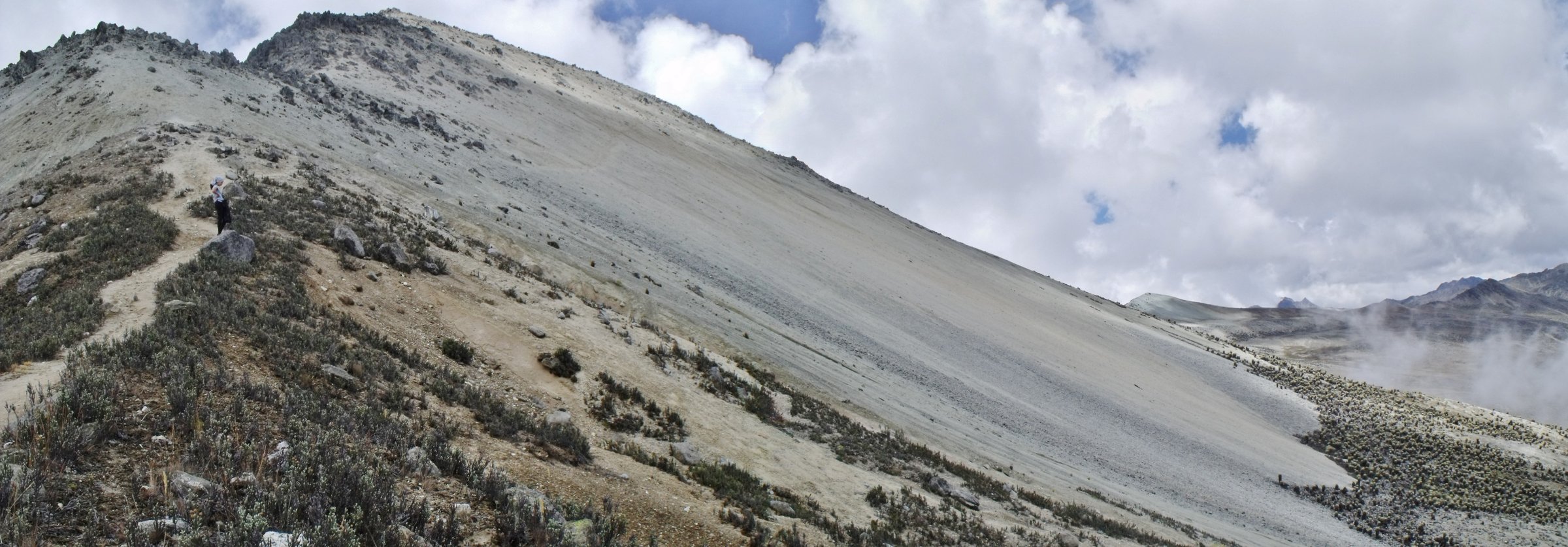
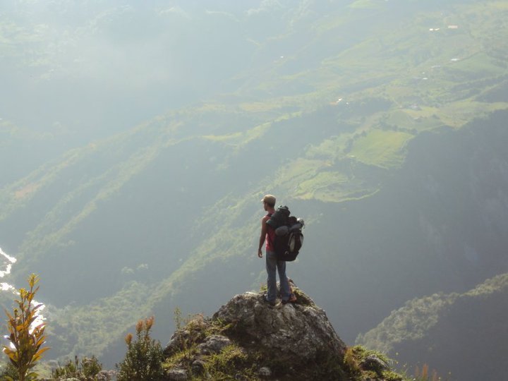
1. Teta de Niquitao / Pico Musí
Snapshot
Itinerary
The normal day objective is to reach the high crest and summit area of Teta de Niquitao, also known as Pico Musí or Picacho. Wikiloc listings show several approaches from Niquitao and nearby ridges; the shortest “Monumento Nacional Teta Niquitao / Pico Musi” listing is 7.43 km with 656 m ascent, while longer ridge variants exceed 16 km.
Why it is essential
Teta de Niquitao is the highest mountain of Trujillo state and the defining protected summit of the Trujillo Andes.
Equipment
Mountain hiking kit, warm layer, waterproof/windproof shell, gloves, sun protection, offline map/GPS and enough water. A local guide is recommended because trailheads and route variants differ.
Hazards and notes
The monument has steep slopes, high paramo weather, fog and route ambiguity. Confirm legal access and whether the chosen route crosses private or community land.
GPX / KML links
| Source | URL | Format / access | Reuse status |
|---|---|---|---|
| Wikiloc, Niquitao area listings including Monumento Nacional Teta Niquitao / Pico Musi | es.wikiloc.com | Source-map / listing | Wikiloc terms apply; source-map reference only |
| Wikiloc: Teta de Niquitao older source route | es.wikiloc.com | Source map | Wikiloc terms apply; use with care, may include non-walking approach sections |
External links
- INPARQUES — Teta de Niquitao-Guirigay 25th anniversary note
- INPARQUES — Teta de Niquitao-Guirigay 27th anniversary note
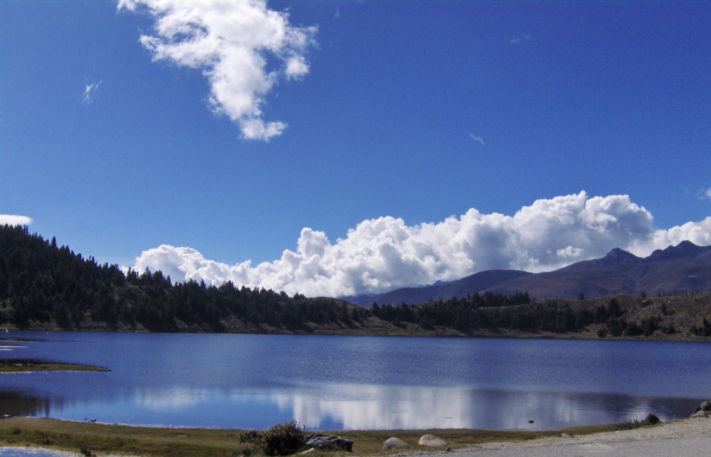
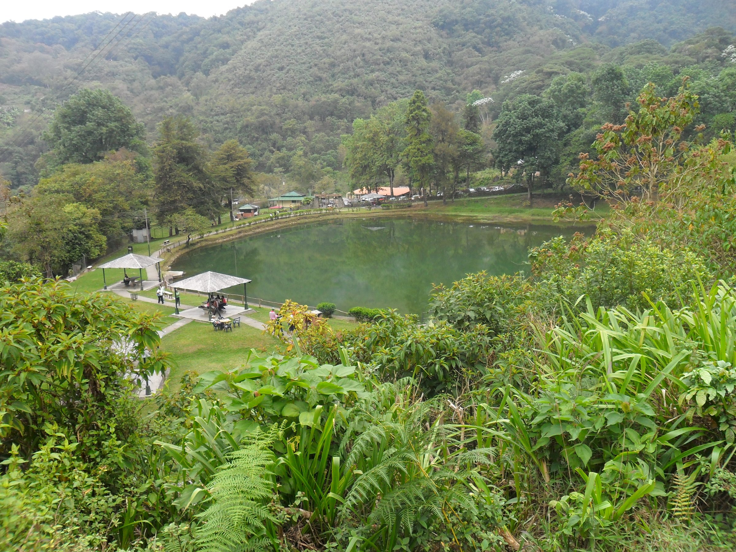
2. Guaramacal - Laguna de Los Cedros
Snapshot
Itinerary
From the Guaramacal / Boconó access sector, follow the forest and lake route toward Laguna de Los Cedros. The selected Wikiloc route links Boconó police-post access, Laguna de Los Cedros and Mirador El Salvaje in an 8.47 km outing. Shorter “MTC a la laguna de los cedros” variants also exist.
Why it is essential
Laguna de Los Cedros is Guaramacal’s best-known walking objective, combining cloud forest, high humidity, emerald lake scenery and Trujillo’s most important national-park landscape outside the highest paramo.
Equipment
Waterproof footwear, rain shell, warm layer, water, food, offline map/GPS and insect protection. Expect mud and wet vegetation.
Hazards and notes
Fog, slippery mud and confusing side tracks are likely. Confirm current park access and whether guides are required.
GPX / KML links
| Source | URL | Format / access | Reuse status |
|---|---|---|---|
| Wikiloc, Valle Verde listings including Laguna de los Cedros | es.wikiloc.com | Source-map / listing | Wikiloc terms apply; source-map reference only |
| OpenStreetMap search: Laguna de Los Cedros Guaramacal | openstreetmap.org | Map geometry cross-check | OSM data is ODbL; geometry cross-check only |
External links
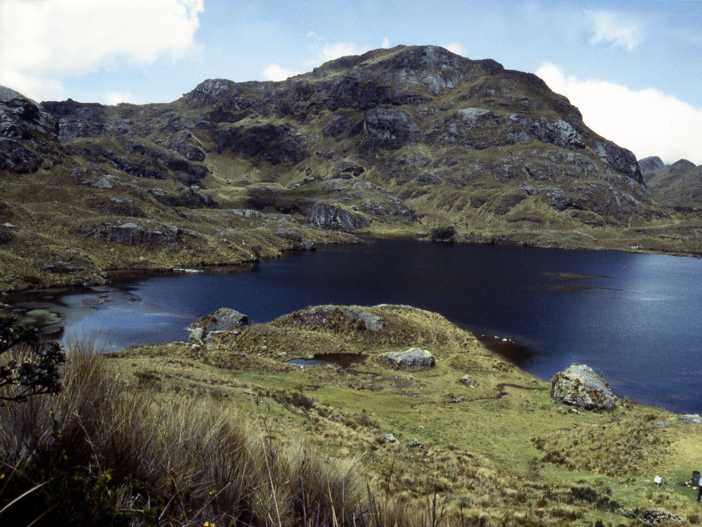
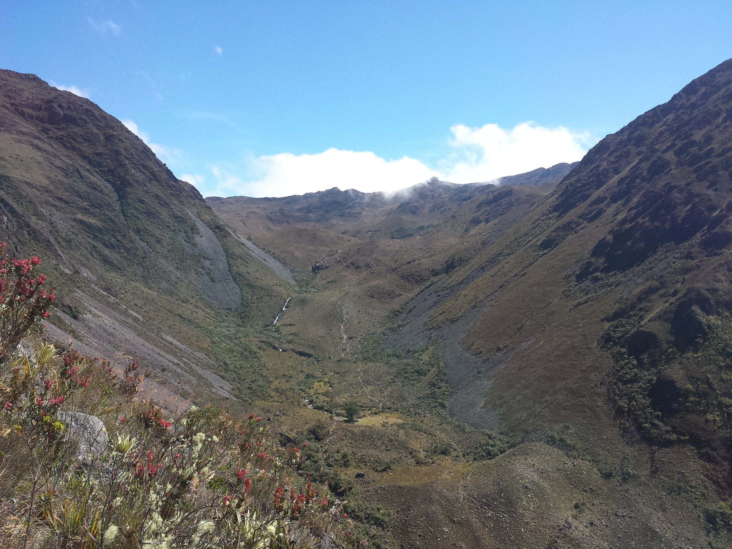
3. Páramo El Batallón - Laguna Grande to Laguna Las Verdes Bajas
Snapshot
Itinerary
The verified GPS segment links Laguna Grande with Laguna Las Verdes Bajas in the Páramo del Táchira / General Juan Pablo Peñaloza highlands. The route author states that the track is partial and that walkers first need to reach Laguna Grande from Portachuelo or another access. Treat this as the core scenic section, not a complete trailhead-to-trailhead day until the approach is mapped.
Why it is essential
Páramo El Batallón and the Peñaloza lagoon system are among Táchira’s most distinctive high-Andean landscapes: periglacial lakes, open paramo and broad views across the La Grita / El Rosal highlands.
Equipment
Warm mountain clothing, waterproof shell, gloves, sun protection, boots, water, food, offline GPS and backup navigation. A local guide is recommended.
Hazards and notes
The public route file is partial. Landslide ground, poor visibility and confusing parallel trails are noted by the source author. Confirm the approach to Laguna Grande before using this as a published hike.
GPX / KML links
| Source | URL | Format / access | Reuse status |
|---|---|---|---|
| Wikiloc: Laguna la grande a laguna las verdes baja | es.wikiloc.com | Source map / downloadable route via Wikiloc | Wikiloc terms apply; source-map reference only, partial route |
| OpenStreetMap search: Laguna Grande Táchira | openstreetmap.org | Map geometry cross-check | OSM data is ODbL; geometry cross-check only |
External links
- INPARQUES — General Juan Pablo Peñaloza anniversary note
- INPARQUES — Los Páramos de Táchira y Mérida anniversary note
4. La Ventana del Páramo El Tamá
Snapshot
Itinerary
The selected Wikiloc route descends from La Ventana del Páramo El Tamá toward Vega Grande / San Vicente de La Revancha, following the high paramo line then dropping through rougher mountain terrain. A broader 33 km El Tamá traverse also records La Ventana, Cerro El Cobre, Cerro El Cristo, Páramo Tamá and Cascada El Chorrerón as waypoints, but that is too long for a standard day hike.
Why it is essential
La Ventana is the most recognisable high viewpoint in the Venezuelan El Tamá sector, giving a rare day-hike window into the frontier paramo and sandstone-wall landscape shared with the Colombian Andes.
Equipment
Full mountain kit, waterproofs, warm layers, gloves, sun protection, boots, headtorch, offline map/GPS, emergency layer and enough water/food. A local guide and arranged transport are strongly recommended.
Hazards and notes
This is a hard one-way descent with very large elevation loss and possible route-finding issues. INPARQUES notes El Tamá as a protected and sensitive area; permissions and access should be confirmed before any publication.
GPX / KML links
| Source | URL | Format / access | Reuse status |
|---|---|---|---|
| Wikiloc: La Ventana Del Paramo el Tama bajando a Vega Grande | es.wikiloc.com | Source map / downloadable route via Wikiloc | Wikiloc terms apply; source-map reference only |
| Wikiloc: El Tamá traverse source | es.wikiloc.com | Source map / waypoint reference | Wikiloc terms apply; too long for selected hike, contextual route reference |
| OpenStreetMap search: La Ventana El Tamá | openstreetmap.org | Map geometry cross-check | OSM data is ODbL; geometry cross-check only |
External links
5. Chorro El Indio Waterfall and Forest Trails
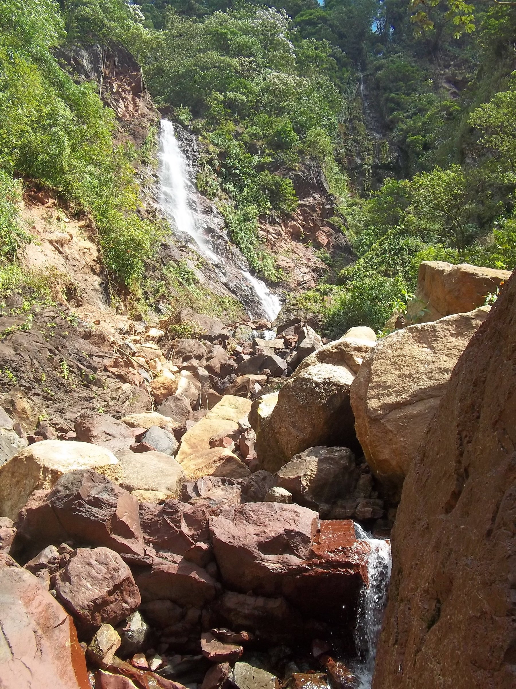
Snapshot
Itinerary
The full source loop links the Chorro El Indio trail network around El Macdonald, Las Caminerías, Nevada and Las Posas del Indio. INPARQUES identifies the waterfall, Loma del Viento, Loma de Panaga, Cerro El Chimborazo / La Z and other walking areas as the main recreation landscape east of San Cristóbal. For a shorter guidebook version, use the waterfall and official recreation sector; for a hard day, use the full loop only after local confirmation.
Why it is essential
Chorro El Indio is the most accessible and culturally recognised waterfall/forest hiking area in Táchira, close to San Cristóbal but still within a protected montane landscape.
Equipment
Trail shoes or boots with grip, rain shell, water, food, insect protection and offline map. For the full loop, carry a headtorch and extra clothing.
Hazards and notes
Wet rock, mud, steep forest paths and snakes are possible. INPARQUES specifically notes venomous snake encounters in Chorro El Indio forest sectors; stay on legal trails and avoid handling wildlife.
GPX / KML links
| Source | URL | Format / access | Reuse status |
|---|---|---|---|
| Wikiloc: Senderos Chorro el Indio | es.wikiloc.com | Source map / downloadable route via Wikiloc | Wikiloc terms apply; source-map reference only |
| Wikiloc, Pirineos / Chorro El Indio trail listings | es.wikiloc.com | Source-map / listing | Wikiloc terms apply; source-map reference only |
| OpenStreetMap search: Chorro El Indio | openstreetmap.org | Map geometry cross-check | OSM data is ODbL; geometry cross-check only |
External links
- INPARQUES — Parque Nacional Chorro El Indio detail page
- INPARQUES — Chorro El Indio anniversary / access note
- INPARQUES — Snake-safety context in Chorro El Indio forest sectors
External links
| Source | URL |
|---|---|
| INPARQUES — Teta de Niquitao-Guirigay 25th anniversary | inparques.gob.ve |
| INPARQUES — Teta de Niquitao-Guirigay 27th anniversary | inparques.gob.ve |
| INPARQUES — General Cruz Carrillo / Guaramacal | inparques.gob.ve |
| INPARQUES — General Juan Pablo Peñaloza | inparques.gob.ve |
| INPARQUES — Los Páramos de Táchira y Mérida | inparques.gob.ve |
| INPARQUES — Parque Nacional El Tamá | inparques.gob.ve |
| INPARQUES — El Tamá anniversary | inparques.gob.ve |
| INPARQUES — Parque Nacional Chorro El Indio | inparques.gob.ve |
| INPARQUES — Chorro El Indio anniversary / access | inparques.gob.ve |
| INPARQUES — Chorro El Indio snake-safety note | inparques.gob.ve |
| Wikiloc — Niquitao listings | es.wikiloc.com |
| Wikiloc — Teta de Niquitao older route | es.wikiloc.com |
| Wikiloc — Valle Verde listings | es.wikiloc.com |
| Wikiloc — Laguna Grande a Laguna Las Verdes Baja | es.wikiloc.com |
| Wikiloc — La Ventana El Tamá descent | es.wikiloc.com |
| Wikiloc — El Tamá traverse | es.wikiloc.com |
| Wikiloc — Senderos Chorro el Indio | es.wikiloc.com |
| Wikiloc — Pirineos / Chorro El Indio listings | es.wikiloc.com |