Regional overview
Sierra La Culata forms the northern wall of the Mérida Andes, opposite the Sierra Nevada de Mérida. It is a broad highland of paramo, cloud forest, glacial valleys, high passes, lagoons, condor habitat and long historic routes between Mérida, Mucuchíes, La Culata, Mifafí and the Maracaibo-draining valleys. INPARQUES identifies La Culata, Mifafí, Pico El Águila, Laguna Los Guaches, Monte Zerpa and Pico Pan de Azúcar as major visitor / excursion sectors.
The region’s day hikes range from short cloud-forest walks above Mérida to very high, strenuous summit days above 4,600 m. Route information is uneven: a few routes have good official descriptions or recent GPS tracks, while others are known local excursions with incomplete public GPX coverage. Those gaps are marked below.
Selection rationale
The selection balances the range’s defining experiences: the iconic Pico Pan de Azúcar summit, the Mifafí / Las Verdes paramo, the Laguna Los Guaches roadside-highland sector, the Cañada Las González / Páramo Los Conejos ridge, and the lower Monte Zerpa cloud forest. Multi-day La Culata traverses and technical/scree-heavy peak chains are excluded.
Summary table
| # | Hike | Route type | Distance | Gain | Max elevation | Difficulty | Photo status |
|---|---|---|---|---|---|---|---|
| 1 | La Culata - Pico Pan de Azúcar | Loop / out-and-back variants | 23.45 km loop source; 12.64 km one-way source | 1,647-1,680 m | approx. 4,689-4,691 m | Hard | Commons images found |
| 2 | Valle de Mifafí - Lagunas Las Verdes Circuit | Loop | 8.59 km | 546 m | 4,275 m | Moderate-hard by altitude | Commons Mifafí images found |
| 3 | Laguna Los Guaches and Pico El Águila / El Gavilán Viewpoints | Short out-and-back / flexible | approx. 2-6 km; full Pico El Gavilán route unresolved | Inparques lists Pico El Gavilán at 4,320 m | Easy-moderate for lake/viewpoint; hard if summiting | Commons images found | |
| 4 | Cañada Las González - Páramo Los Conejos - Pico Campanario | Loop | 8.03 km | 777 m | 4,204 m | Moderate-hard | No route-specific open image found |
| 5 | Monte Zerpa - Santa Rosa Forest Trail | Point-to-point / out-and-back | 6 km | Easy-moderate | No route-specific open image found |
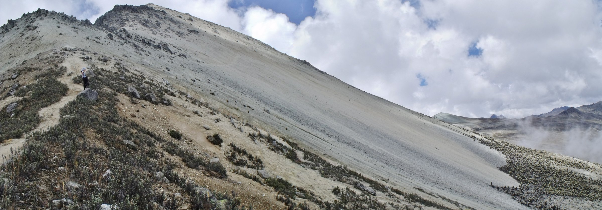
1. La Culata - Pico Pan de Azúcar

Snapshot
Itinerary
The route leaves the La Culata valley and climbs through paramo toward Valle Muerto, Segundo Refugio, Barro Negro and the final ridge of Pico Pan de Azúcar. Wikiloc variants differ between a long loop and a direct one-way ascent, but they agree that this is a very high, steep day with over 1,600 m of ascent.
Why it is essential
Pico Pan de Azúcar is the signature day-summit of Sierra La Culata: high, visible, non-glaciated and closely associated with the La Culata access corridor.
Equipment
Full mountain day kit, warm layers, waterproof/windproof shell, gloves, hat, sun protection, headtorch, offline map/GPS and enough water/food for a long exposed day. Use a local guide unless the route is already known.
Hazards and notes
Altitude, cold, strong wind, fog, loose ground and a long descent are the main hazards. This route is near the upper limit of a non-technical day hike; do not continue in electrical storms or poor visibility.
GPX / KML links
| Source | URL | Format / access | Reuse status |
|---|---|---|---|
| Wikiloc: La Culata Pico Pan de Azúcar | es.wikiloc.com | Source map / downloadable route via Wikiloc | Wikiloc terms apply; source-map reference only |
| Wikiloc: Culata - Pan de azúcar | es.wikiloc.com | Source map / downloadable route via Wikiloc | Wikiloc terms apply; source-map reference only |
External links
- INPARQUES — Parque Nacional Sierra La Culata
- Wikiloc — La Culata Pico Pan de Azúcar
- Wikiloc — Culata - Pan de azúcar
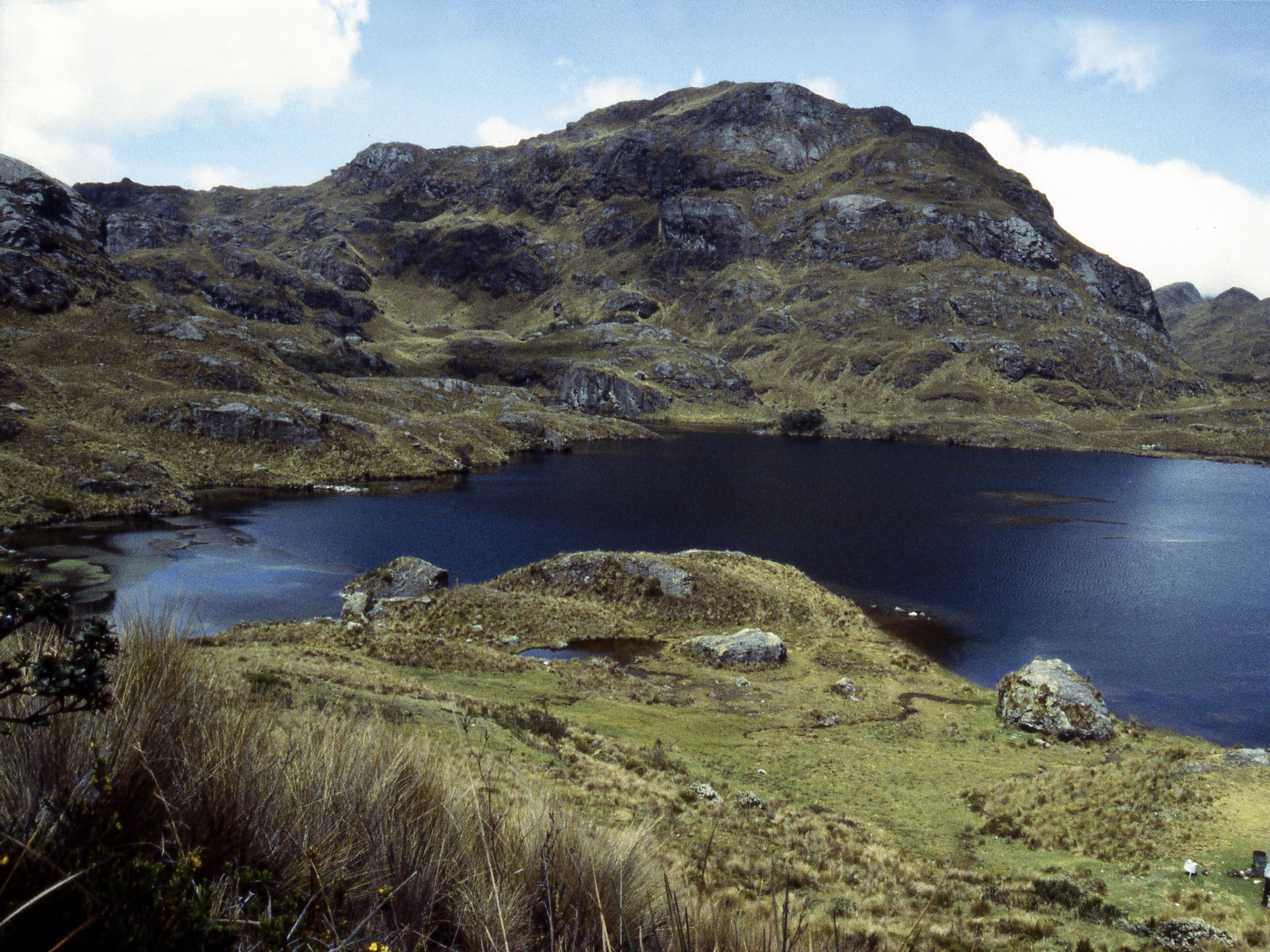
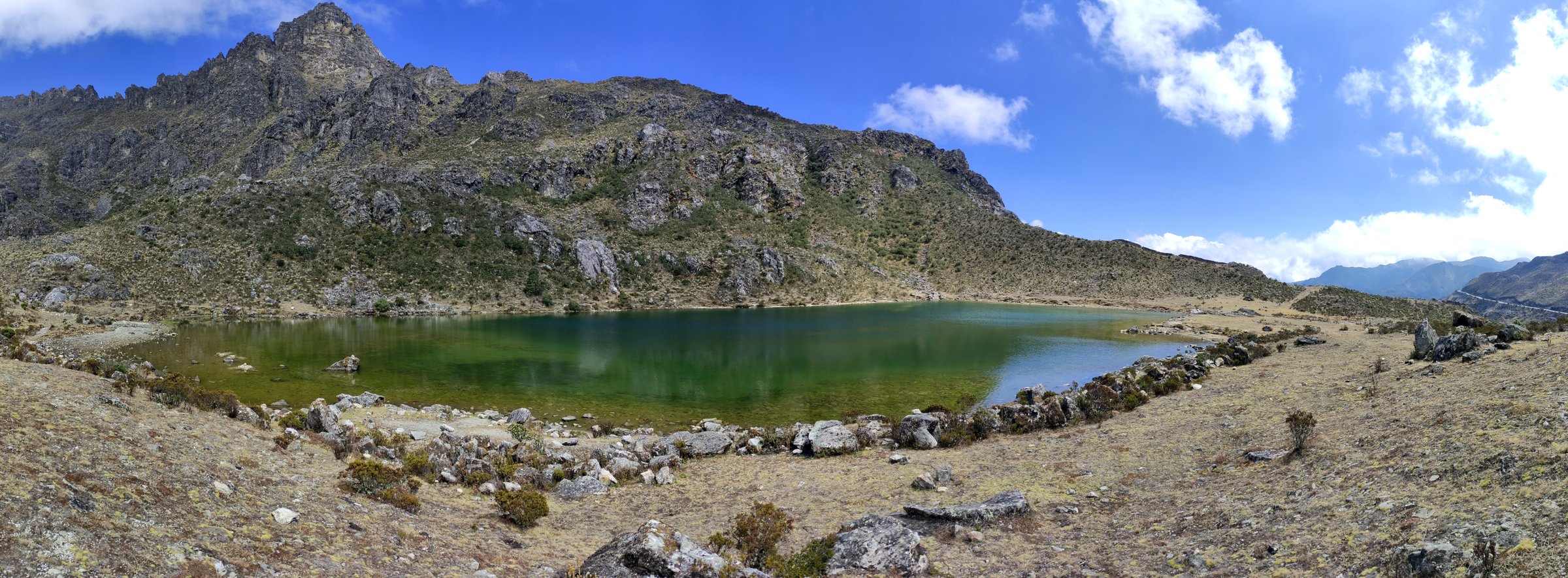
2. Valle de Mifafí - Lagunas Las Verdes Circuit
Snapshot
Itinerary
From the Mifafí valley, the recorded circuit climbs into open paramo and visits the Las Verdes lagoon area before looping back to the valley. INPARQUES describes Mifafí as a cold, rocky valley with visitor infrastructure and condor habitat, and lists a 4-hour route to Páramo Piedras Blancas in the same sector.
Why it is essential
Mifafí is one of the most representative La Culata landscapes: condor country, desert paramo, glacially shaped valleys and high lagoons reachable without committing to a multi-day traverse.
Equipment
Warm mountain clothing, waterproof/windproof shell, gloves, sun protection, sturdy footwear, water, food and offline navigation.
Hazards and notes
The circuit is short but high. Rapid weather changes, strong sun, cold wind and steep descent sections are likely. Confirm whether guide services, the biological station and visitor permissions are operating before setting out.
GPX / KML links
| Source | URL | Format / access | Reuse status |
|---|---|---|---|
| Wikiloc: Circuito Valle de Mifafí - Lagunas Las Verdes - Valle de Mifafí | wikiloc.com | Source map / downloadable route via Wikiloc | Wikiloc terms apply; source-map reference only |
| OpenStreetMap search: Mifafí | openstreetmap.org | Map geometry cross-check | OSM data is ODbL; geometry cross-check only |
External links
- INPARQUES — Sierra La Culata detail page, Sector Mifafí
- Wikiloc — Circuito Valle de Mifafí - Lagunas Las Verdes
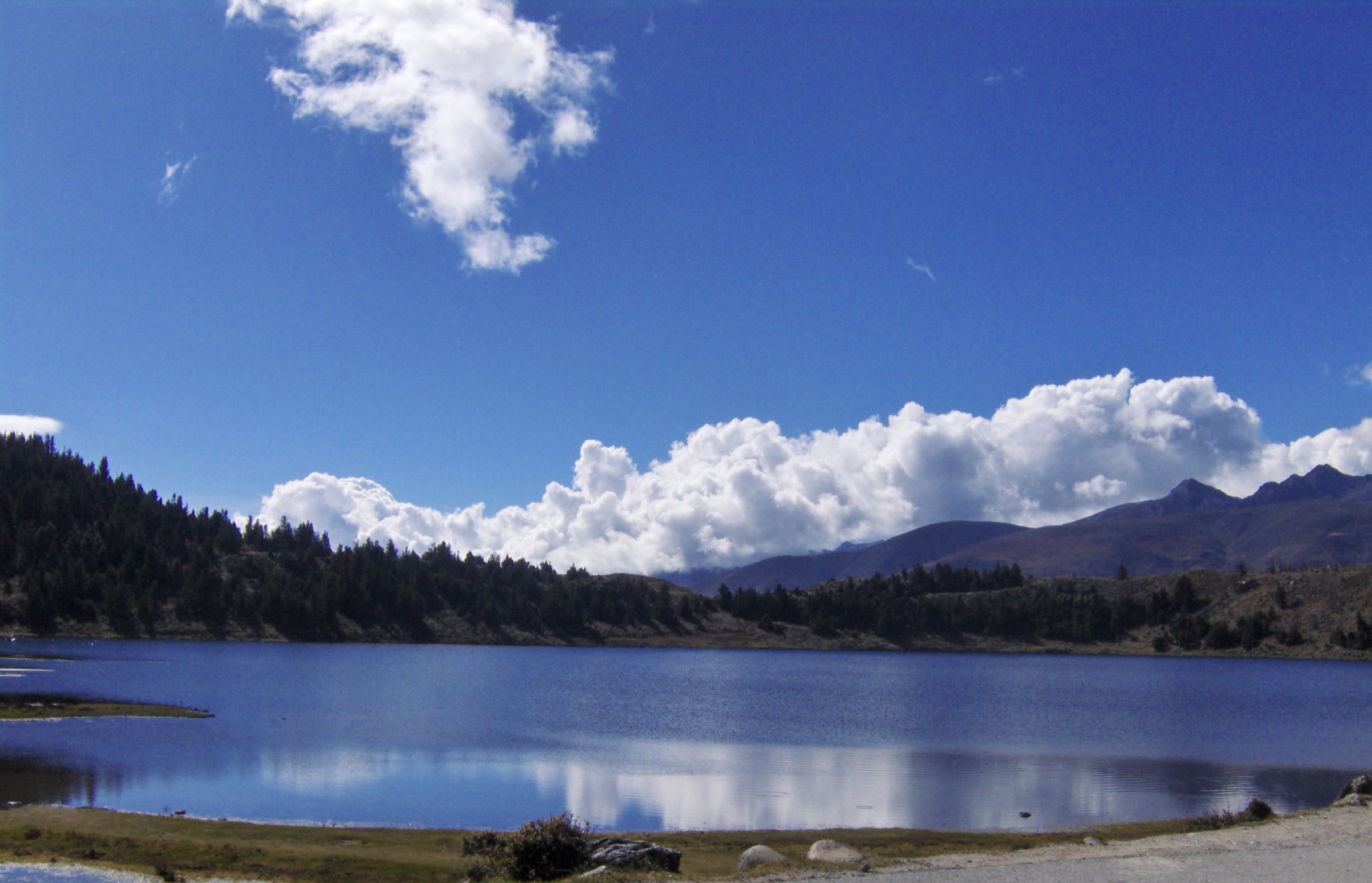
3. Laguna Los Guaches and Pico El Águila / El Gavilán Viewpoints
Snapshot
Itinerary
Use the high-road access near Pico El Águila / Collado del Cóndor to visit Laguna Los Guaches and nearby views toward Pico El Gavilán, Pico Pan de Azúcar and the high La Culata paramo. INPARQUES lists Laguna Los Guaches as a recreation area and names Pico El Gavilán as an excursion objective from La Culata, but no official GPX or consistent public day-route statistics were found in this pass.
Why it is essential
This is the most accessible high-lagoon landscape in Sierra La Culata and a practical way to include the Pico El Águila / Los Guaches side of the range in the catalogue.
Equipment
Warm layer, windproof/waterproof shell, hat, gloves, sun protection, sturdy shoes and offline map. Carry more clothing than the short distance suggests.
Hazards and notes
The elevation data for Laguna Los Guaches is inconsistent across public sources; check on a map/GPS before publication. Do not present a full Pico El Gavilán summit as verified until a reliable GPX and legal access details are obtained.
GPX / KML links
| Source | URL | Format / access | Reuse status |
|---|---|---|---|
| OpenStreetMap search: Laguna Los Guaches | openstreetmap.org | Map geometry cross-check | OSM data is ODbL; geometry cross-check only |
| Wikiloc search: Laguna Los Guaches Pico El Gavilán | wikiloc.com | Source search | Wikiloc terms apply; route file unresolved |
External links
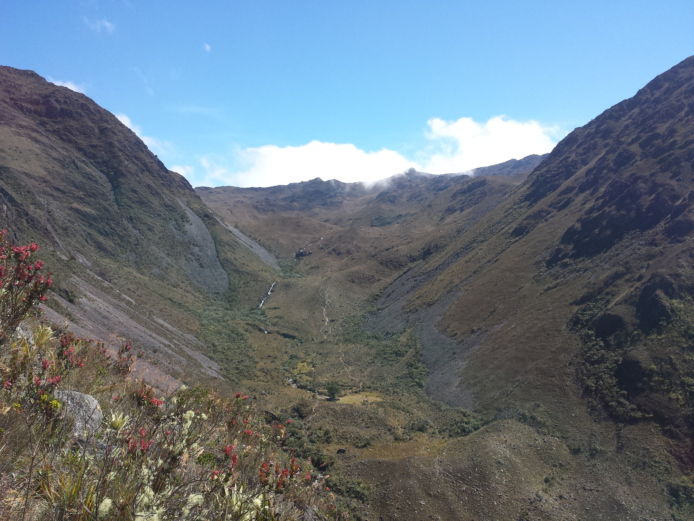
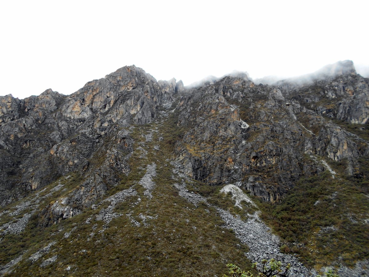
4. Cañada Las González - Páramo Los Conejos - Pico Campanario
Snapshot
Itinerary
The recorded route starts in Cañada Las González, crosses the Río Las González and climbs via Los Callejones and La Mesa into Páramo Los Conejos. It reaches the Campanario area and the summit/viewpoint zone, with views toward Laguna Negra, El Violín, Sierra Nevada and, in clear weather, Lake Maracaibo.
Why it is essential
This hike gives Sierra La Culata its ridge-and-basin day: a compact but steep route into one of the range’s historic paramo corridors.
Equipment
Boots, warm layer, waterproof shell, gloves, sun protection, food, water and offline navigation. A local guide is advisable because the route begins in community terrain and crosses high, fog-prone paramo.
Hazards and notes
Steep slopes, loose stone, fog and unmarked junctions are likely. The Wikiloc author notes the crash remains of a 1985 aircraft on the route; do not disturb any historical or protected remains.
GPX / KML links
| Source | URL | Format / access | Reuse status |
|---|---|---|---|
| Wikiloc: Páramo de Los Conejos al Pico Campanario | es.wikiloc.com | Source map / downloadable route via Wikiloc | Wikiloc terms apply; source-map reference only |
| OpenStreetMap search: Pico Campanario Sierra La Culata | openstreetmap.org | Map geometry cross-check | OSM data is ODbL; geometry cross-check only |
External links
- INPARQUES — Sierra La Culata detail page, Cañada Las González
- Wikiloc — Páramo de Los Conejos al Pico Campanario
5. Monte Zerpa - Santa Rosa Forest Trail
Snapshot
Itinerary
Follow the signed Monte Zerpa cloud-forest route toward Santa Rosa. INPARQUES describes Monte Zerpa as a cloud-forest formation with orchids and ferns and lists the Monte Zerpa - Santa Rosa route as a 6 km excursion of approximately 2 hours. Longer routes from Monte Zerpa toward Laguna Albarregas, Cañada Las González, La Canaleja and Manzano Alto are multi-day and excluded here.
Why it is essential
Monte Zerpa adds the lower, humid face of Sierra La Culata to a set otherwise dominated by high paramo. It is also one of the closest natural walking areas to Mérida city.
Equipment
Light hiking kit, rain jacket, grippy footwear, water, insect protection and offline map. Expect mud after rain.
Hazards and notes
Route details beyond the official distance/time were not found. Confirm signage, safety and transport with local authorities or INPARQUES Mérida before publication.
GPX / KML links
| Source | URL | Format / access | Reuse status |
|---|---|---|---|
| INPARQUES: Sierra La Culata detail page | inparques.gob.ve | Official route description, no GPX found | Government website terms not clearly stated; route fact reference only |
| OpenStreetMap search: Monte Zerpa Mérida | openstreetmap.org | Map geometry cross-check | OSM data is ODbL; geometry cross-check only |
External links
- INPARQUES — Sierra La Culata detail page, Monte Zerpa route
- Aporrea — La Hechicera and Monte Zerpa background
External links
| Source | URL |
|---|---|
| INPARQUES — Parque Nacional Sierra La Culata | inparques.gob.ve |
| Wikiloc — La Culata Pico Pan de Azúcar | es.wikiloc.com |
| Wikiloc — Culata - Pan de azúcar | es.wikiloc.com |
| Wikiloc — Circuito Valle de Mifafí - Lagunas Las Verdes | wikiloc.com |
| Wikiloc — Páramo de Los Conejos al Pico Campanario | es.wikiloc.com |
| Wikiloc — Laguna Los Guaches / Pico El Gavilán search | wikiloc.com |
| Aporrea — La Hechicera and Monte Zerpa background | aporrea.org |