Regional overview
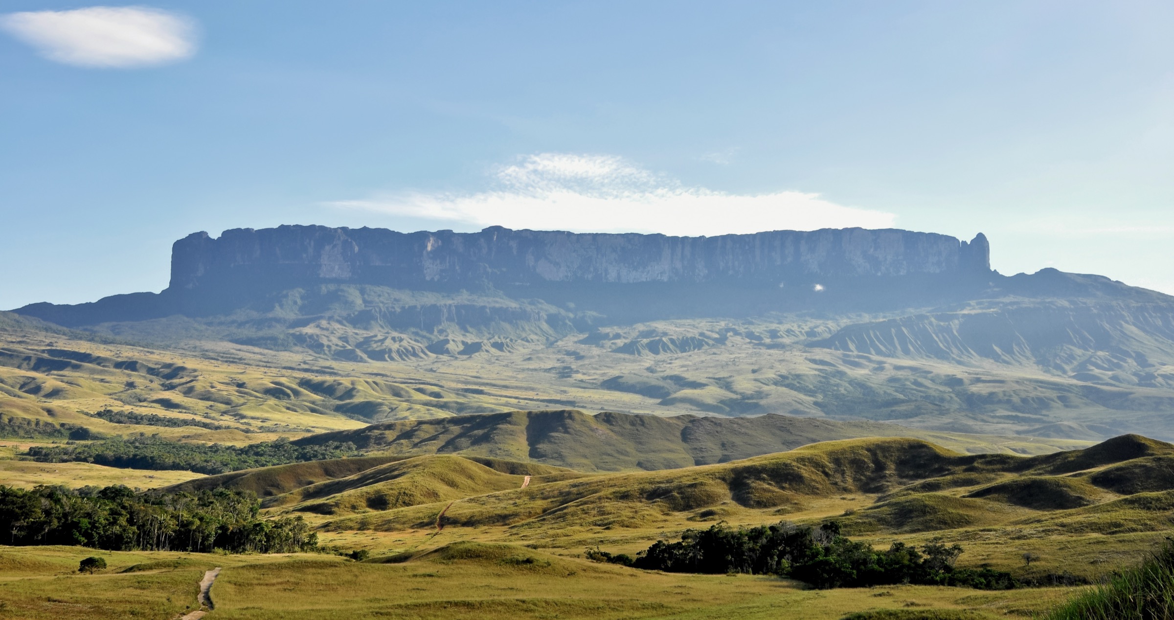
Mount Roraima and Kukenan sit in the eastern tepui country of Canaima National Park and the wider Guiana Highlands, on the border region of Venezuela, Guyana and Brazil. This is not a normal day-hiking region with trailheads, waymarks and public transport. The standard Roraima access is a guided multi-day expedition from the Venezuelan side, normally starting at Paraitepuy after road access from Santa Elena de Uairen / San Francisco de Yuruaní. Kukenan is visually central to the trek, but its summit is not an open catalogue day hike.
The five entries below are therefore selected as one-day sections or summit-plateau objectives within the standard guided Roraima trek. They are essential because they are the actual walking experiences hikers encounter in this region: the savanna approach, the Kukenan/Rio Tek camp stage, the base-camp approach, the La Rampa ascent, and the otherworldly Roraima summit walks. They should not be marketed as independent roadside day hikes.
Selection rationale
The set follows the legal/non-technical Roraima walking line and excludes closed or technical objectives. Kukenan summit routes are not selected: public sources report Kukenan was closed to climbers in 1997 on safety and environmental grounds. Other Roraima approaches from Brazil or Guyana are climbing/expedition routes or far more remote, so they are not treated as essential day hikes here.
Summary table
| # | Hike | Country | Route type | Distance | Gain | Max elevation | Difficulty |
|---|---|---|---|---|---|---|---|
| 1 | Paraitepuy to Rio Tek / Campamento Kukenan | Venezuela | Point-to-point trek section | Approx. 10-13 km; stage distance unresolved | Unresolved | Unresolved | Moderate-hard tropical savanna |
| 2 | Rio Tek / Kukenan Camp to Roraima Base Camp | Venezuela | Point-to-point trek section | Unresolved; commonly a full trek day | Unresolved | Approx. 2,000 m base-camp level | Hard |
| 3 | Base Camp to Roraima Summit via La Rampa / Paso de las Lagrimas | Venezuela | Point-to-point trek section | Unresolved | Approx. 700-800 m | 2,700 m+ plateau | Hard |
| 4 | Roraima summit: Jacuzzis, La Ventana and El Abismo area | Venezuela / border plateau context | Guided summit out-and-back / loop | Unresolved | Unresolved | Approx. 2,700 m | Moderate-hard, navigationally serious |
| 5 | Roraima summit: Maverick Rock and Triple Point | Venezuela / Guyana / Brazil border region | Guided summit out-and-back / loop | Unresolved | Unresolved | 2,810 m at Maverick Rock | Moderate-hard, navigationally serious |
1. Paraitepuy to Rio Tek / Campamento Kukenan

Snapshot
Itinerary
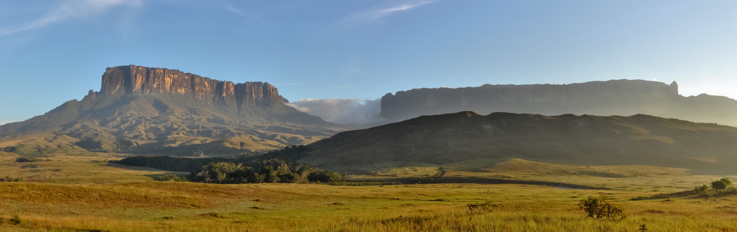
The first Roraima trekking day leaves Paraitepuy and crosses open Gran Sabana terrain toward the Rio Tek and Kukenan river area. Kukenan and Roraima dominate the skyline. Some itineraries stop at Campamento Tek; others continue roughly another hour to Campamento Kukenan so the Tek and Kukenan river crossings are completed before night.
Why it is essential
This is the canonical first walking day in Roraima country: open savanna, distant tepui walls, Pemón-guided expedition logistics and the first close approach to Kukenan and Roraima.
Equipment
Light but supportive hiking shoes/boots, sun hat, sunscreen, rain shell, river-crossing footwear if guides recommend it, water treatment, insect protection, camping gear carried by group/porter arrangement and dry bags.
Hazards and notes
Heat, puri-puri/insects, river levels, lack of shade and route-finding are the core issues. Walk only with an authorized local guide and current INPARQUES/community arrangements.
GPX / KML links
| Source | URL | Format / access | Reuse status |
|---|---|---|---|
| AllTrails: Mount Roraima full trek | alltrails.com | Source map / full route page | AllTrails terms apply; direct GPX not retrieved; full-trek source-map reference only |
| OpenStreetMap search: Paraitepuy Roraima | openstreetmap.org | OSM map geometry cross-check | OSM data is ODbL; geometry cross-check only |
External links
- AllTrails — Mount Roraima full trek
- Wikipedia (Spanish) — Roraima (tepuy)
- UNESCO — Canaima National Park
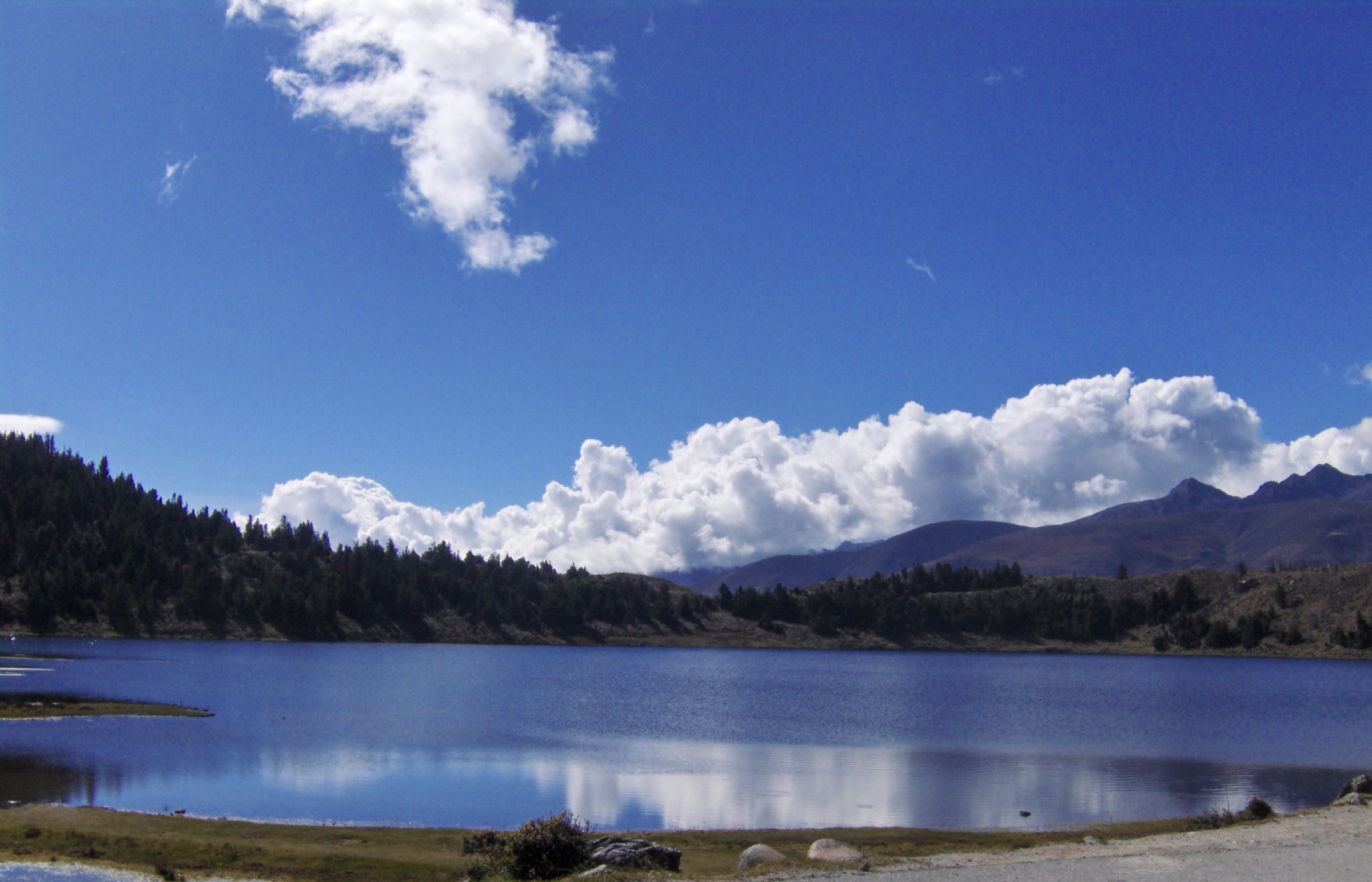
2. Rio Tek / Kukenan Camp to Roraima Base Camp

Snapshot
Itinerary
From the Tek/Kukenan river camp area the route continues across savanna and rising slopes toward the wall of Roraima. The Spanish Roraima source identifies Base Camp as the third camp before the ascent, where parties normally spend the second night and prepare for La Rampa. The day ends beneath the cliffs at the foot of the summit route.
Why it is essential
This stage moves from the broad open Gran Sabana approach into the intimate cliff-base landscape below Roraima. It is the transition from trekking toward the tepui to standing directly under its wall.
Equipment
Expedition daypack, rain shell, sun protection, warm layer for camp, water treatment, insect protection, trekking poles and dry bags. Camp equipment and food logistics should be handled through the guide/operator plan.
Hazards and notes
River crossings, mud, sudden rain, cloud, insects and remoteness matter more than technical terrain. Weather can make the cliff wall and waterfalls more dramatic but also makes navigation and footing worse.
GPX / KML links
| Source | URL | Format / access | Reuse status |
|---|---|---|---|
| AllTrails: Mount Roraima full trek | alltrails.com | Source map / full route page | AllTrails terms apply; direct GPX not retrieved; full-trek source-map reference only |
| OpenStreetMap search: Campamento Base Roraima | openstreetmap.org | OSM map geometry cross-check | OSM data is ODbL; geometry cross-check only |
External links
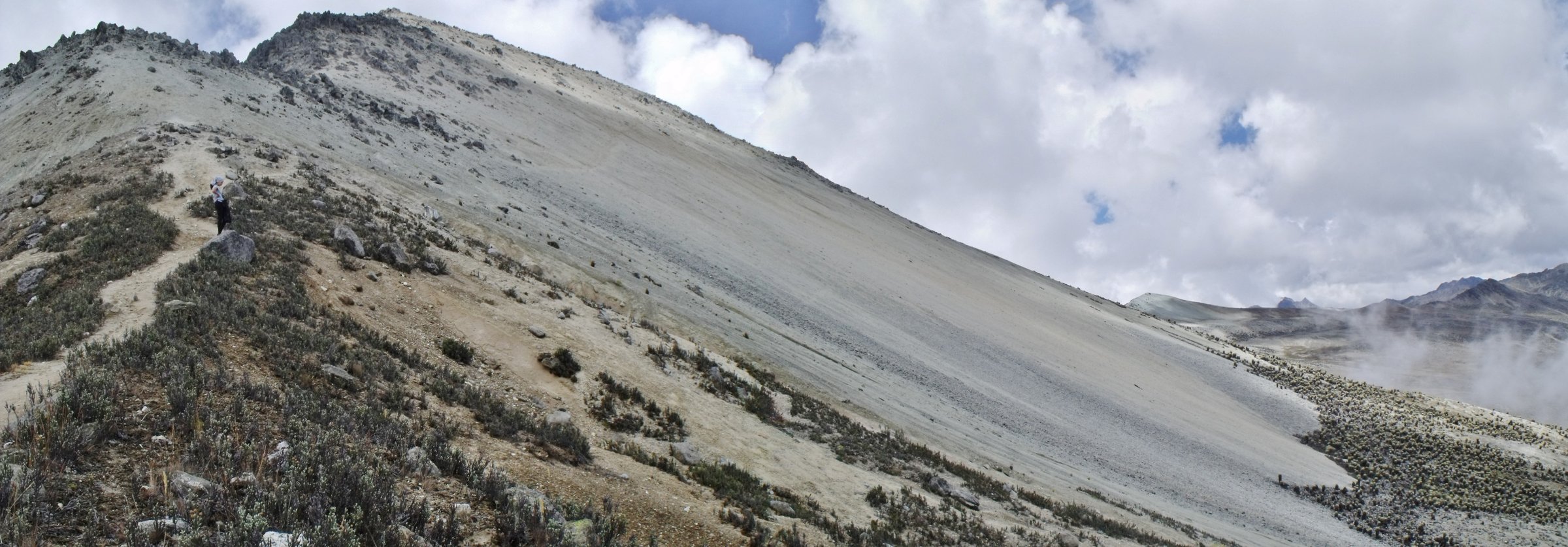
3. Base Camp to Roraima Summit via La Rampa / Paso de las Lagrimas

Snapshot
Itinerary
The climb leaves base camp and ascends the natural ramp on the south-western side of Roraima. Spanish source material names La Rampa as the natural stairway to the summit and identifies Paso de las Lagrimas as a demanding section between base camp and the top, beneath water falling from the wall. The route reaches the summit camp/hotel area on the plateau.
Why it is essential
This is the decisive Roraima day: the only open non-technical route to the summit plateau, passing from savanna/cliff-base terrain into the rock labyrinth and cloud world on top.
Equipment
Grippy footwear, rain shell, warm layer, dry bags, gloves if using wet rock/roots, poles where useful, headtorch and close guide supervision. Keep pack weight controlled.
Hazards and notes
Wet rock, waterfalls, mud, exposure near drops, falling water and route-finding are significant. The same source notes other routes require climbing equipment and advanced knowledge, so this catalogue should not imply any alternative ascent route.
GPX / KML links
| Source | URL | Format / access | Reuse status |
|---|---|---|---|
| AllTrails: Mount Roraima full trek | alltrails.com | Source map / full route page | AllTrails terms apply; direct GPX not retrieved; full-trek source-map reference only |
| OpenStreetMap search: Roraima La Rampa | openstreetmap.org | OSM map geometry cross-check | OSM data is ODbL; geometry cross-check only |
External links
4. Roraima Summit: Jacuzzis, La Ventana and El Abismo Area

Snapshot
Itinerary
From the summit camp/hotel area, guided parties visit a selection of Roraima’s summit features. The Spanish Roraima source lists the Jacuzzis, La Ventana/El Abismo area, El Foso, rock formations and crystal valleys among the Venezuelan-side points of interest. Exact routes vary with weather, camp location and guide judgement.
Why it is essential
The summit plateau is the reason many hikers go to Roraima: black sandstone, quartz basins, natural pools, cloud-wrapped viewpoints and surreal erosion forms unlike normal mountain terrain.
Equipment
Waterproof shell, warm layer, grippy shoes, dry bag, water, snacks and a guide. Navigation must not rely only on footprints: fog can make the plateau disorienting.
Hazards and notes
Cliffs, fissures, deep pools, slippery rock, sudden fog and fragile tepui ecology are serious concerns. Stay with the guide and do not remove quartz or disturb summit vegetation.
GPX / KML links
| Source | URL | Format / access | Reuse status |
|---|---|---|---|
| AllTrails: Mount Roraima full trek | alltrails.com | Source map / full route page | AllTrails terms apply; direct GPX not retrieved; broad summit source-map only; individual summit objective not isolated |
| OpenStreetMap search: Mount Roraima summit | openstreetmap.org | OSM map geometry cross-check | OSM data is ODbL; geometry cross-check only |
External links
- Wikipedia (Spanish) — Roraima (tepuy)
- AllTrails — Mount Roraima full trek
- Wikipedia — Mount Roraima
- Wikimedia Commons — Category: Mount Roraima
5. Roraima Summit: Maverick Rock and Triple Point

Snapshot
Itinerary
From the summit camp/hotel area, guided summit days may visit Maverick Rock, the high point of Mount Roraima, and/or the Triple Point border marker area. The exact route depends on camp location, weather, permitted itinerary and guide judgement. The same plateau can be disorienting in cloud, so this should remain a guided objective.
Why it is essential
Maverick Rock is the high point of Roraima, while the Triple Point gives the mountain its famous three-country border identity. Together they are the summit-landmark counterpart to the Jacuzzis and viewpoint day.
Equipment
Warm/wet-weather layers, grippy shoes, water, snacks, dry bag, headtorch and guide navigation. A GPS track is helpful but not a substitute for local guiding.
Hazards and notes
Do not wander independently on the plateau. Fissures, cliffs, fog and fragile summit ecology are the main risks. Note that the Guyana/Venezuela boundary context is politically sensitive in some sources; the catalogue should use neutral wording around the border region.
GPX / KML links
| Source | URL | Format / access | Reuse status |
|---|---|---|---|
| AllTrails: Mount Roraima full trek | alltrails.com | Source map / full route page | AllTrails terms apply; direct GPX not retrieved; broad summit source-map only; individual summit objective not isolated |
| OpenStreetMap search: Maverick Rock Roraima | openstreetmap.org | OSM map geometry cross-check | OSM data is ODbL; geometry cross-check only |
External links
- Wikipedia — Maverick Rock
- Wikipedia (Spanish) — Roraima (tepuy)
- Wikipedia — Mount Roraima
- Wikipedia — Kukenán-tepui (closure context)
- AllTrails — Mount Roraima full trek
External links
| Source | URL |
|---|---|
| AllTrails — Mount Roraima full trek | alltrails.com |
| Wikipedia (Spanish) — Roraima (tepuy) | es.wikipedia.org |
| Wikipedia — Mount Roraima | en.wikipedia.org |
| Wikipedia — Maverick Rock | en.wikipedia.org |
| Wikipedia — Kukenán-tepui (closure context) | en.wikipedia.org |
| UNESCO — Canaima National Park | whc.unesco.org |
| Wikimedia Commons — Category: Mount Roraima | commons.wikimedia.org |