Regional overview
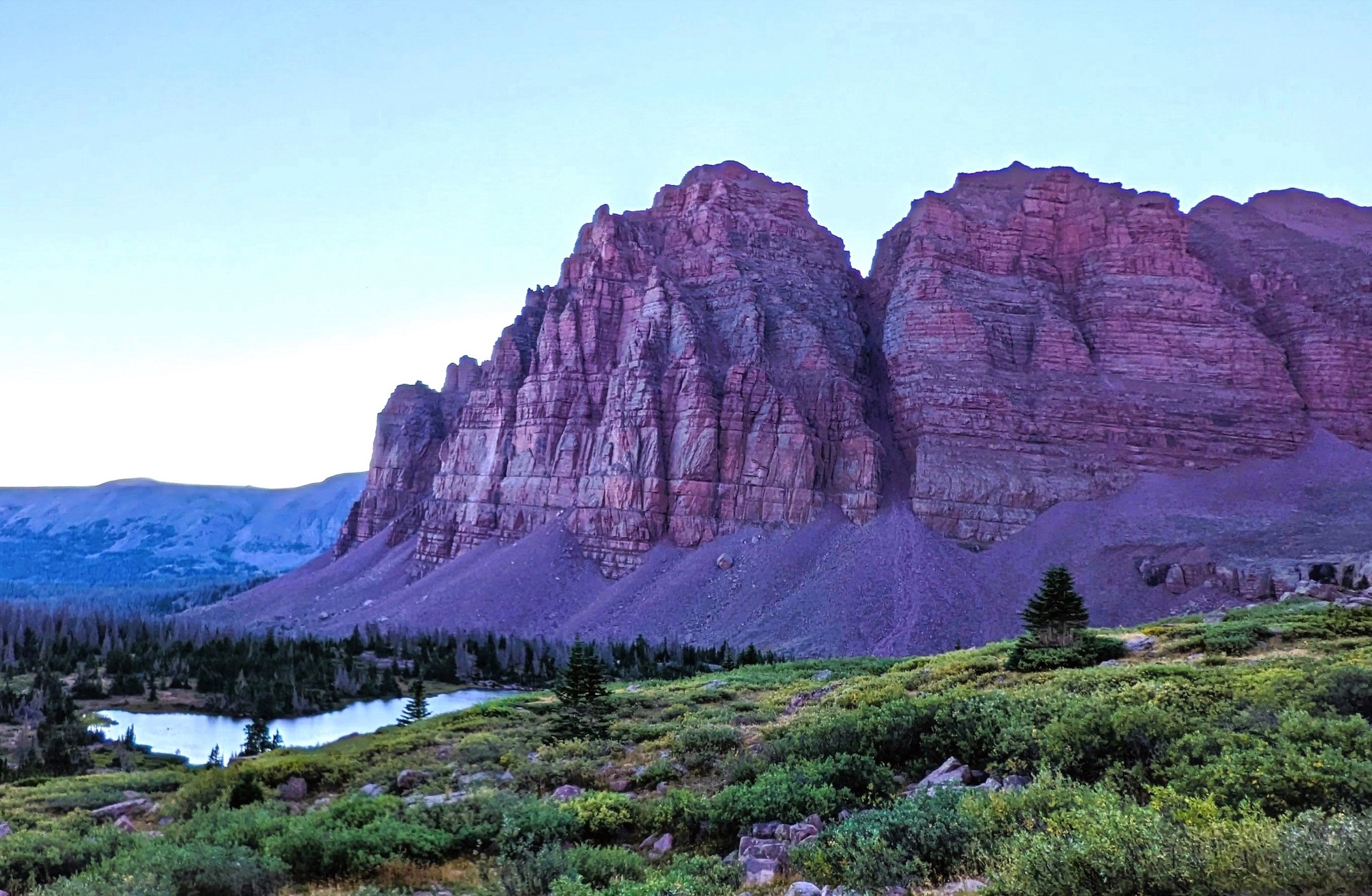
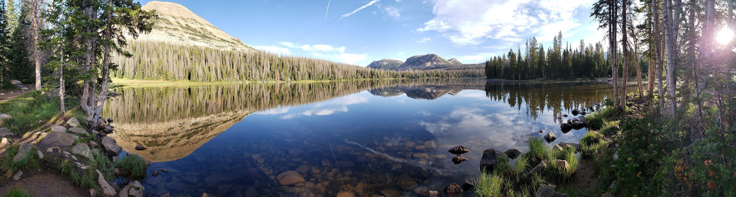
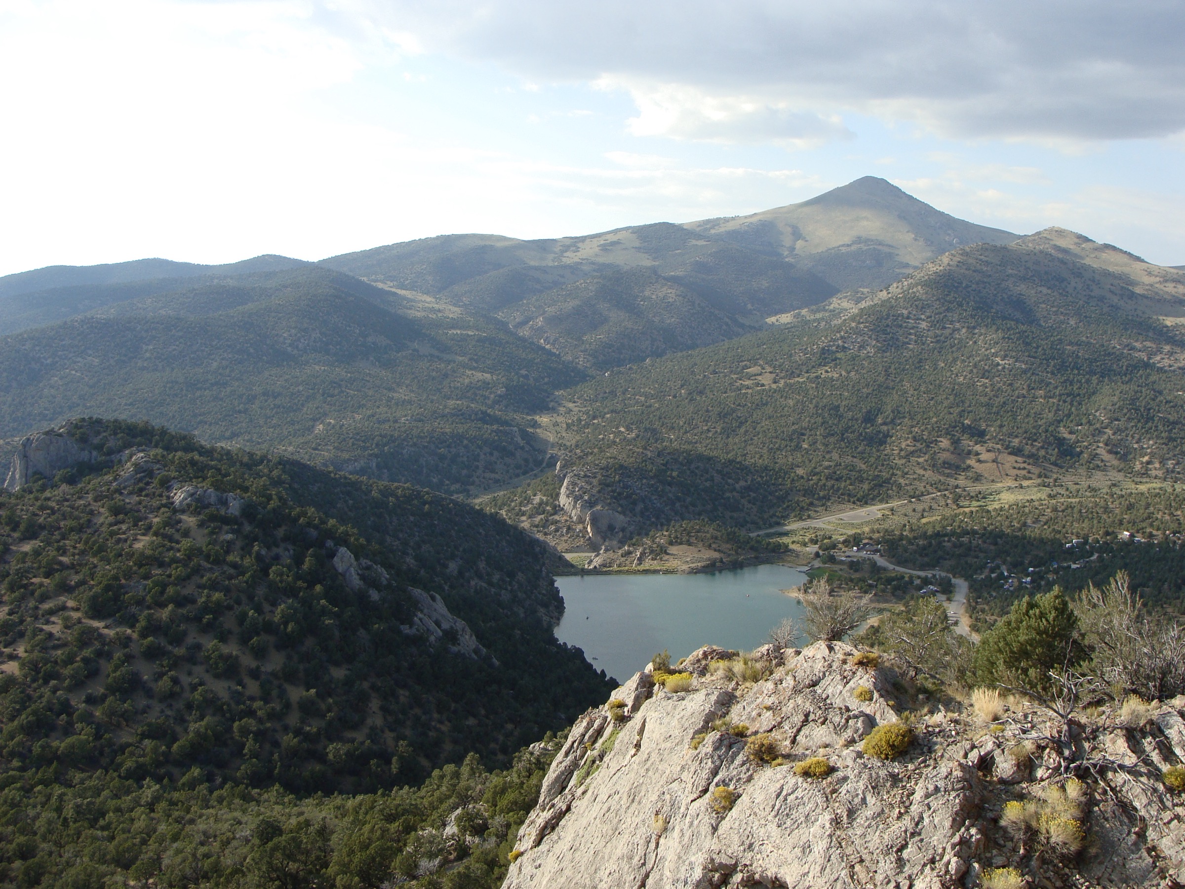
The western Uintas are the most road-accessible part of Utah’s east–west Uinta Mountains, centred on the Mirror Lake Highway, Kamas, Hayden Pass, Pass Lake, Bald Mountain Pass, Christmas Meadows and the western Highline Trailhead. The walking character is high-elevation mountain hiking rather than desert hiking: alpine lakes, open passes, spruce–fir forest, rocky basins, tundra ridges and abrupt weather changes above 3,000 m.
Most of the selected hikes lie in or beside the High Uintas Wilderness and the Uinta-Wasatch-Cache National Forest. The reliable hiking season is short — snow can linger into early July, the Mirror Lake Highway and side roads are seasonal, and afternoon thunderstorms are a serious summer hazard on exposed passes and summits. Mosquitoes can be heavy around lakes in early and mid-summer.
Public transport to the trailheads was not verified in this pass; treat these hikes as private-vehicle or shuttle-access routes and check seasonal road status before departure. USDA Forest Service TrailNFS public GIS geometry was found for the main named trail segments, but official recreation pages for individual trails were incomplete or affected by Forest Service site migration, so route statistics mainly use AllTrails and are labelled as such.
Selection rationale
The five hikes cover the western Uintas’ core day-hike experiences: an accessible high summit at Bald Mountain; a classic lake-and-pass circuit at Lofty Lake Loop; a longer pass-and-lake traverse via Notch Mountain Trail to Ibantik Lake; the major northern basin at Amethyst Lake; and a Highline Trail sample into Naturalist Basin. The list avoids choosing only short Mirror Lake Highway walks while keeping the longer routes feasible for fit, acclimatised day hikers in stable summer conditions.
Summary table
| # | Hike | Country | Route type | Distance | Gain | Max elevation | Difficulty |
|---|---|---|---|---|---|---|---|
| 1 | Bald Mountain Trail | USA | Out-and-back summit | 4.5 km | 360 m | 3,642 m | Moderate |
| 2 | Lofty Lake Loop | USA | Loop | 7.4 km | 290 m | ~3,295 m | Moderate |
| 3 | Ibantik Lake via Notch Mountain Trail | USA | Out-and-back | 19.2 km | 544 m | ~3,238 m at The Notch | Hard |
| 4 | Amethyst Lake via Stillwater and Amethyst Lake Trails | USA | Out-and-back | 20.8–20.9 km | ~709 m | ~3,200–3,250 m | Hard |
| 5 | Naturalist Basin via Highline Trail | USA | Out-and-back basin route | 23.7 km | 605 m | ~3,100–3,200 m | Hard |
1. Bald Mountain Trail
Snapshot
Itinerary
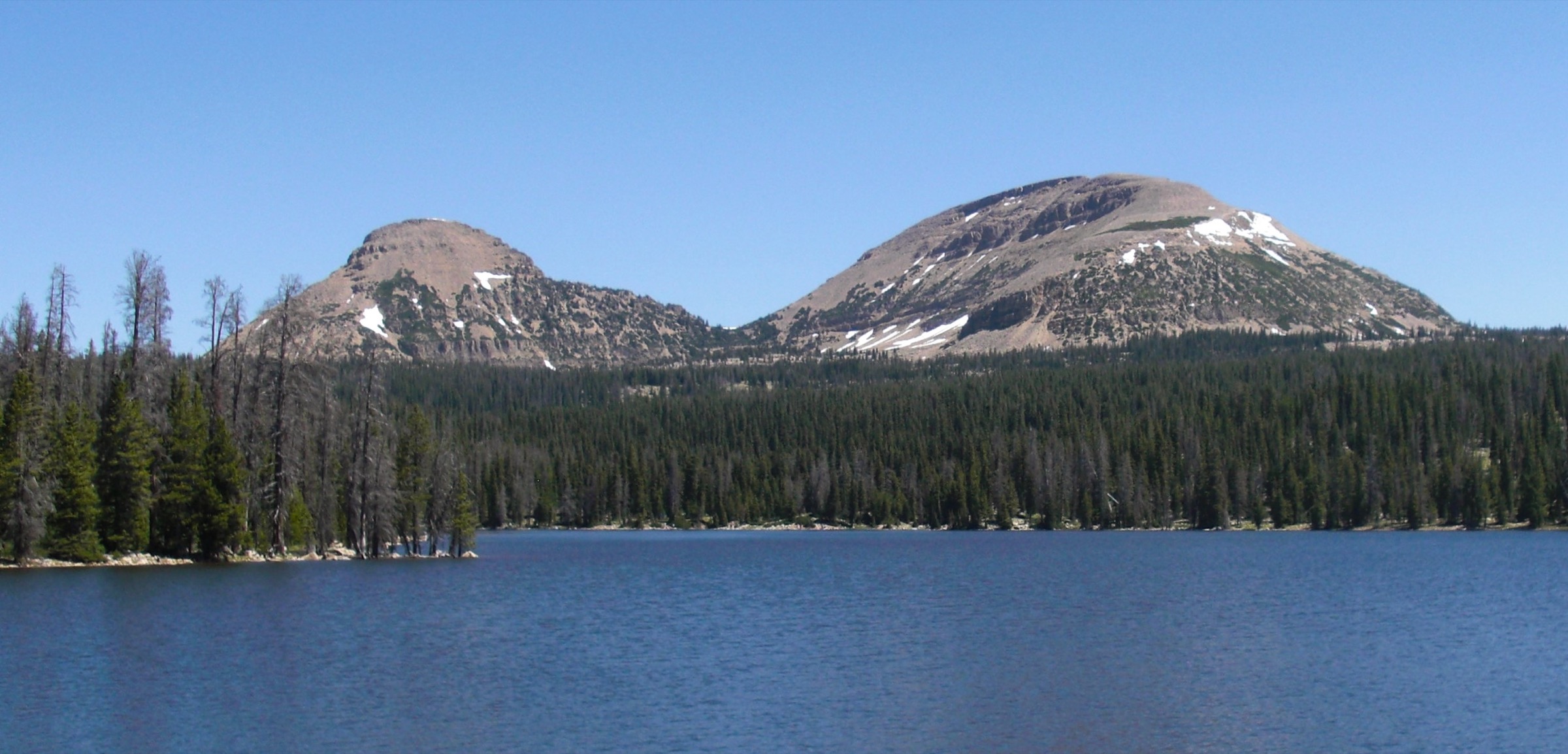
From the Bald Mountain trailhead near Bald Mountain Pass, the maintained trail climbs directly up the mountain’s western shoulder to the broad summit ridge. The path is easy to follow in clear conditions, with open views over the Mirror Lake Highway basin, the surrounding lakes and the western Uinta crest. Return by the same trail.
Why it is essential
Bald Mountain is the most accessible major summit hike in the western Uintas. It delivers a high alpine summit and broad lake-basin views in a short distance, and is a natural first anchor for the region.
Equipment
- Sturdy hiking shoes or boots
- Warm and windproof layers
- Rain shell
- Water and sun protection
- Offline map or GPS
- Microspikes if snow remains on the upper trail
Hazards and notes
- The route is high, exposed and rocky, with little shade.
- Lightning is the main summer hazard — start early.
- Snow or ice make the upper trail more serious outside the normal summer window.
- AllTrails indicates a Mirror Lake Highway recreation fee/pass applies to this area; check current rules locally.
GPX / route file
| Source | URL | Format | Notes |
|---|---|---|---|
| USFS TrailNFS — Bald Mountain Trail #3202 | apps.fs.usda.gov | GeoJSON (ArcGIS service) | Official USDA Forest Service geodata; usable with citation, final reuse terms should be confirmed |
| AllTrails — Bald Mountain Trail | alltrails.com | Source-map route page | Do not reuse proprietary geometry directly |
| OpenStreetMap search — Bald Mountain Uinta | openstreetmap.org | Source map | Reusable only under ODbL terms with attribution/share-alike |
Sources
- AllTrails — Bald Mountain Trail
- Bald Mountain (Uinta Range) — reference page
- USDA Forest Service — TrailNFS public ArcGIS layer
2. Lofty Lake Loop
Snapshot
Itinerary
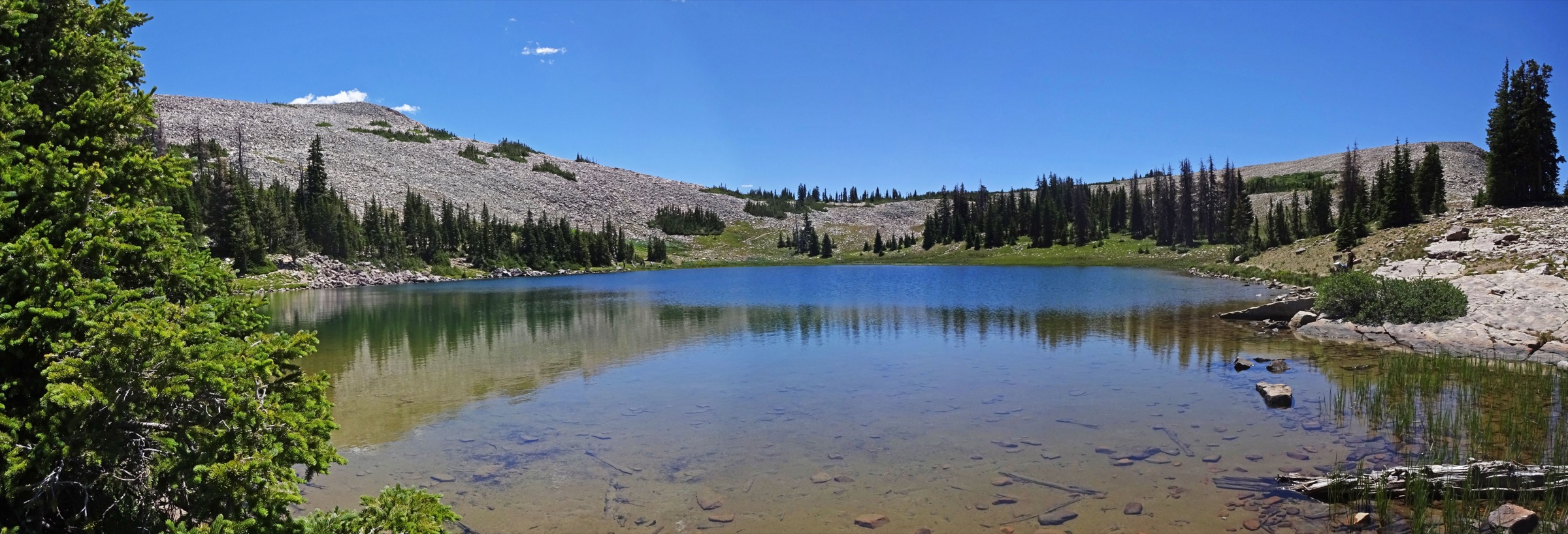
From Pass Lake Trailhead, follow the Weber River Trail and turn onto the Lofty Lake Trail. The loop passes junctions for Cuberant Lake, Kamas Lake, Lofty Lake and Scout Lake before returning by the Weber River side of the circuit. The route gives a compact sample of the western Uintas’ lake basins, open passes and rocky alpine forest.
Why it is essential
Lofty Lake Loop is one of the strongest short loops in the western Uintas: multiple lakes, a high basin and a proper circuit rather than a simple out-and-back.
Equipment
- Sturdy shoes or boots
- Rain shell and a warm layer
- Water, food and sun protection
- Insect protection in summer
- Offline navigation
Hazards and notes
- Rocky tread and wet or muddy sections after snowmelt.
- Mosquitoes near lakes.
- Fast weather changes; snow can linger on shaded and high sections.
- AllTrails notes a fee requirement for the access area.
GPX / route file
| Source | URL | Format | Notes |
|---|---|---|---|
| USFS TrailNFS — Lofty Lake Loop #3217 | apps.fs.usda.gov | GeoJSON (ArcGIS service) | Official geometry for named Lofty Lake Loop segments; not necessarily the full AllTrails loop |
| USFS TrailNFS — Middle Fork Weber River #3222 | apps.fs.usda.gov | GeoJSON (ArcGIS service) | Useful official connector geometry for the loop variant |
| AllTrails — Lofty Lake Trail | alltrails.com | Source-map route page | Do not reuse proprietary geometry directly |
| OpenStreetMap search — Lofty Lake Uinta | openstreetmap.org | Source map | Reusable only under ODbL terms with attribution/share-alike |
Sources
- AllTrails — Lofty Lake Trail
- USDA Forest Service — TrailNFS public ArcGIS layer
- Wikimedia Commons — Lofty Lake image
3. Ibantik Lake via Notch Mountain Trail
Snapshot
Itinerary
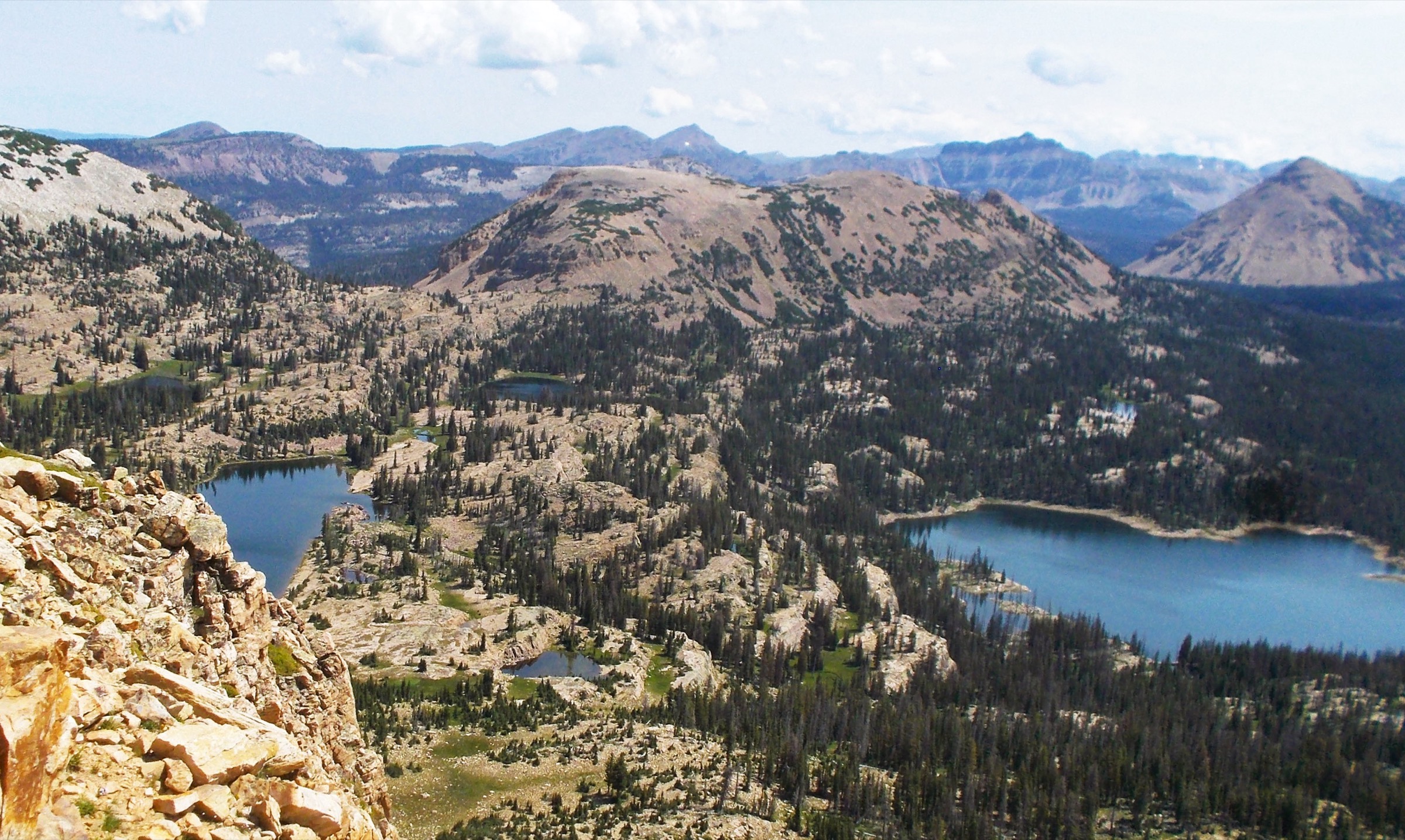
Follow the Notch Mountain Trail into the western Uinta lake country, passing forest, meadows and small lakes before climbing toward The Notch, the gap in Notch Mountain. Continue beyond the pass on the Ibantik Lake route, descending toward lake basins including Lake Lovenia and Ibantik Lake, then return the same way. Shorter variants can turn around at The Notch for a moderate day, but the essential route uses the longer lake objective.
Why it is essential
This route combines two defining western-Uinta features: a named pass cut through Notch Mountain and a chain of high lakes beyond the busier Mirror Lake Highway trailheads. It is the strongest ridge/pass-and-lake day in the western selection.
Equipment
- Sturdy boots
- Warm and rain layers
- Headlamp for a long day
- Water treatment and food
- Offline map / GPS
- Sun and insect protection
- Trekking poles for the return climb
Hazards and notes
- The route is high for its entire length; the outbound leg includes descent that must be regained on return.
- Snow, downed trees, wet ground and afternoon storms can materially change difficulty.
- Dogs are reported as allowed by AllTrails; check current forest and wilderness rules for leash and access requirements.
GPX / route file
| Source | URL | Format | Notes |
|---|---|---|---|
| USFS TrailNFS — Notch Mountain Trail #3228 | apps.fs.usda.gov | GeoJSON (ArcGIS service) | Official geometry for the named Notch Mountain Trail; the full Ibantik variant needs later geometry assembly |
| AllTrails — Ibantik Lake via Notch Mountain Trail | alltrails.com | Source-map route page | Do not reuse proprietary geometry directly |
| Komoot — Ibantik Lake via Notch Mountain Trail | komoot.com | Source-map route page | Komoot terms apply; do not reuse proprietary geometry directly |
| OpenStreetMap search — Notch Mountain Uinta | openstreetmap.org | Source map | Reusable only under ODbL terms with attribution/share-alike |
Sources
- AllTrails — Ibantik Lake via Notch Mountain Trail
- American Southwest — Notch Mountain Trail guide
- USDA Forest Service — TrailNFS public ArcGIS layer
4. Amethyst Lake via Stillwater and Amethyst Lake Trails
Snapshot
Itinerary
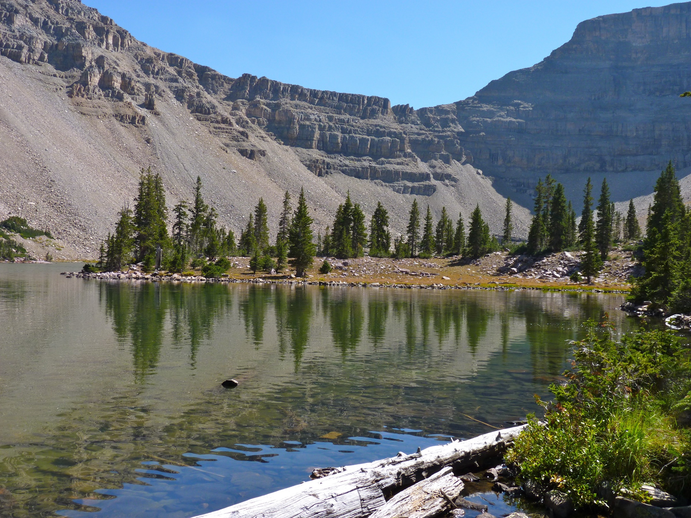
Start on the Stillwater Trail in the Stillwater Fork of the Bear River drainage. After roughly 3.2 km / 2 mi, turn onto the Amethyst Lake Trail. The route climbs through forest and increasingly rocky upper terrain into Amethyst Basin, ending at Amethyst Lake below Ostler Peak and nearby cirque walls. Return by the same route.
Why it is essential
Amethyst Lake is one of the classic northern High Uintas lake-basin objectives. It gives a full mountain day from Christmas Meadows, with forest approach, steep upper trail and a dramatic lake basin below high peaks.
Equipment
- Sturdy boots and trekking poles
- Rain shell and a warm layer
- Headlamp
- Water treatment and food for a long day
- Offline navigation
- Sun and insect protection
Hazards and notes
- Long high-elevation day; snow can persist into July in heavy years.
- A May 2025 AllTrails report noted deep snow before the lake.
- Mosquitoes and muddy sections can be significant early season.
- Road access to Christmas Meadows is seasonal and can be rough after wet weather.
- Fee/pass status for the access area should be checked before departure.
GPX / route file
| Source | URL | Format | Notes |
|---|---|---|---|
| USFS TrailNFS — Amethyst Lake Trail #4149 | apps.fs.usda.gov | GeoJSON (ArcGIS service) | Official geometry for the Amethyst Lake segment |
| USFS TrailNFS — Stillwater Trail #4098 | apps.fs.usda.gov | GeoJSON (ArcGIS service) | Official approach geometry for the Stillwater corridor |
| AllTrails — Amethyst Lake via Stillwater and Amethyst Lake Trails | alltrails.com | Source-map route page | Do not reuse proprietary geometry directly |
| OpenStreetMap search — Amethyst Lake Uinta | openstreetmap.org | Source map | Reusable only under ODbL terms with attribution/share-alike |
Sources
- AllTrails — Amethyst Lake via Stillwater and Amethyst Lake Trails
- Wilderness Portal — Amethyst Lake
- USDA Forest Service — TrailNFS public ArcGIS layer
5. Naturalist Basin via Highline Trail
Snapshot
Itinerary
From the Highline Trailhead, follow the Highline Trail for about 6.4 km / 4 mi to the Naturalist Basin junction. Turn into Naturalist Basin and continue toward Jordan Lake and the surrounding lake bench. The route rolls up and down before the basin climb, with AllTrails noting an early descent from the trailhead and a later climb toward Jordan Lake. Return by the same approach.
Why it is essential
Naturalist Basin is one of the western Uintas’ best day-sized samples of the Uinta Highline corridor: a long high-trail approach, multiple lakes, remote-feeling basins and a direct link to the region’s classic long-distance route.
Equipment
- Sturdy boots
- Headlamp
- Water treatment
- Rain shell and a warm layer
- Food for a long day
- Offline navigation
- Sun and insect protection
- Trekking poles
Hazards and notes
- Long, remote-feeling day at altitude; repeated ups and downs.
- Possible wet ground, rocky tread and navigation around lake-basin side trails.
- Snow, mosquitoes and thunderstorms are common seasonal issues.
- AllTrails reports toilets, water, a stock ramp and nearby campsites at the trailhead; verify current services locally.
GPX / route file
| Source | URL | Format | Notes |
|---|---|---|---|
| USFS TrailNFS — Naturalist Basin Trail #3106 | apps.fs.usda.gov | GeoJSON (ArcGIS service) | Official geometry for Naturalist Basin segments |
| USFS TrailNFS — Highline Trail #3105 | apps.fs.usda.gov | GeoJSON (ArcGIS service) | Official approach geometry for western Highline segments |
| AllTrails — Naturalist Basin | alltrails.com | Source-map route page | Do not reuse proprietary geometry directly |
| OpenStreetMap search — Naturalist Basin Uinta | openstreetmap.org | Source map | Reusable only under ODbL terms with attribution/share-alike |
Photo status: a route-specific Commons candidate for Naturalist Basin was found, but author/source metadata was incomplete in this pass; the inline figure is deferred until attribution is resolved.
Sources
- AllTrails — Naturalist Basin
- Uinta Highline Trail — reference page
- USDA Forest Service — TrailNFS public ArcGIS layer
Further reading
| Source | URL |
|---|---|
| Uinta-Wasatch-Cache National Forest | fs.usda.gov |
| Uinta-Wasatch-Cache National Forest — hiking | fs.usda.gov |
| USDA Forest Service — TrailNFS public ArcGIS layer | apps.fs.usda.gov |
| AllTrails — High Uintas Wilderness | alltrails.com |
| Uinta Mountains — reference page | en.wikipedia.org |
| Uinta Highline Trail — reference page | en.wikipedia.org |
| OpenStreetMap (ODbL 1.0) | openstreetmap.org |
Missing data / follow-up work
- No official downloadable GPX files were found; USFS TrailNFS GeoJSON is available for named trail segments and should be assembled into final project geometry.
- AllTrails and Komoot route data should not be reused as direct geometry unless their route-file terms are separately cleared.
- Naturalist Basin has an open-licence Commons image candidate but author/source attribution is incomplete; resolve before publishing an inline figure.
- Exact maximum elevations for Lofty Lake Loop, Amethyst Lake and Naturalist Basin need final map/GIS extraction if publication precision is required.
- Current road opening dates, Mirror Lake Highway fee rules, trailhead services and post-winter snow conditions need local confirmation each season.