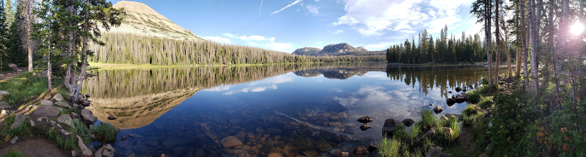
Regional overview
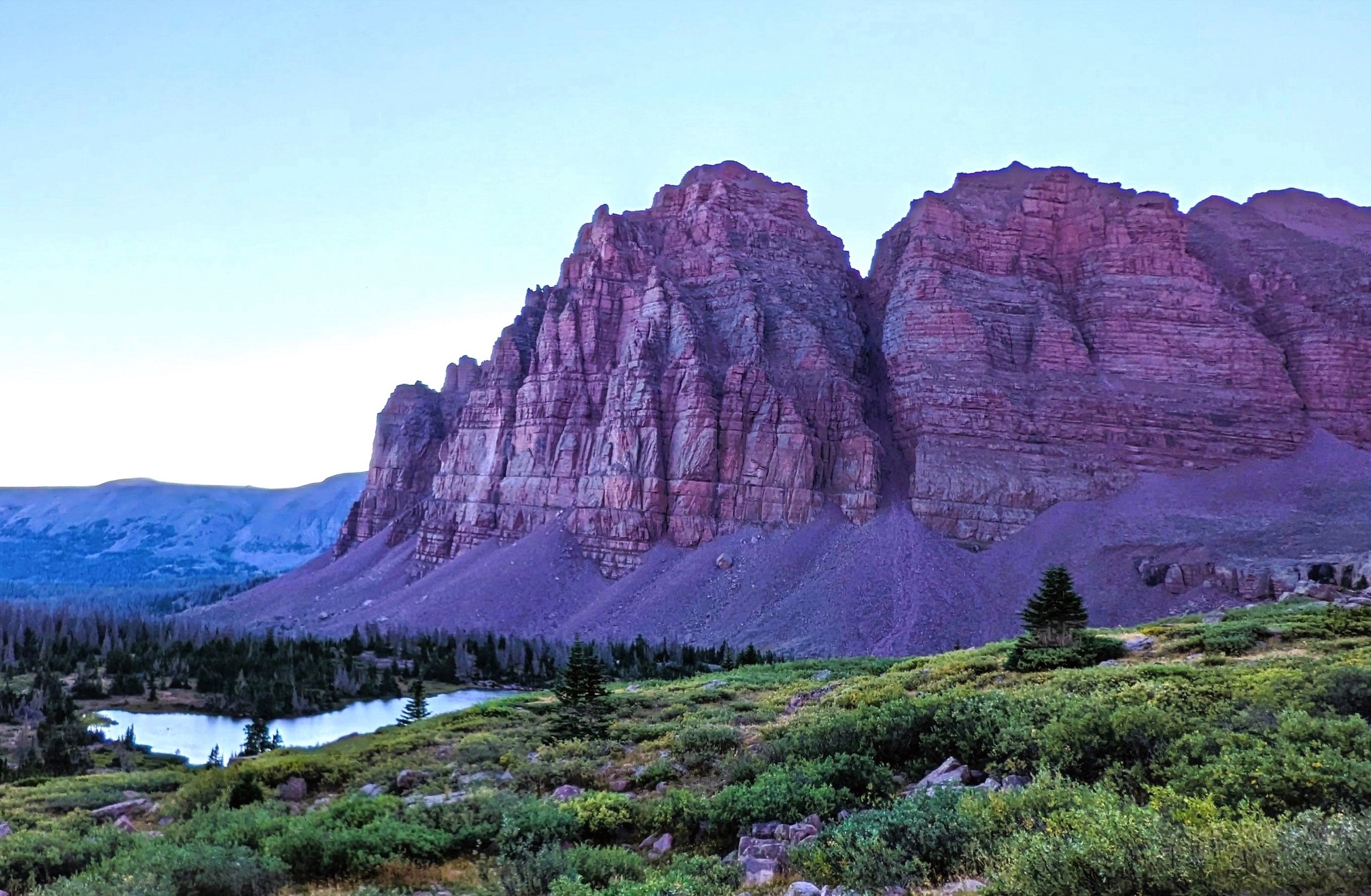
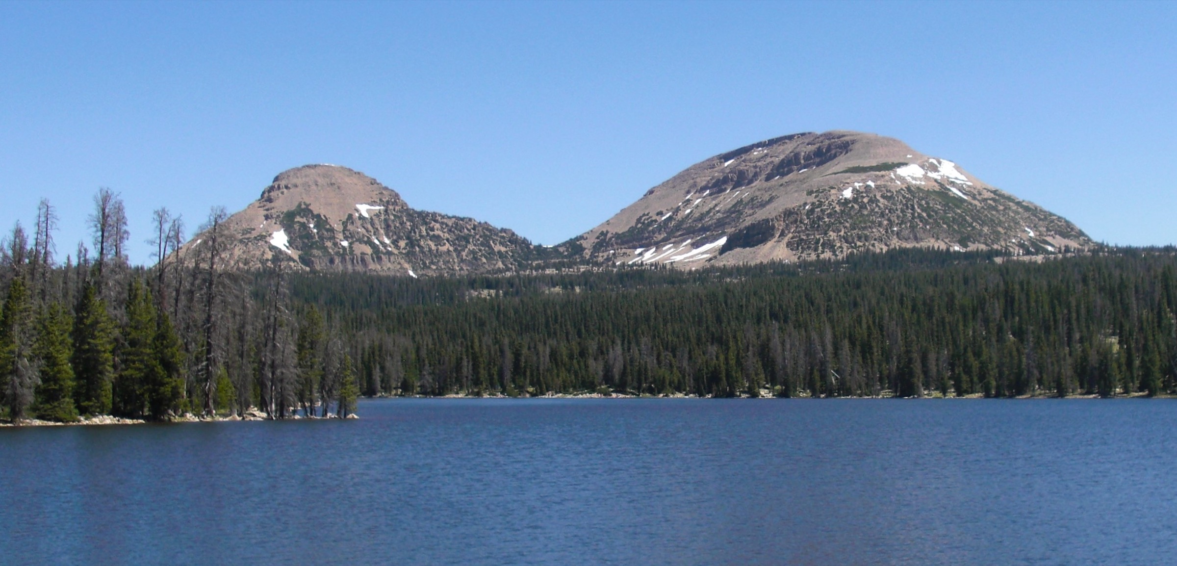
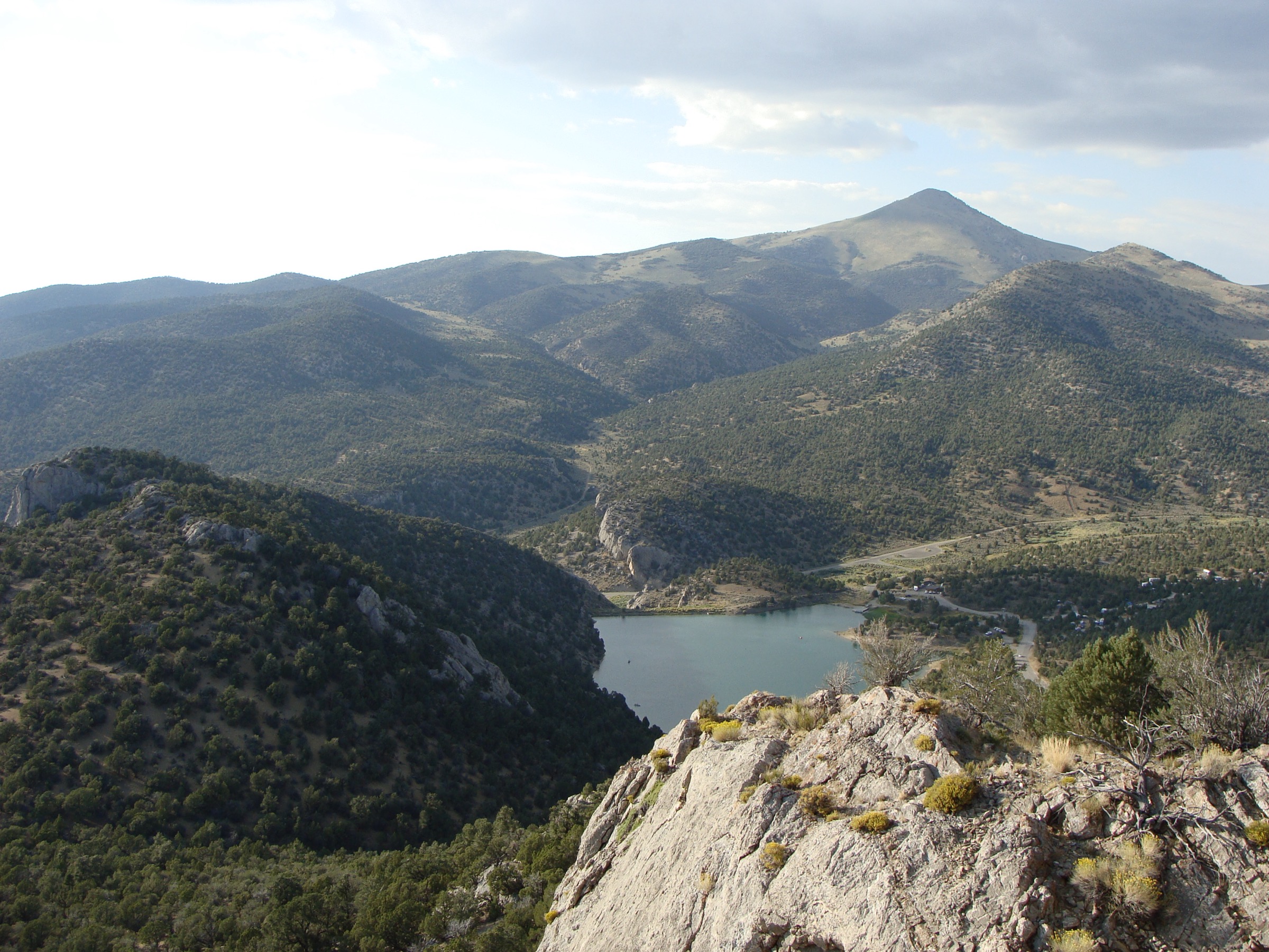
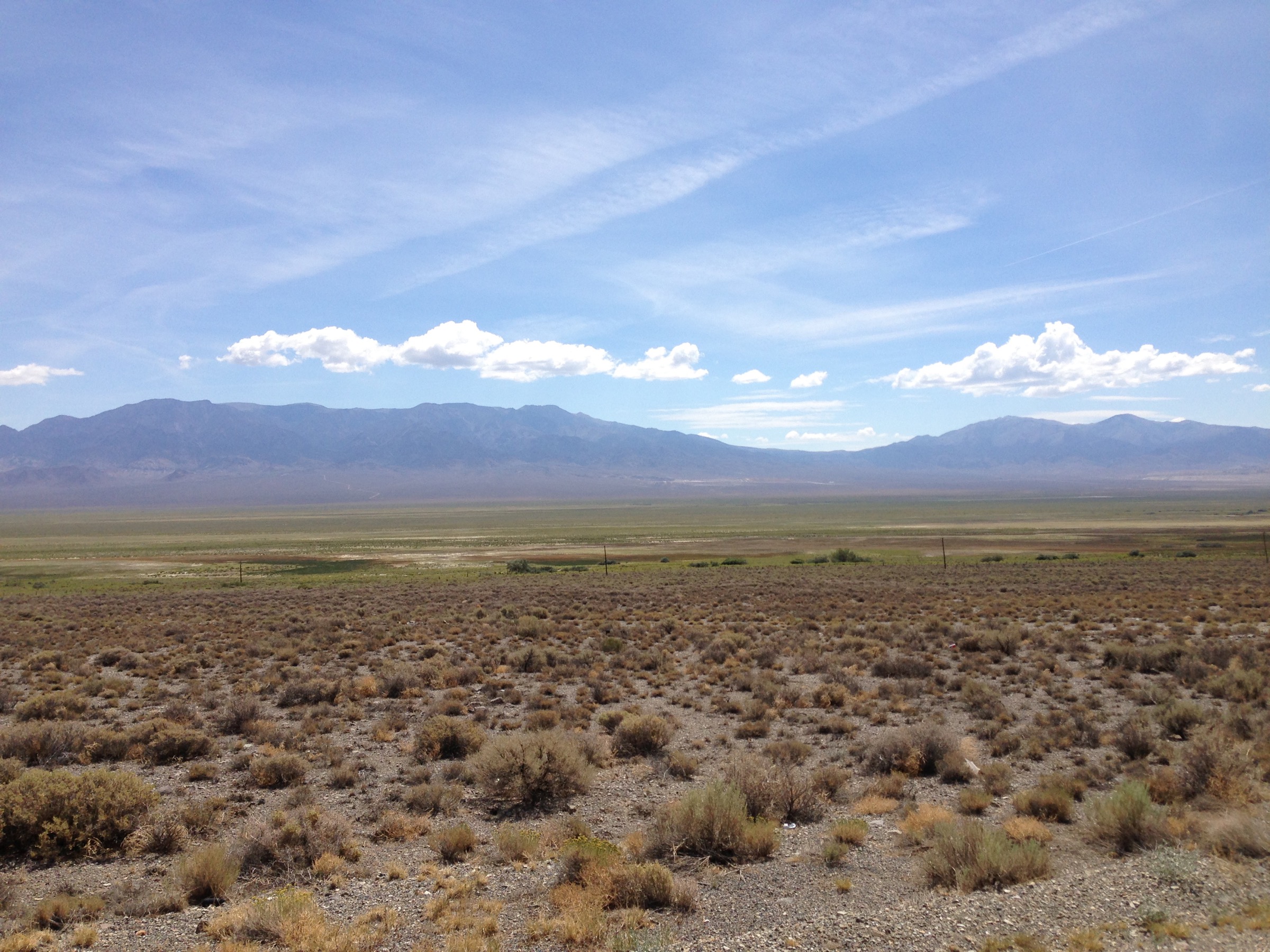
The Mirror Lake Highway region is the most accessible high-elevation day-hiking corridor in the western Uinta Mountains. The official Uinta-Wasatch-Cache National Forest page describes the Mirror Lake Scenic Byway as a route east from Kamas that rises through forest, meadows, rugged peaks and numerous access points into the High Uintas. The corridor gives high trailheads near Bald Mountain Pass, lake loops, short family walks and longer alpine-basin routes.
The walking character is high, scenic and comparatively accessible: short summit hikes, lake loops and moderate loops often begin near 3,050 m (10,000 ft). The main complications are altitude, summer thunderstorms, lingering snow, a short high-country season, corridor recreation fees, winter avalanche terrain and seasonal highway closure.
Selection rationale
The five routes give a balanced first catalogue for the corridor: one iconic summit at Bald Mountain, one classic high-lake loop at Lofty Lake, one moderate lake destination at Cuberant Lakes, one shorter lake-chain trail at Fehr Lake, and the essential easy shoreline loop at Mirror Lake itself. The selection is intentionally concentrated on the highway corridor because the requested region is the Mirror Lake Highway rather than the broader High Uintas Wilderness.
Summary
| # | Hike | Trailhead | Route type | Distance | Gain | Difficulty |
|---|---|---|---|---|---|---|
| 1 | Bald Mountain Trail | Bald Mountain Trailhead, Bald Mountain Pass | Out-and-back | 4.5 km | 360 m | Moderate |
| 2 | Lofty Lake Loop | Pass Lake Trailhead | Loop | 7.4 km | 290 m | Moderate |
| 3 | Cuberant Lakes Trail | Pass Lake Trailhead | Out-and-back | 10.5 km | 293 m | Moderate |
| 4 | Fehr Lake Trail | Fehr Lake / Trial Lake corridor | Out-and-back | 6.0 km | Not verified | Moderate |
| 5 | Mirror Lake Loop | Mirror Lake Recreation Site | Loop | 2.3 km | 11 m | Easy |
1. Bald Mountain Trail
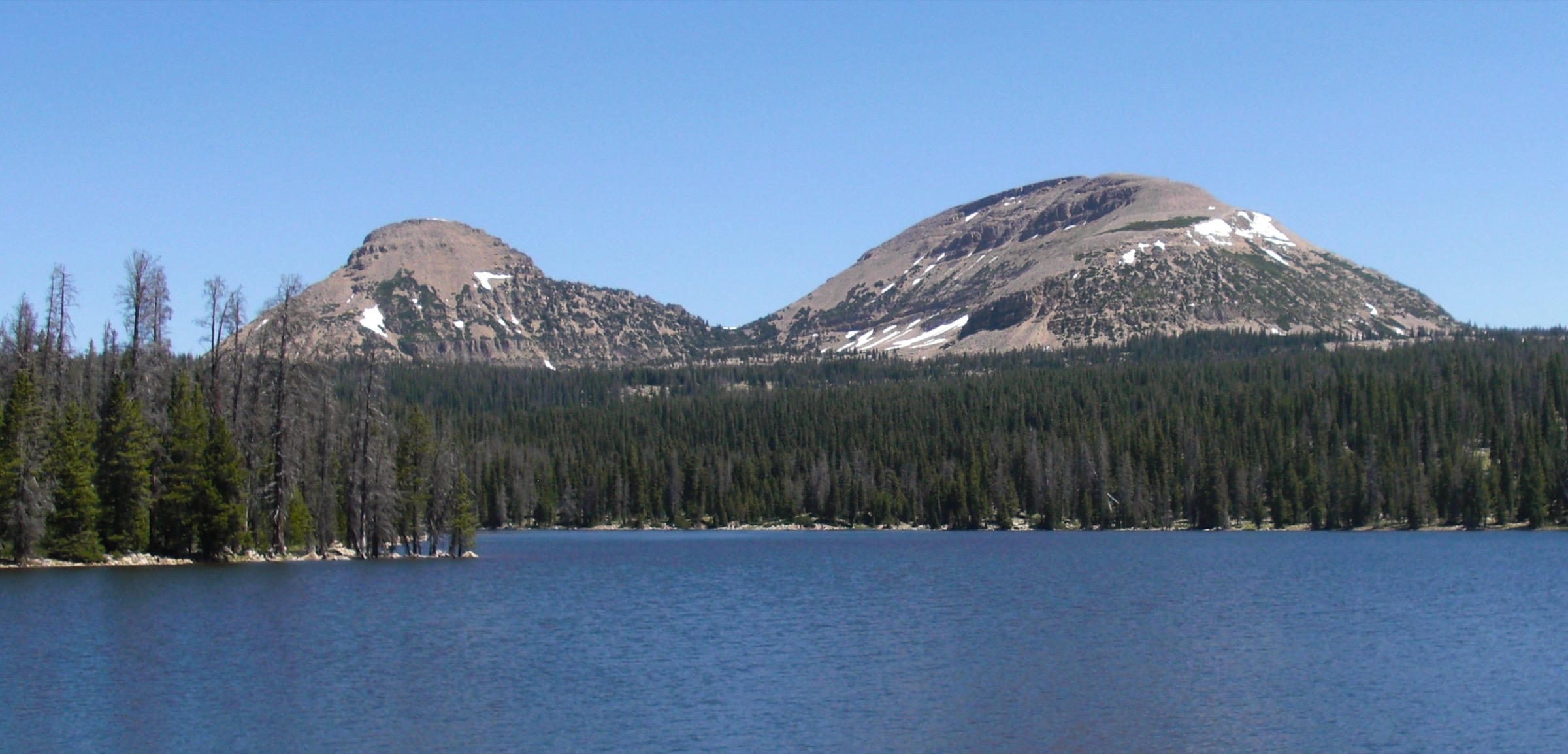
Snapshot
Photo status: no in-body figure was shipped in this pass. Two CC BY-SA candidates on Wikimedia Commons — Bald Mountain (Glennfcowan, CC BY-SA 3.0) and Bald Mountain — Uintahs (Jeff McGrath, CC BY-SA 2.0) — plus a CC BY 3.0 Mirror Lake, Uinta Mountains, Utah view from the summit (Glennfcowan) can be sourced as follow-ups.
Itinerary
From the Bald Mountain Trailhead near the pass, climb a clear rocky trail up the broad slope to the summit of Bald Mountain. The route is short but starts high and has little shade or weather protection. Summit views take in Mirror Lake, Reids Peak, Hayden Peak and the high western Uintas.
Why it is essential
Bald Mountain is the corridor’s most recognisable short summit hike: easily reached from the highway, high enough to feel alpine, and famous for broad lake-and-peak views.
Equipment
- Sturdy footwear for rocky trail.
- Wind / rain shell and warm layer, even in midsummer.
- Sun protection, water, food.
- Traction if snow remains.
Hazards and notes
- Altitude and lightning exposure on the open upper slope.
- No shade; wind is often strong on the summit.
- Steep drop-offs near the summit area.
- Route is not a casual winter hike — treat as an alpine day.
GPX / route file
| Source | URL | Format | Notes |
|---|---|---|---|
| AllTrails — Bald Mountain Trail | alltrails.com | Source route map | Distance, gain and time checked; AllTrails terms apply |
| USFS TrailNFS — Bald Mountain Trail #3202 | apps.fs.usda.gov | GeoJSON | USDA Forest Service data; official geometry for the named trail; reuse terms should be confirmed before shipping geometry |
No packaged Forest Service GPX or KML download was found for this route.
Sources
- AllTrails — Bald Mountain Trail
- USFS — Mirror Lake Scenic Byway
- Wikimedia Commons — Bald Mountain
- Wikimedia Commons — Bald Mountain, Uintahs
2. Lofty Lake Loop
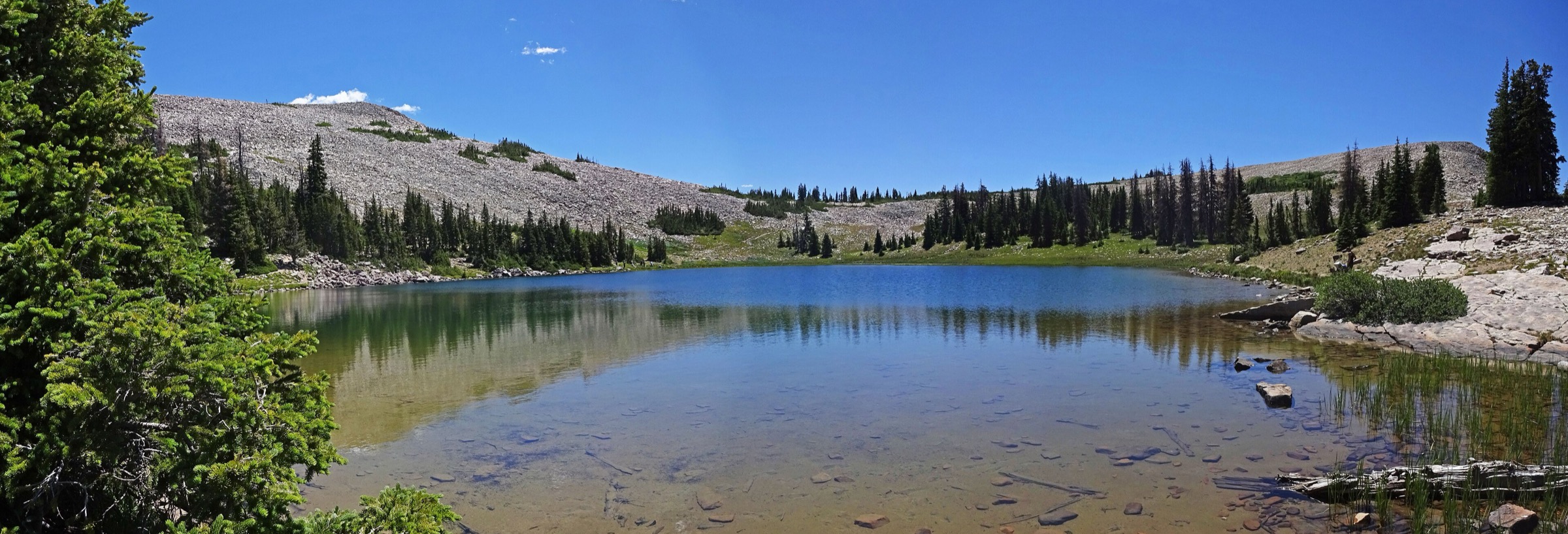
Snapshot
Photo status: no in-body figure was shipped in this pass. Two CC BY 2.0 candidates by Andrey Zharkikh — LoftyLake and LoftyLake2 — are available on Wikimedia Commons.
Itinerary
From Pass Lake Trailhead, start on the Weber River Trail, then turn onto the Lofty Lake Trail. The route passes the Cuberant junction, continues by Kamas Lake and Lofty Lake, crosses high open country, and can return by Scout Lake and the Weber River Trail depending on the exact loop variant.
Why it is essential
Lofty Lake is the corridor’s best compact alpine-lake loop — several lakes, high open terrain and a complete circuit without the very long commitment of the broader High Uintas routes.
Equipment
- Map / offline navigation.
- Rain shell, warm layer, sun protection.
- Water treatment if drawing from lakes.
- Insect protection and footwear for rocky / wet trail.
Hazards and notes
- Altitude and lightning exposure.
- Rocky trail and wet-meadow sections.
- Navigation at trail junctions.
- Seasonal snow lingers early in the season.
GPX / route file
| Source | URL | Format | Notes |
|---|---|---|---|
| AllTrails — Lofty Lake Trail | alltrails.com | Source route map | Distance, gain and time checked; AllTrails terms apply |
| USFS TrailNFS — Lofty Lake Loop Trail #3217 | apps.fs.usda.gov | GeoJSON | USDA Forest Service data; official named-trail geometry; connecting trails may be needed for the exact loop |
No packaged Forest Service GPX or KML download was found for this route.
Sources
- AllTrails — Lofty Lake Trail
- USFS — Mirror Lake Scenic Byway
- Wikimedia Commons — LoftyLake
- Wikimedia Commons — LoftyLake2
3. Cuberant Lakes Trail
Snapshot
Photo status: no route-specific licence-compatible Cuberant Lakes image was verified in this pass. The Lofty Lake and Mirror Lake candidates could serve as clearly labelled corridor imagery.
Itinerary
From Pass Lake Trailhead, follow the Lofty Lake corridor and branch toward Cuberant Lakes. The route passes high lakes and climbs through short steeper sections before reaching the Cuberant basin. Return the same way unless combining with a longer loop variant.
Why it is essential
Cuberant extends the Pass Lake trailhead beyond the short Lofty circuit into a slightly quieter lake destination, while retaining the accessible Mirror Lake Highway character.
Equipment
- Map / offline navigation.
- Rain shell, warm layer.
- Water treatment, insect protection.
- Sun protection and sturdy footwear.
Hazards and notes
- Altitude and lightning.
- Rocky and wet trail; navigation at junctions.
- Seasonal snow and avalanche terrain outside the normal hiking season — treat as a summer / autumn hike unless carrying winter-travel and avalanche training.
- Limited phone service.
GPX / route file
| Source | URL | Format | Notes |
|---|---|---|---|
| AllTrails — Cuberant Lakes Trail | alltrails.com | Source route map | Distance, gain and time checked; AllTrails terms apply |
| USFS TrailNFS — Cuberant Lake Trail #3207 | apps.fs.usda.gov | GeoJSON | USDA Forest Service data; official geometry; the full out-and-back may need an approach connector segment |
No packaged Forest Service GPX or KML download was found for this route.
Sources
4. Fehr Lake Trail
Snapshot
Photo status: no route-specific licence-compatible Fehr Lake image was verified in this pass.
Itinerary
Use the signed trail access for Fehr Lake, then follow the trail to Fehr Lake and, depending on the exact variant and conditions, continue toward additional small lakes before returning the same way. Treat the description as a planning placeholder until a primary route page or a measured GPX is attached.
Why it is essential
Fehr Lake fills the short / moderate lake-chain role: less committing than Lofty or Cuberant, more of a hike than the Mirror Lake shoreline loop, and representative of the corridor’s accessible alpine-lake walking.
Equipment
- Map / offline navigation.
- Rain shell, warm layer, sun protection.
- Insect protection.
- Footwear for rocky or wet trail.
Hazards and notes
- Altitude and afternoon thunderstorms.
- Wet, rocky tread.
- Navigation if extending beyond Fehr Lake.
- Limited cell service.
GPX / route file
| Source | URL | Format | Notes |
|---|---|---|---|
| AllTrails — Echo Lake via Fehr Lake Trail | alltrails.com | Related-route / search-result listing | Only listing-level detail retrievable this pass; do not treat as a complete source route |
| USFS TrailNFS — Fehr Lake Trail #3212 | apps.fs.usda.gov | GeoJSON | USDA Forest Service data; official geometry for the named trail |
No packaged Forest Service GPX or KML download was found for this route.
Sources
5. Mirror Lake Loop
Snapshot
Photo status: no in-body figure was shipped in this pass. Two CC-licensed candidates on Wikimedia Commons — MirrorLakeUintahs1 (Ziracote, CC BY-SA 4.0) and Mirror Lake, Uinta Mountains, Utah (Glennfcowan, CC BY 3.0) — are available.
Itinerary
The Mirror Lake Loop circles the shoreline of the corridor’s namesake lake from the Mirror Lake Recreation Site. It is a short, low-gain walk with close views of the lake, surrounding forest and Bald Mountain skyline.
Why it is essential
Mirror Lake is the byway’s signature roadside lake and the easiest way for visitors to experience the high Uinta lake landscape without a long hike.
Equipment
- Comfortable walking shoes.
- Sun protection, rain shell.
- Insect protection in summer.
- Water and layers — the site is high and weather changes quickly.
Hazards and notes
- Altitude and cold weather.
- Afternoon thunderstorms.
- Slippery shoreline sections.
- Busy recreation-site traffic in season.
GPX / route file
| Source | URL | Format | Notes |
|---|---|---|---|
| AllTrails — Mirror Lake Loop | alltrails.com | Source route map | Distance, gain and time checked; AllTrails terms apply |
| USFS TrailNFS — Mirror Lake Trail #3223 | apps.fs.usda.gov | GeoJSON | Official trail-segment geometry |
| USFS TrailNFS — Mirror Lake Shoreline Trail #3225 | apps.fs.usda.gov | GeoJSON | Official shoreline geometry — useful for reconstructing the loop |
| USFS TrailNFS — Mirror Lake Connector #3224 | apps.fs.usda.gov | GeoJSON | Connector geometry for the loop |
No packaged Forest Service GPX or KML download was found for this route.
Sources
- AllTrails — Mirror Lake Loop
- USFS — Mirror Lake Scenic Byway
- Wikimedia Commons — MirrorLakeUintahs1
- Wikimedia Commons — Mirror Lake, Uinta Mountains, Utah
Region-level sources
| Source | URL |
|---|---|
| USFS — Uinta-Wasatch-Cache National Forest recreation | fs.usda.gov |
| USFS — Mirror Lake Scenic Byway | fs.usda.gov |
| USFS — High Uintas Wilderness (Ashley NF) | fs.usda.gov |
| USFS TrailNFS ArcGIS service | apps.fs.usda.gov |
| AllTrails — Bald Mountain Trail | alltrails.com |
| AllTrails — Lofty Lake Trail | alltrails.com |
| AllTrails — Cuberant Lakes Trail | alltrails.com |
| AllTrails — Echo Lake via Fehr Lake Trail | alltrails.com |
| AllTrails — Mirror Lake Loop | alltrails.com |
| Wikimedia Commons — Bald Mountain | commons.wikimedia.org |
| Wikimedia Commons — Bald Mountain, Uintahs | commons.wikimedia.org |
| Wikimedia Commons — LoftyLake | commons.wikimedia.org |
| Wikimedia Commons — MirrorLakeUintahs1 | commons.wikimedia.org |
| Wikimedia Commons — Mirror Lake, Uinta Mountains, Utah | commons.wikimedia.org |
Missing data / follow-up work
- Fehr Lake needs a fully verified primary route page or a lawfully measured GPX / DEM calculation; the direct AllTrails page was not fully retrievable this pass.
- Exact maximum elevations are unresolved for the Lofty Lake Loop, the Cuberant Lakes Trail and the Fehr Lake Trail.
- Route-specific licence-compatible photos are still needed for Cuberant Lakes and Fehr Lake; strong candidates already exist for Bald Mountain, Lofty Lake and Mirror Lake.
- Current Mirror Lake Scenic Corridor fees, seasonal highway opening, trailhead access, fire restrictions and weather should be confirmed immediately before field use.
- fr.md not created — a French translation pass is still owed for parity with sibling articles.