Regional overview
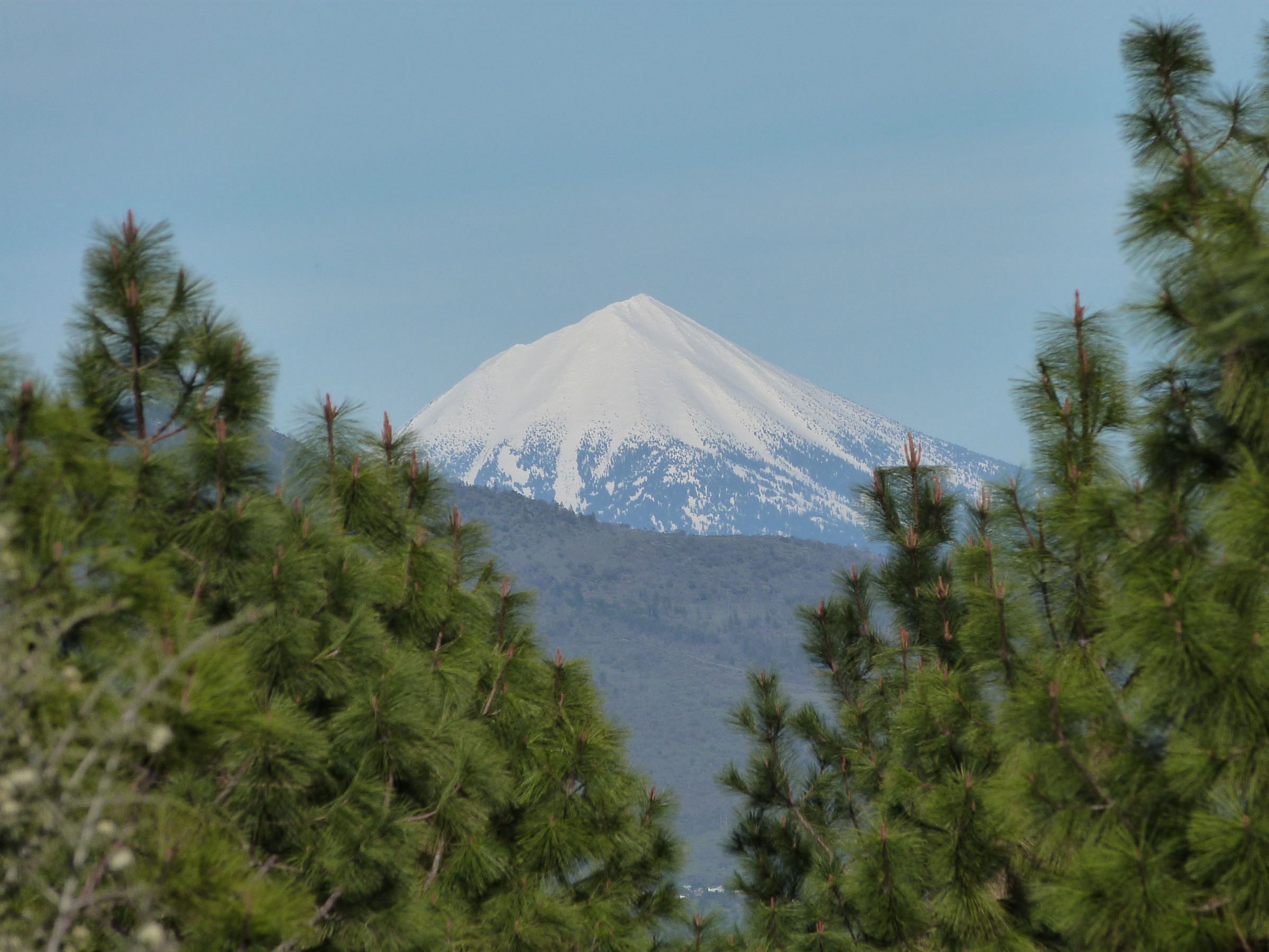
The Southern Oregon Cascades run from Willamette Pass on the north down to the California border on the south, along the same volcanic arc that carries Mount Hood, the Three Sisters and Mount Mazama further north. Excluding the Crater Lake caldera (covered in the Crater Lake / Mount Mazama article), the region is organised around three wilderness cores and one waterfall corridor: Sky Lakes Wilderness (47,072 ha straddling the Cascade crest south of Crater Lake, with Mount McLoughlin at 2,894 m as its high point), Mountain Lakes Wilderness (a compact 9,336 ha township surrounding a cluster of eroded shield volcanoes with Aspen Butte at 2,502 m), Rogue–Umpqua Divide Wilderness (13,436 ha straddling the divide about 15 km west of Crater Lake), and the North Umpqua “Highway of Waterfalls” corridor along Oregon Highway 138 in the Umpqua National Forest. Diamond Peak Wilderness and the Willamette Pass hikes further north sit more naturally with the central Oregon Cascades and are excluded from this file.
The geology is straightforward Cascade volcanism. Mount McLoughlin is a Pleistocene basaltic-andesite stratovolcano whose north-east cirque was plucked open by Pleistocene glaciers, exposing its lava layers in cross-section. The Mountain Lakes cluster is a tight group of four overlapping, deeply eroded shield volcanoes with glacial cirques filling into small lakes. The Rogue–Umpqua Divide carries dissected volcanic and volcaniclastic outcrops — the pinnacle-and-cliff Palisades sit at its heart. Along Highway 138 in the North Umpqua canyon, columnar basalt frames Toketee Falls, and a 272-foot (83 m) plunge over a basalt cliff makes Watson Falls the third-tallest waterfall in Oregon. On Highway 62 north of Prospect, the Upper Rogue cuts a slot through a lava-tube-riddled basalt flow at Rogue Gorge and Natural Bridge, where the river disappears into a lava tube and re-emerges downstream.
Vegetation banding follows the standard southern-Cascades sequence: mixed Douglas-fir, white fir and western hemlock on the lower slopes; a wide mountain hemlock, Pacific silver fir and whitebark pine band from roughly 1,800 m; and open pumice, scoria and alpine meadow above 2,400 m on McLoughlin and Aspen Butte. Access is from three east-west state highways — Oregon 140 across the range between Medford and Klamath Falls (Mount McLoughlin, Fish Lake, Fourmile Lake, Mountain Lakes trailheads), Oregon 62 north of Prospect toward Crater Lake (Rogue Gorge, Union Creek, Natural Bridge), and Oregon 138 along the North Umpqua (Toketee, Watson, Fall Creek). No scheduled public transport reaches any wilderness trailhead. Wilderness day-use permits are not required in Sky Lakes, Mountain Lakes or Rogue–Umpqua Divide (unlike the central-Cascades permit zones on Three Sisters); a Northwest Forest Pass or $5 day fee is required at the Mt. McLoughlin trailhead and at Watson Falls. The reliable summer season for high wilderness routes is mid-July to mid-October, with mosquitoes at their worst in Sky Lakes and Mountain Lakes basins from mid-June into late July.
Selection rationale
The five hikes below cover the range in day-hike scale without duplicating character. Mount McLoughlin is the iconic summit and the region’s signature climb — the highest point south of Crater Lake and the reference profile from every angle in the Rogue Valley. Sky Lakes Basin from Cold Springs is the classic lakes-and-meadow day, threading through the lake-rich heart of the wilderness on a moderate loop. Aspen Butte via Varney Creek is the Mountain Lakes counterpart — a longer, quieter push to the wilderness’s high point through a deeply eroded shield-volcano cluster. Watson Falls paired with Toketee Falls represents the North Umpqua “Highway of Waterfalls” corridor in a single low-elevation half-day. Rogue Gorge and Natural Bridge close the set with the region’s most accessible volcanic-canyon walk, showing the Upper Rogue disappearing into a lava tube and re-emerging downstream — the geological pivot between the McLoughlin volcanic centre and the Crater Lake caldera.
Alternative hikes considered but displaced: Fish Mountain in the Rogue–Umpqua Divide is a genuine peak, but the summit trail is not maintained and the FS 37 approach is very rough; Devils Peak duplicates the summit character of Mount McLoughlin from the north end of Sky Lakes; Union Peak (from the PCT south of Crater Lake) sits closer to the Mount Mazama article; Diamond Peak sits more naturally with the central Oregon Cascades; and Fall Creek Falls is a short substitute for Watson Falls on the same corridor.
Summary
| # | Hike | Country | Route type | Distance | Gain | Max elevation | Difficulty |
|---|---|---|---|---|---|---|---|
| 1 | Mount McLoughlin Trail #3716 | USA | Out-and-back | 16.1 km | 1,220 m | 2,894 m | Very hard |
| 2 | Sky Lakes Basin Loop from Cold Springs | USA | Loop | 14.0 km | 305 m | 1,980 m | Moderate |
| 3 | Aspen Butte via Varney Creek Trail #3718 | USA | Out-and-back with loop | 20.6 km | 1,035 m | 2,502 m | Hard |
| 4 | Watson Falls + Toketee Falls | USA | Two out-and-backs | 2.6 km | 180 m | 1,022 m | Easy–moderate |
| 5 | Rogue Gorge and Natural Bridge Loop | USA | Loop | 11.0 km | 45 m | 1,005 m | Easy |
1. Mount McLoughlin Trail #3716
Snapshot
Itinerary
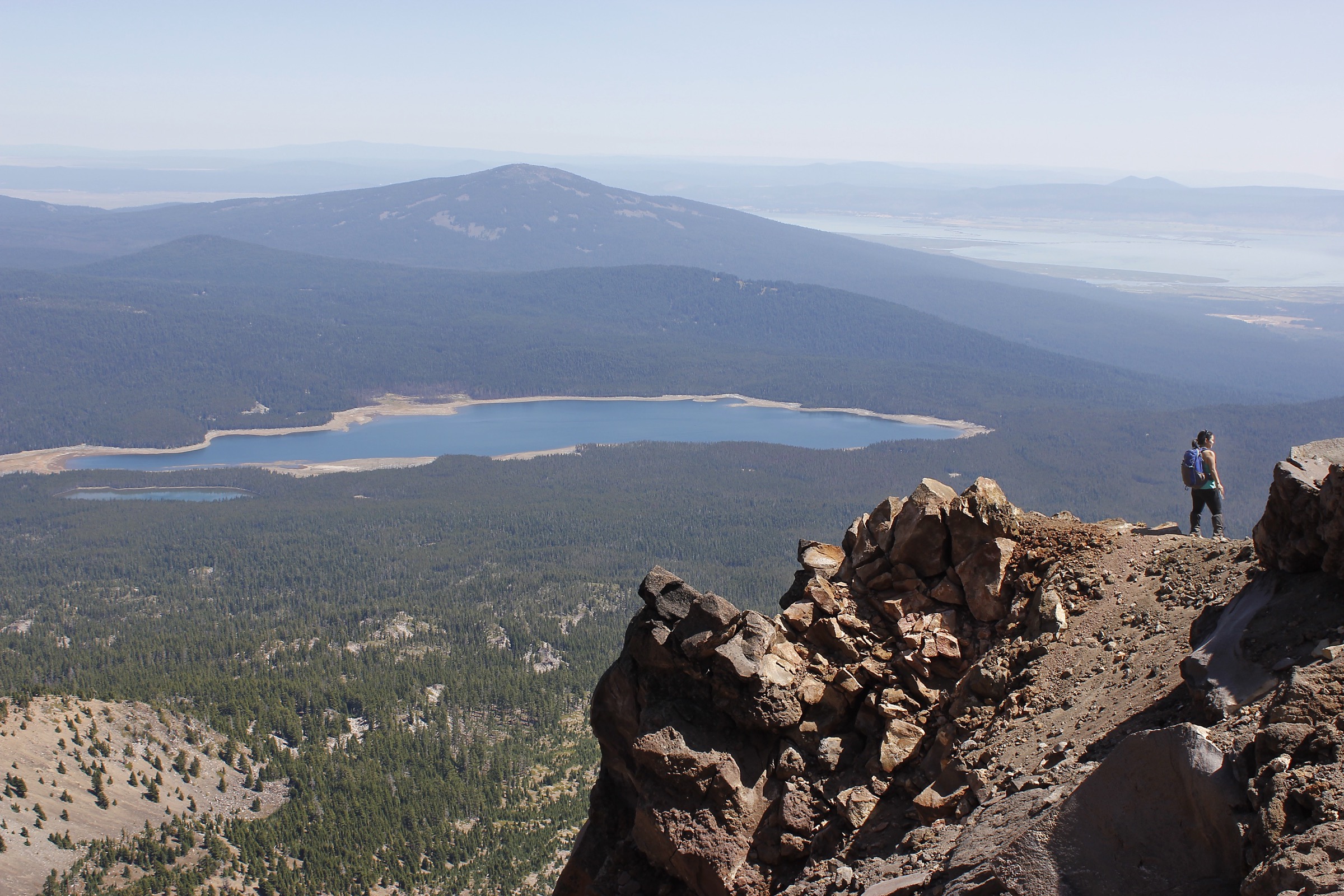
From the Mt. McLoughlin Trailhead on FSR 3650, Trail #3716 crosses the PCT after 200 m and climbs steadily east through mixed lodgepole and Shasta red fir. The grade is easy for the first 3 km, then begins to steepen as the trail turns south-east onto the mountain’s main climbing rib. A sequence of switchbacks carries the trail up into the mountain hemlock and whitebark pine band, and at about 6.5 km the tree cover thins and the route emerges onto the open south-west ridge at roughly 2,400 m. The last kilometre is a sustained scramble up loose cinder and talus, with the trail marked by a series of cairns along the crest. The summit at 2,894 m — Sky Lakes Wilderness’s highest point — offers views north to Mount Thielsen and Diamond Peak, south to Mount Shasta, west across the Rogue Valley, and directly into the ice-carved north-east cirque of the mountain. Descent is by the same route.
Why it is essential
Mount McLoughlin is the reference peak of the Southern Oregon Cascades, the highest point between Crater Lake and Mount Shasta and the defining silhouette of the Rogue Valley skyline. It is the region’s signature big-summit day, and one of the more rewarding non-technical volcano climbs in the Cascade Volcanic Arc.
Equipment
- Sturdy mountain boots with edge for cinder and talus; trekking poles strongly recommended.
- 3–4 L water — no reliable water on the route above the first stream crossing.
- Wind shell, warm midlayer, gloves and hat; the summit ridge is fully exposed.
- Sun and UV protection; sun hat.
- Map, compass and GPS; USFS explicitly warns hikers about descent route-finding — the summer trail off the summit is not obvious and hikers who follow the wrong shoulder get cliffed out on the ice-carved north face every year.
- Microspikes and ice axe if lingering snow is present on the upper ridge.
Hazards and notes
- Descent route-finding is the principal hazard. The summer trail leaves the summit heading south-west; hikers who wander onto the west or north ridges get lost or cliffed out. Turn around from the summit only after identifying your descent line.
- No water above the first stream crossing — hydrate early.
- Loose cinder and talus above the tree line; falling rock is a hazard for parties spread out on the ridge.
- Afternoon thunderstorms and lightning on the exposed ridge; start early and be off the summit by early afternoon.
- Snow lingers on the upper ridge into July in heavy-snowpack years.
- Trailhead access on FSR 3650 is gravel but passenger-car friendly in summer.
Routes and maps
| Source | URL | Format / access | Reuse status |
|---|---|---|---|
| USFS — Mt. McLoughlin Trail #3716 (Rogue River-Siskiyou NF) | fs.usda.gov | Official trail page | Public information |
| USFS — Mt. McLoughlin Trailhead (Fremont-Winema NF) | fs.usda.gov | Official trailhead page | Public information |
| AllTrails — Mount McLoughlin Trail | alltrails.com | GPX (members) | AllTrails terms; reference only |
| OpenStreetMap (Mt. McLoughlin Trail) | openstreetmap.org | OSM XML / GPX export | ODbL 1.0; reusable with attribution |
Further reading
- USFS — Mt. McLoughlin Trail #3716
- Wikipedia — Mount McLoughlin
- Oregon Hikers — Mount McLoughlin Hike
2. Sky Lakes Basin Loop from Cold Springs
Snapshot
Itinerary
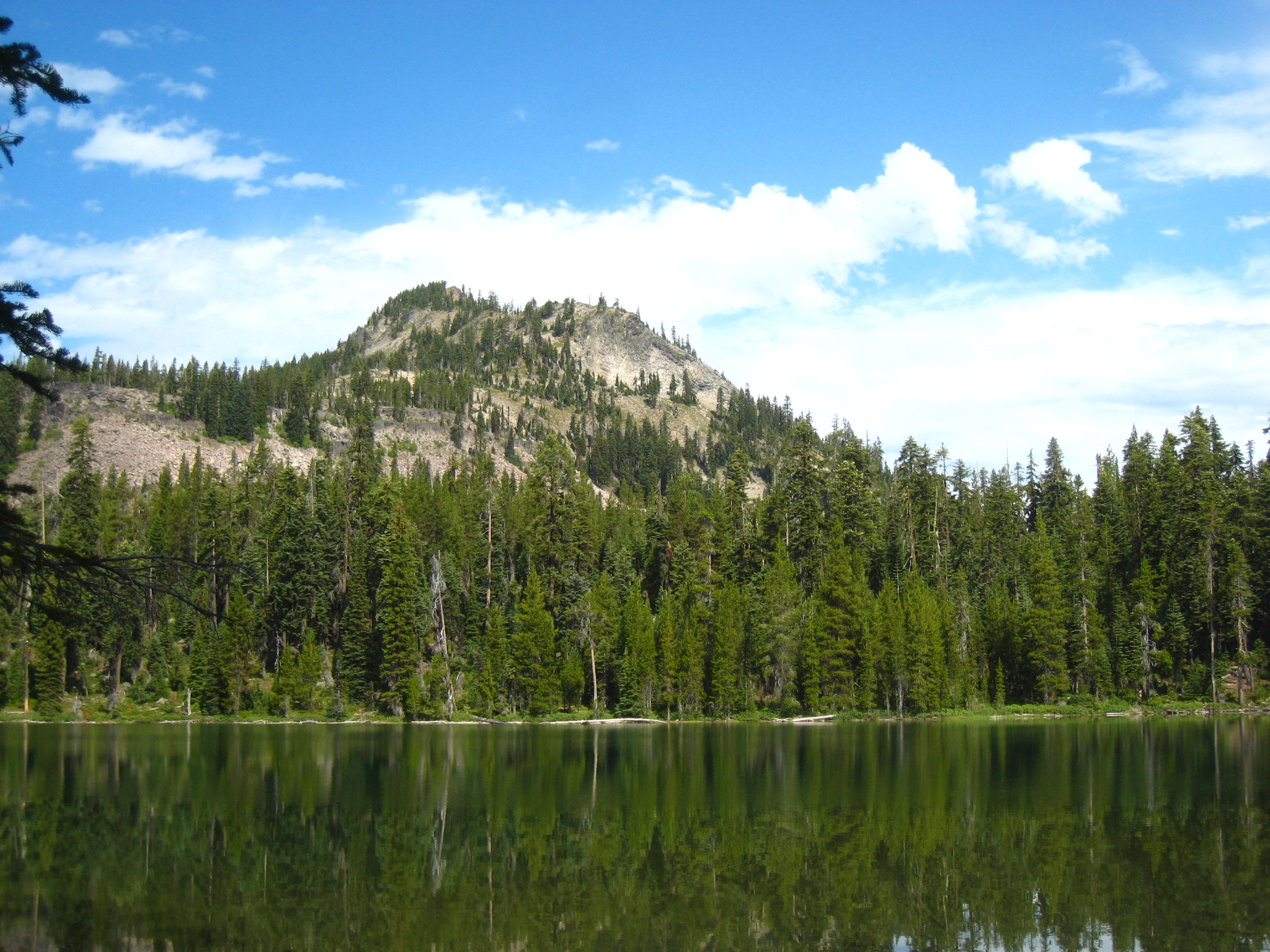
From the Cold Springs Trailhead, follow the Cold Springs Trail (#3710) west and then north-west through a mountain hemlock and lodgepole pine flat to the eastern end of the Sky Lakes Basin at approximately 3 km. At the signed junction, take the Sky Lakes Trail (#3762) north through the heart of the basin, threading past Natasha Lake, Elizabeth Lake and Isherwood Lake on the extension loop, or past the smaller shoreline of Trapper Lake if taking the shorter direct line. The basin is peppered with more than a dozen small glacial-tarn lakes, all sitting in shallow depressions between low volcanic ridges. At the north end of the basin, meet the Pacific Crest Trail on the crest at approximately 1,980 m, then follow the PCT briefly south to the Divide Trail junction. The Divide Trail traces the crest above the basin with intermittent views west into the Rogue Valley, then descends south-east onto the South Rock Creek Trail (#3709), which closes the loop back to the Cold Springs Trailhead. Longer variants including the Nannie Creek approach add another 6-8 km.
Why it is essential
Sky Lakes Basin is the classic lake-basin day walk of the Southern Oregon Cascades and gives the wilderness its name — more than 100 small lakes in a compact volcanic-plateau basin at 1,900 m, surrounded by whitebark and mountain hemlock. The loop from Cold Springs is short enough for a day but rich enough to represent the full character of the basin.
Equipment
- Trail shoes or light boots — the tread is smooth pumice and duff.
- 2 L water — treat any drawn from the lakes.
- Map essential — the basin has ~10 lettered junctions in a small area and route confusion is common.
- Insect repellent and head net through mid-July; expect ferocious mosquitoes in early season.
- Layers and light rain shell; afternoon storms build over the crest in summer.
Hazards and notes
- Mosquitoes — the single largest hazard is comfort. Peak infestation is mid-June through late July; September is essentially bug-free.
- Route-finding through the lakes basin — carry a topo map and count junctions.
- Afternoon thunderstorms build over the crest; keep an eye on cloud development.
- Water — many lakes are drinkable with treatment; do not drink from shallow ponds.
- Bears use the basin; food storage discipline applies.
- FSR 3651 is gravel but passable in summer to passenger cars.
Routes and maps
| Source | URL | Format / access | Reuse status |
|---|---|---|---|
| USFS — Sky Lakes Wilderness (Fremont-Winema NF) | fs.usda.gov | Official wilderness page | Public information |
| Oregon Hikers — Sky Lakes Loop Hike | oregonhikers.org | Trail description | Public reference |
| OpenStreetMap (Sky Lakes basin) | openstreetmap.org | OSM XML / GPX export | ODbL 1.0; reusable with attribution |
Further reading
3. Aspen Butte via Varney Creek Trail #3718
Snapshot
Itinerary
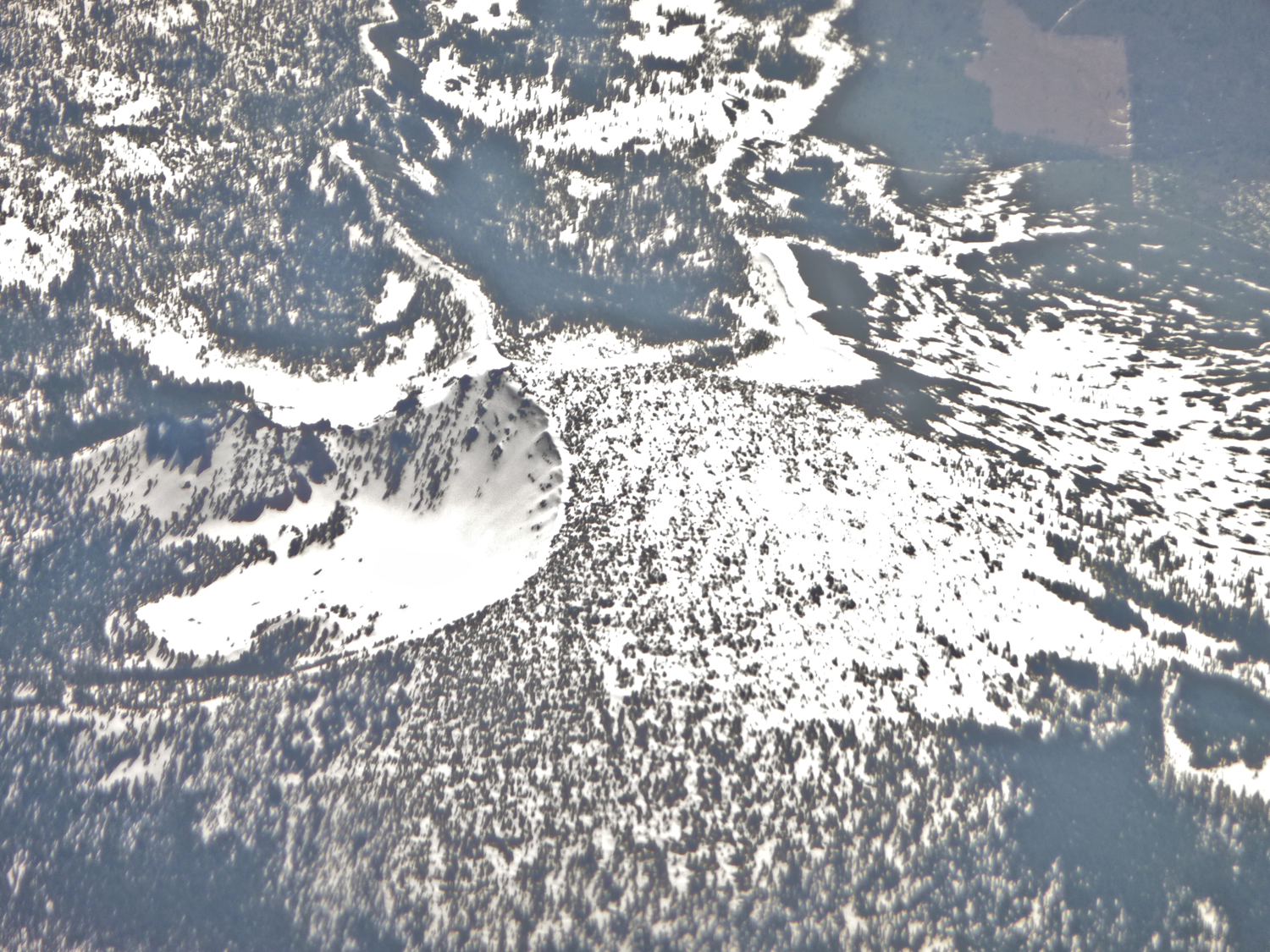
From the Varney Creek Trailhead on FSR 3637, the Varney Creek Trail (#3718) climbs steadily south-east through Douglas-fir and white fir, then contours onto the west flank of the Mountain Lakes cluster. At approximately 6 km the trail reaches the western junction with the Mountain Lakes Loop Trail (#3727), which encircles the heart of the wilderness — a tight rim of four overlapping shield volcanoes with small glacial-cirque lakes at their feet. Turn south (right) onto the loop and traverse eastward past Eb and Zeb Lakes into the upper cirque near Lake Harriette at approximately 2,150 m. From here a short but faint user trail climbs south on scree and thin krummholz to the summit of Aspen Butte at 2,502 m — the wilderness’s high point. The view spans north into Sky Lakes and Crater Lake, west across the Rogue Valley to Mount McLoughlin, and south to Mount Shasta. Return by the same route, or continue clockwise on the loop to close the 24 km circuit back to Varney Creek.
Why it is essential
Aspen Butte is the highest point in the Mountain Lakes Wilderness and offers one of the finest overview panoramas of the southern Cascades. The Mountain Lakes cluster is a compact, deeply eroded shield-volcano landscape unique in the region — quieter than Sky Lakes and rarely crowded even in high summer.
Equipment
- Sturdy boots for the mixed forest tread and the loose summit scree; trekking poles useful.
- 3 L water — no reliable summit water; Lake Harriette is drinkable with treatment.
- Wind shell and warm midlayer for the summit.
- Sun and UV protection.
- Map, compass and GPS — the Aspen Butte summit user trail is faint above the loop trail.
- Microspikes if lingering snow is present on north aspects into July.
Hazards and notes
- The Aspen Butte summit spur is unmaintained; route-finding is easy in clear weather but a poor bet in cloud.
- Long day — allow full daylight and plan for 8+ hours on the trail.
- Mosquitoes through July in the lake basin.
- Afternoon thunderstorms build over the crest; start early.
- Trailhead can be washboarded after wet springs; passenger cars fine in dry conditions.
- No dogs restrictions but bears are present; food storage discipline applies.
Routes and maps
| Source | URL | Format / access | Reuse status |
|---|---|---|---|
| USFS — Mountain Lakes Loop Trail #3727 (Fremont-Winema NF) | fs.usda.gov | Official trail page | Public information |
| Oregon Hikers — Mountain Lakes via Varney Creek Hike | oregonhikers.org | Trail description | Public reference |
| AllTrails — Aspen Butte via Varney Creek Trail | alltrails.com | GPX (members) | AllTrails terms; reference only |
| OpenStreetMap (Mountain Lakes Loop) | openstreetmap.org | OSM XML / GPX export | ODbL 1.0; reusable with attribution |
Further reading
- USFS — Mountain Lakes Loop Trail #3727
- Wikipedia — Mountain Lakes Wilderness
- Wikipedia — Aspen Butte
4. Watson Falls and Toketee Falls
Snapshot
Itinerary
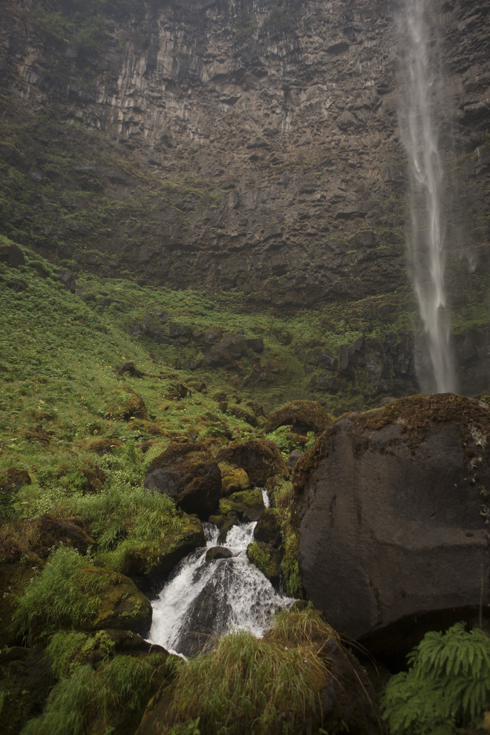
Watson Falls. From the Watson Falls trailhead on FSR 37, the trail climbs steadily through a dense Douglas-fir and vine maple stand for approximately 400 m to a footbridge at the base of the falls. Watson Creek drops 272 ft (83 m) over a columnar basalt cliff in a single plunge — the third-tallest waterfall in Oregon. An upper trail continues to a fenced viewing platform on the shoulder of the plunge; the small loop returns via the parking area.
Toketee Falls. Drive 3 km west on Highway 138 and turn onto FSR 34 (Toketee-Rigdon Road) for approximately 800 m. From the trailhead, the Toketee Falls Trail contours ~650 m through mixed conifer on a gently graded path with a set of stairs and a wooden viewing platform at the end. Toketee Falls drops in two tiers — an upper 12 m and lower 24 m — through a slot of near-perfect columnar basalt, one of the most photographed waterfall settings in Oregon. Return by the same trail.
Why it is essential
Watson and Toketee are the two anchor waterfalls of the North Umpqua Highway of Waterfalls, and the combined half-day gives the region’s low-elevation, forest-and-water character in a compact loop. Watson delivers height (272 ft / 83 m); Toketee delivers the columnar basalt frame. Neither is more than a short walk, but together they justify their own outing.
Equipment
- Trail shoes; the tread is stone stairs and packed forest duff.
- Light layers and rain shell — the North Umpqua corridor is wet even in July.
- 1 L water.
- Sun protection is largely unnecessary — the trail is shaded throughout.
- Poison oak is present at lower elevations — stay on the tread.
Hazards and notes
- Wet, slippery stone steps and platform decking; take care with young children.
- Steep drops from viewing platforms — stay behind railings.
- Wildfire scars from the 2020 Archie Creek fire affected parts of the North Umpqua corridor; verify trail status before travel.
- FSR 37 and FSR 34 are paved / short gravel — passenger-car friendly year-round when Highway 138 is open.
- Toketee Dam regulates flow at Toketee Falls; the falls run through the driest late summer.
Routes and maps
| Source | URL | Format / access | Reuse status |
|---|---|---|---|
| USFS — Watson Falls Trail (Umpqua NF) | fs.usda.gov | Official trail page | Public information |
| USFS — Toketee Falls Trail (Umpqua NF) | fs.usda.gov | Official trail page | Public information |
| AllTrails — Watson Falls Trail | alltrails.com | GPX (members) | AllTrails terms; reference only |
| OpenStreetMap (Watson & Toketee) | openstreetmap.org | OSM XML / GPX export | ODbL 1.0; reusable with attribution |
Further reading
5. Rogue Gorge and Natural Bridge Loop
Snapshot
Itinerary
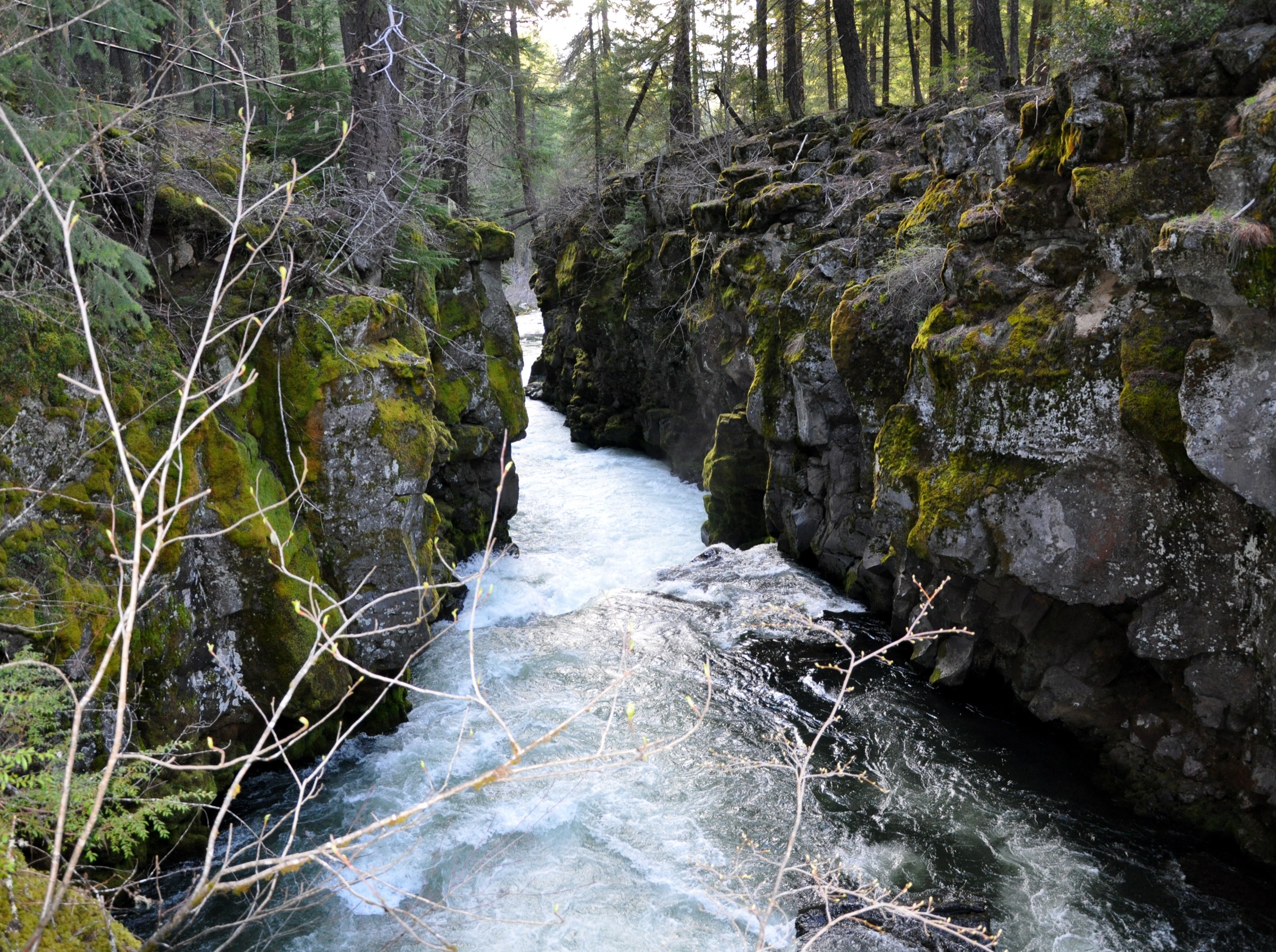
From the Natural Bridge Viewpoint Trailhead, a short paved spur reaches a footbridge that crosses directly above Natural Bridge — the point at which the Upper Rogue disappears into a lava tube in a basalt flow and re-emerges 60 m downstream through a small cave mouth. From the footbridge, the Upper Rogue River Trail (#1034) follows the west (or east) bank downstream through a mixed Douglas-fir and pine forest, tracing the river past a series of potholes and spinning-cobble sculpted basalt features. After approximately 5.5 km the trail reaches the Rogue Gorge Viewpoint, where the river funnels into a 3 m-wide slot cut through the basalt with a set of railed boardwalks and interpretive plaques. The return follows the opposite bank on the same trail system, closing the loop back at Natural Bridge for a full 11 km circuit. The Rogue Gorge Viewpoint alone is walkable in 30 minutes as a boardwalk-only visit.
Why it is essential
Rogue Gorge and Natural Bridge together form the region’s most accessible volcanic-canyon walk and one of the clearest field examples of lava-tube plumbing in the Cascades. The two viewpoints frame the transition from the McLoughlin volcanic centre south to the Crater Lake caldera, and the loop is walkable in almost any season when Highway 62 is open.
Equipment
- Trail shoes or light boots.
- Light layers and rain shell — the Upper Rogue corridor is often overcast even in summer.
- 1 L water.
- Sun protection for the exposed boardwalks.
- Microspikes in winter — the corridor can ice over.
- No technical equipment required.
Hazards and notes
- Sheer unfenced drops into the gorge at several points on the west bank; keep children and dogs closely supervised.
- Slippery railings and boardwalks after rain.
- Winter ice is common on the boardwalks and viewpoint decking.
- Highway 62 is a fast two-lane road; take care crossing at the Natural Bridge and Rogue Gorge exits.
- No permit required, but donations are appreciated at the Union Creek Interpretive Center.
Routes and maps
| Source | URL | Format / access | Reuse status |
|---|---|---|---|
| USFS — Rogue Gorge Trail (Rogue River-Siskiyou NF) | fs.usda.gov | Official trail page | Public information |
| USFS — Upper Rogue River Trail #1034 (Rogue River-Siskiyou NF) | fs.usda.gov | Official trail page | Public information |
| AllTrails — Rogue Gorge to Natural Bridge | alltrails.com | GPX (members) | AllTrails terms; reference only |
| OpenStreetMap (Upper Rogue) | openstreetmap.org | OSM XML / GPX export | ODbL 1.0; reusable with attribution |
Further reading
Further reading
| Source | URL |
|---|---|
| USFS — Rogue River-Siskiyou National Forest | fs.usda.gov |
| USFS — Fremont-Winema National Forest | fs.usda.gov |
| USFS — Umpqua National Forest | fs.usda.gov |
| USFS — Mt. McLoughlin Trail #3716 | fs.usda.gov |
| USFS — Sky Lakes Wilderness | fs.usda.gov |
| USFS — Mountain Lakes Loop Trail #3727 | fs.usda.gov |
| USFS — Watson Falls Trail | fs.usda.gov |
| USFS — Toketee Falls Trail | fs.usda.gov |
| USFS — Rogue Gorge Trail | fs.usda.gov |
| Wikipedia — Mount McLoughlin | en.wikipedia.org |
| Wikipedia — Sky Lakes Wilderness | en.wikipedia.org |
| Wikipedia — Mountain Lakes Wilderness | en.wikipedia.org |
| Wikipedia — Rogue-Umpqua Divide Wilderness | en.wikipedia.org |
| Oregon Hikers — Sky Lakes Loop Hike | oregonhikers.org |
| OpenStreetMap (ODbL 1.0) | openstreetmap.org |