Regional overview
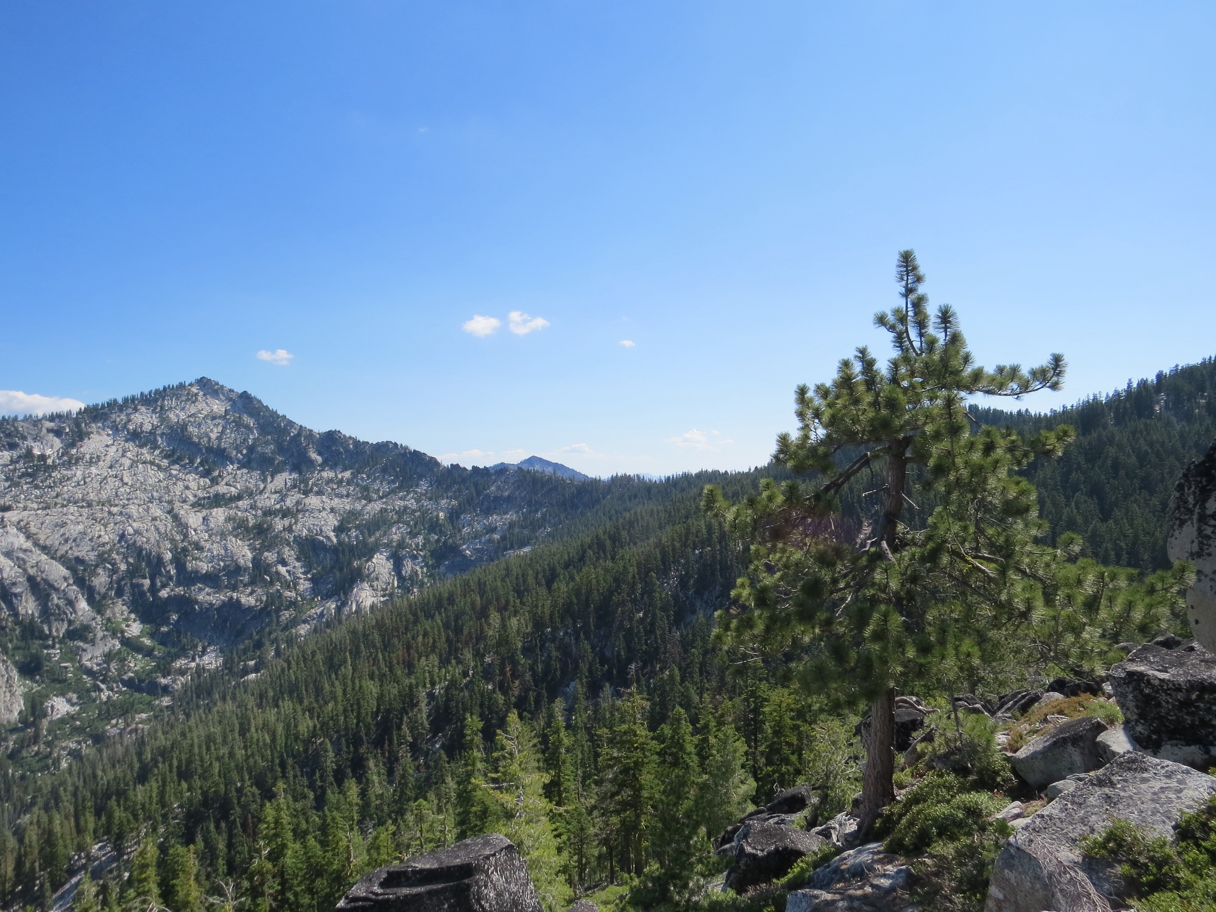
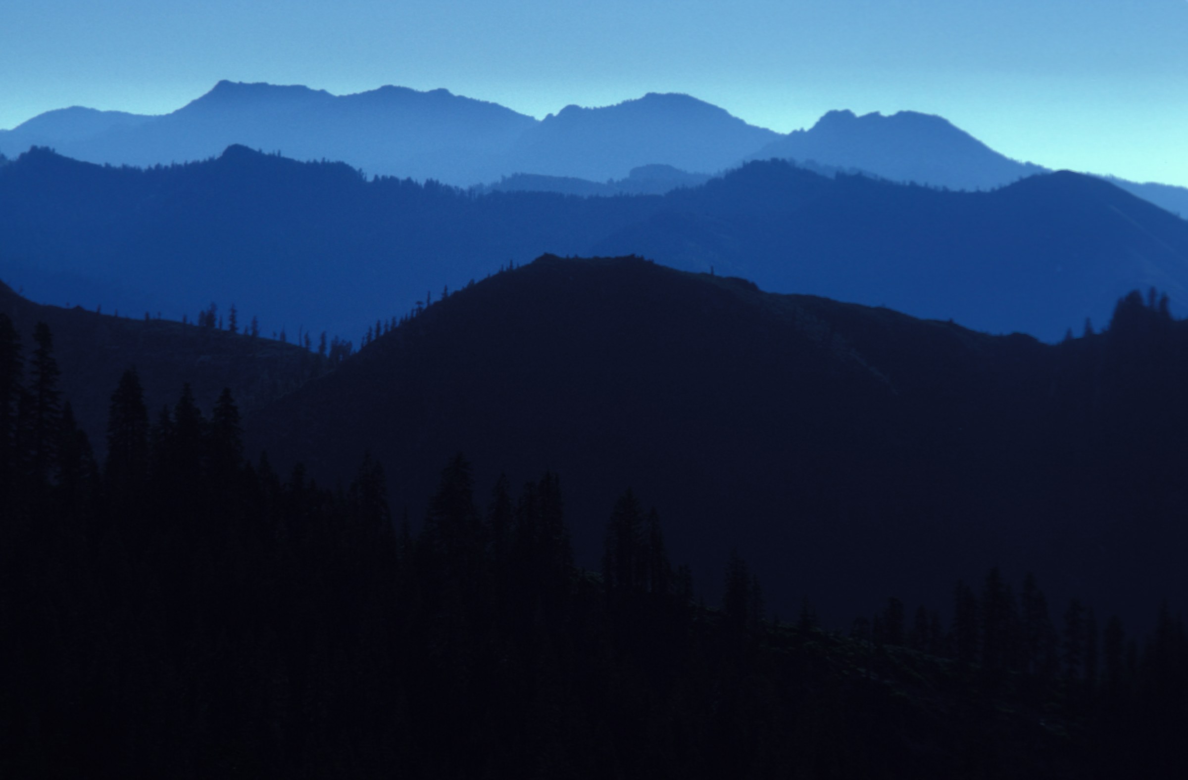
The Marble Mountain Wilderness sits in Siskiyou County about 100 km south-west of Yreka, in the Klamath National Forest. It covers 241,744 acres (978 km²) and was first protected as the Marble Mountain Primitive Area in April 1931, becoming designated wilderness in 1964 under the original Wilderness Act — one of the “freshman class” of American wilderness areas. The horseshoe-shaped Salmon Mountains form its core, with Marble Mountain itself a north-trending spur off them. The Forest Service administers it from the Salmon/Scott River Ranger District at Fort Jones, with the western Wooley Creek flank falling to Six Rivers National Forest.
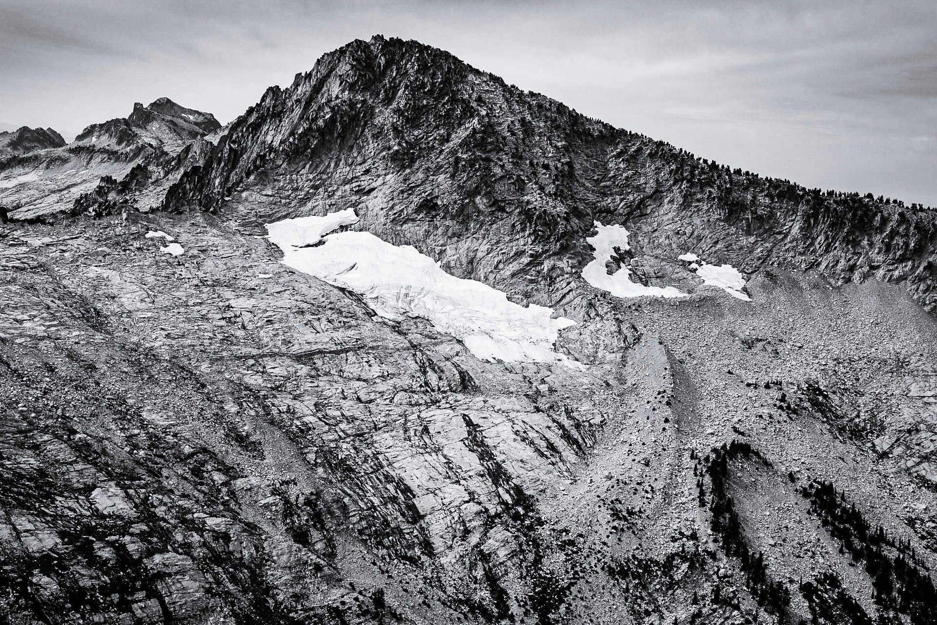
The name is literal. The range is built of light-coloured limestone and marble interbedded with black metamorphic rock, which gives the peaks a genuinely marbled appearance, and at least five distinct rock types have been mapped within the wilderness. Marble Mountain, 6,990 ft, is not a single summit but a long escarpment of stark white marble — the Marble Rim — visible from far across the Klamaths. Being limestone country, it is also karst: over 150 caves have been documented here, most containing stalactites and stalagmites, and sinkholes and eroded chalk-like formations are visible from the trail along the crest. The caves are for experienced cavers only and should not be entered casually.
Water is the other half of the story. The wilderness holds 89 lakes, almost all of them glacial cirque lakes gouged out during the last ice age, and Cliff Lake in the Shackleford drainage is the deepest of them. Two Wild and Scenic river systems — Wooley Creek and the North Fork Salmon River — drain the range. Elevations run from 400 ft to 8,299 ft (122–2,530 m) at Boulder Peak, the wilderness high point. As elsewhere in the Klamaths, the conifer diversity is exceptional; the Marbles hold the southernmost stand of Pacific silver fir in the species’ range, alongside subalpine fir and serpentine specialists, and avalanche lilies (Erythronium montanum) carpet the high basins at snowmelt. Thirty-two miles of the Pacific Crest Trail cross the wilderness.
Access is entirely by car, on Scott River Road out of Fort Jones and then several miles of forest road; no public transport reaches any trailhead, and none of them has drinking water. The reliable season runs July to October. Two practical points matter more than anything else here. First, no wilderness permit is required — for day use or overnight — which is unusual and contradicts some secondary guides. Second, cattle are grazed seasonally around Shackleford and Paradise Lake, so all water must be treated, without exception. Forest-wide fire restrictions took effect on 18 June 2026 following a record-low winter snowpack: in the wilderness this means no wood fires at all, and a pressurised gas or liquid-fuel stove with a shut-off valve may be used only by someone carrying a valid California Campfire Permit.
Selection rationale
The five routes cover the range’s archetypes without leaving the wilderness. Sky High Lakes Basin is the iconic destination — a huge meadow complex holding three lakes beneath the white bulk of Marble Mountain, reached up the Canyon Creek trail from Lovers Camp. The Marble Rim by way of Marble Valley is the geological route and the reason the range has its name: stone steps up to a 1930s guard station, the Pacific Crest Trail, and then the blinding white escarpment itself. Boulder Peak is the summit, and the high point of the wilderness at 2,530 m. Campbell, Cliff and Summit Lakes from Shackleford Creek is the quieter lake route, threading Jeffrey pine parkland to the deepest lake in the Marbles. Paradise Lake and Kings Castle is the crest route, climbing steeply to a lake that sits directly on the PCT with a use-trail summit above it.
An honest word on feasibility, because most of the literature treats these as backpacking trips. The Shackleford lakes and Paradise Lake are comfortable day walks. Sky High Lakes and the Marble Rim are long but firmly within a fit walker’s day at roughly 18–20 km. Boulder Peak is a big day at the outer limit — 21 km and 1,340 m of ascent — and should be treated as such. Ukonom Lake, Deep Lake and Little Elk Lake were excluded because they are genuinely overnight objectives, not day hikes, whatever their appeal.
The Russian Wilderness immediately to the south-east is a close relative — same forest, same ranger district, covered by the same forest order, and linked by the PCT — and no sibling article in this series covers it. It is noted at the end of this article rather than given one of the five slots, because each of the five archetypes is better served from inside the Marbles.
Summary
| # | Hike | Country | Route type | Distance | Gain | Max elevation | Difficulty |
|---|---|---|---|---|---|---|---|
| 1 | Sky High Lakes Basin | USA | Out-and-back | 17.7–19.8 km | ~670 m | ~1,830 m | Hard |
| 2 | Marble Rim via Marble Valley | USA | Out-and-back | 20.3 km | 732 m | 1,940 m | Hard |
| 3 | Boulder Peak | USA | Out-and-back | 21.4 km | 1,340 m | 2,530 m | Very hard |
| 4 | Campbell, Cliff and Summit Lakes | USA | Lollipop loop | 15.6 km | 451 m | 1,775 m | Moderate |
| 5 | Paradise Lake and Kings Castle | USA | Out-and-back | 6.4–6.9 km to the lake | ~440 m to the lake | 2,257 m at the summit | Moderate–hard |
1. Sky High Lakes Basin
Snapshot
Itinerary
The Canyon Creek Trail leaves Lovers Camp heading west into the wilderness and follows Canyon Creek up a forested canyon at an easy grade. A 40-foot waterfall crosses the path along the way, though it diminishes markedly by late summer and cannot be relied on. At about 6.4 km, just after a small tributary joins Canyon Creek, the Sky High Valley Trail branches off; take it and climb roughly 2.4 km into the basin.
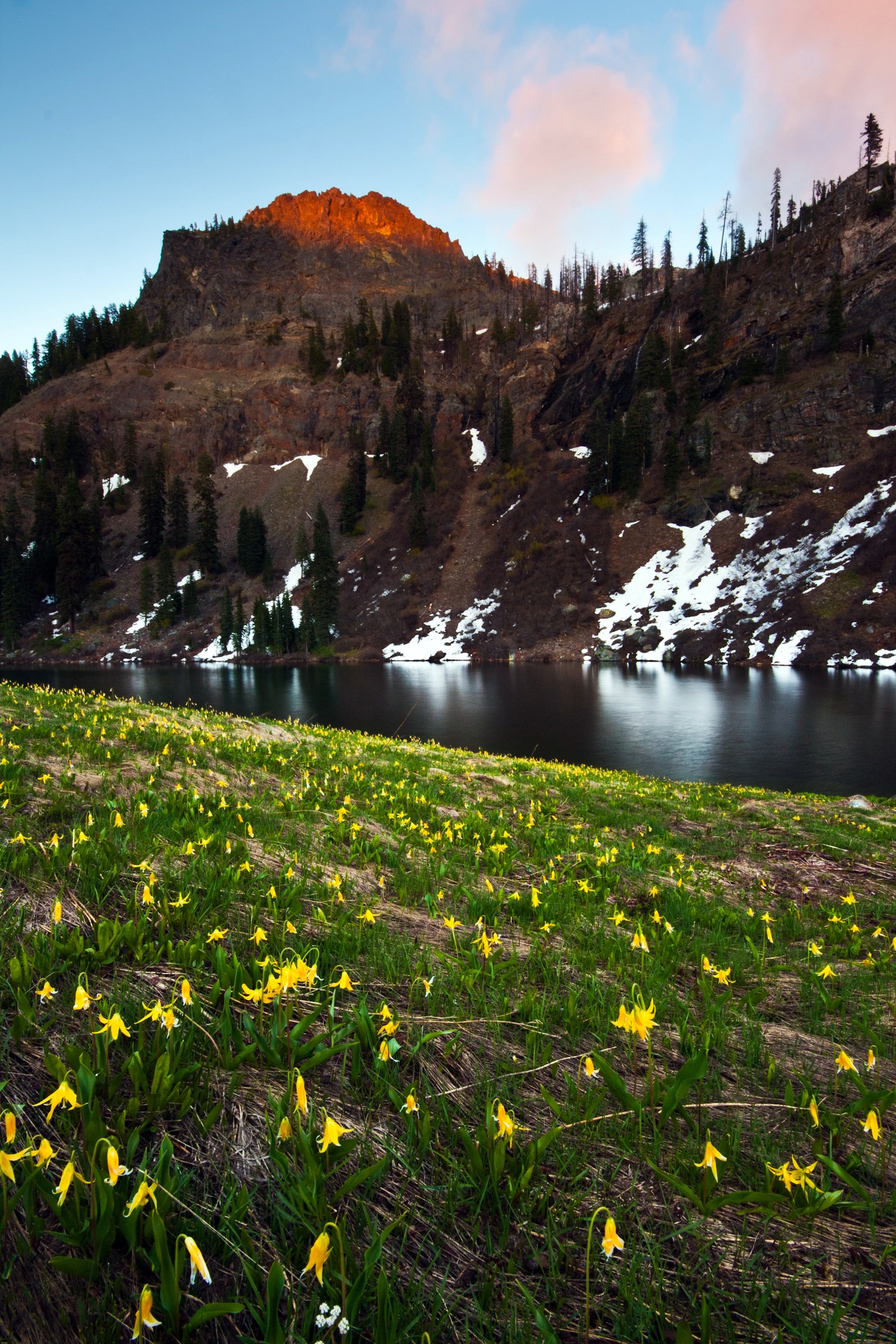
Sky High Lakes Basin is a huge meadow complex holding three lakes — Upper Sky High Lake, Lower Sky High Lake, and the small Frying Pan Lake, which from above genuinely resembles one. The white bulk of Marble Mountain rises over the basin, and at snowmelt the meadows are carpeted with avalanche lilies. From the basin the trail can be continued up to the Pacific Crest Trail and the Marble Rim, returning through Marble Valley to make a loop of about 19.8 km — the way most parties who have the legs for it choose to do the day.
Why it is essential
This is the destination that defines the Marbles: a broad glacial basin of meadow and lake sitting directly beneath the range’s white marble escarpment. It combines the two things the wilderness is known for — the 89 glacial lakes and the marble geology — in a single day, and it is the natural first visit to the range.
Equipment
- Mountain hiking equipment; the trail is long but well graded.
- 2–3 L water capacity. There is no drinking water at the trailhead. Canyon Creek and the lakes are reliable, but treat everything — cattle and stock use these trails.
- Insect repellent and a head net early in the season; mosquitoes in the basin are a genuine problem at snowmelt.
- Sun protection: the basin is high, open and strongly exposed.
- A stove with a shut-off valve and a California Campfire Permit if brewing up; wood fires are prohibited.
Hazards and notes
- Mosquitoes in early season are severe in the basin.
- Strong sun exposure and no shade in the meadows.
- Snow can linger into June, and the Forest Service warns that higher-elevation trails may hold it late.
- Stream crossings early in the season; horses and cattle share the trail.
- Forest-wide fire restrictions have been in force since 18 June 2026.
Routes and maps
| Source | URL | Format / access | Reuse status |
|---|---|---|---|
| USFS — Lovers Camp Trailhead (Klamath NF) | fs.usda.gov | Official trailhead page with coordinates and permit rules | Public information |
| USFS — Hiking, Klamath National Forest (PDF) | fs.usda.gov | Official mileages and difficulty grades | Public domain (US federal work) |
| AllTrails — Sky High Lakes and Marble Mountain Rim | alltrails.com | GPX (subscription) | AllTrails terms; reference only |
| Outdoor Project — Sky High Lakes Basin | outdoorproject.com | Route description | Public reference |
No official Forest Service GPX or KML exists for this route.
Further reading
- USFS — Lovers Camp Trailhead
- Wikipedia — Marble Mountain Wilderness
- USFS — Klamath NF alerts and notices
2. Marble Rim via Marble Valley
Snapshot
Itinerary
Follow the Canyon Creek Trail west from Lovers Camp. At about 6.4 km the Sky High Valley Trail branches left; continue straight ahead for Marble Valley. Well-built stone steps carry the trail up the steep section into the valley itself, where a Forest Service cabin — the Marble Valley Guard Station, dating from the 1930s — stands beside the junction with the Pacific Crest Trail.
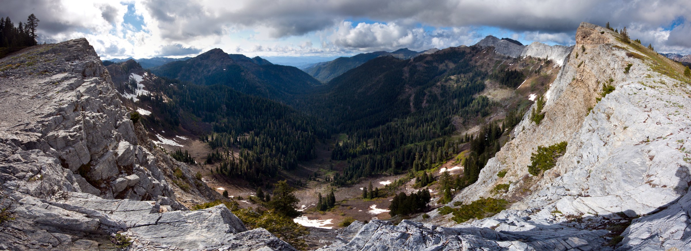
From Marble Valley, switchbacks climb to Four Corners Saddle on the Marble Rim, a four-way junction at 1,940 m. The reward is the blinding white of Marble Mountain’s exposed slopes and, from the rim, the view over the west face down into Rainy Valley. The panorama takes in the Wooley Creek drainage, the Trinity Alps and Preston Peak. The rim is an escarpment rather than a peak, and can be walked along; loop returns run through Little Marble Valley and Sky High Lakes.
Why it is essential
This is the route that explains the range. Marble Mountain is a mass of stark white marble — metamorphosed limestone — unique in the Klamaths, and standing on the rim is the only way to grasp the scale of it. The karst beneath is riddled with over 150 documented caves, and the eroded, chalk-like surface formations are visible from the trail. Add the 1930s guard station and the Pacific Crest Trail through Marble Valley, and it is the most complete day in the wilderness.
Equipment
- Mountain hiking equipment; sturdy boots for the stone steps and the rim.
- 2–3 L water capacity. Canyon Creek and Marble Valley supply water; treat it.
- Sun protection — the rim is exposed and the white rock is glaring.
- Wind shell for the saddle.
Hazards and notes
- The rim edge is steep and exposed. Keep back from the escarpment lip.
- Karst hazards: sinkholes and cave openings are present on the marble. The caves are for experienced cavers with proper equipment only; do not enter them casually.
- Horses and occasional cattle use the trail.
- Snow can linger into June on the upper section.
- The 40-foot waterfall on the Canyon Creek trail is seasonal and much reduced by late summer.
Routes and maps
| Source | URL | Format / access | Reuse status |
|---|---|---|---|
| USFS — Hiking, Klamath National Forest (PDF) | fs.usda.gov | Official mileages: 4.5 mi to Marble Valley, 1 mi to the rim | Public domain (US federal work) |
| USFS — Lovers Camp Trailhead | fs.usda.gov | Official trailhead page | Public information |
| Oregon Hikers — Marble Valley Hike | oregonhikers.org | Distance, gain and high point | Public reference |
| SummitPost — Marble Mountain / Marble Rim | summitpost.org | Geology and route notes | User content; check per-page licence |
No official Forest Service GPX or KML exists for this route.
Further reading
3. Boulder Peak
Snapshot
Photo status: no licence-compatible image of Boulder Peak was found in this pass. The images on Wikimedia Commons matching the name all depict other Boulder Peaks in Idaho, Montana and Colorado, and no lookalike has been substituted.
Itinerary
From the Boulder Creek trailhead the trail climbs relentlessly through forest, gaining over 900 m in the first 5 km. It passes Lower Wright Lake and Upper Wright Lake — the peak’s north face rises some 460 m directly above the lower lake — and reaches a ridgeline at about 2,350 m, where a use trail branches south-west toward the summit. The use trail runs level for roughly 800 m before climbing again for the last 400 m, and the final 30 m to the top is a scramble. The summit panorama covers the whole wilderness.
Two other approaches exist. From Shackleford Creek the walk is 25.1 km with 1,160 m of gain, starting higher but taking longer. From Big Meadows it is only 11 km with 580 m of gain, which is by far the easiest way up — but the road access to Big Meadows and its current condition could not be verified, and it should be checked with the ranger district before relying on it.
Why it is essential
Boulder Peak is the high point of the Marble Mountain Wilderness at 2,530 m, with nearly 900 m of topographic prominence — 51st in California. It is the summit day of the range, and the only way to see the whole of it at once.
Equipment
- Mountain hiking equipment; sturdy boots for the scramble and trekking poles for a long descent.
- 3 L water capacity. Boulder Creek supplies water low down, and the Wright Lakes are the reliable high source — but treat everything, as cattle graze seasonally in the area.
- Sun protection and a warm layer for the summit ridge.
- Headtorch; this is a full-value day.
Hazards and notes
- 1,340 m of ascent over 21 km. This is at the outer limit of a day hike and should be started at dawn.
- The final 30 m is an exposed scramble, though non-technical.
- Black bears are present, though they typically avoid people.
- Seasonal cattle grazing means all water must be treated.
- The road numbers for the Boulder Creek trailhead come from secondary sources only. There is no official Forest Service page for this trailhead. Check the forest’s Motor Vehicle Use Map before setting out.
Routes and maps
| Source | URL | Format / access | Reuse status |
|---|---|---|---|
| SummitPost — Boulder Peak | summitpost.org | Three approaches, distances and gain | User content; check per-page licence |
| AllTrails — Boulder Peak via Big Meadows | alltrails.com | GPX (subscription); the short approach | AllTrails terms; reference only |
| USFS — Klamath NF alerts and notices | fs.usda.gov | Current restrictions and closures | Public information |
No official Forest Service GPX, KML or trailhead page was found for this route.
Further reading
4. Campbell, Cliff and Summit Lakes via Shackleford Creek
Snapshot
Photo status: no licence-compatible image of Campbell, Cliff or Summit Lakes was found in this pass. No image of a different lake has been substituted.
Itinerary
From the Shackleford trailhead the Shackleford Creek Trail heads south-west into the wilderness, first through old-growth forest, then onto more open ground where the tread becomes trail-like in Jeffrey pine parkland as it nears the wilderness boundary. It passes Log Lake at about 4.8 km and crosses a large meadow before reaching Campbell Lake — a large, shallow lake with a number of campsites around it.
A short side trip from Campbell reaches Cliff Lake, the deepest lake in the Marble Mountains. Summit Lake and Summit Meadow Lake lie hidden in cirques above, about 1.2 km from the Pacific Crest Trail. All of the lakes hold healthy trout populations. Note the nuance here: the Forest Service states that the Shackleford trail has no direct connection to the PCT, while the upper lakes do sit close to it — both are true, and there is no through-trail from the trailhead to the crest.
Why it is essential
This is the quieter half of the wilderness, and the best introduction to its lake country at a manageable scale. Four lakes in one loop, the deepest water in the range, and a walk that a moderately fit party can enjoy without the dawn start that Sky High or Boulder Peak demand.
Equipment
- Standard hiking equipment; the tread is good.
- 2 L water capacity. Shackleford Creek and the lakes supply water, but cattle graze this drainage seasonally — treat everything without exception.
- Sun protection for the open parkland.
- Swimming kit in high summer; fishing tackle if that is the point of the day.
Hazards and notes
- Seasonal cattle grazing is explicit on the official Forest Service page for this trailhead. All water must be treated.
- Busy on summer weekends; horses use the trail.
- Snow lingers early in the season.
- Regional guides note this is not a family-friendly walk despite the modest gain — it is a long enough day on rough ground.
Routes and maps
| Source | URL | Format / access | Reuse status |
|---|---|---|---|
| USFS — Shackleford Trailhead (Klamath NF) | fs.usda.gov | Official trailhead page with coordinates and facilities | Public information |
| USFS — Hiking, Klamath National Forest (PDF) | fs.usda.gov | Official mileages | Public domain (US federal work) |
| Oregon Hikers — Campbell Lake Loop Hike | oregonhikers.org | Distance, gain and high point | Public reference |
| Hiking Project — Shackleford Trail #5542 | hikingproject.com | GPX download | onX/REI terms; personal use |
No official Forest Service GPX or KML exists for this route.
Further reading
5. Paradise Lake and Kings Castle
Snapshot
Photo status: no licence-compatible image of Paradise Lake or Kings Castle was found in this pass.
Itinerary
The trail climbs steeply for about 3.2 km to Paradise Lake, which sits directly on the Pacific Crest Trail and marks the eastern terminus of the Kelsey National Recreation Trail before it drops away toward Kelsey Creek. The Forest Service grades this short approach “steep, moderately difficult”, and it is the whole of the walk for anyone content with the lake.
For the summit, keep round the left side of the lake to pick up a faded use trail climbing to the ridge; the switchbacks are visible from the lakeshore. Cairns mark the way through sections of rockfall. Kings Castle tops out at 2,257 m, with a rock bench and a benchmark, and a panorama across the wilderness. Black Marble Mountain is in view from the top but requires Class 3 scrambling and is not a walking objective. The limestone along the PCT here shows prominent sinkholes and eroded, chalk-like formations — the same karst that riddles the Marble Rim. Heading south on the PCT from Paradise Lake runs the crest toward Marble Valley.
Why it is essential
This is the crest route: the shortest way in the wilderness to stand on the Pacific Crest Trail, at a lake, with a genuine summit above it. It also shows the karst geology at close range, and it is the one hike here that can be done as a half-day.
Equipment
- Mountain hiking equipment; the summit use trail is loose and faded, and poles help.
- 2 L water capacity. Paradise Lake is the only water, and cattle grazing around it is heavy — treat everything. There is nothing reliable on the steep climb.
- Sun protection; the climb is exposed.
- Navigation: the summit route is a use trail marked by cairns, not a maintained path.
Hazards and notes
- The summit use trail crosses loose rockfall sections and is faded in places.
- Heavy cattle grazing around Paradise Lake, which also has a muddy bottom — poor for swimming, and all water must be treated.
- Frost and frozen ground by October.
- The 2022 McKinney Fire burn scar lies to the north of here, and its emergency closure ran along the northern edge of the wilderness. That closure is no longer in force, but expect visible fire effects on the northern stretch of the PCT.
- No official Forest Service page exists for this trailhead. The access road numbers come from secondary sources; verify them before setting out.
Routes and maps
| Source | URL | Format / access | Reuse status |
|---|---|---|---|
| USFS — Hiking, Klamath National Forest (PDF) | fs.usda.gov | Official mileage: 2 mi one way to Paradise Lake | Public domain (US federal work) |
| SummitPost — Kings Castle | summitpost.org | Summit elevation, use-trail route and access road | User content; check per-page licence |
| AllTrails — Paradise Lake Trail | alltrails.com | GPX (subscription) | AllTrails terms; reference only |
No official Forest Service GPX, KML or trailhead page was found for this route.
Further reading
Nearby: the Russian Wilderness
The Russian Wilderness adjoins the Marbles to the south-east. It lies in the same national forest and the same ranger district, is covered by the same forest order, and is linked to the Marbles by the Pacific Crest Trail. It is best known for the “Miracle Mile”, a concentration of conifer species that is among the densest anywhere in the temperate world.
The natural day hike there is Statue Lake, reached from the Music Creek Trailhead by way of the Pacific Crest Trail — a small lake of 0.7 acres at about 2,195 m, set beneath granite pillars. Sources disagree sharply on the effort involved: the Forest Service’s hiking publication calls it 2.5 miles and “easy”, while AllTrails measures 7.1 km with 300 m of gain and grades it moderate. The Forest Service also notes that there is no trail down to the lake itself — leaving the PCT for the shore is a moderate-to-difficult scramble. Treat the “easy” grading with caution, and note that the access road number could not be verified.
Practical notes
Permits. No wilderness permit is required in the Marble Mountain Wilderness for day use or overnight stays. This is stated plainly on the official Klamath National Forest trailhead pages, and it contradicts some regional guides which claim a self-issued permit is needed — the official position is the one to follow, though it is worth reconfirming with the district office at Fort Jones (530-841-6131) before travelling. There is no trailhead or parking fee. The group-size limit in the wilderness is 15 people, and bicycles and all vehicles are prohibited.
Fire. Forest-wide fire restrictions took effect on 18 June 2026, prompted by a record-low winter snowpack. In practice this means no wood fires anywhere in the wilderness. A pressurised gas or liquid-fuel stove, grill or lantern with a shut-off valve may be used, kept at least 1.5 m from anything flammable, but only by someone carrying a valid California Campfire Permit — which is free. Restrictions can change; check the forest’s alerts page before travelling.
Water. No trailhead in this article has drinking water. Cattle are grazed seasonally in the Shackleford drainage and around Paradise Lake, and stock use the trails throughout. Treat all water, everywhere, without exception.
Further reading
| Source | URL |
|---|---|
| USFS — Klamath National Forest | fs.usda.gov |
| USFS — Salmon/Scott River Ranger District | fs.usda.gov |
| USFS — Lovers Camp Trailhead | fs.usda.gov |
| USFS — Shackleford Trailhead | fs.usda.gov |
| USFS — Hiking, Klamath National Forest (PDF) | fs.usda.gov |
| USFS — Klamath NF alerts and notices | fs.usda.gov |
| USFS — Wilderness Area Restrictions order | fs.usda.gov |
| USFS — Six Rivers NF, Marble Mountains Wilderness Area | fs.usda.gov |
| CAL FIRE — California Campfire Permit | readyforwildfire.org |
| Wikipedia — Marble Mountain Wilderness | en.wikipedia.org |
| SummitPost — Marble Mountain / Marble Rim | summitpost.org |
| Oregon Hikers — field guide | oregonhikers.org |
| OpenStreetMap (ODbL 1.0) | openstreetmap.org |
Missing data / follow-up work
- No licence-compatible photographs exist for three of the five hikes — Boulder Peak, the Shackleford lakes, and Paradise Lake / Kings Castle. Wikimedia Commons holds only eleven files in its Marble Mountain Wilderness category, and the “Boulder Peak” matches are all in Idaho, Montana and Colorado. Nothing has been substituted. The photographer of the Sky High Lakes and Marble Ridge images used here has a Flickr stream under CC BY 2.0 that probably contains more usable frames.
- Trail numbers are unverified. #5532 (Canyon Creek), #5542 (Shackleford Creek) and #5541 (Campbell Lake) come from regional guides and were never seen on an official Forest Service page. No numbers were found at all for the Sky High Valley, Boulder Creek, Paradise Lake or Kings Castle trails, so none are printed here.
- The Paradise and Boulder Creek trailheads have no official Forest Service page. Their coordinates are unverified, and their road numbers (FS 44N44 and FS 44N53Y) rest on secondary sources. Check the forest’s Motor Vehicle Use Map before travelling. Lovers Camp and Shackleford are officially documented and their coordinates are verified.
- No trailhead elevation is published for Lovers Camp, Shackleford or Paradise. Figures given elsewhere are back-solved from gain and high-point arithmetic and should be treated as estimates.
- The permit position is disputed. The official Forest Service trailhead page states that no wilderness permit is required for day or overnight use; oregonhikers.org states twice that a free self-issued permit is required from Fort Jones. The official page is followed here, but the conflict should be resolved with the district office.
- The distance and gain for Kings Castle including the summit could not be found in any source and are not estimated here.
- Estimated times for the Marble Rim, Boulder Peak and the Shackleford lakes are inferences, not published figures.
- Dog rules could not be verified. No Klamath NF statement on dogs in this wilderness was found, so none is asserted.
- No bear-canister requirement was found for this wilderness, and none is believed to exist — but that is an absence of evidence rather than a positive confirmation.
- The Big Meadows approach to Boulder Peak — much the shortest — could not be verified for road access or current condition.
- The fire-restriction status is genuinely ambiguous. The alerts page listed the 18 June 2026 restrictions as active when checked on 12 July 2026, but an undated “Klamath National Forest lifts fire restrictions” release also exists on the same site. Re-check on the day of travel.
- The Wilderness Area Restrictions order expires on 31 July 2026. A renewal is likely but was not posted at the time of writing.
- No OpenStreetMap way or relation IDs are cited for this region. None was confirmed, and none has been invented. An Overpass query would supply them.
- wilderness.net returned only boilerplate on two attempts, so no fact in this article is sourced from it.
- No official agency GPX or KML exists for any of the five routes.