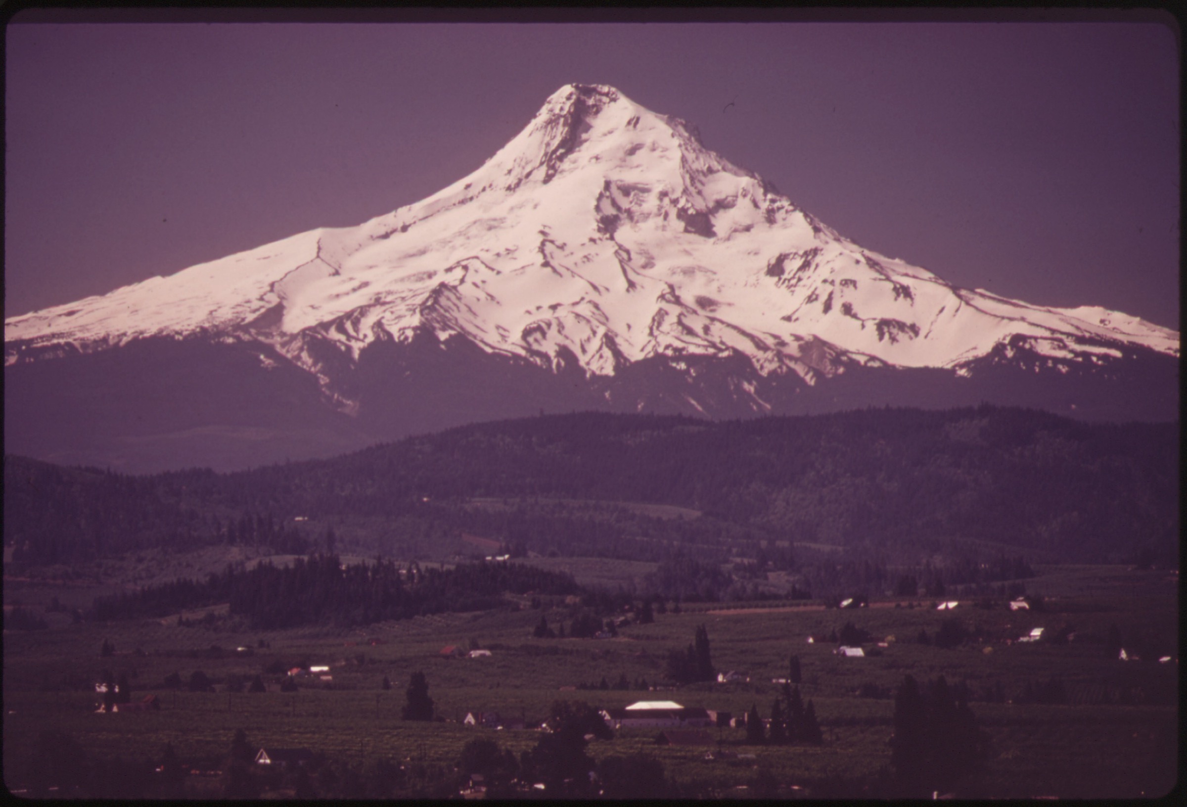
Regional overview
Mount Hood (Wy’east in the Sahaptin and Kiksht languages of the Confederated Tribes of Warm Springs) is a 3,429 m (11,249 ft) Pleistocene-to-Holocene stratovolcano on the western edge of the Cascade Volcanic Arc, roughly 80 km east-southeast of Portland, and the northern anchor of the Oregon Cascade volcanic line that runs south through the Mount Jefferson and Three Fingered Jack sector to the Three Sisters and Bend region. Its summit cone sits at the northern end of a 60 km-long volcanic massif inside the 4,400 km² Mt. Hood National Forest, of which 26,000 ha are managed as the Mt. Hood Wilderness. Twelve named glaciers ring the peak — Eliot (the largest, on the north-east), Coe and Ladd on the north, Sandy and Reid on the west, Zigzag and White River on the south — and feed the four major drainages that organise the foot of the mountain: the Sandy on the west, the Hood on the north, the White on the east, and the Salmon on the south. The Pacific Crest Trail (#2000) crosses the south flank within metres of historic Timberline Lodge (a 1937 WPA building at 1,820 m), and the 65 km Timberline Trail (#600) circles the peak between roughly 1,200 m and 2,300 m. Most of the day hikes in this file thread or branch off this trail system.
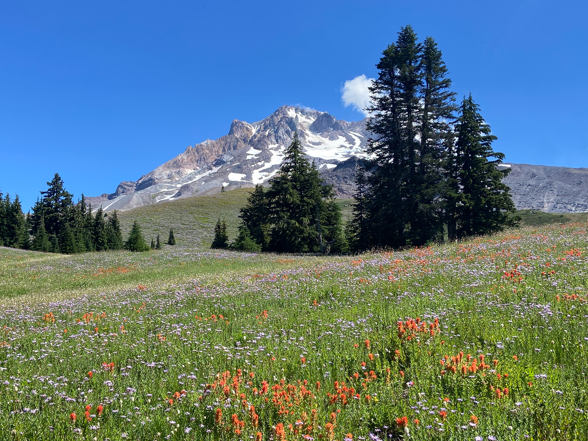
Vegetation banding around Hood is textbook Pacific Northwest. Lower west-side approaches from Lolo Pass and the Sandy River pass through dense Douglas-fir, western hemlock and western red cedar forest with thick understorey of vine maple and salmonberry. Above roughly 1,400 m the band shifts to Pacific silver fir and mountain hemlock, and from approximately 1,800 m the timberline groves of subalpine fir and whitebark pine open into the heather, lupine and red-paintbrush meadows that define Paradise Park, McNeil Point and the upper Timberline Trail. Above the meadow band, loose volcanic ash, scoriaceous lapilli, glacier moraine and snowfield take over: Cooper Spur is the clearest example, climbing onto the bare north-east shoulder above the Eliot Glacier headwall. South-side and west-side slopes typically clear of snow earlier than the north-east, but lingering snow on the Timberline Trail and on the upper meadow benches is normal into early July and can persist on north aspects into August in heavy-snowpack years.
Access is overwhelmingly private-vehicle based. US Highway 26 services the south side (Timberline Lodge, Mirror Lake, Government Camp), Oregon Highway 35 services the east (the Cooper Spur road branches off OR-35 to the Cloud Cap historic district), and the Lolo Pass road links to Top Spur and Ramona Falls on the west. The Mount Hood Express bus runs limited service from Sandy through Government Camp to Timberline, but no public transit reaches the Lolo Pass, Cloud Cap or Ramona Falls trailheads. A Sno-Park permit is required at Mirror Lake and most south-side lots between 1 November and 30 April; a NW Forest Pass or America the Beautiful pass covers day-use fees at the bulk of the remaining trailheads in season; the Ramona Falls trailhead specifically requires a federal recreation pass between 1 May and 31 October, and the Mt. Hood Wilderness uses free self-issue permits at trailheads from approximately mid-May to mid-October. Hard-floor cautions specific to the mountain: the Sandy River on the Ramona Falls loop has no footbridge and routinely runs at unsafe glacial flow into July; the Cloud Cap road is narrow, unpaved and high-clearance only, often snowed in until late June; and the upper Cooper Spur ridge runs onto mountaineering terrain where unroped scrambling has produced repeated fatalities.
Selection rationale
The five hikes below were chosen to circumnavigate Mount Hood at the day-hike scale, covering the four aspects of the peak — south, west, north-east and the lake-and-summit foothills — without duplicating character. Paradise Park is the south-side flower-meadow circuit from Timberline Lodge, the canonical Hood meadow walk and the only entry that uses the PCT directly. McNeil Point is the west-side alpine viewpoint, climbing to a CCC-era stone shelter directly below the Sandy and Reid Glaciers; it is the close-up alpine entry. Cooper Spur is the north-east counterpart, climbing the quieter Eliot-Glacier flank to the highest non-mountaineering viewpoint on Hood. Ramona Falls is the major waterfall day hike on the west side, mixing glacial river crossing, lodgepole forest and a 35 m basalt-cascade. Tom, Dick and Harry Mountain via Mirror Lake closes the set with the classic accessible lake-reflection-plus-ridge-view hike on the mountain’s western foothills, walkable across a longer season than any of the four higher entries.
Alternative hikes considered but displaced: Cairn Basin and Eden Park overlap with McNeil Point on the same Top Spur approach; Lookout Mountain duplicates the lake-and-ridge character of Tom, Dick and Harry from the east side; the full Timberline Circumnavigation (the 65 km loop) sits beyond the day-hike envelope; and Bald Mountain alone is a sub-component of the McNeil Point line.
Summary
| # | Hike | Country | Route type | Distance | Gain | Max elevation | Difficulty |
|---|---|---|---|---|---|---|---|
| 1 | Paradise Park Loop via PCT (Trail #757) | USA | Loop | 19.8 km | 842 m | 1,855 m | Hard |
| 2 | McNeil Point Trail | USA | Out-and-back | 15.4 km | 1,029 m | 2,114 m | Hard |
| 3 | Cooper Spur via Eliot Glacier View Trail | USA | Out-and-back | 11.1 km | 916 m | 2,723 m | Hard |
| 4 | Ramona Falls Trail | USA | Loop | 11.6 km | 329 m | 1,065 m | Moderate |
| 5 | Tom, Dick and Harry Mountain via Mirror Lake (#664) | USA | Out-and-back | 13.2 km | 517 m | 1,543 m | Moderate |
1. Paradise Park Loop via PCT (Trail #757)
Snapshot
Itinerary
From the western end of the Timberline Lodge parking complex, follow the signed Pacific Crest Trail (PCT #2000) / Timberline Trail (#600) westbound across the upper south flank. The trail descends through wind-scoured timberline scrub of subalpine fir and whitebark pine, then plunges into the deeply cut canyons of the Little Zigzag and Zigzag rivers — the Zigzag crossing is the most committing on the loop and runs cold and fast through midday. Above the Zigzag canyon, the trail climbs back to roughly 1,700 m and meets the signed junction with the Paradise Park Trail (#757). Take #757 north-east as it climbs through huckleberry and silver fir into the first open benches of Paradise Park at approximately 1,800 m.
The route then traverses the high meadow benches eastward across Lost Creek and Rushing Water Creek under the south-west face of Hood, passing seasonal meadow displays of lupine, paintbrush, mountain heather and avalanche lily, and offering one of the closest open views of the upper Reid and Zigzag glaciers from a trail. The route rejoins the PCT high on the meadow shoulder at around 1,855 m, the loop’s high point, then traces the PCT back eastward across the Zigzag and Little Zigzag canyons to Timberline Lodge. The full clockwise circuit returns to the trailhead at 19.8 km.
Why it is essential
Paradise Park is the canonical Mount Hood meadow walk and the only entry in this selection that delivers the south-side flower benches with the upper Reid and Zigzag glaciers framed above. It opens from the historic Timberline Lodge — a National Historic Landmark and arguably the most iconic mountain lodge in the western United States — and uses the PCT directly, making it the natural pilgrimage route of the south side.
Equipment
- Mountain boots with edge for loose volcanic gravel; trekking poles strongly recommended for the creek crossings.
- 2–3 L water; treat any drawn from streams.
- Warm midlayer, weatherproof shell, sun and UV protection (the upper meadows are open at ~1,800 m).
- Map, compass and GPS backup; the meadow benches have multiple parallel social trails.
- Microspikes useful into early July on the Zigzag-canyon north aspect.
Hazards and notes
- The Zigzag River crossing is the principal hazard. It runs glacially cold and fast through afternoon; cross early when flows are lower.
- Loose volcanic tread on the upper benches; trekking poles help on descent.
- Fast weather changes — afternoon thunderstorms can build off the south face in summer.
- Stay on durable surfaces; the Paradise Park meadows are a heavily impacted alpine vegetation zone.
- Black bears use the meadow benches; food storage discipline applies.
- No potable water on route; the Timberline Lodge offers refill before and after.
Routes and maps
| Source | URL | Format / access | Reuse status |
|---|---|---|---|
| AllTrails — Pacific Crest Trail to Paradise Park Loop 757 | alltrails.com | GPX (members) | AllTrails terms; reference only |
| USFS — Timberline Lodge Trailheads | fs.usda.gov | Official trailhead page | Public information |
| OpenStreetMap (PCT / Timberline Trail) | openstreetmap.org | OSM XML / GPX export | ODbL 1.0; reusable with attribution |
Further reading
- USFS — Timberline Lodge Trailheads
- Timberline Lodge — National Historic Landmark
- Oregon Hikers — Paradise Park Loop Hike
2. McNeil Point Trail
Snapshot
Itinerary
From the small Top Spur trailhead, take Top Spur Trail (#785) east through dense Pacific silver fir forest for 0.5 mi to a four-way junction with the Timberline Trail (#600) and the PCT (#2000). The signed route bears right (south-east) onto a brief PCT segment, then left (east) onto the Timberline Trail toward Bald Mountain. The trail traverses the north slope of Bald Mountain on the open meadow shoulder — the first sustained Hood view of the day — and contours east across the McGee Creek headwaters into Cairn Basin and Eden Park country.
At approximately 4 km from the trailhead the route reaches the signed McNeil Point user trail, climbing south-east on a steep, often loose path through dwarf subalpine fir krummholz and onto the open upper benches. The trail steepens markedly above 1,950 m, crossing seasonal snowfields and switchbacking up a scoria-and-pumice ridge to the small stone shelter at 2,114 m — built by the Civilian Conservation Corps in the 1930s. The shelter sits directly below the headwall of the Sandy and Reid glaciers, with the west face of Hood filling the eastern horizon. Return is by the same route; the upper user trail is markedly more committing on descent when loose.
Why it is essential
McNeil Point is one of Mount Hood’s most striking close-up alpine viewpoints, and the only entry in this selection that puts a hiker directly at the foot of a glacier headwall. The CCC-era stone shelter is a recognised piece of Pacific Northwest trail history. The approach through Bald Mountain, Cairn Basin and Eden Park covers the full meadow-to-alpine band of the west side in a single day.
Equipment
- Sturdy boots with edge for loose scoria and gravel; trekking poles strongly recommended on the upper user trail.
- Map, compass and GPS — the upper trail is a user path with multiple parallel lines and route-finding above the benches.
- Warm midlayer, wind shell, sun and UV protection.
- 2.5 L water; treat any drawn from the meadow streams.
- Microspikes and ice axe if snow lingers on the upper benches; full mountaineering kit and judgment if the route is not yet melted.
Hazards and notes
- The upper user trail is steep, loose and unmaintained — route-finding errors have caused accidents.
- Lingering snowfields on the upper benches into mid-July; check conditions before committing.
- Loose volcanic gravel and pumice on the final climb; falling rock is a hazard if a party is above.
- Lightning exposure on the open meadow benches and the upper ridge — start early.
- Dogs are not well-suited to the upper user trail.
- Vehicle break-ins have been reported at remote trailheads in the Mt. Hood NF.
Routes and maps
| Source | URL | Format / access | Reuse status |
|---|---|---|---|
| AllTrails — McNeil Point Trail | alltrails.com | GPX (members) | AllTrails terms; reference only |
| USFS — Top Spur Trailhead | fs.usda.gov | Official trailhead page | Public information |
| OpenStreetMap (Timberline Trail / Top Spur) | openstreetmap.org | OSM XML / GPX export | ODbL 1.0; reusable with attribution |
Further reading
3. Cooper Spur via Eliot Glacier View Trail
Snapshot
Itinerary
From the Cloud Cap Trailhead, take the Timberline Trail (#600) south for approximately 0.5 km to the signed junction with the Cooper Spur Trail (#600B). The route turns south-east, climbing in steady switchbacks through the last band of subalpine fir and whitebark pine and emerging onto open scoria by about 2,100 m. Continue south-east along the Tilly Jane–Cooper Spur ridge, passing the small stone Cooper Spur emergency shelter at roughly 2,250 m — another CCC-era structure, a useful storm wind-break but not a designed bivouac.
Above the shelter the trail steepens and climbs onto the bare upper ridge of Cooper Spur proper, with the Eliot Glacier headwall dropping away vertically to the west. The standard hiking high point sits at approximately 2,723 m, where the maintained trail effectively ends and the line continues onto serious mountaineering terrain toward the Tie-In Rock and the Cooper Spur climbing route. Hikers should turn here; the route ahead crosses the Eliot Glacier headwall and has produced repeated fatalities to unroped scramblers. From the high point the view spans east into the Hood River Valley, north to Mt. Adams and Mt. Rainier on a clear day, and west across the Eliot, Coe and Ladd glaciers. Descent is by the same route.
Why it is essential
Cooper Spur is the sharpest high-mountain viewpoint on Hood available to a non-mountaineer. It is the quietest of the five entries — the Cloud Cap district receives a fraction of the south-side traffic — and the only one that climbs to the bare volcanic shoulder of the peak above the glacier headwalls. The Cloud Cap Inn (1889, the oldest standing structure on Mount Hood) and the CCC-era Tilly Jane campground sit beside the trailhead, giving the route a strong historical dimension.
Equipment
- Mountain boots with stiff sole for scoria edging; trekking poles for the bare upper ridge.
- Wind shell, warm midlayer, gloves and a hat — wind on the upper spur is constant and cold even in summer.
- Sun and UV protection — the upper route is fully exposed at 2,400–2,700 m.
- Helmet sensible if continuing onto loose upper terrain; not required for the maintained trail.
- 2.5 L water; no reliable water on route.
- Microspikes and ice axe if snowfields remain on the ridge; mountaineering kit and skills are required to continue past the hiking high point.
Hazards and notes
- Mountaineering terrain immediately above the hiking high point. Repeated fatalities have occurred when hikers continued unroped onto the Eliot Glacier headwall; turn at the maintained trail end.
- Loose volcanic scoria on the upper ridge; rockfall hazard if a party is above.
- High wind and rapid weather change — the spur is fully exposed.
- Lingering snowfields can persist on the ridge into August in heavy-snowpack years.
- Lightning exposure on the open ridge; start early.
- Cloud Cap Road is rough — verify open status with the USFS before committing.
Routes and maps
| Source | URL | Format / access | Reuse status |
|---|---|---|---|
| AllTrails — Cooper Spur via Eliot Glacier View Trail | alltrails.com | GPX (members) | AllTrails terms; reference only |
| USFS — Cloud Cap Trailhead | fs.usda.gov | Official trailhead page | Public information |
| USFS — Mt. Hood National Forest roads | fs.usda.gov | Road status | Public information |
| OpenStreetMap (Cooper Spur / Timberline Trail) | openstreetmap.org | OSM XML / GPX export | ODbL 1.0; reusable with attribution |
Further reading
4. Ramona Falls Trail
Snapshot
Itinerary
From the Ramona Falls trailhead at the end of NF-1825, follow the Sandy River Trail (#770) east through lodgepole pine and Douglas-fir for approximately 2.5 km along the glacial outwash floodplain of the Sandy. The trail reaches the seasonal log crossing of the Sandy River — there is no footbridge; the Forest Service has removed bridges here repeatedly after washouts and explicitly states that hikers must judge the crossing themselves. If the crossing is unsafe, the only correct decision is to turn back.
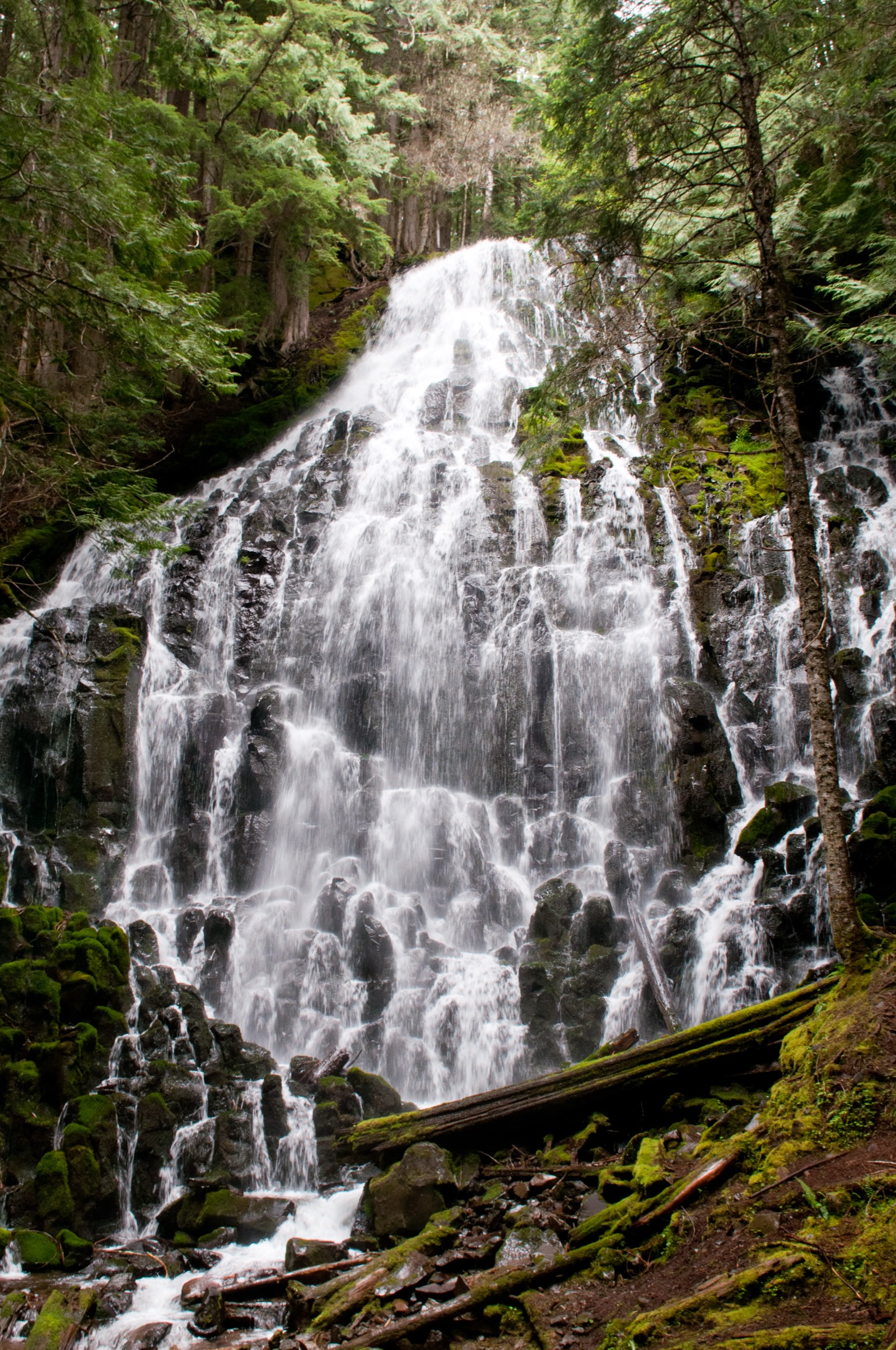
On the far side, the trail joins the PCT (#2000) / Timberline Trail (#600) corridor and climbs gently through old-growth Douglas-fir and western red cedar to the Ramona Falls amphitheatre at approximately 1,065 m. The falls themselves fan down a 35 m wall of columnar basalt in dozens of small braided cascades — the distinctive moss-and-fern wall is fed by the Sandy Glacier system above. The return is on the Ramona Falls Trail (#797), descending along Ramona Creek through the same old-growth band and back to the Sandy crossing, closing the standard 11.6 km loop.
Why it is essential
Ramona Falls is Mount Hood’s signature waterfall day hike and a recognised PCT highlight. The 35 m basalt-cascade wall is one of the most photographed waterfalls in Oregon, and the loop mixes glacial river, lodgepole pine floodplain, old-growth forest and waterfall basin in a single moderate day — without the elevation commitment of the higher entries on the mountain.
Equipment
- Boots with good traction for the log crossing and the glacial-cobble shore of the Sandy.
- Trekking poles strongly recommended for the river crossing.
- Water treatment; do not drink from the Sandy directly (heavy glacial sediment).
- Light layers; the loop sits below the meadow band and is sheltered.
- Insect protection in early summer.
- Do not rely on water shoes — they are useful only if the crossing is already judged safe and the party is competent on glacial water.
Hazards and notes
- The Sandy River crossing is the principal hazard. There is no footbridge; the river is glacially cold, opaque with sediment, and runs at unsafe flows into July. Turn back if the crossing is unsafe.
- Sandy River channel braids shift annually; the crossing point may not match older trip reports.
- Black bears use the floodplain and the falls amphitheatre — food storage discipline applies.
- Heavy weekend crowds at the falls themselves — start early or visit midweek.
- The Lolo Pass road approach is paved but narrow; the final NF-1825 spur is gravel.
Routes and maps
| Source | URL | Format / access | Reuse status |
|---|---|---|---|
| AllTrails — Ramona Falls Trail | alltrails.com | GPX (members) | AllTrails terms; reference only |
| USFS — Ramona Falls Trailhead | fs.usda.gov | Official trailhead page | Public information |
| USFS — Ramona Falls Trail Guide & Map | fs.usda.gov | Official PDF map | Reuse not stated; reference |
| OpenStreetMap (Ramona Falls loop) | openstreetmap.org | OSM XML / GPX export | ODbL 1.0; reusable with attribution |
Further reading
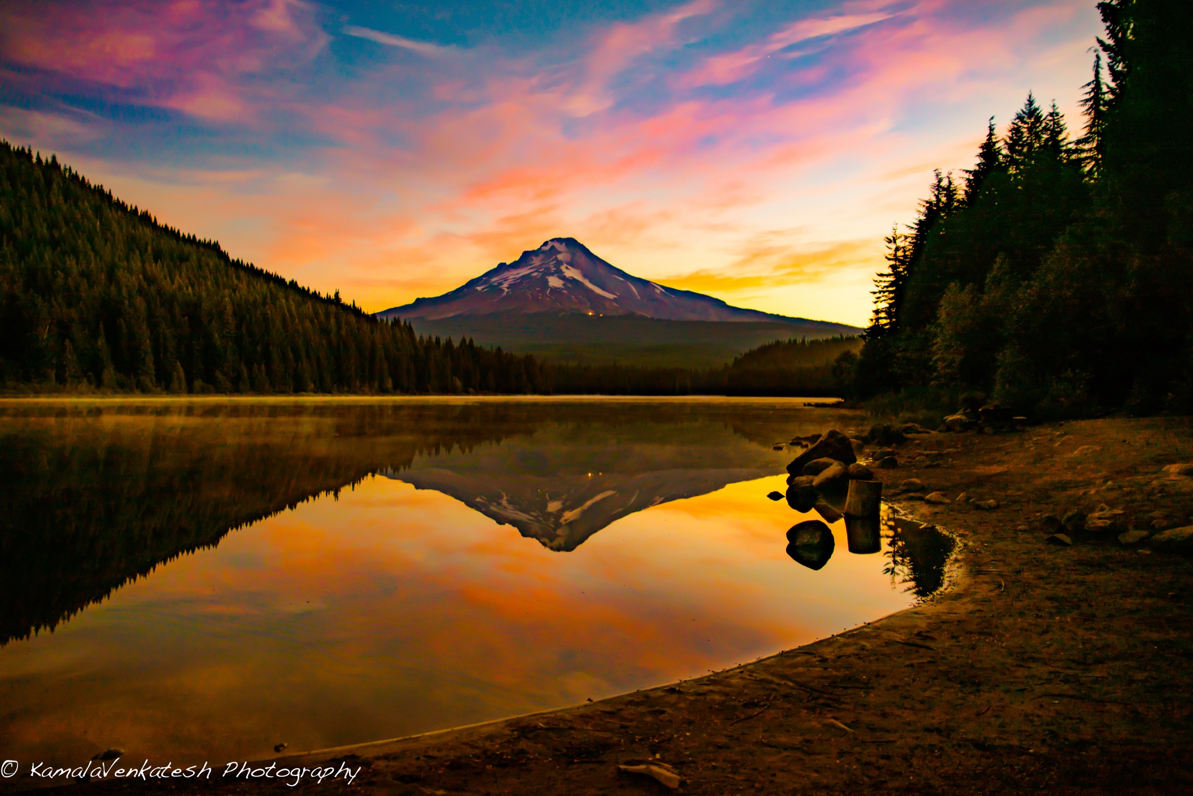
5. Tom, Dick and Harry Mountain via Mirror Lake (#664)
Snapshot
Itinerary
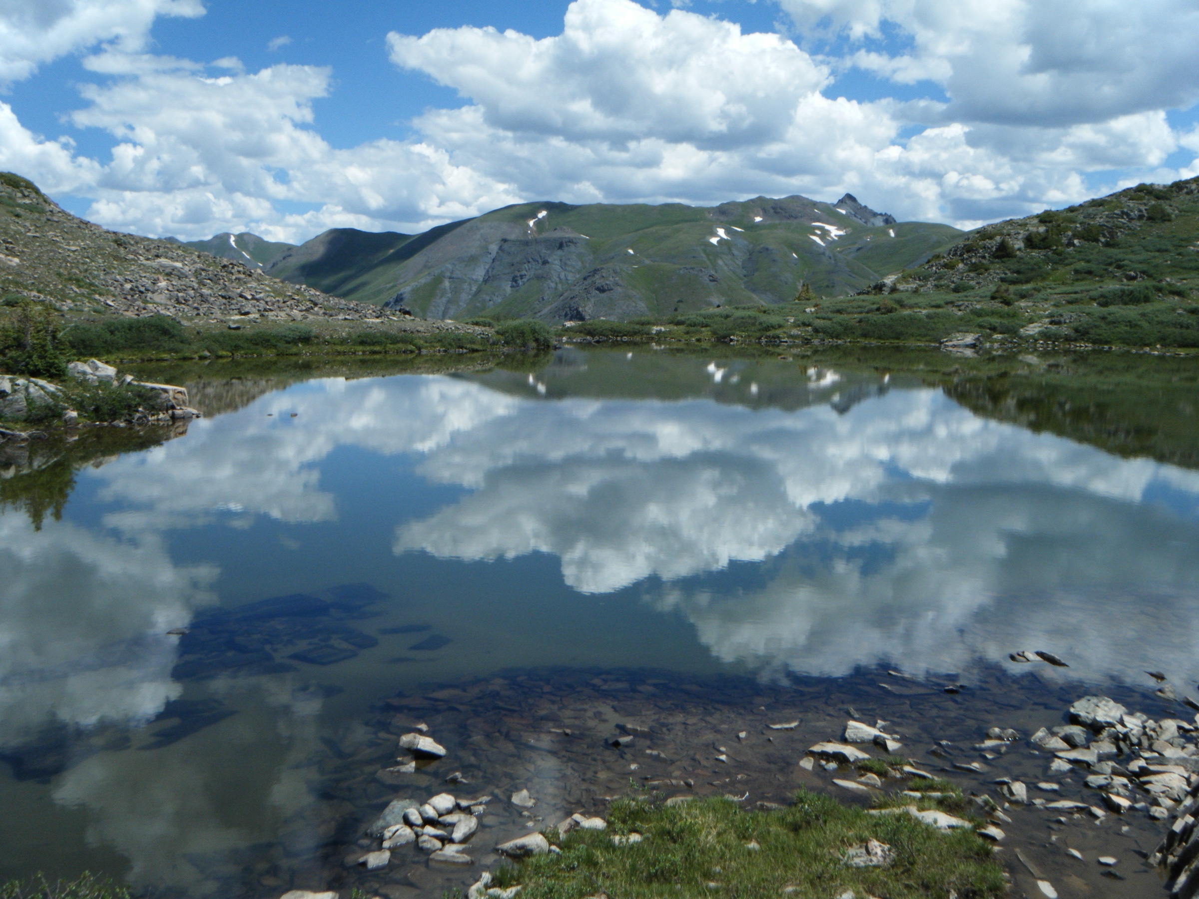
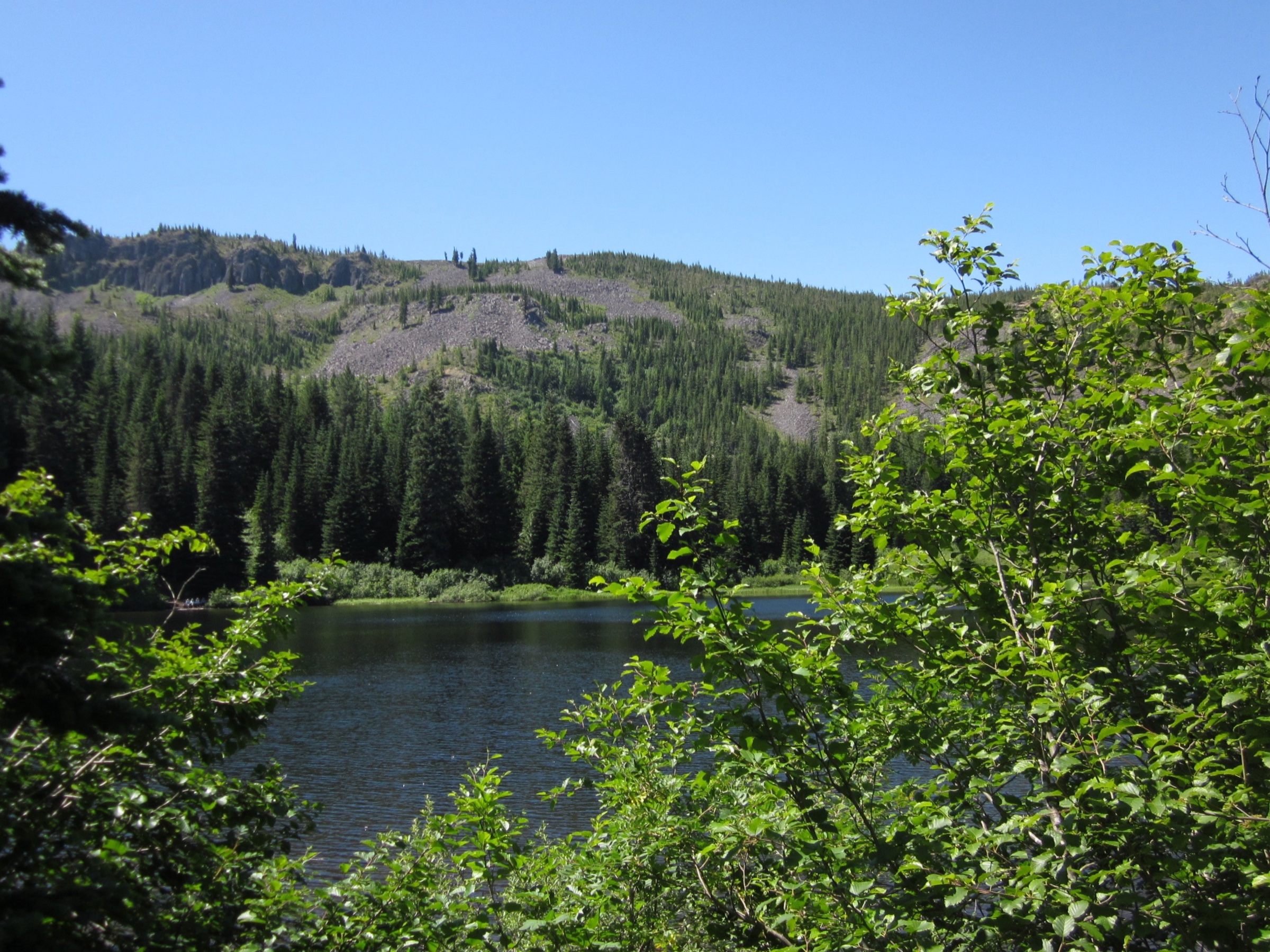
From the Mirror Lake Sno-Park on US-26, the Mirror Lake Trail (#664) climbs through Pacific silver fir and mountain hemlock in steady switchbacks. After approximately 2.2 km the trail reaches the small east shore of Mirror Lake at 1,260 m — the classic foreground for a south-side Mount Hood reflection, ringed by huckleberry and heather. A short loop circles the lake, with several established viewpoints and a rest spot at the outlet.
For Tom, Dick and Harry, continue past the lake on the same trail, which climbs the ridge to the north-west in a long set of switchbacks. The forest opens onto a rocky shoulder at approximately 1,450 m, then traces the summit ridge eastward through alpine huckleberry and broken talus to the high point at 1,543 m. The summit panorama opens north to Mount Hood directly across the Zigzag valley, west to the Cascade foothills and the Salmon River drainage, and east to Mount Adams on clear days. Descent is by the same route. Tom, Dick and Harry has three sub-summits along the same ridge — the standard hiking objective is the central or eastern one.
Why it is essential
Tom, Dick and Harry via Mirror Lake is the classic accessible Hood reflection-plus-summit-view hike and the most reliable shoulder-season entry in this selection. Mirror Lake is the canonical south-side foreground for photos of Mount Hood, and the summit ridge delivers a broad panorama at moderate elevation — a sensible objective when the higher trails on the mountain are still under snow or when conditions on Cooper Spur and McNeil Point are off the table.
Equipment
- Trail shoes or light boots; trekking poles useful on the rocky upper trail and in snow.
- Layers and weatherproof shell; the summit ridge is exposed.
- Sun and UV protection.
- 1.5–2 L water; no reliable water on the ridge.
- Microspikes or traction devices December to April; full snowshoe kit in deep winter.
Hazards and notes
- Heavy weekend crowds at Mirror Lake — the lake area is one of the most heavily impacted destinations on the south-west side; stay on durable surfaces.
- Rocky upper trail; the summit ridge has occasional loose tread.
- Winter ice forms on the lake-area switchbacks; sno-park parking does not include snow removal of the trail itself.
- Black bears use the Mirror Lake area; standard food-storage discipline applies.
- Bicycle access is permitted on the lower Mirror Lake Trail — share the path.
Routes and maps
| Source | URL | Format / access | Reuse status |
|---|---|---|---|
| AllTrails — Tom, Dick and Harry Mountain via Mirror Lake Trail #664 | alltrails.com | GPX (members) | AllTrails terms; reference only |
| USFS — Mirror Lake Sno-Park & Trailhead | fs.usda.gov | Official trailhead page | Public information |
| OpenStreetMap (Mirror Lake / Tom, Dick and Harry) | openstreetmap.org | OSM XML / GPX export | ODbL 1.0; reusable with attribution |
Further reading
- USFS — Mirror Lake Sno-Park & Trailhead
- Oregon Hikers — Tom, Dick and Harry Mountain Hike
- Wikipedia — Tom, Dick, and Harry Mountain
Further reading
| Source | URL |
|---|---|
| USFS — Mt. Hood National Forest | fs.usda.gov |
| USFS — Mt. Hood National Forest road conditions | fs.usda.gov |
| USFS — Timberline Lodge Trailheads | fs.usda.gov |
| USFS — Top Spur Trailhead | fs.usda.gov |
| USFS — Cloud Cap Trailhead | fs.usda.gov |
| USFS — Ramona Falls Trailhead | fs.usda.gov |
| USFS — Mirror Lake Sno-Park & Trailhead | fs.usda.gov |
| Timberline Lodge | timberlinelodge.com |
| Mount Hood Express bus | mthoodexpress.com |
| Oregon State Parks — Sno-Park permits | stateparks.oregon.gov |
| Oregon Hikers — Mount Hood index | oregonhikers.org |
| Wikipedia — Mount Hood | en.wikipedia.org |
| Wikipedia — Timberline Trail | en.wikipedia.org |
| Wikimedia Commons — Category:Mount Hood | commons.wikimedia.org |
| OpenStreetMap (ODbL 1.0) | openstreetmap.org |