Regional overview
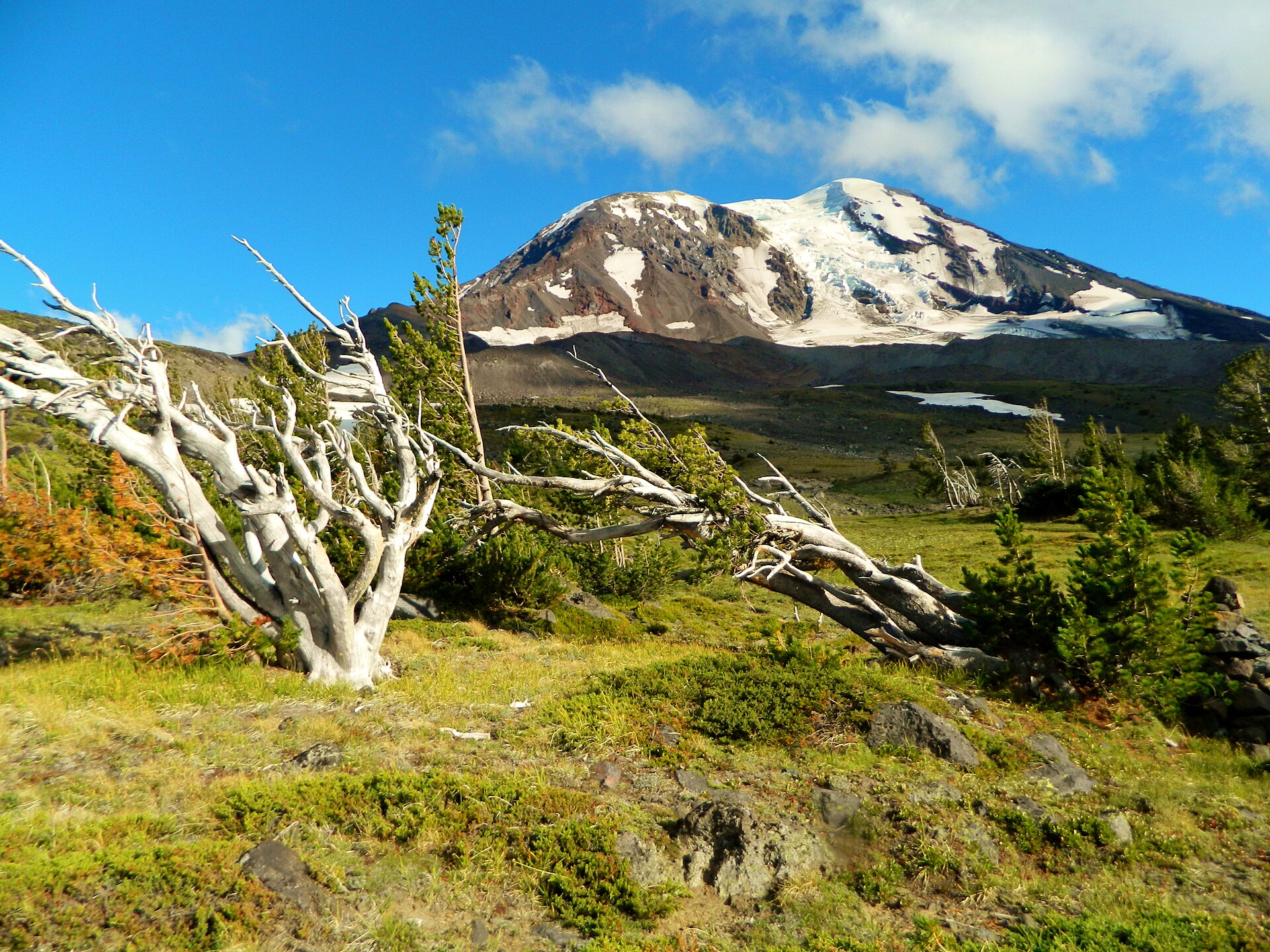
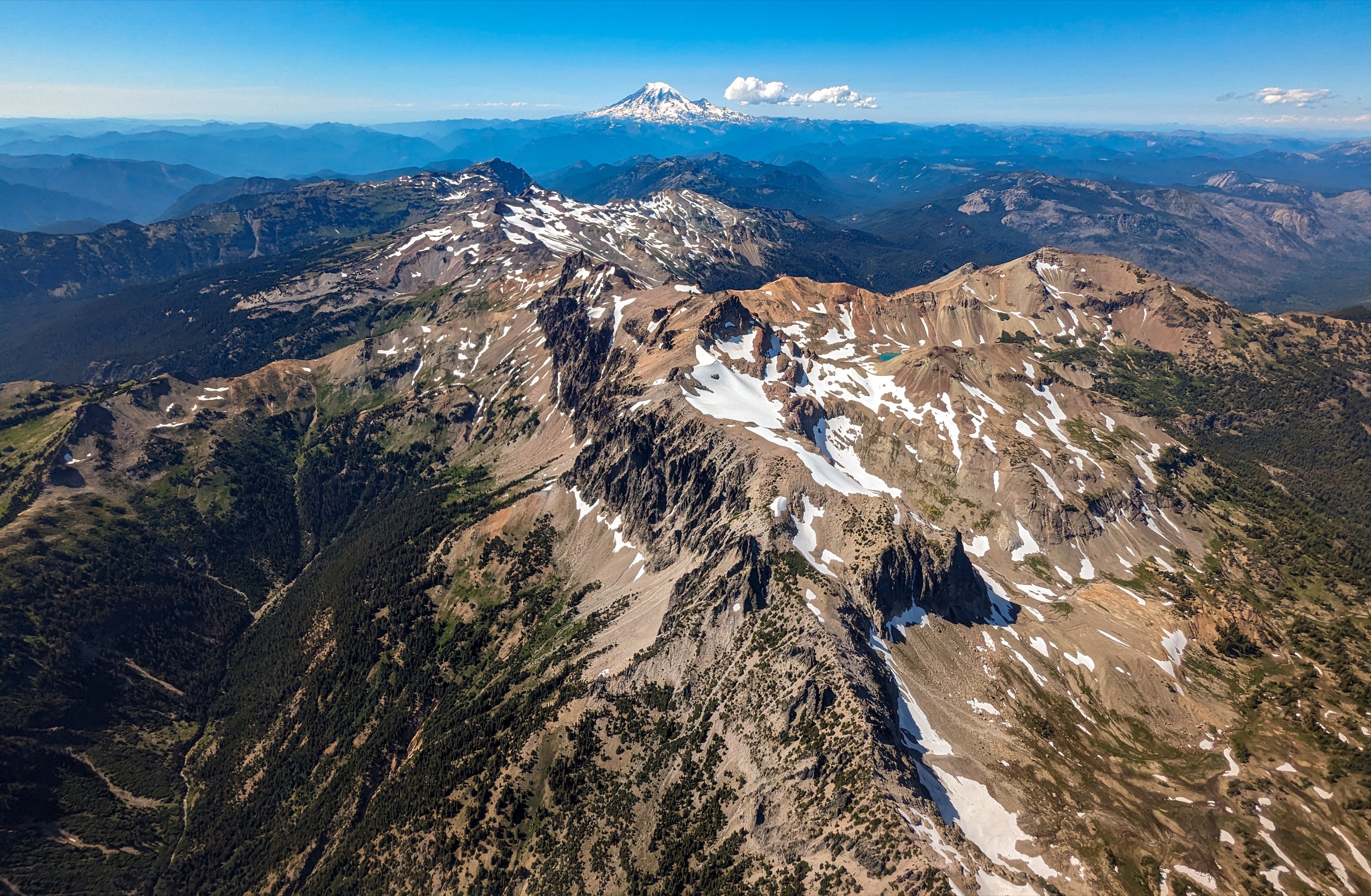
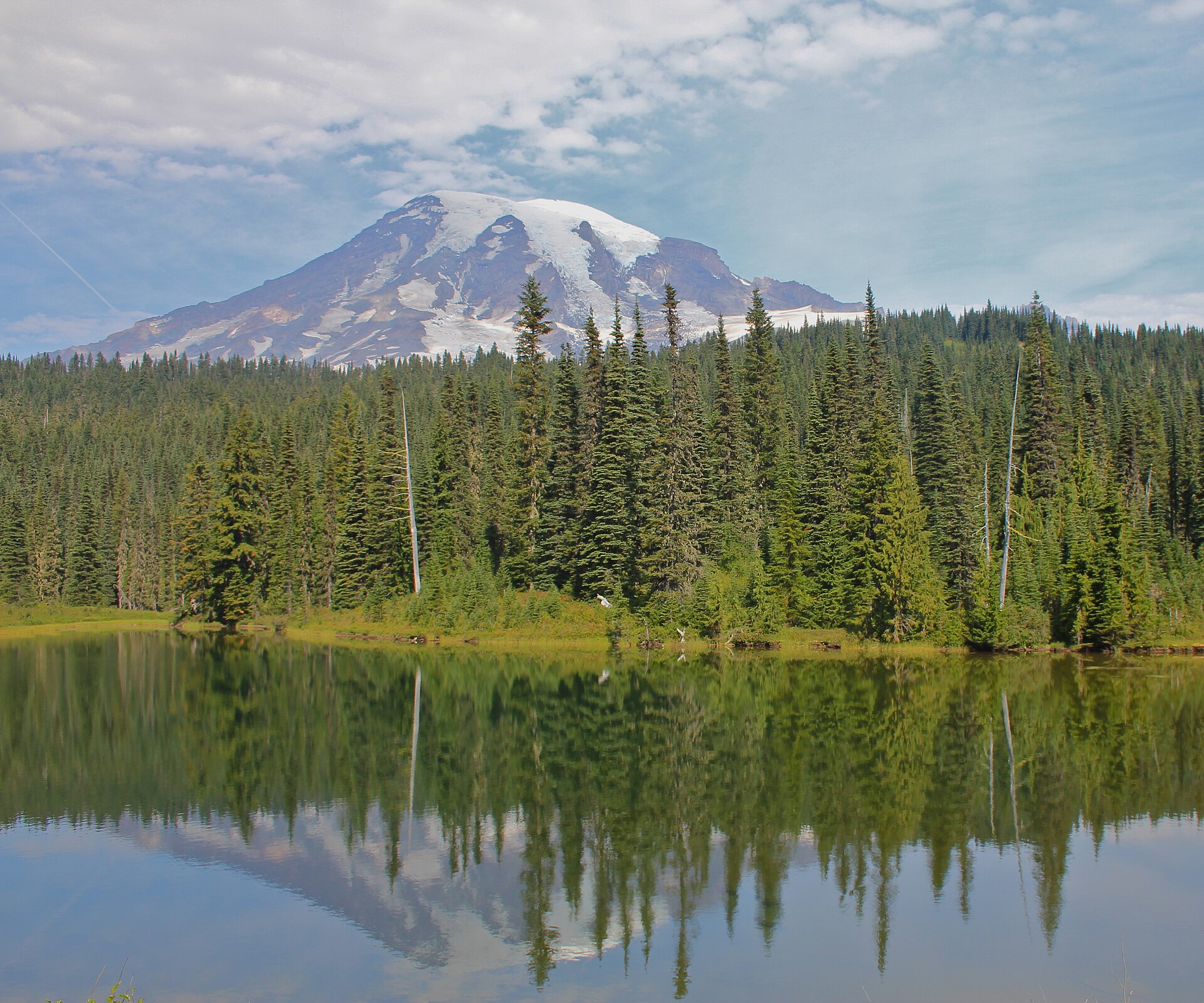
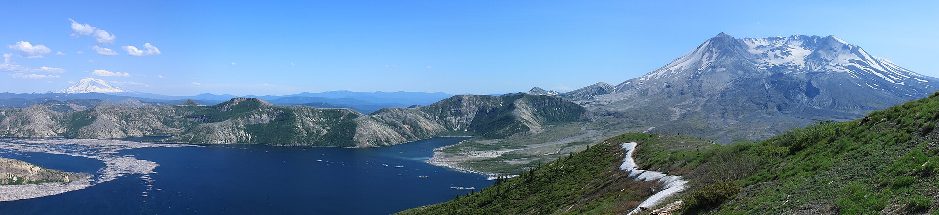
The southern Washington Cascades are dominated by two very different volcanoes standing about 55 km apart. Mount St Helens (2,550 m) is the younger, smaller and far more famous of the pair: its 18 May 1980 lateral blast removed the entire north flank, felled forest across some 600 square kilometres, and left a horseshoe crater open to the north with a growing lava dome inside it. Mount Adams (3,742 m) is the opposite in almost every respect — the second-highest peak in Washington, a broad, glaciated, comparatively quiet andesite pile with a dozen glaciers on its flanks and none of St Helens’ celebrity. Walking here means choosing between the two moods: raw volcanic aftermath on one mountain, classic subalpine meadow and glacier country on the other.
The hiking centres are correspondingly split. Mount St Helens is approached from three separate sides that do not connect to one another by road, and the distinction matters enormously to planning. The west side (State Route 504, the Spirit Lake Memorial Highway) is the visitor-centre corridor and historically the way to Johnston Ridge; the south side (Forest Roads 90, 83 and 81, out of Cougar) serves the summit climb and Ape Canyon; and the east side (Forest Roads 25, 99 and 26, out of Randle) serves Windy Ridge and the Mount Margaret backcountry. Mount Adams is reached from Trout Lake on the south and Forest Road 23 on the north-west, and the mountain’s entire eastern flank lies within the Yakama Indian Reservation and is not generally open to the public. All of this ground is Gifford Pinchot National Forest, with the 445-square-kilometre Mount St Helens National Volcanic Monument at its heart.
The single most important access fact for the current season concerns the west side. On 14 May 2023 the South Coldwater debris slide pushed more than 230,000 cubic metres of material onto State Route 504 near milepost 49, burying the highway and destroying the Spirit Lake Outlet Bridge. SR 504 remains gated at milepost 45.2, and Johnston Ridge Observatory is closed until 2027. Reconstruction began in April 2026 and the roadway is expected to be complete in autumn 2026, with the observatory and the upper highway anticipated to reopen in spring 2027. Vehicles can still reach the Science and Learning Center at Coldwater, Coldwater Lake and the Hummocks trailhead at the gate, but the classic Harry’s Ridge walk from Johnston Ridge is not currently a driveable-to day hike — and Trail #1E is in any case closed Monday to Friday under a separate Spirit Lake infrastructure order running through 2027. Parties who want the Spirit Lake and blast-zone panorama should go to Norway Pass on the east side instead, as this guide does. Verify status on the WSDOT SR 504 project page before travel.
The practical season runs from mid-July to early October for the high routes, with the lower blast-zone trails opening from late June and Mount Adams above about 2,000 m typically clearing in mid-July. Two permit systems apply and both cost money: climbing Mount St Helens above 1,463 m (4,800 ft) requires a permit bought on Recreation.gov, and travelling above 2,134 m (7,000 ft) in the Mount Adams Wilderness requires the Mount Adams Climbing Activity Pass. A free, self-issued wilderness permit is required at Mount Adams Wilderness trailheads, and most Monument trailheads charge a $5 vehicle day-use fee unless a Northwest Forest Pass or America the Beautiful pass is displayed. Forest-wide fire restrictions were in effect from 1 July to 31 October 2026, banning all campfires — including in developed campgrounds — while permitting gas stoves with a shut-off valve. Water is the recurring problem on all five routes below: there is effectively none on the summit climb, none on Sleeping Beauty, and none on the Plains of Abraham.
Selection rationale
The five hikes below deliberately span both volcanoes and all three faces of Mount St Helens that remain open. The Monitor Ridge summit climb is the region’s defining objective — a non-technical but genuinely punishing scramble to the crater rim, and one of very few volcano summits in the lower 48 that a fit walker can reach without ropes. Ape Canyon to the Plains of Abraham is the finest interpretation of the 1980 eruption available on foot: it climbs through old-growth that survived the blast, then crosses a pumice desert directly beneath the east flank. Norway Pass to Mount Margaret is the 2026 answer to the Johnston Ridge closure, delivering the Spirit Lake log raft and the open crater from a driveable trailhead with no weekday restriction. On Mount Adams, Killen Creek to High Camp is the best alpine day on the mountain, ending on a bench of tarns beneath the Adams Glacier. Sleeping Beauty Peak is the short, steep counterpoint — a 1931 fire-lookout site with a Cascade skyline view for 90 minutes of climbing, and the honest replacement for Bird Creek Meadows, which is on Yakama Nation land and has been open to the public for only about a month a year in recent seasons.
Harry’s Ridge, Coldwater Peak and Loowit Falls are all excellent and all compromised in 2026 — by the SR 504 closure, the weekday trail order, or both — and are covered in the follow-up section rather than the main five. The Mount Adams South Climb is excluded because it is a mountaineering objective, not a hike.
Summary table
| # | Hike | Country | Route type | Distance | Gain | Max elevation | Difficulty |
|---|---|---|---|---|---|---|---|
| 1 | Mount St Helens Summit via Monitor Ridge | USA | Out-and-back | ~16.1 km (~10.0 mi) | ~1,372 m | 2,550 m | Very strenuous |
| 2 | Ape Canyon and the Plains of Abraham | USA | Out-and-back | ~17.7–23 km (~11–14.5 mi) | ~430–825 m | 1,280 m | Strenuous |
| 3 | Norway Pass to Mount Margaret | USA | Out-and-back | ~17.7 km (~11.0 mi) | ~715–860 m | 1,762 m | Strenuous |
| 4 | Killen Creek to High Camp | USA | Out-and-back | ~13.2–16.1 km (~8.2–10.0 mi) | ~700 m | 2,112 m | Strenuous |
| 5 | Sleeping Beauty Peak | USA | Out-and-back | ~4.2–4.5 km (~2.6–2.8 mi) | ~427 m | 1,494 m | Moderate but very steep |
1. Mount St Helens Summit via Monitor Ridge
Snapshot
Itinerary
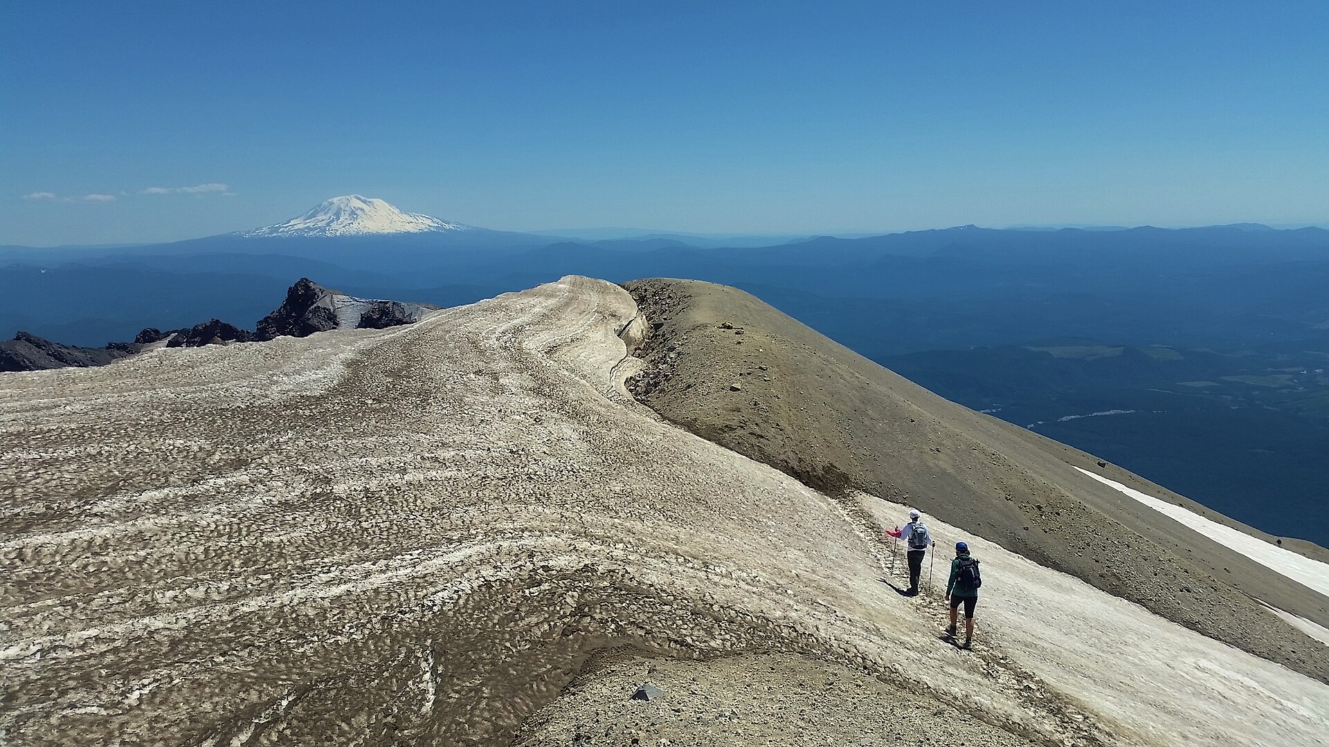
From Climbers Bivouac at 1,128 m the Ptarmigan Trail (#216A) climbs roughly 335 m over 3.6 km through mature forest to the junction with the Loowit Trail (#216). Timberline lies at about 1,463 m (4,800 ft) — this is the elevation above which a climbing permit is legally required, and it is the natural place for a party to make an honest assessment of whether to continue. Above the trees the route becomes the Monitor Ridge climbing route: not a maintained trail but a marked line up roughly 760 m of blocky lava, scrambling over and between boulders, with large wooden posts marking the way to about 2,130 m. The old Earth Observation Station monitoring site is passed on the ridge. The final 400 m of ascent is unmarked and is the crux of the day in effort if not in technique — loose pumice, ash and scree on a steepening cone, where the classic complaint is two steps up for one step back. The rim is reached at 2,550 m. From it the crater, the lava dome and the breached north flank fall away below, with Spirit Lake beyond and Rainier, Adams and Hood on the horizon.
Why it is essential
This is the defining mountain objective of the southern Washington Cascades, and one of a very small number of major volcano summits in the contiguous United States that a fit hill-walker can reach without ropes, crevasse skills or technical climbing. It is also the only vantage point from which the 1980 eruption can be understood in full: the crater, the dome that has been rebuilding inside it, and the blast path running north across Spirit Lake are all laid out from a single spot on the rim. The permit quota keeps numbers manageable even in high summer.
Equipment
- Sturdy boots with stiff soles — the boulder field punishes soft footwear
- Gloves; the lava is abrasive and a fall on the ash-dusted rock cuts skin readily
- Gaiters and long trousers — pumice and ash get into everything
- Trekking poles, strongly recommended for the descent of the ash cone
- 3–4 L water per person; there is none on the route
- Sun protection and wind shell — the upper cone is entirely exposed
- Crampons and ice axe for early-season ascents and dawn starts on frozen snow
- Headtorch; 12-hour days are common
Hazards and notes
- A climbing permit is required year-round for travel above 1,463 m (4,800 ft): $20 per climber per day plus a $6 non-refundable reservation fee, sold only on Recreation.gov. Permits are released in monthly blocks at 07:00 Pacific on the first day of the preceding month
- The daily quota is 350 climbers from 1 April to 14 May and 110 per day thereafter; group size is capped at 12 and the permit holder must be 18 or over
- Entry into the crater is strictly prohibited. The rim is extremely unstable and a wind-formed cornice overhangs the leeward side; USFS asks parties to stay at least 9 m (30 ft) back from the visible edge
- Drones are prohibited on the route and at the summit
- The climbing permit includes a parking pass for the date of the climb; without one, a $5 day-use fee or federal recreation pass applies at Climbers Bivouac
- Sign the climbing register at the trailhead both before and after the ascent
- No water on the route; no shade above timberline
- Dogs are not permitted
GPX / route file
| Source | URL | Format | Notes |
|---|---|---|---|
| USFS — Monitor Ridge Climbing Route | fs.usda.gov | Official page | No official GPX published; route description and current conditions |
| Recreation.gov — Mount St. Helens climbing permit | recreation.gov | Permit portal | Authoritative source for quota, fees and season |
| OpenStreetMap — Ptarmigan Trail, ref TR 216A | openstreetmap.org | OSM way | Mapped with USFS ref; GPX exportable. Above timberline the route is a marked line, not a mapped path |
| USFS National Forest System Trails (ArcGIS Hub) | data-usfs.hub.arcgis.com | GeoJSON / KML / Shapefile | Official national trails layer; supports direct GeoJSON and KML export |
Sources
- USFS — Monitor Ridge Climbing Route
- Recreation.gov — Mount St. Helens Climbing Permit (4675309)
- Washington Trails Association — Mount St. Helens: Monitor Ridge
- Mount St. Helens Institute — Climbing Permits
2. Ape Canyon and the Plains of Abraham
Snapshot
Itinerary
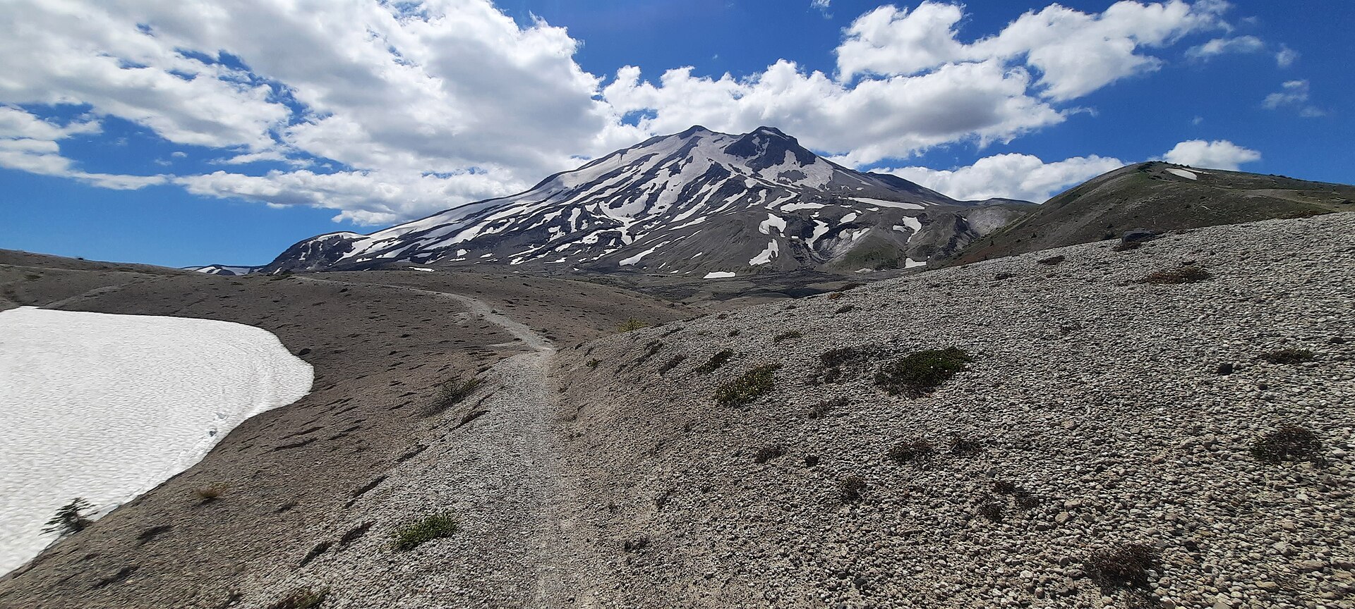
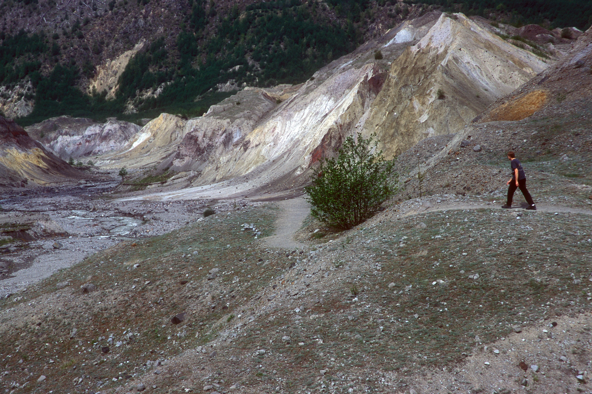
The trail leaves FR 83 beside the Muddy River lahar — a broad grey channel scoured by the 1980 mudflows — and climbs steadily, first through a young plantation and then into a genuinely remarkable stand of old-growth Douglas fir, silver fir and noble fir. This grove sat in the lee of a ridge on 18 May 1980 and survived the lateral blast intact; it is one of the few places where the pre-eruption forest can still be walked through at close range. The trail emerges onto an open ridge crest with views east to Mount Adams and, on the right, down into the narrow slot of Ape Canyon itself — the canyon named for a 1924 incident in which miners claimed to have been attacked overnight by “ape-men”, an episode that helped launch the modern Sasquatch legend. The ridge then runs through standing dead timber killed in 1980 before reaching the junction with the Loowit Trail (#216) at about 1,280 m. Sources place this junction anywhere from 6.8 to 8.9 km from the trailhead; the sign says 5.5 miles, and GPS traces suggest rather less. Turning north on the Loowit leads out across the Plains of Abraham, a flat pumice desert lying directly beneath the volcano’s east flank, with St Helens ahead and Adams and Rainier behind. Return by the same route.
Why it is essential
No other day hike on the mountain reads the 1980 eruption so completely from the ground. The route passes a lahar channel, an old-growth stand that survived the blast, a standing-dead forest that did not, and finally a pumice plain that is still, more than four decades on, only sparsely revegetated. It is also, in 2026, the most reliable of the great St Helens hikes: unlike Harry’s Ridge, Loowit Falls and the Truman Trail, it is affected by no closure order and is open seven days a week.
Equipment
- Standard hiking boots or trail shoes with good grip
- Wind shell — the Plains are completely exposed and the pumice reflects both heat and glare
- Sun protection; there is no shade after the ridge
- 3 L water per person — there is no reliable water on the route, and seasonal sources dry up
- Trekking poles, useful on the loose pumice
- Map and downloaded GPS track; the Loowit Trail is marked with posts across open ground
Hazards and notes
- This trail is an IMBA Epic and carries heavy mountain-bike traffic, particularly at weekends. Walkers should expect fast descending bikes on the ridge section and step aside where sightlines are short
- The Plains of Abraham spur (Trail #216D) and the Truman Trail (#207) are closed Monday to Friday from 1 May to 30 October under the Spirit Lake infrastructure order, in force through 2027. Ape Canyon (#234) and the Loowit traverse (#216) are not affected and are open all week — but a shuttle or exit via Windy Ridge is not possible on weekdays
- No water on the route once the trailhead is left behind
- Parking at the trailhead is limited to roughly seven vehicles; overflow parking is available at Lava Canyon and the Lahar Viewpoint
- A $5 vehicle day-use fee applies, or a Northwest Forest Pass / America the Beautiful pass
- USFS reported the trail open but not yet maintained for the season as of 7 May 2026; expect deadfall
- Forest-wide fire restrictions were in force from 1 July to 31 October 2026 — no campfires of any kind
GPX / route file
| Source | URL | Format | Notes |
|---|---|---|---|
| USFS — Ape Canyon Trail #234 | fs.usda.gov | Official page | No official GPX published |
| USFS — Loowit Trail #216 | fs.usda.gov | Official page | The circum-volcano trail; the Plains section |
| OpenStreetMap — Ape Canyon Trail (TR 234), Loowit Trail (TR 216), Abraham Trail (TR 216D) | openstreetmap.org | OSM ways | All mapped with USFS refs; GPX exportable |
| USFS National Forest System Trails (ArcGIS Hub) | data-usfs.hub.arcgis.com | GeoJSON / KML / Shapefile | Official national trails layer |
Sources
- USFS — Ape Canyon Trail #234
- USFS — Loowit Trail #216
- USFS — Spirit Lake infrastructure project trail closures
- Washington Trails Association — Ape Canyon
3. Norway Pass to Mount Margaret
Snapshot
Itinerary
From the Norway Pass trailhead at 1,219 m the Boundary Trail (#1) climbs an exposed slope above the Meta Lake basin, through blast-zone terrain now thick with fireweed, lupine and penstemon among the silvered trunks of the 1980 blowdown. The Independence Ridge Trail (#227A) branches off at about 1.8 km. At roughly 3.5 km the trail reaches Norway Pass, and the view opens abruptly: Spirit Lake lies directly below with its raft of bleached logs — trees felled by the blast and still floating after more than four decades — and the open crater of Mount St Helens stands squarely across the water. Many parties turn round here, and it is a complete outing in itself. To continue, the Boundary Trail runs west past the Lakes Trail (#211) junction and Bear Camp, where water is available until mid-season but not reliably after, then traverses high above St Helens Lake on slopes that hold snow late. At about 8.5 km an obvious spur climbs right, and a final rocky scramble of some 150 m reaches the summit of Mount Margaret at 1,762 m, with Rainier, Adams, St Helens and Spirit Lake visible together.
Why it is essential
With Johnston Ridge closed until 2027, this is the essential blast-zone walk. It delivers precisely what the Johnston Ridge trails are famous for — the crater squarely framed above Spirit Lake and its log raft — from a trailhead that can still be driven to, on a trail with no weekday closure, and with the added option of a genuine summit. The route also passes through the most vivid of the recovering blast landscapes, where the returning wildflowers and the standing dead forest occupy the same slope.
Equipment
- Mountain hiking boots
- Wind and rain shell; the route is almost entirely exposed with no shelter of any kind
- Warm layer for the summit
- Sun protection — there is no shade on the entire route
- 3 L water; water at Bear Camp is seasonal and unreliable after mid-summer
- Trekking poles for the loose summit scramble
- Map and GPS; snow on the north-facing traverses can obscure the tread into early July
Hazards and notes
- The route is exposed for its entire length. On a hot day it is punishing, and there is nowhere to shelter from an electrical storm
- Snow lingers on the north-facing traverses above St Helens Lake into early July, and the final scramble is loose
- No reliable water after Bear Camp in the second half of the season
- A $5 vehicle day-use fee applies at the trailhead, or a Northwest Forest Pass / America the Beautiful pass; vault toilets and a potable water hand-pump are provided, though USFS warns the pump may be shut down without notice
- Bicycles and pack stock are prohibited in the Mount Margaret Backcountry
- Dogs are not permitted anywhere in the National Volcanic Monument
- Overnight camping in the Mount Margaret Backcountry requires an advance permit from Recreation.gov — these are not sold on site — and campfires are prohibited
GPX / route file
| Source | URL | Format | Notes |
|---|---|---|---|
| USFS — Boundary Trail #1 | fs.usda.gov | Official page | No official GPX published |
| USFS — Norway Pass Trailhead | fs.usda.gov | Official page | Season status, fees and facilities |
| OpenStreetMap — Boundary Trail (TR 1), Mount Margaret Trail (TR 1F) | openstreetmap.org | OSM ways | Mapped with USFS refs; GPX exportable |
| USFS National Forest System Trails (ArcGIS Hub) | data-usfs.hub.arcgis.com | GeoJSON / KML / Shapefile | Official national trails layer |
Sources
- USFS — Boundary Trail #1
- USFS — Norway Pass Trailhead
- Washington Trails Association — Norway Pass
- Washington Trails Association — Mount Margaret
4. Killen Creek to High Camp
Snapshot
Itinerary
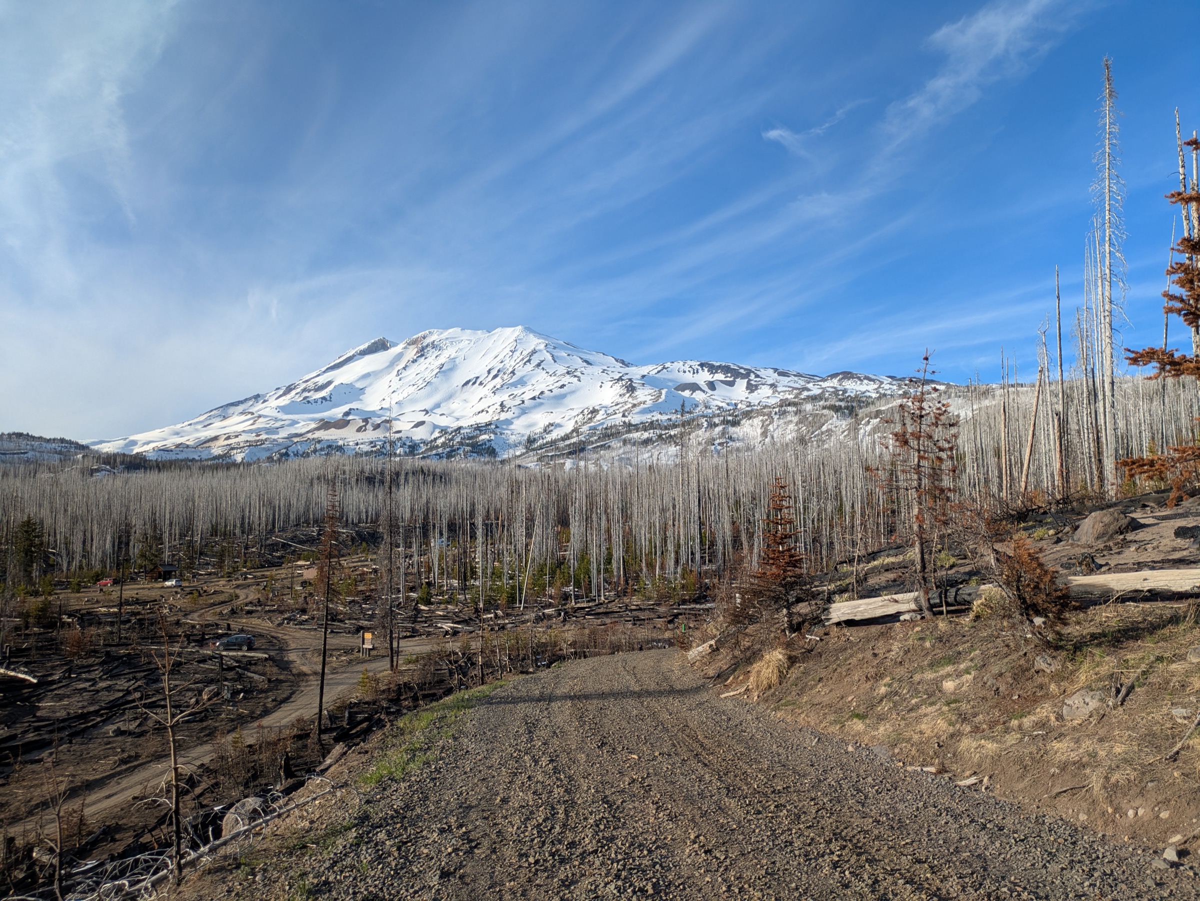
The Killen Creek Trail (#113) begins in dry, dusty lodgepole pine and climbs at a steady grade for the first 3 km or so, with little to see beyond the forest. It then breaks out into open subalpine meadows — lupine, paintbrush and bear grass, with the bulk of Mount Adams filling the sky ahead — and the character of the day changes entirely. At about 5 km, near Adams Creek Meadows, the trail meets the Pacific Crest Trail (#2000) at roughly 1,830 m, where there are tarns and established campsites. A short link north on the PCT leads to the High Camp Trail (#10), which climbs a final 1.1 km over rocky steps to High Camp at 2,112 m: a bench of alpine tarns lying directly beneath the icefall of the Adams Glacier, with the Goat Rocks and Mount Rainier laid out to the north. It is possible to walk on up towards the glacier terminus at around 2,134 m, but this crosses the threshold above which the Mount Adams Climbing Activity Pass is required, and the glacier itself must not be set foot on without rope and crevasse-rescue skills.
Why it is essential
This is the finest alpine day available on Mount Adams. High Camp puts a walker directly beneath one of the largest icefalls in the Washington Cascades without any technical ground, and it does so in a landscape of tarns and meadow that is the antithesis of the pumice and ash across the valley at St Helens. Together with Sleeping Beauty it makes the case that Mount Adams — overshadowed by its famous neighbour and by Rainier — is the better mountain for walkers.
Equipment
- Mountain hiking boots
- Warm layer and wind shell; High Camp is at 2,112 m and exposed
- Sun protection — full exposure above treeline
- 3 L water; USFS states there is no water available on the trail. Killen Creek and the meadow tarns are seasonal and must be treated
- Insect repellent; mosquitoes in the meadows are severe through July
- Map, compass and GPS — the upper trail is genuinely hard to follow when snow lingers
- Trekking poles
Hazards and notes
- A free, self-issued wilderness permit is required at the trailhead for entry into the Mount Adams Wilderness
- The Mount Adams Climbing Activity Pass ($20 per person aged 16 and over, single trip, bought on Recreation.gov) is required above 2,134 m (7,000 ft). High Camp at 2,112 m sits just below that line, so a hike that stops there does not need it — but any wandering uphill towards the glacier does. Parties who may go higher should buy the pass in advance
- Sources conflict on the pass season: Recreation.gov and the USFS Wilderness page give 1 May to 30 September, while the USFS Killen Creek trailhead page gives 1 June. Assume 1 May and buy online
- Group size is limited to 12; campfires are prohibited
- The upper trail is hard to follow in early season when snow covers the tread
- Do not step onto the Adams Glacier. It is crevassed
- Afternoon thunderstorms build quickly on Adams; start early
- There is no toilet and no potable water at the trailhead, and parking is limited to about eight vehicles
GPX / route file
| Source | URL | Format | Notes |
|---|---|---|---|
| USFS — Killen Creek Trail #113 | fs.usda.gov | Official page | No official GPX published |
| USFS — High Camp Trail #10 | fs.usda.gov | Official page | Source of the 2,112 m High Camp elevation |
| OpenStreetMap — Killen Creek Trail #113, High Camp Trail #10 | openstreetmap.org | OSM ways | Mapped with USFS refs; GPX exportable |
| USFS National Forest System Trails (ArcGIS Hub) | data-usfs.hub.arcgis.com | GeoJSON / KML / Shapefile | Official national trails layer |
Sources
- USFS — Killen Creek Trail #113
- USFS — High Camp Trail #10
- USFS — Mount Adams Wilderness
- Recreation.gov — Mt. Adams Climbing Activity Pass
- Washington Trails Association — Killen Creek
5. Sleeping Beauty Peak
Snapshot
Itinerary
The trail climbs from the first step and does not relent. It rises through dense second-growth and then into old-growth Douglas fir and mountain hemlock, gaining roughly 427 m in about 2 km — a grade that is honest work in any conditions. After roughly a kilometre and a half of continuous climbing the tread levels briefly near the ridge crest, then zigzags up bare rock on switchbacks cut into the crag itself. The route finishes along a narrow summit ridge at the site of the old fire lookout, built in 1931 and dismantled in the late 1960s; the footings and some hardware remain in place. From the top, Mount Adams dominates the eastern horizon across the Trout Lake valley, with Mount St Helens, Mount Rainier and Mount Hood all visible, and the plateau of the Indian Heaven Wilderness spread to the south.
Why it is essential
Sleeping Beauty is the best return on effort anywhere near Mount Adams: 90 minutes of climbing buys a full Cascade skyline from a historic lookout site, with the great bulk of Adams directly opposite. It also serves an important practical function in this region. The obvious cultural and scenic counterpart on this side of the mountain — Bird Creek Meadows — lies on Yakama Nation land and has been open to the public for only about a month a year in recent seasons, with no announced 2026 dates. Sleeping Beauty is always open, charges nothing, and gives a comparable view of the mountain.
Equipment
- Standard hiking boots with good grip — the summit switchbacks are on bare rock
- 1.5–2 L water; there is no water on the trail
- Sun protection; the summit rock gets very warm on hot days
- Wind layer for the exposed summit ridge
- Trekking poles for the steep descent
Hazards and notes
- The summit block is exposed rock with genuine fall potential; keep children close and take care in the wet
- Parking is limited to about three vehicles with a difficult turnaround. Arrive early or have an alternative in mind
- No fee or pass is required at this trailhead, which is unusual for the district
- Hikers only — no bicycles and no stock
- There are no facilities: no toilet, no water, no tables
- No water on the trail, and the summit rock offers no shade
GPX / route file
| Source | URL | Format | Notes |
|---|---|---|---|
| USFS — Sleeping Beauty Peak Trail #37 | fs.usda.gov | Official page | No official GPX published |
| USFS — Sleeping Beauty Trailhead | fs.usda.gov | Official page | Access, parking and season |
| OpenStreetMap — Sleeping Beauty Trail, ref TR 37 | openstreetmap.org | OSM way | Mapped with USFS ref; GPX exportable |
| USFS National Forest System Trails (ArcGIS Hub) | data-usfs.hub.arcgis.com | GeoJSON / KML / Shapefile | Official national trails layer |
Sources
- USFS — Sleeping Beauty Peak Trail #37
- USFS — Sleeping Beauty Trailhead
- Washington Trails Association — Sleeping Beauty Peak
Missing data / follow-up work
- Johnston Ridge and Harry’s Ridge, 2026–27. The South Coldwater slide of 14 May 2023 destroyed the Spirit Lake Outlet Bridge and buried SR 504 near milepost 49. The highway remains gated at milepost 45.2; construction began 27 April 2026 and roadworks are expected to finish in autumn 2026, with Johnston Ridge Observatory and the upper highway anticipated to reopen in spring 2027. Harry’s Ridge (Trail #1E) is additionally closed Monday to Friday from 1 May to 30 October under the Spirit Lake infrastructure order, in force through 2027, with federal holidays exempt. Reaching Harry’s Ridge on a weekend currently requires a 26–27 km round trip on foot from the Hummocks trailhead, rather than the familiar 13 km from Johnston Ridge. When the road reopens, Harry’s Ridge should be reconsidered for the main five. Note that WTA gives the weekday closure window as 15 May to 31 October, which conflicts with the USFS order; the USFS dates should be treated as authoritative.
- Mount St Helens climbing permit season — official sources contradict each other. Recreation.gov’s quota detail states that the paid quota runs to 30 November with free self-issued permits from 1 December to 31 March, and the USFS Monitor Ridge page agrees; but Recreation.gov’s own season field, the Mount St. Helens Institute and WTA all give the quota season as 1 April to 31 October. The daily quota figures (350 per day to 14 May, 110 per day thereafter) are consistent across sources. The exact end date of the paid season is unresolved and should be confirmed on Recreation.gov before booking.
- Bird Creek Meadows — status unresolved for 2026. The Mount Adams Recreation Area on the mountain’s eastern flank is Yakama Nation land (Tract D), administered by the Yakama Nation Tribal Forestry Program, and has been closed to non-tribal members for most of each year since the 2015 Cougar Creek Fire destroyed area infrastructure. WTA reports it has opened for only about one month in late summer in recent years. No 2026 opening announcement could be found. Parties wanting Bird Creek Meadows must contact Yakama Nation Tribal Forestry directly (tribalforestry@yakama.com) for current dates and fees. The commonly quoted $20 per vehicle day-use fee comes from secondary reporting, not a 2026 tribal source, and should not be relied upon.
- Mount Adams Climbing Activity Pass season — sources conflict. Recreation.gov and the USFS Mount Adams Wilderness page give 1 May to 30 September; the USFS Killen Creek trailhead page gives 1 June. The same trailhead page says the pass can be bought at the trailhead, while the South Climb page says it is sold online only. Buy online in advance and assume the earlier date.
- Route statistics vary between sources. The Ape Canyon to Plains of Abraham distance ranges from 17 to 23 km across sources, and even the trailhead sign (5.5 miles to the Loowit junction) disagrees with GPS traces. Mount Margaret’s elevation gain is given as 860 m by WTA and 714 m by The Mountaineers. Killen Creek to High Camp ranges from 13.2 to 16.1 km. All are given as ranges above rather than averaged.
- Trailhead elevations are derived, not official. No USFS page publishes trailhead elevations for Ape Canyon, Killen Creek or Sleeping Beauty; the figures given are calculated from published gain and high-point data and should be treated as approximate. Climbers Bivouac (1,128 m) and Norway Pass (1,219 m) are officially stated.
- No licence-compatible photograph of Sleeping Beauty Peak was found in this pass. Wikimedia Commons holds no image of the peak or its lookout site. A future pass should check Flickr Creative Commons and the USFS Pacific Northwest Region photostream.
- No official GPX or KML is published for any of these trails. The Gifford Pinchot trail pages are text only. The authoritative geodata is the USFS National Forest System Trails layer on the ArcGIS Hub, which supports GeoJSON, KML and Shapefile export, but it has not been clipped and inspected to confirm clean geometry for all five routes. OpenStreetMap has every trail mapped with its USFS reference number and is the most reliable free track source in the interim.
- Fire restrictions and closures change fast. Forest-wide restrictions ran from 1 July to 31 October 2026; the only area closure affecting the district in July 2026 was High Rock Trail #266 (8 July – 23 August 2026), which does not touch any hike above. Check the Gifford Pinchot alerts page before travel.
Further reading
| Source | URL |
|---|---|
| USFS Gifford Pinchot National Forest — main site | fs.usda.gov |
| USFS Gifford Pinchot — Alerts and closures | fs.usda.gov |
| USFS — Mount St Helens National Volcanic Monument | fs.usda.gov |
| USFS — South Coldwater Slide information | fs.usda.gov |
| WSDOT — SR 504 South Coldwater Slide project | wsdot.wa.gov |
| USFS — Mount Adams Wilderness | fs.usda.gov |
| Recreation.gov — Mount St. Helens climbing permit | recreation.gov |
| Recreation.gov — Mt. Adams Climbing Activity Pass | recreation.gov |
| Mount St. Helens Institute | mshinstitute.org |
| Washington Trails Association | wta.org |
| USGS Cascades Volcano Observatory | usgs.gov |
| USFS National Forest System Trails geodata (ArcGIS Hub) | data-usfs.hub.arcgis.com |