Regional overview
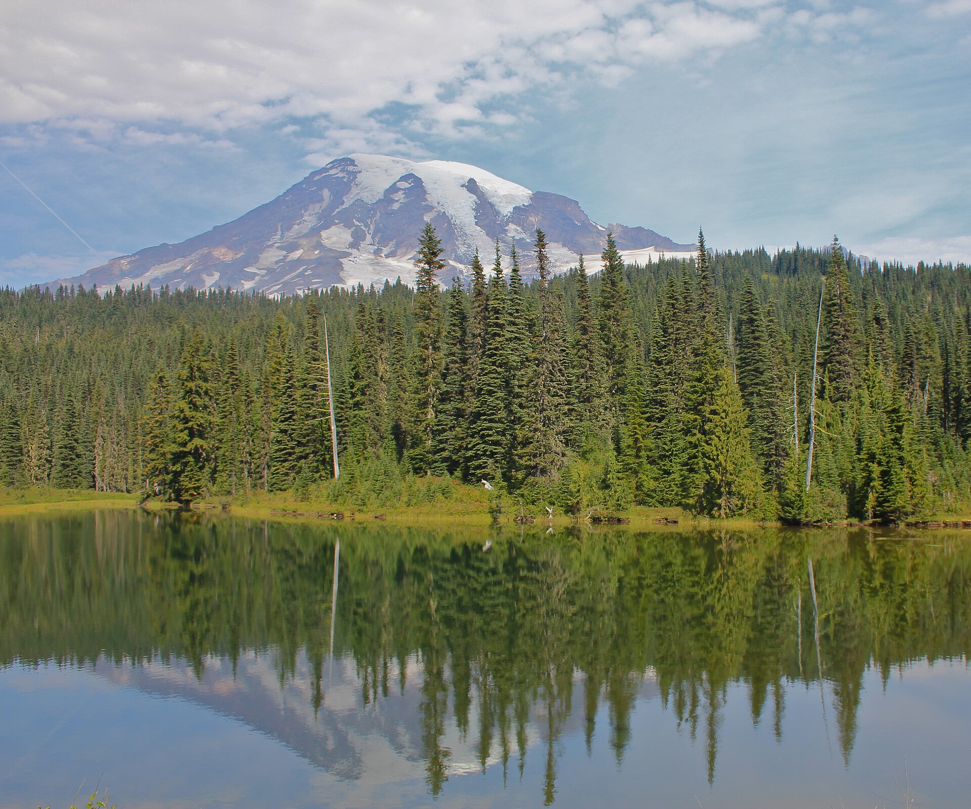
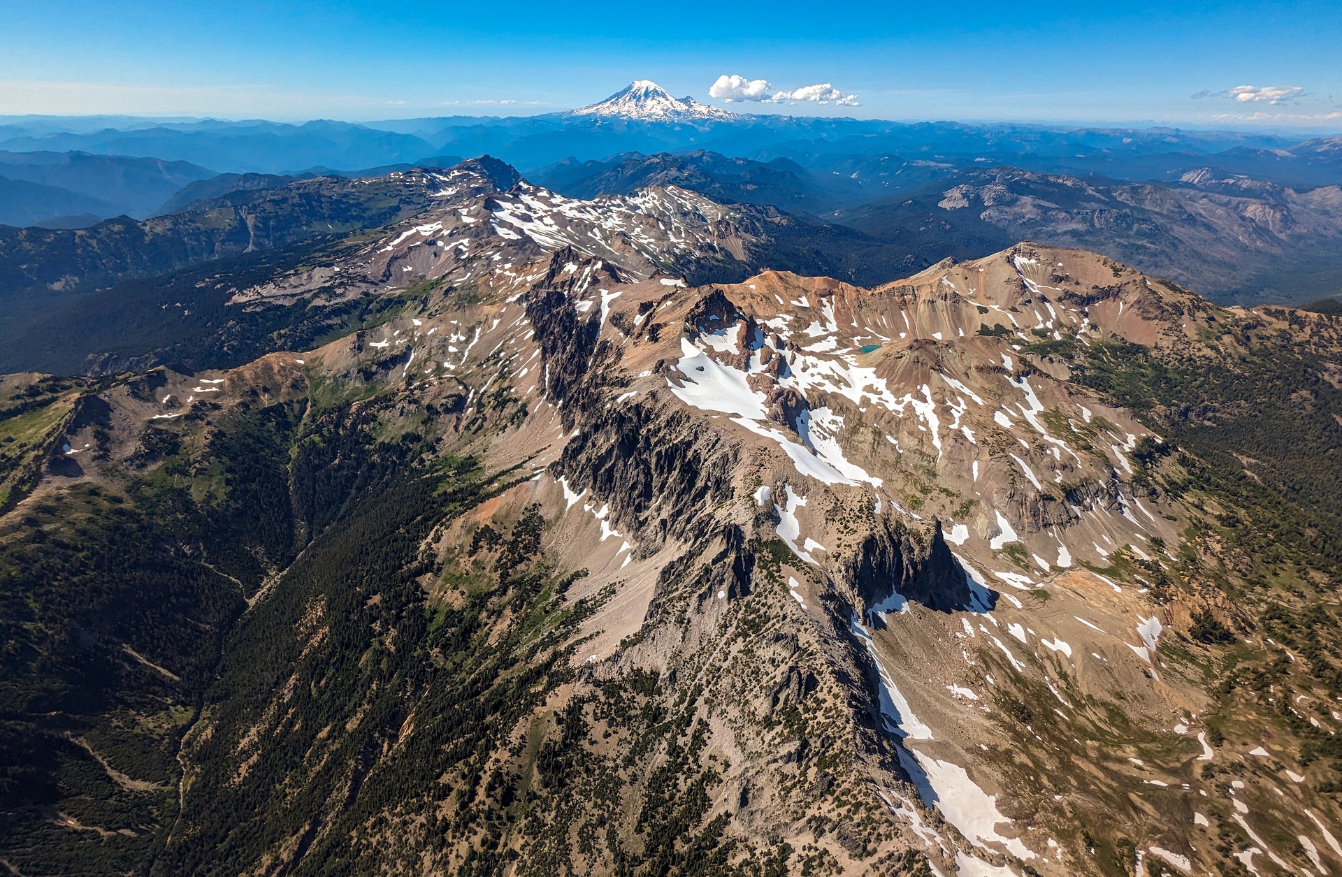
Mount Rainier (4,392 m) is an active stratovolcano standing alone above the Puget Sound lowlands, and it is by a wide margin the most heavily glaciated peak in the contiguous United States. The mountain carries some 26 named glaciers, and the walking is defined by them: almost every trail in the park either climbs towards an icefield or traverses a bench of subalpine meadow beneath one. Below the ice, the park divides into a band of flower meadow — the famous “paradise” parks that ring the mountain between roughly 1,500 and 2,100 m — and, below that, deep valleys of old-growth Douglas fir and western red cedar. Above about 2,200 m the meadows give out to pumice, moraine and arctic tundra.
The park has four historic hiking centres, and in 2026 only three of them can be reached. Paradise (1,646 m) on the south side is the highest point reachable by car in winter and the busiest place in the park. Sunrise (1,951 m) on the north-east is the highest point reachable by car at all, and it opens only from about early July to late September. White River, below Sunrise, serves the eastern valleys. Mowich Lake and Carbon River, in the north-west corner, are closed — see below. Ringing the whole mountain is the 150 km Wonderland Trail, and several of the finest day walks in the park are simply sections of it.
The most important access facts for 2026 are these. First, Mount Rainier does not require a timed-entry reservation this year. The reservation pilot that operated in 2024 and 2025 has been cancelled outright: NPS stated in February 2026 that the park “will not implement a timed entry reservation for any portion of the park in 2026,” and both Paradise and Sunrise are now first-come, first-served, managed by parking capacity instead. A great deal of third-party guidance still describes the old system and is now simply wrong. The entrance fee is unchanged at $30 per private vehicle for seven days, or $55 for a Mount Rainier annual pass; the new non-resident surcharge introduced at eleven other national parks does not apply here.
Second, the north-west corner of the park is unreachable. The 104-year-old Fairfax Bridge on SR 165 was permanently closed in April 2025, and because it sits below the fork into the Carbon River and Mowich Lake roads, one bridge closure severs both. NPS is explicit that “there is NO public access to Carbon River and Mowich Lake from SR 165” and that the bridge is closed to pedestrians and bicycles as well as vehicles, with no alternative route. This removes Tolmie Peak and Spray Park — two of the park’s best-known day hikes — from the catalogue entirely for the foreseeable future; WSDOT has narrowed its options to a roughly $160 million rebuild or outright removal of the bridge, and has not chosen. Third, a campfire ban has been in force parkwide since 26 June 2026, and dogs are prohibited on every trail in the park with one narrow exception noted under the Naches Peak Loop below.
The practical season for the high trails runs from mid-July to late September. Snow lingers in the meadows into July in normal years and the pumice benches above 2,000 m can hold it into August. The characteristic Rainier hazard is not the snow itself but the weather: the mountain builds its own cloud, and a clear morning at Paradise can become a whiteout at Panorama Point within the hour. NPS maintains a trail and backcountry conditions feed with percentage snow cover by trail segment, and it is the single best source before departure.
See also: Mount St Helens and Mount Adams · Stevens Pass.
Selection rationale
The five hikes below cover the three reachable corners of the park and the full range of Rainier terrain. The Skyline Trail loop from Paradise is the iconic walk — the highest-altitude maintained loop in the park, climbing into the flower meadows to Panorama Point and passing the monument to the first documented ascent. Burroughs Mountain from Sunrise is the great ridge and glacier walk, stepping out onto arctic tundra with the Emmons and Winthrop glaciers filling the view. Summerland and Panhandle Gap is the classic pass route and a section of the Wonderland Trail, finishing at the highest point on that entire 150 km circuit. The Naches Peak Loop at Chinook Pass is the short, accessible counterpoint — a lake-and-ridge circuit with the mountain framed ahead for its whole second half. Mount Fremont Lookout takes the historic slot: a standing 1934 fire lookout, the highest in the park and one of only four that remain.
Mount Fremont replaces Tolmie Peak, whose entire appeal was the walk to a historic lookout and which is now unreachable. Comet Falls and Van Trump Park is the strongest alternate and is covered in the follow-up section; it would spread the five across more trailheads, at the cost of the lookout.
Summary table
| # | Hike | Country | Route type | Distance | Gain | Max elevation | Difficulty |
|---|---|---|---|---|---|---|---|
| 1 | Skyline Trail Loop (Paradise) | USA | Loop | ~8.9 km (~5.5 mi) | ~440–520 m | ~2,073 m | Strenuous |
| 2 | Burroughs Mountain (Sunrise) | USA | Loop / out-and-back | ~7.6–14.5 km (~4.7–9.0 mi) | ~275–760 m | 2,386 m | Moderate to strenuous |
| 3 | Summerland and Panhandle Gap | USA | Out-and-back | ~17–19.3 km (~10.6–12.0 mi) | ~900 m | ~2,073 m | Very strenuous |
| 4 | Naches Peak Loop (Chinook Pass) | USA | Loop | ~5.1–5.6 km (~3.2–3.5 mi) | ~150–185 m | ~1,783 m | Easy |
| 5 | Mount Fremont Lookout (Sunrise) | USA | Out-and-back | ~9.0 km (~5.6 mi) | ~275–365 m | ~2,195 m | Moderate |
1. Skyline Trail Loop (Paradise)
Snapshot
Itinerary
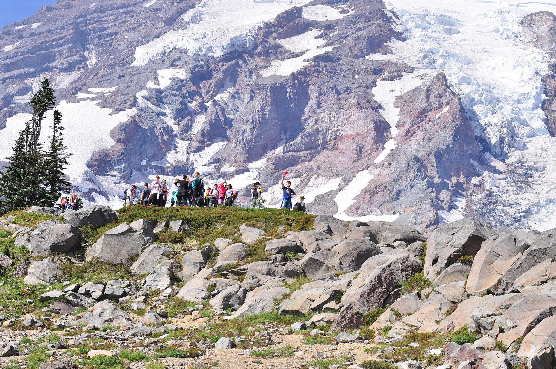
From the trailhead beside the Henry M. Jackson Visitor Center the Skyline Trail climbs immediately into the Paradise meadows, on paved and stone-stepped tread that reflects a century of heavy use. Walked clockwise — the direction NPS recommends — the route passes the Alta Vista and Glacier Vista spurs and climbs steadily to Panorama Point at about 3.2 km and roughly 2,073 m, a broad viewpoint with a toilet, looking south across the Tatoosh Range to Mount Adams, Mount St Helens and Mount Hood. Above Panorama the route splits, and the choice matters: NPS states plainly that “past Panorama Point use of the High Skyline Trail avoids a dangerous icy slope that does not melt.” The High Skyline is the correct line. The trail then contours east and begins to descend past the Stevens–Van Trump Monument at the Paradise Glacier Trail junction, marking the first documented ascent of the mountain in 1870. The descent continues past Sluiskin Falls and down through Paradise Valley, and the loop closes with Myrtle Falls, the most photographed waterfall in the park, framed directly beneath the mountain.
Why it is essential
The Skyline Trail is the definitive Mount Rainier day hike. It climbs from the flower meadows to the edge of the permanent snow in a single loop, delivers the closest maintained-trail view of the Nisqually Glacier, and takes in the monument to the first recorded summit. On 17 August 1870 Hazard Stevens and Philemon Beecher Van Trump reached the top, guided as far as Paradise by a man named Sluiskin, who waited for them to return; NPS is careful to add that “there are oral records of native people reaching the summit long before.” No other walk in the park compresses so much of Rainier — geology, glaciers, meadow ecology and history — into five and a half miles.
Equipment
- Sturdy boots with good grip — the paved sections are slick when wet, and snow patches persist
- Traction (microspikes) and trekking poles into late July; NPS recommended both as of 1 July 2026
- Warm layer and windproof shell — Panorama Point is exposed and often 10°C colder than the car park
- Sun protection; the meadows and the upper trail are fully open
- 2 L water; there is no potable water on the route
- Downloaded map — cloud can close in on the upper loop very quickly
Hazards and notes
- Above Panorama Point, take the High Skyline Trail. NPS states the direct line crosses “a dangerous icy slope that does not melt”
- Early-season walking on this trail may be hazardous; check the NPS conditions feed for current snow cover before setting out
- The mountain generates its own weather. A clear morning at Paradise can be a whiteout above Panorama within an hour
- Parking at Paradise fills early on summer weekends; there is no timed-entry reservation in 2026, but arriving before about 09:00 is prudent
- Stay on the tread. The Paradise meadows are the most heavily used subalpine ground in the park and recover extremely slowly
- Dogs are prohibited. No day-use permit is required
- Parkwide campfire ban in force since 26 June 2026
GPX / route file
| Source | URL | Format | Notes |
|---|---|---|---|
| NPS — Skyline Trail | nps.gov | Official page | No GPX or KML published by NPS |
| NPS Public Trails feature service | mapservices.nps.gov | GeoJSON / shapefile / CSV | Official NPS trail geodata, unrestricted. Query UNITCODE='MORA'. Note: geometry is segment-based — the Skyline loop is assembled from Skyline, High Skyline, Panorama Point, Golden Gate and Deadhorse Creek segments, so route mileage cannot be read from a single record |
| NPS — Paradise area trails map (PDF) | nps.gov | PDF map | Official printed trail map |
| OpenStreetMap — Skyline Trail | openstreetmap.org | OSM ways and relation | Mapped as 24 ways plus a route relation; GPX exportable |
Sources
- NPS — Skyline Trail
- NPS — Stevens–Van Trump Monument
- NPS — Trails and backcountry camp conditions
- Washington Trails Association — Skyline Trail Loop
2. Burroughs Mountain (Sunrise)

Snapshot
Itinerary
From the Sunrise car park the Sourdough Ridge Trail climbs about 120 m in the first kilometre to the ridge crest, then runs west to the five-way junction at Frozen Lake — the small tarn that supplies Sunrise with water, and which is fenced and closed to access. From the junction the Burroughs Mountain Trail climbs onto the broad, flat back of First Burroughs (~2,134 m), and the ground changes completely: this is genuine arctic tundra, a wind-scoured plateau of gravel, lichen and cushion plants, and one of very few places in the contiguous United States where such terrain can be walked on a maintained trail. Second Burroughs, a further 0.8 km and about 120 m higher, is the natural turnaround for most parties, and it is where the mountain arrives — the Winthrop and Emmons glaciers rise directly ahead in a wall of broken ice, with the summit above. Strong parties continue to Third Burroughs at 2,386 m, adding roughly 5 km and 350 m for the closest view. The return can be made a loop by descending the Sunrise Rim Trail past Shadow Lake, Sunrise Camp and the Emmons Glacier overlook above the White River.
Why it is essential
Burroughs Mountain is the best glacier viewpoint on any maintained trail in the park, and the only one that puts a walker on arctic tundra to see it. The scale of the Winthrop and Emmons icefields from Second Burroughs is difficult to convey and impossible to get from Paradise, where the mountain is seen across meadow rather than ice. The route also begins at 1,951 m, which means the great majority of the altitude is given rather than earned — an unusually generous arrangement for a walk of this quality.
Equipment
- Mountain hiking boots
- Warm layer, hat and gloves — at 2,100–2,400 m on an exposed plateau, wind chill is significant even in August
- Windproof shell
- Sun protection; there is no shade of any kind on the route
- 2.5–3 L water — there is no water on the ridge
- Microspikes and trekking poles in early season; the traverse onto First Burroughs holds a snowfield with a poor run-out
- Downloaded map
Hazards and notes
- NPS warns that “early season hiking on this trail may be hazardous due to steep snow-covered slopes.” The crux is the traverse onto First Burroughs, where a slip on firm snow runs out badly. NPS does not mandate an ice axe, but the slope is the reason the trail opens late
- The alpine tundra is extremely fragile. NPS describes the plants as “extremely delicate and slow growing”; a footprint off the tread can last for years. Stay on the trail
- The Sunrise Road is open only from about early July to late September, and the Fryingpan Creek bridge works (2026–2029) impose delays of 20–30 minutes on the drive
- Mountain goats are common on the ridge; do not approach or feed them
- No water on the route; no shade
- Dogs prohibited; no day-use permit required
GPX / route file
| Source | URL | Format | Notes |
|---|---|---|---|
| NPS — Burroughs Mountain | nps.gov | Official page | No GPX or KML published |
| NPS Public Trails feature service | mapservices.nps.gov | GeoJSON / shapefile | Official geodata; Burroughs Mtn Trail, North Burroughs Mtn Trail, Sourdough Ridge Trail, Sunrise Rim Trail |
| NPS — Sunrise area trails map (PDF) | nps.gov | PDF map | Official printed trail map |
| OpenStreetMap — Burroughs Mountain Trail | openstreetmap.org | OSM ways | Mapped; GPX exportable |
Sources
- NPS — Burroughs Mountain
- Washington Trails Association — Burroughs Mountain
- NPS — Trails and backcountry camp conditions
3. Summerland and Panhandle Gap
Snapshot
Itinerary
From the trailhead a short connector joins the Wonderland Trail, which climbs at a gentle, forgiving grade up the Fryingpan Creek valley through mature old-growth. After several kilometres the trail reaches a pair of rocky switchbacks where the creek runs in a cleft below the path, and views open north to the Cowlitz Chimneys. The log crossing of Fryingpan Creek — a flattened log with a handrail, over milky glacial water — is the gateway to the upper valley; the trail then climbs steeply through valerian slopes for the last half-mile into Summerland at about 1,810 m, a hanging meadow beneath Little Tahoma with a CCC-built stone trail shelter of 1934, a wilderness camp and the only toilet on the route. Marmots are everywhere and black bears are not unusual.
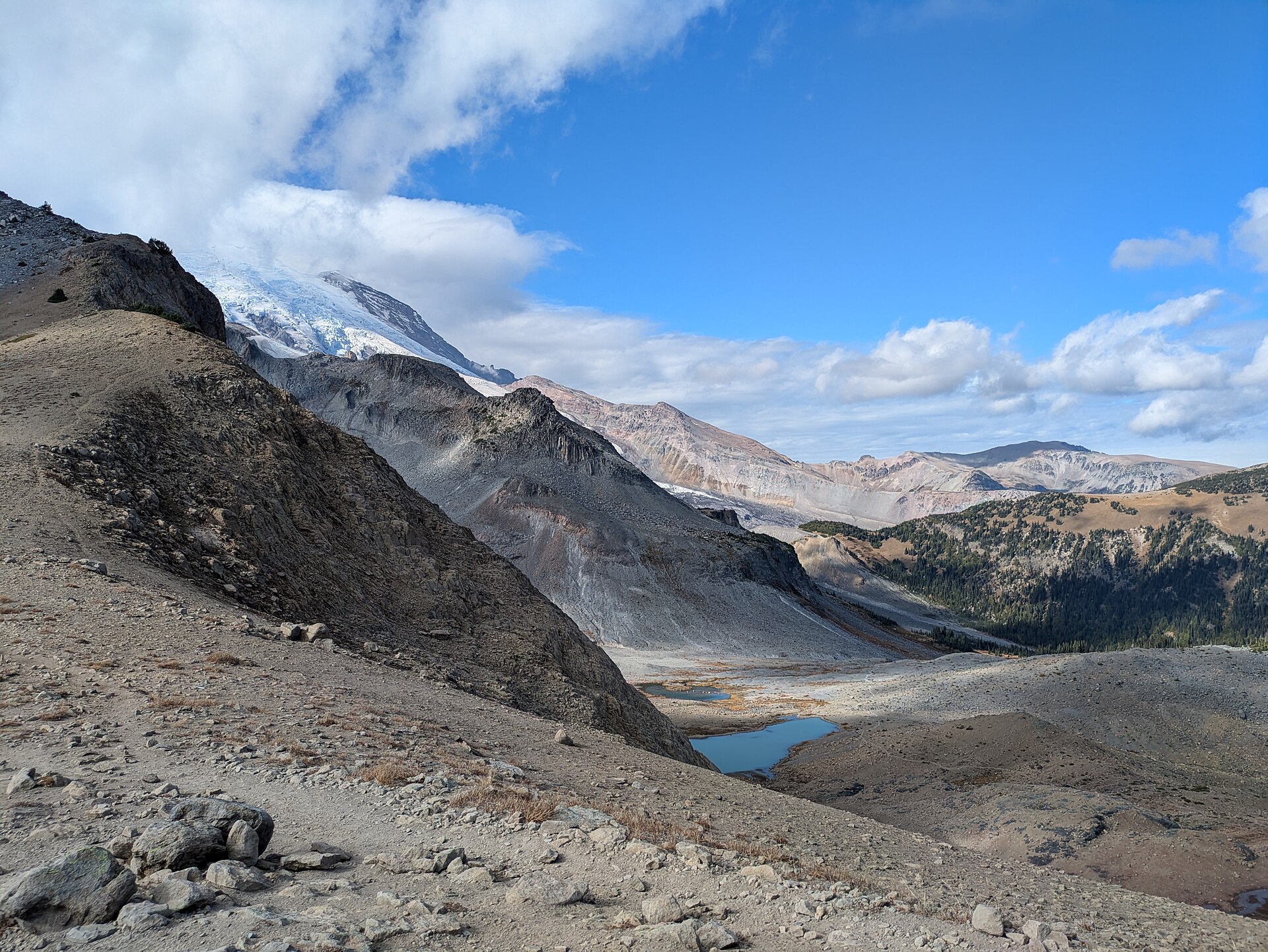
Above Summerland the walk changes character entirely. The tread gives way to boulders, gravel and moraine, the route is marked by cairns — some painted orange — and it crosses meltwater streams, snowfields and shallow tarns that may still hold ice in August. The final approach traverses a steep slope with boulders below it, and finishes at Panhandle Gap, the highest point on the Wonderland Trail. The view from the Gap runs south: Ohanapecosh Park below, then the Goat Rocks, Mount Adams and often Mount Hood on the horizon. Rainier itself is largely hidden here behind the ridge to the west — the mountain views on this hike belong to Summerland and the climb, not to the Gap.
Why it is essential
This is the finest pass walk in the park and the best single day-section of the Wonderland Trail. It climbs through every band of Rainier’s ecology in turn — old-growth valley, subalpine meadow, moraine, permanent snow — and finishes on the highest ground the Wonderland reaches. Summerland alone would justify the walk; the Gap adds a genuinely alpine hour above it.
Equipment
- Mountain hiking boots
- Microspikes and trekking poles are effectively required above Summerland for most of the season; an ice axe is appropriate in early season if the party knows how to use it
- Warm layer, hat and gloves — the Gap is cold and windy even in August
- Waterproof shell
- Map, compass and GPS. The cairned section fails completely in fog
- 3 L water; creeks en route must be treated, and glacial water is silty and clogs filters
- Sun protection
Hazards and notes
- 🚩 Trailhead closure risk, 2026–2029. The Fryingpan Creek bridge on the Sunrise Road is being replaced, and NPS states that “the parking area and Summerland trail access adjacent to the bridge will be closed to public access during construction.” The trailhead was still open as of the 6 July 2026 road status, but it may close mid-season and remain closed for several seasons. Confirm with the park before travelling. The same works impose 20–30 minute delays on the drive to Sunrise
- NPS names Panhandle Gap, alongside Spray Park and Seattle Park, as a frequent problem area for route-finding on snow-covered trail, and states that “you may need a reliable map and compass skills to traverse snow-covered trails.” A day hiker went missing here in July 2014 and was the subject of a multi-day search
- Snow bridges over meltwater streams are a real hazard. NPS advises listening for the muffled sound of running water beneath snow and warns against blindly following a boot pack, which may cross thin snow
- The final traverse to the Gap crosses a steep slope above boulders; when it is frozen hard, it warrants careful assessment before committing
- The Fryingpan Creek log crossing has washed out before and was only reinstated in mid-June 2026. Cross early in the day when meltwater is lowest, and never cross a footlog with water running over it
- Mountain goats are frequently seen at the Gap; elk and black bear lower down
- Dogs prohibited. No permit for day use; the Summerland camp requires a wilderness permit for overnight stays
- Parking is limited to about 25 vehicles with no toilet, and fills before dawn on summer weekends
GPX / route file
| Source | URL | Format | Notes |
|---|---|---|---|
| NPS — Summerland Trail | nps.gov | Official page | No GPX published. NPS gives figures only as far as Summerland, not the Gap |
| NPS — Summerland Trail site bulletin (PDF) | nps.gov | PDF map | Official map; note its stated 1,500 ft gain conflicts with the NPS web page’s 2,100 ft |
| NPS Public Trails feature service | mapservices.nps.gov | GeoJSON / shapefile | Official geodata; Wonderland Trail, Summerland Trail |
| OpenStreetMap — Summerland Trail, Wonderland Trail | openstreetmap.org | OSM ways and relations | Mapped; GPX exportable |
Sources
- NPS — Summerland Trail
- NPS — Fryingpan Creek bridge replacement approved
- NPS — Spring hiking safety
- NPS — Summerland Trail Shelter
- Washington Trails Association — Summerland / Panhandle Gap
4. Naches Peak Loop (Chinook Pass)
Snapshot
Itinerary
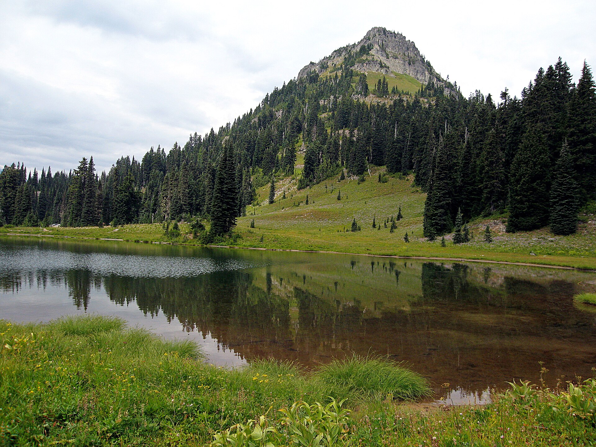
The loop starts at Tipsoo Lake, a shallow subalpine tarn ringed by meadow immediately below Chinook Pass. Walked clockwise — as NPS explicitly advises, because it keeps the mountain ahead for the whole second half — the route crosses SR 410 on the Chinook Entrance Arch, a timber overpass built by the Civilian Conservation Corps in 1936 to carry the Pacific Crest Trail across the highway, and restored in 2011–12. The bridge is the park boundary. The trail then follows the PCT for about 2.6 km outside the park, through the William O. Douglas Wilderness, contouring the eastern flank of Naches Peak through huckleberry and heather with a viewpoint down to Dewey Lake, some 180 m below. At the PCT junction the loop turns back west into the park and traverses the mountain-facing side of Naches Peak, passing an unnamed tarn that produces the classic reflected-Rainier photograph, before descending to Tipsoo.
Why it is essential
The Naches Peak Loop is the most accessible genuinely alpine walk at Rainier, and it earns its place precisely because it is short. It delivers a subalpine lake, an open ridge, a wilderness section of the Pacific Crest Trail and a full-frontal view of the mountain across a reflecting tarn — in under six kilometres and 200 m of ascent. In late July and early August the flower display along the western traverse is among the finest in the Cascades, and in September the huckleberry turns the whole basin red.
Equipment
- Standard hiking shoes or boots
- Weatherproof layer — the pass is high and exposed to weather from the east
- Sun protection
- 1.5 L water; there is no potable water on the route
- Insect repellent — mosquitoes at Tipsoo are severe in early summer
Hazards and notes
- 🐕 The dog rule here is unique in the park, and easy to get wrong. Dogs are prohibited on every trail inside Mount Rainier National Park, and around Tipsoo Lake. The only exception in the entire park is the Pacific Crest Trail along its eastern boundary, where leashed dogs are permitted. That is the outer half of this loop. The practical consequence is that a party with a dog cannot legally walk the loop — they must do the PCT section as an out-and-back, which is the half with the poorer views of the mountain. Note that WTA’s page states flatly that dogs are not allowed, which understates the NPS carve-out
- SR 410 over Chinook Pass is a seasonal road, typically closed from late autumn until May
- The NPS snow-cover feed for this trail can lag; it still showed 70% snow from early June well after the trail had melted out in 2026
- A Northwest Forest Pass is required at the Chinook Pass Overlook trailhead 1 km east, but not at the Tipsoo Lake car park
- There is a vault toilet at Tipsoo Lake
- Half the loop lies outside the national park in the William O. Douglas Wilderness, on Okanogan-Wenatchee National Forest land
GPX / route file
| Source | URL | Format | Notes |
|---|---|---|---|
| NPS — Naches Peak Loop | nps.gov | Official page | No GPX published. Note the NPS URL misspells the name as “natches” |
| NPS — Naches Peak trail map (PDF) | nps.gov | PDF map | Official map |
| NPS Public Trails feature service | mapservices.nps.gov | GeoJSON / shapefile | Naches Loop Trail. Caveat: returns only the in-park half — the PCT section lies outside the park and is not in NPS data |
| PCTA — Pacific Crest Trail data | pcta.org | GPX | CC BY 4.0 — free to use, share and adapt including commercially, with attribution to the Pacific Crest Trail Association. Covers the outer half of the loop |
| OpenStreetMap — Naches Peak Loop Trail | openstreetmap.org | OSM ways and relation | Mapped complete, including the PCT half; GPX exportable |
Sources
- NPS — Naches Peak Loop
- NPS — Pets in the park
- NPS — Chinook Entrance Arch
- Washington Trails Association — Naches Peak Loop
5. Mount Fremont Lookout (Sunrise)
Snapshot
Itinerary
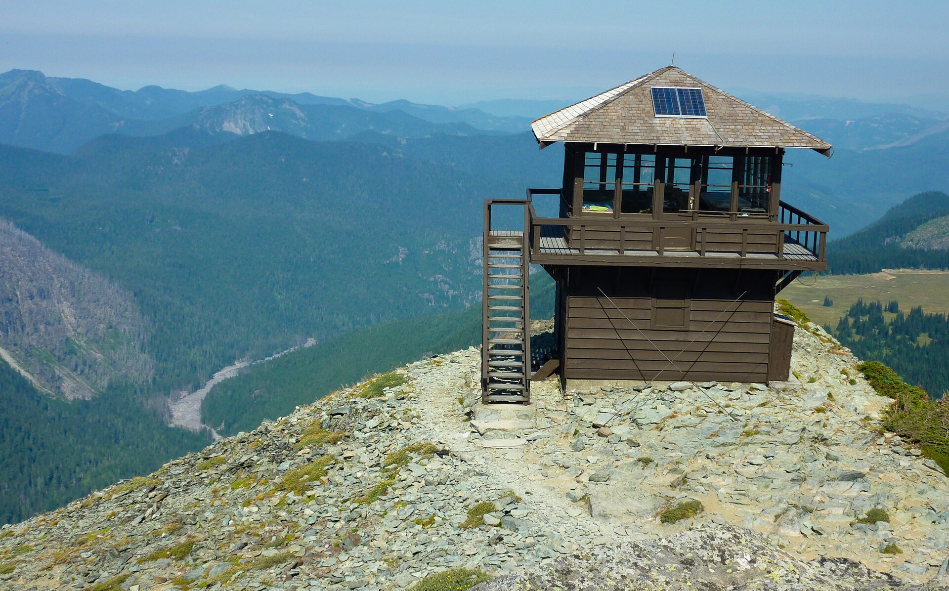
The route shares its first half with Burroughs Mountain: up the Sourdough Ridge Trail from the north edge of the Sunrise car park to the ridge crest, then west along the crest to the five-way junction at Frozen Lake. From the junction the Mount Fremont Lookout Trail turns north-west and climbs a further 2 km along an open, rocky, entirely shadeless ridge, with the ground falling away north into Grand Park — a vast flat expanse of subalpine meadow — and west towards Skyscraper Mountain and Berkeley Park. The lookout stands at the end of the ridge at 2,189 m: a two-storey timber cabin, built in 1934, with Rainier filling the southern sky and the Cascades running north towards Glacier Peak.
Why it is essential
Mount Fremont is the historic walk of the park, and in 2026 it is the only one of its kind that can still be reached. The lookout is the highest in Mount Rainier National Park, one of only four that remain, and a contributing structure to the park’s National Historic Landmark District. It survives because aerial fire surveillance made the network obsolete after the Second World War, not because it was ever demolished, and it is still occasionally used. The walk to it is also the gentlest way to reach genuinely high, open alpine ground at Rainier: no steep snow traverse, no scrambling, and a summit view for a little over 300 m of ascent.
Equipment
- Hiking boots or sturdy trail shoes
- Windproof shell and warm layer — the ridge is fully exposed and often windy
- Sun protection; there is no shade on the entire route
- 2 L water — no water on the route
- Trekking poles, helpful on the rocky ridge
Hazards and notes
- The final ridge is open, rocky and exposed to wind and weather, though the trail itself is not technically difficult
- Snow risk is lower here than on Burroughs — there is no steep snow traverse — but early season still warrants traction
- Alpine plants along the ridge are extremely fragile; stay on the tread
- Mountain goats are commonly seen
- Frozen Lake is Sunrise’s drinking-water supply and is fenced; do not enter the enclosure or take water from it
- The Sunrise Road is open only from about early July to late September
- Dogs prohibited; no day-use permit required
GPX / route file
| Source | URL | Format | Notes |
|---|---|---|---|
| NPS — Mount Fremont Lookout Trail | nps.gov | Official page | No GPX published |
| NPS — Mount Fremont Fire Lookout (place page) | nps.gov | Official page | Source of the 1934 date, the 7,181 ft elevation and the NHL District status |
| NPS Public Trails feature service | mapservices.nps.gov | GeoJSON / shapefile | Mount Fremont Trail, Sourdough Ridge Trail |
| OpenStreetMap — Mount Fremont Lookout Trail | openstreetmap.org | OSM way and relation | Mapped; GPX exportable |
Sources
- NPS — Mount Fremont Lookout Trail
- NPS — Mount Fremont Fire Lookout
- Washington Trails Association — Mount Fremont Lookout
Missing data / follow-up work
- Tolmie Peak and Spray Park are excluded because they cannot be reached. The Fairfax Bridge on SR 165 was permanently closed in April 2025, and it sits below the fork into the Carbon River and Mowich Lake roads. NPS states there is no public access to either from SR 165, and the bridge is closed to pedestrians and bicycles as well as vehicles. The only lawful approach to Mowich Lake is now a multi-day Wonderland Trail backpack (roughly 30 km from Sunrise) with a wilderness permit. WSDOT has narrowed its choices to a rebuild costing about $160 million and taking around six years, or removing the bridge and closing SR 165 permanently; no decision has been made, and claims that the bridge “reopens by 2031” are not supported by any WSDOT source. Both hikes should be reinstated in this catalogue if and when access returns.
- The Summerland trailhead is at risk mid-catalogue. The Fryingpan Creek bridge replacement runs from 2026 to 2029, and NPS has stated that the parking area and Summerland trail access adjacent to the bridge will be closed to the public during construction. The trailhead was open as of the 6 July 2026 road status. Federal contracting listings suggest a notice to proceed around late August 2026, but the exact closure date is unverified and comes from secondary sources. This must be re-checked before any print edition.
- Route statistics vary between sources and are not averaged here. NPS and WTA differ on the Skyline gain (518 m vs 442 m), the Mount Fremont gain (274 m vs 366 m), and substantially on Burroughs Mountain, where NPS quotes 7.0 miles to Second Burroughs but pairs it with a 2.5-hour walking time that cannot be right for that distance. The NPS Summerland site bulletin gives a gain of 1,500 ft where the NPS web page gives 2,100 ft; the web figure is the plausible one. NPS’s own pages give the Naches Peak Loop as both 3.4 and 3.5 miles.
- Several trailhead elevations are unpublished. No NPS source gives elevations for the Summerland, Tipsoo Lake or Comet Falls trailheads; the figures in circulation come from WTA or from blogs and should be treated as approximate.
- Panhandle Gap’s maximum elevation is given as both 6,750 ft and 6,800 ft by different sources, including the NPS map itself. Its status as the highest point on the Wonderland Trail is corroborated by several sources but is never stated by NPS directly.
- Comet Falls / Van Trump Park is the strongest alternate and would be the pick if geographic spread mattered more than the historic-lookout slot — it sits on the Longmire–Paradise corridor rather than adding a second Sunrise hike. Roughly 9.3–9.7 km and 610–655 m of gain to Van Trump Park; note that NPS contradicts itself on the gain to the falls (900 ft on the trail page, 1,200 ft on the place page). Comet Falls is not the park’s tallest waterfall — Fairy Falls at 600 ft is, per NPS’s own list — and the only proper survey of it gives about 300 ft for the main plunge and 460 ft over four tiers, rather than the 320 ft NPS quotes.
- Ohanapecosh is closed for the whole of 2026 (campground, visitor centre and facilities, through November) for wastewater and electrical work, though Stevens Canyon Road remains open for through travel. The Grove of the Patriarchs remains closed following the November 2021 flood, with suspension-bridge replacement not beginning until summer 2027.
- NPS publishes no GPX or KML. Official trail geometry is available from the NPS Public Trails feature service, which is unrestricted and exports GeoJSON, shapefile and CSV — but the geometry is segment-based, not route-based, so the Skyline loop must be assembled from five separate named segments and route mileage cannot be read from any single record. The Naches Peak Loop record contains only the in-park half. For the PCT half, the Pacific Crest Trail Association publishes GPX data under CC BY 4.0, explicitly permitting commercial reuse with attribution — the most permissive route-file licence encountered in this region.
- Errors in wide circulation, for the avoidance of doubt. Timed-entry reservations are not required in 2026. There are no larches at Naches Peak — the golden autumn colour is huckleberry, and the southern limit of Larix lyallii lies well to the north. The claim that Sluiskin was “a Yakama man” is contested and should not be stated flatly; Stevens recorded that he disdained allegiance to any tribe, and he is often conflated with the Yakama leader Saluskin.
Further reading
| Source | URL |
|---|---|
| Mount Rainier National Park — main site | nps.gov |
| NPS — Trails and backcountry camp conditions (live snow cover by trail) | nps.gov |
| NPS — Road status | nps.gov |
| NPS — Fees and passes | nps.gov |
| NPS — No timed entry reservations in 2026 | nps.gov |
| NPS — Carbon River and Mowich (closure) | nps.gov |
| NPS — Pets in the park | nps.gov |
| NPS — Wilderness permits | nps.gov |
| NPS — Wildflower status | nps.gov |
| WSDOT — SR 165 Fairfax Bridge | wsdot.wa.gov |
| Washington Trails Association | wta.org |
| NPS Public Trails geodata (feature service) | mapservices.nps.gov |