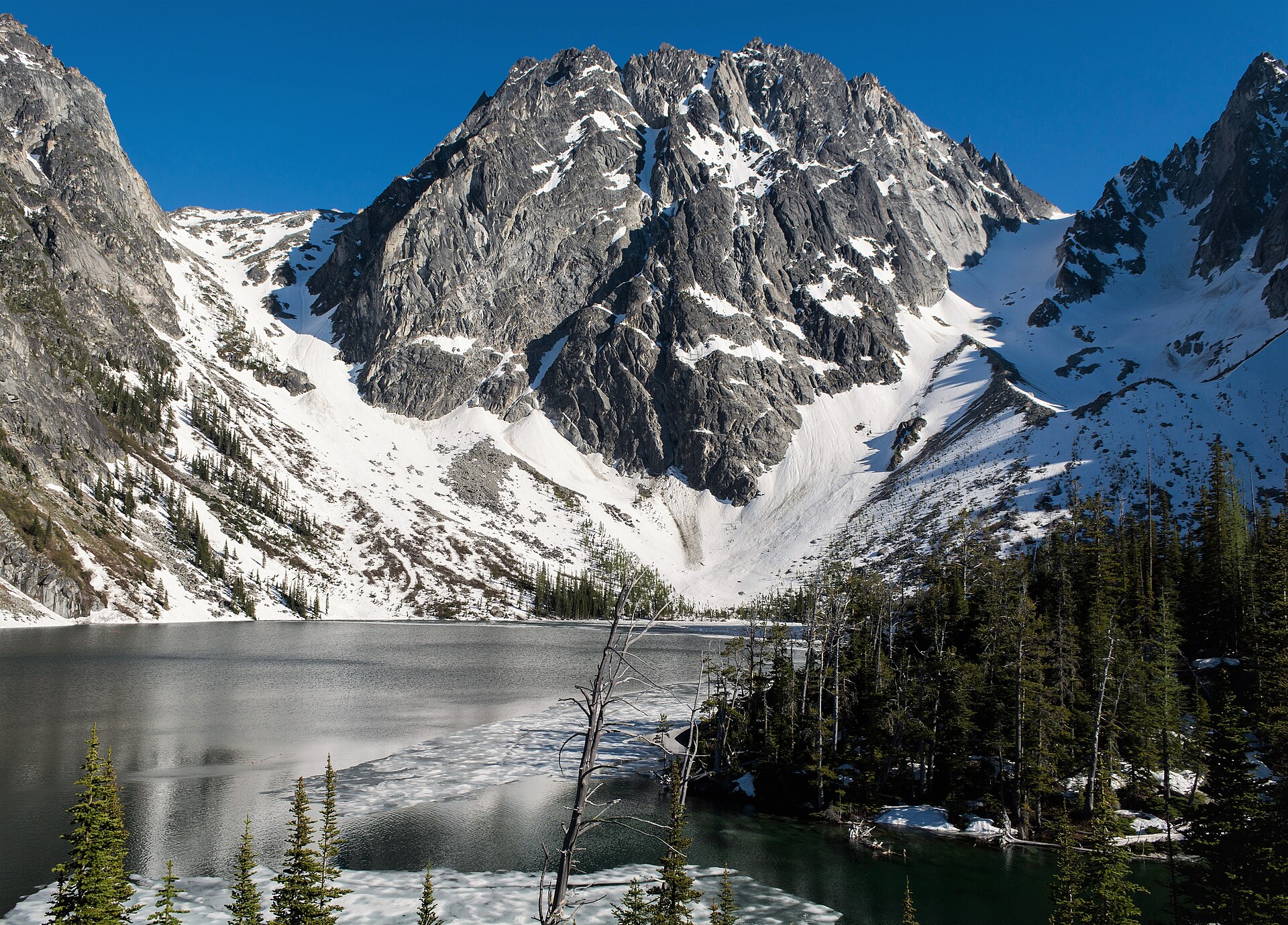
Regional overview
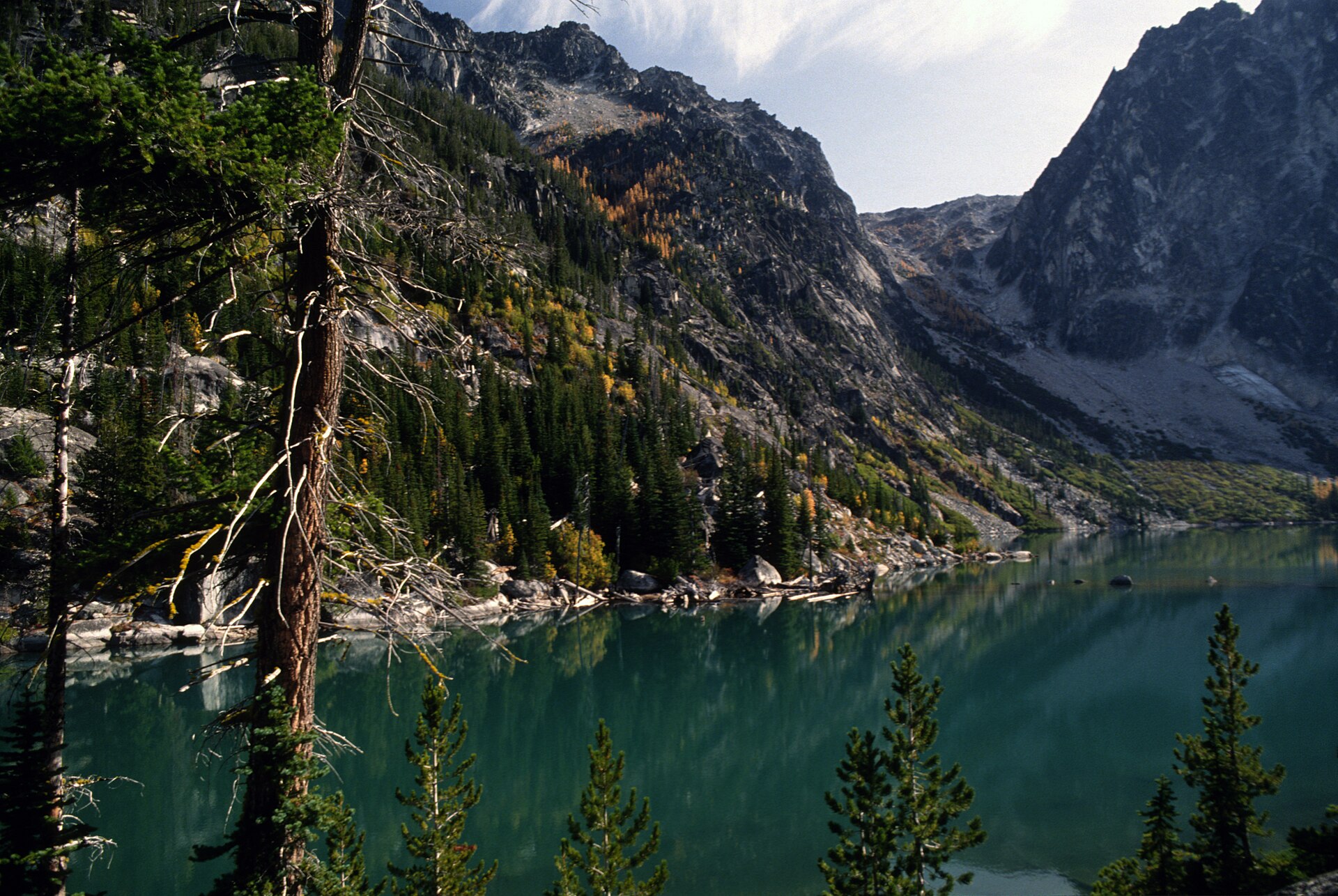
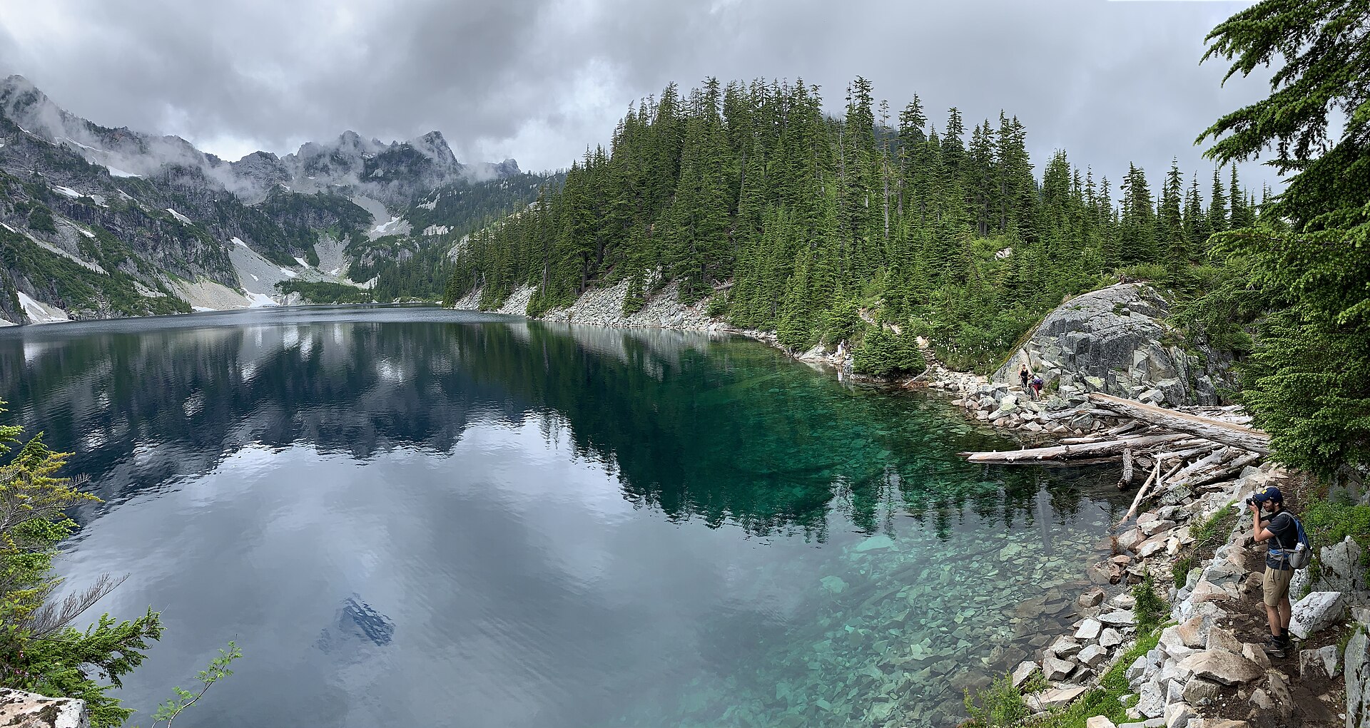
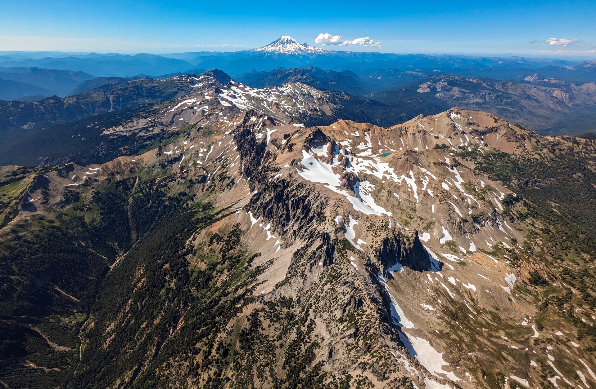
Stevens Pass carries US Highway 2 over the crest of the Washington Cascades at 1,238 m, and it marks the northern boundary of the Alpine Lakes Wilderness — a 160,000-hectare block of glacier-scoured granite, subalpine forest and several hundred lakes running south from the highway to Interstate 90. The two sides of the pass are strikingly different. West of the crest, in the Skykomish drainage, the country is wet, densely forested and steep, with heavy winter snowfall and mossy old growth. East of the crest, the Wenatchee side dries out quickly: ponderosa and larch replace hemlock, the rock becomes cleaner and paler, and the walking becomes hotter and thirstier. Almost every trail in this article is affected by that gradient, and the eastern routes in particular are notably dry.
The hiking is organised around three access corridors rather than a single centre. The US 2 corridor itself runs from Skykomish over the pass to Leavenworth, giving direct access to the Pacific Crest Trail at the pass, to Nason Ridge on the north side of the highway, and to the Iron Goat Trail on the abandoned railway grade below Wellington. Leavenworth, a Bavarian-themed tourist town on the eastern slope, is the gateway to Icicle Creek and the Enchantments — the most celebrated and most heavily managed corner of the wilderness. The Teanaway, reached from Cle Elum and Highway 970 well to the south-east, opens the Esmeralda Basin and the granite of Mount Stuart, at 2,870 m the highest non-volcanic peak in Washington.
The season is short and snow-governed. The high routes — Colchuck Lake, Ingalls Pass, the PCT above Stevens Pass — are normally in condition from mid-July to mid-October, and snow can linger in shaded basins and on north-facing passes well into the summer. Late September and early October bring the golden turn of the alpine larch, which draws enormous crowds to Colchuck Lake and Lake Ingalls in particular; trailhead lots on those weekends can fill before dawn. The Iron Goat Trail, far lower at 640–960 m, is the useful shoulder-season and bad-weather alternative.
Three practical matters shape almost every trip here. First, passes and permits: the trailheads on National Forest land require a Northwest Forest Pass or an Interagency pass (a Washington State Discover Pass is not valid on federal land — a common and expensive mistake), and entry into the Alpine Lakes Wilderness requires a free, self-issued permit filled in at the trailhead box. Second, roads: the December 2025 storms did serious damage across the Cascades, and at the time of writing at least one approach in this article (Forest Road 6700 to Smithbrook) remains closed to vehicles, while the status of the upper Icicle Creek Road is genuinely unclear. Verify road status with the relevant ranger district before committing to a long drive. Third, water: the eastern trails are dry. The Forest Service explicitly describes water as “scarce” on the Ingalls Way Trail and on Nason Ridge, and there is no reliable water on the Alpine Lookout ridge at all.
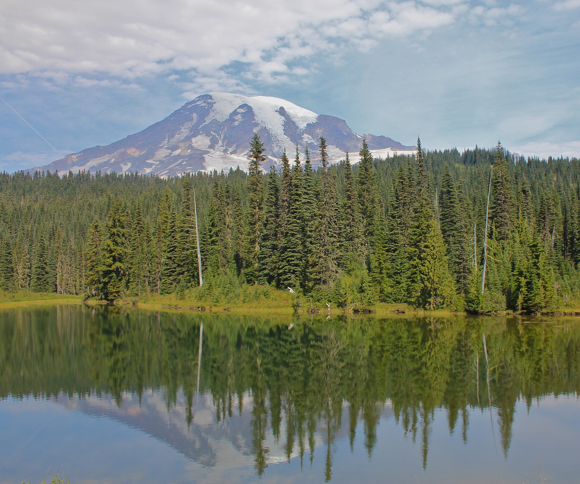
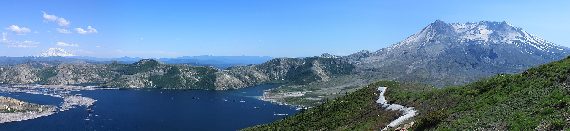
See also: Snoqualmie Pass · Mount St Helens and Mount Adams.
Selection rationale
These five routes cover the region’s distinct characters rather than repeating its most famous lake five times. Colchuck Lake is the wilderness’s signature image — a turquoise cirque lake under the black wall of Dragontail Peak — and the most accessible way to stand in the heart of the Enchantments massif without a lottery permit. Lake Ingalls is the great larch-and-granite walk of the eastern wilderness, crossing a genuine alpine pass to a viewpoint directly opposite Mount Stuart, and is the region’s finest autumn colour route. Lake Valhalla is the classic Pacific Crest Trail day out of Stevens Pass itself, beginning — appropriately for this region — on the levelled grade of the old Great Northern Railway. The Alpine Lookout on Nason Ridge supplies the summit-and-panorama entry: a standing fire lookout on an open ridge north of the highway, with resident mountain goats and a view spanning Glacier Peak to Mount Rainier. The Iron Goat Trail is the historical route, built on the abandoned 1893 railway grade over the pass and passing the site of the 1910 Wellington avalanche, the deadliest in United States history.
Several strong candidates were left out. The full Enchantments traverse (Stuart Lake trailhead to Snow Lakes trailhead via Aasgard Pass) is one of the great hard days in the Cascades, but at roughly 30 km with about 1,500 m of ascent and 2,300 m of descent, requiring a car shuttle and a serious scree pass, it sits at the outer edge of what belongs in a day-hike catalogue; it is noted under Colchuck Lake below. Lake Serene and Bridal Veil Falls, Blanca Lake and Rock Mountain are all first-rate and are listed as alternates in the follow-up section.
Summary table
| # | Hike | Country | Route type | Distance | Gain | Max elevation | Difficulty |
|---|---|---|---|---|---|---|---|
| 1 | Colchuck Lake | USA | Out-and-back | ~12.9–14.5 km (~8.0–9.0 mi) | ~640–695 m | ~1,676–1,701 m | Strenuous |
| 2 | Lake Ingalls via Ingalls Pass | USA | Out-and-back | ~14.5 km (~9.0 mi) | ~760 m | ~1,981 m (Ingalls Pass) | Strenuous |
| 3 | Lake Valhalla via the PCT | USA | Out-and-back | ~16.1–18.3 km (~10.0–11.4 mi) | ~580 m cumulative | ~1,539 m | Moderate |
| 4 | Alpine Lookout via Round Mountain | USA | Out-and-back | ~16.1 km (~10.0 mi) | ~790 m | ~1,900 m | Moderate–strenuous |
| 5 | Iron Goat Trail (Martin Creek loop) | USA | Loop | ~9.7 km (~6.0 mi) | ~215 m | ~853 m | Easy–moderate |
1. Colchuck Lake
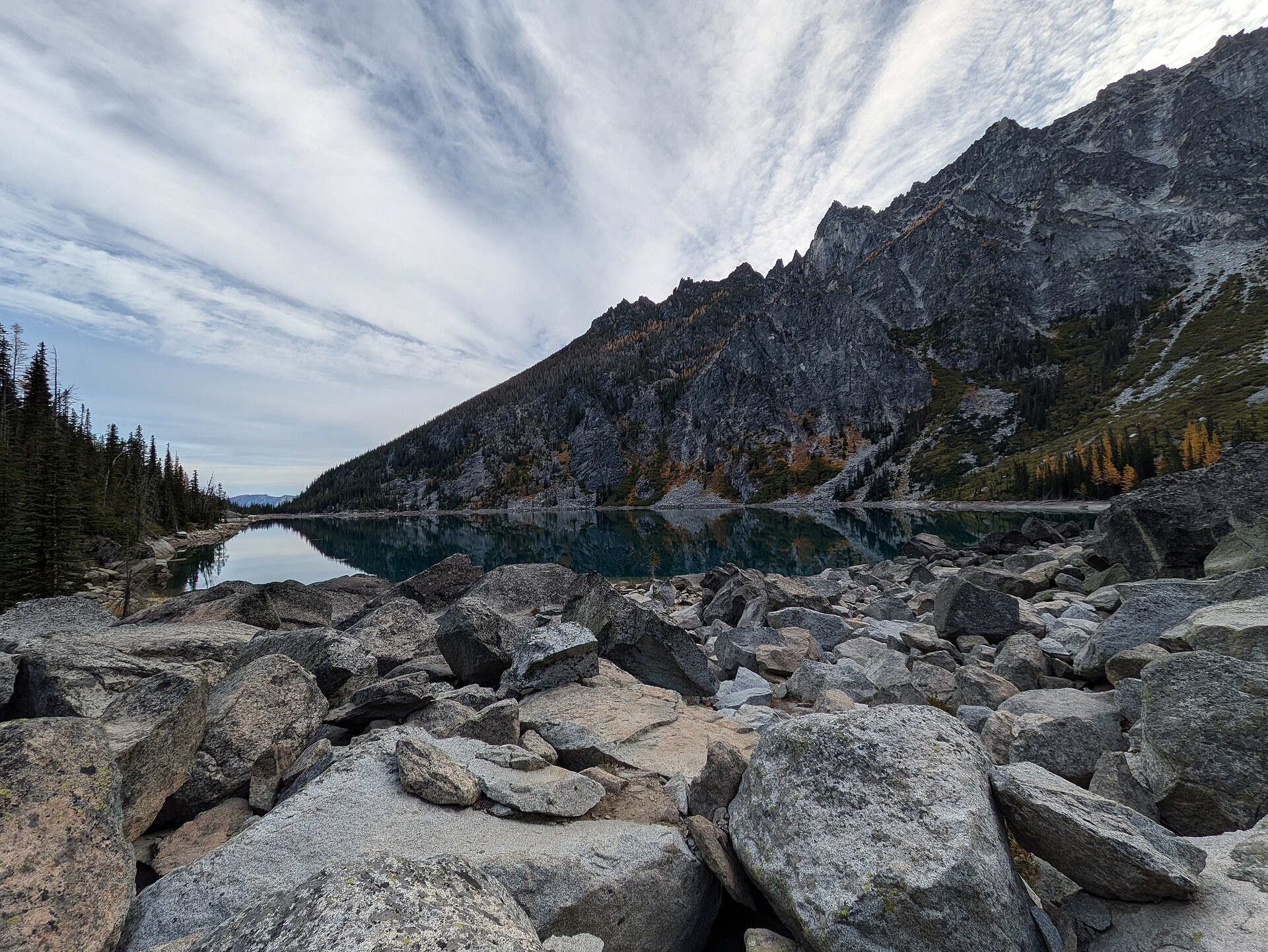
Snapshot
Itinerary
The Stuart Lake Trail #1599 leaves the trailhead at 1,036 m and climbs gently for the first 2.4 km through forest that thins as it rises, staying within earshot of Mountaineer Creek. At about 2.4 km the trail crosses to the right bank of the creek on a substantial log bridge, after which it steepens and grows rockier.
The junction with the Colchuck Lake Trail #1599A comes at roughly 3.6–4.0 km — sources differ, with WTA implying about 2.25 miles and the Forest Service stating 2.5 miles. The trail flattens and drops slightly just before it. Straight ahead leads to Stuart Lake; the Colchuck Lake Trail breaks off to the left. A short forested stretch leads to a second log bridge over a narrow, turbulent section of Mountaineer Creek, and immediately beyond it the path becomes a jumble of boulder-hopping across a large talus slope along the creek bank.
From the talus the trail switchbacks upward — gently at first, then progressively steeper and rockier — with views opening back down the valley and then upward to the serrated ridge of Dragontail Peak. After a final steep pull the path jogs right, drops into a small swale, and arrives abruptly at a broad granite slab above the water.
The cirque is the point of the walk. Dragontail Peak rises roughly 900 m directly above the far shore; to its left is the scree notch of Aasgard Pass, and to the right are the remnants of the Colchuck Glacier and the slopes of Colchuck Peak. A rough path continues about 1 km along the shore, at times hard to follow, to a rock field at the terminal moraine where subalpine fir gives way to larch. WTA flags one awkward junction: at a large tarn the well-trodden dirt path to the right is the wrong line — the route continues over rocky slopes to the left.
Aasgard Pass (2,377 m) is the gateway to the Enchantments proper, and the full traverse from here to the Snow Lakes trailhead is one of the great hard days in the Cascades. It should not be treated as an extension of this hike. The pass climbs roughly 600 m in about 1.2 km on scree that is near-vertical in places, it holds snow into early July, and both WTA and the Forest Service record fatalities on it. It is a mountaineering approach, not a walking route.
Why it is essential
Colchuck Lake is the defining image of the Alpine Lakes Wilderness: milky-turquoise glacial water held in a granite bowl beneath the black north wall of Dragontail Peak. It is also the only way to stand at the threshold of the Enchantments — the most sought-after backcountry permit in Washington — on a day walk, with no lottery and no reservation. The walk itself is a fair summary of what the eastern wilderness does: forest, a creek, a talus field, and then an abrupt granite theatre.
Equipment
- Sturdy boots with good grip — the upper trail is rocky and the talus requires boulder-hopping
- Trekking poles, strongly recommended for the descent
- Weatherproof shell and a warm layer — the lake basin is cold and shaded even in August
- 2–3 L water; there is no potable water at the trailhead and all backcountry water must be treated
- Sun protection
- Map and downloaded GPS track
- Microspikes if walking before mid-July, when snow can persist on the upper trail and the moraine
- Headtorch — the lot often fills before dawn, and many parties start and finish in the dark
Hazards and notes
- Permit nuance — read this carefully. Colchuck Lake lies inside the Enchantment Permit Area, and a permit is required for both day and overnight use between 15 May and 31 October. Day hikers are exempt from the lottery, not from the permit: the day-use permit is free and self-issued at the trailhead box, with no quota. It is the overnight permit that requires the advance or daily lottery ($5 per person per night). The common shorthand “day hikers don’t need a permit” is wrong.
- A Northwest Forest Pass or Interagency pass must be displayed, or a $5 day fee paid. Parking is prohibited on the left-hand side of FR 7601; violators are ticketed and towed.
- Dogs are banned, not merely restricted — throughout the Enchantment Permit Area, service animals excepted. This is enforced.
- 2026 road access is unresolved. A Forest Order closing storm-damaged roads on the Wenatchee River District (effective 20 May 2026 through 31 December 2027) names Forest Road 7600 — Icicle Creek Road — while the forest’s own conditions page lists Eightmile Road 7601 to the trailhead as open as of late May 2026, and describes landslide debris “near Eightmile… Campground”, which is at the turn-off. These statements are in tension. Confirm with the Wenatchee River Ranger District before travelling.
- FR 7601 is steep and heavily washboarded; the Forest Service recommends high-clearance vehicles. Parking is very limited and visitors may have to park a considerable distance from the trailhead.
- Bear canisters are not required here — the rule is to hang food. Mountain goats in the permit area are habituated and are attracted to salt in urine; do not approach or feed them, and urinate on rock or bare ground well away from the trail.
- Campfires are prohibited above 1,524 m (5,000 ft) and within 800 m of any lake — which means no fires at Colchuck Lake at any time.
- Stage 1 fire restrictions were in force forest-wide at the time of writing.
GPX / KML links
| Source | URL | Format | Notes |
|---|---|---|---|
| OpenStreetMap — Colchuck Lake Trail #1599A | openstreetmap.org | OSM route relation 4152031 | ODbL 1.0 — reusable with attribution and share-alike on derived databases. The only verified licence-compatible geometry for this route |
| Waymarked Trails — relation 4152031 | hiking.waymarkedtrails.org | GPX export via the site UI | Renders the OSM relation above (ODbL) |
| USFS — Colchuck Lake Trail | fs.usda.gov | Official page | No official GPX is published. Paper maps referenced: Green Trails 209S / 208SX |
| Washington Trails Association — Colchuck Lake | wta.org | Trail description | No GPX download offered; static map image only |
Trailhead coordinates: 47.5278, −120.8206 (USFS, corroborated by OSM). Colchuck Lake: 47.493, −120.834 (OSM / Wikipedia).
Sources
- Washington Trails Association — Colchuck Lake
- USFS Okanogan-Wenatchee — Colchuck Lake Trail
- USFS Okanogan-Wenatchee — Stuart Lake Trailhead
- Recreation.gov — Enchantment Permit Area rules and regulations
- The Mountaineers — Colchuck Lake
- USFS Okanogan-Wenatchee — current conditions
2. Lake Ingalls via Ingalls Pass
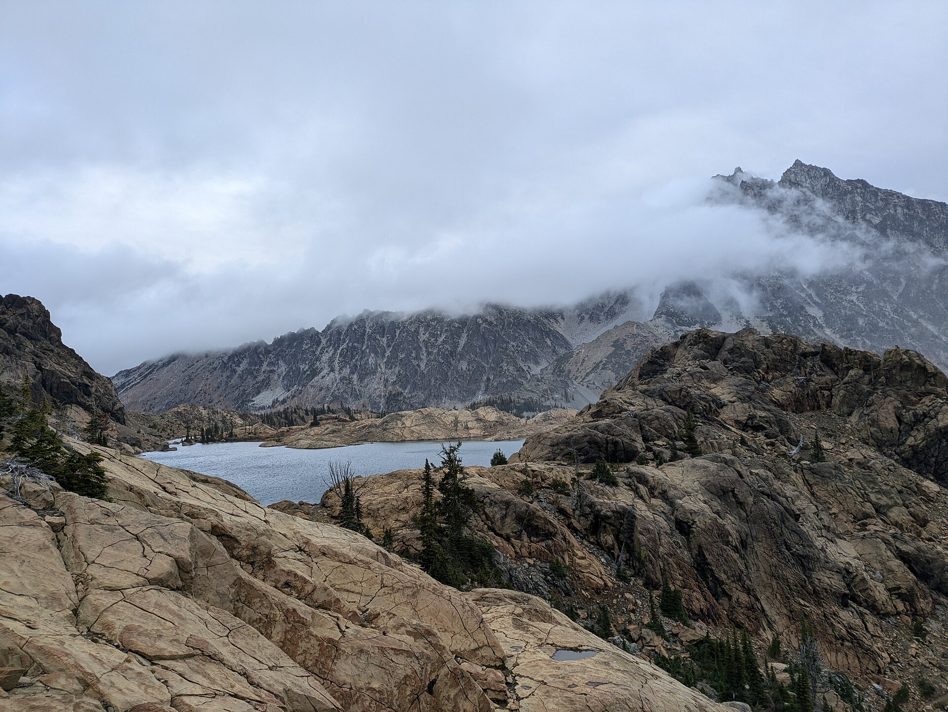
Snapshot
Itinerary
The Ingalls Way Trail #1390 shares the Esmeralda Basin trailhead with two other routes. At 0.6 km a signed junction splits the trails: bear right for Ingalls Way (straight on continues into Esmeralda Basin). This junction is also where dogs must stop — see hazards below.
The trail climbs through forest, then switchbacks up through open meadow and scattered trees, passing the Longs Pass Trail junction at roughly 2.3 km. Beyond it the route steepens into a long, increasingly rocky climbing traverse with the craggy Esmeralda Peaks across the valley, and the views improve steadily to Ingalls Pass at about 5 km and 1,981 m, on the Alpine Lakes Wilderness boundary.
The pass is the moment the walk delivers. Mount Stuart — at 2,870 m the highest non-volcanic summit in Washington — appears across Headlight Basin, a green hanging bowl of grass, meltwater streams and scattered stands of alpine larch. Two signed options cross the basin: an upper line that hugs the rim and holds its height, and a lower line (signed Ingalls Way Alternate #1390.2) that drops into the basin and passes the campsites. The Forest Service and independent guides disagree about which is shorter; the practical distinction is that the rim line stays high and the basin line has the camps.
The final stretch to the lake climbs steeply through rocks and over a rocky ridge, and the way around the western side of the lake is a genuine boulder scramble — trip reports routinely describe it as the hardest part of the day. Lake Ingalls sits at 1,971 m in bare granite, with Mount Stuart filling the skyline directly across the water. Mountain goats frequent the basin and the lakeshore.
Why it is essential
This is the great larch walk of the Washington Cascades. Alpine larch is a deciduous conifer that grows only at high elevation on the eastern crest, and for two or three weeks from late September its needles turn a hard electric gold; Headlight Basin holds one of the most accessible concentrations of it in the state. The route also crosses a real alpine pass and finishes at a viewpoint set directly opposite the biggest granite face in the range. It is the eastern wilderness distilled: dry, open, rocky and bright.
Equipment
- Sturdy boots — the lakeshore approach is a boulder scramble, with genuine ankle and fall risk when wet
- Trekking poles
- 3 L of water minimum. The Forest Service states plainly that “water is scarce along this trail”, and there is no potable water at the trailhead
- Sun protection and a hat — above the pass the route is fully exposed with no shade
- Warm layer, hat and gloves outside midsummer; the pass is windy and cold
- Weatherproof shell
- Map and downloaded GPS track — the Forest Service notes route-finding is difficult in Headlight Basin
- Microspikes in early season for lingering snow on the pass
Hazards and notes
- Dogs are prohibited on the Ingalls Way Trail and in Headlight Basin. They are permitted only on the first 0.6 km, as far as the Ingalls Way junction. The ban exists largely to protect the mountain goats.
- A free, self-issued Alpine Lakes Wilderness permit is required at the trailhead between 15 May and 31 October. A Northwest Forest Pass or Interagency pass is required for parking; a Washington State Discover Pass is not valid here.
- Larch-season crowding is extreme. The trailhead lot is small, and hikers report it filling well before dawn on peak autumn weekends, with long lines of cars along the forest road. If parking on the verge, park only on the west side and do not block the road.
- The last 15 km or so of the approach is unpaved. No official source states a clearance requirement, but expect washboard.
- Mountain goats are habituated and salt-seeking — they approach hikers for sweat and urine. Keep your distance, do not feed them, and urinate on rock well off the trail.
- The 2025 Labor Mountain Fire burned in the Teanaway and triggered a large closure that originally included this trail. The current closure order (effective 20 May to 31 December 2026) does not list Ingalls Way, Esmeralda Basin or the main FR 9737 — only the FSR 9737-112 Beverly Creek spur. Stage 1 fire restrictions run 19 June to 15 October 2026. Check the live alerts page before travelling.
- Camping is prohibited within 800 m of Lake Ingalls; campfires are prohibited.
GPX / KML links
| Source | URL | Format | Notes |
|---|---|---|---|
| OpenStreetMap — Ingalls Way Trail #1390 | openstreetmap.org | OSM route relation 5626186 | ODbL 1.0 — reusable with attribution and share-alike. Note the relation covers the full length of #1390 (well beyond the lake) and must be clipped |
| Waymarked Trails — relation 5626186 | hiking.waymarkedtrails.org | GPX export via the site UI | Renders the OSM relation above (ODbL) |
| USFS — Ingalls Way Trail | fs.usda.gov | Official page | No official GPX, and no distance or elevation figures published |
| Washington Trails Association — Lake Ingalls | wta.org | Trail description | No GPX download offered |
Trailhead coordinates: 47.4367, −120.9369 (USFS). Lake Ingalls: 47.4703, −120.9386 (USGS GNIS via Wikipedia).
Sources
- Washington Trails Association — Lake Ingalls
- USFS Okanogan-Wenatchee — Ingalls Way Trail
- USFS Okanogan-Wenatchee — Esmeralda Trailhead
- USFS Okanogan-Wenatchee — Alpine Lakes Wilderness
- USFS — Labor Mountain Fire road and trail closure, Cle Elum Ranger District
3. Lake Valhalla via the Pacific Crest Trail
Snapshot
Itinerary
The trail begins in the large parking area on the north side of US 2, opposite the ski area base, beside an electric power substation; the entrance is at the far corner of the lot from the pedestrian overpass. Northbound, the Pacific Crest Trail here runs its first 2.4 km along the levelled grade of the original Great Northern Railway — the same 1893 alignment that the Iron Goat Trail follows further west, and a fitting introduction to a region whose walking is shaped by an abandoned railway.
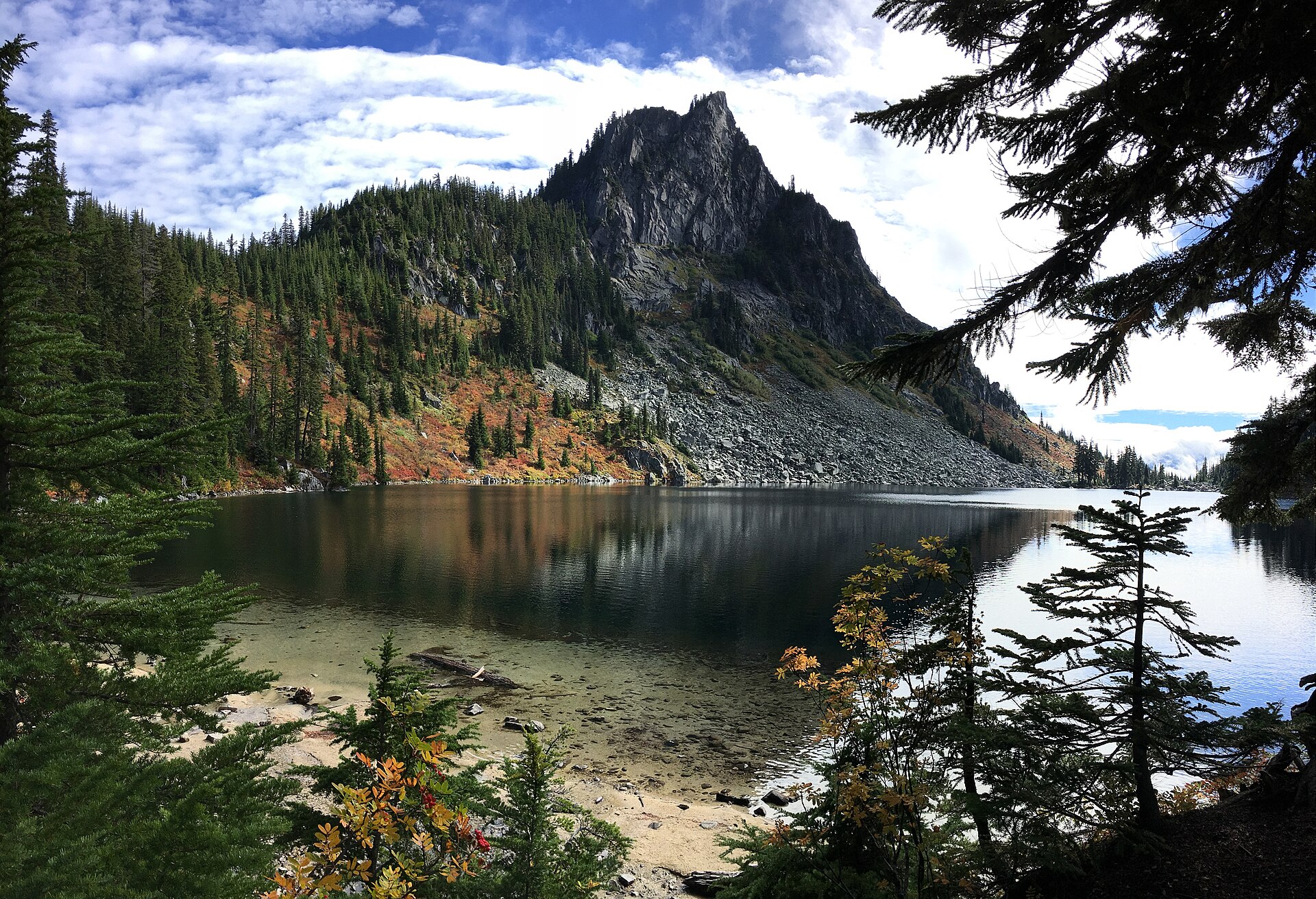
Beyond the old grade the trail enters the Henry M. Jackson Wilderness and begins a long, moderate climbing traverse through forest and a series of meadows, working around the flank of Lichtenberg Mountain (1,781 m), whose steep rock face dominates the second half of the walk. The trail reaches its high point at about 1,539 m and then descends roughly 65 m to Lake Valhalla, a deep bowl of water pinned against the base of Lichtenberg’s north-east wall, with a sandy beach at its outlet. Because the lake lies below the high point, the return begins with a climb.
The obvious addition is Mount McCausland (1,750 m), whose spur leaves the PCT at an unmarked but obvious switchback shortly before the lake and climbs about 0.8 km on a steep, loose and occasionally brushy path. It adds roughly 90–120 m of ascent and repays it with a view north to Glacier Peak and a fine aerial perspective of Lichtenberg standing over Lake Valhalla. Summiting first and dropping to the lake afterwards makes the better order.
A shorter approach exists from the Smithbrook trailhead on Forest Road 6700, reaching the lake from the north over Union Gap in about 11.3 km with 460 m of ascent — but see the hazards below.
Why it is essential
This is the Pacific Crest Trail day out of Stevens Pass: the route that most walkers use to see what the crest looks like here, on a graded trail with no scrambling, no exposure and no route-finding. It supplies the “classic pass route” in this region, and it does so with an unusually literal sense of history, starting on the railway grade that the pass was built around. Lake Valhalla itself, held in a rock bowl under Lichtenberg Mountain, is among the more shapely lakes on this section of the crest.
Equipment
- Standard mountain hiking equipment — boots, weatherproof shell, warm layer
- Insect repellent and a head net. Mosquitoes here are notorious in July; Forest Service rangers reported heavy mosquito activity around the alpine lakes in early July 2026
- 2–3 L water. The lake is a reliable source (treat it), but the traverse below Lichtenberg is dry
- Sun protection
- Trekking poles, useful on the Mount McCausland spur
- Map and downloaded GPS track
- Microspikes in early season for lingering snow banks in the lake basin
Hazards and notes
- The Smithbrook approach is currently unavailable by car. Forest Road 6700 (Smithbrook/Rainy Creek Road) has been closed to vehicles since storm damage in December 2025 and is barricaded at US 2; WTA carried an active closure notice through mid-2026. The Stevens Pass PCT approach described above is the only drivable access. Confirm status before relying on the shorter route.
- Snow bridges over meltwater were reported undermined and “hollow” near the lake in late June 2026 — a real hazard in early season.
- Blowdowns are a persistent feature; trip reports in mid-2026 counted around 20 downed trees on the way to the lake, some requiring climbing or crawling.
- A free, self-issued wilderness permit is required at the trailhead. A Northwest Forest Pass or $5 day fee is required for parking — despite what some third-party sources claim. Group size in the Henry M. Jackson Wilderness is capped at 12.
- Campfires are prohibited within 400 m of Lake Valhalla. There are backcountry toilets at the lake.
- Navigation is straightforward on the PCT, with two traps: at Union Gap the PCT is signed but Lake Valhalla is not, and the Mount McCausland spur is unmarked.
- The Stevens Pass ski area runs summer operations (chairlift, bike park) on the south side of US 2; they do not affect the PCT trailhead on the north side.
GPX / KML links
| Source | URL | Format | Notes |
|---|---|---|---|
| Pacific Crest Trail Association — official PCT data | pcta.org | GPX, KMZ, GeoJSON, Shapefile, File Geodatabase | CC BY 4.0 — explicitly free to use, share and adapt “for any purpose (including commercial)” with credit to the PCTA. The cleanest licensed route file in this article. Clip the Stevens Pass → Lake Valhalla segment |
| OpenStreetMap — Pacific Crest Trail | openstreetmap.org | OSM superroute relation 1225378 | ODbL 1.0 — attribution and share-alike |
| USFS — PCT Stevens Pass North trailhead | fs.usda.gov | Official page | No GPX. Note the page lists the trailhead elevation as 3,000 ft, which is an error — the pass is 4,061 ft |
| Washington Trails Association — Lake Valhalla | wta.org | Trail description | No GPX download offered |
Trailhead coordinates: 47.7470, −121.0885 (OSM/WTA consensus; the lot is large). Lake Valhalla: 47.7895, −121.1012 (USGS GNIS via OSM).
Sources
- Washington Trails Association — Lake Valhalla
- USFS Mt. Baker-Snoqualmie — Pacific Crest Trail, Stevens Pass North
- USFS Okanogan-Wenatchee — PCT Stevens Pass North trailhead
- PCTA — PCT data and maps
- Washington Trails Association — Mount McCausland
- PCTA — PCT transportation
4. Alpine Lookout via the Round Mountain Trail
Snapshot
Itinerary
The Round Mountain Trail #1529 climbs immediately and steeply from the trailhead through switchbacks in dense forest, gaining roughly two-thirds of the day’s total ascent within the first 3 km. After the first kilometre or so the trail enters an old burn — WTA dates it to the mid-1980s — where silvered snags open the view down to the valley and the ground beneath carries a heavy summer bloom of lupine, paintbrush and delphinium.
At about 2.6 km the trail meets the Nason Ridge Trail #1583; turn left (west). From here the route rolls along the ridge crest for roughly 5 km, alternating forest and wildflower meadow, undulating in short climbs and drops as it passes the flank of Round Mountain and crosses the Ninemile Saddle area. A final spur climbs about 0.5 km and 75 m to the lookout.
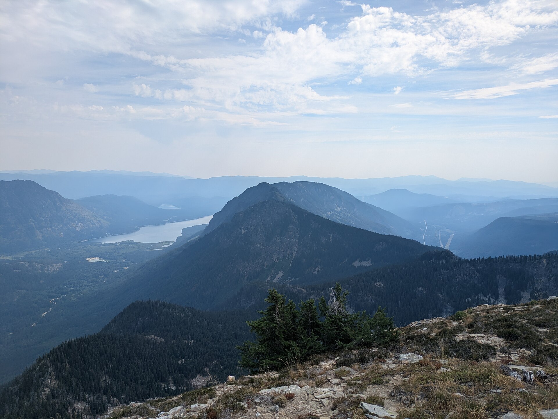
The Alpine Lookout stands at about 1,900 m: a 4.6 m square R-6 flat-cab structure built in 1975 on a lookout site established in 1920, replacing a 1936 ground house. It was nominated to the National Historic Lookout Register in July 1995, and it is the only remaining lookout structure in the Stevens Pass area. From the deck the view drops directly onto Lake Wenatchee and runs north to Glacier Peak, south-west to Mount Rainier, and south-east to Mount Stuart and the Enchantments. Mountain goats are frequently seen along the ridge.
Why it is essential
Every other route in this article ends at water. This one ends on an open ridge crest with a standing fire lookout and a panorama that takes in three of Washington’s great volcanoes and the whole eastern crest. It also lies outside any designated wilderness, which changes the character of the day — no permit box, dogs are allowed on the lead — and it sheds its snow earlier than the routes to the south, making it one of the first big-view walks of the season in this corner of the Cascades.
Equipment
- Sturdy boots and trekking poles
- 3 L of water, carried from the car. This is the key point. The Forest Service describes water as “limited” on Trail #1529 and “scarce” on Nason Ridge, WTA calls the trail “dry with minimal water sources”, and there is no water at the lookout. Beyond an unreliable early-season spring near the trailhead, there is nothing until Merritt Lake, far along the ridge
- Sun protection — the burn zone and the open ridge give very little shade
- Warm layer and wind shell; the crest can deliver wind, rain, sleet or snow even in September
- Insect repellent — mosquitoes can be heavy
- Map and downloaded GPS track
Hazards and notes
- Do not count on the lookout being open. Sources conflict: WTA and the Forest Service describe it as active or staffed, while other accounts report it is only intermittently occupied and was found locked in recent seasons. A deck wraps most of the way around it regardless.
- The turn from US 2 onto Butcher Creek Road (FR 6910) is poorly signed. It lies roughly 29 km east of Stevens Pass, just past the Nason Creek Rest Area. A 2025 trip report describes deep grooves on the forest road and brush scraping vehicles on the final spur; high-clearance is advisable.
- A Northwest Forest Pass or Interagency pass is required. No wilderness permit is needed — Nason Ridge lies north of US 2 and is outside the Alpine Lakes Wilderness. (Note that at least one lookout-focused website mislabels it as being inside the wilderness; it is not.)
- Dogs are allowed on the lead, unlike on Ingalls Way or in the Enchantment Permit Area.
- Mountain bikes are permitted on this trail and along Nason Ridge, and motorcycles are permitted on #1583 east of Ninemile Saddle — expect to share the ridge.
- Mountain goats along the ridge are salt-seeking; keep your distance and urinate well off the trail.
- Stage 1 fire restrictions were in force forest-wide at the time of writing, and this is fire-prone east-slope country.
GPX / KML links
| Source | URL | Format | Notes |
|---|---|---|---|
| OpenStreetMap — Round Mountain Trail #1529 | openstreetmap.org | OSM way 235689655 | ODbL 1.0. No OSM route relation exists for this hike — the route must be assembled from individual ways |
| OpenStreetMap — Nason Ridge Trail #1583 | openstreetmap.org | OSM ways 378067108 and 895710903 | ODbL 1.0 — attribution and share-alike |
| USFS — Round Mountain Trail | fs.usda.gov | Official page | No official GPX, and no distance or elevation figures published |
| Washington Trails Association — Alpine Lookout | wta.org | Trail description | No GPX download offered |
Trailhead coordinates: 47.7923, −120.7944 (WTA and The Mountaineers, in agreement). Alpine Lookout: approximately 47.812, −120.868 — single-source and not independently confirmed; treat as approximate.
Sources
- Washington Trails Association — Alpine Lookout
- USFS Okanogan-Wenatchee — Round Mountain Trail #1529
- USFS Okanogan-Wenatchee — Nason Ridge Trail #1583
- The Mountaineers — Alpine Lookout / Round Mountain
5. The Iron Goat Trail
Snapshot
Itinerary
The Iron Goat Trail (#1074) is laid along the abandoned grade of the Great Northern Railway’s original 1893 crossing of Stevens Pass, and it is built as an upper grade and a lower grade joined by three steep crossover trails — Martin Creek, Corea and Windy Point.
The standard day is the Martin Creek loop: out along the lower grade, up the Windy Point crossover, and back along the upper grade via the Martin Creek crossover — about 9.7 km with 215 m of ascent. The Windy Point crossover is the one piece of real climbing, roughly 1 km of tight switchbacks gaining about 215 m to the Windy Point viewpoint, from which the west portal of the 12.6 km 1929 Cascade Tunnel — still in daily use by BNSF freight — is visible below.
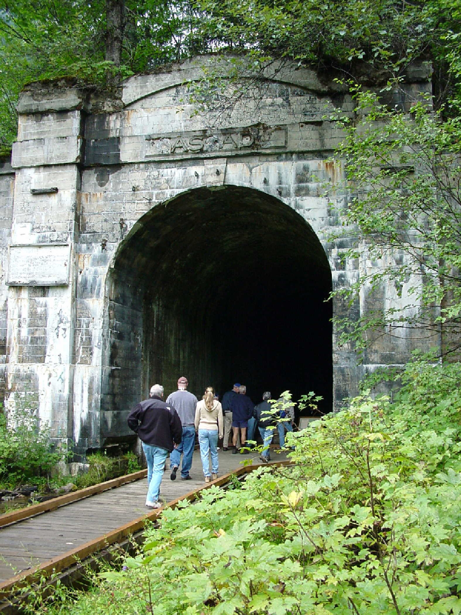
The grade itself runs past the physical wreckage of the old railway: concrete snowsheds, retaining walls, culverts and the black mouths of tunnels, all being slowly reclaimed by moss and alder. Interpretive signs stand at the significant points. The tunnels and snowsheds are structurally unsound and must not be entered — both WTA and the trail’s builders state this explicitly, and the old timbers are prone to collapse.
Two other configurations are useful. From the Wellington trailhead a 4.8 km barrier-free section runs south along the grade to the Windy Point Tunnel, passing the site of the disaster described below. From the Iron Goat Interpretive Site at US 2 milepost 58.3 — which is free, needs no pass, and is maintained by the Washington State Department of Transportation — a roughly 4.8 km barrier-free section of the lower grade runs to Martin Creek, built to a 2.2 per cent gradient and genuinely wheelchair-accessible, with accessible toilets at all three trailheads.
Why it is essential
This is the historical route of the region, and the history is exceptional.
The Great Northern Railway reached Seattle in January 1893, with the last spike driven at Scenic. To avoid the cost and delay of a tunnel, James J. Hill’s engineers took the line over the pass on a series of eight switchbacks with gradients as steep as 4 per cent. A first Cascade Tunnel, 4.2 km long, replaced the switchbacks in December 1900, and the line ran through the little railway town of Wellington, on a shelf below Windy Mountain.
In late February 1910 two westbound trains — the Spokane Local passenger train No. 25 and the Fast Mail No. 27 — were halted at Wellington by a blizzard and sat stranded for six days. In the small hours of 1 March 1910, after rain and thunder had fallen on the heavy snowpack, an avalanche swept both trains off the shelf and into the ravine below. Ninety-six people were killed — 35 passengers, 58 railway employees asleep on the trains, and three more asleep in cabins — and 23 were dug out alive. It remains the deadliest avalanche in United States history.
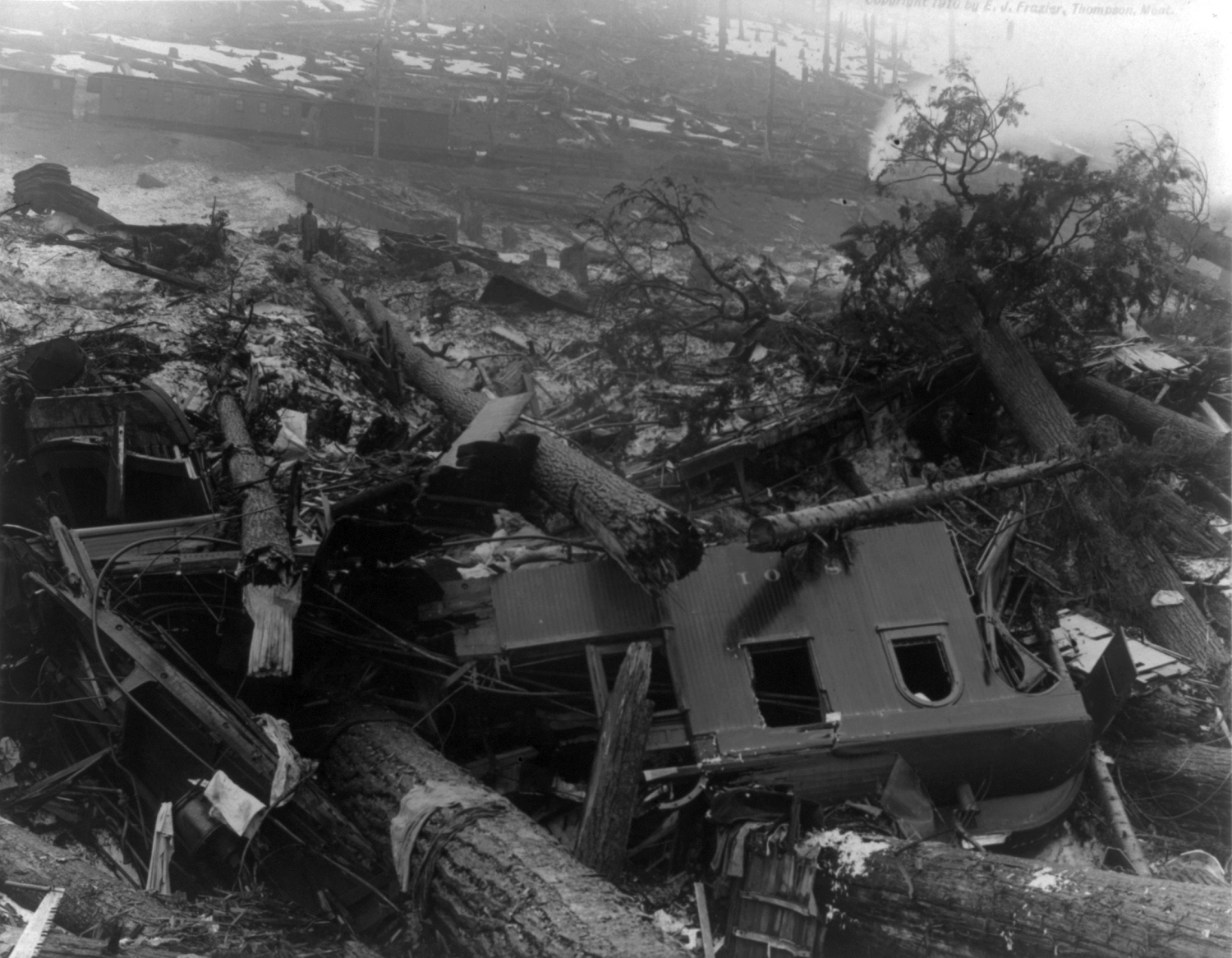
The railway responded by building concrete snowsheds over nine miles of track between Scenic and Tye, and the town of Wellington, its name now inseparable from the disaster, was quietly renamed Tye in October 1910. A second, smaller avalanche killed eight passengers near Corea in January 1916. The whole line over the pass was finally abandoned in 1929, when the 12.6 km Cascade Tunnel opened 150 m lower down.
The trail’s name comes from the Great Northern’s corporate emblem — a mountain goat standing on a rock. Trains were “iron horses”; the Great Northern became the “iron goat”.
The trail exists because of Ruth Ittner, a Mountaineers member who proposed it to the Forest Service in 1987 as a Washington centennial project. It was built by Volunteers for Outdoor Washington in partnership with the Forest Service and WSDOT, and opened on 2 October 1993; the Washington Trails Association has carried out trail work here every year from 2022 to 2026. A plaque at Martin Creek records the line as an ASCE National Historic Civil Engineering Landmark. The original railway was built by some 800 workers, many of them Japanese immigrants — a history the Wing Luke Museum now interprets through heritage walks on this trail.
Equipment
- Standard hiking equipment — shoes or boots, weatherproof layer, water, food
- The grade is gentle and the surface is packed dirt and gravel, so this is a walk rather than a mountain day
- Sun protection is less critical here than elsewhere in the region — much of the trail is shaded
- A torch is not an invitation to enter the tunnels; do not enter them
- Trekking poles for the crossover trails
- Wheelchair users: the lower grade from the Interpretive Site and the Wellington section are barrier-free; the crossovers and upper grade are not
Hazards and notes
- Do not enter the tunnels or snowsheds. They are unsafe, and the old timbers are prone to collapse. This is the single most important rule on this trail.
- Rockfall, landslides and washouts are ongoing. A WTA trip report from April 2026 recorded downed trees, mud and rock slides, a completely washed-out boardwalk, and a landslide that has diverted water onto the trail.
- US 2 between Skykomish and Stevens Pass was closed by catastrophic flooding in December 2025 and reopened on 2 January 2026. No Iron Goat-specific closure was listed on the forest’s alerts page at the time of writing.
- A Northwest Forest Pass or Interagency pass is required at Martin Creek and Wellington. The Scenic / Interpretive Site is free — no pass needed. A Washington State Discover Pass is not valid at any of them.
- Day use only, sunrise to sunset. The trail is closed to bicycles, motor vehicles and stock. Dogs are allowed on the lead.
- Note on sources: the former official trail website, irongoattrail.org, is defunct — the domain has lapsed and now serves unrelated spam content. A similarly named site is an affiliate content farm. Neither should be used.
GPX / KML links
| Source | URL | Format | Notes |
|---|---|---|---|
| OpenStreetMap — Iron Goat Trail #1074 | openstreetmap.org | OSM route relation 5539606 | ODbL 1.0 — reusable with attribution and share-alike. The only verified licence-compatible geometry for this route |
| Waymarked Trails — relation 5539606 | hiking.waymarkedtrails.org | GPX export via the site UI | Renders the OSM relation above (ODbL) |
| USFS — Iron Goat Trail (Martin Creek) | fs.usda.gov | Official page | No official GPX. Paper map referenced: Green Trails 176 |
| Washington Trails Association — Iron Goat Trail | wta.org | Trail description | No GPX download offered |
Trailhead coordinates: Martin Creek 47.72963, −121.20653 and Wellington 47.74725, −121.12767 (both official USFS figures). The Iron Goat Interpretive Site is at approximately 47.7113, −121.1619 — OSM-derived, as no official coordinate is published.
Sources
- Washington Trails Association — Iron Goat Trail
- USFS Mt. Baker-Snoqualmie — Iron Goat Trail #1074, Martin Creek
- USFS Mt. Baker-Snoqualmie — Iron Goat Trail #1074, Wellington
- HistoryLink — Train disaster at Wellington kills 96 on March 1, 1910
- HistoryLink — The Iron Goat Trail opens on October 2, 1993
- Wikipedia — Cascade Tunnel
- Wing Luke Museum — Iron Goat heritage walks
Missing data / follow-up work
- Icicle Creek Road (FR 7600) 2026 status is genuinely unresolved. A Forest Order closing storm-damaged roads on the Wenatchee River District names FSR 7600 and runs to 31 December 2027, yet the forest’s conditions page lists Eightmile Road 7601 to the Stuart Lake trailhead as open, while also describing slide debris “near Eightmile… Campground” at the junction. These statements cannot both be straightforwardly true. Confirm directly with the Wenatchee River Ranger District before publication or travel.
- Forest Road 6700 (Smithbrook) is closed to vehicles following December 2025 storm damage and was barricaded at US 2 as of mid-2026. The shorter Smithbrook approach to Lake Valhalla is therefore unavailable until further notice. Re-check before publication.
- No official GPX exists for any route in this article except the Pacific Crest Trail. The Forest Service publishes no downloadable tracks, and WTA offers none. The PCTA’s PCT data (CC BY 4.0) is the only cleanly licensed official route file; everything else must be derived from OpenStreetMap under ODbL.
- The USFS publishes no distance or elevation figures at all for the Ingalls Way Trail, the Round Mountain Trail, the Nason Ridge Trail or the Iron Goat Trail. All statistics for those routes come from WTA and other secondary sources, and the ranges given reflect genuine disagreement between them.
- No walking-time estimate is published by any authoritative source for Colchuck Lake. The 6–8 hour figure given here is derived from distance and ascent, and is labelled as such.
- Elevation loss into Headlight Basin (Lake Ingalls) is not quantified by any source. The lake is only about 10 m below Ingalls Pass, but the basin crossing adds undulation that no published figure captures.
- No gain figure is published for the Wellington section of the Iron Goat Trail, and no source gives a reliable one-way distance for a full Martin Creek → Wellington traverse. The trailhead elevations quoted are derived from the USGS 3DEP elevation service, not from published figures.
- The Alpine Lookout’s staffing status is contested between sources — treat it as a standing structure that may well be locked.
- The Alpine Lookout coordinate is single-source and has not been independently confirmed against a topographic map.
- No licence-compatible photograph of the Alpine Lookout structure itself was found on Wikimedia Commons in this pass. The image used shows Nason Ridge with the lookout on the crest, photographed from Mount Mastiff. Likewise, only one openly-licensed photograph of the Iron Goat Trail as a trail was found; a future pass could look to Flickr Creative Commons or the USFS media library.
- Wildfire and storm closures in this region change fast. Stage 1 fire restrictions were in force forest-wide at the time of writing, and the 2025 Labor Mountain Fire closure in the Teanaway was revised during 2026. Always check the live Okanogan-Wenatchee and Mt. Baker-Snoqualmie alerts pages before travelling.
- Strong alternates not included in the five. The full Enchantments traverse (~30 km, ~1,500 m ascent, ~2,300 m descent, car shuttle, Aasgard Pass); Lake Serene and Bridal Veil Falls below Mount Index; Blanca Lake; and Rock Mountain on Nason Ridge (8.0 mi / 4,050 ft — a punishing, notoriously dry climb to a higher summit than the Alpine Lookout). Each merits a full entry in a future pass.
Further reading
| Source | URL |
|---|---|
| USFS Okanogan-Wenatchee National Forest — Alpine Lakes Wilderness | fs.usda.gov |
| USFS Mt. Baker-Snoqualmie — Alpine Lakes Wilderness | fs.usda.gov |
| USFS Okanogan-Wenatchee — current conditions | fs.usda.gov |
| USFS Mt. Baker-Snoqualmie — alerts and closures | fs.usda.gov |
| USFS Mt. Baker-Snoqualmie — wilderness regulations | fs.usda.gov |
| Recreation.gov — Enchantment Permit Area | recreation.gov |
| Washington Trails Association — trail database | wta.org |
| Pacific Crest Trail Association — official PCT data (CC BY 4.0) | pcta.org |
| HistoryLink — Wellington avalanche, 1 March 1910 | historylink.org |
| HistoryLink — the Iron Goat Trail | historylink.org |
| Northwest Avalanche Center | nwac.us |
| Waymarked Trails — hiking routes (OSM) | hiking.waymarkedtrails.org |