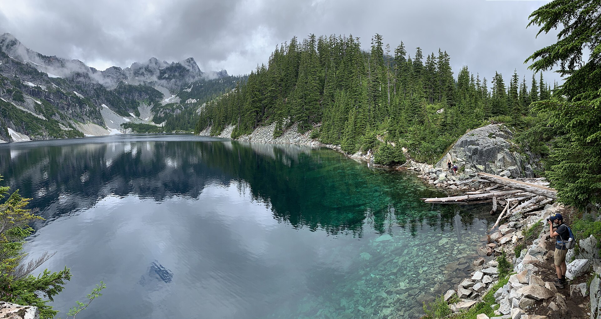
Regional overview
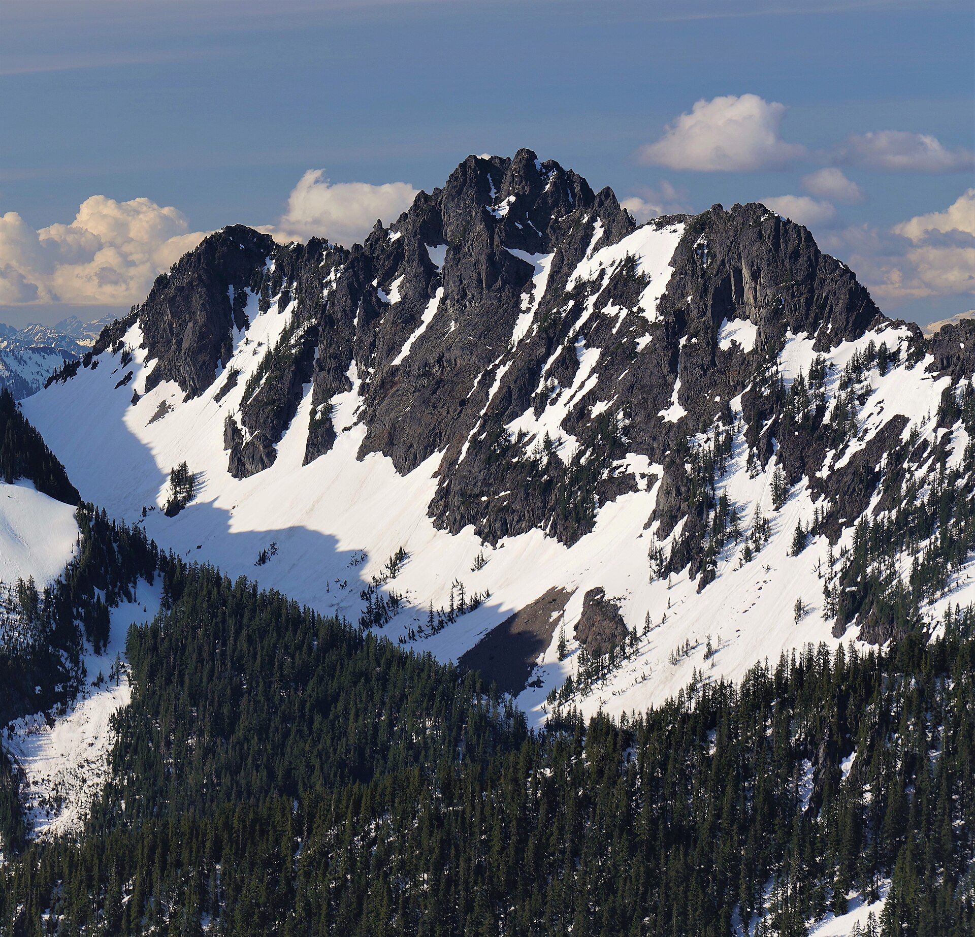
Snoqualmie Pass is the lowest and busiest crossing of the Washington Cascades, carrying Interstate 90 over the crest at about 920 m barely 80 km from downtown Seattle. That proximity defines the walking here more than the terrain does. This is the most heavily used mountain corridor in the state — the trailheads at Exits 47 and 52 serve a metropolitan area of four million people, the lots fill before breakfast on summer weekends, and the Forest Service describes the Snow Lake Trail as the single most frequented trail in the entire Alpine Lakes Wilderness.
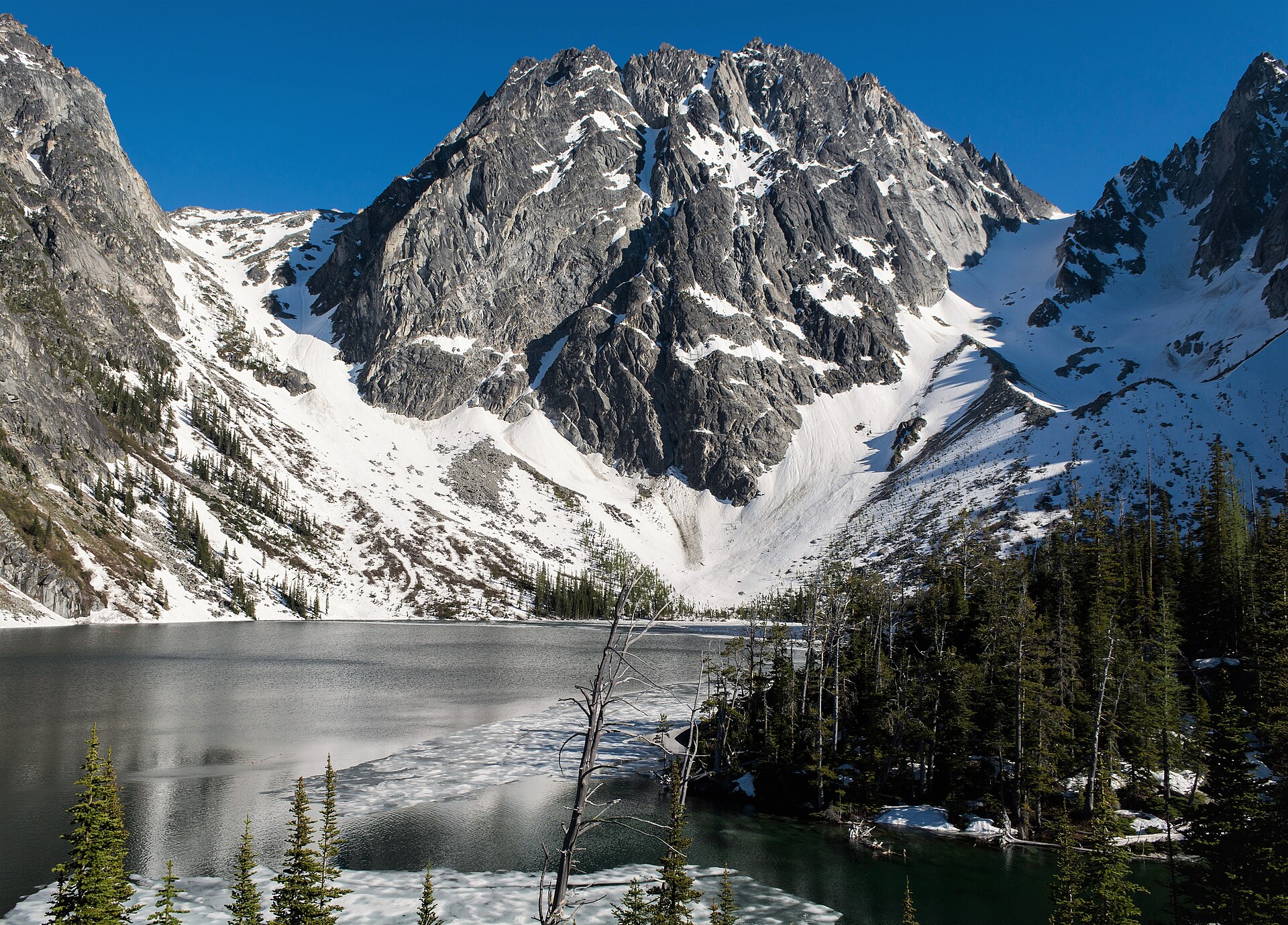
The country itself is steep, wet and heavily glaciated. West of the crest the forest is dense and mossy, the rainfall is high, and the peaks rise abruptly out of forested valleys in walls of dark rock — Chair Peak, Kaleetan Peak, The Tooth and Denny Mountain form a serrated skyline above the pass. The Alpine Lakes Wilderness boundary runs close to the highway on both sides, so a walker can be inside designated wilderness within an hour of leaving the interstate. The lakes are the region’s signature: Snow, Melakwa, Gem, Pratt, Mason and dozens more, held in rock basins scooped out by ice.
The corridor divides naturally into two zones. North Bend and the Snoqualmie Valley, at the western foot of the range, hold the low, front-range peaks — Mount Si, Mount Teneriffe, Little Si, Rattlesnake Ledge, Mailbox Peak — which are walkable almost year-round and absorb the heaviest traffic. These sit on Washington State Department of Natural Resources land, not National Forest, which matters for parking. Snoqualmie Pass proper, at Exits 47 and 52, holds the alpine routes: Snow Lake, Melakwa Lake, Granite Mountain, the Kendall Katwalk and the Pacific Crest Trail.
Three practical points shape every trip. First, the parking pass depends on who owns the land, and getting it wrong is expensive: the Forest Service trailheads at the pass require a Northwest Forest Pass or Interagency pass (or a $5 day fee), while Mount Si and its neighbours require a Washington State Discover Pass — which rose to $45 a year on 1 October 2025. Neither is valid on the other’s land. Entering the Alpine Lakes Wilderness also requires a free, self-issued permit from the trailhead box. Second, public transport is almost entirely absent, with one important exception: King County Metro’s seasonal Trailhead Direct shuttle runs from Seattle to Mount Si, Little Si and Mount Teneriffe at weekends through the summer, and because the Discover Pass is a vehicle permit, arriving by bus means needing no pass at all. It does not serve Snoqualmie Pass; the private shuttle that once did appears to have ceased trading. Third, snow lingers, and it kills people here. The avalanche chutes on Granite Mountain have caused multiple fatalities, and both the Snow Lake saddle and the Kendall Katwalk hold hard snow on steep ground well into the summer.
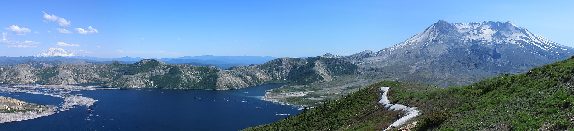
See also: Stevens Pass · Mount St Helens and Mount Adams.
Selection rationale
These five cover the corridor’s distinct terrain rather than repeating its most crowded lake. Mount Si is the region’s cultural landmark and its front-range icon — the most-walked mountain trail in the state, reachable by bus from Seattle, and the one hike here that most Washingtonians have done. Snow Lake is the classic cirque-lake walk and the most visited trail in the Alpine Lakes Wilderness, delivering the full Chair Peak amphitheatre for a moderate effort. The Kendall Katwalk supplies the ridge-and-balcony route: a ledge blasted from a granite cliff on the Pacific Crest Trail, and the corridor’s most photographed piece of trail engineering. Granite Mountain is the summit day — a relentless, sun-beaten climb to one of the last operational fire lookouts in the forest, with Mount Rainier filling the southern sky. Denny Creek to Melakwa Lake is the valley-and-pass route, threading beneath the elevated deck of Interstate 90, past a granite waterslide and two waterfalls, and over Hemlock Pass — and it carries the corridor’s history, since the trailhead road runs along the line of the 1867 Snoqualmie Pass Wagon Road.
Mailbox Peak, Rattlesnake Ledge, Mount Defiance via the Ira Spring Trail and Rachel Lake are all strong and are noted as alternates in the follow-up section.
Summary table
| # | Hike | Country | Route type | Distance | Gain | Max elevation | Difficulty |
|---|---|---|---|---|---|---|---|
| 1 | Mount Si | USA | Out-and-back | ~12.9 km (~8.0 mi) | ~960 m | 1,189 m at the trail end (1,270 m Haystack summit) | Strenuous |
| 2 | Snow Lake | USA | Out-and-back | ~9.7–11.6 km (~6.0–7.2 mi) | ~550 m incl. return re-ascent | 1,341 m at the saddle | Moderate |
| 3 | Kendall Katwalk (PCT) | USA | Out-and-back | ~17.7–19.3 km (~11.0–12.0 mi) | ~790–820 m | ~1,646 m | Strenuous |
| 4 | Granite Mountain | USA | Out-and-back | ~12.9–13.8 km (~8.0–8.6 mi) | ~1,158 m | 1,716 m | Strenuous |
| 5 | Denny Creek to Melakwa Lake | USA | Out-and-back | ~13.7–15.3 km (~8.5–9.5 mi) | ~820 m | 1,402 m at Hemlock Pass | Moderate–strenuous |
1. Mount Si
Snapshot
Itinerary
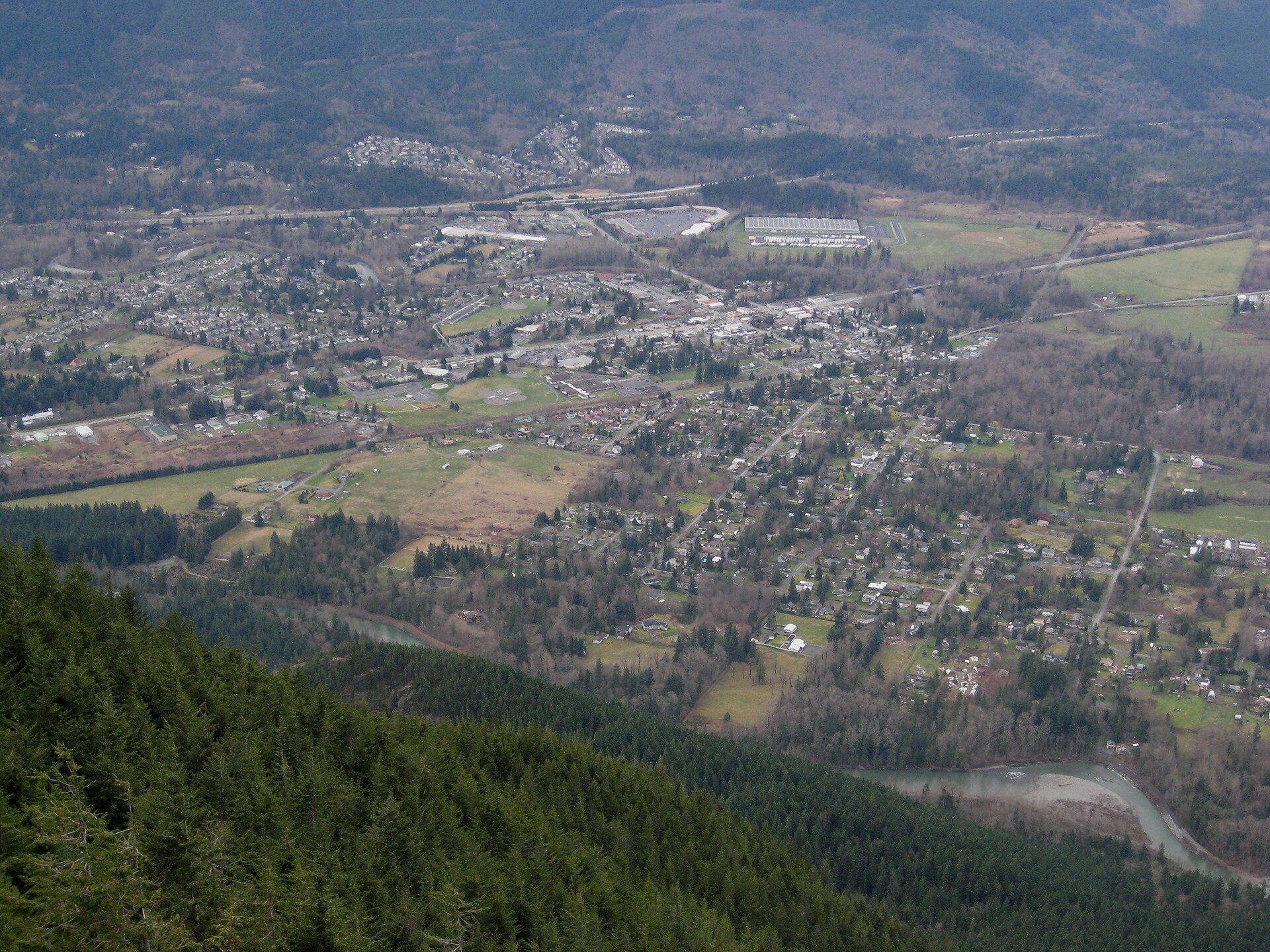
The Mount Si Trail begins from a large car park on Mount Si Road and climbs immediately into second-growth forest, settling into a rhythm of steady switchbacks that it holds for most of the ascent. At about 3 km the trail passes Snag Flats, where a short boardwalk and interpretive panels explain the surrounding forest — a remnant stand of older trees left by a 1910 fire, and the one place on the climb where the walking eases.
Above Snag Flats the trail steepens through younger forest, gaining height without much view, until at around 5.5 km the trees begin to open. The trail ends at a broad rocky plateau and talus field at about 1,189 m, where stone steps lead to an overlook. This is the destination for the overwhelming majority of walkers. The Snoqualmie Valley lies directly below; the view runs west to Seattle and the Olympic Mountains, south to Mount Rainier, and east along the ridge of Mount Teneriffe.
Above the plateau rises the Haystack — a rock fin roughly 45 m high that holds the true summit at 1,270 m. It is an exposed Class 3 scramble, and it should not be treated as the natural finish to the walk. There is a memorial near its base to those who have died falling from it; a hiker fell some 15 m in May 2026, striking his head, and was airlifted to hospital in critical condition. Rockfall dislodged by scramblers above is an additional hazard. Parties without scrambling experience should stop at the plateau, which is where the trail — and this route description — ends.
Why it is essential
Mount Si is the mountain of the Seattle metropolitan area. Somewhere between 80,000 and 100,000 people climb it each year; it is the standard fitness benchmark, the first big hike for a large share of Washington walkers, and — thanks to its appearance in the opening credits of Twin Peaks, filmed in North Bend — the most recognisable peak in the state to people who have never walked up anything. It is also, uniquely in this region, reachable by public transport from central Seattle. In Snoqualmie tradition the mountain is q̓əlbc̓, understood as the fallen body of a paramount being — a reminder that this is a landscape with much older meaning than its trail statistics suggest.
Equipment
- Standard hiking equipment — boots or trail shoes, weatherproof layer, warm layer
- 2 L water. No source consulted confirms drinkable water on the trail; carry your own
- Trekking poles for the descent — the gradient is unremitting and hard on the knees
- Microspikes in winter and early spring for ice on the upper switchbacks and the plateau
- Headtorch for a late finish or a sunrise start
- Bear awareness (see below)
- No scrambling equipment is needed for the route as described, because the route as described does not include the Haystack
Hazards and notes
- The Haystack has killed people. It is an exposed Class 3 scramble with a fatal fall potential, and Washington DNR publishes no safety notice about it. Treat it as a separate objective requiring scrambling competence, not as the last 20 minutes of a hike.
- A black bear attacked two teenage hikers on this trail on 16 June 2026 — a sow with cubs charged and clawed a boy about 4.5 km up the trail. All Mount Si NRCA trails were closed; they reopened on 18 June 2026. The bear was never located and the search was called off; DNR has installed bear-aware signage at the trailheads. This was reported as the first documented human–bear contact on the trail. Make noise, travel in groups, and do not run from a bear.
- Search-and-rescue volume is high and rising. King County SAR had logged 10 callouts to the Mount Si group of trails by late May 2026, already exceeding the 9 recorded across the whole of the previous year.
- Parking: a Washington State Discover Pass is required — not a Northwest Forest Pass. This is DNR land. The annual pass rose from $30 to $45 on 1 October 2025; a one-day pass is $10. WTA warns that the lot is patrolled regularly.
- The Discover Pass is a motor-vehicle permit. Arrive on the Trailhead Direct bus, on foot or by bike, and no pass is required at all.
- Day use only — no camping. Dogs are permitted on the lead. There is no rubbish collection; pack out what you bring.
- No wilderness permit applies: this is conservation land, not designated Wilderness.
GPX / KML links
| Source | URL | Format | Notes |
|---|---|---|---|
| Washington DNR — official Mount Si trail map | dnr.wa.gov | PDF map | Official, but no reuse terms are stated on the file, and it carries no GPX |
| OpenStreetMap — Mount Si Trail | openstreetmap.org | OSM ways (42636915, 946181461-63, 42730595, 479966018) | ODbL 1.0. No OSM route relation exists — the trail is mapped as individual ways and must be assembled |
| Washington Geospatial Open Data Portal — state trails database | geo.wa.gov | Shapefile / GeoJSON / KML | State trails layer published by the Recreation and Conservation Office. Licence terms could not be verified — the portal pages are script-rendered. Confirm before reuse |
| Washington Trails Association — Mount Si | wta.org | Trail description | No GPX download offered |
Trailhead coordinates: 47.4880, −121.7231 (WTA). Haystack summit: 47.5076, −121.7401 (Wikipedia, corroborated by OSM).
Sources
- Washington Trails Association — Mount Si
- Washington State DNR — Mount Si NRCA
- Washington State DNR — Discover Pass
- Trailhead Direct — Mount Si route
- Snoqualmie Valley Record — one rescue, one death on Mount Si in May 2026
- Wikipedia — Mount Si
2. Snow Lake
Snapshot
Itinerary
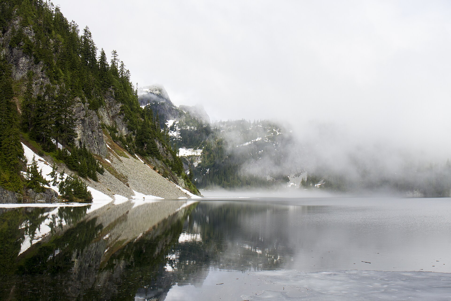
The Snow Lake Trail #1013 leaves the north end of the parking area at the Alpental ski area and climbs about 60 m on log steps before settling into a gradual ascent through forest. At roughly 1.6 km the trees break for a talus slope — the first real view, and the moment the landscape changes character, with Chair Peak standing at the end of a jagged ridge across the valley.
At 2.7–2.8 km the trail reaches the Source Lake junction, exactly where the main trail turns right and begins to switchback. The left fork is the Source Lake Overlook Trail, a nearly level spur continuing up-valley to a viewpoint over Source Lake, the headwaters of the South Fork Snoqualmie River — a worthwhile short detour, and the easier objective on a day when the saddle is snowbound.
Bearing right, the trail climbs a series of steep switchbacks, gaining about 150 m over the next kilometre to the saddle at 1,341 m, which is also the Alpine Lakes Wilderness boundary and the watershed divide between the South and Middle Forks of the Snoqualmie. The lake appears below, and it is worth resisting the temptation to stop here: the view from the saddle is not the view from the shore.
From the saddle the trail descends about 120 m over 800 m of walking to reach an inlet, passing the remains of an old cabin — a relic of a time when this shoreline was private land. A short spur drops to the water. Crossing the inlet and continuing another 800 m brings the trail to the outlet, where the lake drains toward the Middle Fork valley, and where the full amphitheatre of Chair Peak finally opens: sheer cliffs crowned with polished rock, waterfalls threading down to the shore, and ribbons of snow surviving in the shaded coves well into July. The lake’s name is not decorative.
The trail continues to a junction with the High Lakes Trail #1012, which climbs on to Gem Lake — a further 4 km or so of walking each way, making a 16 km day with about 850 m of ascent by WTA’s reckoning, and the natural extension for a stronger party.
Why it is essential
Snow Lake is the largest lake in the Alpine Lakes Wilderness within a day’s reach of Seattle, and the Forest Service states plainly that this is the most frequented trail in the entire wilderness. That popularity is deserved rather than accidental: for a moderate half-day the walk delivers a complete high cirque — a big lake in a rock basin, a genuine alpine saddle, a wilderness boundary crossed on foot, and the finest single view of Chair Peak available without a rope.
Equipment
- Sturdy boots — the trail is rocky, rooty and includes a talus traverse
- Trekking poles for the descent to the lake and the climb back out
- Weatherproof shell and a warm layer
- 2 L water; no potable water at the trailhead, and all lake water must be treated
- Sun protection
- Microspikes into July, and the judgement to turn back if the descent from the saddle is hard snow — this is the section that causes trouble
- Map and downloaded GPS track
Hazards and notes
- Snow on the north-facing drop from the saddle is the defining hazard. The Forest Service states that “Snow Lake can be snow covered until mid-July and the trail down from the saddle is often snow covered on July 4th”. That slope is steep, shaded and the last to melt out; hard snow there has produced slips.
- In winter and early spring this is an avalanche route, not a walk. WTA is explicit: the steep terrain in the first part of the trail puts visitors at high avalanche risk when snow is present, and multiple avalanche chutes cross the trail. Proper equipment and the ability to assess the snowpack are prerequisites.
- The crowds are real. The lot fills to capacity on any summer weekend. Start early or walk elsewhere.
- A Northwest Forest Pass or Interagency pass is required, or a $5 day fee; a Washington State Discover Pass is not valid here. There is a vault toilet but no potable water.
- A free, self-issued Alpine Lakes Wilderness permit is required for day use as well as overnight trips from 15 May to 31 October, from the box at the trailhead.
- Group size is capped at 12. Dogs are permitted on the lead.
- Camping and campfire restrictions apply at the lake; the specifics could not be confirmed from an official source in this pass, and should be checked with the Snoqualmie Ranger District.
GPX / KML links
| Source | URL | Format | Notes |
|---|---|---|---|
| OpenStreetMap — Snow Lake Trail #1013 | openstreetmap.org | OSM route relation 4793517 | ODbL 1.0 — reusable with attribution and share-alike. The only verified licence-compatible geometry. Mapped length 5,395 m one-way |
| Waymarked Trails — relation 4793517 | hiking.waymarkedtrails.org | GPX export via the site UI | Renders the OSM relation above (ODbL) |
| OpenStreetMap — High Lakes Trail #1012 (Gem Lake continuation) | openstreetmap.org | OSM route relation 4794794 | ODbL 1.0 |
| USFS — Snow Lake Trail #1013 | fs.usda.gov | Official page | No official GPX, and no distance or gain figures published |
Trailhead coordinates: 47.4457, −121.4237 (USFS). Snow Lake: 47.4666, −121.4566 (OSM / USGS GNIS). The saddle is unnamed and untagged in OSM; no citable coordinate exists for it.
Sources
- Washington Trails Association — Snow Lake
- USFS Mt. Baker-Snoqualmie — Snow Lake Trail #1013
- USFS Mt. Baker-Snoqualmie — Snow Lake Trailhead
- The Mountaineers — Snow and Gem Lakes
- Washington Trails Association — Gem Lake
3. The Kendall Katwalk

Snapshot
Itinerary
The Pacific Crest Trail leaves the large trailhead lot on the north side of I-90 — not from the ski area — and climbs gently and interminably through forest. This is a long, patient approach: the first half of the walk is almost entirely wooded, and the reward is back-loaded.
At around 3 km the trail enters open talus and crosses into the Alpine Lakes Wilderness, dropping about 30 m before a set of stream crossings that require balance, or poles, during spring runoff. Shortly afterwards, at roughly 4 km, the Commonwealth Basin / Red Pond trail (#1033) branches left; the PCT continues right. WTA warns that the trail can be hard to follow through the old-growth section that follows, where it dodges sharply right in deep shade.
At about 6.8 km the trail crosses a nearly flat ridge — a possible camp, but a dry one, with no water. From here the character changes entirely. The route climbs steep, rocky and exposed ground through boulder fields and open slopes, passing through the meadows sometimes called the Kendall Gardens, where lupine, paintbrush, phlox, penstemon and columbine bloom around 1,500 m.
At about 1,646 m comes the Katwalk itself: a pathway blasted from a steeply sloping granite face on the north ridge of Kendall Peak, completed in 1975 and roughly 140 m long. It is a genuine ledge on a cliff, and the drop below it is severe. Authoritative sources do not publish its width or the height of the fall beneath it, and this guide will not invent figures — but the consequences of a slip here are plainly fatal, and have been.
Beyond the Katwalk, a further 2 km reaches Ridge Lake, beside the trail, and Gravel Lake just below it — the natural camp for anyone continuing north.
Why it is essential
The Katwalk is the most celebrated piece of trail engineering in the Washington Cascades, and the single most recognisable image of the Pacific Crest Trail in this state: a thread of path cut across a blank granite wall with the range falling away beneath it. Reaching it is also a proper mountain day, with a long forested approach that gives way to an hour of high, open, rocky walking. It is the region’s definitive ridge route.
Equipment
- Sturdy boots with good grip on rock
- Trekking poles — useful for the stream crossings and the long descent
- Weatherproof shell and a warm layer; the ridge is fully exposed
- 3 L water. The upper route is dry — there is no water at the ridge camp, and the streams are all low down
- Sun protection
- Microspikes and an ice axe if any snow remains on the approach traverse — and the judgement to turn back rather than use them on ground you are not equipped for
- Map and downloaded GPS track
- Headtorch — this is a long day
Hazards and notes
- Lingering snow on the traverse before the Katwalk is the hazard that hurts people, and it is more dangerous than the ledge itself. In May 2026 a woman in her late sixties slid about 30 m on a steep patch of lingering snow near the Katwalk, sustaining serious upper-body injuries and requiring a large multi-agency rescue that ran until 10 p.m. King County Explorer Search and Rescue’s advice afterwards was direct: snow can remain on shaded slopes well into early summer; carry traction, and turn back if you meet snow without the equipment to cross it.
- The Katwalk has been fatal. In September 2018 an experienced 64-year-old hiker and Mountaineers volunteer leader slipped while descending and fell roughly 90 m; conditions prevented a helicopter reaching her and she died at the scene.
- WTA’s own summary is terse and worth heeding: “Lingering snow can make the way treacherous; check trail conditions.”
- Spring runoff makes the stream crossings around the 3 km mark genuinely awkward.
- A Northwest Forest Pass or Interagency pass is required. The main lot holds 50-plus vehicles and has vault toilets.
- A free, self-issued Alpine Lakes Wilderness permit is required, from the trailhead box. Group size is capped at 12. Dogs are permitted on the lead.
- Leaving or storing equipment or supplies unattended for more than 48 hours is prohibited.
GPX / KML links
| Source | URL | Format | Notes |
|---|---|---|---|
| Pacific Crest Trail Association — official PCT data | pcta.org | GPX, KMZ, GeoJSON, Shapefile, File Geodatabase | CC BY 4.0 — explicitly free to use, share and adapt “for any purpose (including commercial)” with credit to the PCTA. The cleanest licensed route file in this article. Clip the Snoqualmie Pass → Katwalk segment |
| OpenStreetMap — Pacific Crest Trail | openstreetmap.org | OSM superroute relation 1225378 | ODbL 1.0 — attribution and share-alike |
| Washington Trails Association — Kendall Katwalk | wta.org | Trail description | No GPX download offered |
| AllTrails | alltrails.com | Third-party track | Proprietary; redistribution prohibited by its terms of service |
Trailhead coordinates: 47.4278, −121.4135 (WTA). The Katwalk: 47.4517, −121.3786 (Wikipedia). Kendall Peak: 47.4430, −121.3848.
Sources
- Washington Trails Association — Kendall Katwalk
- The Mountaineers — Kendall Katwalk
- Wikipedia — Kendall Katwalk
- KOMO News — rescuers save hiker hurt in 100-foot slide near Kendall Katwalk (May 2026)
- USFS Mt. Baker-Snoqualmie — wilderness regulations
- PCTA — PCT data and maps
4. Granite Mountain
Snapshot
Itinerary
The trail begins as the Pratt Lake Trail #1007 from the trailhead at Exit 47, climbing at a moderate grade through cool, mossy forest. At about 1.9 km, at roughly 790 m, the Granite Mountain Trail #1016 branches right; the Pratt Lake Trail continues left toward the lakes.
From the junction the trail does not relent. It climbs narrow forested switchbacks at a sustained gradient — roughly 300 m of ascent for every kilometre of distance — and the Forest Service’s own description is blunt: the trail “rises steeply and does not let up for almost its entire length”, and in places is badly rutted by water erosion.
About 1.6 km above the junction the trail crosses a large open avalanche chute — a meadow-and-talus slope that is the scenic highlight in summer and the lethal hazard in winter and spring. Above it the trail climbs through high meadows that grow steadily rockier, then over granite boulders onto the final summit ridge.
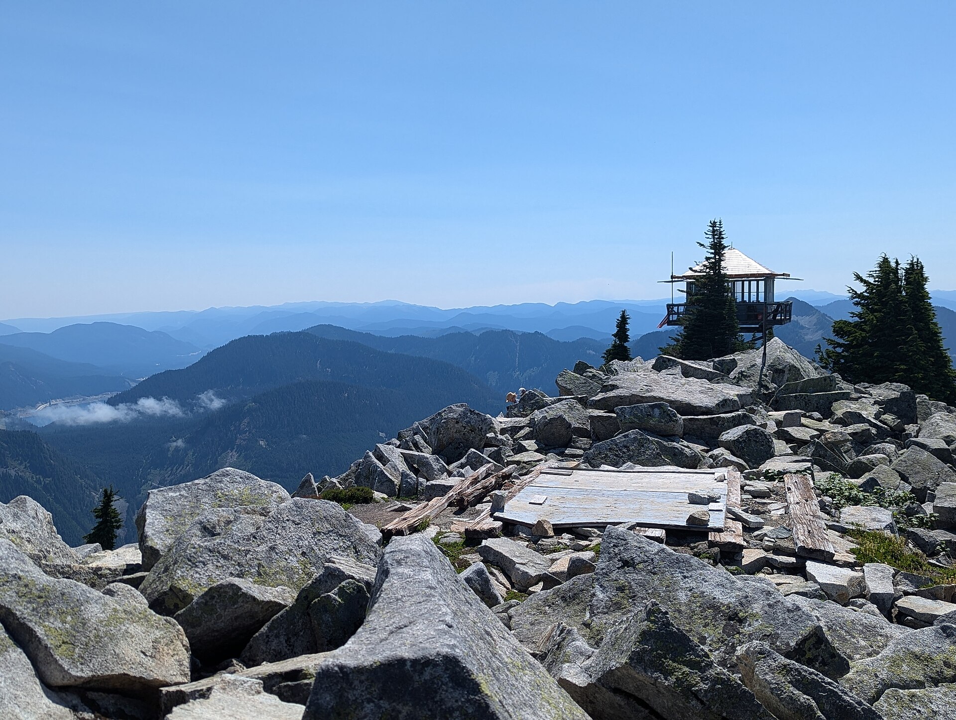
The lookout sits on the rocks at 1,716 m. A D-6 cupola cabin was built here in 1924, making it one of the earliest Forest Service lookouts in the region, and it served as an aircraft warning post in the Second World War. The present structure is a 3 m L-4 tower dating from the mid-1950s (sources give 1955 or 1956), and it is listed on the National Historic Lookout Register. It remains one of the last operational lookout towers in the forest, staffed by volunteers from June to September; visitors are welcome inside during the day when it is open, though it should not be counted on.
The view is the point. Mount Rainier dominates the southern sky. Mount Baker may be visible far to the north on clear days, Mount Stuart and the Teanaway to the east, and immediately around are the pointed summit of Kaleetan Peak, the deep blue of Crystal Lake, and The Tooth.
Why it is essential
This is the summit day of the I-90 corridor: the biggest continuous climb, the best panorama, and a working fire lookout at the top of it. Where Mount Si offers a view of the lowlands and Snow Lake offers a view of a cirque, Granite Mountain offers a view of the entire range — and it earns it, with 1,158 m of ascent packed into a trail that gives almost nothing away.
Equipment
- Sturdy boots and trekking poles — the descent is punishing
- 3–4 L water in hot weather. There is no reliable water on the upper trail and none at the lookout. The upper mountain is south-facing, open and rocky, and it gets genuinely hot
- Sun protection — the top half of the climb has no shade at all
- Weatherproof shell and a warm layer; the summit is a bare rock perch with no shelter
- Map and downloaded GPS track
- Microspikes and avalanche awareness if attempting outside high summer — or, better, a different objective
Hazards and notes
- Avalanches on this mountain have killed people, and the danger persists into late spring. The Mountaineers state that “avalanches have killed and injured climbers on this mountain in April and May”, and describe a series of chutes running from the summit almost to the highway. WTA is equally direct: the route “crosses an avalanche chute and is extremely dangerous when snow is present”. Fatal avalanches were reported in 2013 and 2014. This is not a shoulder-season walk, and the warm spring day that makes it tempting is exactly the day that makes it dangerous. Check the Northwest Avalanche Center forecast for the Snoqualmie Pass zone.
- The Forest Service notes that snow often obscures the route until late June.
- Heat and dehydration are the summer hazards. Start early, both for the parking and for the shade.
- The summit is fully exposed to lightning; descend if storms build, as the last kilometre has no cover.
- Parking at the Pratt Lake trailhead is limited to roughly 35 vehicles, with overflow along the access road. A Northwest Forest Pass or Interagency pass is required.
- The summit lies inside the Alpine Lakes Wilderness, so a free, self-issued wilderness permit is required from the trailhead box, in addition to the parking pass. Group size is capped at 12. Dogs are permitted on the lead. Camping is not allowed at the lookout or on its deck.
- A forest-wide bear-resistant food storage order is in effect.
GPX / KML links
| Source | URL | Format | Notes |
|---|---|---|---|
| OpenStreetMap — Granite Mountain Trail #1016 | openstreetmap.org | OSM route relation 4794995 | ODbL 1.0 — reusable with attribution and share-alike. The only verified licence-compatible geometry |
| Waymarked Trails — relation 4794995 | hiking.waymarkedtrails.org | GPX export via the site UI | Renders the OSM relation above (ODbL) |
| USFS — Granite Mountain Trail #1016 | fs.usda.gov | Official page | No official GPX. Note the page misstates the summit elevation |
| Washington Trails Association — Granite Mountain | wta.org | Trail description | No GPX download offered |
Trailhead coordinates: 47.3978, −121.4865 (OSM, corroborated by WTA). Granite Mountain lookout: 47.4177, −121.4814 (OSM, from USGS data).
Sources
- Washington Trails Association — Granite Mountain
- USFS Mt. Baker-Snoqualmie — Granite Mountain Trail #1016
- USFS Mt. Baker-Snoqualmie — Granite Mountain Lookout
- The Mountaineers — Granite Mountain Trail
- Snoqualmie Fire Lookouts Association — Granite Mountain Lookout
- Northwest Avalanche Center
5. Denny Creek to Melakwa Lake
Snapshot
Itinerary
The Denny Creek Trail #1014 starts in old-growth forest, crosses Denny Creek on a log bridge, and then does something no other trail in this catalogue does: it passes directly beneath the elevated westbound deck of Interstate 90, with freeway traffic thundering overhead on concrete piers. A few hundred metres later it enters the Alpine Lakes Wilderness, and the noise falls away.
At about 1.6 km the trail crosses Denny Creek a second time — and this crossing is an unbridged ford. The bridge that stood here was destroyed by avalanche debris in 2009 and has not been replaced. This is also the site of the Denny Creek waterslide: broad slabs of exposed bedrock over which the creek runs in a series of chutes and pools. In high summer it is one of the most popular family swimming spots in the Cascades, and the Forest Service’s warning is unambiguous — be prepared to turn around here during high water from spring snowmelt.
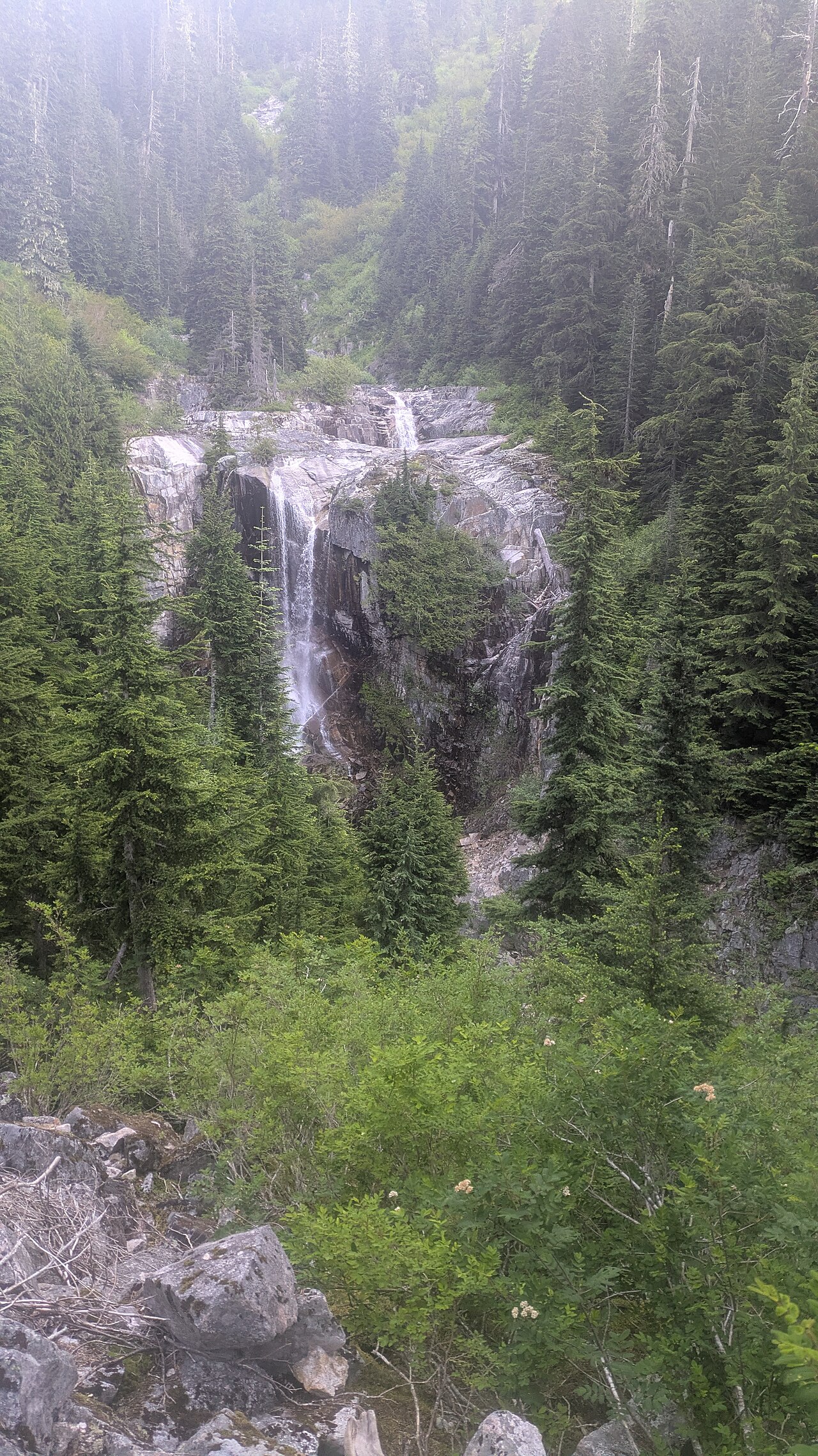
Beyond the slabs the trail climbs to Keekwulee Falls, which drops in two tiers of roughly 27 m and 11 m into a ravine, and then Snowshoe Falls further on. Switchbacks lead up through alternating talus and forest to Hemlock Pass at 1,402 m — the high point — after which the trail descends about 30 m over the final 600 m to the lake.
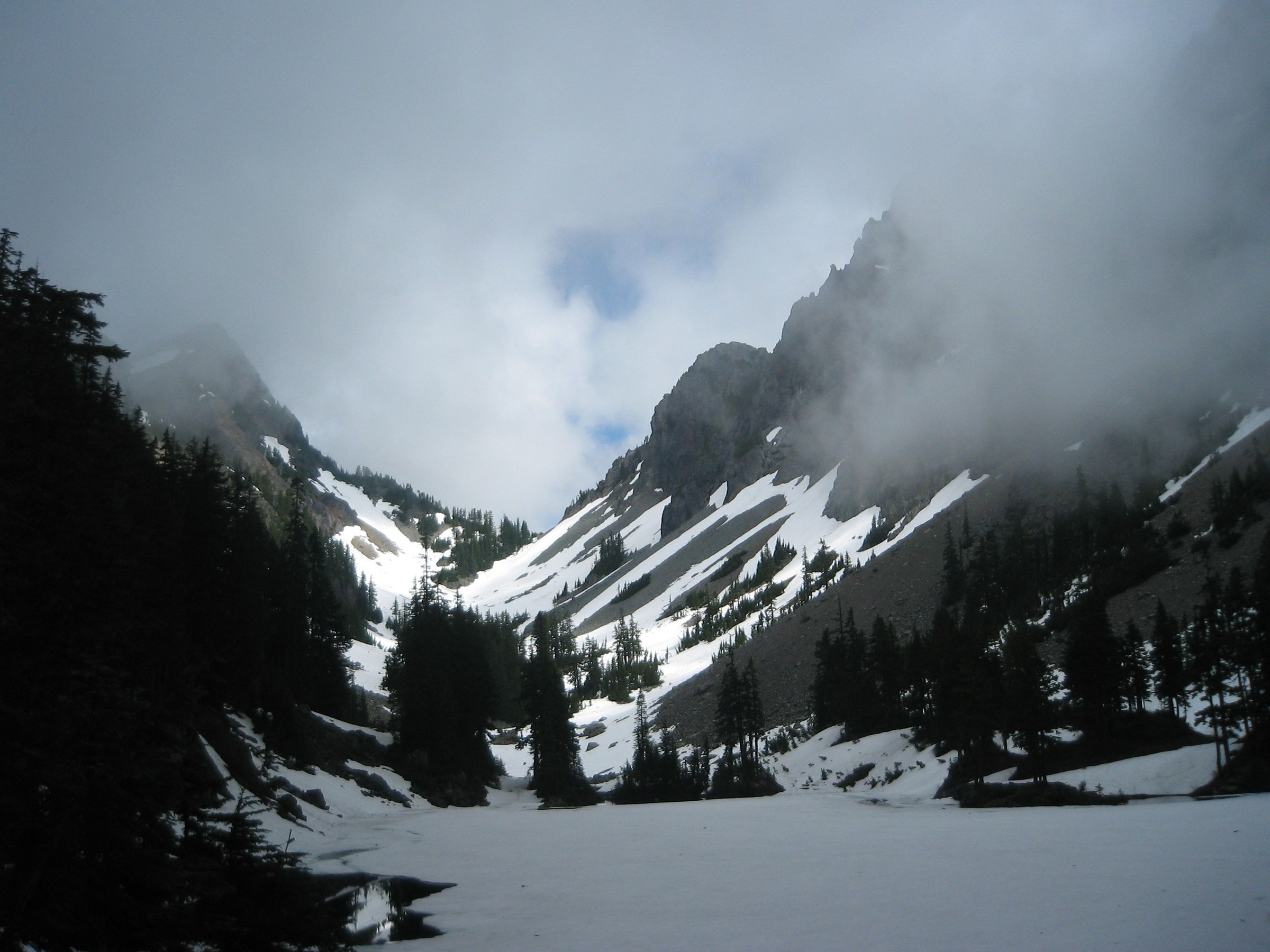
Melakwa Lake sits at 1,373 m in a narrow rock basin, with Kaleetan Peak (1,908 m) to the west and Chair Peak (1,902 m) to the east, and a substantial logjam across its outlet. Upper Melakwa Lake lies about 300 m further on, and Melakwa Pass beyond that.
Why it is essential — and the history it carries
This is the corridor’s waterfall-and-pass route, and the one that best shows how thoroughly human infrastructure and wild country are interleaved at Snoqualmie Pass: the walk starts under a motorway viaduct and finishes in a wilderness rock basin.
It also carries the region’s history. The road to the trailhead — Forest Road 58 — follows the corridor of the Snoqualmie Pass Wagon Road. Seattle residents subscribed $2,500 in 1865 to build a road from Rangers Prairie, the future North Bend, over the pass; the survey party included Arthur Denny, one of Seattle’s founders. Six wagons crossed during construction that year, and on 7 October 1867 the Seattle Weekly Intelligencer announced the road complete from Seattle to Ellensburg. It became a toll road in 1884 — $25 for a year, or $40 for a lifetime pass — and was made obsolete almost immediately, when the Northern Pacific Railway opened its line over Stampede Pass in 1887 and travellers took the train instead. The corridor was absorbed into the Sunset Highway in 1915, and the interstate followed.
About a mile of the original wagon road survives, marked and preserved as Wagon Road Trail #1021, with old wagon ruts still visible; it joins the Franklin Falls Trail #1036 and can be walked as a two-mile loop from the same road, mostly through old growth. Franklin Falls itself is a 3.2 km round trip with 120 m of ascent, and its first 150 m are wheelchair-accessible. The Denny Creek Campground nearby is one of the oldest Forest Service campgrounds in the forest.
The lake names are Chinook Jargon, the trade language of the nineteenth-century Pacific Northwest — a pidgin drawing on Chinookan, Nuu-chah-nulth, French and English. Melakwa means mosquito (via the French maringouin), which is a warning rather than a decoration. Keekwulee is best understood as low, below, under, down — it is often loosely rendered as “falling”, but the better-sourced meaning is the former. It is worth being clear that these are settler-applied names drawn from a trade jargon — Keekwulee Falls was named by hikers from The Mountaineers club in 1916 — and not original Indigenous place names.
Equipment
- Sturdy boots
- Water shoes or sandals for the unbridged ford at the waterslide — WTA recommends them explicitly
- Trekking poles, genuinely useful for the crossing
- Insect repellent. The lake is named for its mosquitoes
- Weatherproof shell and a warm layer
- 2–3 L water; no potable water at the trailhead
- Map and downloaded GPS track
- Microspikes for early-season snow on the switchbacks and at Hemlock Pass
Hazards and notes
- The unbridged ford at the waterslide is the hazard of this trail, and it is aggravated by the crowds it attracts. The Forest Service says to be prepared to turn around there during high water from spring snowmelt. WTA warns that “the swift and ever-changing current and the water’s frigid temperatures can be dangerous”, that levels can rise quickly, and that the slabs are impassable in high water. The compounding risk is the setting: polished wet granite, cold fast snowmelt, large family crowds and small children, at precisely the time of year when the creek is still running hard.
- The first crossing, near the trailhead, is bridged. The second, at the slabs, is not. The distinction matters.
- The vault toilet at the Denny Creek trailhead is permanently closed. The nearest is at the Franklin Falls trailhead.
- Parking is limited and this is one of the most oversubscribed trailheads on the corridor; overflow stretches down FR 58 and adds real distance to the day.
- A Northwest Forest Pass or Interagency pass is required ($5 day fee otherwise). A Washington State Discover Pass is not accepted.
- A free, self-issued Alpine Lakes Wilderness permit is required for day use from 15 May to 31 October.
- Dogs are permitted on the lead. The trail is closed to bicycles, stock and motor vehicles.
- No active Forest Service alert for Forest Road 58 was published at the time of writing — but note that the absence of an alert is not evidence that the road is undamaged. The December 2025 storms hit King County hard. Confirm with the Snoqualmie Ranger District before travelling.
- A trap worth flagging: WTA’s Denny Creek page lists trailhead coordinates that actually point to the Franklin Falls trailhead, about 500 m away. Use the coordinates below.
GPX / KML links
| Source | URL | Format | Notes |
|---|---|---|---|
| OpenStreetMap — Denny Creek Trail #1014 | openstreetmap.org | OSM route relation 4793593 | ODbL 1.0 — reusable with attribution and share-alike. The only verified licence-compatible geometry |
| OpenStreetMap — Melakwa Lake Trail #1011 | openstreetmap.org | OSM route relation 4793592 | ODbL 1.0 — the onward trail from the lake |
| Waymarked Trails — relation 4793593 | hiking.waymarkedtrails.org | GPX export via the site UI | Renders the OSM relation above (ODbL) |
| USFS — Denny Creek Trail #1014 | fs.usda.gov | Official page | No official GPX, and no distance or gain figures published |
Trailhead coordinates: 47.4152, −121.4434 (OSM, corroborated by WTA’s Melakwa Lake page). Melakwa Lake: 47.4503, −121.4690. Hemlock Pass: 47.4445, −121.4679. Franklin Falls: 47.4250, −121.4329.
Sources
- Washington Trails Association — Melakwa Lake
- Washington Trails Association — Denny Creek
- USFS Mt. Baker-Snoqualmie — Denny Creek Trail #1014
- USFS Mt. Baker-Snoqualmie — Wagon Road Trail #1021
- HistoryLink — Snoqualmie Pass wagon road
- HistoryLink — Seattle and Walla Walla Trail and Wagon Road Company
- Wikipedia — Melakwa Lake
- Wikipedia — Keekwulee Falls
Missing data / follow-up work
- No official GPX exists for any Forest Service trail in this article. The USFS publishes no downloadable tracks and WTA offers none. The PCTA’s Pacific Crest Trail data (CC BY 4.0) is the only cleanly licensed official route file; everything else must be derived from OpenStreetMap under ODbL. Mount Si has no OSM route relation at all — only individual ways.
- The Forest Service publishes no distance or elevation figures for the Snow Lake, Granite Mountain or Denny Creek trails. All statistics come from WTA and other secondary sources, and the ranges given reflect genuine disagreement.
- The USFS Granite Mountain Trail page contains an error, describing the summit as “nearly 3,800 feet” — that is the elevation gain; the summit is 5,629 ft.
- No authoritative source publishes a width for the Kendall Katwalk, or the height of the drop below it. Figures circulating online come from content-farm sites. They are deliberately omitted here rather than guessed.
- No walking-time estimate is published by any authoritative source for any hike in this article. The times given are derived from distance and ascent and are labelled as such.
- The Granite Mountain lookout’s construction date is contested — the Forest Service and the National Historic Lookout Register say 1955; the Snoqualmie Fire Lookouts Association and The Mountaineers say 1956. Its 2026 staffing and renovation status could not be confirmed.
- Camping and campfire specifics at Snow Lake and Melakwa Lake could not be confirmed from an official source in this pass. Check with the Snoqualmie Ranger District, (425) 888-1421.
- Mount Si’s trailhead elevation is not published by any source, and the widely repeated claim that it is “the most-climbed mountain in Washington” could not be traced to an authoritative source — it is therefore not asserted here. Its reputation as a training climb for Rainier and Everest is likewise unsourced.
- The Denny Creek waterslide is not represented on Wikimedia Commons. Despite being the trail’s most photographed feature, a search returned no openly licensed image. A Flickr Creative Commons search is the obvious next step.
- No licence-compatible close-up of the Mount Si Haystack was found. The best Commons image is a panorama taken from it, not of it.
- Forest Road 58 (Denny Creek) condition is unconfirmed. A previously published closure alert now returns a 404 and the road is absent from the live alerts list — which shows only that no alert is currently published, not that the road is undamaged.
- Public transport is a moving target. Trailhead Direct’s 2026 season runs 23 May to 30 August and serves only Mount Si, Little Si, Mount Teneriffe and the Issaquah Alps. The private “To The Mountain Shuttle”, which formerly ran to Snoqualmie Pass, appears to have ceased trading — its domain now redirects to an unrelated retailer. Verify before publication.
- Strong alternates not included in the five. Mailbox Peak (a notoriously brutal climb, and a major SAR generator); Rattlesnake Ledge (short, crowded, and the classic valley viewpoint); Mount Defiance via the Ira Spring Trail, taking in Mason Lake; and Rachel Lake and Rampart Ridge on the eastern side of the pass. Each merits a full entry in a future pass.
Further reading
| Source | URL |
|---|---|
| USFS Mt. Baker-Snoqualmie — Alpine Lakes Wilderness | fs.usda.gov |
| USFS Mt. Baker-Snoqualmie — wilderness regulations | fs.usda.gov |
| USFS Mt. Baker-Snoqualmie — alerts and closures | fs.usda.gov |
| Washington State DNR — Mount Si NRCA | dnr.wa.gov |
| Washington State Discover Pass | discoverpass.wa.gov |
| Trailhead Direct — seasonal hiker shuttle from Seattle | trailheaddirect.org |
| Northwest Avalanche Center — Snoqualmie Pass forecast | nwac.us |
| Washington Trails Association — trail database | wta.org |
| Pacific Crest Trail Association — official PCT data (CC BY 4.0) | pcta.org |
| HistoryLink — Snoqualmie Pass wagon road | historylink.org |
| Waymarked Trails — hiking routes (OSM) | hiking.waymarkedtrails.org |