Regional overview
The Three Sisters and Bend region sits on the east side of the Oregon Cascade crest, where the high stratovolcano line of the Cascade Range — running south from Mount Hood and the Mount Jefferson / Three Fingered Jack sector — meets the pumice plains and ponderosa-pine forests of the central Oregon high desert. The principal hiking centres are Bend itself, the Cascade Lakes Highway corridor (Mount Bachelor, Devils Lake, Sparks Lake, Elk Lake, Cultus Lake), Sisters, and the Smith Rock canyon north-east of Redmond. Elevations on the routes below range from roughly 2,800 ft (850 m) in the Crooked River canyon at Smith Rock to 10,358 ft (3,157 m) on the summit of South Sister, the third-highest peak in Oregon.
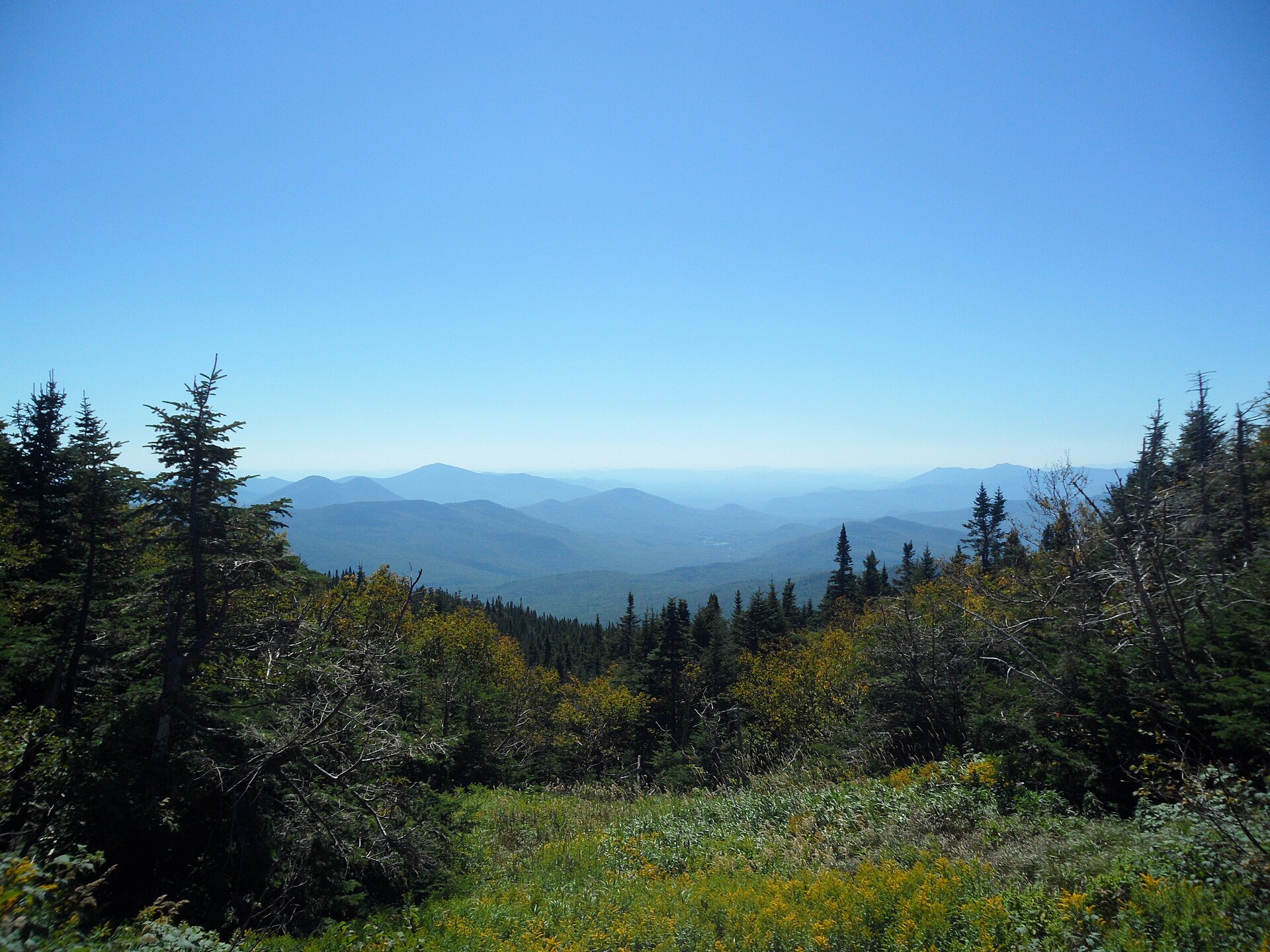
The walking divides into three distinct sub-environments. The high alpine objectives — South Sister, the Green Lakes basin between South Sister and Broken Top, and the rim country above Three Creek Lake — lie inside the Three Sisters Wilderness and are managed by the Deschutes and Willamette National Forests. The mid-elevation Bend volcanic foreground — Tumalo Mountain and the Cascade Lakes viewpoints — is reached directly from Cascade Lakes Highway near Mount Bachelor. The non-alpine end of the region is the Crooked River canyon at Smith Rock State Park, an isolated block of welded volcanic tuff that is one of the birthplaces of American sport climbing and the only Oregon State Park in the selection.
The standard hiking season runs roughly mid-June to mid-October, but two formal access rules shape the trip planning. From 15 June to 15 October the Central Cascades Wilderness Permit is required for day use on most trailheads inside the Three Sisters, Mount Jefferson and Mount Washington Wilderness areas — including South Sister, Green Lakes and the Tam McArthur Rim trailheads. Permits are issued via Recreation.gov on a daily quota and sell out for popular summer dates. Smith Rock sits outside the wilderness system but requires an Oregon State Parks day-use parking permit. Independent of permits, the Deschutes National Forest enforces seasonal raptor closures on some Smith Rock walls between January and August, and afternoon thunderstorms, lingering snow on north-facing slopes into July, and very hot mid-summer days at low elevation are recurring safety factors.
Selection rationale
The five hikes below were chosen to give a balanced cross-section of the region — one major volcano summit, one signature alpine-lake basin, one easy-access high rim, one short high-reward Bend summit, and the iconic non-alpine canyon loop:
- South Sister Climber Trail — Oregon’s most famous non-technical big-volcano day climb and the only summit in the catalogue above 10,000 ft.
- Green Lakes Trail — the signature lake-basin hike of the Bend side of the Three Sisters, between South Sister and Broken Top.
- Tam McArthur Rim Trail — the best moderate high-rim viewpoint hike in the Sisters area, with direct sightlines onto Broken Top and the Three Sisters.
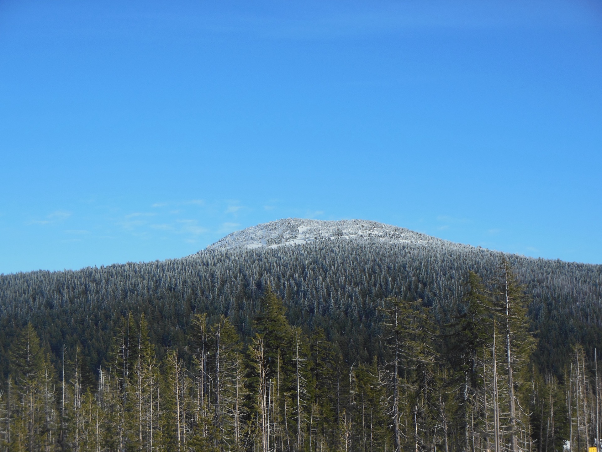
- Tumalo Mountain Trail — a short, steep Cascade Lakes summit that gives the biggest panoramic return for the smallest day.
- Misery Ridge and River Trail — the Smith Rock loop, the defining non-alpine Bend-area walk and a key piece of Oregon climbing geography.
The Broken Top crater rim and the Chush Falls / Whychus Creek loop were strongly considered. Broken Top was set aside because the long approach road and informal scramble onto the rim sit at the edge of the day-hike category; Chush Falls was set aside in favour of Tam McArthur Rim, which represents the same trailhead corridor with a more iconic view.
Summary table
| # | Hike | Sub-region | Route type | Distance | Gain | Max elevation | Difficulty |
|---|---|---|---|---|---|---|---|
| 1 | South Sister Climber Trail | Three Sisters Wilderness / Devils Lake | Out-and-back | 20.0 km | 1,535 m | 3,155 m | Hard |
| 2 | Green Lakes Trail | Three Sisters Wilderness / Cascade Lakes | Out-and-back | 15.0 km | 359 m | 2,004 m | Moderate |
| 3 | Tam McArthur Rim Trail | Three Sisters Wilderness / Three Creek Lake | Out-and-back | 8.7 km | 382 m | 2,358 m | Moderate |
| 4 | Tumalo Mountain Trail | Cascade Lakes / Mount Bachelor | Out-and-back | 6.6 km | 434 m | 2,371 m | Hard (short and steep) |
| 5 | Misery Ridge and River Trail | Smith Rock State Park | Loop | 5.8 km | 279 m | 1,006 m | Hard (steep, exposed) |
1. South Sister Climber Trail
Snapshot
Itinerary
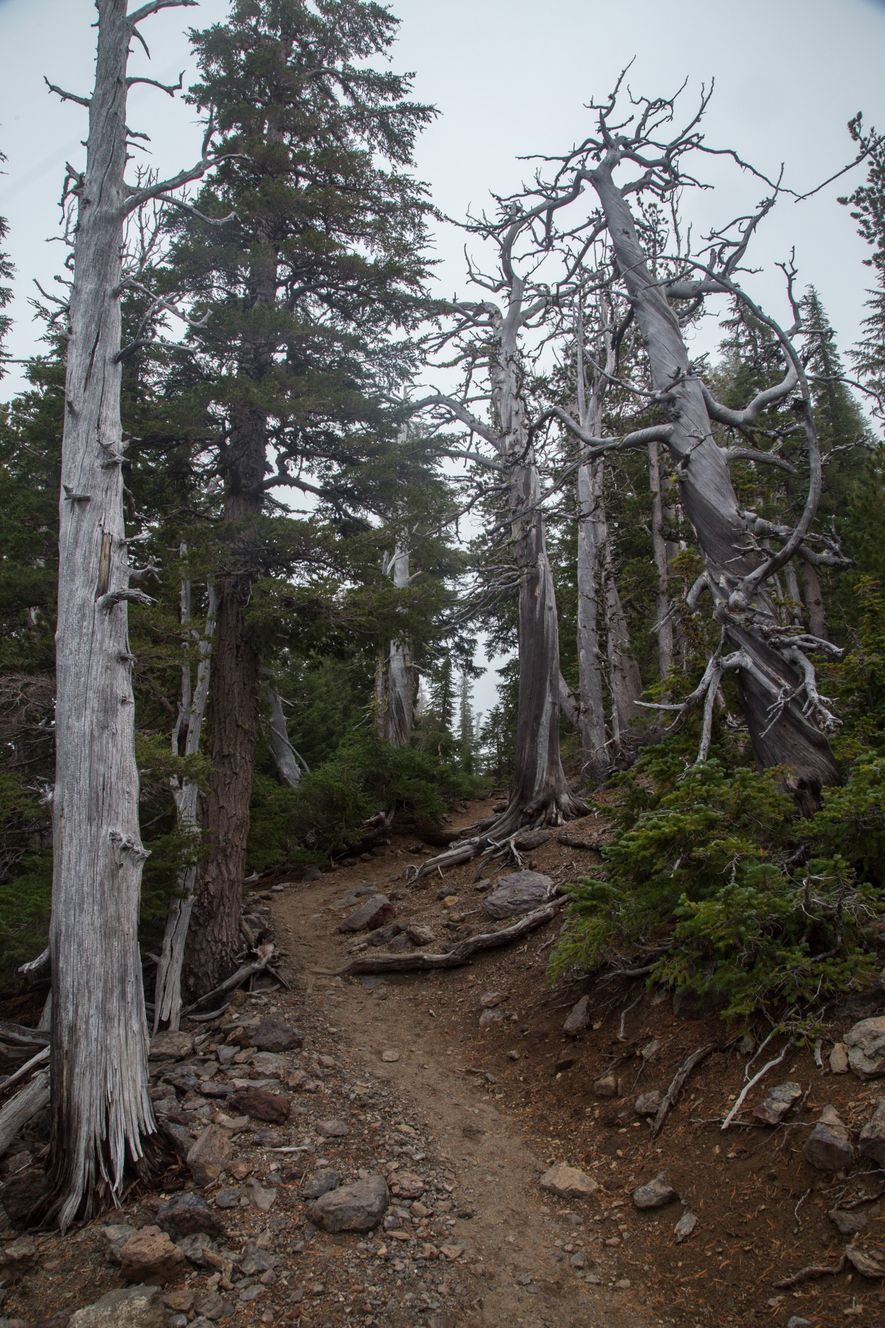
From the Devils Lake / South Sister Trailhead on Cascade Lakes Highway, the route crosses the highway and climbs steeply through old-growth mountain hemlock for the first 1.5 miles. Above the forest the trail emerges onto the broad pumice bench between Devils Lake and Moraine Lake, with the south face of South Sister directly ahead. The grade eases briefly here before the climb proper begins on the long volcanic ridge above Moraine Lake. The trail follows the ridge for roughly 3 miles of loose pumice and scoria, gaining altitude steadily and crossing a small permanent snowfield at about 9,200 ft (2,800 m).
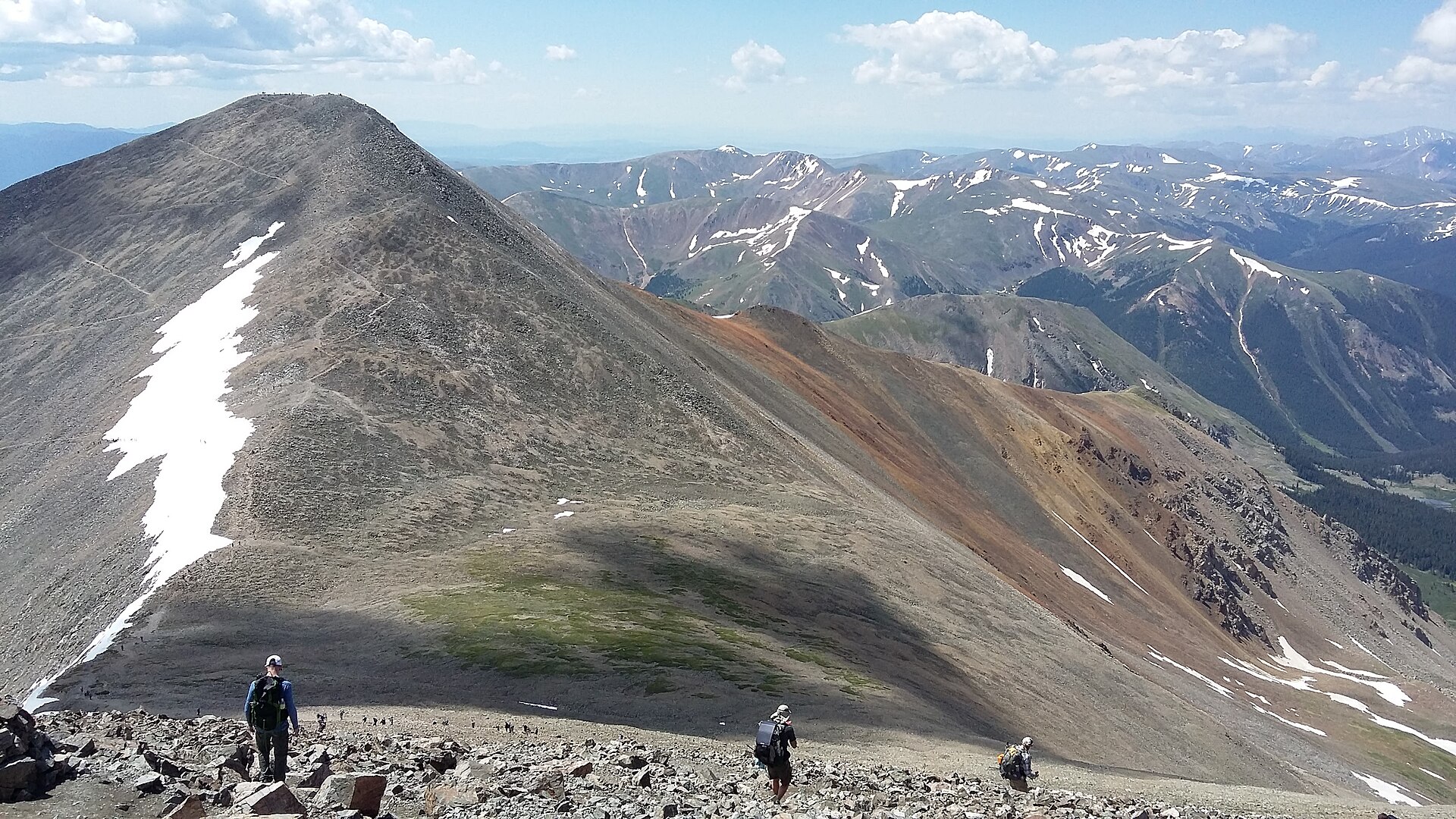
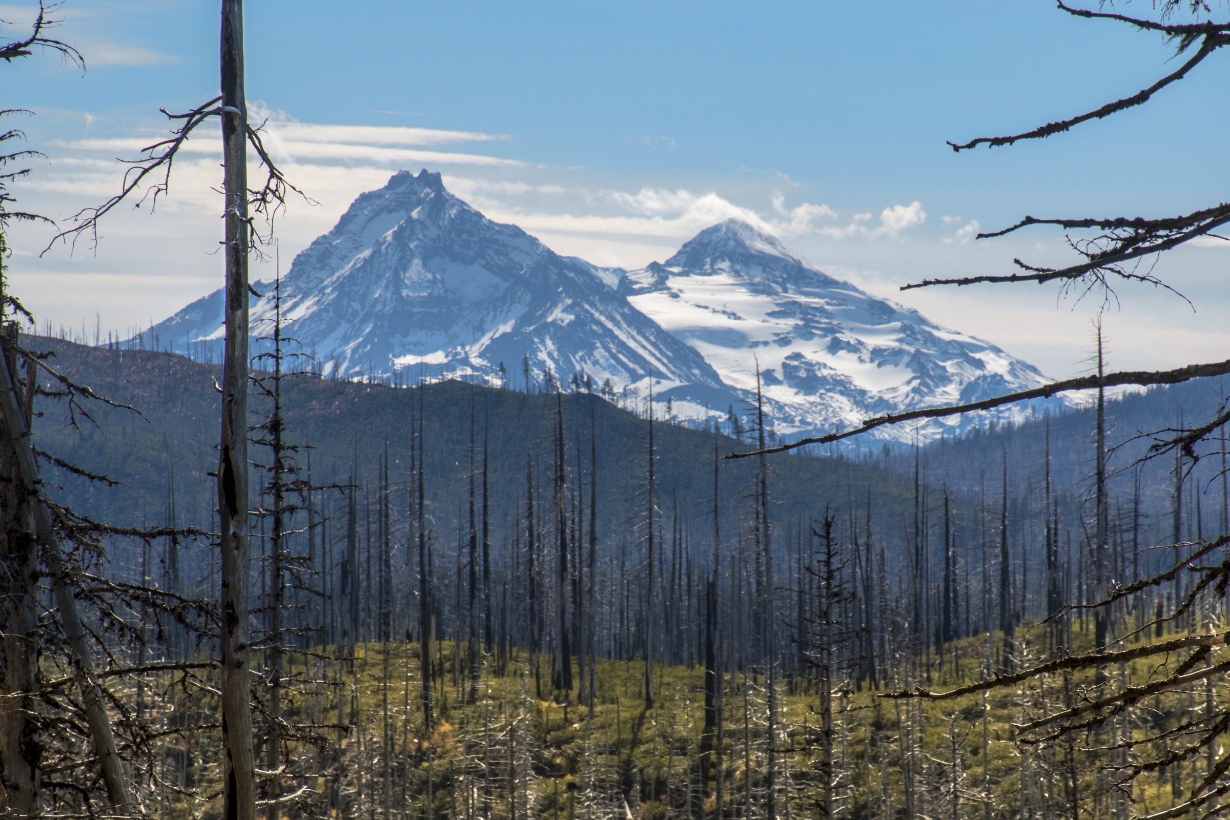
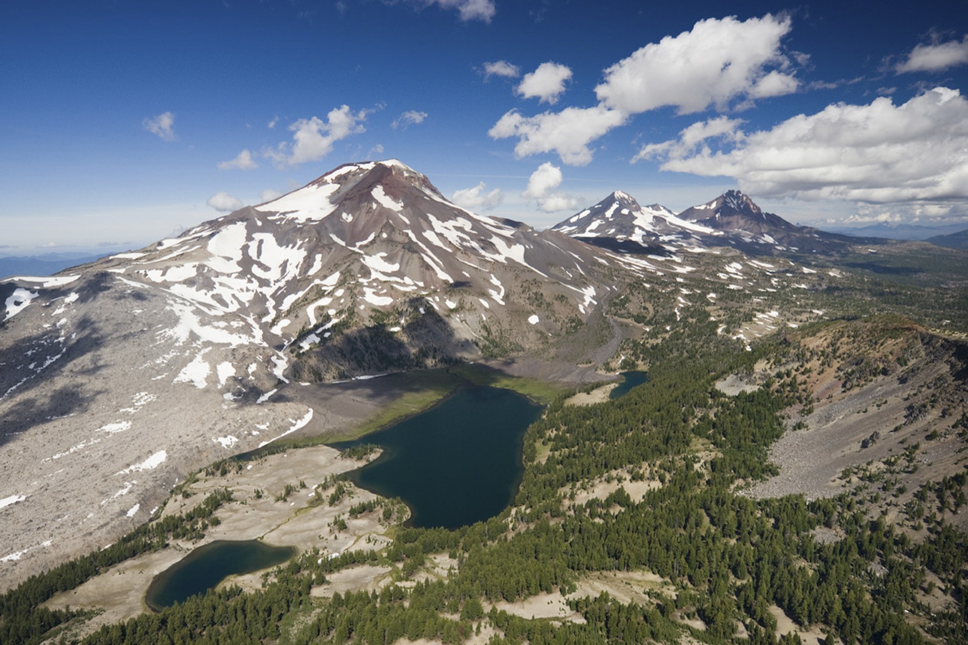
Above the snowfield the route reaches the crater rim near 10,000 ft (3,050 m), traverses the western rim past the small crater lake (Teardrop Pool, the highest lake in Oregon), and finishes on the true summit on the north side at 10,358 ft (3,157 m). On a clear day the view spans the rest of the Cascade volcanic line — Middle and North Sister and Mount Jefferson immediately north, Broken Top and Mount Bachelor south, and Mount Adams, Mount St Helens, Mount Hood and Diamond Peak on the wider horizon. Return is by the same route; descents in loose pumice can be hard on knees and ankles and typically take 3–4 hours.
Why it is essential
South Sister is the easiest of the major Cascade stratovolcanoes to climb without technical mountaineering equipment in normal summer conditions. It is the only Oregon Cascade peak above 10,000 ft accessible as a long day walk and is consistently cited by the U.S. Forest Service and by regional guidebooks as the defining big-volcano objective in the Three Sisters Wilderness. The combination of trailhead access from a paved highway, the iconic Moraine Lake / Devils Lake foreground, the crater rim and the summit panorama makes it the single hike that best represents the upper-elevation alpine character of the catalogue.
Equipment
- Mountain hiking boots; gaiters useful in loose scoria.
- Trekking poles strongly recommended for the descent.
- Layered clothing including warm and windproof shell — the summit is often 15–20°C cooler than the trailhead.
- 3–4 litres of water (no reliable on-route water above Moraine Lake).
- Sun protection, including glasses and brimmed hat — most of the upper route is fully exposed.
- Microspikes and an ice axe if significant snow remains on the upper ridge, particularly in June or after early-autumn storms.
- Headtorch for any long day or early start.
Hazards and notes
- The climb is altitude-significant for unacclimatised hikers; the summit at 3,157 m is the highest point most regional hikers will reach in a day.
- Loose pumice is the main day-to-day hazard — sprains, slips and dust ingress are routine.
- Lightning is the main objective hazard on summer afternoons; turn back if storms develop. There is no shelter above the forest.
- Snow can linger on the upper ridge well into July; verglas can return any time after mid-September.
- No fires, no camping in the climbers’ route corridor near the summit, and Leave No Trace practice is enforced.
- A Central Cascades Wilderness Permit is required from 15 June to 15 October and quotas sell out — book in advance on Recreation.gov.
GPX / KML links
| Source | URL | Format / access | Reuse status |
|---|---|---|---|
| Deschutes National Forest — Devils Lake / South Sister Trailhead | fs.usda.gov | Web reference (no GPX) | US federal work — reusable |
| OpenStreetMap — South Sister Climber Trail ways | openstreetmap.org | OSM XML / GPX export | ODbL; reusable with OSM attribution |
| AllTrails — South Sister Trail | alltrails.com | Web view; GPX behind paywall | Proprietary; cross-check only |
Further reading
- Deschutes National Forest — Devils Lake / South Sister Trailhead
- Central Cascades Wilderness Permits
- Wikipedia — South Sister (Oregon)
2. Green Lakes Trail
Snapshot
Itinerary
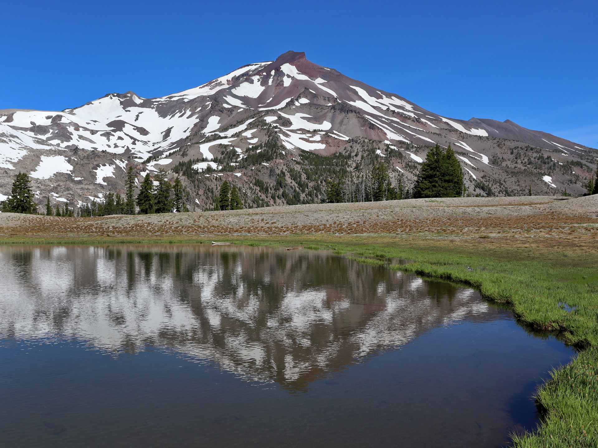
From the Green Lakes / Fall Creek Trailhead on Cascade Lakes Highway the trail follows Fall Creek upstream on a moderate grade, passing a sequence of small cascades and pools in the first two miles. The route stays in mature mountain hemlock and lodgepole pine forest until roughly the halfway point, when the canopy opens onto subalpine meadows below South Sister’s eastern flank. The trail then climbs more gently into the upper basin and arrives at the three Green Lakes, set in a glacial cirque between South Sister to the west and Broken Top to the east.
The basin makes a natural turnaround and lunch spot, with the option to add a short exploration of the lakeshore loop and the unnamed pond at the head of the basin. Strong parties sometimes continue across the basin onto the Broken Top Trail or scramble onto the lower south-east shoulder of South Sister, both of which are outside the scope of this route. Return is by the same approach trail.
Why it is essential
Green Lakes is the most-walked alpine objective on the Bend side of the Three Sisters and is consistently described by the Deschutes National Forest as one of the signature lake-basin destinations of the wilderness. The combination of a low-stress trailhead, a creek-side approach, classic glacial cirque scenery and direct sightlines onto both South Sister and Broken Top make it the natural mid-difficulty hike of the catalogue. It complements South Sister by representing the lake basin rather than the summit.
Equipment
- Trail shoes or light boots; the trail is well-graded and mostly free of loose rock below the basin.
- Insect protection — mosquitoes can be heavy in June and early July.
- Water filter or bottle; on-route water plentiful in season.
- Layered clothing including a warm layer for the basin.
- Sun protection for the open meadows.
- Headtorch as a backup for late-summer days.
Hazards and notes
- The trailhead and basin can be crowded in peak summer; mid-week or early-morning starts are recommended.
- Mosquitoes are intense in early summer; deet or a head net is often needed.
- Snow patches and stream crossings can persist into early July, particularly on the upper section.
- Fragile lake-shore meadows — stay on durable surfaces and do not camp within the day-use corridor.
- A Central Cascades Wilderness Permit is required for day use from 15 June to 15 October.
GPX / KML links
| Source | URL | Format / access | Reuse status |
|---|---|---|---|
| Central Cascades Wilderness Permits — Willamette National Forest | fs.usda.gov | Web reference (no GPX) | US federal work — reusable |
| OpenStreetMap — Green Lakes Trail ways | openstreetmap.org | OSM XML / GPX export | ODbL; reusable with OSM attribution |
| AllTrails — Green Lakes Trail | alltrails.com | Web view; GPX behind paywall | Proprietary; cross-check only |
Further reading
3. Tam McArthur Rim Trail
Snapshot
Itinerary
From the Tam McArthur Rim Trailhead at Three Creek Lake (Forest Road 16 from the town of Sisters) the trail climbs through a stand of mountain hemlock for the first half-mile, then turns onto a long traverse up the south flank of the rim. The grade is sustained but not steep, and the route emerges from the trees onto open pumice and lava at roughly the halfway point.
Above treeline the path follows the broad rim westward over open volcanic ground, with progressively expanding views of Broken Top directly across the basin and the Three Sisters volcanic line on the western horizon. The main rim viewpoint at about 2.5 miles is the natural turnaround. Strong parties continue along the rim toward Broken Hand (an additional 2.5 miles each way) for closer views over the Broken Top moraines; this extension turns the route into a long day. Return is by the same trail.
Why it is essential
Tam McArthur Rim is the best moderate-grade high-rim hike on the eastern side of the Three Sisters and is the standard recommendation in the Sisters area for parties who want a high panoramic objective without the commitment of a major summit. The combination of an open volcanic rim, direct sightlines onto Broken Top and the Sisters, and reasonable distance and gain make it the natural companion to the South Sister climb and the Green Lakes basin route.
Equipment
- Trail shoes or light boots.
- Wind layer — the rim is fully exposed.
- Sun protection, hat and sunglasses.
- 1.5–2 litres of water (no on-route water above the trailhead).
- Trekking poles useful but optional.
Hazards and notes
- The rim has exposed drops; supervise children and dogs.
- Lightning is the main objective hazard on summer afternoons; the rim has no shelter.
- Snow patches and cornices can persist into early July on north-facing aspects.
- Mosquitoes can be intense near Three Creek Lake in early summer.
- Forest Road 16 is paved most of the way and gravel for the final approach to the trailhead; passenger cars manage it in normal summer conditions.
- A Central Cascades Wilderness Permit is required from 15 June to 15 October.
GPX / KML links
| Source | URL | Format / access | Reuse status |
|---|---|---|---|
| Deschutes National Forest — Tam McArthur Rim Trailhead | fs.usda.gov | Web reference (no GPX) | US federal work — reusable |
| OpenStreetMap — Tam McArthur Trail #4078 | openstreetmap.org | OSM XML / GPX export | ODbL; reusable with OSM attribution |
| AllTrails — Tam McArthur Rim Trail | alltrails.com | Web view; GPX behind paywall | Proprietary; cross-check only |
Further reading
- Deschutes National Forest — Tam McArthur Rim Trailhead
- Central Cascades Wilderness Permits
- Wikipedia — Tam McArthur Rim
4. Tumalo Mountain Trail
Snapshot
Itinerary
The Tumalo Mountain trail leaves the Dutchman Flat parking area on the north side of Cascade Lakes Highway, directly opposite the Mount Bachelor main lodge. It climbs steeply from the start through open lodgepole pine, gaining altitude with almost no flat sections. The route follows a single broad switchback line up the south flank of the mountain, with views opening progressively toward Mount Bachelor across the highway.
About two-thirds of the way up the trail emerges from the canopy into open subalpine ground, with the cone of Tumalo Mountain directly above. The final approach traces the west side of the summit cone on loose volcanic soil, reaching the open summit dome at 7,778 ft (2,371 m). The 360° view spans Mount Bachelor immediately south, Broken Top and the Three Sisters to the west and north-west, and Mount Jefferson on the northern horizon — among the best easy-summit panoramas on the Cascade Lakes corridor. Return is by the same trail.
Why it is essential
Tumalo Mountain delivers the largest panoramic return for the smallest day in the catalogue. It is the standard short-and-steep summit objective from Bend and is regularly cited as the best half-day high-viewpoint hike in the area. It also represents the Cascade Lakes mid-elevation foreground rather than the deep wilderness, complementing the more committed objectives in the Three Sisters Wilderness.
Equipment
- Trail shoes or boots; the trail is dusty and steep but not technical in summer.
- Trekking poles for the descent, which can be hard on knees.
- Wind layer — the summit is fully exposed.
- 1.5 litres of water (no on-route source).
- Sun protection.
- Snowshoes and avalanche-aware skills if attempting the route in winter snow conditions.
Hazards and notes
- Loose volcanic soil on the upper section can be slippery, especially on descent.
- The summit is fully exposed to weather; turn back in storms.
- Dogs are prohibited from the Tumalo Mountain trail between 15 November and 20 April for winter-wildlife protection (verify current rules with the Deschutes National Forest before travelling).
- Cascade Lakes Highway is closed by snow above Mount Bachelor in winter; access from late autumn onward becomes a longer ski tour.
- Trailhead parking can fill on weekends in peak summer.
GPX / KML links
| Source | URL | Format / access | Reuse status |
|---|---|---|---|
| Deschutes National Forest — Cascade Lakes Highway / Mount Bachelor area | fs.usda.gov | Web reference (no GPX) | US federal work — reusable |
| OpenStreetMap — Tumalo Mountain Trail | openstreetmap.org | OSM XML / GPX export | ODbL; reusable with OSM attribution |
| AllTrails — Tumalo Mountain | alltrails.com | Web view; GPX behind paywall | Proprietary; cross-check only |
Further reading
5. Misery Ridge and River Trail
Snapshot
Itinerary
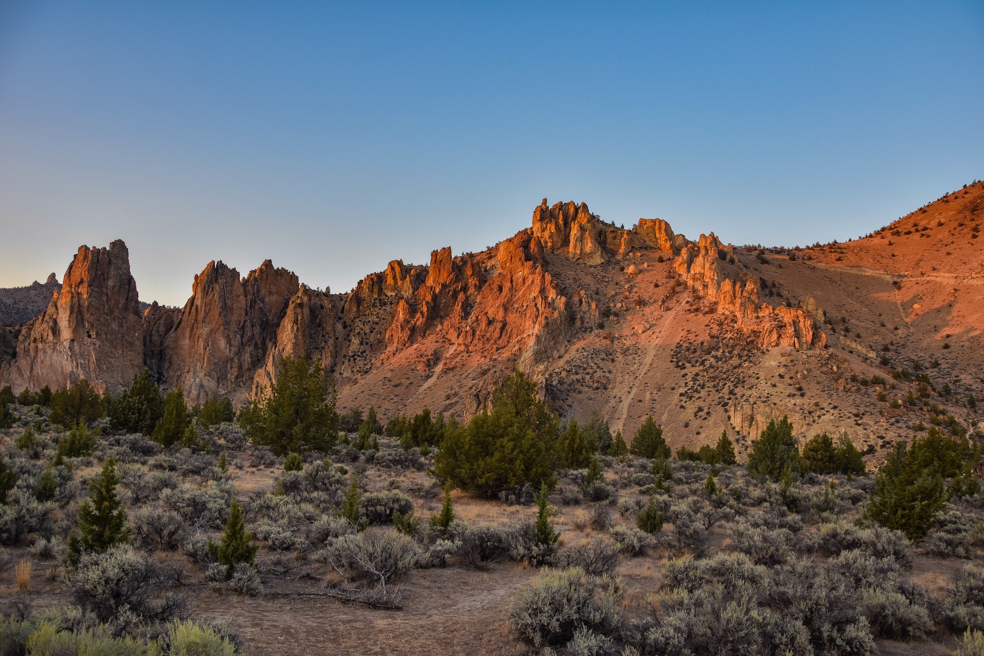
The loop starts at the main day-use area on the rim above Smith Rock, descends a series of switchbacks to the Crooked River footbridge, then turns left for the climb up Misery Ridge — a short, steep, sun-exposed path that gains the canyon rim in about a kilometre. The top of the ridge gives the iconic view down onto Monkey Face, the free-standing welded-tuff tower that is the most photographed climbing landmark in central Oregon, with the Crooked River canyon and the Cascade volcanic line stretching west on a clear day.
From the ridge crest the route descends on the north side, passes the base of Monkey Face on the Mesa Verde / Monkey Face traverse trail, then joins the River Trail at the canyon floor for the return along the Crooked River back to the footbridge. The loop closes with the climb back up to the main day-use parking area. The route is short but unrelenting, with two distinct climbs and minimal flat ground.
Why it is essential
Smith Rock is the defining non-alpine landscape of the Bend region — a deep canyon of welded volcanic tuff, an internationally significant sport-climbing destination since the 1980s, and the only Oregon State Park in the selection. The Misery Ridge / River Trail loop is the standard hiker’s circuit through the canyon: it crosses the Crooked River, climbs to the iconic rim viewpoint over Monkey Face, and returns through the climbing-area floor on the River Trail. It is the obvious counterpoint to the four alpine hikes in this catalogue.
Equipment
- Sturdy shoes with good grip — the climb on Misery Ridge is steep and dusty.
- 2 litres of water in summer; the canyon is hot.
- Sun hat and high-SPF sun protection (no shade on the ridge).
- Light snack — there are no services on the loop.
- Optional trekking poles for the descent.
Hazards and notes
- The Misery Ridge climb is exposed, dusty and very hot in afternoon summer sun — start early or hike in shoulder season.
- The river-trail side of the loop passes directly beneath climbers; watch for falling rock, rope debris and loose holds.
- Rattlesnakes are present in the canyon between roughly April and October.
- Seasonal raptor closures (January–August) apply to several climbing walls; check the Smith Rock State Park page for current alerts.
- Parking can fill by mid-morning on summer weekends; an Oregon State Parks day-use parking permit is required.
- Dogs allowed on leash; bikes prohibited on Misery Ridge.
GPX / KML links
| Source | URL | Format / access | Reuse status |
|---|---|---|---|
| Oregon State Parks — Smith Rock State Park | stateparks.oregon.gov | Park info page and downloadable trail map | Oregon Parks terms; web reference reusable |
| OpenStreetMap — Misery Ridge and River Trails | openstreetmap.org | OSM XML / GPX export | ODbL; reusable with OSM attribution |
| AllTrails — Misery Ridge and River Trail Loop | alltrails.com | Web view; GPX behind paywall | Proprietary; cross-check only |
Further reading
- Oregon State Parks — Smith Rock State Park
- Oregon State Parks — Day-use parking permits
- Wikipedia — Smith Rock State Park
- Wikipedia — Monkey Face (Smith Rock)
Further reading
| Source | URL |
|---|---|
| Deschutes National Forest | fs.usda.gov |
| Willamette National Forest | fs.usda.gov |
| Central Cascades Wilderness Permits | fs.usda.gov |
| Devils Lake / South Sister Trailhead | fs.usda.gov |
| Tam McArthur Rim Trailhead | fs.usda.gov |
| Oregon State Parks — Smith Rock State Park | stateparks.oregon.gov |
| Oregon State Parks — Day-use parking permits | stateparks.oregon.gov |
| Recreation.gov — Central Cascades Wilderness Permits | recreation.gov |
| Wikipedia — Three Sisters Wilderness | en.wikipedia.org |
| Wikipedia — South Sister (Oregon) | en.wikipedia.org |
| Wikipedia — Broken Top | en.wikipedia.org |
| Wikipedia — Smith Rock State Park | en.wikipedia.org |
| Wikimedia Commons — Three Sisters Wilderness category | commons.wikimedia.org |
| Wikimedia Commons — Smith Rock State Park category | commons.wikimedia.org |