Regional overview
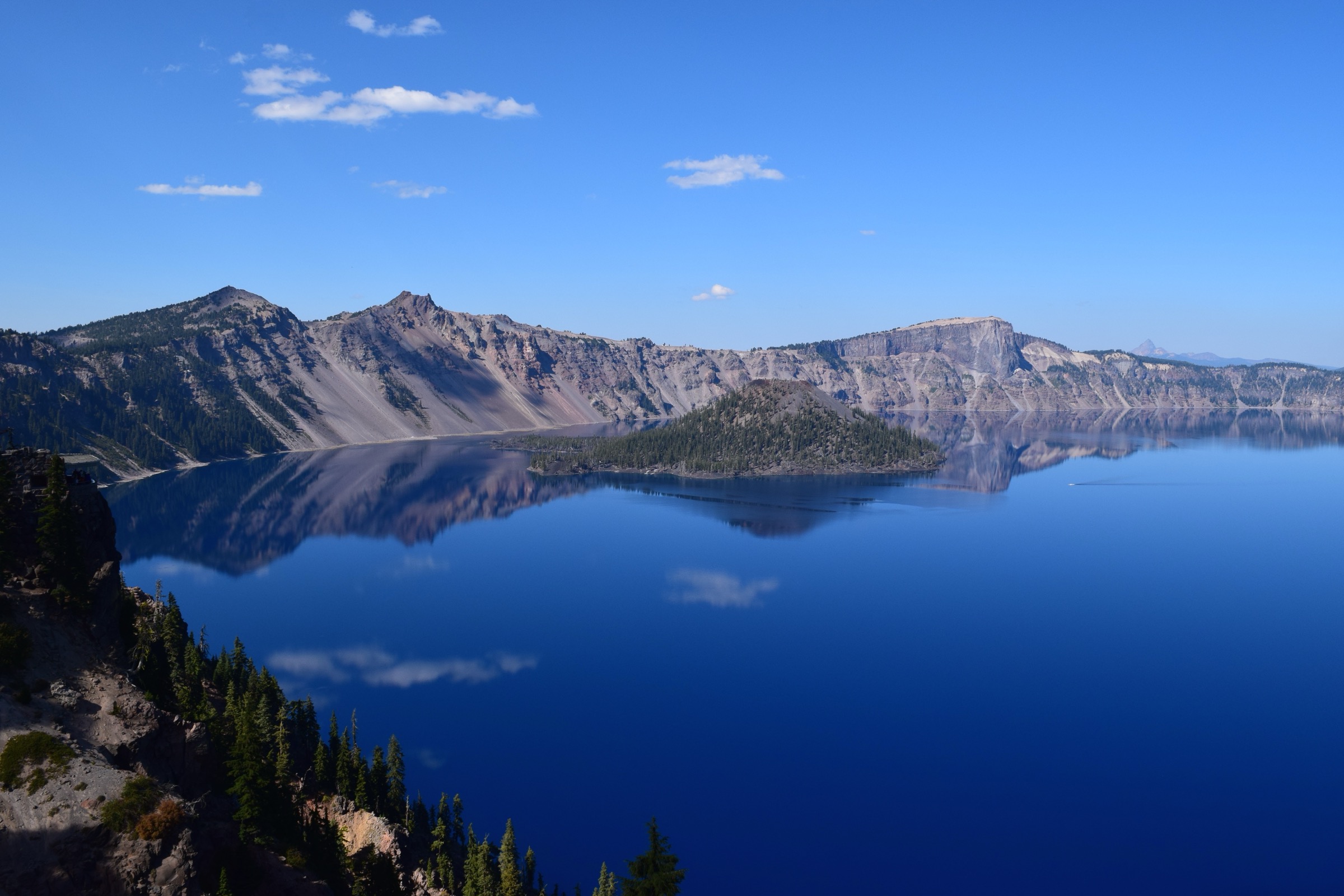
Crater Lake occupies the caldera of Mount Mazama, a collapsed Pleistocene-to-Holocene stratovolcano on the southern spine of the Cascade Volcanic Arc in the Klamath and Jackson county backcountry of southern Oregon. The climactic eruption of Mazama, dated to approximately 7,700 years before present, ejected roughly 50 km³ of magma in one of the largest Holocene eruptions in North America and dropped the pre-eruption 3,300–3,700 m summit into a caldera 8 × 10 km across and around 1,200 m deep. The caldera slowly filled with precipitation and snowmelt to form Crater Lake, whose surface sits at 1,883 m (6,178 ft) and whose bed lies at 594 m (1,949 ft) below the water — the deepest lake in the United States. Crater Lake National Park (established 22 May 1902, the fifth national park in the United States) protects 741 km² around the caldera and its Cascade-crest neighbourhood, and links north into the Southern Oregon Cascades wildernesses — Rogue-Umpqua Divide, Sky Lakes, Mountain Lakes — as one continuous volcanic corridor.
The park’s hiking terrain is organised around three concentric rings: the Rim Drive (a 53 km paved loop that circles the caldera between roughly 2,000 m and 2,500 m and reaches the trailheads for Garfield Peak, The Watchman and Mount Scott), the Pinnacles Road / East Rim spurs (giving Plaikni Falls and Sun Notch), and the Pacific Crest Trail and Union Peak wilderness sections further south. Vegetation banding rises through ponderosa pine and lodgepole pine at the park’s lower boundaries, into a wide mountain-hemlock band around 1,800 m, and up to whitebark pine, Shasta red fir and subalpine fir at the caldera rim and the highest slopes of Mount Scott. Above roughly 2,600 m, pumice, cinder and glacially plucked lava outcrops take over. Weather is characteristically maritime-Cascade — the North Entrance and Rim Drive average more than 12 m of snow a year, closing the loop road from the first heavy snow (typically early November) until it is plowed clear (mid-May to early July depending on the winter).
Access is by private vehicle from Oregon Highway 62 on the south, US Highway 97 on the east (through the Klamath Falls corridor), and Oregon Highway 138 on the north through Diamond Lake. The seasonal Crater Lake Trolley operates two-hour narrated tours of Rim Drive from Rim Village between early July and mid-September, and a seasonal Mazama Village – Rim Village shuttle links the south-side campground to the rim, but no scheduled bus reaches any hiking trailhead directly. Park entrance is by the standard federal fee ($30 per vehicle in summer, $20 in winter, or the America the Beautiful pass), and no day-hiking permit is required. The single largest access constraint for 2026 through 2028 is the Cleetwood Cove Trail and Marina rehabilitation: the only legal access to the lake shore, the boat tours to Wizard Island and Wizard Island itself are all closed to the public until the trail is expected to reopen for the 2029 season. The five hikes below are drawn from the trails that remain open through this closure period.
Selection rationale
The five hikes below trace the caldera from the classic rim summits down to a shaded spring-fed waterfall and out to the south-rim overlook of Phantom Ship, without duplicating character. Garfield Peak is the canonical Rim Village summit hike — a moderate switchback climb from the historic Crater Lake Lodge terrace to a wide caldera panorama with Wizard Island and Phantom Ship both in frame. Mount Scott is the highest point in the park and the only summit from which the entire caldera is visible in one sweep, along with a still-active fire lookout tower (1926). The Watchman is the short, sharp west-rim counterweight to Garfield: a stone-built 1932 lookout on a caldera-rim spatter cone, ideal for evening light onto Wizard Island. Plaikni Falls stands in for the forest-and-water character of the eastern park, a short, near-level walk to a spring-fed cliff cascade in a hemlock stand. Sun Notch closes the set with the shortest, most exposed south-rim view of Phantom Ship, the 52 m andesitic dike that is the oldest exposed rock in the caldera.
Alternative hikes considered but displaced: Cleetwood Cove and Wizard Island are closed through the 2028 season; Discovery Point overlaps with Garfield Peak on the same south-rim viewpoint band; Union Peak (a full-day out-and-back off the PCT south of the park) fits more naturally in the neighbouring Southern Oregon Cascades article; Crater Peak faces away from the lake and dilutes the caldera-centric theme; and Annie Creek Canyon is more a campground stroll than a day hike.
Summary
| # | Hike | Country | Route type | Distance | Gain | Max elevation | Difficulty |
|---|---|---|---|---|---|---|---|
| 1 | Garfield Peak Trail | USA | Out-and-back | 5.8 km | 308 m | 2,457 m | Moderate–hard |
| 2 | Mount Scott Trail | USA | Out-and-back | 7.1 km | 381 m | 2,722 m | Hard |
| 3 | The Watchman Peak Trail | USA | Out-and-back | 2.6 km | 128 m | 2,443 m | Moderate |
| 4 | Plaikni Falls Trail | USA | Out-and-back | 3.2 km | 30 m | 2,029 m | Easy |
| 5 | Sun Notch Trail | USA | Small loop | 1.3 km | 46 m | 2,180 m | Easy |
1. Garfield Peak Trail
Snapshot
Itinerary
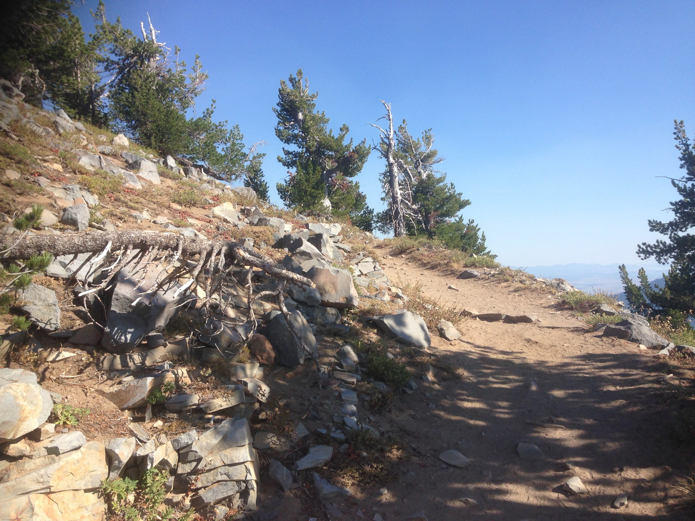
The trail leaves the terrace at the east end of Crater Lake Lodge and climbs eastward along the caldera rim through mountain hemlock, whitebark pine and Shasta red fir. The first kilometre traces a rising traverse above the lodge with intermittent lake views to the north-west; the middle section swings onto the upper south-rim slope in a series of switchbacks through open pumice and scattered whitebark pine. Yellow-bellied marmots and American pikas are common in the talus. The final ~500 m follows a rocky spine to the small summit block of Garfield Peak at 2,457 m, with an uninterrupted view spanning Wizard Island directly across the caldera, Llao Rock and Hillman Peak on the west rim, and Phantom Ship and Mount Scott to the east. Descent is by the same trail; the loose pumice underfoot makes trekking poles helpful on the way down.
Why it is essential
Garfield Peak is the canonical Rim Village summit hike and delivers the most complete single view of the caldera available without leaving the historic south rim. It starts directly at Crater Lake Lodge — a 1915 grand-hotel building on the National Register of Historic Places — and is one of the earliest trails to clear of snow, making it the reliable “arrival hike” from Rim Village through the summer season.
Equipment
- Mountain boots or trail shoes with edge for loose pumice; trekking poles useful on descent.
- 2 L water; no water on route.
- Sun and UV protection — the trail sits between 2,150 and 2,460 m and is largely open.
- Warm midlayer and wind shell; the summit is exposed and windy even in high summer.
- Microspikes useful into mid-July if snow lingers on the upper north-facing switchbacks.
Hazards and notes
- Steep drop-offs into the caldera on the upper trail; children should be held close on the summit block.
- Afternoon thunderstorms are common in July–August — start early and turn around at first sign of build-up.
- No shade from mid-trail up; heat and UV exposure are significant on clear days.
- Marmots and Clark’s nutcrackers investigate packs at the summit; do not leave food unattended.
- No dogs on Crater Lake trails.
Routes and maps
| Source | URL | Format / access | Reuse status |
|---|---|---|---|
| NPS — Hiking in Crater Lake | nps.gov | Official hike list | Public information |
| AllTrails — Garfield Peak Trail | alltrails.com | GPX (members) | AllTrails terms; reference only |
| OpenStreetMap (Garfield Peak Trail) | openstreetmap.org | OSM XML / GPX export | ODbL 1.0; reusable with attribution |
Further reading
2. Mount Scott Trail
Snapshot
Itinerary
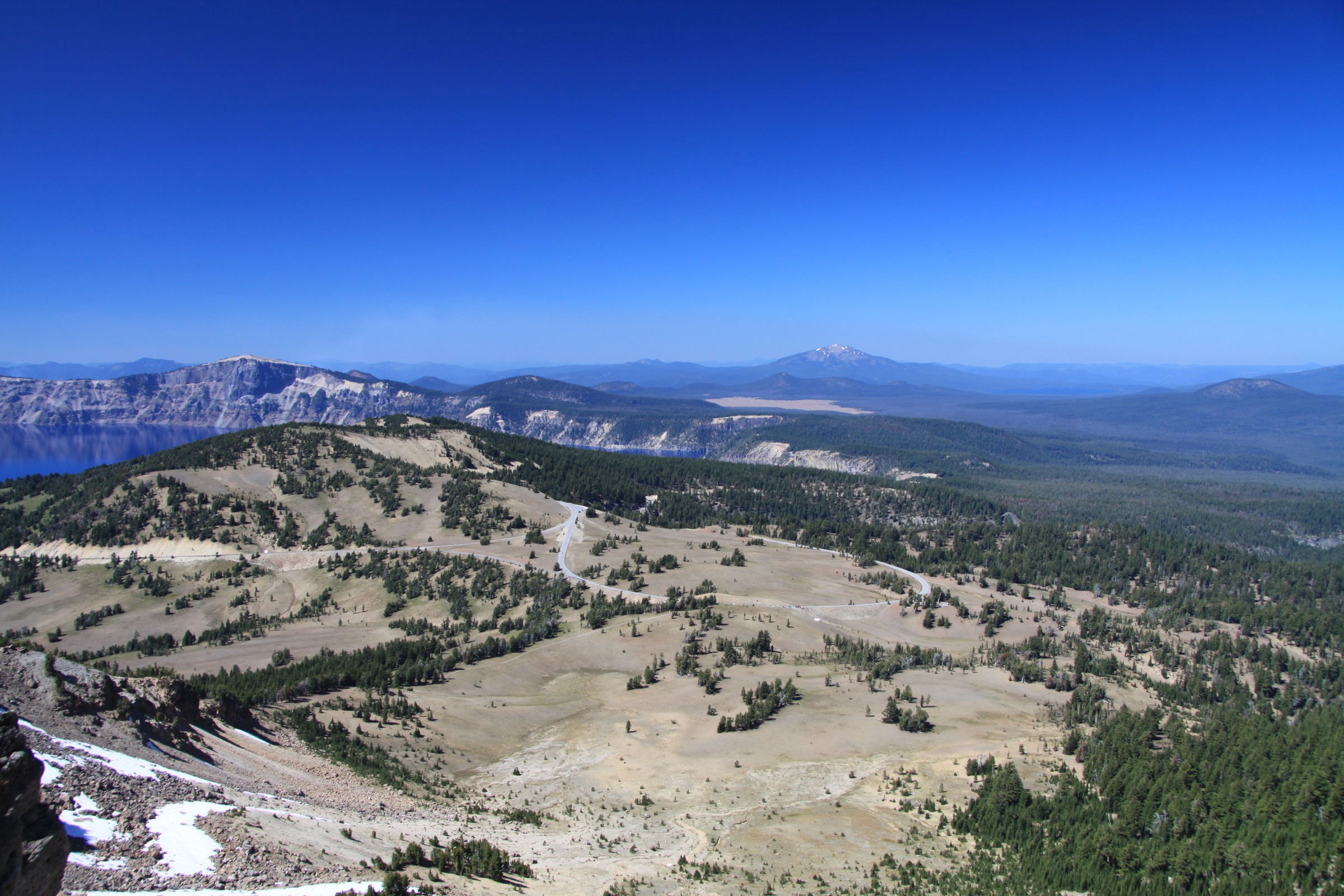
From the small pull-out on East Rim Drive, the trail crosses a short flat of mountain hemlock and whitebark pine, then curves eastward onto the south flank of Mount Scott, an eroded parasitic cone erupted roughly 420,000 years ago on the flank of the ancestral Mount Mazama. The climb is a long, steady grade of switchbacks through open pumice, whitebark pine and short-cropped subalpine meadow, gaining nearly all of its 381 m over the last 2.5 km. Above roughly 2,600 m the trail hardens onto bare volcanic tread and traces a broad shoulder to the summit block, where a 1926-vintage fire lookout tower still stands (staffed in fire season). The summit gives the only view in the park that takes in the entire caldera in one sweep — Wizard Island, Cleetwood Cove, Llao Rock and the Watchman all at once — and, on clear days, Mount Thielsen to the north, Mount McLoughlin to the south, and Mount Shasta on the California horizon.
Why it is essential
Mount Scott is the highest point in Crater Lake National Park and the only summit from which the whole caldera can be seen. The route is the biggest climb open to hikers inside the park boundary and the natural counterpart to Garfield Peak — a longer, more strenuous full-caldera view rather than the south-rim panorama. The active fire lookout adds a piece of NPS history.
Equipment
- Sturdy boots with edge for volcanic pumice; trekking poles strongly recommended.
- Wind shell and warm midlayer — the summit ridge is fully exposed at 2,700 m.
- Sun and UV protection; sun hat.
- 2.5–3 L water; no water on the route.
- Microspikes useful into late July on the north-facing upper switchbacks in heavy-snowpack years.
Hazards and notes
- Altitude — the summit sits above 2,700 m and can affect visitors coming from sea level.
- Afternoon thunderstorms and lightning are the principal hazard; the summit is fully exposed. Start early and be off the summit by early afternoon.
- East Rim Drive typically only opens fully in late June or early July; the trailhead is inaccessible for much of the year.
- No shade above the first kilometre; heat and UV exposure are significant on clear days.
- Fire lookout is an active NPS structure — do not enter unless staff invite.
- No dogs on Crater Lake trails.
Routes and maps
| Source | URL | Format / access | Reuse status |
|---|---|---|---|
| NPS — Hiking in Crater Lake | nps.gov | Official hike list | Public information |
| AllTrails — Mount Scott Trail | alltrails.com | GPX (members) | AllTrails terms; reference only |
| OpenStreetMap (Mount Scott Trail) | openstreetmap.org | OSM XML / GPX export | ODbL 1.0; reusable with attribution |
Further reading
3. The Watchman Peak Trail
Snapshot
Itinerary
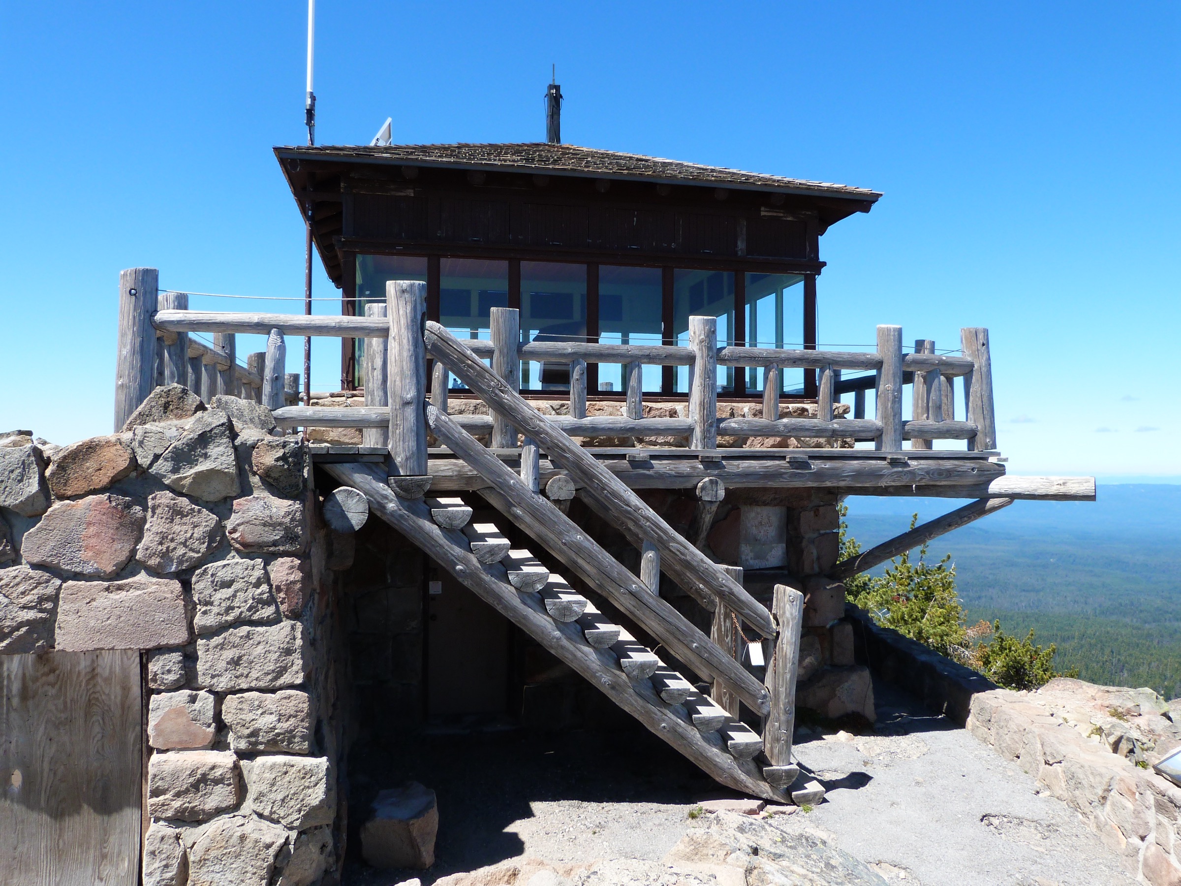
From the west end of the Watchman Overlook parking area, the trail follows the old lookout access road on a rising traverse northward beneath the summit block, then switches back south onto the west flank of The Watchman in a set of short zigzags through wind-cropped whitebark pine. The final 200 m climb onto the small summit plateau, where the stone-and-timber Watchman Lookout Station No. 168 — built in 1932 by a WPA/CCC crew and listed on the National Register of Historic Places — still stands and is staffed during fire season. The view is the classic west-rim vantage: Wizard Island floats directly below, the caldera curls around to Llao Rock in the north and Garfield Peak on the south rim, and Mount McLoughlin, Mount Shasta and the Klamath Basin fill the southern and western horizons. Descent is by the same route.
Why it is essential
The Watchman is the best short hike in the park for direct-overhead views of Wizard Island and the finest evening light on the caldera, when the low sun catches the west face of the lake. The staffed 1932 fire lookout is a piece of NPS history and one of the most photogenic summit buildings in the Cascades.
Equipment
- Trail shoes or light boots; the trail is mostly smooth but exposed pumice sections benefit from grip.
- Wind shell — the summit is windy even in high summer.
- Sun and UV protection.
- 1 L water; no water on route.
- No technical equipment required in normal summer conditions.
Hazards and notes
- Drop-offs into the caldera from the summit — stay behind the lookout railings.
- Late-day thunderstorms are the main risk in July–August; the summit is fully exposed.
- Ice patches on the north-facing switchbacks into early July in heavy-snowpack years.
- Do not attempt access when West Rim Drive is closed by snow — the trail runs directly off the road.
- No dogs on Crater Lake trails.
Routes and maps
| Source | URL | Format / access | Reuse status |
|---|---|---|---|
| NPS — Hiking in Crater Lake | nps.gov | Official hike list | Public information |
| AllTrails — Watchman Peak Trail | alltrails.com | GPX (members) | AllTrails terms; reference only |
| OpenStreetMap (Watchman Peak Trail) | openstreetmap.org | OSM XML / GPX export | ODbL 1.0; reusable with attribution |
Further reading
- NPS — Crater Lake Hiking
- Wikipedia — Watchman Lookout Station No. 168
- Crater Lake Institute — The Watchman
4. Plaikni Falls Trail
Snapshot
Itinerary
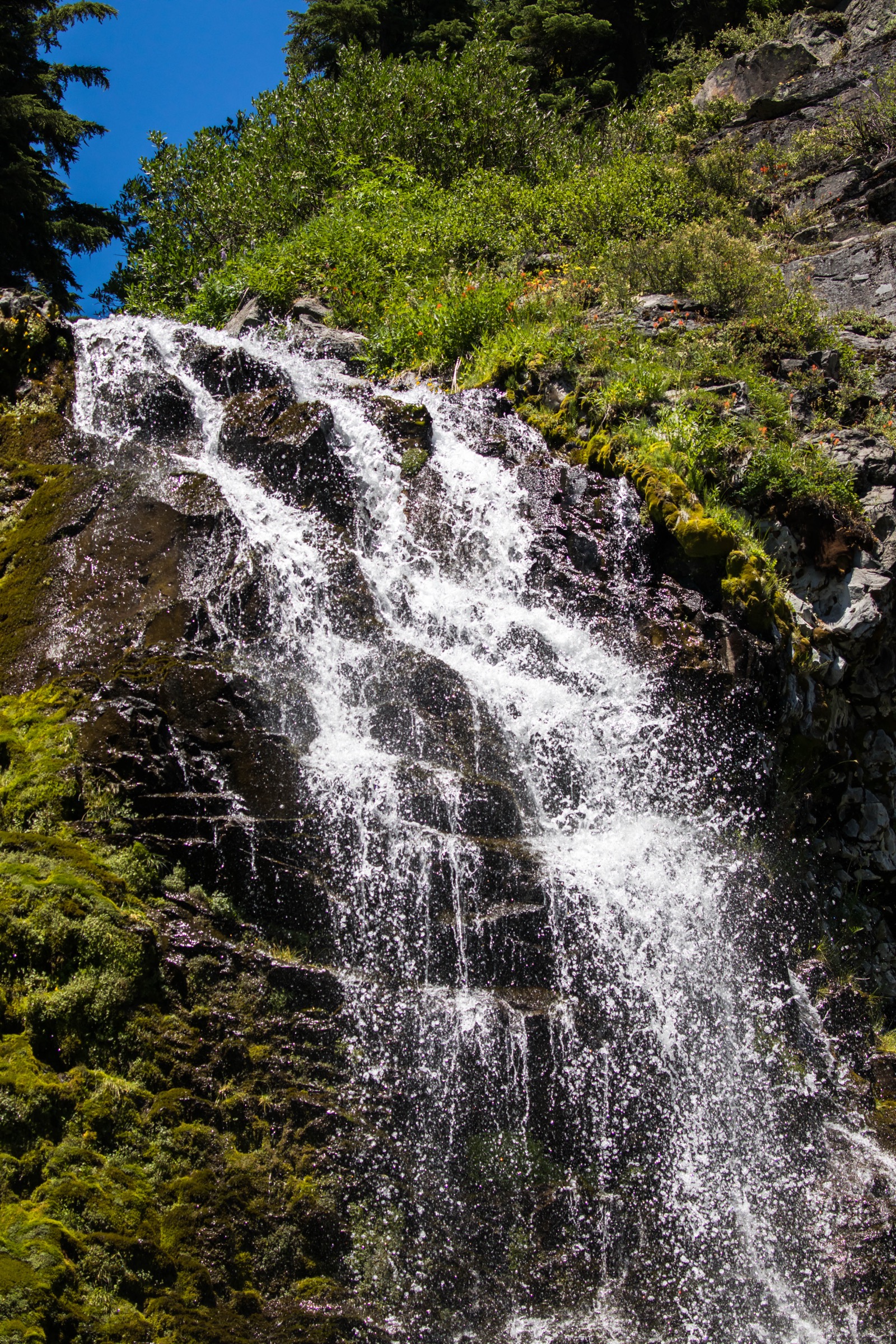
The trail leaves the small Pinnacles Road trailhead and winds gently east through a mixed stand of mountain hemlock, subalpine fir and lodgepole pine, contouring above the shallow Sand Creek drainage. The first three-quarters are near-level and graded for wheelchair access with a companion; the tread is compact volcanic pumice. After roughly 1.2 km the trail steepens slightly and enters a small hemlock-shaded amphitheatre where Plaikni Falls fans down a glacially plucked andesite cliff. The falls are fed by a cliff spring rather than a snowmelt stream, so flow is unusually steady from July through October. In late July and August the meadow at the base carries a strong display of monkeyflower, columbine, lupine and paintbrush. Return is by the same trail.
Why it is essential
Plaikni Falls is the single most accessible flowing-water feature in the park interior and provides a change of character from the exposed pumice-and-caldera walking that dominates the rim hikes. “Plaikni” is a Klamath word meaning “from the high country,” a rare naming that keeps the Klamath Tribes’ relationship to Mazama on the map. The trail’s wheelchair-accessible first section also makes it the most inclusive walk in the park.
Equipment
- Trail shoes or light hiking shoes.
- Sun protection for the exposed pumice sections at the trailhead.
- 1 L water; treat any drawn from Sand Creek.
- Insect protection early in the season — mosquitoes can be strong through July.
- No technical equipment required.
Hazards and notes
- Wet, mossy rock at the base of the falls — do not attempt to climb the cliff.
- Occasional deadfall across the trail after storms; NPS crews clear seasonally.
- Pinnacles Road can be closed by construction — verify current status with the NPS before travel.
- Bears use the drainage; do not leave food unattended.
- No dogs on Crater Lake trails.
Routes and maps
| Source | URL | Format / access | Reuse status |
|---|---|---|---|
| NPS — Hiking in Crater Lake | nps.gov | Official hike list | Public information |
| AllTrails — Plaikni Falls Trail | alltrails.com | GPX (members) | AllTrails terms; reference only |
| OpenStreetMap (Plaikni Falls Trail) | openstreetmap.org | OSM XML / GPX export | ODbL 1.0; reusable with attribution |
Further reading
- NPS — Crater Lake Hiking
- Crater Lake Institute — Plaikni Falls
- Klamath Tribes — Culture and language
5. Sun Notch Trail
Snapshot
Itinerary
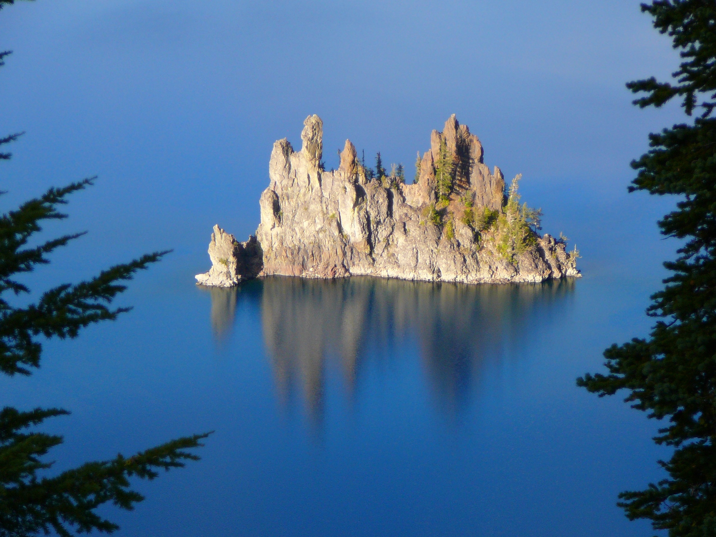
The trail leaves the small pull-out on East Rim Drive and rises gently north through an open pumice-and-hemlock meadow characteristic of the Mazama debris apron. Wildflowers — lupine, phlox, penstemon — line the tread in July and August. After about 400 m the meadow opens into the notch itself, a wide U-shaped gap in the south rim of the caldera. The unfenced viewpoint at the top gives the classic framing of Phantom Ship, a 52 m andesitic dike that is the oldest exposed rock in the caldera (approximately 400,000 years old) and one of only two islands in the lake. Dutton Cliff rises on the east side of the frame and the Chaski Slide — a large landslide scar that peeled away the south caldera wall — falls away directly below. The return is either back the same way or on the short loop trail west across the meadow, closing at the parking area.
Why it is essential
Sun Notch is the shortest walk in the park that delivers a genuinely dramatic caldera view, and the only one that puts Phantom Ship directly in frame. It is the natural companion to the west-rim Watchman viewpoint, giving the south-rim equivalent from the opposite side of the caldera. It also sits close to the Pinnacles Road spur, allowing a compact half-day pairing with Plaikni Falls.
Equipment
- Trail shoes; the pumice tread is easy but loose.
- Sun protection — the meadow and notch are fully exposed.
- Windbreak layer; the notch funnels wind on cool days.
- 0.5 L water.
- No technical equipment required.
Hazards and notes
- Unfenced cliff edge at the notch — hold children close and keep well back on windy days.
- Sudden weather changes; the south rim exposes the notch to storm build-up in the afternoon.
- Wind funnels through the notch and can be substantially stronger than at the parking area.
- No dogs on Crater Lake trails.
- East Rim Drive may be affected by 2026 construction near Phantom Ship — verify access on the day.
Routes and maps
| Source | URL | Format / access | Reuse status |
|---|---|---|---|
| NPS — Hiking in Crater Lake | nps.gov | Official hike list | Public information |
| AllTrails — Sun Notch Trail | alltrails.com | GPX (members) | AllTrails terms; reference only |
| OpenStreetMap (Sun Notch Trail) | openstreetmap.org | OSM XML / GPX export | ODbL 1.0; reusable with attribution |
Further reading
Further reading
| Source | URL |
|---|---|
| NPS — Crater Lake National Park | nps.gov |
| NPS — Crater Lake Hiking | nps.gov |
| NPS — Crater Lake Current Conditions | nps.gov |
| NPS — Cleetwood Cove Trail & Marina Rehabilitation | nps.gov |
| Crater Lake Institute — Trails Index | craterlakeinstitute.com |
| Crater Lake Trolley | craterlaketrolley.net |
| USGS — Mount Mazama and Crater Lake caldera | usgs.gov |
| Wikipedia — Crater Lake | en.wikipedia.org |
| Wikipedia — Mount Mazama | en.wikipedia.org |
| Wikipedia — Crater Lake National Park | en.wikipedia.org |
| Wikimedia Commons — Category:Crater Lake | commons.wikimedia.org |
| OpenStreetMap (ODbL 1.0) | openstreetmap.org |