Regional overview
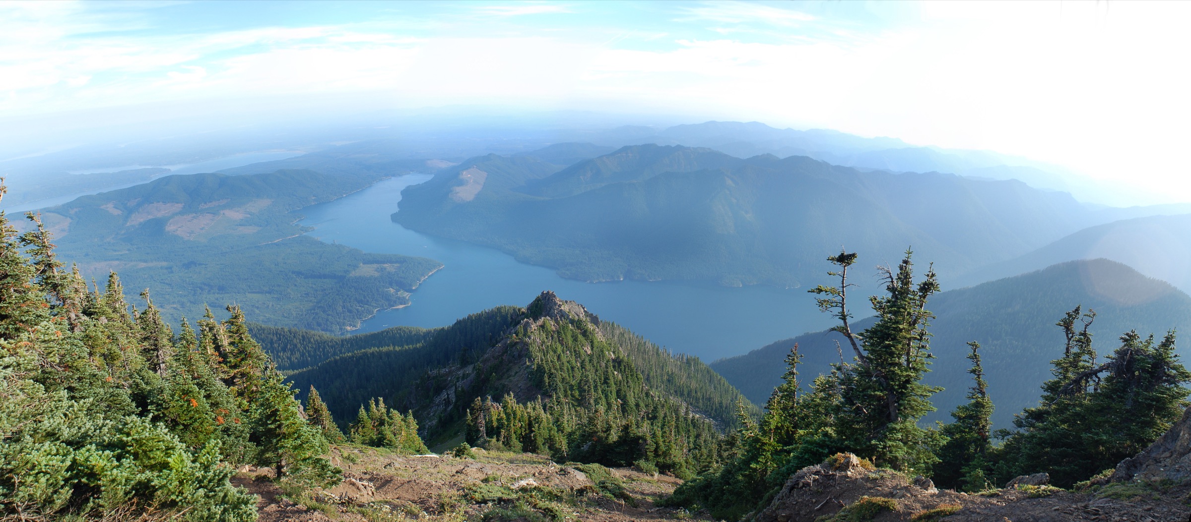
The eastern flank of the Olympic Mountains is the drier, more accessible face of the Olympic Peninsula. Where the west side lifts the Pacific weather into 3,500 mm of annual precipitation and grows the temperate rainforests of the Hoh and Quinault, the east side sits in the rain shadow of Mount Olympus and drains sharply into Hood Canal through a set of parallel valleys — the Big Quilcene, Dosewallips, Duckabush, Hamma Hamma and Skokomish rivers. The mountains here climb from tidewater to nearly 2,000 m in about 15 km of horizontal distance; the Brothers (2,085 m), Mount Constance (2,320 m), Mount Deception (2,373 m) and Mount Skokomish (1,984 m) form the wall visible from every ferry crossing on Puget Sound. Nearly all of this east-side high country is USFS land: the Olympic National Forest’s Hood Canal Ranger District administers three congressionally designated wilderness areas — Buckhorn Wilderness (~19,000 hectares) in the north around Marmot Pass, The Brothers Wilderness (~6,900 hectares) in the middle around the Hamma Hamma valley, and Mount Skokomish Wilderness (~5,300 hectares) in the south around Mount Ellinor and Lake Cushman.
The main hiking centres are Quilcene on US-101 for the northern Buckhorn approaches, Brinnon at the mouth of the Dosewallips, Eldon and the Hamma Hamma River Road for the central east-side trails, and Hoodsport / Lake Cushman for the southern block above Skokomish country. US-101 runs the length of Hood Canal and links every trailhead access road; Seattle is about a 3-hour drive via the Bremerton or Bainbridge ferries, or a longer highway loop through Tacoma. The Olympic Discovery Trail runs the length of the peninsula for cyclists but does not serve mountain trailheads. Public transport is negligible: Jefferson Transit runs limited service to Quilcene and Brinnon on weekdays, and Mason Transit reaches Hoodsport, but no bus serves the forest roads that lead to the trailheads themselves.
The practical dry-hike season for the east-side alpine runs from mid-July to early October. Snow lingers on the higher passes and summits into July in normal years, sometimes into August after heavy winters; October storms can put fresh snow onto Marmot Pass or Mount Ellinor at any time. The forest walks — Lena Lake, the lower Hamma Hamma trails — are largely snow-free from April to November. Winds on the exposed east-facing ridges are frequently stronger than the sheltered west-side interior; the classic east-side hazard is a warm summer afternoon that draws marine cloud straight up the Hood Canal valleys and reduces summit visibility to zero within an hour. Water is generally available in the valleys but scarce on the ridges above 1,500 m.
Access rules are simpler than the National Park interior. A Northwest Forest Pass ($5 day / $30 annual, or the America the Beautiful pass) is required at Olympic National Forest trailheads with developed facilities — Mount Ellinor upper trailhead, Upper Big Quilcene (Marmot Pass), Mount Townsend, and Lena Lake all require it; Mount Rose is a rare exception with no fee. No permits or reservations are required for day hiking on any of the five routes below. Overnight travel that crosses into Olympic National Park (Upper Lena Lake, the Dosewallips headwaters, the upper Duckabush) requires a park wilderness permit through the ONP Wilderness Information Center; day walkers turning back before the park boundary do not. Bears are present throughout — food storage discipline is required at any planned lunch stop.
The Dosewallips Road is the region’s single major access closure. FSR 2610 has been closed to vehicles since a January 2002 washout at approximately mile 10; a longer washout inspected in 2010 confirmed the closure would remain indefinite. As of the 2026 season the road is berm-blocked and open only to walkers and bikes; reaching the former Dosewallips trailheads (Constance Pass, Dose Meadows, Anderson Pass) now requires a 10–11 km one-way road walk or bike-ride to the old parking area before the trail proper begins. None of the five hikes below rely on Dosewallips access, but parties combining east-side trips should factor this closure into any plan touching the Dosewallips drainage. Verify current status on the Olympic National Forest alerts page before travel.
Selection rationale
The five hikes below span the four defining experiences of the eastern Olympics. Mount Ellinor via the upper trailhead is the classic east-side summit — short, steep and iconic above Lake Cushman, with a full Hood Canal panorama at the top. Marmot Pass via the Upper Big Quilcene Trail is the region’s finest pass walk, delivering the essential Buckhorn Wilderness meadow-and-summit view for a strong day. Mount Townsend is the long ridge walk from the Quilcene Ranger District — panoramic, blossom-rich and among the widest east-side summit views in the range. Lower Lena Lake is the family-scale forest walk to the peninsula’s largest backcountry lake, and the walking gateway to The Brothers Wilderness. Mount Rose is the steep southern counterpoint above Lake Cushman — a shorter lollipop with a different sector of view than Ellinor and a rare no-fee trailhead. Upper Lena Lake, Mount Zion, Tubal Cain Mine + Buckhorn Mountain, and Silver Lakes are all noted in the follow-up section as strong alternates.
Summary table
| # | Hike | Country | Route type | Distance | Gain | Max elevation | Difficulty |
|---|---|---|---|---|---|---|---|
| 1 | Mount Ellinor via Upper Trailhead | USA | Out-and-back | ~5.1 km (~3.2 mi) | ~745 m | 1,812 m | Very strenuous |
| 2 | Marmot Pass via Upper Big Quilcene | USA | Out-and-back | ~18.5 km (~11.5 mi) | ~1,060 m | 1,830 m | Very strenuous |
| 3 | Mount Townsend via Upper Trailhead | USA | Out-and-back | ~12.9 km (~8.0 mi) | ~915 m | 1,908 m | Strenuous |
| 4 | Lower Lena Lake | USA | Out-and-back | ~9.7 km (~6.0 mi) | ~365 m | 610 m | Moderate |
| 5 | Mount Rose | USA | Lollipop loop | ~10.3 km (~6.4 mi) | ~1,065 m | 1,311 m | Very strenuous |
1. Mount Ellinor via Upper Trailhead
Snapshot
Itinerary
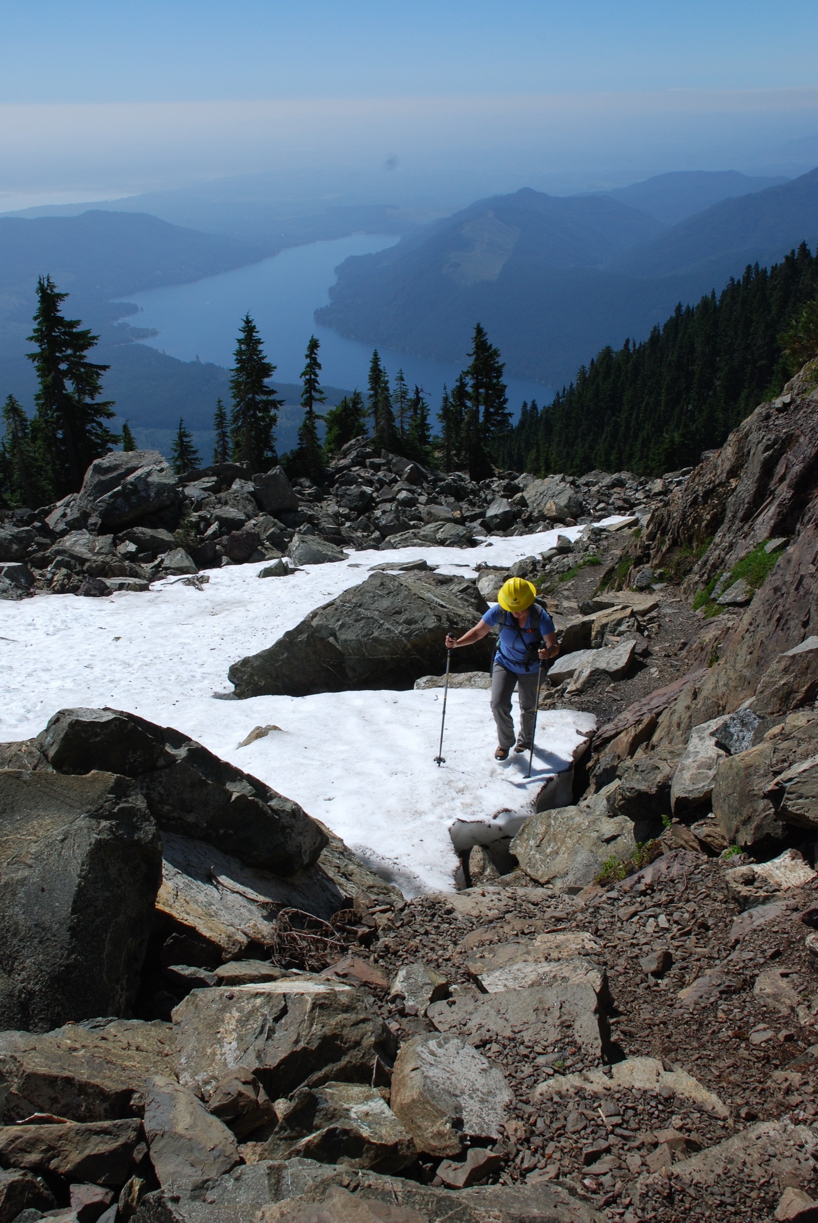
From the upper trailhead the Mount Ellinor Trail (USFS #812) climbs almost immediately through an old-growth silver fir and mountain hemlock forest on stone-stepped switchbacks. At about 0.5 km the tread breaks into open subalpine meadow with the first view south to Lake Cushman and west to Mount Washington; from here the grade steepens and the route becomes a sustained direct climb up the south-east ridge on a mixture of rock steps, root ladders and the built stone stairway installed by USFS crews. At about 1.3 km the trail reaches a small saddle where the summer route and the winter route separate — in dry summer conditions the trail continues up the rock ridge; when snow lingers, a well-marked snow chute (the “summer” route stays on rock, the “winter” route uses the chute) delivers a direct line to the summit crown. The final 200 m are a walk on open rock and heather with unlimited exposure east across Hood Canal. The summit is a small rocky platform with a summit register at 1,812 m; the panorama runs south to Mount Rainier, east across Hood Canal to Puget Sound and the Cascades, north to Mount Constance and The Brothers, and west into the ridges of the Skokomish and Duckabush drainages. Return by the same route.
Why it is essential
Mount Ellinor is the archetypal east-side Olympic summit — an alpine peak with a genuine 360-degree Hood Canal panorama, reachable in a half-day from a paved forest road. Its position at the southern edge of the Mount Skokomish Wilderness, straight above Lake Cushman, gives the most direct expression of the “sea to summit” character that distinguishes the east side of the range: 1,800 m of relief in under 5 km of horizontal ground. Mountain goats are commonly seen on the upper ridge, and the summit sees regular Olympic marmot activity in the meadows below.
Equipment
- Sturdy hiking boots — rock steps and root ladders throughout
- Weatherproof shell — the summit is fully exposed
- Warm layer for the summit, even in July
- 2 L water — no reliable source above the trailhead
- Sun protection — the upper ridge is fully open
- Trekking poles strongly recommended for the descent
- Map and downloaded USFS trail map
- Microspikes / ice axe if attempting before mid-July while the snow chute is holding
- Headtorch for a late finish
Hazards and notes
- The summit couloir holds snow well into July in normal years — early-season parties should carry microspikes or full traction and an ice axe if travelling on the snow route
- The upper ridge is exposed rock scrambling; falls have occurred on wet or icy rock
- Northwest Forest Pass required at the upper trailhead ($5 day / $30 annual, or America the Beautiful pass); the lower trailhead does not require a pass
- FSR 2419-014 to the upper trailhead is a narrow forest road not maintained for passenger cars in winter; verify road status with the Hood Canal Ranger District before travel
- Mountain goats have been habituated to hikers on the summit; do not feed or approach — maintain the 50 m separation recommended by USFS
- Cell coverage is patchy at the trailhead, absent above the treeline
- Dogs allowed on leash; no permits for day use
GPX / KML links
| Source | URL | Format | Notes |
|---|---|---|---|
| USFS Olympic National Forest — Mt. Ellinor Trail #812 | fs.usda.gov | Official page | No official GPX published; route description and access notes |
| Washington Trails Association — Mount Ellinor | wta.org | Trail database | Current trip reports; approximate stats |
| Waymarked Trails — Olympic trails | hiking.waymarkedtrails.org | OSM route relations | Ellinor trail mapped in OSM; GPX exportable via relation |
Sources
- USFS Olympic National Forest — Mt. Ellinor Trail #812
- Washington Trails Association — Mount Ellinor
- The Mountaineers — Mount Ellinor
2. Marmot Pass via Upper Big Quilcene
Snapshot
Itinerary
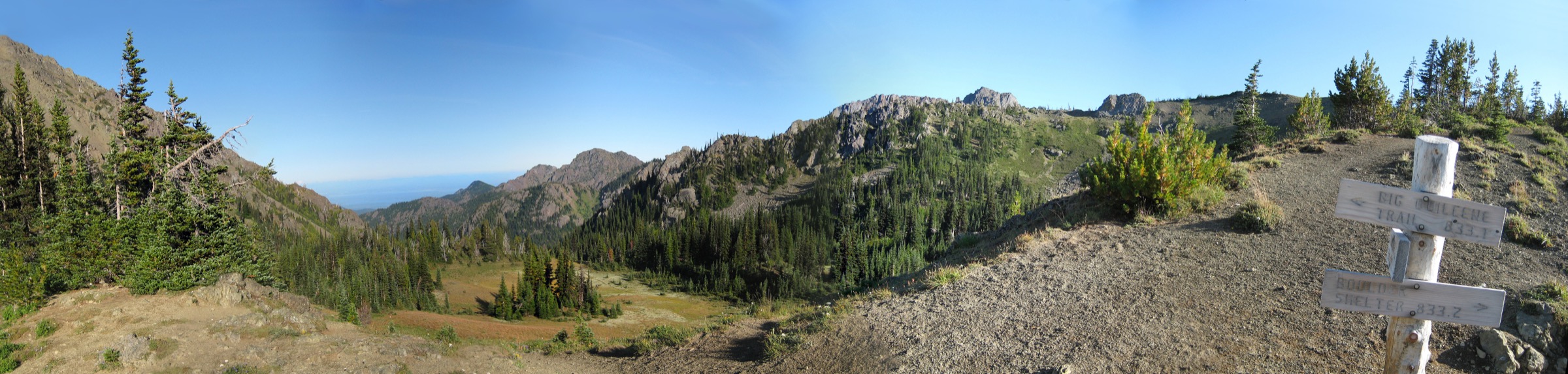
From the Upper Big Quilcene trailhead the trail (USFS #833) enters the Buckhorn Wilderness at the register and follows the north bank of the Big Quilcene River through mature old-growth Douglas fir, western hemlock and Pacific silver fir. The first 4 km are a gentle streamside walk; the trail climbs steadily but easily to the campsite at Shelter Rock (~4.5 km, ~1,265 m), a large rock overhang with several tent sites where many overnight parties stop. Beyond Shelter Rock the grade steepens through a subalpine meadow of avalanche lily, paintbrush and lupine, and the trail crosses two small creeks before entering the amphitheatre of Camp Mystery (~7.5 km, ~1,555 m), a broad flat with reliable water and further tent sites. The final 1.7 km climb from Camp Mystery to Marmot Pass ascends open meadow and low subalpine forest with expanding views west into the interior of the Olympics. Marmot Pass itself is a broad saddle at 1,830 m; the panorama west opens to Mount Constance (2,320 m), the Warrior peaks and the crags of the Needles, with Buckhorn Mountain rising immediately north of the pass. Strong parties add a 1 km (one-way) climbers’ path up the south ridge of Buckhorn Mountain for the summit at 2,133 m and a wider Olympic interior view. Return by the same route.
Why it is essential
Marmot Pass is the archetypal east-side pass — the classic walk into the true alpine of the Buckhorn Wilderness from a valley trailhead. The Upper Big Quilcene approach delivers old-growth forest, streamside meadows, subalpine flowers and finally a genuine high pass with a full-Olympic-interior view, all in a single hard day. The Mountaineers and Washington Trails Association both consistently list it in the top east-side day hikes, and the addition of Buckhorn Mountain for a strong party extends the outing to a nearly 7,000-foot summit.
Equipment
- Sturdy hiking boots
- Weatherproof shell — the pass is fully exposed to Olympic weather
- Warm layer for the pass
- 3 L water; reliable sources at Shelter Rock and Camp Mystery
- Sun protection — the upper meadows are fully open
- Trekking poles recommended for the descent
- Map, compass and downloaded USFS map
- Headtorch for a late finish — 9-hour days are common
- Microspikes if attempting before mid-July while snow patches remain on the upper meadows
Hazards and notes
- Long day; start early to avoid afternoon thunderstorm build-up on the exposed pass
- Snow can persist on the north-facing meadow above Camp Mystery into July; check current WTA trip reports before travel
- FSR 2750 access road is unpaved and steep in its final section; passenger cars are usually fine in summer but verify with Hood Canal Ranger District after storms
- Bear-aware food storage on any lunch stop; goats and marmots are commonly seen at the pass
- Northwest Forest Pass or America the Beautiful pass required at the trailhead
- Cell coverage is absent above the trailhead
- Dogs allowed on leash
GPX / KML links
| Source | URL | Format | Notes |
|---|---|---|---|
| USFS Olympic National Forest — Buckhorn Wilderness | fs.usda.gov | Official page | No official GPX published |
| Washington Trails Association — Marmot Pass | wta.org | Trail database | Current trip reports; approximate stats |
| Waymarked Trails — Olympic trails | hiking.waymarkedtrails.org | OSM route relations | Upper Big Quilcene mapped in OSM; GPX exportable via relation |
Sources
- Washington Trails Association — Marmot Pass
- The Mountaineers — Marmot Pass & Buckhorn Mountain
- Explore Hood Canal — Marmot Pass
3. Mount Townsend via Upper Trailhead
Snapshot
Itinerary
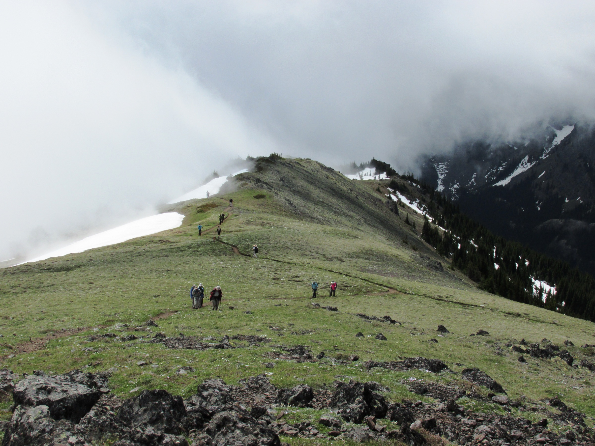
From the upper trailhead the Mount Townsend Trail (USFS #839) climbs steadily through mature Pacific silver fir and mountain hemlock on well-graded switchbacks, gaining altitude in a series of long traverses. At about 2.6 km the trail reaches Camp Windy, a small flat with a reliable spring and one of the classic east-side lunch stops on the way up. Beyond Camp Windy the tread breaks into open subalpine meadow with the first sustained views east across Puget Sound to the Cascades. The route now climbs a broad open bowl of paintbrush, lupine and phlox on a series of sweeping switchbacks — the trail’s most photographed section, particularly in early August when the meadow peaks. At about 5.8 km a signed junction offers the Silver Lakes spur (2 km one-way descent to two small subalpine tarns, a worthwhile detour on the return if time permits); the main trail continues onto the ridge. The final 0.6 km walk to the north summit is a broad, wind-scoured turtleback with unlimited views. The north summit at 1,908 m offers a 360-degree panorama — north across the Strait of Juan de Fuca to Vancouver Island and the San Juans, east across Puget Sound to Seattle, Mount Rainier, Mount Baker and the North Cascades, west into the Buckhorn interior toward Mount Constance and Warrior Peak, and south along the eastern Olympic wall to The Brothers. The south summit is a five-minute walk further along the ridge for those who want the full traverse. Return by the same route.
Why it is essential
Mount Townsend is the widest east-side viewpoint in the eastern Olympics that can be walked on a maintained trail. Its position on the north edge of the Buckhorn Wilderness gives it a horizon that reaches from the North Cascades to Mount Rainier and Vancouver Island simultaneously, and the subalpine meadow approach is one of the finest wildflower walks in the range. The trail is well-graded and non-technical, which makes it the most approachable of the east-side alpine summits for parties who find Mount Ellinor’s grade too aggressive.
Equipment
- Sturdy hiking boots or trail shoes with grip
- Weatherproof shell — the summit ridge is fully exposed
- Warm layer for the summit
- 2.5 L water; reliable spring at Camp Windy
- Sun protection — the alpine section is fully open and often windy
- Trekking poles helpful on the descent
- Map and downloaded USFS map
- Insect repellent for early season (July black flies in the meadows)
Hazards and notes
- Wind on the summit ridge is frequently strong even in summer
- Snow can persist on the north-facing switchbacks into July; check current WTA trip reports
- FSR 27-190 is unpaved for the final section; passenger cars are usually fine in summer
- Northwest Forest Pass required at the trailhead
- The Silver Lakes junction adds a serious extra ~4 km and ~200 m loss/gain; plan accordingly if adding it
- Dogs allowed on leash
- Cell coverage is absent above the trailhead
GPX / KML links
| Source | URL | Format | Notes |
|---|---|---|---|
| USFS Olympic National Forest — Mt. Townsend Trail #839 | fs.usda.gov | Official page | No official GPX published |
| Washington Trails Association — Mount Townsend | wta.org | Trail database | Current trip reports; approximate stats |
| Waymarked Trails — Olympic trails | hiking.waymarkedtrails.org | OSM route relations | Townsend trail mapped in OSM |
Sources
- Washington Trails Association — Mount Townsend
- The Mountaineers — Mount Townsend
- Explore Hood Canal — Mount Townsend
4. Lower Lena Lake
Snapshot
Itinerary
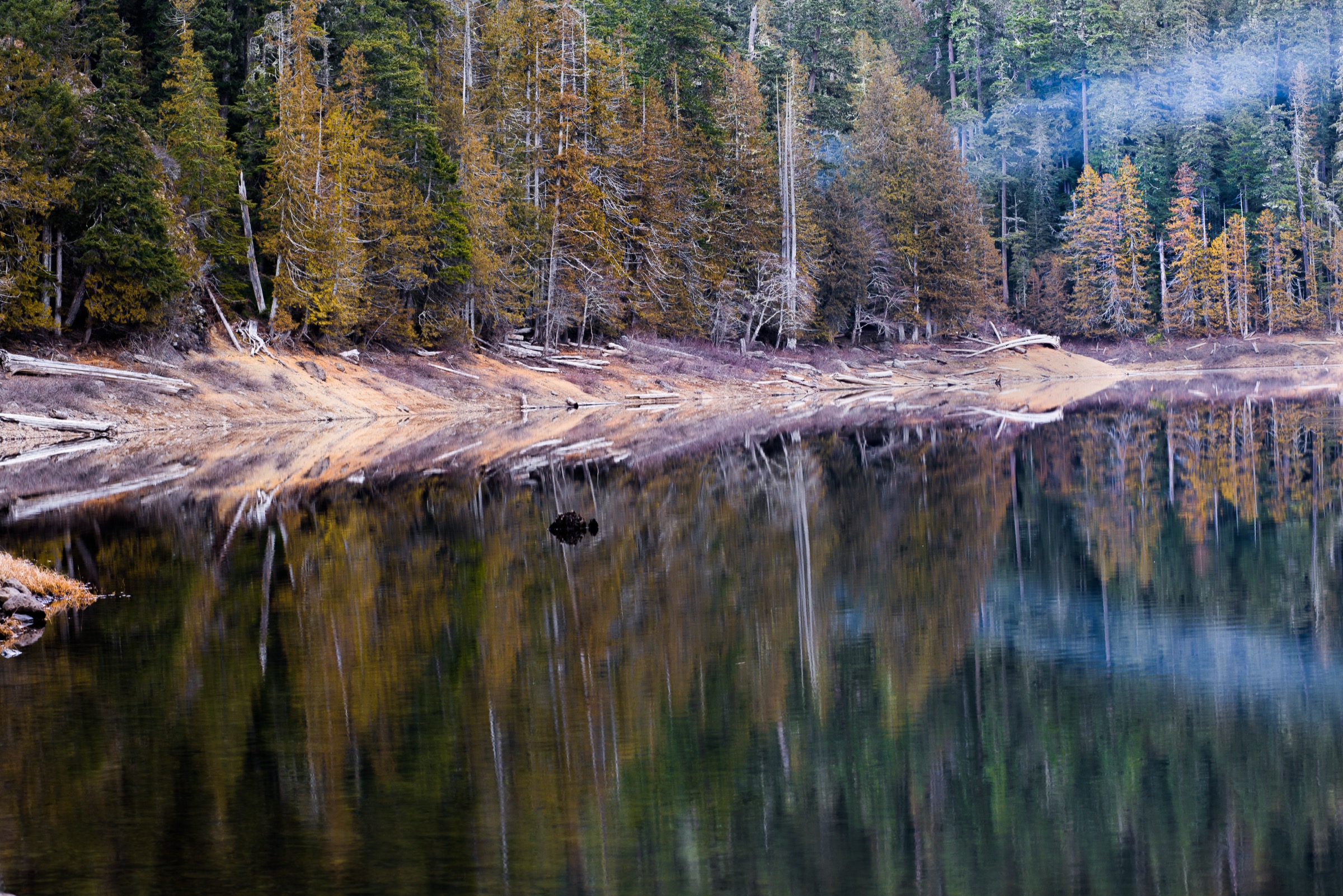
From the Lena Lake trailhead the trail (USFS #810) climbs steadily up the northern flank of the Hamma Hamma valley on well-engineered switchbacks in mature second-growth Douglas fir and western hemlock, with sections of old-growth still standing above the tread. At approximately 2 km the trail crosses the log bridge over Lena Creek — a common turnaround point for families with young children — and continues climbing at a moderate grade through the forest, dropping in and out of the noise of the creek as the tread ascends. At about 4.3 km the switchbacks ease and the trail enters the flat basin holding Lower Lena Lake at 610 m: 55 acres of clear water impounded 1,300 years ago when a landslide dammed Lena Creek. The lake basin sits in a broad amphitheatre with The Brothers (2,085 m) rising directly above to the west, and the shore is fringed with second-growth and remnant old-growth. A rough shore trail circles the north and west sides of the lake through 28 rustic campsites; the standard turnaround point is the north end of the lake near the lake register and USFS composting toilets. Strong parties may continue up the Upper Lena Lake trail (see follow-up section) toward the Olympic National Park boundary. Return by the same route.
Why it is essential
Lower Lena Lake is the peninsula’s largest backcountry lake and the classic walking introduction to The Brothers Wilderness. The route delivers old-growth character, a river crossing, and a genuine subalpine lake in a full day at a moderate grade — making it the essential family-scale hike of the eastern Olympics. It is also the walking approach to the climbers’ route on The Brothers, and its Boy Scout Camp Cleland history dates back to the 1930s. The Wilderness boundary lies just above the lake at the entrance to the Upper Lena Lake trail.
Equipment
- Standard hiking shoes or boots
- Weatherproof shell — the Hamma Hamma valley catches Pacific weather
- Warm layer for the lake basin, particularly in shoulder season
- 1.5 L water; treat any lake or stream water
- Sun protection
- Insect repellent for mosquitoes in June / July
- Downloaded USFS map
Hazards and notes
- The route is well-graded and non-technical but the switchbacks can be slippery when wet
- Bear-aware food storage at the lake — a hard-sided container is recommended for any overnight stay
- Northwest Forest Pass required at the trailhead ($5 day / $30 annual, or America the Beautiful pass)
- Overnight camping at the lake is first-come-first-served; no reservation but the composting toilets and metal fire rings are actively maintained by USFS
- Dogs permitted on leash on the USFS section; Olympic National Park boundary lies further up the Upper Lena Lake trail and dogs are prohibited beyond it
- Cell coverage is absent at the lake
GPX / KML links
| Source | URL | Format | Notes |
|---|---|---|---|
| USFS Olympic National Forest — Lena Lake Trail #810 | fs.usda.gov | Official page | No official GPX published |
| Washington Trails Association — Lena Lake | wta.org | Trail database | Current trip reports; approximate stats |
| Waymarked Trails — Olympic trails | hiking.waymarkedtrails.org | OSM route relations | Lena Lake trail mapped in OSM |
Sources
- USFS Olympic National Forest — Lena Lake Trail #810
- Washington Trails Association — Lena Lake
- Explore Hood Canal — Lena Lake Trail
5. Mount Rose
Snapshot
Itinerary
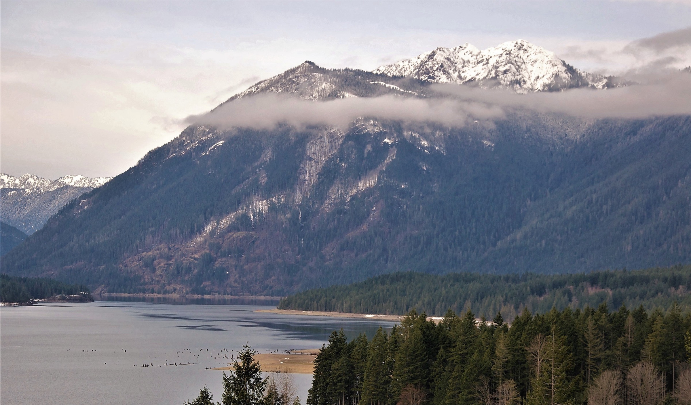
From the Lake Cushman Road trailhead the Mount Rose Trail (USFS #814) climbs almost immediately on relentlessly steep switchbacks through mature Douglas fir and western hemlock. At approximately 2.9 km the trail reaches a signed junction — the tip of the lollipop — where a right turn (the “up” branch) climbs the short, steep 1.8 km ridge to the summit gaining approximately 500 m; a left turn (the “down” branch) takes a longer, less steep 2.9 km loop that many parties prefer as the descent. The right-branch upper section climbs the south-east rock ribs of the mountain through a mixed subalpine forest with occasional views south to the Skokomish delta and west to Lightning Peak. The summit at 1,311 m is a small rock and clearing platform with a broad view south to Mount Rainier, the Skokomish delta and the Willapa Hills; south-east to the Black Hills; and north across Lake Cushman toward Mount Washington and Mount Ellinor. Return via the longer left-branch descent to complete the loop, then out on the common stem to the trailhead.
Why it is essential
Mount Rose is the steep, honest southern counterpoint to Mount Ellinor above Lake Cushman. The route gains 1,065 m in about 5 km of climbing — one of the harshest sustained grades in the Hood Canal Ranger District — and the summit gives a distinct south-east-facing sector of view that neither Ellinor nor the Buckhorn summits offer. It is also one of the very few maintained east-side Olympic trailheads with no fee or Northwest Forest Pass required, which makes it a natural pick for parties who prefer the fee-free option. The mountain honours Alfred A. Rose, the first non-Indigenous settler at Lake Cushman in 1885.
Equipment
- Sturdy hiking boots — steep, rooty tread throughout
- Weatherproof shell
- Warm layer for the summit
- 2.5 L water — no reliable source on the climb
- Sun protection
- Trekking poles strongly recommended for the descent — the down-branch is a long knee-hammering pitch
- Downloaded USFS map
- Insect repellent for early season
Hazards and notes
- Sustained steepness on both branches of the loop — one of the region’s least-graded trails
- The lollipop loop is not always well signed at the tip junction; verify the direction with the WTA map before departure
- No reliable water on the climb; carry all you need
- The lower forest was in a 2006 burn area — expect stumps and standing dead in the first km, with visible fire recovery
- Dogs allowed on leash; no permits or fees at this trailhead
- Cell coverage is patchy in the lower forest, absent above
- Snow can linger in shaded pockets into June even at the summit elevation
GPX / KML links
| Source | URL | Format | Notes |
|---|---|---|---|
| USFS Olympic National Forest — Mt. Rose Trail #814 | fs.usda.gov | Official page | No official GPX published |
| Washington Trails Association — Mount Rose | wta.org | Trail database | Current trip reports; approximate stats |
| Waymarked Trails — Olympic trails | hiking.waymarkedtrails.org | OSM route relations | Mount Rose loop mapped in OSM |
Sources
Missing data / follow-up work
- Dosewallips Road 2026 status — FSR 2610 has been closed to vehicles since the January 2002 washout at approximately mile 10; a further increase in the washout length was documented in 2010. As of the 2026 season the road remains berm-blocked and open only to walkers and bikes. None of the five hikes above rely on it, but any party planning Constance Pass, Dose Meadows, Anderson Pass or the West Fork Dosewallips trailhead should factor in a 10–11 km one-way road walk and verify current status on the Olympic National Forest alerts page before travel.
- Upper Lena Lake — the continuation from Lower Lena Lake to Upper Lena Lake enters Olympic National Park at approximately 6 km from the trailhead. Upper Lena is a serious full day (~22.5 km, ~1,240 m gain per NPS) and crosses the ONP wilderness permit boundary for overnight travel. Strong day hikers can push through but it is a very long outing; parties considering it should verify current park permit rules with the ONP Wilderness Information Center.
- Mount Zion (Bon Jon Pass) — a shorter (~7.4 km / ~600 m gain) rhododendron and view hike from the north end of the Buckhorn Wilderness; considered as an alternate to Townsend for parties looking for a shorter day but excluded from the top 5 because the wildflower and view profile is thinner than Townsend’s.
- Tubal Cain Mine + Buckhorn Mountain — a historic mining-district approach from the north side of Buckhorn Wilderness (~20 km round trip to the mine, longer to the summit) with wreckage from a 1952 B-17 crash. Excluded from the top 5 for length and complex access via FSR 27; would make a strong sixth candidate.
- Silver Lakes — a spur off the Mount Townsend trail (~4 km round trip added) to two subalpine tarns; commonly added as an extension for parties with time.
- Mildred Lakes — a strenuous ~14 km round-trip approach with sustained root-and-rock scrambling and no maintained tread in places; a Mountaineers scramble-grade day rather than a maintained hike and therefore excluded from the top 5.
- Mount Ellinor snow-chute season — the summer versus winter route split at the summit couloir needs local verification most years; the chute holds snow well into late July in normal winters. WTA trip reports are the fastest current-condition source.
- Northwest Forest Pass 2026 pricing — $5 day-use and $30 annual per current Olympic National Forest fee schedule; verify at the Hood Canal Ranger District office in Quilcene before travel.
Further reading
| Source | URL |
|---|---|
| USFS Olympic National Forest — main site | fs.usda.gov |
| USFS Olympic National Forest — Alerts | fs.usda.gov |
| USFS Olympic National Forest — Passes | fs.usda.gov |
| USFS Olympic National Forest — Hood Canal Ranger District | fs.usda.gov |
| Washington Trails Association | wta.org |
| The Mountaineers | mountaineers.org |
| Olympic National Park — Current road conditions | nps.gov |
| Olympic Peninsula tourism — open/closure status | olympicpeninsula.org |
| Explore Hood Canal — hikes and walks | explorehoodcanal.com |
| Waymarked Trails — hiking | hiking.waymarkedtrails.org |
| Recreation.gov — Olympic National Forest Passes | recreation.gov |