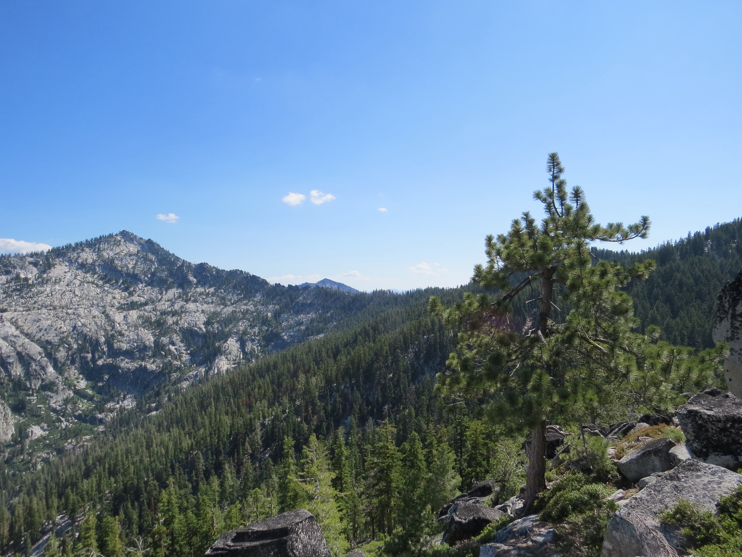
Regional overview
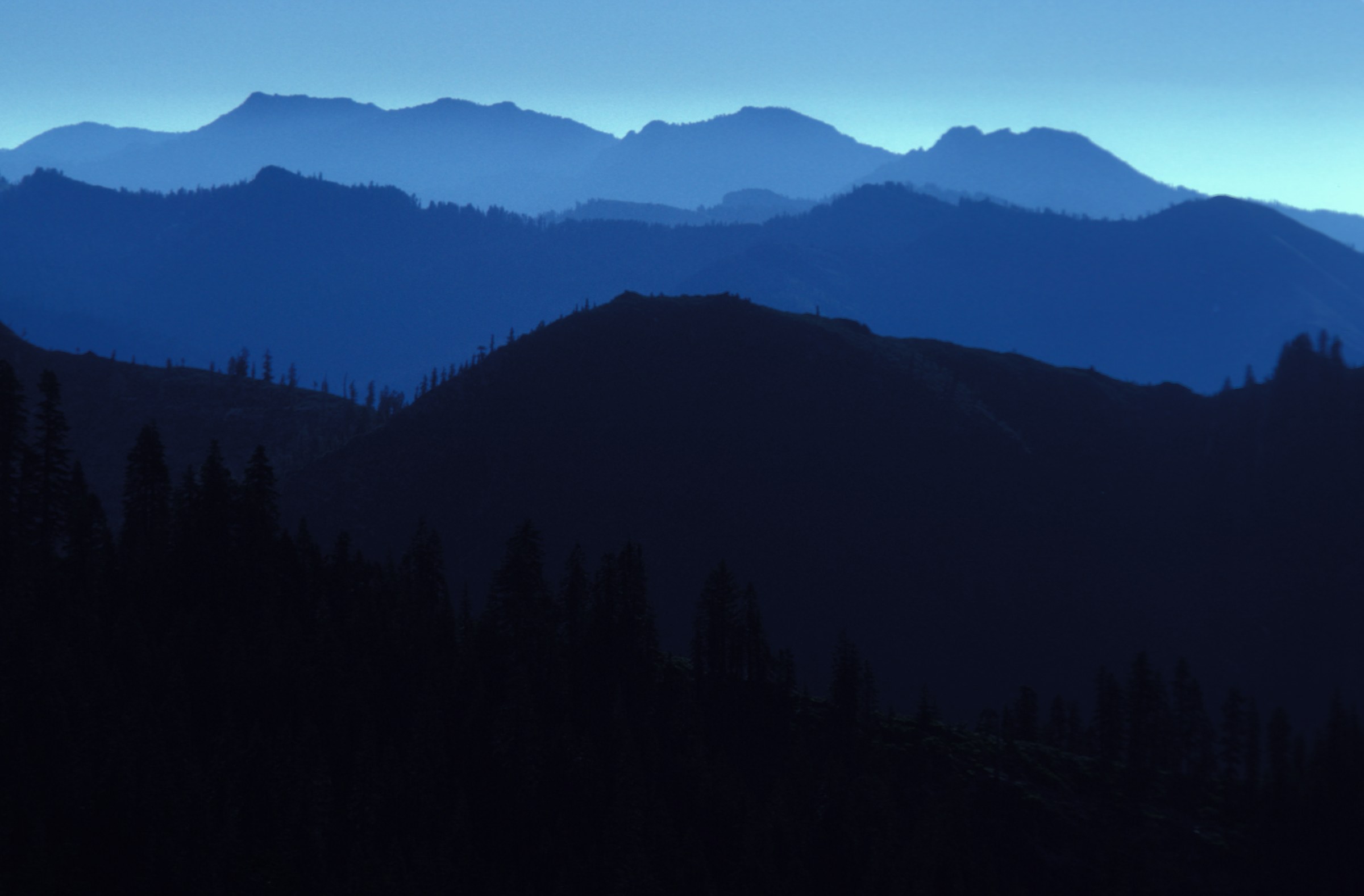
The Russian Wilderness is a compact, high, botanically famous unit in the Klamath Mountains of northern California, tucked between the Scott River and Salmon River drainages. Wilderness Connect lists it at 12,521 acres under the Klamath National Forest, with elevations from roughly 4,800 ft up to Russian Peak at about 8,200 ft, 22 named lakes and a north–south Pacific Crest Trail corridor of about 17 miles.
For day-hikers, that scale translates to short-to-moderate distances that still feel serious: the terrain is steep, glaciated, lake-rich, remote and often brushy or deadfall-affected, and trailheads are reached by mountain roads rather than transit. The area is also one of North America’s most conifer-diverse landscapes — the ridge running south from Little Duck Lake toward Russian Peak includes foxtail pine, whitebark pine, Jeffrey pine and several other high-country species in a single basin.
Current access note checked on 2026-07-13: Klamath National Forest recreation pages were not extractable during research; current fire, smoke, road and trail-closure status is therefore unresolved and must be checked directly with the Klamath National Forest before travel.
See also: Trinity Alps · Siskiyou Mountains.
Selection rationale
The five hikes below cover the range’s core day-hike experiences: an accessible high-lake basin (Statue Lake), the classic namesake-lake approach (Russian and Waterdog via South Russian Creek), the Duck Lakes glacial basin, a Taylor Lake / PCT link to Paynes Lake, and the technical high point (Russian Peak). Together they represent the Russian Wilderness’ lakes, ridges, botanical importance and remote wilderness feel without turning the entry into a backpacking itinerary.
Summary
| # | Hike | Country | Route type | Distance | Gain | Difficulty | Primary trailhead |
|---|---|---|---|---|---|---|---|
| 1 | Statue Lake Trail | USA | Out-and-back | 6.9 km / 4.3 mi | 304 m / 997 ft | Moderate | Music Creek trailhead |
| 2 | Russian and Waterdog Lakes via South Russian Creek | USA | Out-and-back | 18.3 km / 11.4 mi | 780 m / 2,559 ft | Hard | South Russian Creek Trail access, Sawyers Bar |
| 3 | Little Duck and Big Duck Lake | USA | Out-and-back | 14.2 km / 8.8 mi | 739 m / 2,425 ft | Hard | Duck Lakes route access, Callahan side |
| 4 | Taylor Lake trailhead to Paynes Lake | USA | Out-and-back | 9.8 km / 6.1 mi | 381 m / 1,250 ft | Moderate | Taylor Lake trailhead |
| 5 | Russian Peak | USA | Out-and-back summit route | 7.4 km / 4.6 mi | 609 m / 1,998 ft | Strenuous — Class 3 scrambling | Russian Peak route access, Callahan side |
1. Statue Lake Trail
Snapshot
Itinerary
From the Music Creek trailhead the trail climbs into the granite basin holding Statue Lake, a small high lake tucked beneath a steep back wall. Access is from Sawyers Bar via County Highway 1C01, then Forest Road 40N54 near Idlewild Campground.
Why it is essential
The most efficient day-hike in the Russian Wilderness — short enough for a moderate mountain day, and still a genuine high-lake basin.
Equipment
- Trail shoes
- 2 L water
- Navigation backup — the route is signed but remote
- Insect protection in early summer
- Sun protection and warm layer for the exposed basin
Hazards and notes
- Overgrown sections and downed trees reported on the approach — expect slower travel after fire or storm seasons.
- Verify road and current fire conditions before the long drive from Sawyers Bar.
- The Russian Wilderness has no reliable cell coverage; carry an emergency communicator on any full-day outing.
Routes and maps
| Source | URL |
|---|---|
| Wilderness Connect — Russian Wilderness | wilderness.net |
| Klamath National Forest | fs.usda.gov |
| AllTrails — Statue Lake Trail | alltrails.com |
| OpenStreetMap — Statue Lake Trail | openstreetmap.org |
Further reading
2. Russian Lake and Waterdog Lake via South Russian Creek Trail
Snapshot
Itinerary
The route follows remote singletrack through dense forest along Russian Creek, climbing into the Russian Lake basin — the wilderness’ namesake — and continuing to Waterdog Lake. It is the seldom-visited long way to the popular Russian Lake and combines two of the defining lake basins into a single big day.
Why it is essential
Russian Lake is the namesake destination of the wilderness; adding Waterdog Lake makes the day a coherent tour of the range’s defining lake landscape.
Equipment
- Sturdy trail shoes or light boots
- 3 L water plus treatment
- Strong navigation — the trail can be faint
- Insect protection
- Sun and rain layers
- Headlamp, extra food, emergency communicator
Hazards and notes
- Overgrown or hard-to-find sections in high summer; treat as a real wilderness day and turn around early if route-finding slows.
- Very limited services on the Sawyers Bar approach.
- Deadfall and blowdown common after fire or storm seasons.
Routes and maps
| Source | URL |
|---|---|
| Wilderness Connect — Russian Wilderness | wilderness.net |
| Klamath National Forest | fs.usda.gov |
| AllTrails — Russian Lake and Waterdog Lake via South Russian Creek | alltrails.com |
| OpenStreetMap — Russian Lake / Waterdog Lake | openstreetmap.org |
Further reading
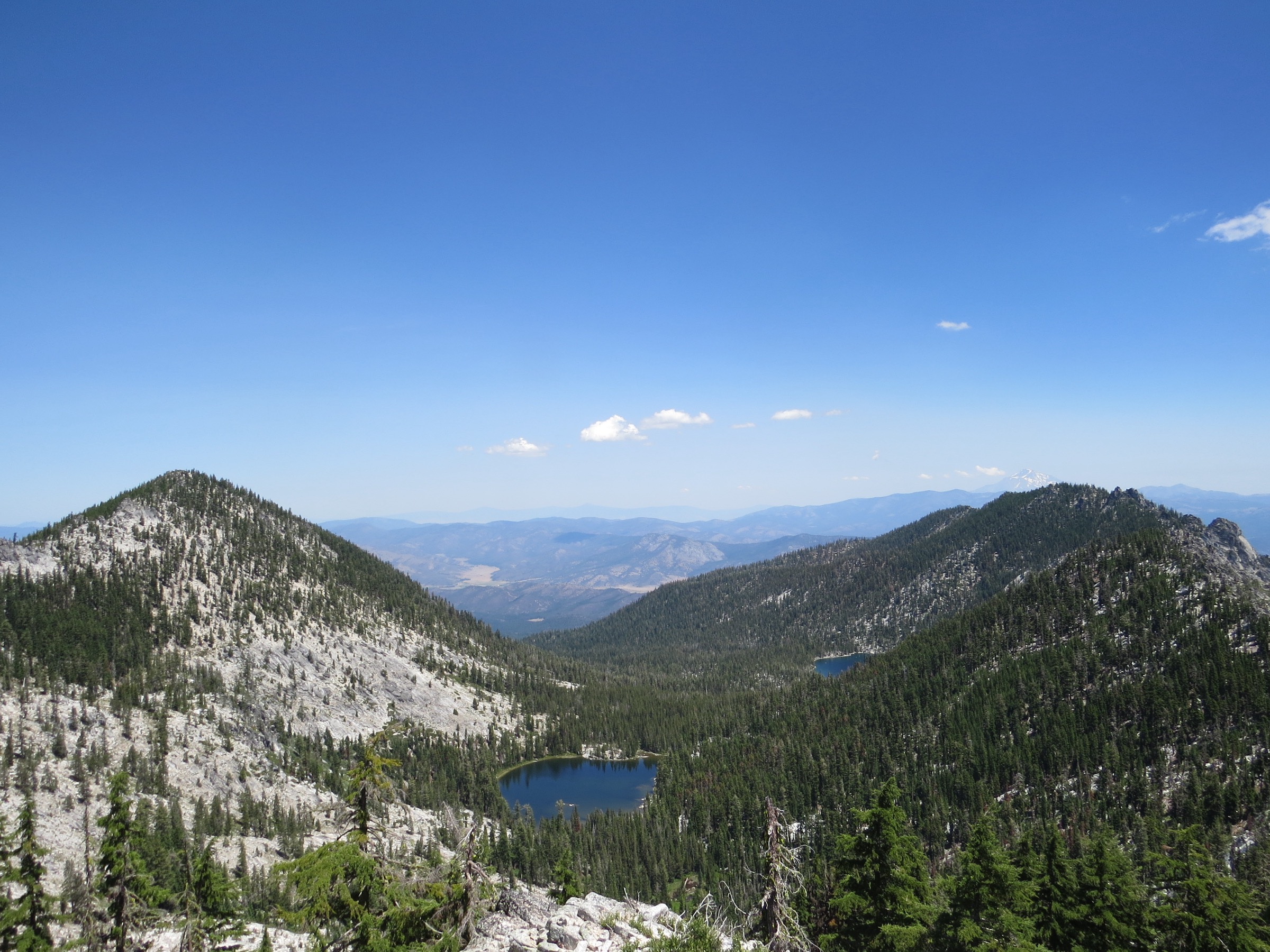
3. Little Duck and Big Duck Lake
Snapshot
Itinerary
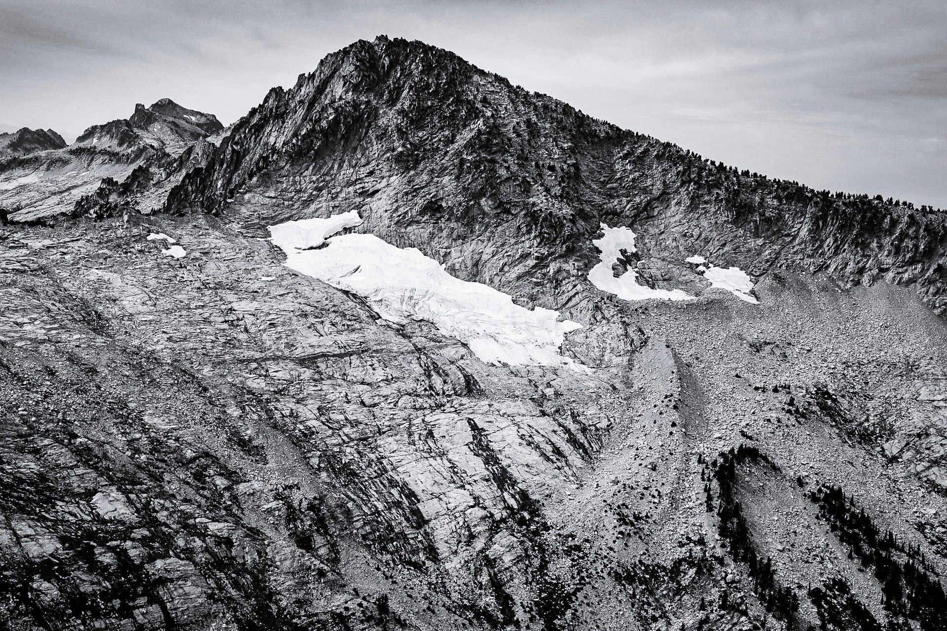
The route climbs through shaded forest and steeper upper sections into the Duck Lakes basin — first Little Duck, then Big Duck, both set in glaciated terrain below the ridges that carry Russian Peak. It is compact but demanding, with real elevation gain for the distance.
Why it is essential
The clearest expression of the Russian Wilderness’ glacial lake landscape, and a natural counterweight to the Russian Lake and Statue Lake objectives.
Equipment
- Sturdy trail shoes
- 2.5 L water plus treatment
- Trekking poles for the descent
- Sun protection and warm layer
- Insect protection
- Navigation backup
Hazards and notes
- Steep climbs and shaded forest sections with downed trees; slower travel after storms or fire.
- Rocky terrain around the lakes — care on wet granite.
- Verify Callahan-side road access before travel.
Routes and maps
| Source | URL |
|---|---|
| Wilderness Connect — Russian Wilderness | wilderness.net |
| Klamath National Forest | fs.usda.gov |
| AllTrails — Little Duck and Big Duck Lake | alltrails.com |
| OpenStreetMap — Duck Lakes | openstreetmap.org |
Further reading
4. Taylor Lake trailhead to Paynes Lake
Snapshot
Itinerary
From the Taylor Lake trailhead the route follows the Taylor Lake Trail toward the Pacific Crest Trail corridor, climbing on the east side of Taylor Lake before continuing to Paynes Lake. It is a shorter, moderate counterpart to the longer Russian Lake and Duck Lakes days.
Why it is essential
Links two of the wilderness’ accessible lake landscapes to the PCT corridor in a single moderate day — the best “sampler” hike in the range.
Equipment
- Trail shoes
- 2 L water plus treatment
- Insect protection
- Sun protection and warm layer
- Headlamp if starting late
Hazards and notes
- Snow can linger on shaded slopes and near passes into early summer.
- Smoke and fire restrictions can shift access quickly in Klamath NF; verify before travel.
- The PCT corridor is well-marked; junctions off the PCT toward Paynes Lake are less obvious.
Routes and maps
| Source | URL |
|---|---|
| Wilderness Connect — Russian Wilderness | wilderness.net |
| Klamath National Forest | fs.usda.gov |
| AllTrails — Taylor Lake to Paynes Lake | alltrails.com |
| OpenStreetMap — Taylor Lake / Paynes Lake | openstreetmap.org |
Further reading
5. Russian Peak
Snapshot
Itinerary
The route follows maintained or semi-maintained approaches near the Bingham Lake / Russian Peak area, then becomes a rugged summit route with steep, exposed granite near the summit and Class 3 hands-on movement. The peak is the high point of the Russian Wilderness and one of the botanically most significant summits of the Klamath Mountains — the ridge below carries foxtail and whitebark pine among many other species.
Why it is essential
The defining summit of the wilderness, and the technical outlier of this catalogue — the hike that tests judgement and scrambling ability rather than only fitness.
Equipment
- Approach shoes or scrambling-appropriate footwear
- Helmet if the party judges rockfall risk significant
- Navigation backup
- Extra water and food
- Sun, wind and warm layers
- Enough experience to retreat cleanly from exposed Class 3 terrain
- Emergency communicator
Hazards and notes
- Class 3 scrambling with real exposure on the upper mountain — not appropriate for hikers uncomfortable with hands-on movement or loose rock.
- Snow, wet rock, smoke, wind or poor visibility are turnaround conditions.
- Long drive from Callahan side; verify road status and fire conditions.
Routes and maps
| Source | URL |
|---|---|
| Wilderness Connect — Russian Wilderness | wilderness.net |
| Klamath National Forest | fs.usda.gov |
| AllTrails — Russian Peak | alltrails.com |
| OpenStreetMap — Russian Peak | openstreetmap.org |
Further reading
Region-wide cautions
- The Russian Wilderness has no reliable cell coverage; carry an emergency communicator on any full-day outing.
- Trailheads are reached by mountain roads from Sawyers Bar (west) or Callahan (east); verify road status and vehicle suitability before every trip.
- Deadfall, overgrown sections and slow route-finding are common in high summer, particularly on the South Russian Creek and Duck Lakes approaches.
- Smoke and fire closures can shift access at short notice across Klamath NF; check the official recreation pages before travel.
- The Russian Peak summit route involves Class 3 scrambling and exposure — treat it as a mountaineering-adjacent day, not a walk.
Routes excluded
- Full Russian Wilderness PCT traverse — a ~17-mile north–south corridor best done as a multi-day trip; the Taylor Lake to Paynes Lake hike samples the corridor in a single day.
- Extended lake-basin loops — several off-trail links between the lake basins are practical for experienced parties but exceed a single-day objective in this catalogue.
Data and media notes
- No official GPX/KML files were found for these five exact day-hike routes; AllTrails pages are used as source-map references, and OpenStreetMap search links are provided as starting points. AllTrails geometry should not be reused without separate permission or independent reconstruction; OSM data is reusable under ODbL.
- Route-relevant licence-compatible images were verified only for the cover (Jeffrey Pine ridge with Russian Peak) and Duck Lakes Valley. Statue Lake, Russian Lake / Waterdog Lake, Paynes Lake and Russian Peak sections ship without figures pending better-resolution licensed photography.
- Current Klamath National Forest closure, fire and road status was not extractable at research time; verify directly with the Forest before travel.