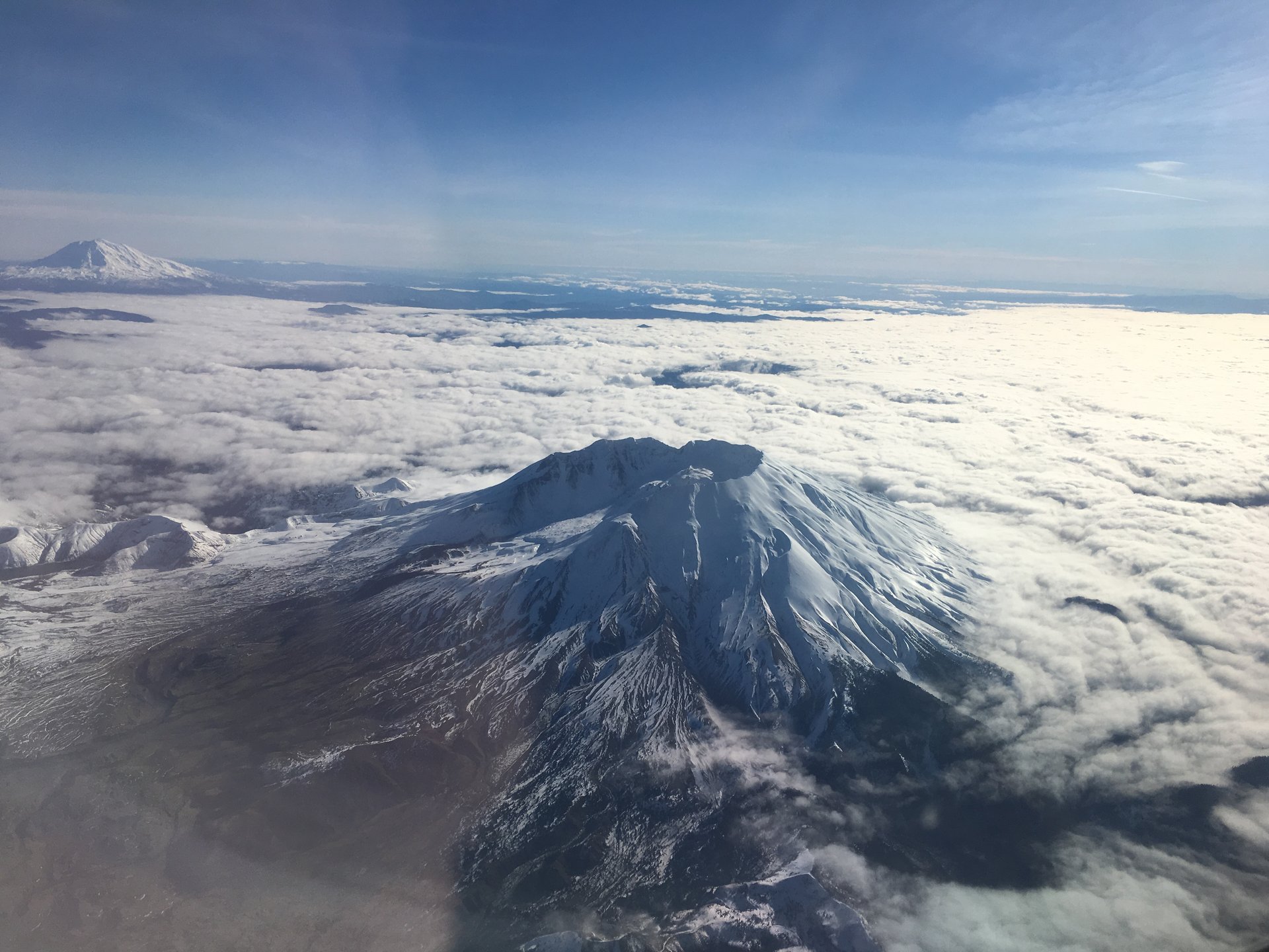
Regional overview
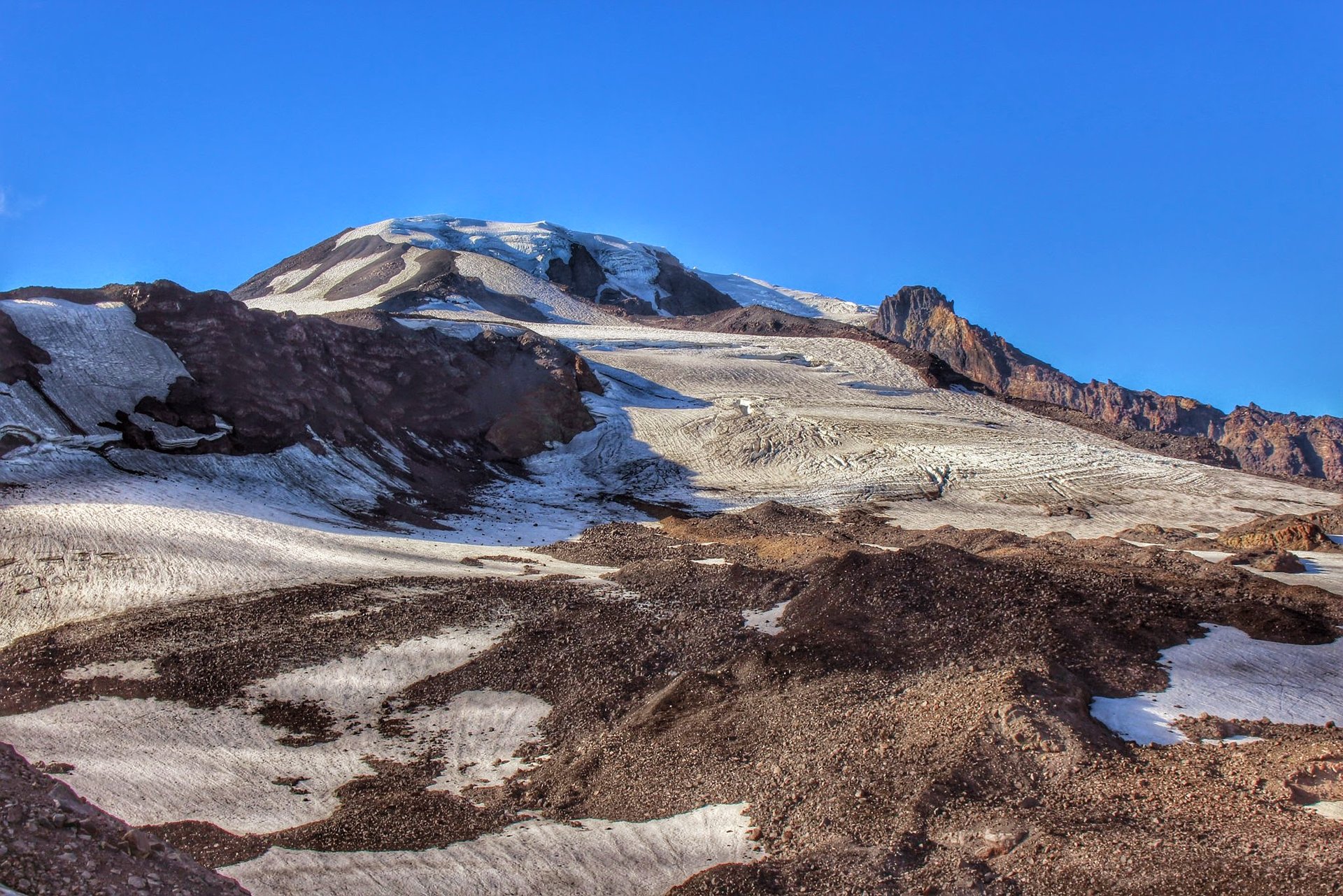
These two volcanoes stand about 50 km apart on either side of the Cascade crest in southern Washington, and they could hardly be less alike. Mount St Helens is the young one, and the broken one. On 18 May 1980 a magnitude-5.1 earthquake released the bulging north flank as a debris avalanche — about 2.5 cubic kilometres of mountain, the largest landslide in recorded history — and the decompressed magma beneath it erupted sideways. The upper 400 m of the summit went with it. What remains is a horseshoe-shaped crater roughly 2 by 3.5 km, open to the north, and a summit that fell from 2,950 m (9,677 ft) to about 2,550 m (8,365 ft), demoting the peak from Washington’s fifth-highest to a rank it no longer troubles anyone about. Lava-dome building continued from 1980 to 1986 and resumed from 2004 to 2008. The volcano currently sits at a normal alert level, but the United States Geological Survey rates its threat “Very High” and calls it the volcano in the contiguous United States most likely to erupt again.
Mount Adams is the old one, and the big one. At 3,742 m (12,277 ft) it is Washington’s second-highest mountain, but its more telling statistic is bulk: it has erupted roughly 300 cubic kilometres of material over the past million years, more than any other Cascade stratovolcano except Shasta. The result is not a cone but a sprawling massif, a broad shouldered mountain carrying twelve named glaciers — Adams on the north-west, Klickitat on the south-east, Lyman, White Salmon, Mazama, Rusk and Wilson among them. Its last eruption was about 3,800 years ago. Where St Helens is a geological event you can walk into, Adams is a mountain you walk beneath, and the contrast between the two is the reason to treat them as a single hiking region.
The walking here is volcanic in a way that will surprise anyone arriving from granite ranges. Above the treeline the ground is loose pumice, scree and ash — the upper thousand feet of the Monitor Ridge climbing route is famously “two steps forward and one step back” — and the blast zone below St Helens is a pumice desert crossed by trails that offer no shade whatsoever. Water is the defining logistical problem: four of the five hikes below have no water at all, on the trail or at the trailhead, and the fifth is unreliable. Carry everything. Navigation is the other trap, because a featureless pumice plain in cloud gives nothing to steer by, and the top of the summit route is unmarked above 2,134 m (7,000 ft). Sun exposure is severe and relentless.
Access is from four small towns — Cougar for the south side of St Helens, Randle for the east, Castle Rock for the west, and Trout Lake for Mount Adams — and it is genuinely complicated in 2026, more so than in any comparable American hiking region. Two things dominate. First, State Route 504 remains closed beyond the Hummocks trailhead, where a 2023 landslide of more than 300,000 cubic yards destroyed the Spirit Lake Outlet Bridge; permanent reconstruction began in April 2026 and the road is expected to reopen in autumn 2026, but Johnston Ridge Observatory needs further restoration beyond that and is not expected back until 2027 at the earliest. The classic west-side viewpoint of the crater, and the Harry’s Ridge walk that goes with it, are simply unavailable this season. Second, the Spirit Lake tunnel reconstruction closes a set of blast-zone trails Monday to Friday, excluding federal holidays, through 31 October 2027 — among them Harry’s Ridge itself, the Truman Trail, and the Plains of Abraham connector. There is a certain symmetry in this: the drainage tunnel being rebuilt is the one bored through bedrock after 1980 to stop Spirit Lake, dammed by the debris avalanche, from bursting and destroying everything downstream. Forty-six years on, the eruption is still closing trails.
Two further points of law and courtesy. The Monument is a scientific reserve as much as a park: entry to the crater is prohibited outright, the Pumice Plain research area is closed to all public entry, and off-trail travel is banned throughout — restrictions that exist to protect one of the world’s most valuable ecological experiments, the study of how a sterilised landscape recovers. Penalties run to US$5,000. And the eastern flank of Mount Adams is not public land. Some 21,000 acres, including Bird Creek Meadows, were restored to the Yakama Nation by executive order in 1972, correcting an error that had stood since the 1855 treaty — a misfiled map, rediscovered in 1930, took another 42 years to put right. Mount Adams is Pahto to the Yakama, and the recreation area on its eastern side opens and closes at the tribe’s discretion, in recent years for roughly one month in late summer. It is covered here as history, not as a hike, for reasons set out in the follow-up section.
Selection rationale
The five walks below split three to two between the volcanoes, and between them they use five different road corridors — so no single closure can take out more than one of them, which in this region is a design requirement rather than a nicety. Every one is legally open seven days a week in 2026, which the obvious shortlist was not.
The Monitor Ridge summit climb is the headline: the only non-technical walk-up of an active volcano in the Lower 48 that ends by looking down into a live crater, and the region’s hardest permit to obtain. Mount Margaret from Norway Pass replaces Harry’s Ridge as the blast-zone viewpoint — it delivers the same head-on panorama of Spirit Lake, its floating log raft and the breached crater, but from the east, outside the construction closure and reachable every day of the week. Ape Canyon and the Plains of Abraham crosses from surviving old-growth forest onto the pumice desert in a single afternoon, which is the clearest lesson in what the lateral blast actually did. Killen Creek and High Camp is the counterweight: alpine meadows, wildflowers and tarns directly beneath the Adams Glacier, and the finest glacier-view walk in the region. Sleeping Beauty is the short one and the historical one, a steep 4 km to a 1930s fire-lookout site on a rock outcrop with all four southern volcanoes in view.
Two candidates were deliberately excluded, and honesty about why matters more than a tidy list. Harry’s Ridge cannot be reached in 2026 — the road is shut and the trail is closed on weekdays regardless. Bird Creek Meadows is on Yakama Nation land whose 2026 opening could not be confirmed; publishing it as a listed hike would risk directing walkers to trespass. The South Climb of Mount Adams is a mountaineering objective, not a hike — 6,700 ft of ascent requiring ice axe, crampons and, per current Forest Service advice, a helmet — and listing it beside a 4 km lookout walk would misrepresent the risk.
Summary table
| # | Hike | Country | Route type | Distance | Gain | Max elevation | Difficulty |
|---|---|---|---|---|---|---|---|
| 1 | Mount St Helens summit via Monitor Ridge | USA | Out-and-back | ~16.1 km (~10 mi) | ~1,372 m | 2,550 m | Very strenuous; non-technical scramble |
| 2 | Norway Pass and Mount Margaret | USA | Out-and-back | 17.7–18.3 km (11.0–11.4 mi) | 700–860 m | 1,762–1,785 m | Strenuous |
| 3 | Ape Canyon and the Plains of Abraham | USA | Out-and-back | 15.1–23.5 km (9.4–14.6 mi) | 430–760 m | ~1,280 m | Moderate–strenuous |
| 4 | Mount Adams — Killen Creek to High Camp | USA | Out-and-back | 12.2–16.1 km (7.6–10.0 mi) | ~700 m | 2,112 m | Strenuous |
| 5 | Sleeping Beauty | USA | Out-and-back | 4.2–4.5 km (2.6–2.8 mi) | ~427 m | 1,494 m | Moderate; steep and sustained |
Distance and elevation figures vary between the Forest Service, the Washington Trails Association and reputable secondary guides, in several cases by wide margins, because sources measure to different turnaround points. Ranges are given where sources genuinely disagree, and the discrepancies are explained in each snapshot.
1. Mount St Helens summit via Monitor Ridge
Snapshot
Itinerary
The route begins at Climbers Bivouac on the mountain’s forested south flank and follows the Ptarmigan Trail #216A, which climbs about 335 m (1,100 ft) in 3.6 km (2.25 mi) of pleasant forest to timberline at roughly 1,463 m (4,800 ft). At about 3.2 km the path crosses the Loowit Trail #216, the 30-mile circumnavigation of the volcano. Above the trees the walking changes completely.
From timberline the route ascends Monitor Ridge itself — a spine of old lava flows and boulder fields between two gullies. There is no trail in any conventional sense. The way is marked by large wooden posts up to about 2,134 m (7,000 ft), and between them walkers pick their own line through blocky lava and boulders dusted with sharp ash and pumice. Hands come out of pockets frequently; gloves are genuinely useful rather than a refinement.
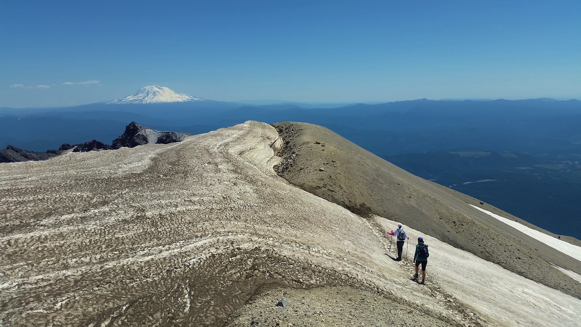
Above the last post the final 400 m (1,300 ft) is unmarked and consists of loose rock, ash and pumice at the angle of repose — the section climbers describe as taking two steps forward and one step back, and as being akin to walking up a sand dune. It is the crux of the day, and it is a crux of patience rather than technique. The slope eases at the crater rim, where the ground drops away without warning into the crater and onto the lava dome, with Mount Adams, Mount Rainier and Mount Hood standing around the horizon. The true summit lies a short distance west along the rim.
Return is by the same route. Descending the upper ash is quick; the boulder field below it is not.
Why it is essential
This is the only non-technical walk-up of an active volcano in the contiguous United States that finishes by looking directly down into a live crater at a growing lava dome. It requires no rope, no axe and no glacier skills in midsummer, yet it delivers a genuine 1,372 m mountain day and a summit view across the whole southern Cascade volcanic chain. It is also, in the most literal sense, a walk to the edge of the 1980 eruption: the rim a climber stands on is the broken edge of the mountain that was there before.
Equipment
- Sturdy boots with good ankle support — the boulder field punishes soft shoes
- Gloves — the lava is sharp and hands are used constantly
- Weatherproof shell and a warm layer; the rim is cold and windy even on hot days
- 3–4 L of water — there is none on the route and none at the trailhead
- Food for a long day
- Sun protection: hat, high-factor sunscreen, sunglasses. There is no shade above timberline and the ash reflects hard
- Gaiters, to keep ash and grit out of boots
- Trekking poles for the descent
- Map, compass and downloaded track — the upper route is unmarked
- Headtorch; many parties finish late
- Climbing permit (printed or on a phone) and photo ID
- Enough supplies to survive an unplanned night out — the Institute advises this explicitly, and there is little to no mobile coverage
Hazards and notes
- The crater rim is unstable and undermined by constant rockfall. The Mount St Helens Institute’s warning is blunt: “EXERCISE EXTREME CAUTION AT THE RIM. Do not approach the unsupported edge of the rim! Stay back — stay alive!” The Forest Service advises staying at least 9 m (30 ft) back from the visible edge
- A cornice forms on the rim and does collapse. People have fallen into the crater. Do not walk to the apparent edge, which may be overhanging snow above nothing
- Entry into the crater is strictly prohibited, and the closure is enforced
- Loose rock on the upper slope, and a real risk of dislodging stones onto parties below — do not climb directly beneath others
- No water anywhere on the route
- Little to no mobile phone coverage
- A climbing permit is required year-round to go above 1,463 m (4,800 ft). From 1 April to 31 October it is booked through Recreation.gov; from 1 November to 31 March it is free and self-issued at the trailhead
- Permits are the hardest part of this hike. The quota is 110 climbers per day from 15 May, and permits are released in one-month blocks at 07:00 Pacific on the first day of the preceding month — a mid-July climb goes on sale on 1 June. Summer weekends sell out within minutes
- The fee is quoted as US$20 per climber on Recreation.gov and US$15 by the Mount St Helens Institute, both plus a US$6 non-refundable reservation fee. Confirm at booking
- Maximum group size is 12 per permit; the permit holder must be 18 or over
- A Northwest Forest Pass or America the Beautiful pass is also needed to park at Climbers Bivouac, though the day-use fee is waived for permit holders on their climb date
- Forest Road 830 is not suitable for RVs or trailers
GPX / KML links
| Source | URL | Format | Notes |
|---|---|---|---|
| USFS — Monitor Ridge Climbing Route | fs.usda.gov | Official route description | No downloadable GPX published |
| USFS FSGeodata — National Forest System Trails | data.fs.usda.gov | Shapefile / geodatabase | Authoritative trail geometry incl. Ptarmigan #216A and Loowit #216; US federal government work |
| Mount St Helens Institute — climbing information | mshinstitute.org | Route and conditions | Current conditions updated through the season |
The upper route above timberline is a marked corridor rather than a constructed trail, so no trail geometry exists for it in any official dataset — a track for the section above 1,463 m has to be recorded or drawn by hand.
Sources
- USFS — Monitor Ridge Climbing Route
- USFS — Climbers Bivouac trailhead
- Recreation.gov — Mount St Helens climbing permit
- Mount St Helens Institute — current conditions
- Washington Trails Association — Mount St Helens: Monitor Ridge
2. Norway Pass and Mount Margaret
Snapshot
Itinerary
This walk replaces Harry’s Ridge, which is unreachable in 2026, and it arguably does the job better. It starts on the east side of the Monument, outside the Spirit Lake construction closure, and it is open seven days a week.
From the Norway Pass trailhead the Boundary Trail #1 climbs left through the 1980 blast zone — dusty, ashy ground scattered with the silvered trunks of the ghost forest, felled in ranks by the lateral blast and never removed. At about 1.5–1.8 km the path meets the Independence Ridge Trail #227A and bears right, continuing to climb the exposed hillside in long traverses.
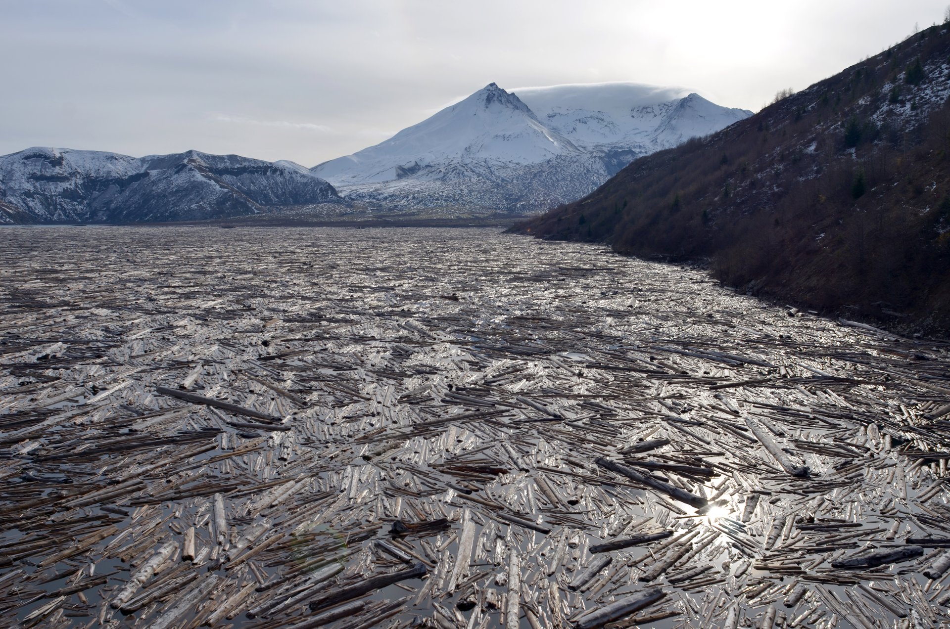
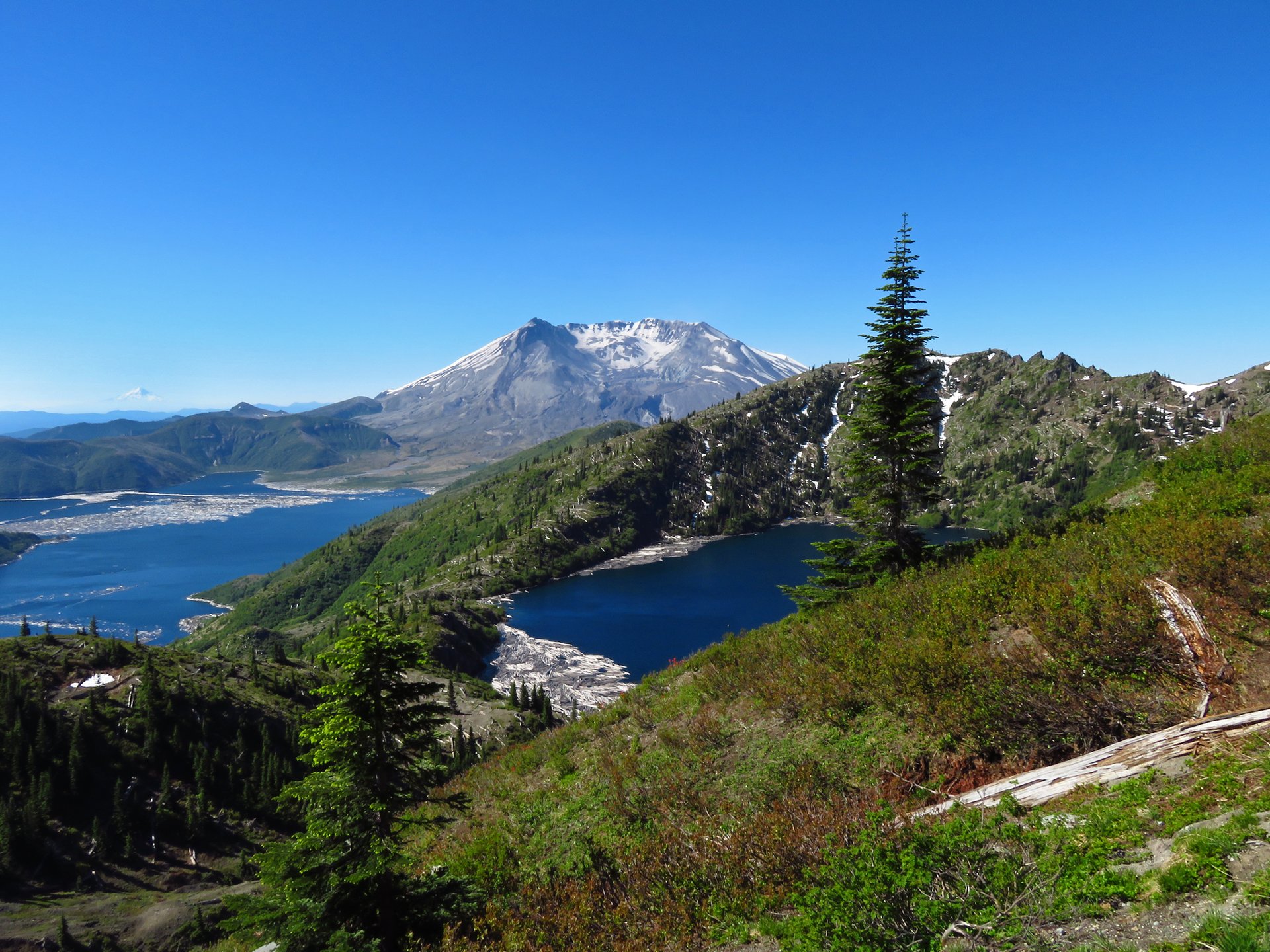
At 3.4 km (2.1 mi) the trail reaches Norway Pass at about 1,372 m (4,500 ft), and this is the moment the walk exists for. Nothing of the volcano is visible until this point — the Forest Service notes that St Helens “remains hidden from view until the trail reaches a rewarding vista at Norway Pass” — and then the whole thing opens at once: Spirit Lake directly below, its surface still carrying the enormous mat of floating logs, and beyond it the breached crater with the pumice plain spilling out of the gap. For many walkers this is the day, and turning round here makes a fine short outing.
Continuing, the Boundary Trail passes the Lakes Trail #211 junction near Bear Pass at about 4.7 km and stays left, reaching Bear Camp at roughly 6.6 km, where water is sometimes available into mid-season. The trail then climbs past a pass at about 1,731 m (5,680 ft) and the Whittier Ridge Trail #214 junction at about 7.6 km — a trail the Forest Service describes as “extremely challenging, very narrow, crosses steep cliffs, and is unsuitable for inexperienced hikers,” and which is not part of this route.
At about 8.5 km (5.3 mi) an obvious but unsigned path branches right, and climbs in a few hundred metres to the summit of Mount Margaret. The view runs to Mount Rainier in the north, Mount Adams in the east, the St Helens Lake basin below, and — southward — Spirit Lake and the crater in a single frame. Return by the same route.
Why it is essential
It is the finest blast-zone walk still open. Every element of the 1980 catastrophe is legible from the Boundary Trail in one continuous sequence — the flattened ghost forest underfoot, the log raft on the lake, the breach in the crater wall, the pumice plain pouring through it — and the walk arrives at that view suddenly, at a pass, exactly as a walk should. With Johnston Ridge closed, this is the region’s essential interpretive day, and unlike the west-side alternatives it is reachable every day of the week.
Equipment
- Hiking boots or sturdy trail shoes; the ash surface is dusty when dry and slick when wet
- Weatherproof shell and a warm layer for the exposed ridge
- 3 L of water. Treat this route as dry: the Forest Service lists a hand pump at the trailhead but WTA and other guides record no water at all, and on-trail sources at Bear Camp are seasonal and unreliable by late summer
- Sun protection — there is no shade anywhere on this route, and the exposure is relentless
- Trekking poles for the descent
- Map and downloaded track
- Insect repellent in early summer
Hazards and notes
- Total sun exposure and no shade. The Forest Service notes that “portions of this part of the trail are steep and little shade is offered” — on a hot day this is the main hazard
- Ash surfaces become slick and dangerous when wet
- Trails beyond the pass periodically close after landslides; check current alerts
- Do not be tempted onto the Whittier Ridge Trail, which crosses steep cliffs and is unsuitable for inexperienced walkers
- Day hiking needs no backcountry permit — only a US$5 vehicle day-use fee, Northwest Forest Pass or America the Beautiful pass. Overnight camping in the Mount Margaret Backcountry is a separate reserved permit at US$7 per person per night
- Approach from the south via Forest Road 25. FR 26 from the north has storm damage and requires high clearance
- Bicycles and stock are prohibited throughout the Mount Margaret Backcountry; no campfires; dogs on a leash
- Off-trail travel is prohibited in this part of the Monument
- Forest Roads 99 and 26 normally open from late June and close in November
GPX / KML links
| Source | URL | Format | Notes |
|---|---|---|---|
| USFS — Mount Margaret Backcountry | fs.usda.gov | Official page | Route and permit information; no GPX |
| USFS FSGeodata — National Forest System Trails | data.fs.usda.gov | Shapefile / geodatabase | Contains Boundary Trail #1 geometry; US federal government work |
| Recreation.gov — Mount Margaret Backcountry permits | recreation.gov | Permit portal | Overnight only; day hikers exempt |
Sources
- Washington Trails Association — Mount Margaret (Mount St Helens) — note that WTA hosts a second, unrelated “Mount Margaret” near Snoqualmie Pass; figures of 5,459 ft refer to the wrong peak
- Washington Trails Association — Norway Pass
- USFS — Norway Pass trailhead
- USFS — Mount Margaret Backcountry
- The Mountaineers — Mount Margaret via Norway Pass
3. Ape Canyon and the Plains of Abraham
Snapshot
Itinerary
The trail leaves Forest Road 83 beside the Muddy River — the drainage that carried a lahar down this side of the mountain in 1980 — and climbs through a plantation of young trees before entering groves of large Douglas fir, silver fir and noble fir. This is surviving old growth, protected from the blast by the ridge above, and it makes the transition that follows all the more striking.
After about 5 km the path emerges onto an open ridge crest, with views east into the slot of Ape Canyon and out to Mount Adams, and then crosses patches of 1980 standing dead forest — trees killed where they stood. In its upper reaches Ape Canyon narrows dramatically; at the head of the canyon the walls close to a few metres apart.
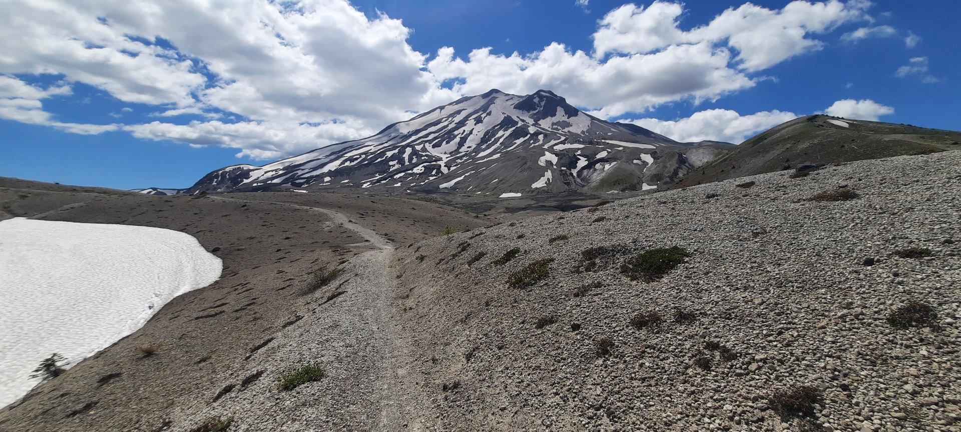
At about 7.2 km (4.5 mi) the Ape Canyon Trail ends at its junction with the Loowit Trail #216 at roughly 1,271 m (4,170 ft). Turning right and north on the Loowit, the trail climbs a further 800 m or so and emerges onto the Plains of Abraham: a flat, open expanse of pumice below the volcano’s east flank, laid down by the pyroclastic surges of 18 May 1980, and named — with the dry wit of the region — for the plain outside Quebec. It is a desert. Nothing casts a shadow. The crater wall rises directly ahead.
Walkers can cross as much of the Plains as time allows before returning the way they came. The out-and-back described here is legal seven days a week.
Why it is essential
No other day walk in the region moves so cleanly from before to after. The lower trail passes through the forest as it was; the upper trail crosses the ground as the blast left it, and the two are separated by a single ridge. The Plains of Abraham are the clearest surviving demonstration of what a pyroclastic surge does to a landscape, and reaching them on foot from an old-growth trailhead makes the point better than any interpretive display.
Equipment
- Hiking boots or trail shoes
- Weatherproof shell and warm layer — the Plains are wind-scoured
- 3 L of water. There is none on the trail and none at the trailhead
- Sun protection: the upper half of this walk has no shade at all
- Trekking poles
- Map, compass and downloaded track — the pumice is featureless in cloud
- Gaiters, for pumice and grit
Hazards and notes
- This is a popular mountain-bike descent, and bike traffic is heavy at weekends. The Forest Service asks walkers to expect it and share the trail — the route forms part of a well-known circuit ridden down from Windy Ridge
- Steep, near-vertical drops at the rim of Ape Canyon
- The route north across the Plains toward Windy Ridge is closed Monday to Friday (excluding federal holidays) through 31 October 2027, under the Spirit Lake tunnel construction order — the closure covers the Abraham Trail #216D connector, the Truman Trail #207 and the Forest Road 99 extension. The out-and-back from Ape Canyon on trails #234 and #216 is not affected and is open every day. Most online descriptions of this walk frame it as a Windy Ridge loop; that version is a weekend-only outing until the works finish
- Off-trail travel is prohibited in this part of the Monument
- Parking is for approximately seven vehicles and regularly overflows in summer; overflow parking exists at Lava Canyon and the Lahar Viewpoint
- The Forest Service notes the trail may not have received maintenance — expect blowdown
- No water, no toilets at the trailhead
- A Northwest Forest Pass, US$5 day pass or America the Beautiful pass is required
GPX / KML links
| Source | URL | Format | Notes |
|---|---|---|---|
| USFS — Trail #234 Ape Canyon | fs.usda.gov | Official trail page | Route description; no GPX |
| USFS — Trail #216 Loowit | fs.usda.gov | Official trail page | The 30-mile circuit of the volcano |
| USFS FSGeodata — National Forest System Trails | data.fs.usda.gov | Shapefile / geodatabase | Carries the official trail numbers used by the closure orders; US federal government work |
Sources
- USFS — Trail #234 Ape Canyon
- USFS — Ape Canyon trailhead
- USFS — Spirit Lake Infrastructure Project trail closures
- Washington Trails Association — Ape Canyon
- Oregon Hikers — Ape Canyon Hike
4. Mount Adams — Killen Creek to High Camp
Snapshot
Itinerary
From the small trailhead on Forest Road 2329 the Killen Creek Trail #113 climbs steadily — steeply in places, with steps built in to control erosion — through dry, dusty lodgepole forest. After roughly 3 km the trees begin to open, and the path enters a succession of meadows carrying vast wildflower displays: lupine, paintbrush and aster in season, threaded by small streams.
At 5 km (3.1 mi), at about 1,829 m (6,000 ft), the trail crosses the Pacific Crest Trail in the open ground of Adams Creek Meadows, close to the junction with the High Camp Trail #10. Continuing straight and up, the path leaves the last trees behind and climbs steep, rocky, scrambly ground — the hardest walking of the day, though it remains a walk.
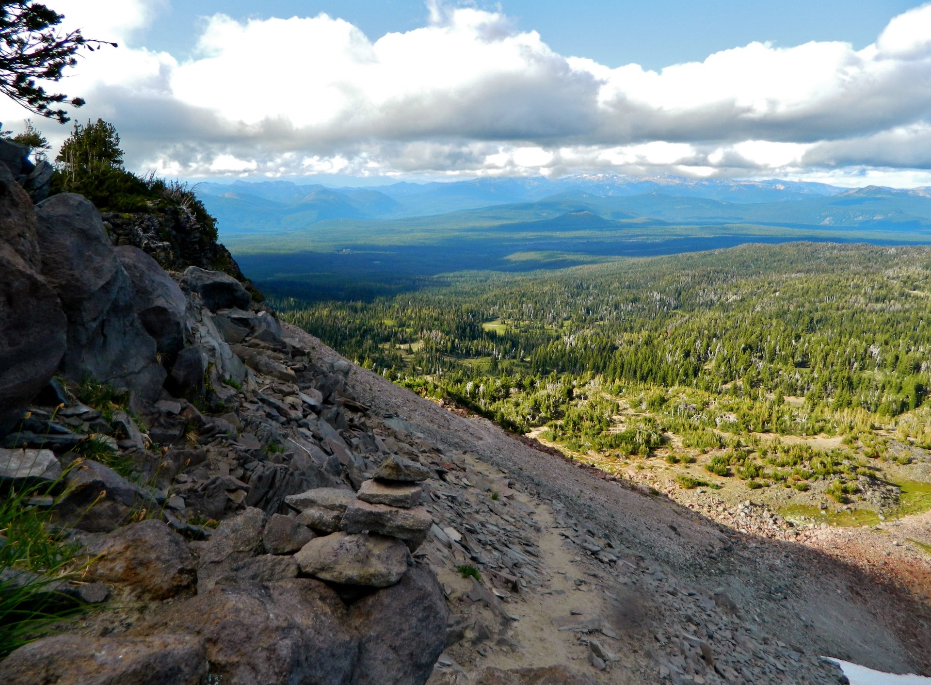
High Camp sits at 2,112 m (6,928 ft): a high alpine meadow of tarns and heather set directly beneath the Adams Glacier, whose crevassed tongue falls from the mountain’s north-west face immediately above. Mount Rainier stands to the north and the Goat Rocks to the north-west. It is one of the great mountain amphitheatres of the Cascades, and it is reached on a maintained trail.
Return the way you came.
Why it is essential
This is the region’s counterweight to the blast zone: a walk that ends beneath a living glacier rather than inside a destroyed landscape, and the best glacier viewpoint in southern Washington reachable without mountaineering equipment. The wildflower meadows on the approach are among the finest on the mountain, and the sudden arrival at a tarn-strewn alpine bench under a hanging glacier is the kind of thing walkers remember for years.
Equipment
- Sturdy boots — the upper section is loose and rocky
- Weatherproof shell and warm layer; High Camp is exposed and cold
- 2.5–3 L of water. The Forest Service records no water on the trail; the streams crossed in the meadows are seasonal and unreliable by late summer
- Sun protection
- Trekking poles
- Insect repellent — mosquitoes here are notorious in early season
- Map and compass; the Forest Service advises being prepared to use them
- Microspikes in early season for lingering snow patches near High Camp
- Free self-issued wilderness permit, available at the trailhead
- Northwest Forest Pass or America the Beautiful pass for parking
Hazards and notes
- The permit line runs at 7,000 ft, and High Camp is 72 feet below it. The US$20 Mount Adams Climbing Pass (the “Cascade Volcano Pass”) is required for anyone aged 16 or over travelling above 2,134 m (7,000 ft) in the Mount Adams Wilderness between 1 May and 30 September — even if not attempting the summit. High Camp, at 2,112 m (6,928 ft), sits just below the threshold, so a walk to High Camp and no higher does not need it. Anyone continuing up toward the glacier terminus crosses the line and does. (One Forest Service page gives the season as starting 1 June rather than 1 May; assume 1 May)
- A free, self-issued wilderness permit is always required, whether or not the climbing pass is
- Do not attempt to continue onto the Adams Glacier without glacier-travel skills and equipment; it is crevassed
- Lingering snow on north-facing slopes into July; loose rocky terrain above the PCT
- Campfires are prohibited on this trail and at High Camp, and forest-wide fire restrictions run 1 July to 31 October 2026
- Parking is for eight vehicles, on gravel. No toilets, no water
- Delicate alpine vegetation at High Camp — stay on the path
GPX / KML links
| Source | URL | Format | Notes |
|---|---|---|---|
| USFS — Trail #113 Killen Creek | fs.usda.gov | Official trail page | Segment lengths and conditions |
| USFS — Trail #10 High Camp | fs.usda.gov | Official trail page | Confirms High Camp at 6,928 ft |
| USFS FSGeodata — National Forest System Trails | data.fs.usda.gov | Shapefile / geodatabase | Contains #113, #10 and the PCT; US federal government work |
Sources
- USFS — Trail #113 Killen Creek
- USFS — Trail #10 High Camp
- USFS — Mount Adams summit and climbing pass
- Recreation.gov — Mount Adams Climbing Activity Pass
- Washington Trails Association — Killen Creek
5. Sleeping Beauty
Snapshot
Itinerary
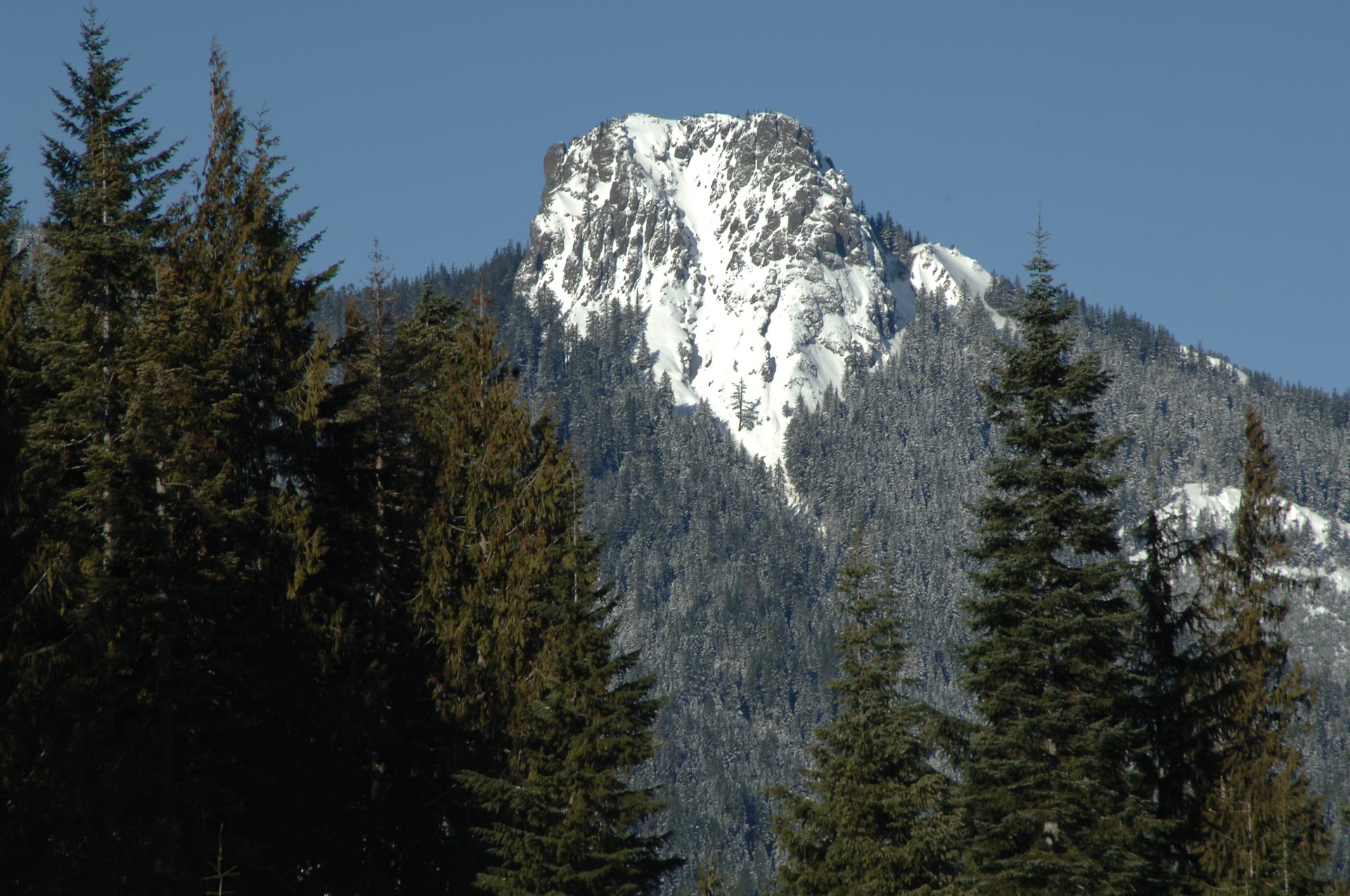
The trail starts climbing immediately, and does not stop. It rises through dense second-growth forest that gives way to old-growth Douglas fir and mountain hemlock, holding a continuous steep grade for about 1.6 km before levelling briefly near the ridge top. It then zigzags up bare rock, threading a line through cliff bands, to the old fire-lookout site on the summit outcrop.
The lookout is gone — an L-4 cab built around 1929–1931 and removed in the late 1960s — but the eyebolts that anchored it to the rock are still there, and so is the reason it was put here. The summit is a small rock platform with a clear view down the Trout Lake valley and out to Mount Adams, with Mount St Helens, Mount Rainier and Mount Hood visible in clear conditions. Four volcanoes from a peak that takes barely an hour and a half to climb.
Return by the same route; the descent is steep and hard on the knees.
Why it is essential
It is the region’s best payoff for the least effort, and it is the historical hike of the set. The fire-lookout network that once covered these forests has almost entirely vanished, and Sleeping Beauty is where its logic is most legible: a rock tower placed exactly where a single watcher could see four volcanoes and the valleys between them. It is also the only short walk here — a set consisting entirely of eight-hour days would misrepresent the region — and its longer season makes it the reliable option when the high trails are still under snow.
Equipment
- Hiking boots with good grip — the upper section crosses bare rock
- Weatherproof shell and warm layer
- 1.5–2 L of water. There is none on the trail and none at the trailhead
- Sun protection — the summit rock is exposed and gets genuinely hot in summer
- Trekking poles, which earn their place on the descent
Hazards and notes
- Sheer drop-offs at the ridge crest and on the summit outcrop. The rock platform is small and unfenced
- Sustained steep grade — about 427 m of climb in roughly 2 km
- The summit rock becomes very warm in summer, with no shade
- Parking is for three vehicles only, with limited turning space. This is the most parking-constrained trailhead in the region; arrive early or have a plan B
- No pass or fee is required — unusually for this region
- Hikers only: bicycles and all motorised use are prohibited. Dogs on a leash
- No toilets, no water at the trailhead
- Forest Road 8810 and the 040 spur: road quality is not described by official sources, and directions given by the Forest Service and WTA do not reconcile cleanly. Allow extra time to find the trailhead
GPX / KML links
| Source | URL | Format | Notes |
|---|---|---|---|
| USFS — Trail #37 Sleeping Beauty Peak | fs.usda.gov | Official trail page | Route description; no GPX |
| USFS — Sleeping Beauty trailhead | fs.usda.gov | Official page | Parking and access |
| USFS FSGeodata — National Forest System Trails | data.fs.usda.gov | Shapefile / geodatabase | Contains Trail #37; US federal government work |
Sources
- USFS — Trail #37 Sleeping Beauty Peak
- USFS — Sleeping Beauty trailhead
- Washington Trails Association — Sleeping Beauty Peak
Missing data / follow-up work
- Harry’s Ridge and Johnston Ridge Observatory are unavailable in 2026, and the guidance here should be revisited before the 2027 season. State Route 504 reconstruction is expected to finish in autumn 2026, but the observatory needs further restoration afterwards and no reopening date has been published. WTA currently states the road is expected closed through 2027. If and when both reopen, Harry’s Ridge belongs in this list — but note that its trail (#1E) is separately closed Monday to Friday until 31 October 2027 under the Spirit Lake construction order.
- Bird Creek Meadows could not be published as a hike. The Mount Adams Recreation Area on the mountain’s eastern flank is Yakama Nation land, and in recent years has opened to non-tribal visitors for only about a month in late summer. No 2026 opening announcement could be found, and the Forest Service explicitly declines to speak for the area, maintaining its trails only as far as the reservation boundary. Anyone wishing to visit must contact Yakama Nation Tribal Forestry directly (509-865-5121 ext. 4613) for current opening dates and day-use fees. It is a genuinely beautiful place and its exclusion here reflects the access position, not its quality.
- The Mount St Helens climbing permit fee is quoted inconsistently — US$20 per climber on Recreation.gov, US$15 by the Mount St Helens Institute, both plus a US$6 reservation fee. Confirm at booking.
- Killen Creek total distance is unresolved: the Forest Service’s own segment lengths sum to 7.6 mi return, while WTA gives 10.0 mi. Both are given.
- Mount Margaret’s summit elevation is given as 5,780 ft by WTA and 5,858 ft by The Mountaineers. Both are printed above; neither has been reconciled against a survey source.
- The Mount Adams climbing-pass season start date is given as 1 May by Recreation.gov and the Forest Service summit page, but 1 June on the Forest Service Killen Creek trailhead page. Assume 1 May.
- Photography for the lesser trails is thin. No licence-compatible image of the Monitor Ridge boulder field itself could be found — the photograph used shows the summit view instead — and the only free image of Sleeping Beauty shows the peak in winter. No licence-compatible summit view from Sleeping Beauty exists at all; every candidate was all rights reserved.
- Forest Road 8810 access to Sleeping Beauty is described differently by the Forest Service and WTA, and the two sets of directions do not reconcile. Road quality is not stated by any official source.
- Fire restrictions are in force forest-wide from 1 July to 31 October 2026, with fire danger rated High on Mount Adams. Conditions change; check current alerts before travel.
Further reading
| Source | URL |
|---|---|
| USFS — Mount St Helens National Volcanic Monument | fs.usda.gov |
| USFS — Gifford Pinchot National Forest alerts and closures | fs.usda.gov |
| USFS — Spirit Lake Infrastructure Project trail closures | fs.usda.gov |
| USFS — Mount St Helens Volcanic Monument restrictions | fs.usda.gov |
| USFS — Mount Adams summit and climbing pass | fs.usda.gov |
| Mount St Helens Institute — current conditions | mshinstitute.org |
| Recreation.gov — Mount St Helens climbing permit | recreation.gov |
| WSDOT — rebuilding SR 504 | wsdot.wa.gov |
| USGS — Mount St Helens | usgs.gov |
| USGS — Mount Adams | usgs.gov |
| USFS FSGeodata Clearinghouse — National Forest System Trails | data.fs.usda.gov |
| Washington Trails Association | wta.org |