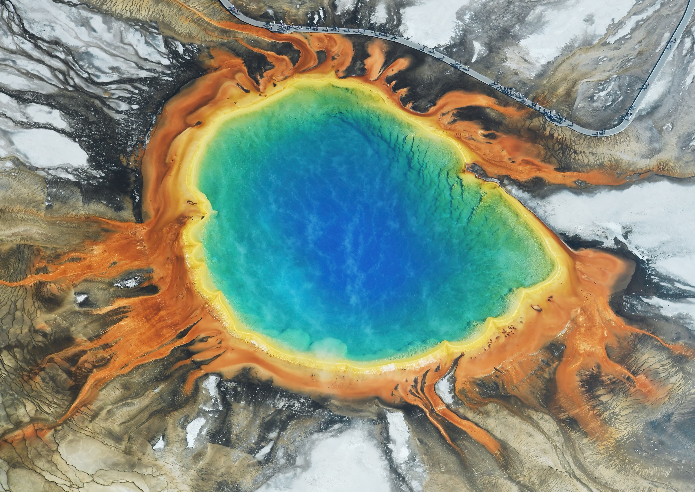
Regional overview
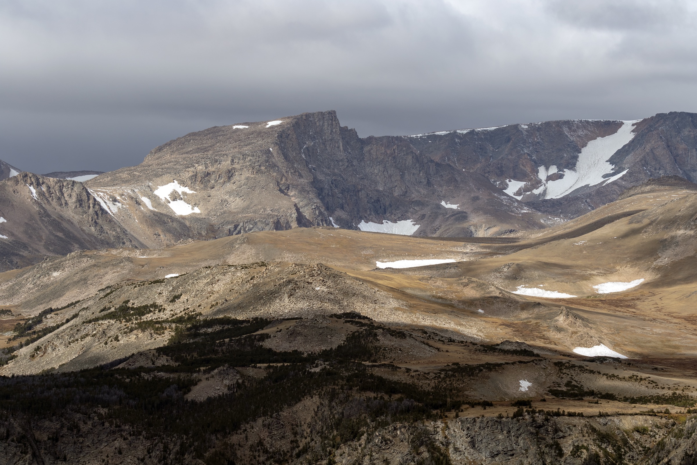
The Yellowstone Plateau is the high, rolling volcanic tableland that forms the core of Yellowstone National Park — a roughly 2,200 km² (850 sq mi) surface sitting between 2,200 m and 2,800 m above sea level, capped in the north-east by the Washburn Range, cut on the north by the Grand Canyon of the Yellowstone, held on the south-east by the Absaroka wall, and ringed to the west and south by the great geyser basins and the shore of Yellowstone Lake. The plateau is the resurgent floor of the Yellowstone Caldera, one of the largest active volcanic systems on the continent, and the thermal features, lakes, canyons and forested benches that structure its day-hike terrain are all products of that setting.
The park is administered by the National Park Service and the plateau’s day-hiking is concentrated in four corridors along the Grand Loop Road. The Canyon–Tower section provides the Mount Washburn and Grand Canyon rim trailheads; the Fishing Bridge–Lake–East Entrance corridor accesses Avalanche Peak and Elephant Back; the Old Faithful–Madison section reaches the Fairy Falls / Grand Prismatic Overlook trailhead; and the Norris–Mammoth stretch links the northern geyser basins with the front range. The NPS publishes trail statistics, closures and the current-season road-status map on its Yellowstone plan-your-visit pages, and issues bear-management-area closures each spring that can affect specific trails without notice.
The reliable snow-free walking season on the plateau’s higher features — Mount Washburn’s ridge, Avalanche Peak’s cirque, the highest sections of the canyon rim — is mid-July to mid-September. Lower canyon-rim, geyser-basin and lake-shore trails are typically usable from late May to early October, tracking the park’s road-opening schedule. Afternoon thunderstorms and lightning are the dominant summer risk on any exposed ridge or summit, and the working practice is to start early and be off high ground by early afternoon. Both grizzly and black bears are present throughout the plateau, and Yellowstone requires that visitors carry and know how to use bear spray, hike in groups of three or more where possible, make noise on blind sections, and follow strict food-storage rules at trailheads. Hydrothermal hazards — scalding water, thin crust, unstable ground — are unique to Yellowstone and constrain off-trail movement in every geyser basin.
Regulation is strict. Dogs are not permitted on any trail in Yellowstone National Park. A park entrance fee applies at all staffed entrance stations. Cell coverage is spotty and largely limited to the developed areas at Canyon, Old Faithful, Lake and Mammoth; treat the backcountry as unreachable by phone. For neighbouring ranges in the same broader region, see the sister catalogues on the Gallatin Range on the plateau’s north-west shoulder, and the Teton Range an hour south down the John D. Rockefeller Jr. Memorial Parkway.
See also: Madison Range, Montana · Gallatin Range.
Selection rationale
The five routes below sample the plateau’s main day-hike faces: an alpine fire-lookout summit, a canyon-rim descent to the river, an east-rim non-technical peak day, a thermal-basin overlook walk, and a compact lake-view classic. Mount Washburn is the plateau’s flagship summit and the most historically dense walk in the park — a working fire lookout, sweeping caldera panorama and reliable bighorn-sheep sightings. Seven Mile Hole is the only maintained trail that descends from the canyon rim into the Grand Canyon of the Yellowstone itself — a steep, hot, committing day that puts the walker inside the canyon rather than above it. Avalanche Peak is the eastern rim’s classic non-technical summit — steep, direct, exposed above treeline, and the shortest way to a 3,100 m viewpoint over Yellowstone Lake and the Absaroka wall. Fairy Falls with the Grand Prismatic Overlook links the plateau’s most photographed thermal feature with a 60 m waterfall in a single low-elevation loop. Elephant Back Mountain closes the selection with the short, well-documented plateau-classic summit above the north end of Yellowstone Lake.
Long backcountry routes (the Bechler Meadows overnight, Heart Lake, Thorofare) and technical objectives are out of scope for a day-hike catalogue. The Uncle Tom’s Trail to the Lower Falls was excluded because access has been intermittent through the current construction cycle and its status varies year to year; the Fairy Falls / Grand Prismatic Overlook pair was preferred as the reliable thermal-basin representative.
Summary
| # | Hike | Trailhead | Route type | Distance | Gain | Max elevation | Difficulty |
|---|---|---|---|---|---|---|---|
| 1 | Mount Washburn via Dunraven Pass | Dunraven Pass Trailhead | Out-and-back | ~10.6 km | ~430 m | 3,122 m | Moderate–hard |
| 2 | Seven Mile Hole | Glacial Boulder Trailhead | Out-and-back | ~17.7 km | ~490 m descending / ~490 m regaining | ~2,395 m | Hard |
| 3 | Avalanche Peak | Avalanche Peak Trailhead (East Entrance Road) | Out-and-back | ~7.4 km | ~640 m | ~3,110 m | Hard |
| 4 | Fairy Falls and Grand Prismatic Overlook | Fairy Falls Trailhead | Out-and-back | ~8.4 km | ~65 m | ~2,290 m | Easy–moderate |
| 5 | Elephant Back Mountain loop | Elephant Back Trailhead | Loop | ~5.6 km | ~240 m | ~2,472 m | Moderate |
1. Mount Washburn via Dunraven Pass
Snapshot
Itinerary
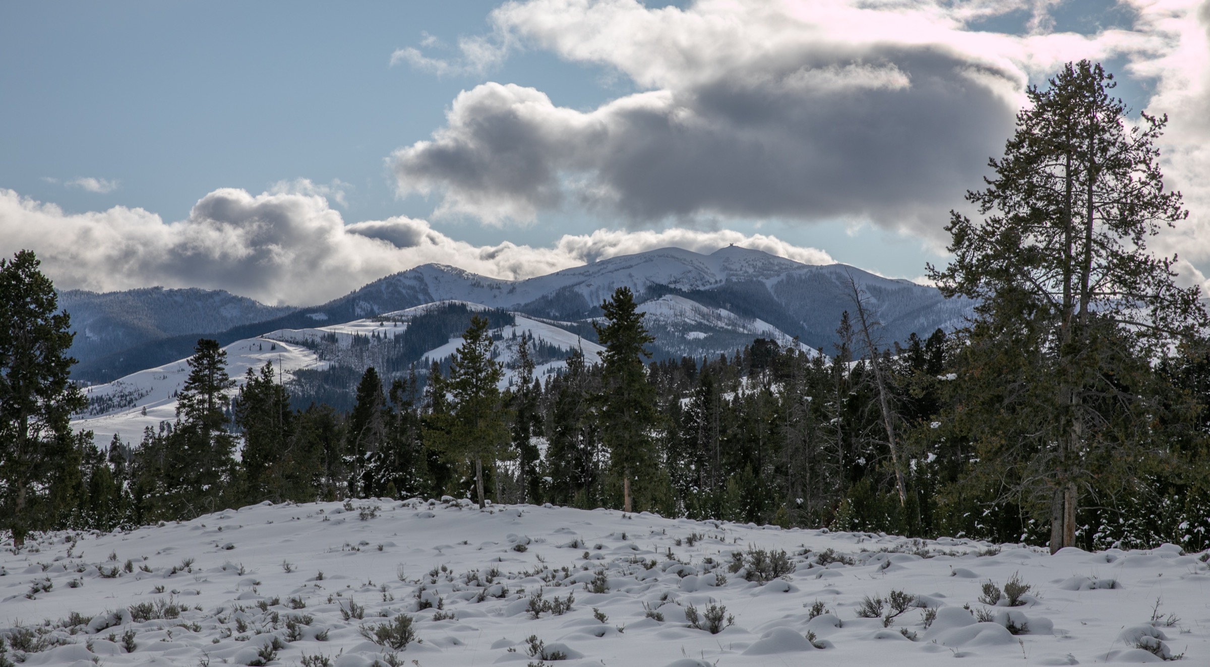
The route leaves the Dunraven Pass Trailhead at 2,690 m on the Grand Loop Road between Canyon Village and Tower Junction, and follows the graded old service road north-west up the south flank of the Washburn massif. The tread climbs steadily through sub-alpine spruce–fir and open wildflower meadow, with the summit lookout coming into view on the skyline within the first kilometre. Above about 2,900 m the trail breaks onto the open alpine ridge, with resident bighorn sheep commonly seen on the tundra to either side. The final section runs the ridge north-east to the Mount Washburn Fire Lookout at 3,122 m — a working lookout with an interpretive observation floor open to hikers during business hours. The 360° panorama takes in the Yellowstone Caldera to the south, the Absaroka Range to the east, the Beartooth wall to the north, and the whole northern rim of the Grand Canyon of the Yellowstone below. Descent reverses the route.
Why it is essential
Mount Washburn is the single best day-hike on the plateau for a first-time visitor. It is short by alpine-summit standards, graded throughout, guaranteed to produce a working fire lookout at the top, and its panorama gives the walker a map-in-the-hand view of the whole caldera. It is also the most reliable bighorn-sheep encounter in the park.
Equipment
- Sturdy hiking boots or trail shoes; the tread is graded but rocky in places
- Rain and wind shell plus a warm layer for the summit — the ridge is exposed and windy in any season
- Sun hat, high-SPF sunscreen and sunglasses — no shade above treeline
- Minimum 2 L water; no reliable water on route
- Bear spray, accessible on the pack
- Offline map and GPS with route loaded
- Binoculars for bighorn sheep and long-distance viewing from the lookout
Hazards and notes
- Afternoon thunderstorms and lightning are the dominant summer risk on the exposed ridge; plan a dawn or early-morning start.
- Snow can linger on the north side into July in cool years; verify current conditions.
- Grizzly-bear activity is documented throughout the Washburn Range; carry spray and hike in a group where possible.
- The Chittenden Road alternative access from the north is longer and typically used by cyclists; the Dunraven Pass route is the standard hiker approach.
- Dogs are not permitted on any Yellowstone trail.
- Dunraven Pass Trailhead parking fills early on summer weekends.
GPX / route file
| Source | URL | Format | Notes |
|---|---|---|---|
| NPS Yellowstone — day-hiking | nps.gov | Web page | Official managing authority; no GPX exposed |
| AllTrails — Mount Washburn via Dunraven Pass | alltrails.com | Web page | Distance and elevation cross-check only — proprietary geometry, do not reuse |
Sources
2. Seven Mile Hole
Snapshot
Itinerary
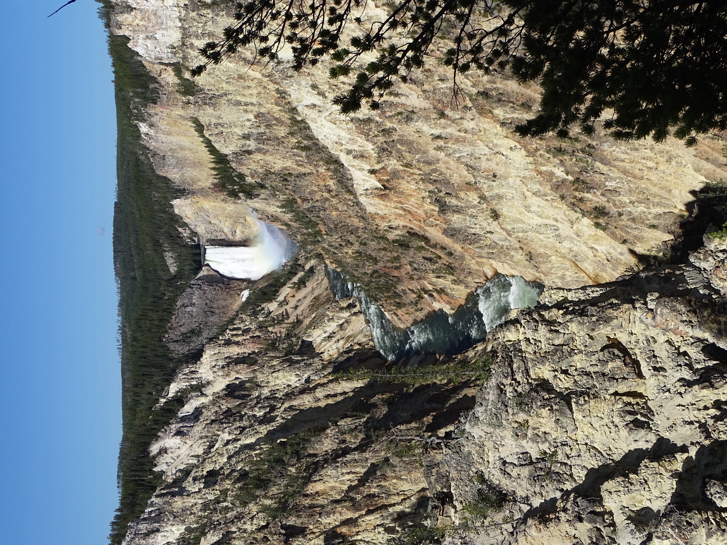
The route leaves the Glacial Boulder Trailhead on the north rim near Inspiration Point and runs east on level ground along the pine-and-lodgepole rim, briefly meeting the Washburn Spur connector before the descent proper begins. At the signed Seven Mile Hole junction the trail turns south and drops steeply through a series of open switchbacks, passing exposed sulphur and iron-stained bands and one or two active hydrothermal vents on the canyon wall. The tread threads a mid-canyon bench of thermal seeps and small colourful runoffs — a rare place inside the Grand Canyon where the walker is within touching distance of active geology — before the final steep pitch to the Yellowstone River bank at Seven Mile Hole (so named for the fishing distance below the Lower Falls). The rest and turn-around are at the river. Return retraces the descent, with the full elevation regain held for the second half of the day.
Why it is essential
Seven Mile Hole is the plateau’s only trail that actually delivers the walker into the Grand Canyon of the Yellowstone rather than framing it from above. It is the strongest single day-hike statement of the canyon’s active volcanic setting, and the river-bank rest is one of the most enclosed and least-visited settings in the park’s front country.
Equipment
- Sturdy hiking boots and trekking poles for the sustained descent and steep re-ascent
- Sun hat, high-SPF sunscreen and sunglasses — the canyon wall is exposed and reflective
- Minimum 3 L water plus treatment; the Yellowstone River is a treatable source at the turnaround
- Bear spray, accessible on the pack
- Rain shell for afternoon storm cells over the rim
- Offline map and GPS with route loaded — the connector junctions can be confusing
Hazards and notes
- The whole climb is held for the return; plan accordingly and turn round early if the day is running long.
- The canyon face is hot and shadeless in mid-summer — start early and carry more water than seems reasonable.
- Hydrothermal features on the descent: stay strictly on the tread, do not touch water, do not step off-trail near steaming ground.
- Grizzly-bear activity is documented on the rim and in the canyon; carry spray.
- Dogs are not permitted.
- Rim-side parking at Glacial Boulder is limited and fills by mid-morning.
GPX / route file
| Source | URL | Format | Notes |
|---|---|---|---|
| NPS Yellowstone — day-hiking | nps.gov | Web page | Official managing authority |
| AllTrails — Seven Mile Hole Trail | alltrails.com | Web page | Distance and elevation cross-check |
Sources
3. Avalanche Peak
Snapshot
Itinerary
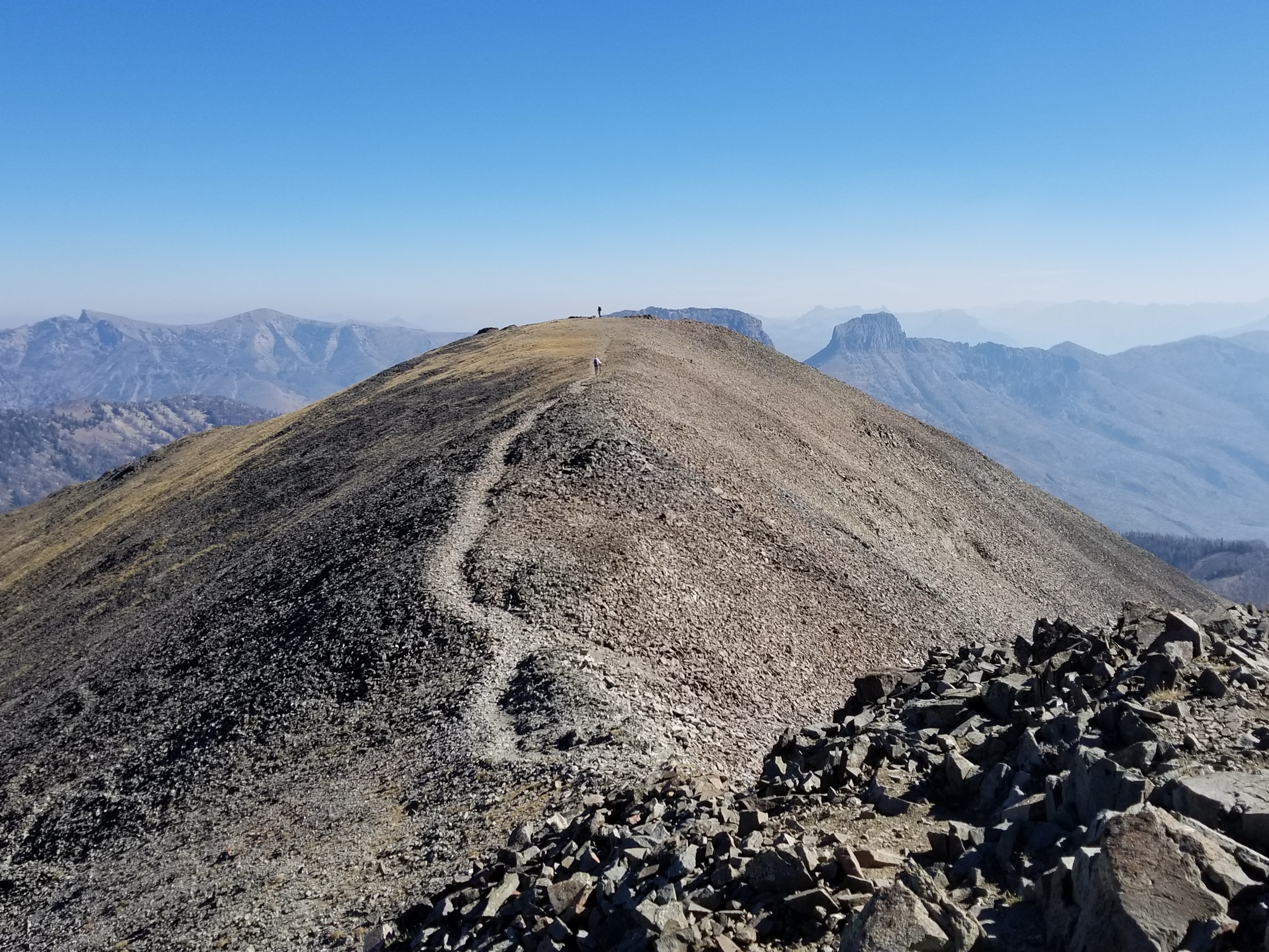
The route leaves the small pullout opposite Eleanor Lake on the East Entrance Road and climbs immediately into subalpine conifer forest on a steep, unrelenting single-track. There is no gentle approach — the trail gains altitude fast on well-worn tread, breaking above treeline within the first two kilometres. The middle section crosses an open glacial cirque below the north-east face of the peak, with the last of the summer snow often visible in the shaded basin to the right of the trail. The upper section is loose scree and volcanic talus on the final ridge to the summit at approximately 3,110 m — an open, unmarked high point with 360° views over Yellowstone Lake to the west, the Absaroka Range to the east, and the plateau’s south-east corner to the south. Descent reverses the route; the scree and loose upper tread require patience on the way down.
Why it is essential
Avalanche Peak is the shortest route to a 3,100 m viewpoint anywhere in the park and the only non-technical summit on the plateau’s eastern rim. It is the walk that most cleanly separates Yellowstone Lake from the wider caldera, and its cirque-and-scree character stands out against the park’s more typical rolling-forest terrain.
Equipment
- Sturdy mountain hiking boots with good ankle support for the scree descent
- Trekking poles strongly recommended
- Rain and wind shell plus a warm layer for the summit — the ridge is high and often cold and windy
- Sun hat, high-SPF sunscreen and sunglasses — long open sections above treeline
- Minimum 2 L water; no reliable water on route
- Bear spray, accessible on the pack — grizzly activity is documented in the drainages either side
- Offline map and GPS with route loaded
- Microspikes early in the season for snow in the upper cirque
Hazards and notes
- Extremely exposed to lightning above treeline; plan a dawn start and turn round if storm cells build.
- Loose scree and volcanic talus on the upper mountain — footing is unforgiving on the descent.
- Grizzly-bear activity documented on the approach; carry spray.
- The trail is not signed at the summit ridge; navigate carefully in reduced visibility.
- Dogs are not permitted.
- Parking at the trailhead is limited to a small roadside pullout.
GPX / route file
| Source | URL | Format | Notes |
|---|---|---|---|
| NPS Yellowstone — day-hiking | nps.gov | Web page | Official managing authority |
| AllTrails — Avalanche Peak Trail | alltrails.com | Web page | Distance and elevation cross-check |
Sources
4. Fairy Falls and Grand Prismatic Overlook
Snapshot
Itinerary
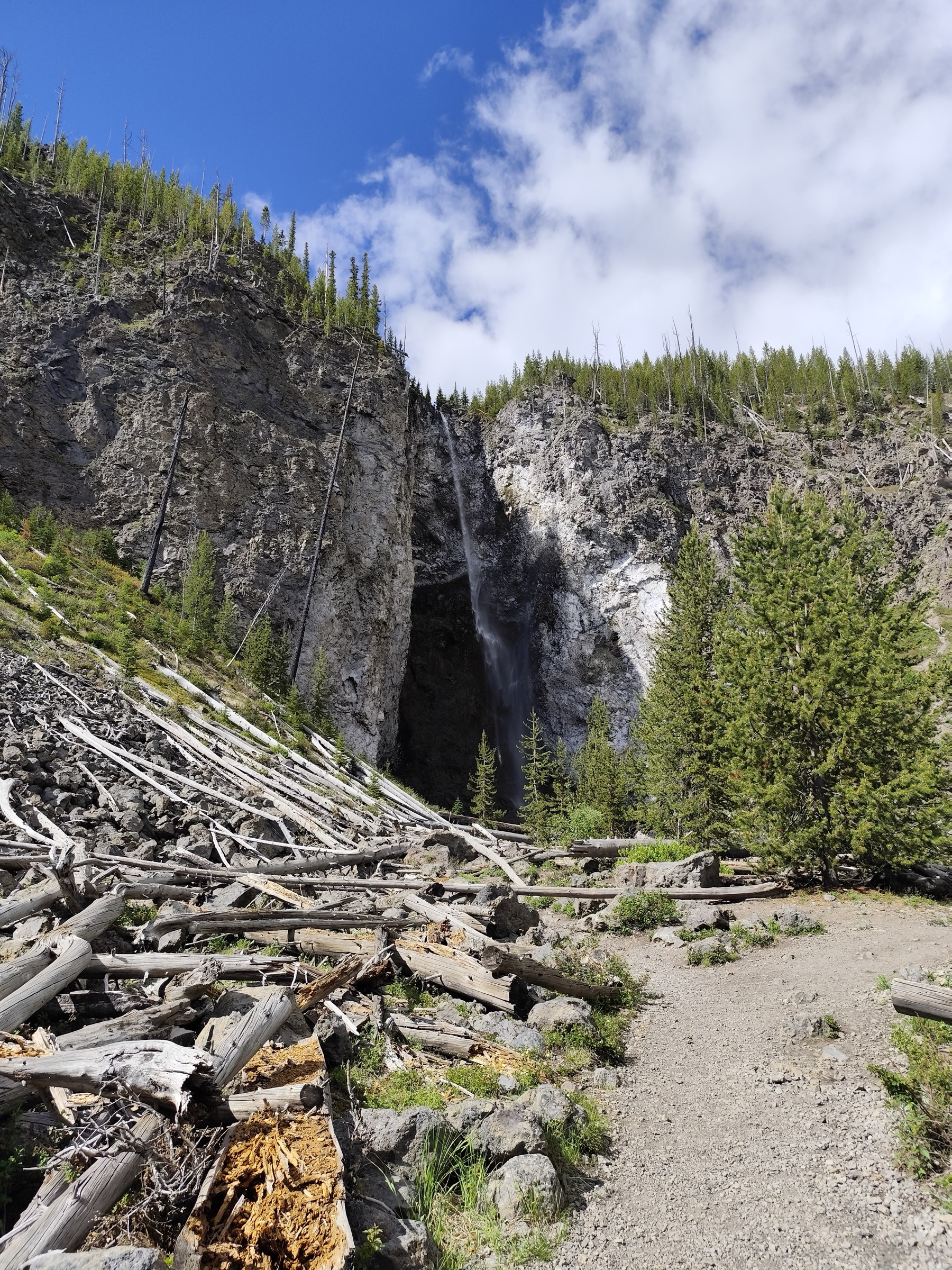
The route leaves the Fairy Falls Trailhead parking area south of the Midway Geyser Basin, crosses the Firehole River on a bridge and follows a level gravel service road (the old Fountain Freight Road) north-west across the open flat above Midway. About one kilometre in, a signed spur climbs a wooded ridge to the Grand Prismatic Spring Overlook, the sanctioned viewpoint above the Midway Geyser Basin and the only elevated view of the spring — the walk that most photographs of Grand Prismatic are taken from. Back on the main trail, the tread continues west into open lodgepole flat, then turns south into the trees for the final approach to Fairy Falls, a single-drop 60 m plunge into a small basin at the foot of the Twin Buttes. The return retraces the outbound line; a short extension of about a kilometre past the falls reaches the small Imperial and Spray geysers for parties with time to spare.
Why it is essential
Fairy Falls with the Grand Prismatic Overlook is the plateau’s most efficient thermal-basin walk. The overlook is the only place in the park where the scale and colour of Grand Prismatic is visible from above — the boardwalk itself gives no comparable view — and the falls at the end add a second, quieter destination. The whole walk is low-elevation and long-season, and it is the best day-hike answer for a party mixing walkers of different fitness.
Equipment
- Trail shoes or hiking shoes; the surface is level gravel and packed earth
- Sun hat, high-SPF sunscreen and sunglasses — long open sections with no shade
- Rain shell for afternoon storm cells
- Minimum 1.5 L water; no reliable water source on route
- Bear spray, accessible on the pack — grizzly and black bears use the basin’s edges
- Camera and a mid-length lens for the overlook
Hazards and notes
- The overlook spur is the sanctioned viewing point; leaving the tread to reach an unofficial closer viewpoint is prohibited by the NPS and dangerous over unstable ground.
- Hydrothermal hazards: stay strictly on tread and boardwalk in every geyser basin.
- Grizzly and black bears are common in the Midway–Twin Buttes area; carry spray.
- The Fairy Falls trailhead lot fills mid-morning through peak summer.
- Dogs are not permitted.
- Winter closures may apply on the Fountain Freight Road section; check the NPS current-season status.
GPX / route file
| Source | URL | Format | Notes |
|---|---|---|---|
| NPS Yellowstone — day-hiking | nps.gov | Web page | Official managing authority |
| AllTrails — Fairy Falls and Grand Prismatic Overlook | alltrails.com | Web page | Distance and elevation cross-check |
Sources
5. Elephant Back Mountain loop
Snapshot
Itinerary
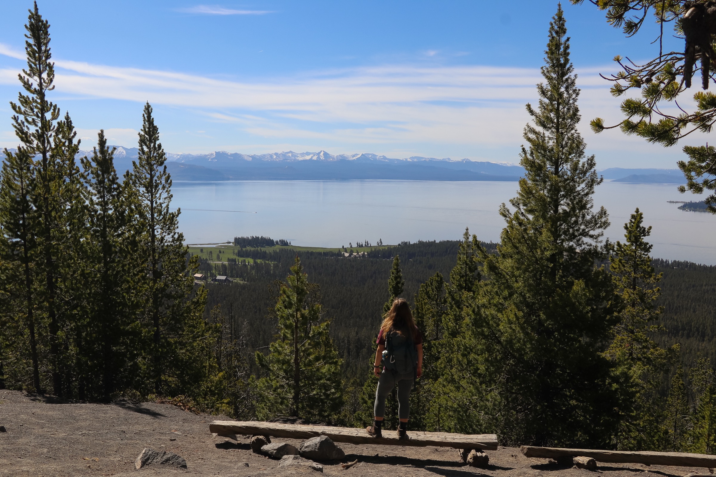
The route leaves the Elephant Back Trailhead on the Grand Loop Road one mile south of Fishing Bridge Junction and climbs steadily through mature lodgepole pine forest on a graded single-track. At about 1.6 km the trail reaches the loop junction; either direction gains the summit viewpoint on comparable tread, and the standard practice is to take the left (clockwise) branch first for a shorter climb and a longer descent. The forest opens briefly at the summit ridge at approximately 2,472 m, where the maintained viewpoint gives a wide look over the northern basin of Yellowstone Lake — the largest high-elevation lake in North America — with the Absaroka Range across the water to the east and the Pelican Valley to the north-east. The loop closes back to the outbound tread and the stem returns to the trailhead.
Why it is essential
Elephant Back Mountain is the plateau’s most efficient lake-view walk. It packs a purpose-built forest climb, a maintained summit-style viewpoint over Yellowstone Lake and a clean loop into a half-day that is accessible to a wide range of walkers. It is the natural counterpoint to the geyser-basin day and the walk that most cleanly frames the plateau’s south-east character.
Equipment
- Trail shoes or light hiking boots
- Rain shell for afternoon storm cells
- Sun hat, high-SPF sunscreen and sunglasses
- Minimum 1.5 L water; no reliable water source on route
- Bear spray, accessible on the pack — the Fishing Bridge / Lake area has one of the park’s highest recorded grizzly densities
- Camera for the Yellowstone Lake panorama
Hazards and notes
- Grizzly bears are highly active in the Fishing Bridge / Lake corridor; the NPS strongly recommends parties of three or more and audible noise on blind sections. Bear-management-area closures can affect this trail on short notice.
- Afternoon storm cells develop quickly over the lake; carry a shell.
- Trail is popular and the trailhead lot fills by mid-morning at weekends.
- Dogs are not permitted.
- Winter access requires ski or snowshoe travel and is not covered by this profile.
GPX / route file
| Source | URL | Format | Notes |
|---|---|---|---|
| NPS Yellowstone — day-hiking | nps.gov | Web page | Official managing authority |
| AllTrails — Elephant Back Mountain Loop | alltrails.com | Web page | Distance and elevation cross-check |
Sources
Region-level sources
| Source | URL |
|---|---|
| NPS Yellowstone National Park — plan your visit | nps.gov |
| NPS Yellowstone — day-hiking | nps.gov |
| NPS Yellowstone — hiking overview | nps.gov |
| NPS Yellowstone — bear safety and bear spray | nps.gov |
| NPS Yellowstone — hydrothermal safety | nps.gov |
| NPS Yellowstone — current-season road status | nps.gov |
| Wikipedia — Yellowstone Caldera | en.wikipedia.org |
| Wikipedia — Grand Canyon of the Yellowstone | en.wikipedia.org |
Further reading
- Gallatin Range — essential day-hikes — the plateau’s north-west shoulder, sharing the same Custer Gallatin / NPS management boundary
- Teton Range — essential day-hikes — the fault-block wall an hour south down the John D. Rockefeller Jr. Memorial Parkway
- Cloud Peak Wilderness — essential day-hikes — the granite alpine core of the Bighorn Mountains four hours to the east
Missing data / follow-up work
- No official downloadable GPX or KML files were located for any of the five routes; route geometry can be exported from OpenStreetMap or CalTopo.
- The Avalanche Peak summit elevation is quoted at ~10,200 ft in most NPS materials; a small number of secondary sources give 10,566 ft. Both values circulate; the lower figure is used above and should be verified against a current USGS quad before publication.
- Distances quoted are NPS figures where available; several routes carry small NPS-vs-AllTrails discrepancies (typically ±0.5 km) that reflect exactly where the trail is measured to and from — the NPS figure is preferred.
- Seven Mile Hole distance varies with the exact turnaround point on the riverbank (10.5–11 mi is the range in the literature); the composite ~17.7 km above is the commonly quoted round-trip.
- Bear-management-area closures update through the season; verify with the current-season NPS backcountry office before planning any trip to Elephant Back or the Washburn spur.
- Public transport access was not verified for the 2026 season; Yellowstone has no in-park public transit.